Mount High-G and Ginnett Hill
February 29, 2024
219m
Anacortes, WA
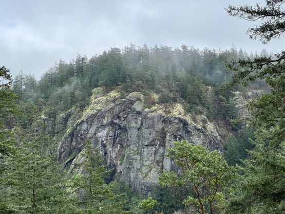
Mt. High-G and Ginnett Hill are two officially-named forested pimples on Fidalgo Island with the higher of the two, Mt. High-G holding more than 100 m prominence. There’s nothing special about them and in fact, these pimples are among some of the trashiest that I had ever done. This was the leap day of 2024 meaning this was my one-in-four-year chance to fill in that specific dot on the Peakbagger’s grid. Up to this date my grid (338/366) had been completely organic but Raphael Smith successfully convinced me to at least bag “something” on this leap day, so that’s the sole purpose of this trip. This was a Thursday so I needed to be at work in the afternoon and evening, and the weather forecast was awful enough that I normally would not consider a morning-bag otherwise. To successfully fill in that “dot” I needed to bag at least one new “P100m” objective and after spending hours to study the various weather forecasts I decided on Mt. High-G near Anacortes as this area had the least amount/chance of precipitation. This diving game had gone completely nerdy recently as only the selected few individuals could understand what I’ve been talking about.
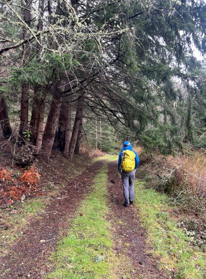
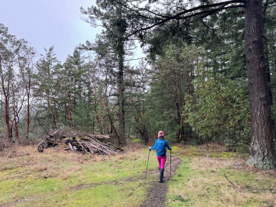
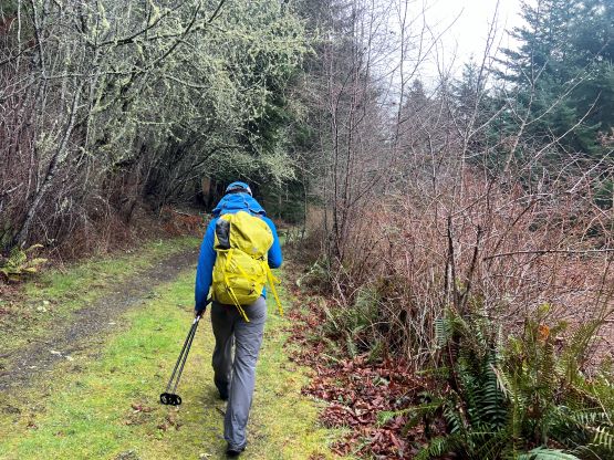
In any case I slept in Kate’s house on Wednesday night as I did not finish work until 10 pm. I would not make sense for me to drive back to my parents’ house in Surrey at 11 pm and then drive back to White Rock in the morning. The plan was made to leave at 9 am as these objectives would not warrant the need to wake up early. I wanted to wake up naturally as the work had been exhausting recently. The weather was actually better than expected as we only encountered a period of heavy rain near Burlington. As we drove westwards down Highway 20 we could even see patches of blue skies. The most commonly used approach for Mt. High-G starts from Pass Lake’s boat launch but that parking lot requires a Discovery Pass. I refused to support that money-grab so I did my homework and found several other starting points to bypass that requirement. The first one that we decided to check out was the northern approach (Tursi Trail) from the end of Donnell Road, but we couldn’t find a designated parking lot but rather a shit ton of “no parking” signs. The locals are probably very grumpy. We nevertheless found a spot to park about a kilometer back on Sharpe Road. This would lengthen the trip but given the better-than-expected weather we might as well do more exercise.

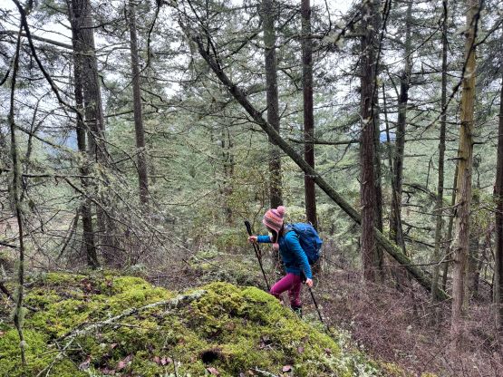
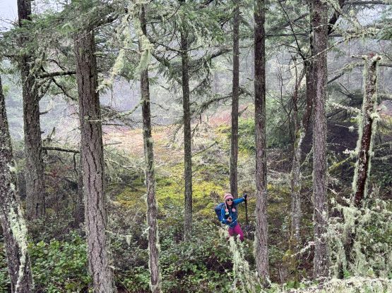
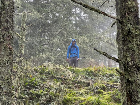
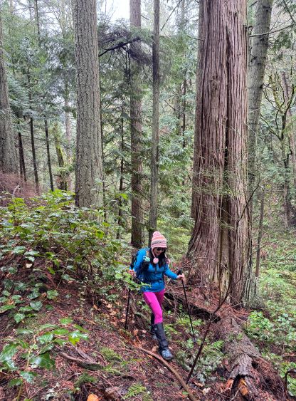
The trail was in some excellent conditions but involves fair amount of up-and-downs traversing the flanks of Ginnett Hill. Our first objective was Mt. High-G as that’s the one holding the prominence, so we ignored Ginnett Hill and went all the way down to Big Cedar Trail. This trail ascends steeply up a ravine and before reaching the trail’s high point we would bail into the forest. I did not do much research about the bushwhack as it’s rather short, but it did end up requiring fair amount of thrashing in thorny plants as well as route-finding in micro-terrain. I was fairly certain that we did not take the path of the least resistance, but neither did we search hard. All we needed was to go uphill and in about half an hour we arrived at the forested summit. There are two contenders so we made sure to have visited both, and to traverse between them required more thrashing in underbrush.


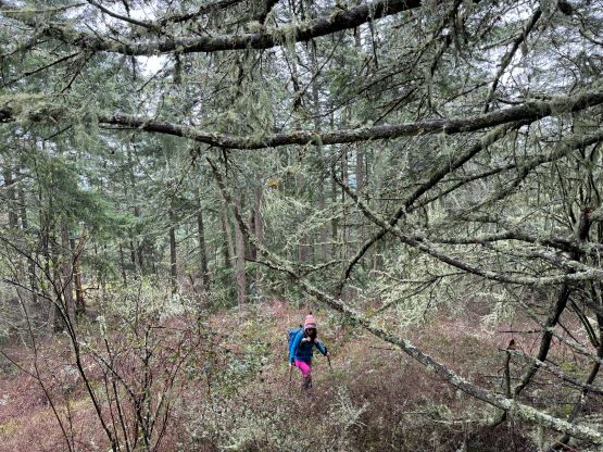
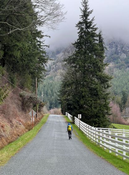
I made the in-situ decision to descend by bushwhacking northwards to join the private roads on that side to make a loop, mostly to shorten the amount of bushwhacking. We could have also gone up from that side but that almost certainly would require trespassing. By descending that way we would be entering their private properties from behind the bushes and hopping the gates/fences from inside out, so even if we got caught we should still be allowed to proceed. The bushwhacking on the north slopes was worse than I thought, but was definitely shorter. The roads turned out to be mostly as expected, gated with private signs so we definitely made the correct decision to make this loop in a clockwise direction. We exited the questionable areas after walking down to Ginnett Road, turned right and made a hasty dash eastwards to the road’s end where this road joined the trail system that we took in the morning. The end of this Ginnett Road was another possible starting point that I had considered, but again the grumpy locals had put up a shit ton of “no parking” signs such that I could not find any logical spot to leave a vehicle behind without going at least one mile backwards down the road. They really wanted visitors to park at Pass Lake to pay for that Discovery Pass but the more they wanted me to pay, the harder I would search for a bypass.
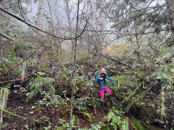


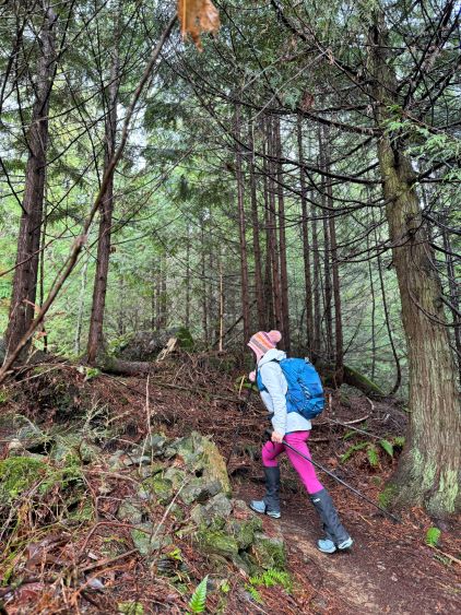
It was tempted to skip Ginnett Hill as we weren’t doing particularly great on time, but the objective’s right there and I simply could not have gone home without turning that dot green, even though it doesn’t even boast over 100 m prominence. It’s officially named, so it mattered. We followed the trail to the SE side where the supposed bushwhacking was the shortest. The terrain was similar to what we had just done on Mt. High-G, not the worst but definitely not the best. There were fair amount of thorny plants to thrash through, and the summit offered no view whatsoever. We took a slightly different way down but this line involved worse bushwhacking, so I would not recommend it. The rest of the return was uneventful and our round trip time was 2.5 hours. I did some mental math that we no longer had enough time to go to White Rock for a “proper” lunch because I needed to be at work by 3 pm. Instead, I made Kate to stop in a McDonald’s for a quick grab of food in the drive-through.