Mount Hamilton
February 23, 2025
1516m
Merritt / Nicola Lake, BC
Mt. Hamilton on the ranchlands east of Nicola Lake is not a well known objective in the peakbagging community but had caught my attention for a number of years. There are several summits with the southern one being the highest and subsequently boasting over 400 m prominence. There’s an old fire lookout on the officially named north summit but it boasts very minimal prominence. Most hikers would call it “good enough” by visiting the lookout site but peakbaggers must make that seemingly meaningless kilometer-long thrash to the higher south summit to properly claim an ascent of Mt. Hamilton. I was struggling to find a suitable objective for this past Sunday due to the questionable weather and conditions but the area east/north of Merritt showed the highest chance of being sunny. I went to the maps and picked Mt. Hamilton, and Jon was keen to come along even though this wasn’t an exciting objective. The decision was made to leave Vancouver at 8:30 pm on Saturday evening even though the objective itself wouldn’t require a long day. This was the right decision as I wasn’t aware that the access would be through some private properties.
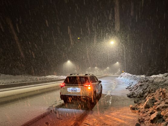
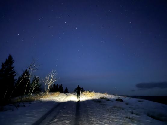
The driving was very difficult up through Fraser Valley with heavy rain and pooling water on the highway, and the situation was not getting any better up towards Coquihalla Pass. The heavy rain turned gradually into a snow blizzard and I even had to put up fresh tire tracks up towards the pass. I took a break at Falls Lake parking lot as the visibility was really bad. Thankfully a few trucks and several cars came by so I just followed for the next half an hour. The winter condition ended as we approached Merritt, but the rain never actually stopped. The plan was to camp somewhere on the fire lookout road above Douglas Lake Road but we pulled in at midnight and noticed that spur road was gated with massive signs indicating our intended route would be on private lands. We had no choice but to park next to the gate and slept inside the vehicle. The weather was miserable with pissing rain and howling winds but the rain eventually stopped. Due to the access issues I decided for us to wake up at 5:30 am and do the entire ascent in the dark as this was my usual way of dealing with this kind of situations. I did not do any homework but I dug out a few (brief) trip reports after coming back home. Apparently it’s possible to bypass the private property but not without adding considerable amount of distance into the already-monotonous plodding.
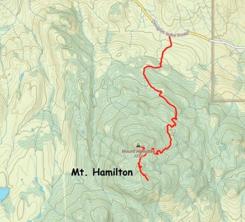
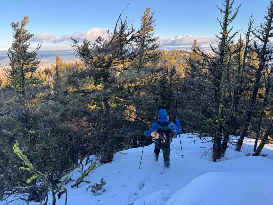
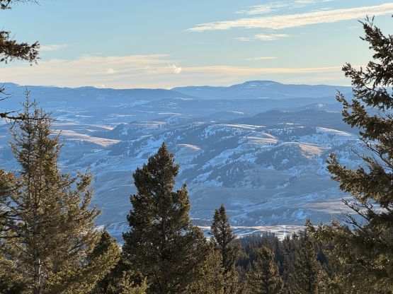
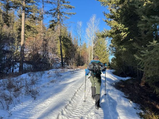
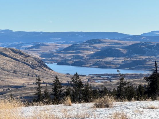
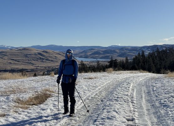
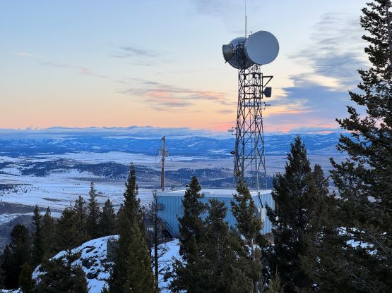
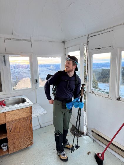
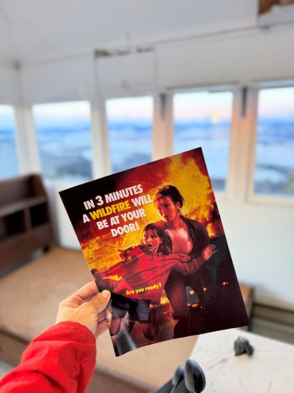
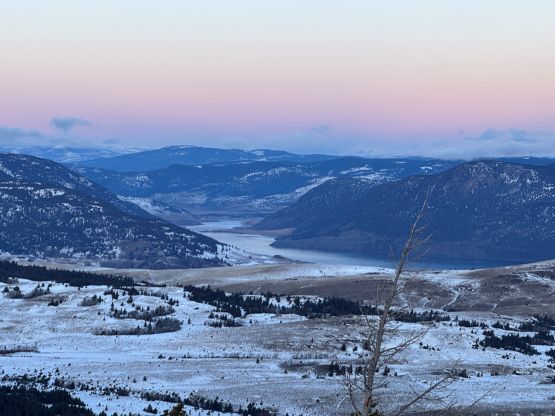
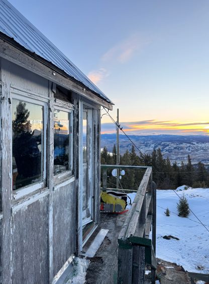
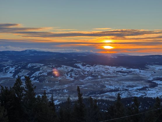
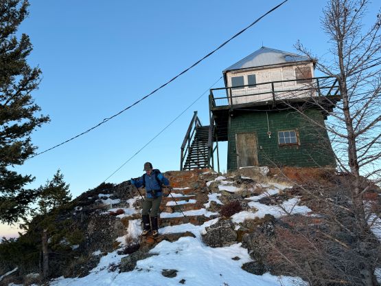
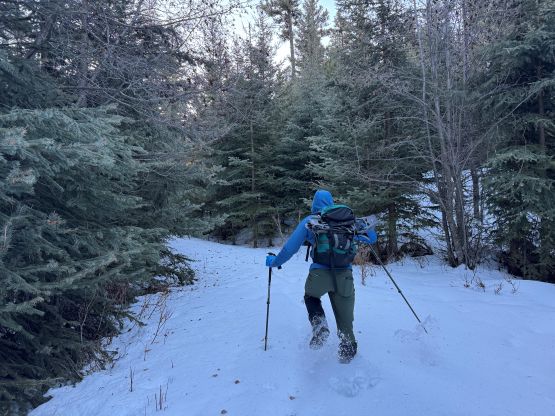
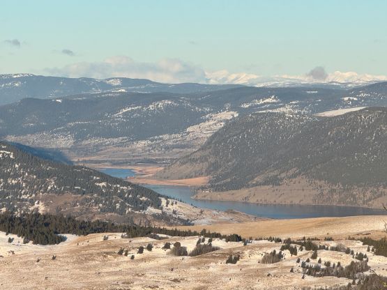
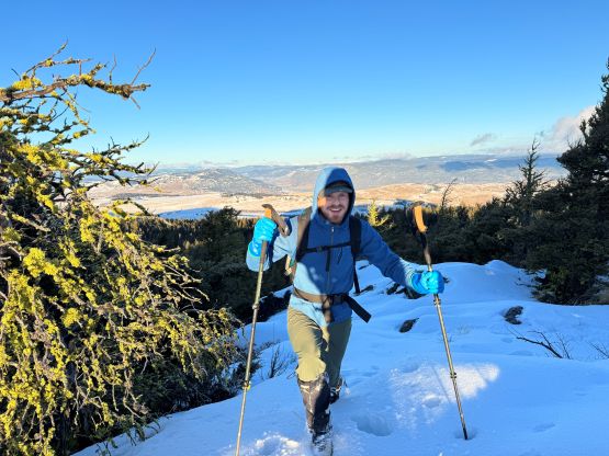
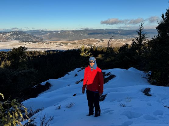
In terms of gears we carried snowshoes and microspikes but ended up using none of those. The snowshoes could have helped in some sections but we just persisted through by post-holing. The lower few kilometers along that gated road was also very icy but we were able to make do without donning traction. The road was entirely packed with truck and snowmobile tracks so the going was quite easy. It was just very boring in the dark. Jon was leading most of the way and I had to work quite hard to keep up with the pace. I liked our pace because apparently the snowmobiles had made all the way to the north summit. They could have driven up at daybreak to catch us, and we needed to be as fast as possible to avoid getting caught. My plan was actually to tag the higher south summit first but we missed the secondary road that led to the saddle between the summits. We might as well check out the old fire lookout first, and we managed to get there right before sunrise. The views were surprisingly quite good given the lowly status of this peak.
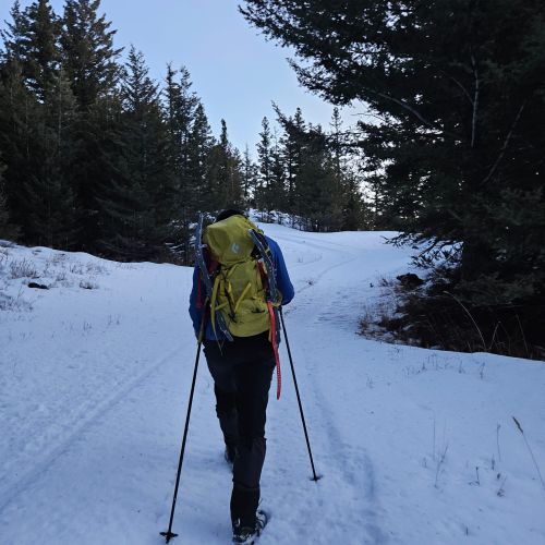
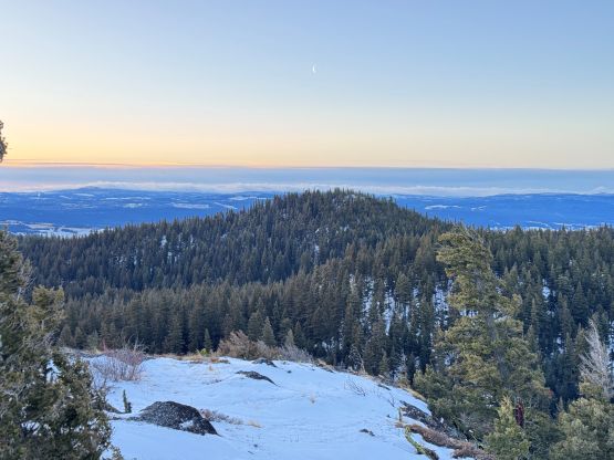
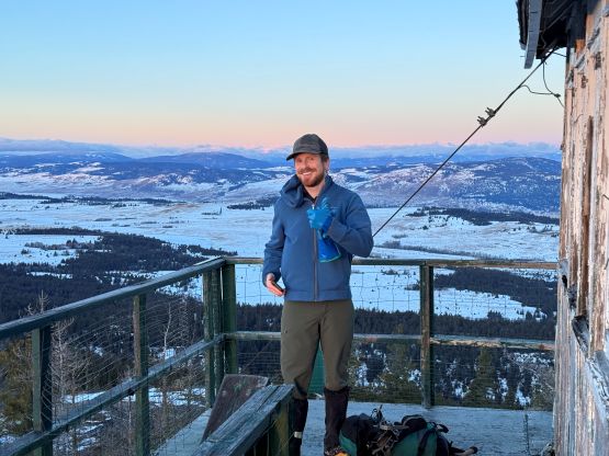
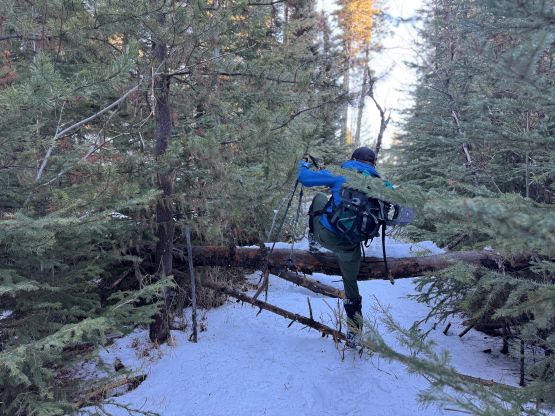
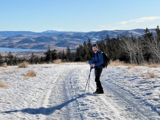
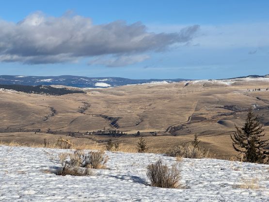
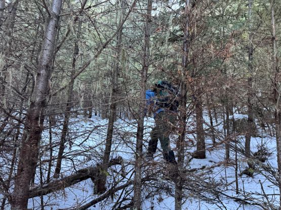
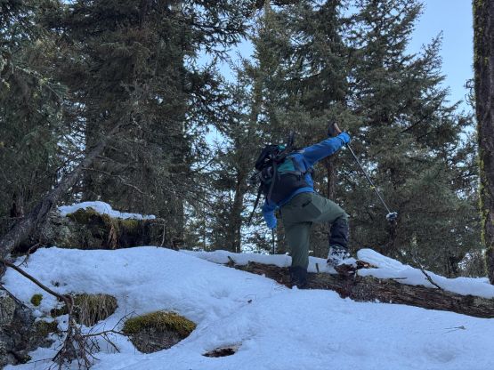
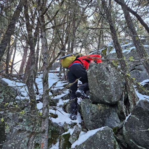
Due to the cold winds we made no lingering but immediately started the traverse to the higher south peak. I anticipated some heinous bushwhacking over dead-falls but the situation was actually not that bad. The worst of the thrashing was around the first saddle between the north peak and the central bump. Most of the travel was actually in open forest. The snow was mostly only 30 cm deep so the snowshoes weren’t actually required. On the way over to the south peak we bypassed the very top of that “central bump” and then scrambled up the NW Ridge of the south peak. There was one bluffy zone on the upper route that required a few scrambling moves, and the post-holing was also quite deep. I would be tempted to strap the snowshoes on but we were already very close to the true summit so might as well keep pushing. The true summit was not entirely forested and actually offered some views, though nothing magical.


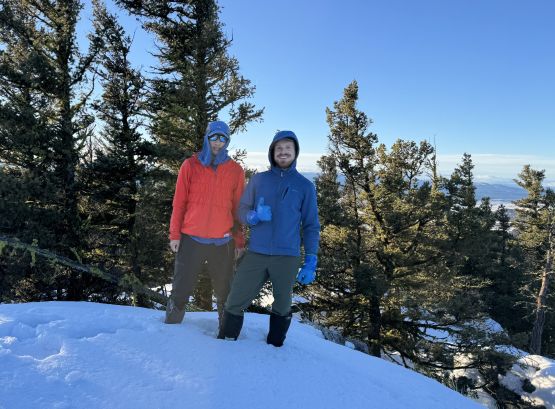
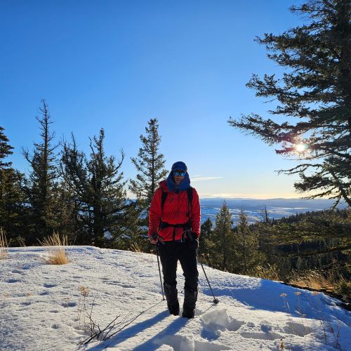
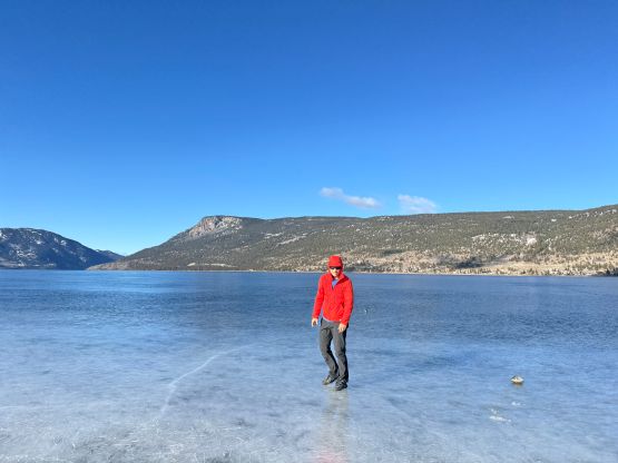
After taking some obligatory victory shots we started the descent following our own tracks. We made quick work down the NW Ridge and then decided to tag the very top of that “central bump” for simple reason of why-not. We then traversed a stretch of an old and overgrown road to avoid re-ascending the north summit, but this stretch required some deep post-holing. The rest of the descent down the fire lookout road was uneventful. We even jogged part of the lower sections but had to pay extra attention given the icy conditions. Our round trip time was 3.5 hours and it turned out that our vehicle was still intact, so the mission was successful. Not sure how much I would recommend this objective to the general public or the casual hikers but it was a fun trip for us, after all. We even made a few touristy stops along the frozen Nicola Lake and in Merritt as we were doing excellently on time.