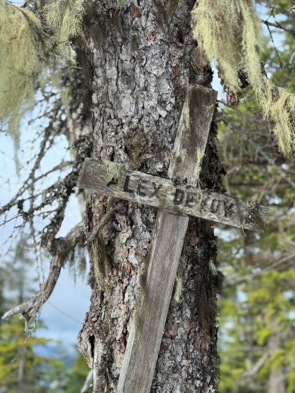
Mount Devoy
May 15, 2024
1424m
Hope, BC
Despite the forested nature Mt. Devoy is very recognizable from westbound of the Trans-Canada Highway between Hope and Chilliwack, and despite the proximity to the highway this peak is obscured and rarely ascended. The northern flanks are very steep and bluffy (Simon C. has a trip report) but the south ridge offers a much easier route to the top, as explored by Alan and Katie a few years ago. The obscurity is largely due to the lack of mountaineering interest (the summit is basically forested) and the difficult and ever-changing access situation. When Alan and Katie did it there was some active logging on Lorenzetta Road but they managed to drive in nevertheless after some sweet-talking. This did not sound like a sure way to me, so I waited for a few years until they completely finished their logging. The access was still an unknown but even at the worst case scenario of having to walk several extra kilometers the objective could still be easily done as a before-work exercise, so I was quite keen to finally pull the trigger. Ironically the trigger was pulled purely because the primary objective could not be reached.
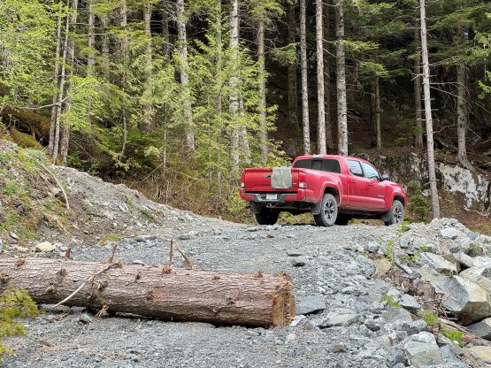
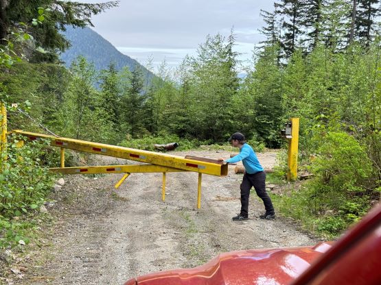
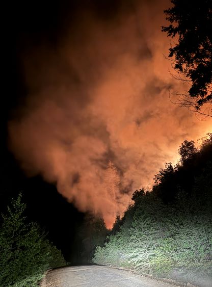
Harry, son of the famous guidebook author David Crerar was keen to join me on Mt. Fagervik taking advantage of the open gate on Cogburn FSR, but we discovered an active forest fire triggered by a burnt vehicle somewhere 17.5 km up the East Harrison. We actually encountered some trukers warning us about the fire but we decided to check it out anyway. The fire was clearly out of control so we turned around and made some calls after getting back to Harrison Hot Springs, and that was 11:30 pm. I evaluated our options and decided to settle on Mt. Devoy, which required another hour of driving. We had little information about Lorenzetta Road but it turned out to be fine. Somewhere between 2 km and 3 km up this road we encountered a homeless camp and a gate, but the gate was not locked (actually, vandalized) so we drove to the start of the new spur road that went to the east side of the creek. Alan and Katie were able to drive to the end of that spur road, but there’s one massive downed log and a pulled bridge (discovered in the morning), so our drivable end was basically 4.5 km up the Lorenzetta at the start of the east side spur road. I turned the truck around and opted for an open bivy in the trunk. Harry pitched his tent beside the truck and we agreed to wake up at 5 am to start hiking at around sunrise.

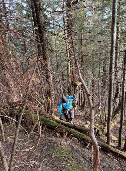
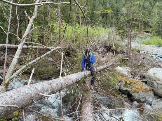
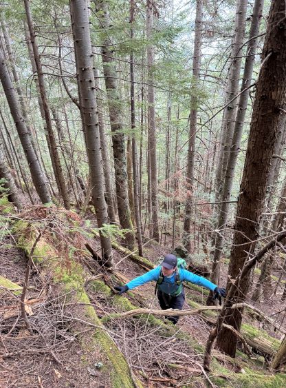
I was completely exhausted so it took me a minute to realize what was actually happening after the alarms went off. On hindsight I was glad that we switched the objective because the original plan would require another all-nighter push and I might not have enough energy to drive and work afterwards. In any case we discovered the pulled bridge but there were some downed logs on the side that we were able to use to cross. The log crossing wasn’t trivial, but worked. A direct crossing of the creek would otherwise not be possible without wetting our feet. We encountered at least a dozen impassible ditches on the east side spur road so this road was pretty much completely gone, and then dashed up the cut-block on the farther edge. The cut-block was not horrible and neither was the steep forest to gain the south ridge, but there was definitely some bushwhacking involved. Harry is someone who has done most of the Baggers Challenge peaks in summer prior to the establishment of those “trails” so bushwhacking was not a problem for him. We made quick progress and the next thing we were already on the southern sub-summit.


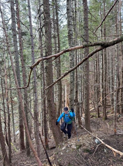
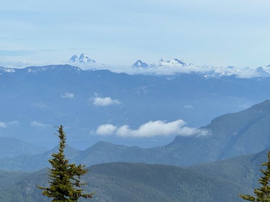
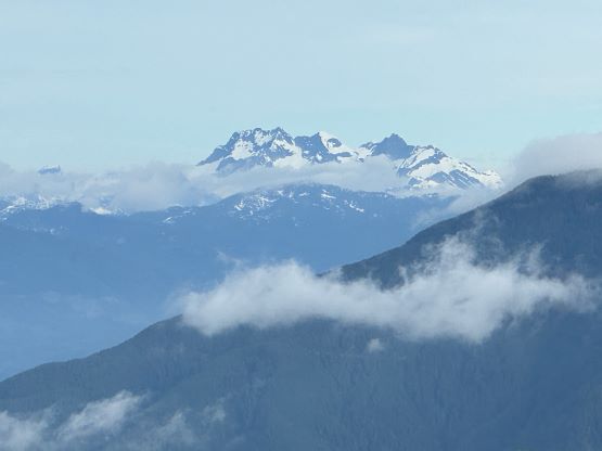
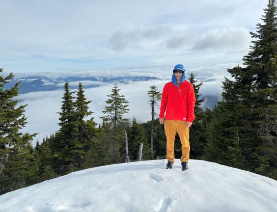
I had decided to bring mountaineering boots, an ice tool and crampons in case of encountering steep snow in the forest, but all of those turned out to be training weight. We did encounter some snow near the summit but I was able to wear the trail runners for the entire day. The traverse across the south ridge was long and undulating, and definitely felt tedious in the end. One bluff/notch required some scrambling on slippery terrain to descend and that was basically the crux of the entire route. We firstly went to check out the viewpoint west of the summit, and then tagged the true summit which actually offered a bit of views eastwards, but not by much.

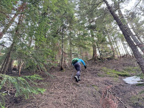


Due to the long day ahead we did not linger up there but quickly started the descent. I led us traversing back across the south ridge sticking as closely to the GPX track as possible. It was tempted to start descending earlier but I resisted that temptation as I knew the forest would be bluffy elsewhere. Harry then made some quick work down the west side forest down into the cut-block and I had to be 100% in my elements to keep up the pace. We then jogged down the spur road and finished the round trip in 3 hours 20 minutes. Not doing much lingering I turned on the engine and drove us out of there, but the homeless guys were already awake by the time we showed up at the gate. One of them required us to give a jump start to their truck. I hesitated but eventually gave in, but after about 10 minutes their truck was still not working, so we offered to give one of them a ride down to the highway to sort things out. These are some legit guys that simply went homeless in favour of being cheap. They even had a cat and a dog at the campsite. I barely had enough energy to drive home afterwards and then slept for 2 hours straight. I hadn’t felt this exhausted for a while, but that 2-hour nap did give me enough fuel to pull through the work in the afternoon and evening.