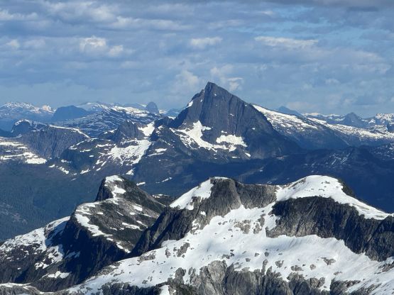
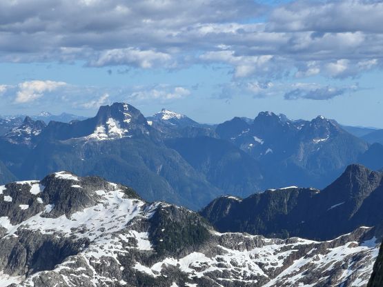
Mount Denman
July 14-15, 2025
1991m
Powell River, BC
Mt. Denman might not be well-known internationally but is one of, if not the most sought-after objective in Powell River vicinity which is also known as the Qathet. The climbing circle in this area is rather small, but everybody knows the significance of Mt. Denman and it’s on everybody’s dream list. This peak also boasts over 1000 m prominence and as a result, it starts to catch attention from peak-baggers living in areas farther away. I had honestly never put in too much thoughts about Mt. Denman mostly because the access would require a private boat transfer, but I was always waiting for that “perfect oppourtunity” to come. Earlier in this summer the local climber Tyler Zakkour messaged me on Instagram asking if I’d be keen on Mt. Denman and his offer included providing the round trip boat transfers. Tyler was recommended by the local legend Jason Addy so I immediately prioritized making this trip happen. Both Tyler and I are almost indefinitely flexible about timing the weather window so the decision was eventually made for Monday/Tuesday, the first two days of this heat wave in mid July. I also managed to sell this trip to Erica so we would be taking the two ferries to Powell River on Sunday and crash in Tyler’s house for the night.
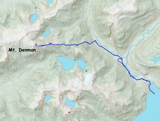
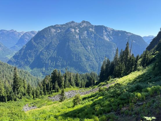
The plan was to climb the East Face from Daniels River which is a relatively new route detailed by Jason’s party in 2022. Jason did not manage to make the first ascent of it but the only source of “beta” was from his trip. This route has seen two documented ascents so likely hasn’t been climbed by more than a handful times anyway. The traditional South Ridge route that comes up from Forbes Bay requires a longer boat ride and a longer bushwhack/approach but has the benefit of being only 4th class. The East Face route has three short pitches rated at 5.5 so the downside was having to bring a rope and climbing gears. Nevertheless that was what Tyler was looking for so I agreed with the plan. I inquired Jason about some details about these climbing pitches so the final decision was to bring Erica’s 48m 8mm rope in addition to Tyler’s single rack and everybody would be bringing rock shoes. The rack and rock shoes of course turned out to become training weight as we managed to “scramble” the entire route without changing footwear. The East Face still has a gnarly approach that requires boating the entire way up Powell Lake, biking 8 km and bushwhacking the entire way up from the sea level, so Mt. Denman is an ordeal no matter what. I was actually looking forward to do a “west coast adventure” and this trip seemed like the one that would involve everything except for a river crossing. In retrospect we could have camped at the dock and do the entire route boat-to-boat as our round trip time minus camping was only 18 hours, but it was more enjoyable and definitely more scenic to camp up on the ridge for one night.
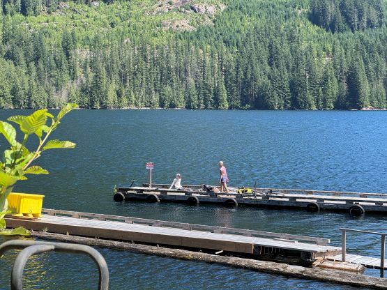
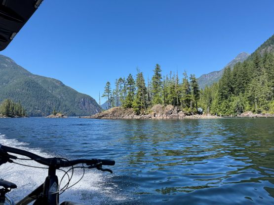
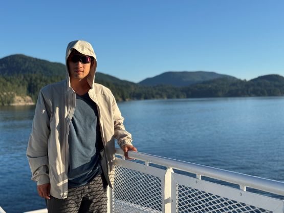
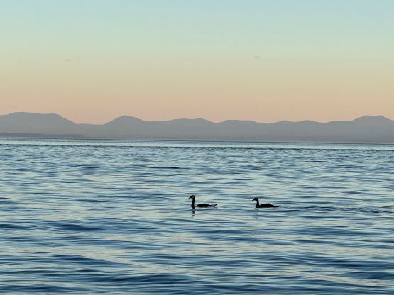
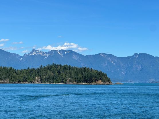
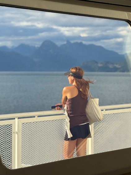
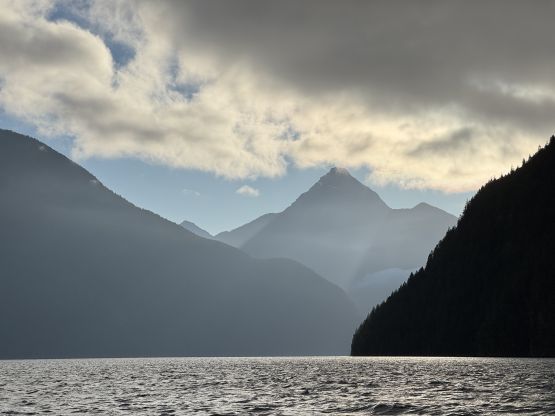
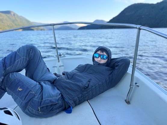
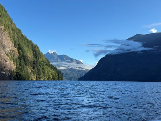
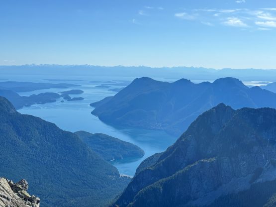
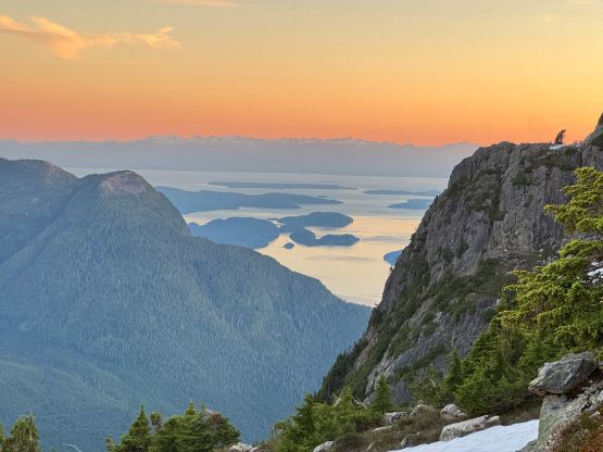
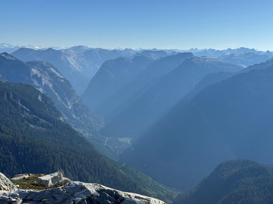
Erica and I left home on Sunday around 2 pm so we had less than 24 hours of resting between Mt. Odin and Mt. Denman. I was not fully physically recovered but when the weather window formed, we must go. I anticipated having to wait for multiple sails as it’s a sunny Sunday but we got to the Horseshoe Bay terminal at 3 pm and managed to get on the 3:10 pm ride without reservation. That was quite a sweet treat. The second ferry to Powell River went uneventfully and we showed up in Tyler’s house at 7:30 pm. Tyler was having a massive family barbeque dinner and kindly invited us to join, so we spent the rest of the evening there. We did the final sorting of gears and went to bed at around 11 pm. The next morning we left Tyler’s house at 6 am together with his dad Zak, the boat and three bikes. This was actually my first time fully participating the loading and unloading part of a boat-assisted expedition and as expected, it was far from “no brainer”. The water was quite choppy and the wind was cold, but 1 hour 15 minutes later we made to the head of Powell Lake, traversing around the west side of Goat Island. I got partially soaked from the water splashing. This lake is like a massive fjord with length exceeding Howe Sound.

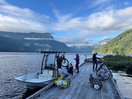
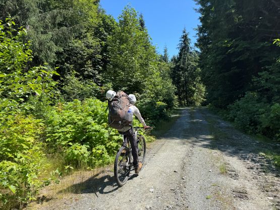
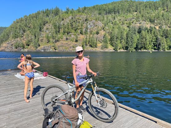
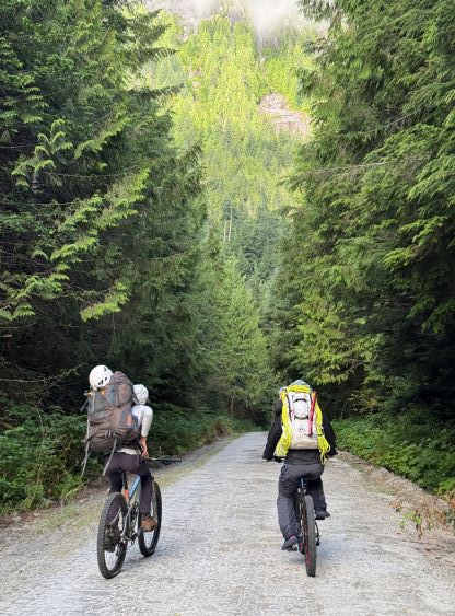
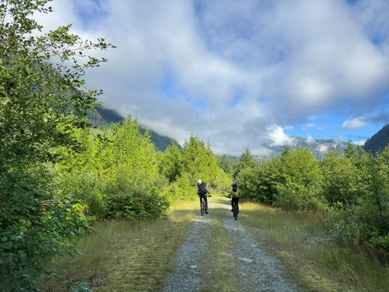
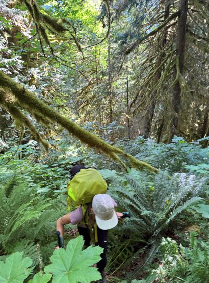
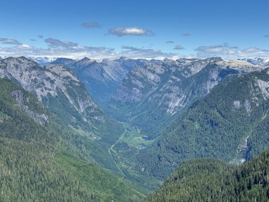
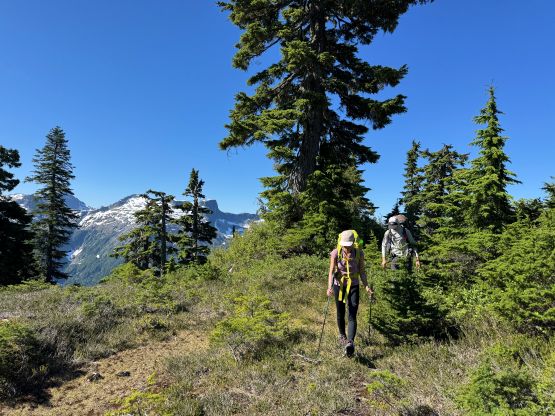
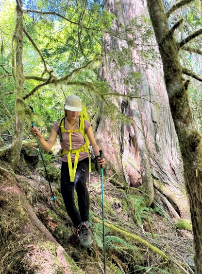
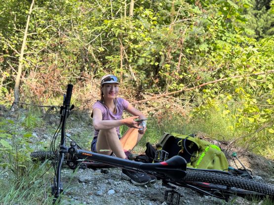
The next leg of the expedition was biking 8 km up the Daniels Valley and Erica and I would be using the bikes borrowed from Tyler and his friend. Biking was never my expertise so I totally couldn’t figure out how to switch gears. As a result Tyler and Erica were nowhere seen and had to wait for me to catch up, cranking awkwardly on the lowest gear on a flat gravel road. Tyler had to teach me how to properly use this bike, but I eventually switched bike with Erica as her bike had that adjustable seat position similar to the old fatbike that I got from Matt Juhasz. We also made one navigation error missing a supposedly new turn-off and the result was having to push the bikes up a steep hill and adding 1 km to the biking distance. I think they had altered the logging roads in this valley because the new roads were nowhere to be seen on the satellite images that I had downloaded. The old (more straight) road had a wash-out that’s impassible by vehicular traffic, and had started to become overgrown. We correctly located the next turn-off and biked the rest of the way to the starting point with some gentle elevation gain. The altitude at the starting point is only 120 m so this 8 km ride was mostly flat. We then took a much-needed break before embracing the gnarly 1600-m bushwhacking.
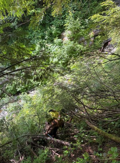
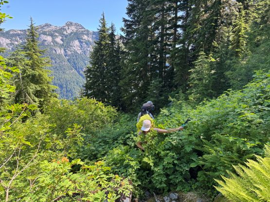
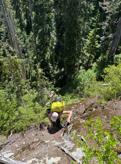
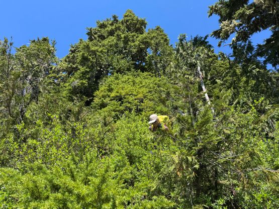
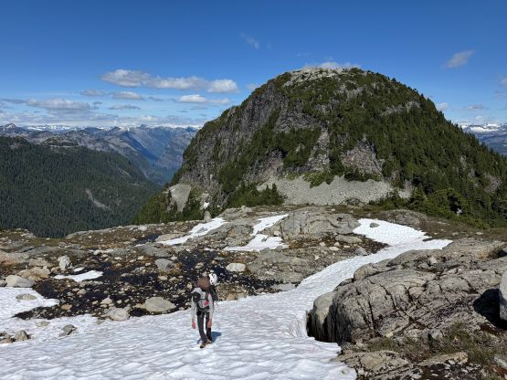
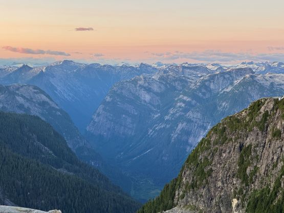
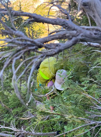
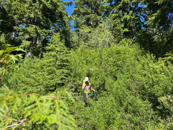
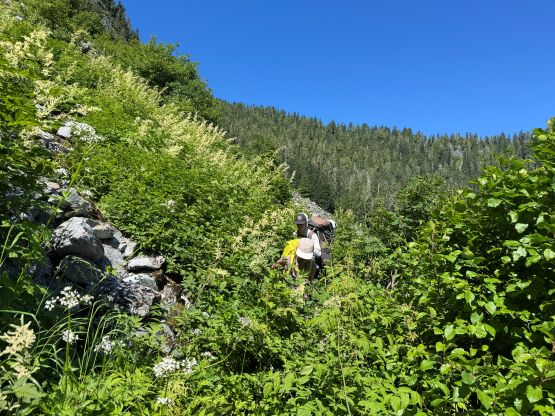
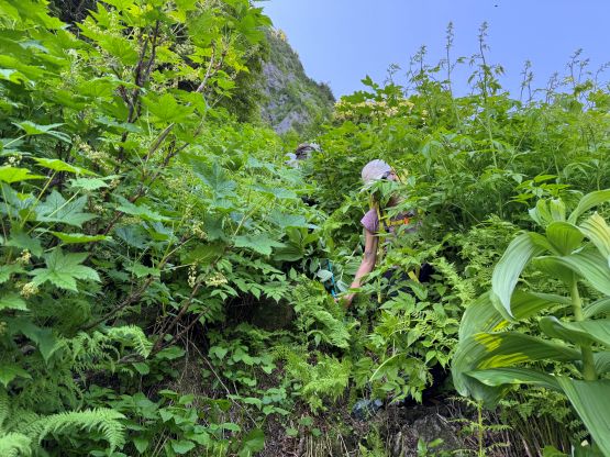
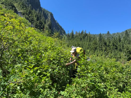
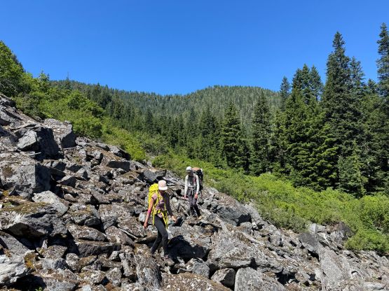
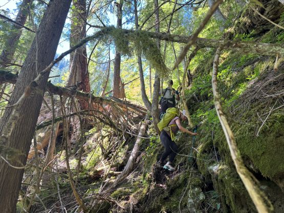
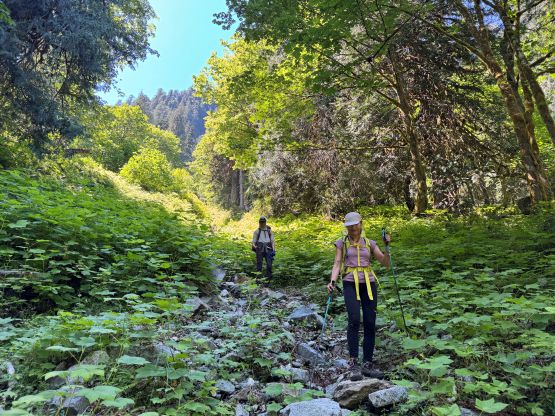
Tyler led the way diving right into the bushes but he was too fast for Erica and I to follow. Tyler eventually opted to let me do the route-finding and followed from behind. We somehow decided to ascend parallel to Jason’s track but dealt with a shit ton amount of Devil’s Clubs and other types of thorny plants. I wasn’t aware that Jason’s route actually ascends the middle of a dry creek bed so did a lot more unnecessary bushwhacking. A few hundred meters higher we finally merged into that creek bed and cruised upwards to the point we were supposed to leave this creek for a diagonal traverse. This was where the shit show began. We did this traverse slightly above the most optional elevation band and encountered some gnarly old growth with gigantic rotten dead-falls that had several meters of air underneath to crawl across or duck under, a shit ton of thorny undergrowth and some loose rocks on the side-hilling. This section terminates at a sketchy down-climb into a deep ravine using vege-belay, but this ravine kindly offered us some much-needed fresh water. I had opted to not bring too much water as I was bidding on having sources of water somewhere along the route, and I was correct. To climb out of the ravine required more vertical thrashing followed by some steep old growth. The intensity of the bushwhacking finally eased at around 650 m elevation so we made steady progress to the series of boulder fields, traversing underneath the 1450-m unnamed bump.
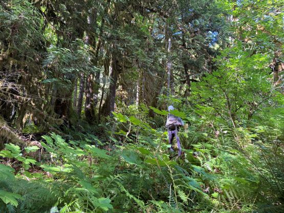
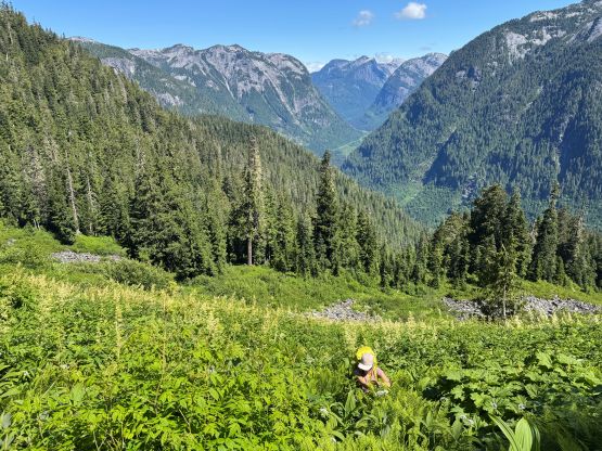
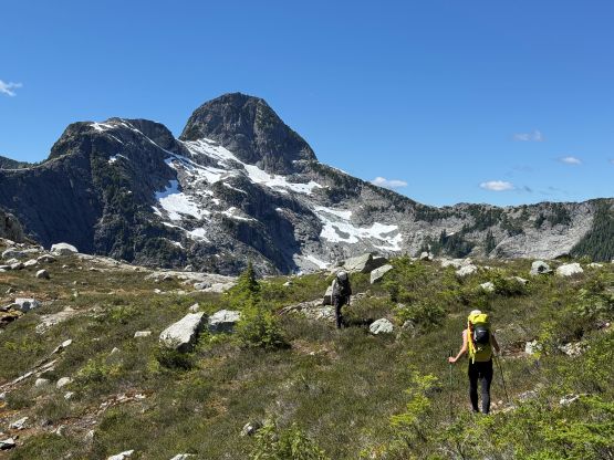
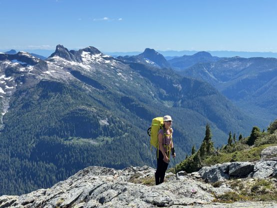
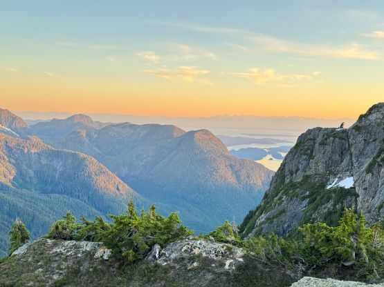
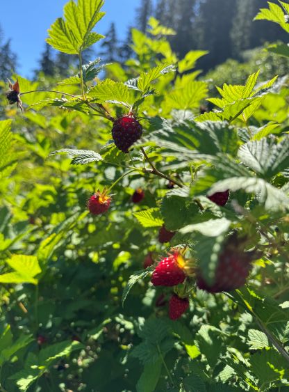
I thought we would be “home free” at this point but that was not true. I was still not getting how bad the bushwhacking in the Qathet or how tough these local climbers are. The boulder fields started out easily but on the second or the third field I naively decided to make a short-cut by thrashing through a band of “greens”. Jason’s track went up and over and I thought there’s no point in doing that, but I forgot that Jason had thrashed through this section 4 times so if he chose to do something, there had to have a reason. The “greens” turned out to be some 2-m tall BW5 brambles that was next to impossible to thrash through without having some full body protections, so we turned around and went straight up. This straight-up thrashing section was also bad with lots of brambles, so we should have stuck with the known. The upside was that we found lots of salmonberries and ate them literally like bears, and we found more water sources to stay hydrated. We then ascended the loose boulders to the head of this valley and then bailed climber’s right into more sub-alpine bushes. The intensity of the bushwhacking stayed in “BW3” for the next few hundred meters to near the top of the first bump at 1450 m elevation. On the satellite images this stretch looked rather “open” but the open fields had some intense underbrush. The traverse from there to “the punisher” was thankfully mostly bush-free and didn’t involve that much of micro-terrain. We had encountered several good camping spots but decided to push further.
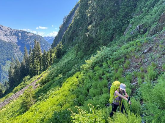
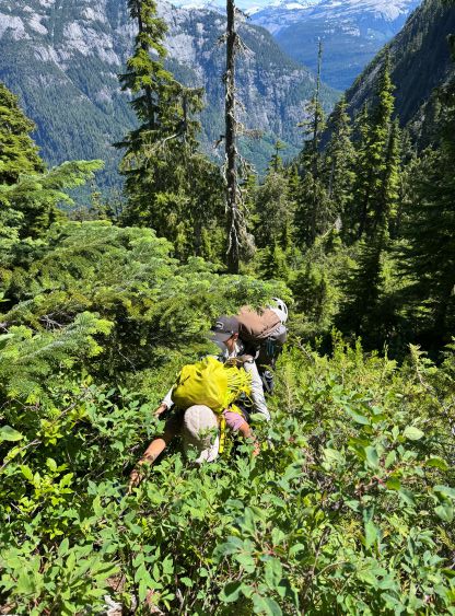
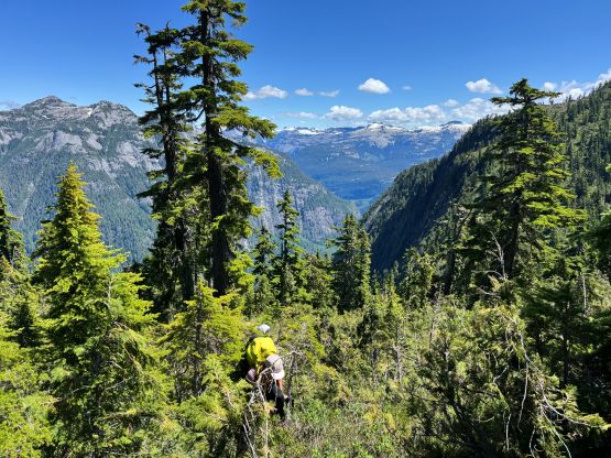

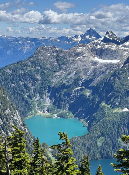
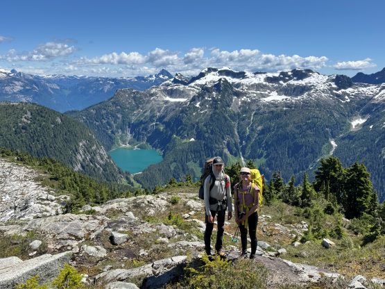
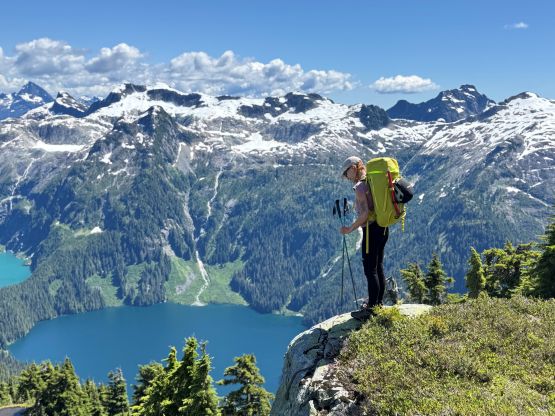
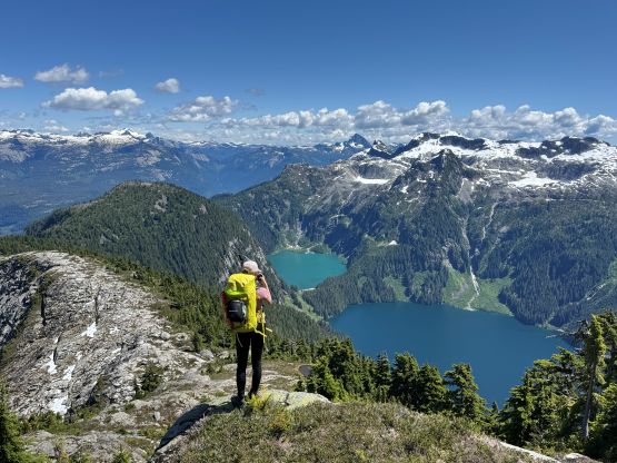
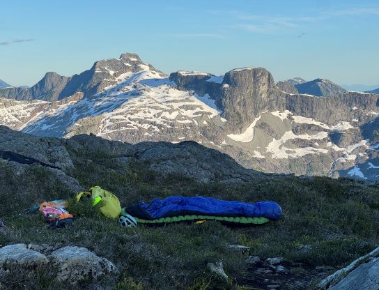
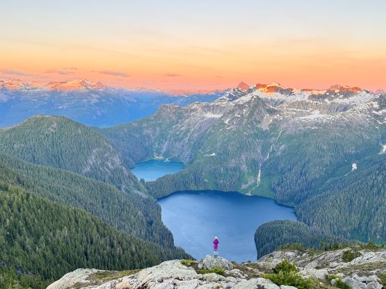
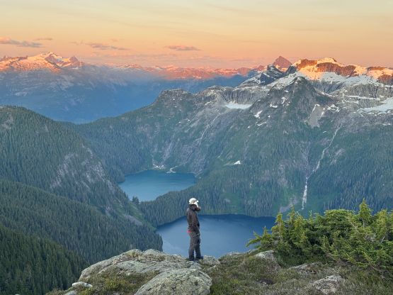
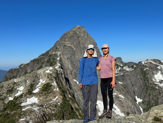
“The Punisher” has over 100 m prominence so counts as a separate peak but there’s no point in tagging the summit until the return. Instead, we cut across the south slopes and started to embrace the punishing bushwhacking with 100 m elevation loss. Right off the bat I made a route-finding error that resulted in me having to make an in-situ rappel. My harness was buried at the bottom of the backpack so it would be very awkward to dig it out. Instead, I simply wrapped the rope around my body and “rapped” off. This caused some bruising on my hands and arms. Erica and Tyler went and walked around the section. I then paid more attention to route-finding and I believed we managed to find the simplest way, but it still involved a lot of bushwhacking and exposed 3rd/4th class scrambling. The rocks were down-sloping and covered in moss, so thankfully it was not wet. The day was still young so the decision was to tag the summit in the evening, and camp as high as we could for better views. There’s a 5-star campsite at 1580 m but we pushed for another hundred meters higher and found another site with running water.

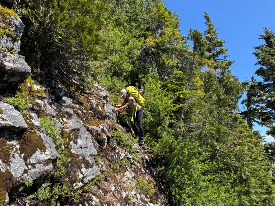
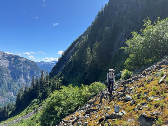
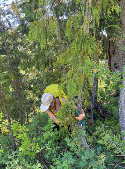
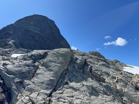
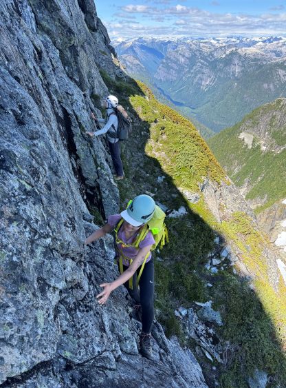
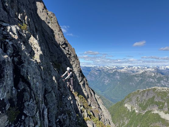
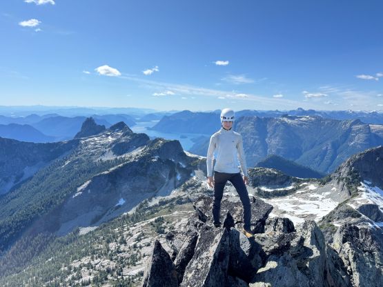
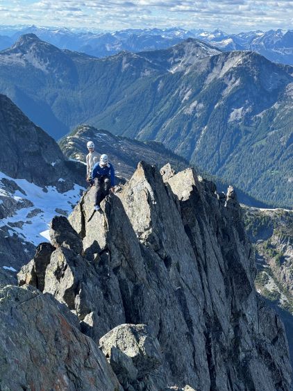
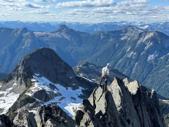
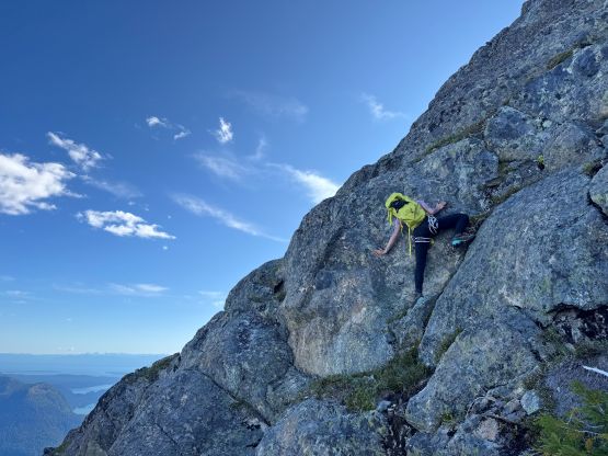
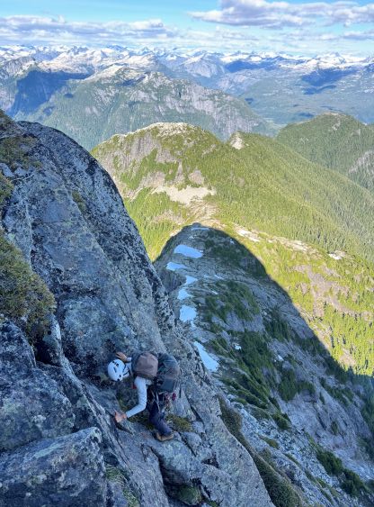
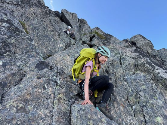
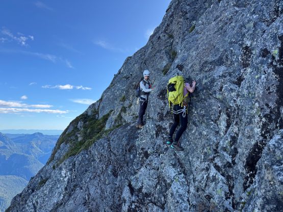
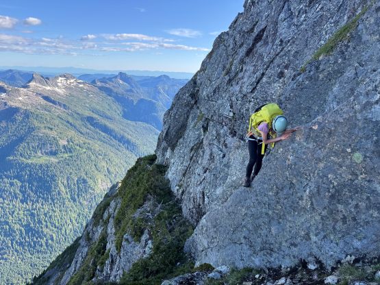
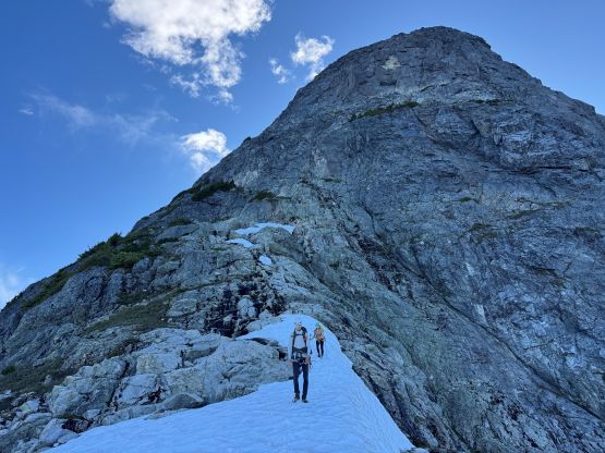
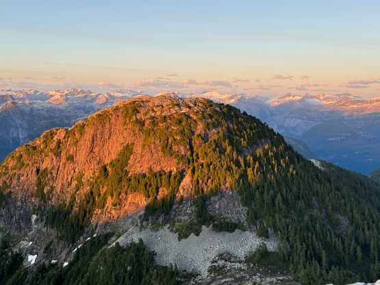
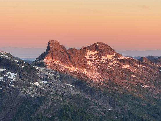
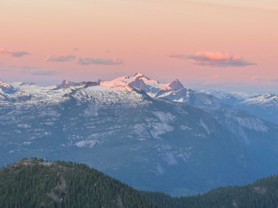
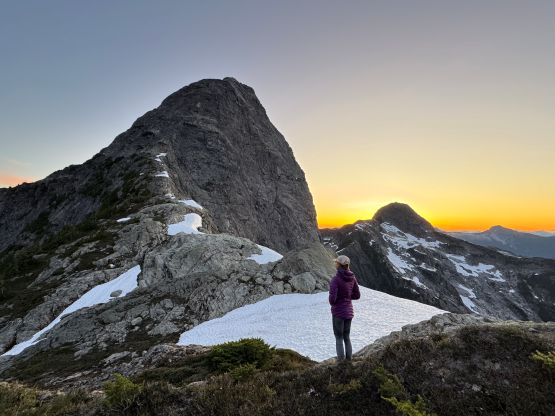
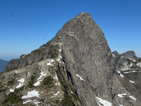
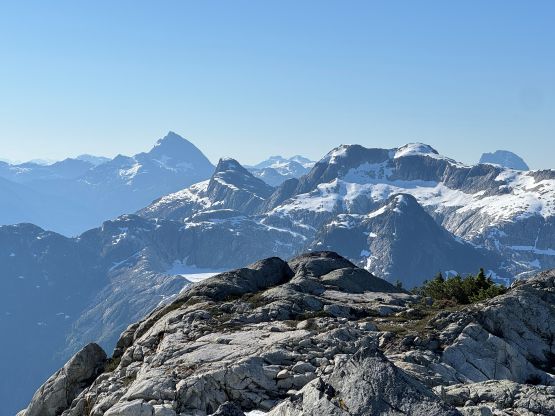
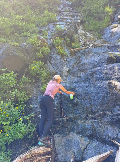
The east face of Mt. Denman appeared intimidating and in fact, we couldn’t figure out how exactly Jason’s group went. There’s only one way to tell, that was to stick our noses into it. The scrambling was straightforward until some point where things became steep enough for Erica and I to ditch the trekking poles. We continued scrambling to where the supposed 5.5 pitches were, but found no obvious climbing options. I traversed around climber’s left on a ledge and thrashed up a vertical section completely using vege-belay, and I believed in retrospect this (or nearby lines) was the 1st pitch. The next section involved a tricky leftwards trending traverse on down-sloping holds but there were only a few class-5 moves so we all scrambled across, and the 3rd pitch probably involved that difficult step-up move on a smooth-looking slab. Again, if there’s anything 5th class it wasn’t longer than “a few moves”, so we did the entire climb without evening donning harness nor changing footwear. I thought the entire route could be down-climbed so we were wondering where exactly the climbing pitches are. In any case we scrambled up some easy terrain after traversing around to the south side of the upper face, and were quickly standing on this elusive summit. Tyler and I even went further down the north ridge for photos and more scrambling oppourtunities.


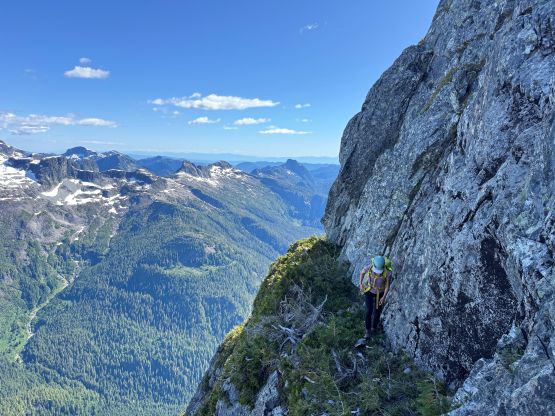
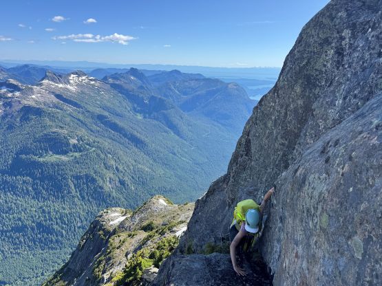


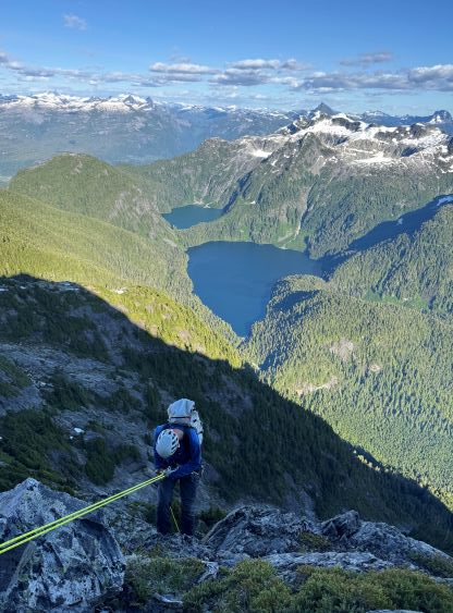
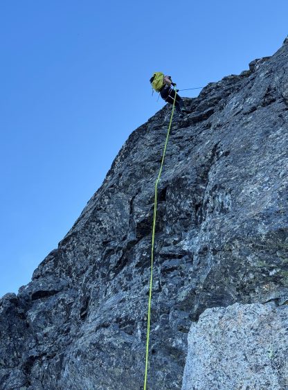
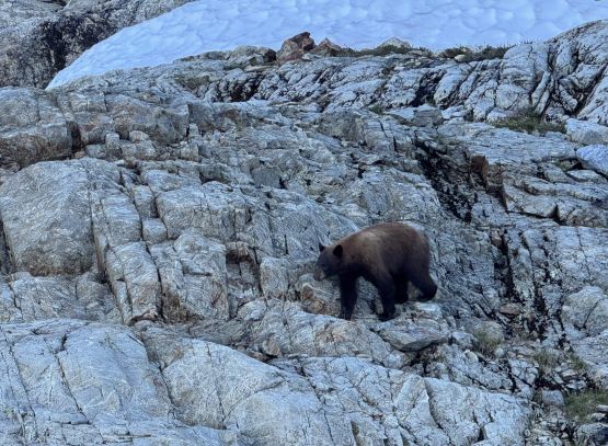
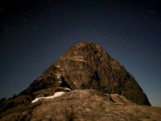
We still had a few hours of daytime but figured we might as well descend to camp as we were getting hungry. To get down the upper face there were lots of route options but for the steep parts we stuck on the line we had taken. We also looked fairly hard but couldn’t find a single rappel station so again, I’m not 100% sure if we had taken the route that Jason’s group did. The original plan was to make some rappels but we ended up down-climbing all the way to that vertical thrashing pitch. There’s a great-looking boulder above what seemed like a clean line to rappel off, so we cut some of Tyler’s webbing and made the only rappel on this mountain. Erica’s 48-m rope was plenty enough for the job. After getting back to camp we had a crazy bear encounter minutes before starting to cook for dinner. The bear had chased Tyler back to camp after he went around for some views, and we had to come face to face with that bear for about 10 minutes before the bear finally reluctantly left. Throwing rocks simply didn’t deter him. For that reasons we finally decided to “camp properly” and buried our food away from the sleeping sites under a pile of rocks. I was expecting the bear to get those food but he left us alone. The night was extremely windy that the sleeping was not that great in the open. I also lost my pillow while getting briefly up to take some nighttime photos.
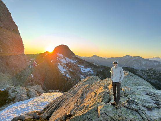
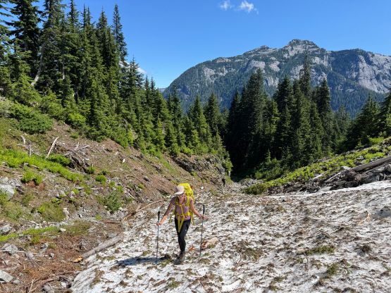
The original plan was to get up at 5 am to watch sunrise but the colours were rather mediocre especially comparing to the sunset in the previous evening, so none of us actually got up. We eventually got up at 7 am. The weather was still very windy so we didn’t bother to cook breakfast and simply packed up and went. We unfortunately had to re-climb that “punisher” but we knew the way this time, so it wasn’t too bad. I then directed us gaining the extra 50 m elevation to the very top of it so that we could claim this secondary summit. There’s even a tarn with fresh water and the wind was dying down, so Erica and I took our time cooking the ramen breakfast. There’s no point in rushing. The going was not too bad until we started to descend from that final bump. I was leading most of the bushwhacking and my strategy was to stay on the GPS track and deal with the known. The thrashing was bad. My pants got ripped off right at the start and the rip extended to almost the entire leg length, such that I basically did the descent in “shorts”. The worst was still the bands of greens in the middle of those boulder fields. On the descent we stayed even higher but still had to thrash through some 2-m tall brambles. Lower down we made sure to stay hydrated on the two important running creeks, but other than that, we just stuck close to the track and made the tedious descent one step at a time. Finding Jason’s dry creek bed extending much further down was a relief as I wasn’t looking forward to those nasty Devil’s Clubs even though we had been dealing with Devil’s Clubs for quite a lot in the past two days.

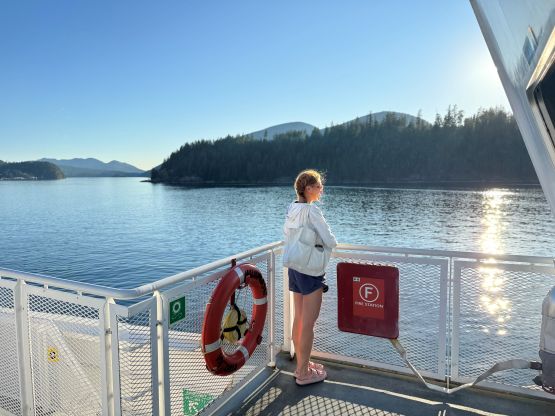
It was eventually the time to start biking, and Tyler had been texting his dad using the satellite texting function in the new iPhones. The plan was to get picked up at 3 pm so we had lots of time to linger around. We did find the “correct way” on the exit but as expected, this road was partially blocked and was clearly not for vehicular traffic anymore. Still, it was much simpler on the bikes than to deal with that hill in the heat. Our round trip time (sans camping) was 18 hours but moving time was less than 11 hours. Had we known the route better we could definitely have day-tripped it. We had about 40 minutes to kill at the dock according to the clock but Tyler’s parents came earlier than expected so we were quickly on the way homewards. This time we traversed around the east side of Goat Island completing a circumnavigation of Goat Island in boat. The rest of the journey back home involved two more ferries and a lot of driving and waiting in between. We were only able to get on the 7 pm ride from Saltery Bay to Earls Cove, and subsequently the last ride (10:30 pm) from Langdale to Horseshoe Bay. I didn’t get back home until midnight but that’s alright. I would be surprised if anybody had managed to pull off Mt. Denman in a mere 2.5 days return from Vancouver. I had to thank Tyler and his parents for inviting us and hosting the trip. Without the support from the local communities there’d be no way, as neither Erica nor I own a boat, the equipment to haul a boat nor the knowledge to drive a boat.