Mount David
June 10, 2024
2262m
Glacier Peak Wilderness, WA
Mt. David is one of the “P600m” objectives in the eastern Glacier Peak Wilderness. Matt J. had suggested this for at least 2 or 3 times but I was never too keen because this was going to be just another long slog on a somewhat unmaintained trail. But then if the weather was only good on the eastern slopes then Mt. David could make a lot more sense. I was supposed to be with Erica on Monday after she finished her crevasse rescue course but I figured we could all go together. I did not bother to do much research but I did read on Washington Trails Association at the last minute that the trail was technically “closed” due to the Airplane Lake fire. We did have a “Plan B” but I did a whole bunch of digging and found out that the fire was not on Mt. David itself (but rather Mt. Saul) so we decided to stick to the plan. There was nevertheless no trip report since Aug. 2023 so we did have to face some unknowns. The original meetup time was 6:30 am in Surrey but we lifted that to 5:30 am. The trail condition turned out to be fine but the trip itself was longer than we thought, so it was a good thing that we woke up earlier, after all.
As usual Matt would do all of the driving so for once in a while I appreciated for not having to drive myself. Erica and I both took some naps and the traffic was a bit brutal around Everett. We made to the trail-head about 4 hours later which is also the same starting point for the Bulgers – Clark/Luahna. The last few miles were rough and required a vehicle with some clearance. This was an unusually late start for me for a decently sized objective in the “spring conditions”, but I also desperately needed some sleep and none of us was able to leave in the previous evening for different reasons.

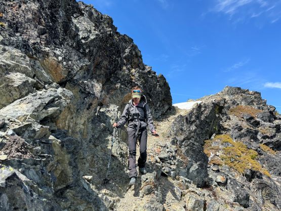
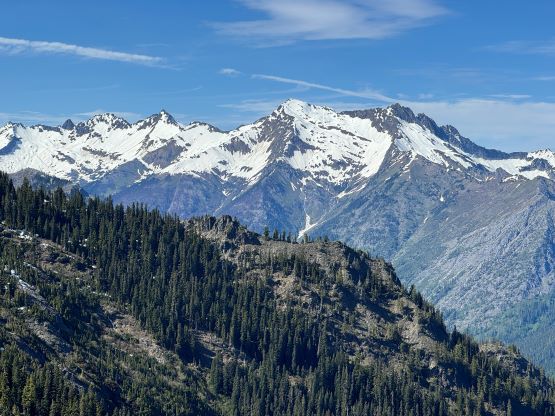
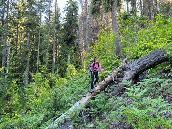
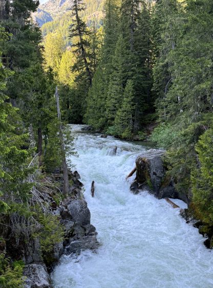
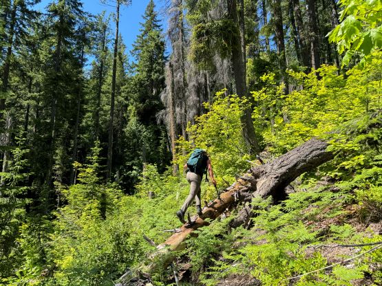
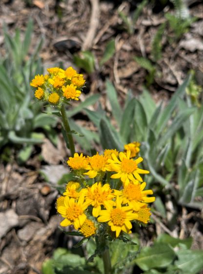
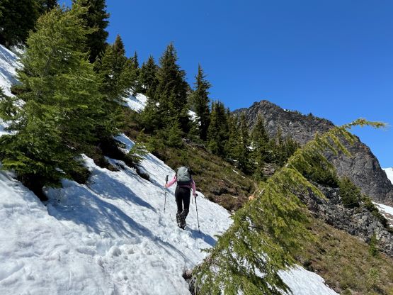
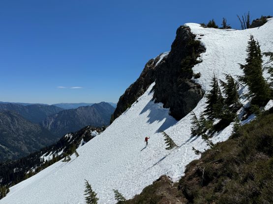
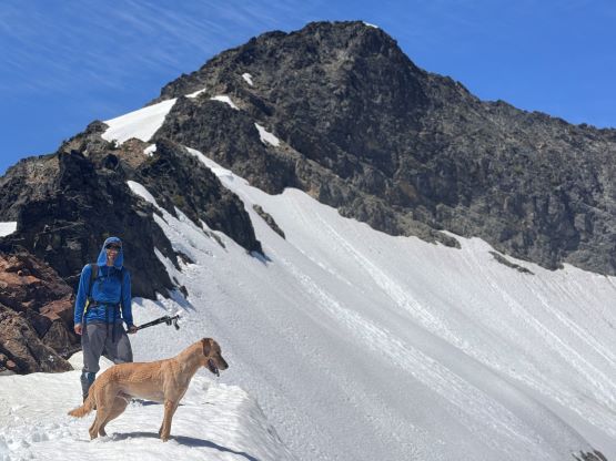
White River was raging but thankfully the hikers’ footbridge was still intact, and from the crossing we had to dash southwards down the riverbank for about 1.5 km distance with 50 m elevation loss before actually starting the ascent. The next stage was a long plod up some endless switchbacks all the way to the ridge crest with almost 1000 m elevation gain. Matt was cruising up as his usual fast pace and I was always struggling to keep up at the initial hour. The day was hot and humid and I was also using this trip to test out my brand new Arc’teryx trail shoes and those shoes were starting to give me blisters about half way up. I had to take a break to tape my feet but other than that, the shoes were rather awesome. We encountered some patches of snow near the ridge crest and I was able to even kick some steps in. The objective was still very far away with several bumps to traverse around, but the views were opening up and our stoke level was high. This was shaping up to become a prettier day than anticipated.


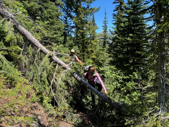

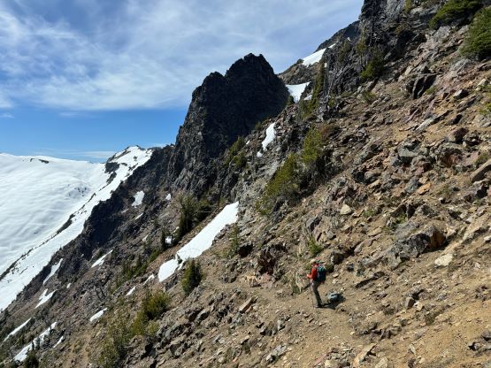
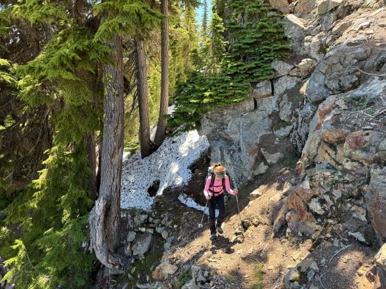
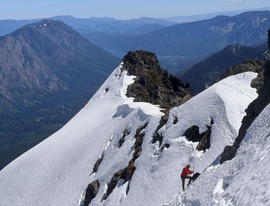
The first bump was ascended on the SW side and the trail was mostly dry on that side, but the trail bypasses the second bump on the NE side and was entirely covered in snow. The ridge crest was mostly dry so we made the decision to go up and over this bump despite the 30+ meters of elevation loss. The backside of this bump required some 3rd class scrambling so it wasn’t exactly the “plodding over”. I was going to ditch the trail runners for mountaineering boots at the top of this bump but decided to carry them down to the next col in case we wouldn’t be going back via the same way. We all took a long break at the next col ditching a bunch of stuffs, and the route ahead would be more “mountaineering” than “hiking” in the current conditions. Matt led us traversing around the obvious buttress ahead on climber’s right roughly following the snow-covered trail, and then Erica and I took over the lead post-holing our way back up to the ridge crest. The snow was extremely sloppy (expected) and the trail-breaking duty was heavy at times. The next buttress was attacked on the drier SW side and we were able to mostly follow the trail, zig-zagging our way up.
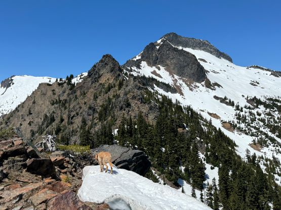


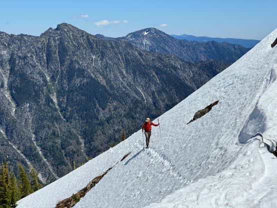
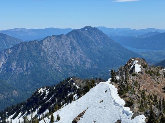


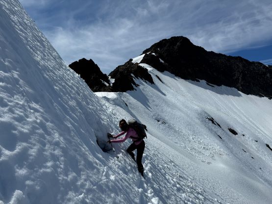
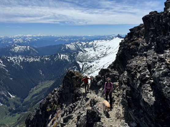
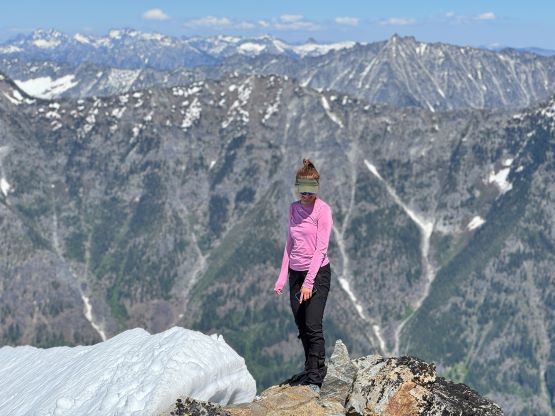
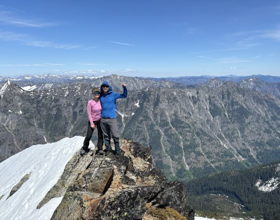
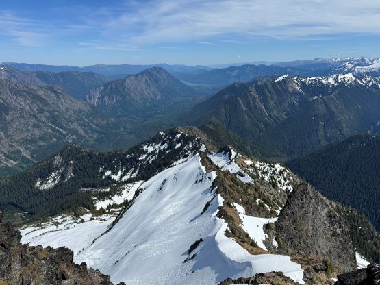
It appeared that the connecting ridge was no longer an option due to some jagged towers and the trail shown on my map indicated a rightwards traverse onto the open snow slope. We decided to traverse the snow slope but staying as high as possible. The condition was quite shitty as I triggered a bunch of wet slides while leading the way across. I actually on purposely to dislodge the slope underneath and I was able to trigger most of it as we went across. At one point Twig somehow decided to go directly above me and that put me in a rather dangerous position. Thankfully I was not far below the ridge and was able to climb out of the slide that Twig triggered. Matt called Twig to stay behind and then all of them followed me up rotten and steep slope onto the ridge. There was more scrambling involved because the most obvious route involved climbing another steep and unsupported slope and I did not like the condition for that. Thankfully the climber’s right of that snow slope was easy enough to scramble (class 2+). We did eventually have to cross that snow finger but that was much higher up, and then picked up the uppermost trail and were on the summit shortly after. This felt like a hard won summit and we lingered on the top for over half an hour to soak in the views.


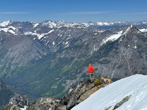


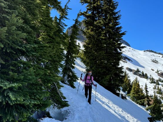
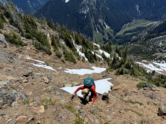
On the descent Matt volunteered to go ahead and he plunged some rather large steps roughly following our own tracks. The sun was already somewhat behind the slope and Matt was unable to trigger additional slides. Erica and I gingerly followed from behind and we did a few more bypasses on more steep slopes following Matt’s lead. At one point Matt discovered a neck-deep moat/hole but was able to climb out of it, and despite the overall shitty conditions we made quick work back to the saddle where I ditched the trail runners. The decision was made to stick with the devil that we knew, so we scrambled back over that bump, and I kept the waterlogged mountaineering boots all the way until completely running out of snow. Matt, being the fastest on the downhills took off ahead but Erica and I were also going to run most of the descent. We eventually finished about 15 minutes behind Matt but we took numerous breaks to appreciate the environment so we likely didn’t run much slower after all. This was a very pleasant “easy trail run”. Our round trip time was under 8 hours. While driving out Matt discovered a burger place in situ and we had an awesome dinner before committing to the long drive ahead. We eventually got back at 10:30 pm and both Erica and I discovered ticks. There was thankfully no bite as we found them rather quickly.