Mount Colonel Foster
July 4-6, 2023
2134m
Vancouver Island, BC
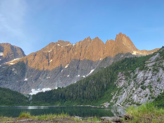
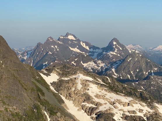
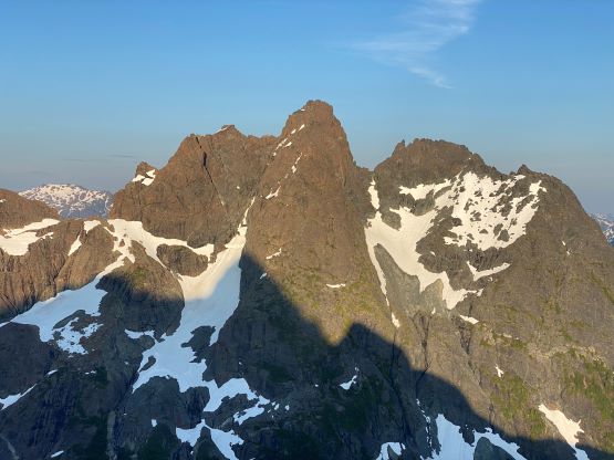
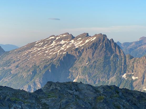
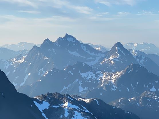
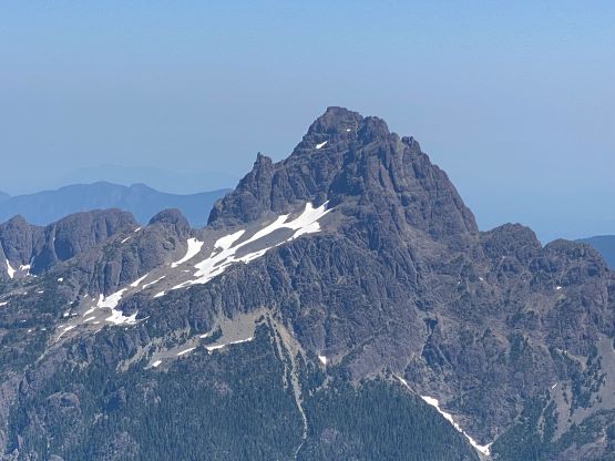
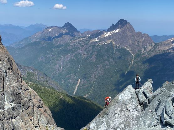
The daunting massif of Mt. Colonel Foster is the “mountaineering central” for the island’s alpinists thank to the mile-high East Face offering numerous difficult routes, summer and winter. It’s also generally considered as the most difficult peak on the island by the easiest possible way, at least among the major, sought-after objectives. The true summit sits in the middle of the 2-km ridge with countless towers and gendarmes. While some folks only ascended the easier southeast peak and claimed Mt. Colonel Foster, I could not do that. To claim the success one must climb the main peak. The route “beta” of Mt. Colonel Foster is overwhelming on Island Alpine Select by Phil Stone and internet.
I had been studying and thinking about this peak for many years, and eventually decided on the ascent by southern half of the summit traverse, and the descent by GWC “Great Western Couloir”, while camping at the South Col. Generally speaking I’m only interested in the easiest way up a mountain, and some might wonder why I didn’t ascend the GWC which by many, is considered as the easiest way to reach the main peak after it being discovered in the recent years. I only partially agree with that because the timing of an ascent of the main peak by GWC is very tricky. One needs the couloir to be filled in and the summit ridge to be dry. To combine this with 3-4 days of bomber weather the window generally do not last for one week each year around “late spring” and the exact timing varies. For someone not living on Vancouver Island it’s very difficult to find the right window. The route I took by doing the summit traverse from south does involve more (though not harder) climbing, but can be done anytime in the first half of “summer”. One only needs some adequate amount of snow coverages to rappel/descend the GWC as opposed to ascending it. The final trigger was pulled spontaneously as the original objective fell through thank to the lack of available helicopters. I made the suggestion to climb Mt. Colonel Foster on the island. Francis and Elise agreed, but not extremely stoked but that’s understandable. They had never seen this peak and Francis had never even heard about it. I assured the team that they would be tackling one of, if not the hardest peak in their respective climbing career to date.
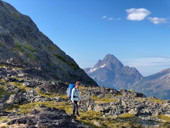
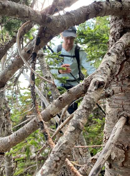
Due to the uncertainty in ferry logistics I insisted for us to have 4 days cleared from work but realistically I was counting on only needing 3 days, and I was correct. Elise and I booked our outbound 5:15 am ferry from Tsawwassen to Duke Point and we almost missed out the ride thank to not showing up there more than half an hour ahead. We showed up at 5 am and they cancelled our reservation spot, but we got on nonetheless, though barely. There were 4-5 more vehicles behind us and that’s it. Had we shown up a few minutes later we would have to wait several hours for the next ride. A few hours later we were in Campbell River refueling and another hour later we parked at Elk River trail-head. We eventually started the long ass approach at 11:30 am and our packs all weighted around 30 lb. We decided to open-bivy both nights and I even left the Thermarest behind, carrying only +2C Western Mountaineering bag (weights 450 grams) for the overnight stays. I also left behind the rain/hardshell jacket, putting my fate on the weather forecast being correct for the 48-hour period. In terms of technical gears we had two 60m half ropes – my 7.5 mm and Francis’ 8 mm, a small trad rack, rock shoes, mountaineering boots, aluminum crampons and one ice axe for each climber, and used everything that we brought. We could have left behind some of those cams but that’s it.

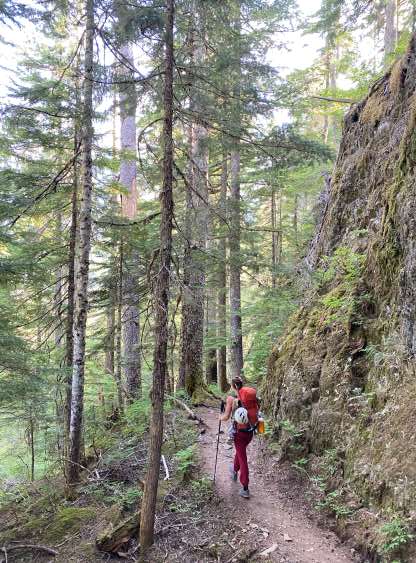
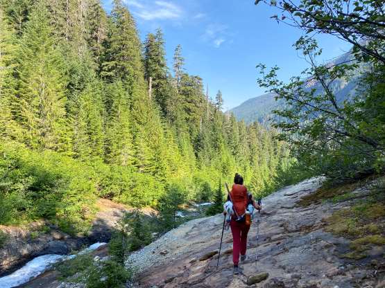
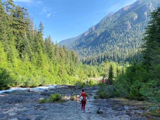
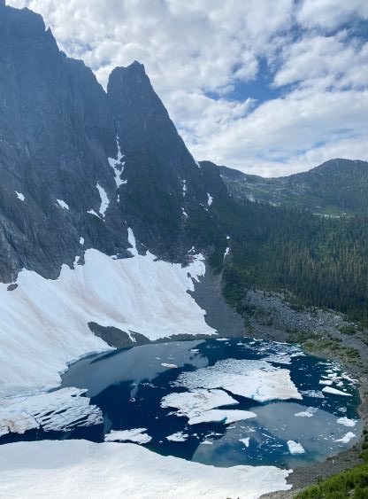
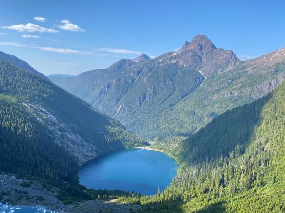
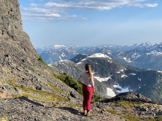
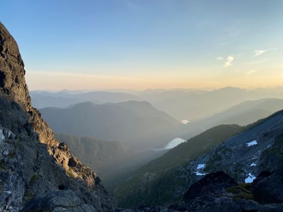
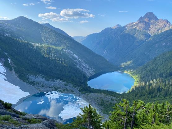
There’s not much worth documenting about the 12-km approach to Landslide Lake but I have to stress that despite the popularity this is still an Island’s trail, meaning we had to step mostly on rocks and roots and deal with countless up-and-downs. To gain the same elevation/distance stats I think Vancouver Island terrain requires the most amount of work among all of the places I’ve climbed in, and this trip proved this hypothesis again. Right off the bat we had to deal with a 60-m elevation loss that we must appreciate two days later on the return. We made sure to take our time doing multiple stops. We had agreed to not carry too much water as there are water sources everywhere, so we needed at least 3-4 breaks to filter/load up water. Landslide Lake was the first scenic spot in this entire approach and even I was impressed by how dauntingly big Mt. Colonel Foster is, even after seeing it through my own eyes several times in the past. The sight was jaw-dropping for Elise and especially Francis since he hadn’t even heard of this peak before. I don’t know how, as it’s the best mountain on the Island. The water in the lake was not looking particularly promising but I had brought the filter for a purpose, so we drank from the lake. We then dashed up the even-more-rugged trail around Landslide Lake to Iceberg Lake. Part of this trail was literally a boulder field on a stream bed. I reminded the group again that we were overall on the island and this was to be expected.


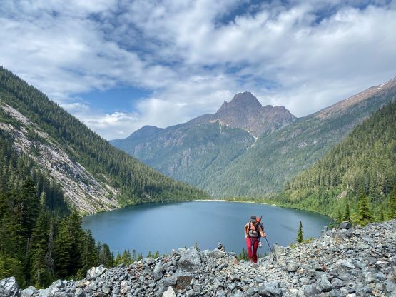
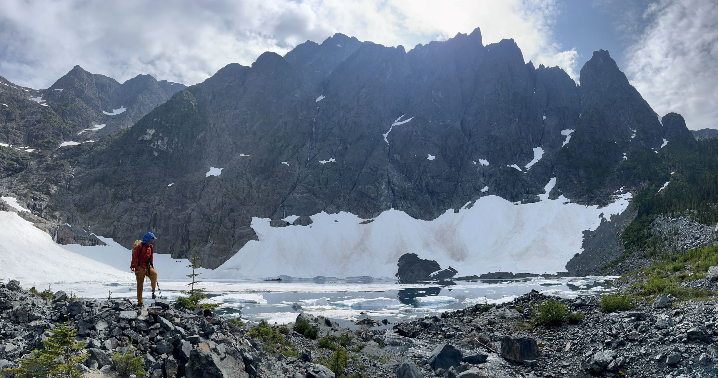
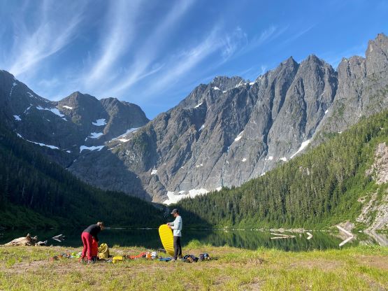
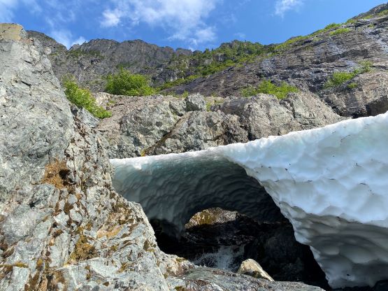
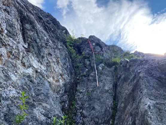
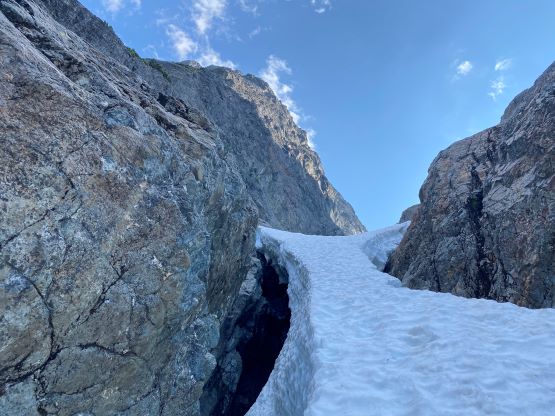
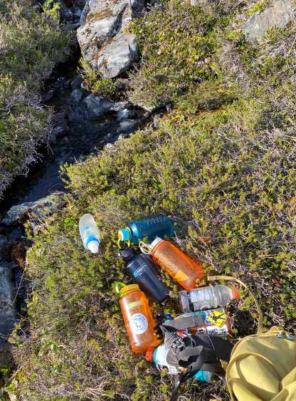
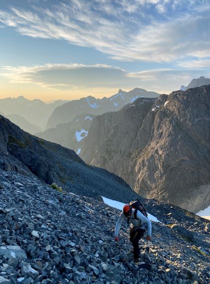
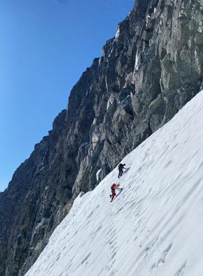
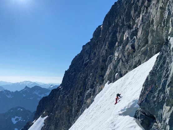
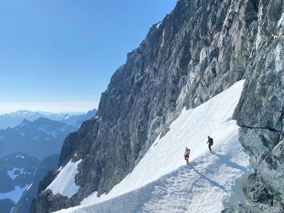
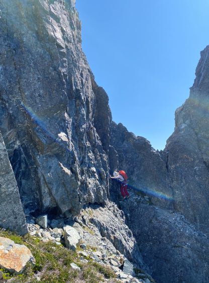
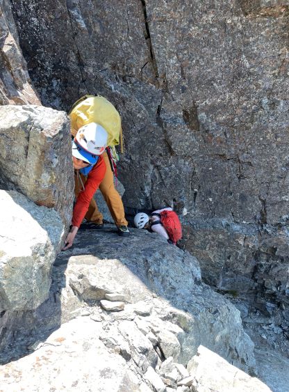
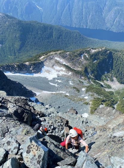
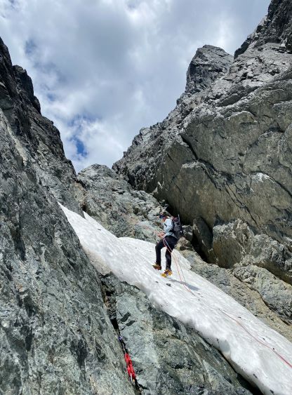
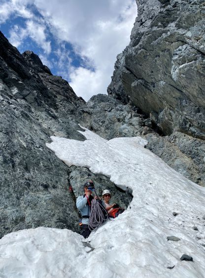
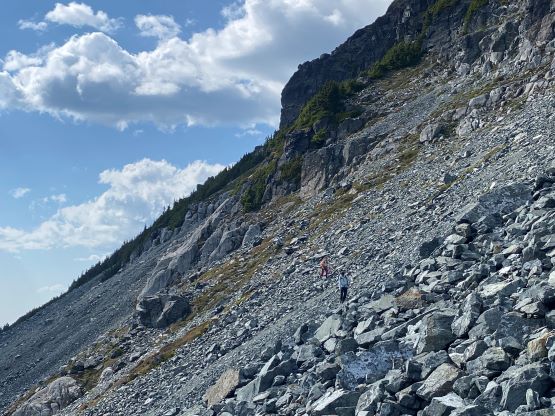
Not doing much lingering I led us traversing around Iceberg Lake and then we ascended a long slope of unstable talus and scree. The exact route on the lower section of the climb to South Col depends solely on the snow coverages so we were relying on in-situ decision making. This year was exceptionally dry so we were in the “late season” conditions. Above this aforementioned talus slope we traversed horizontally towards climber’s right. The snow couloir was long gone, so our only option was the rocks on climber’s right. I tried to locate the “class 2 grassy ledge” mentioned in Phil Stone’s book but to no avail. Instead, we spotted some slings and decided to just climb the direct line, which turned out to be 4th class. With our heavy packs it was very difficult and we decided instantly to rappel this section on the descent. The steep bits yielded to a long stretch of 3rd class scrambling before we were able to merge onto the snow. The snow appeared to have one tight constraint but I insisted us to don crampons at least to check that out. I was correct in the end, that despite the look the hourglass was just wide enough to ascend though a gap was already starting to form. After gingerly made our way across we plodded a long ways, gaining several hundred meters to the south col, slowly but steadily. The final headwall beneath the col also required a little bit of steep snow climbing and we took several different lines. There was abundant mosquitoes but no running water at the col, but I spotted a tiny stream down on the opposite side. I then loaded all of our water bottles and made a single trip down west (~50 m descent) and the result was positive. I obtained sufficient water for all of us to at least the upper snowfield on the following day.


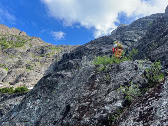


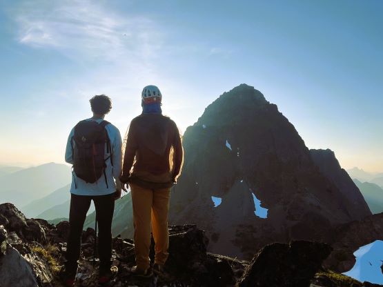
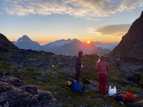
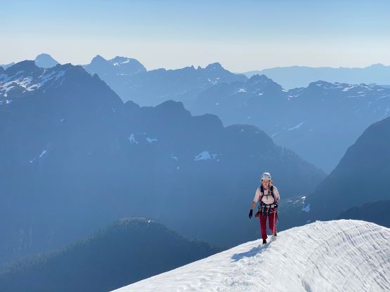
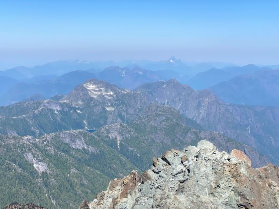
Due to the mosquitoes I was not keen on lingering at the col. I did bring a bug jacket but they were still annoying. I made the suggestion to scramble “Slocomb’s Rise” which is the sub-summit to the south. It does have a name, though unofficial, as well as over 100 m prominence so it qualifies as an independent peak. Francis was more keen than Elise, but both of them ended up following me up. I had no “beta” whatsoever and the peak did not look like a walk-up from this side, and turned out to be a fun class 3/4 scramble. I was sure that we didn’t take the easiest possible way, but we found a route that worked for us, and in short time we all stood on the summit admiring the late-evening views. The timing was getting on, so we made a hasty retreat and got back to camp before head-lamp time. My head-lamp was accidently turned on in the pack so I used some of the battery pack’s capacity to charge it up. This eventually turned out to be redundant as we did not need our head-lamps in this entire trip. The night was comfortable in my +2C sleeping bag without a pad. I simply put the backpack and the rope underneath. I also used the bug jacket to cover my face and that kept me from being eaten alive by the mosquitoes. I anticipated some bugs but didn’t think they could be that bad at the South Col. This was literally the worst spot for mosquitoes on the entire mountain.


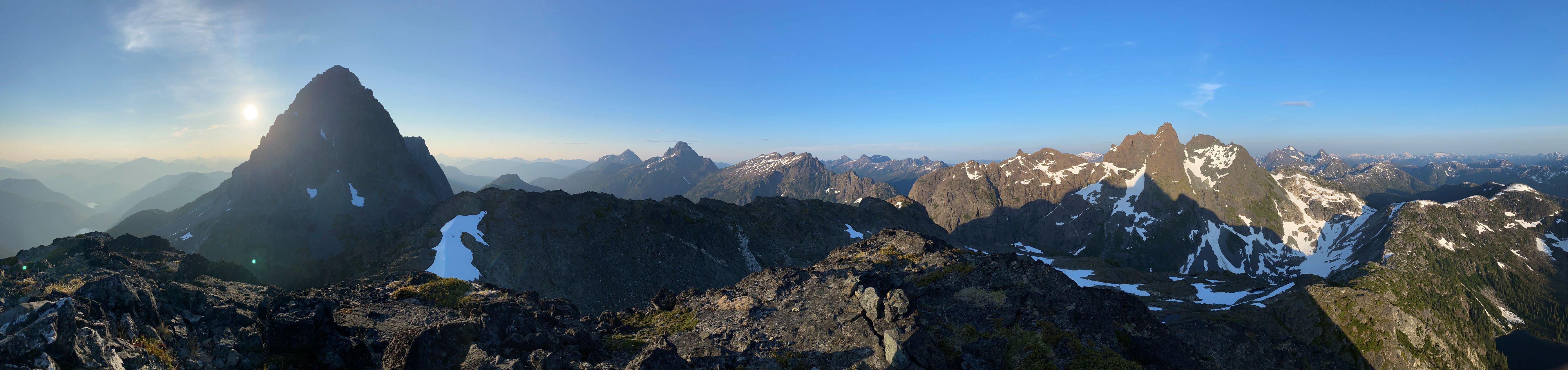


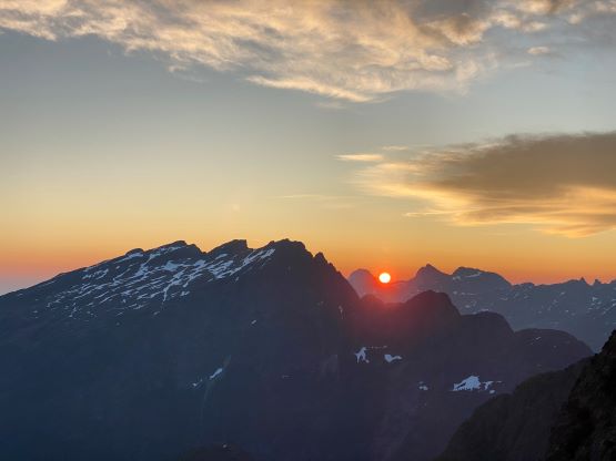
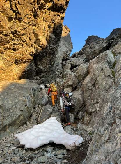
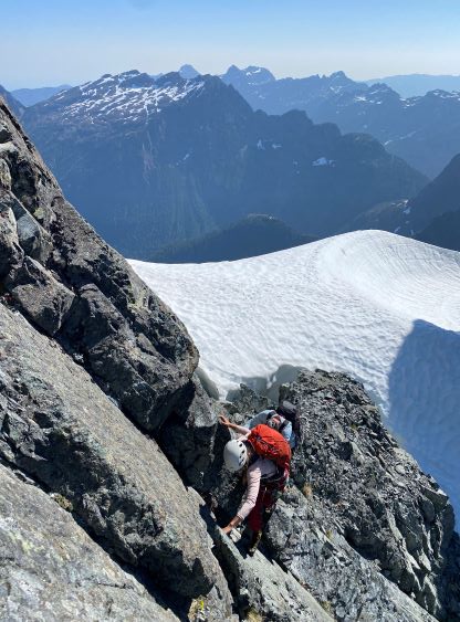
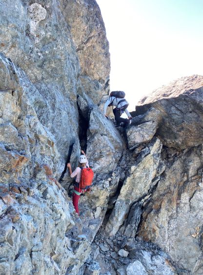
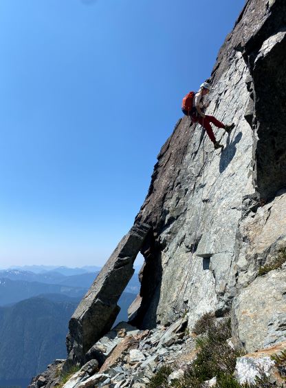
The plan was to wake up at 4:30 am to start climbing at sunrise, but we were about 20 minutes behind schedule. Francis and Elise did not wake up in time but I needed some extra cooking time (hot ramen as usual), so that’s fine. But by 4:50 am they were still asleep so I had to wake them up so we could get going. We watched the incredible sunrise while packing up. The first challenge was the lower gullies to get onto the south face of the SE Peak. There are apparently three route choices illustrated in the book but all I could see was one line being obviously easier than any other option. The book warned this line to be “loose” but I didn’t think so. It’d be loose everywhere on this mountain so it wouldn’t matter much in the end. We entered the two-gully system from the left side, climbed a vertical step with one difficult class 5 move, traversed right then back climber’s left. This positioned us next to a snow-filled gully and we scrambled the 3rd/4th class rock adjacent to the snow to a notch feature on the left hand skyline. From there we traversed further left onto the west side, and corkscrewed around back to the sunnier south side. There was no more difficulty to reach the summit of the SE Peak and I think we nailed the route really well despite not trying to follow the “beta”. By this time I already realized that we should just do our own in-situ route-finding as multiple lines go on this mountain and the “beta” was not super clear at times.


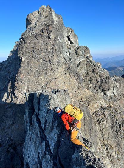
Immediately after crossing the southeast peak we faced a short wall that’d be difficult to down-climb. There was an obvious rappel station so we did one rappel using Francis’ 60m rope. The next section was an awkward knife-edge followed by an exposed traverse around a small pinnacle, which I would call the first real crux of the day. This bits of excitement brought us down to SE/SW peaks saddle. I immediately started soloing the direct ridgeline towards the southwest peak and stopped halfway. A steeper, almost vertical, section on the ridge forced me to don rock shoes (awkward transition) and meanwhile I took my rope out and asked Elise to belay me. Francis was hesitating at the bottom of this pitch and read out the “beta” that we in fact should traverse further climber’s right into a loose gully. I thought about that, but disliked the upper portion of that gully, and replied back that I’d be fine leading this short pitch (5.6 ish). There wasn’t much in terms of protection, but felt straightforward in rock shoes. I then belayed the others up using an existing anchor and we then easily scrambled to the summit of the southwest peak.


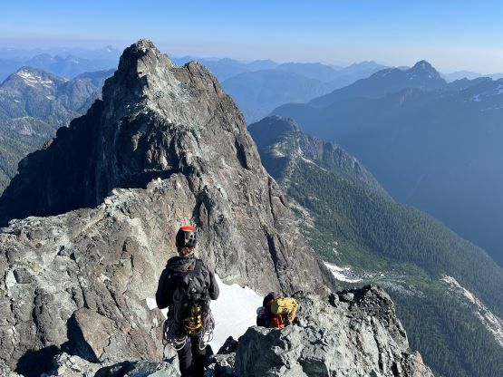
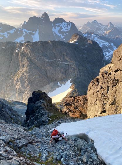
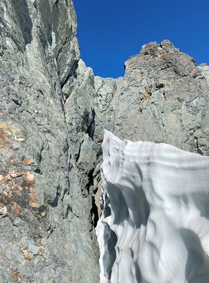
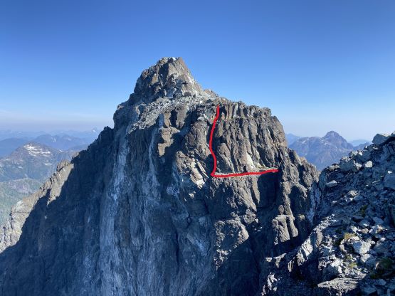
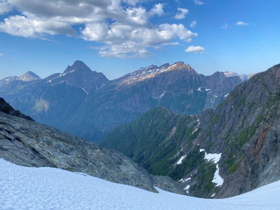
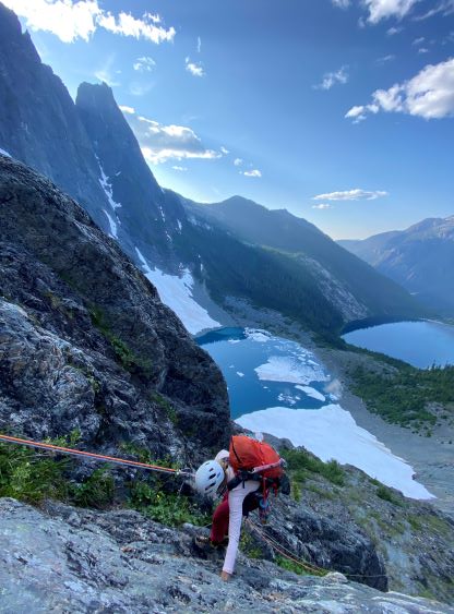
I had read somewhere that we were supposed to do 3 rappels roughly following the obvious granite dyke down to the top of the “upper glacier” separating the SE/SW peaks from the main summit, but I couldn’t find an existing rappel station, nor did I really look for it. Instead, I thought the down-climb appeared rather reasonable so led us down-climbing essentially the first rappel, including one exposed 5.5 slab and some really chossy ledges. We spotted the next stations and did two rappels using my 60 m rope to get down onto the glacier. The 60 m rope wasn’t sufficient enough to completely link up the two rappels so we had to down-climb about 2 meters of exposed 4th class rock. The second rappel was tricky in the way that I had to aim perfectly for the only spot where the rock-to-snow transition wasn’t a 10-m deep moat. While waiting for the others to rappel down I donned crampons and took the ice axe out. The traverse from here to the top of the Great Western Couloir was steeper than expected such that we had to traverse facing into the slopes for quite a ways, thank to the slushy snow conditions. We then took the first lengthy (planned) break at the top of the GWC to melt snow. That was part of the plan as we didn’t want to carry too much water knowing there’d definitely have snow on the route. We also ditched the extra sleeping bag, ice axe and crampons as it’s obvious that we wouldn’t be forced to bivouac on this route. It had only taken us 3 hours to get here and we were now thinking to even descend to Landslide Lake at the end of the day to shorten our exiting day.


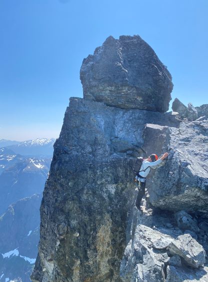
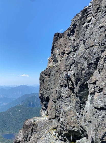
The next section was an easy solo (low 5th class) on boots to get onto a fin type of ridge traverse, which terminated at an exciting au-cheval to the anchor above the infamous 5.8 slab. Our strategy was to leave one rope behind (fixed) so we wouldn’t have the pressure to lead that 5.8 climb on the return, and that’s the main reason why we even brought two ropes here. After the rappel I swapped footwear back to rock shoes and dragged the other rope up the “two-tier pinnacle”. I think the correct route eventually ascends towards climber’s left but I went right after crossing the first pinnacle, and I had to do a series of 5th class moves on an uber exposed corner traverse, while searching for a route. To me this was the mental crux of the climb. Francis soloed behind me and Elise came up with me giving a belay.


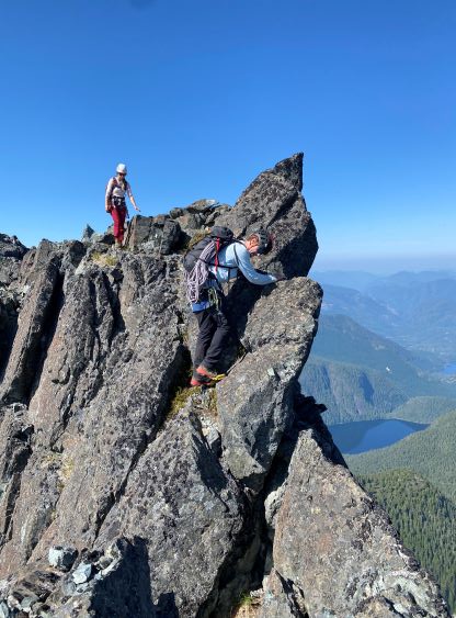
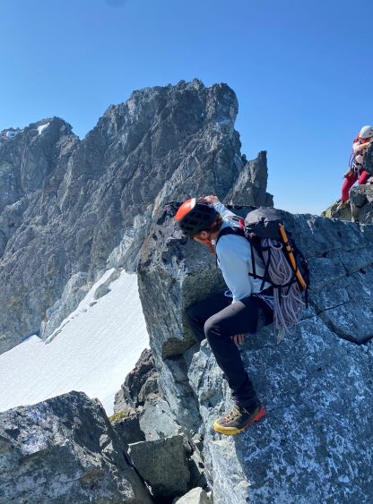


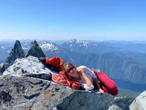
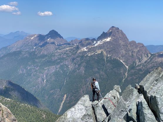
A short, 5th class down-climb brought us down to the next infamous section, the down-sloping ledge traverse leading to an airy step-across with 300 m air straight down into the abyss. I felt this section was easier than expected, but the exposure was definitely real. The “easy gully” afterwards was actually not as easy as expected. Francis took over the lead and we all ended up doing a challenging undercling, which I did not feel particularly exciting about. The gully brought us to an easy stretch under the main summit. We were supposed to traverse climber’s left across a wide scree ledge. We did so, but didn’t traverse far enough. Instead, I started climbing once I spotted a line that appeared reasonable and this decision turned our final summit bid from a simple scramble to an exciting free solo. There were at least two mid 5th class spots in addition to at least two uber airy ledge traverses with massive exposure. The main summit was already in sight and I knew we were off-route, but I didn’t have that patience to deal with more rope work and just soloed everything and we all made the true summit in short time.


About 20 minutes later we had to start descending. Francis pointed out a potential descent line as the ascent to the main summit was not supposed to be that hard. I agreed, and led us down some loose 4th class terrain back onto that wide scree bench. Checking the GPS I finally realized how off-route we were on the ascent, but I liked the result as it’s quite a fun adventure problem-solving into the unknown. The existing anchor would give us a rappel into the “easy gully” but without bypassing that airy step-across. We did not like that option, so moved the sling to another boulder and rappelled straight down to the ledge. While pulling the rope I started soloing up the backside of the two-tier pinnacle as I spotted the existing rappel station on the top of that pinnacle. The soloing was mostly low 5th class but with massive exposure. I yelled back that we should all solo up to speed the process and meanwhile I dealt with the tangled rope while setting up the next rappel. I eventually figured out the rope’s problem, went down and started re-ascending the 5.8 slabs using a prussik to belay myself. Elise stayed behind to make sure my rope was always tight so I could slide the prussik up more easily. We were already doing great on time, so Francis wanted that extra challenge to lead this supposedly most difficult pitch of the whole climb, so I pulled the rope up and started moving backwards across that fin section. I found a good spot to take pictures for Francis and Elise. I don’t know how things get rated on the island but I did not feel this slab to be that difficult and I actually felt a few other spots to be more technical than here. I was already wearing rock shoes so just down-climbed the 5th class wall to the top of GWC whereas Elise and Francis opted to rappel. We took our next lengthy break here, again mostly to melt snow for water.


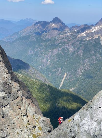


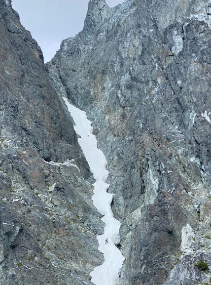
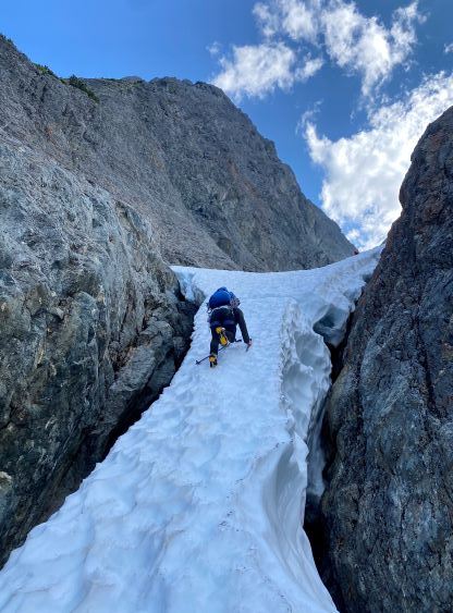
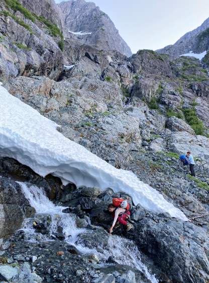
The descent off GWC was not a walk in the park. I knew that but I still underestimated this section. I made us to don crampons as we’d be eventually rappelling onto some steep snow and I did not want to do transition there. We firstly did one single-rope rappel from station to station and the rope was horribly tangled thank to the low-angle terrain. The gully (without snow) was also a horrible rock fall central and full of choss. For the second rappel we decided to just do one double-rope descent straight down to continuous snow and the rockfall induced greatly reminded me the good ol’ Rockies days. Francis and I went down first, found a moat to hide and I said we should remove our packs in case we needed to shield ourselves from unavoidable rockfalls. I had done that multiple times in the Rockies but never had to practice that in the Coast. The ropes thankfully didn’t get stuck nor did the drag induce more additional rock fall. What’s left was about 200 vertical meters of 40-45 degrees down-climbing on snow. With only one ice axe, aluminum crampons and not-so-rigid boots this wasn’t trivial. I nonetheless went down at a faster pace as I wanted to be out of this rockfall zone as quickly as possible. While watching Francis and Elise descending I was humbled by how big this terrain actually is. I had one GPX track stored for the traverse from bottom of GWC back to South Col but we somehow still entered some horrible bush (BW level 4) because we wanted to stay higher. Thankfully it wasn’t too long and the full body wrestling was actually quite fun. I then led us back traversing a mix of choss, boulders and steep heather/grass back to that spot where I loaded up the water bottles, and the 50-m re-ascent was as tiring as I remembered.


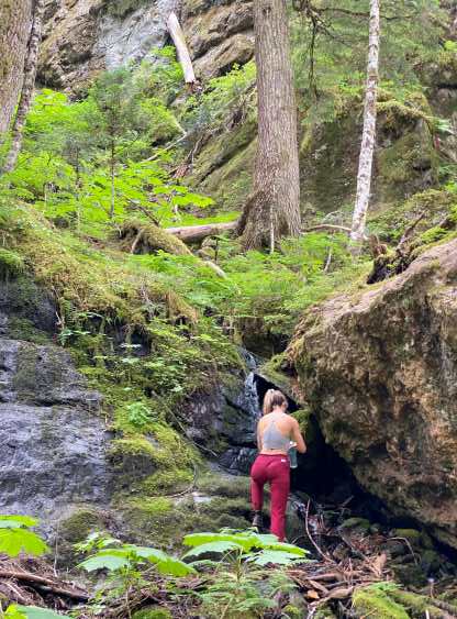
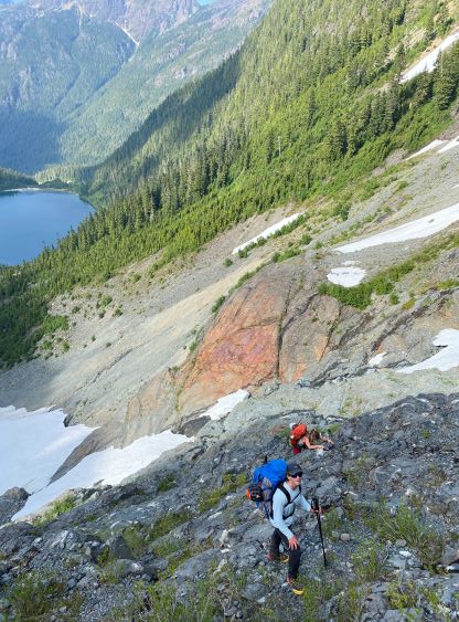
Nonetheless we had to immediately pack up and descend as the mosquitoes were horrendous at the campsite. The packing process took us about 20 minutes and soon we were descending the snow slope under the south col. The lower constraint now had a more obvious gap forming, but was still passible, and in short time we were back to that scrambling section. As planned we did need to rappel, but instead of doing two from station to station we tied the two ropes together and only needed one rappel. Francis led us down as I was already mentally exhausted and needed a break. I then led us descending some confusing grassy ramps and found a perfect spot with running water and a snow cave to cook dinner. About an hour later we had gathered enough strength to descend the 200-m horrible choss slopes down to Iceberg Lake. The traverse to the outflow of Landslide Lake might seem easy on the map, but involved at least 150 m of elevation regain here and there. I don’t know why there are so many up-and-downs but as mentioned earlier this was to be expected on Vancouver Island. We got back to Landslide Lake with about an hour of daylight time left, and leisurely set up for another open bivy. To our surprise there were actually not that many mosquitoes here.


On the 3rd day we slept in till 8:30 am and I still didn’t know how. The sun beams were already shone on our faces and we were still sleeping. It was already too hot by the time we got going, so after finishing the water slabs section Francis and I took off the shirts again. We met a lot of hikers and campers coming up, some with ridiculously large packs and I had now idea how they could be wearing the cloths. The humidity of the island felt like a sauna every time I come here and this day was not an exception. I think we took two short breaks but otherwise we dashed the 12 km out in one shot at a reasonably fast pace. I’m not Mel and I could not run the whole way, but I did lead us power-walking our way out. Our time was under 48 hours car to car with some leisure breaks and long overnight stays. In retrospect we are probably actually fast enough to do the full summit traverse in one day from Iceberg Lake to do this peak in a more aesthetic way, but at the time I wasn’t sure. With years of Rockies and Washington experience I would say the terrain on Mt. Colonel Foster is a perfect fit to my expertise – non-stop route-finding, choss, ledges, low 5th class, but no real multi-pitch climbing at above 5.8 grade. It’s the ultimate test piece for one’s all around mountaineering skills, but one does not need to be a “rock climber” to summit this mountain. We finished the trip at noon, drove to Campbell River for a massive meal in A&W and eventually waited at the Duke Point until 8 pm to finally board the homewards ferry.