Mount Athelstan
September 20, 2024
2800m
Pemberton / Upper Lillooet River, BC
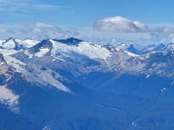
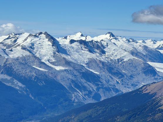
Mt. Athelstan is a large glaciated massif in the headwaters of Upper Lillooet River and is in fact one of the tallest peaks in the loosely defined region of SW British Columbia. It is however, not as prominence as one might expect (only P500+ meters) as it’s connected towards the higher Mt. Ethelweard by some long and undulating glaciated ridges. Regardless whether this is a P600m objective or not Mt. Athelstan should receive more attention than what a simple Google search shows. Most of the trip reports were actually from rock climbers putting up routes on the walls facing Salal Creek, including the “Randy Stoltmann Tower” but those routes have nothing to do with the summit of Mt. Athelstan. There was hardly any “beta” about the summit scramble with the most detailed one being Dean Perez’s vaguely described trip from the lower Salal Creek. This peak had been on my radar for at least 8 years and I thought for sure that someone else would beat me to publish a detailed account on this objective given that it’s only 3rd class and can be done in one day, but I was being too optimistic about the popularity of this area. Fast forward to 2024 I finally decided to pull the trigger and I still had to resolve the unknowns. I did know that a few friends including Alex R. and Vlad M. had climbed it but they did not post trip reports back in the old days. I went back to Dean’s account and this time, with my previous experience in Athelney Pass I was able to more or less put together Dean’s route, and between his ascent and decent lines I opted to take the descent (gully) variation mostly for simpler navigation.
As usual Erica would accompany me for the mission and our decision was to leave Vancouver in the previous evening and sleep at the trail-head, or more precisely the end of the drivable road. I also thought about the longer south route which might be more “obvious” from the topographic maps but the SW (Dean’s) route is definitely shorter, albeit much steeper. Given our time constraint it made sense to take the most efficient way. This area is known to have grizzlies so we invited a few others, but no one else was keen to join. I finished work at 9 pm in White Rock, drove home to swap vehicles and then drove to Burquitlam to grab Erica at exactly 10 pm. We made quick work up the Sea to Sky corridor but the 40+ kilometers of bumpy ride along the Upper Lillooet FSR wasn’t as smooth as I was hoping for. The second half wasn’t too bad but the initial 15 km had some long stretches of washboards. Gaia was still incorrect about that section above Keyhole Hot Springs but I knew the way this time after making a mistake back in May on the Meager Group trip. We then turned onto the Salal Creek FSR which was apparently decommissioned given the amount of ruts we encountered in less than 2 km distance. To navigate this road one needs a 4×4, high clearance vehicle. I was originally hoping to drive into and through the pumice mine but it’s gated, so I drove around to the next (secondary) spur system, and parked shortly after the turn-off. That final spur road had become seriously overgrown to the point that hiking would be faster than driving anyway. We then hastily set up the tent and went to bed at 2 am.

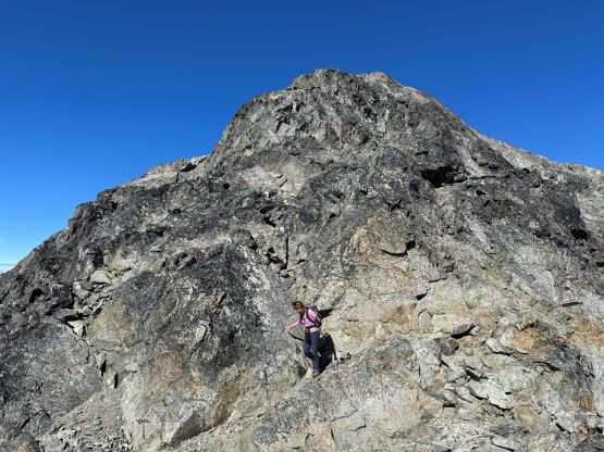
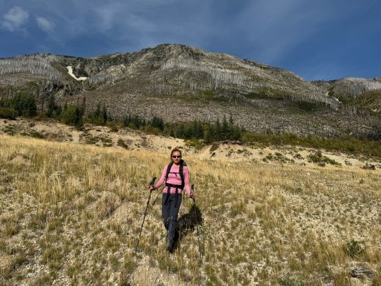
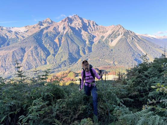
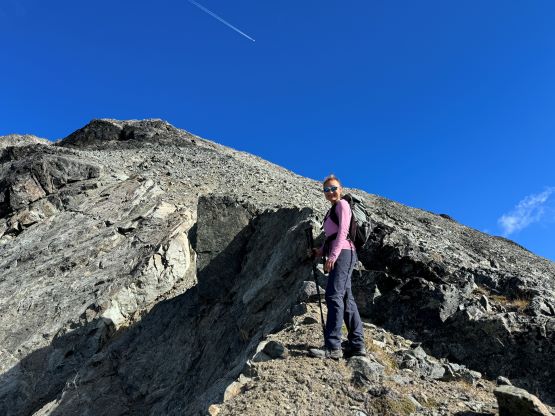
The weather was supposed to be good for the entire day so there was no need to rush. I decided for us to sleep in until 7 am and we did not start hiking until 8 am after the usual morning car-camping routine. One benefit for driving this far into the remoteness was the ability to leave the tent unattained for the course of the day. The sleeping bags would be left there to dry while we were out hiking, and there’s no need to worry about theft activities. Until this point I was still not 100% clear where exactly Dean went but now with daylight I could finally make out his route(s). I decided to aim for his descent gully but take our own variation and do our own route-finding as in the microscopic scale we needed no assistance in route-finding. We firstly followed this overgrown road to the open (but gated, not accessible) road above and beyond the mine site, and then continued the eastwards bearing after passing the road’s end. The forest had been burnt in the recent time so the cross-country travel was straightforward with minimal bushwhacking. The in situ decision was made to traverse into that gully as quickly as possible but in retrospect it would be easier to plod up this burnt forest for a few hundred vertical meters and intersect the gully much higher up. The lower gully had at least two 4th class steps that put our scrambling skills in test. The lower one was wet and down-sloping whereas the second one was loose even by Rockies standard. I promised Erica that we would find another route on the way down.


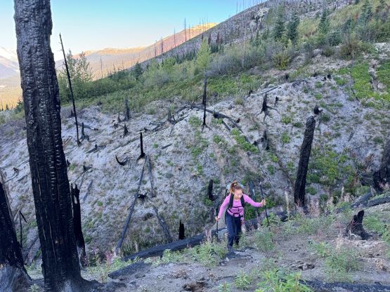


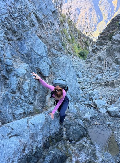
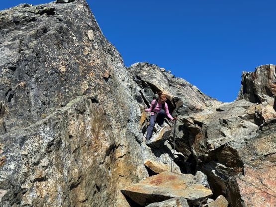
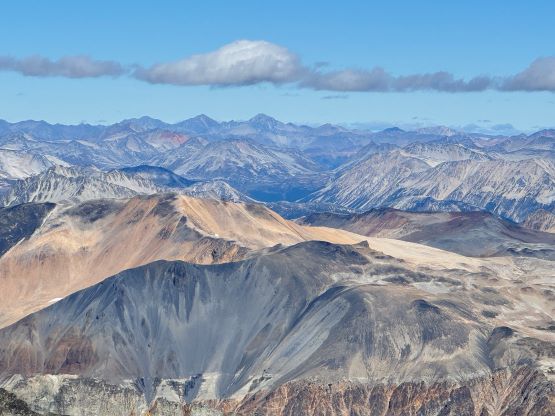
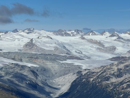
I also believed that Dean did not take this lower gully on his way down and he likely veered skier’s right and descended the burnt forest in similar way that we did a few hours later. In any case the middle gully wasn’t too bad, but the entire course of this approach route was loose. It might actually be better to investigate the forested rib on the climber’s right side of this gully as the going was quite tedious especially on the way down and especially if climbing in a larger party. All of the obstacles and steps could be attacked head-on with minimal detouring except for one, which we bypassed on climber’s left. The terrain was loose even on the bypasses. The last few steps in the upper gully was definitely 3rd class and we even did some more direct 4th class moves for practicing purposes. Again when I go out with Erica I needed not necessarily aim at the easiest possible way because she needed to gain experience as quickly as possible. The gully eventually gave way to a steep slope with some compact moraine type of choss, and we aimed slightly climber’s right instead of following the fall line. After a much-needed break donning sun protection we ascended into what I called the “middle basin” in this Truckwash Creek drainage, and then did a hard rightwards side-hilling traverse across several ribs and creeks to access the upper mountain. We resisted gaining elevation too quickly here.


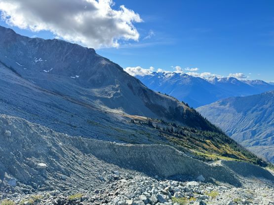
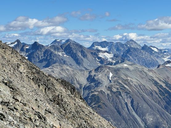
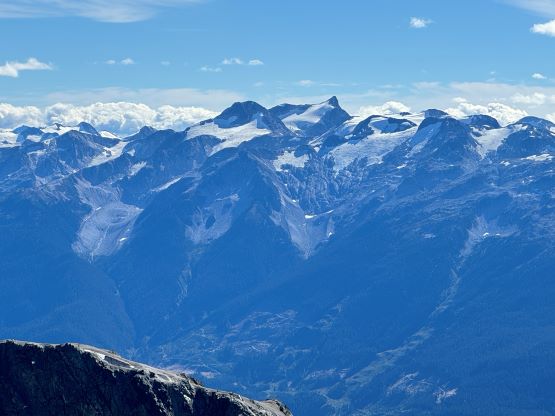
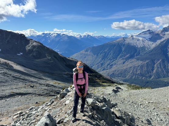
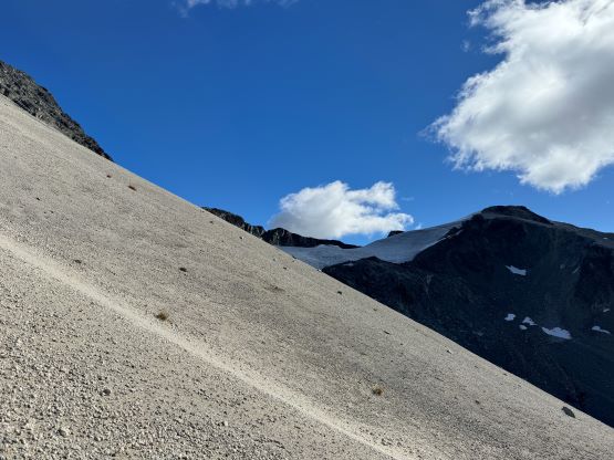
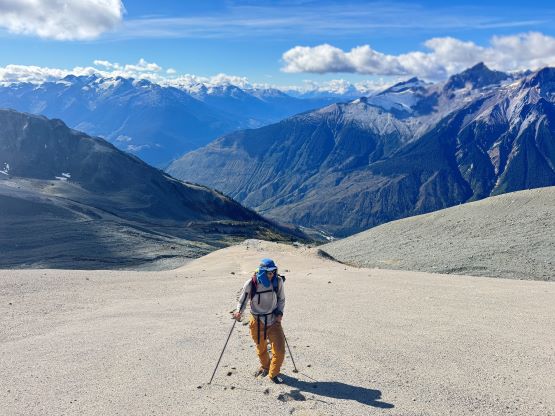
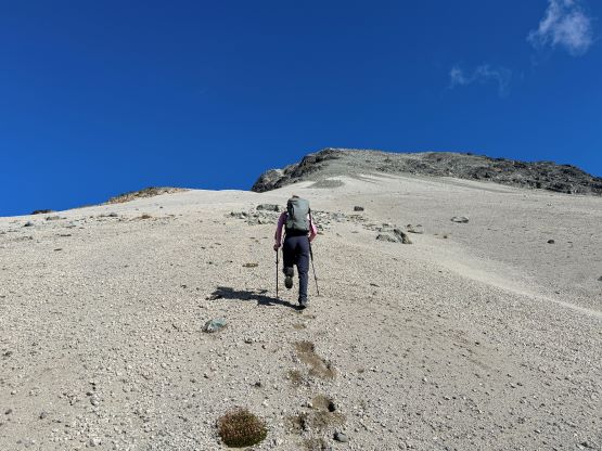
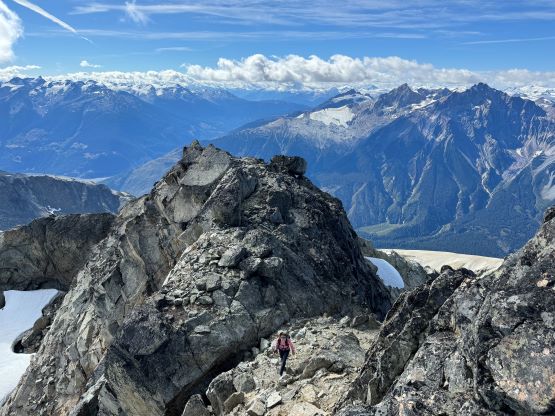
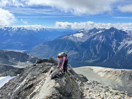
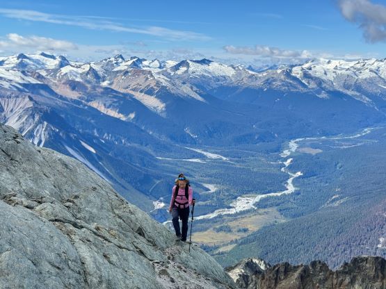
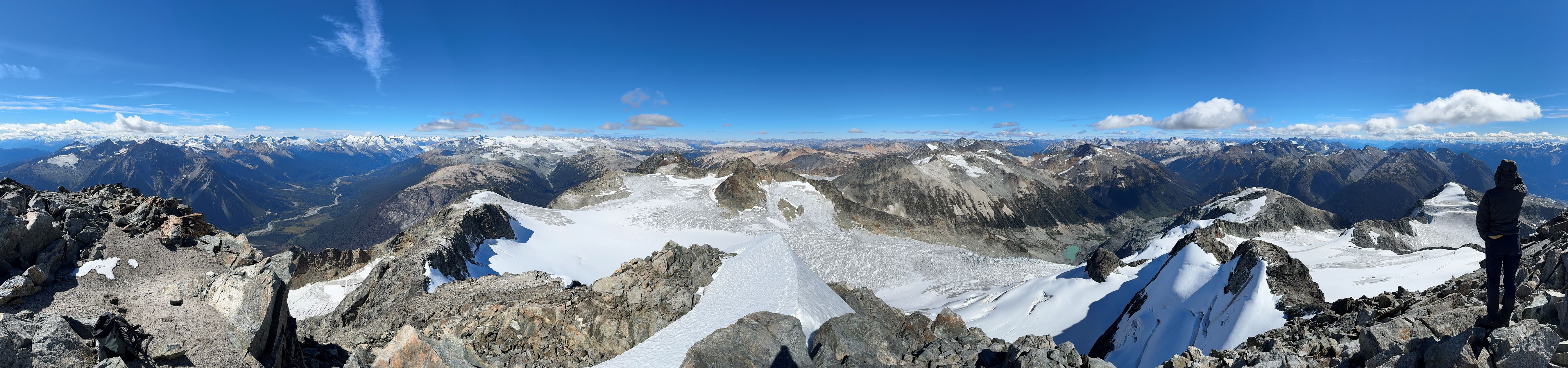
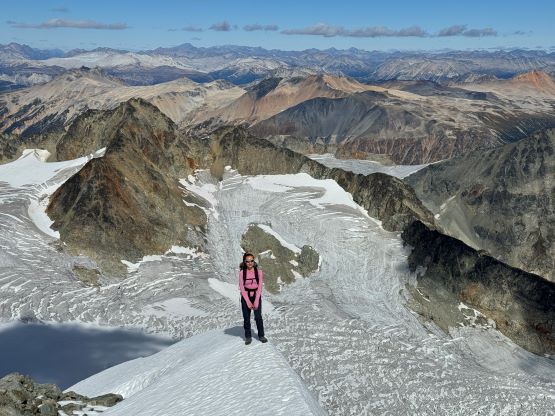
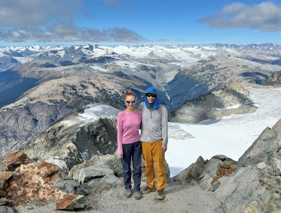
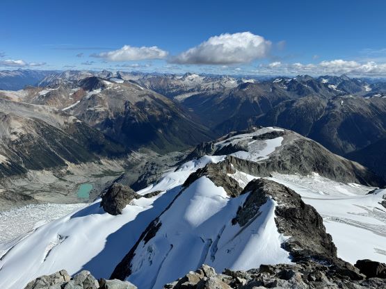
We eventually traversed onto a moraine crest and followed this crest for at least 100 vertical meters to the base of the infamous pumice slope. In retrospect we should have kept the traversing even more flat and that would bypass this moraine crest. The moraine was far from “fun” and definitely required some caution but I told Erica that the one I ascended on Mt. Cayley was five times worse, so might as well take this as a practicing oppourtunity. The pumice wasn’t as bad as what people made it sound like, but it was definitely a tiring treadmill game. I made Erica to go ahead for the maximum amount of experience and I had to made additional “trail-breaking” on top of her tracks. I honestly thought this was quite interesting as the slope wasn’t never-ending so the post-holing was sort of refreshing from the tiring grunt on the various other types of choss. I found the slog to the false summit from the top of this pumice field was the most tedious as the terrain was monotonous and we were already sort of tired by this point. For the final traverse to the true summit along the south ridge we opted to stick as close to the crest as possible dealing with numerous 4th class steps. The scrambling was longer and more challenging than expected. I however thought most, if not all of the 4th class challenges could be bypassed if needed. Our ascent time was 4 hours so the day was still young. The clouds were also lifting so we lingered on the summit for quite a while to fully soak in the experience.


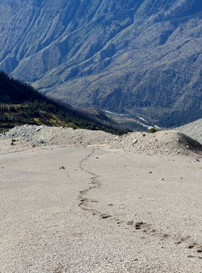


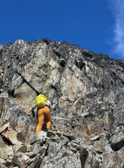


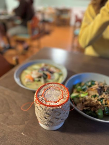
On the descent I initially thought about to make things on purposely hard as right off the bat I led us down-climbing a committed 4th class variation, but then I became tired and wanted to get off this mountain as quickly as possible. I then did the route-finding more carefully and bypassed the rest of the challenging steps so the south ridge would indeed go at “class 3” if one wants it to be in that realm. We then enjoyed a furious plunge down that pumice field but then we had to face that moraine crest as well as the tedious and loose terrain lower down. The rest of the descent into and then through the gully was far from enjoyable and we took numerous breaks along the way. I had opted to wear trail-runners for the entire day and they were slightly undertooled for this type of terrain on the descent. It was loose even by Rockies standard and at times the microwave sized boulders could come loose upon touching. I also had to regularly dump choss out of my shoes as the tiny built-in gaitors were of no use. Eventually I spotted a reasonable place to leave the gully and led us traversing into the burnt but open forest. To get out of the gully required a band of intense bushwhacking but that was short-lived. The rest of the descent was rather enjoyable but again we had to deal with the sands in our shoes. This turned out to be one of the filthiest routes I’ve done in SW BC with infinite amount of choss (of various types), but the technical difficulty was at most the upper end of “class 3”. The access does require a beefy vehicle but the approach is “short” especially by this area’s standard. Our round trip time was 8.5 hours including all of the breaks. We then drove back to Pemberton for a well-deserved Thai dinner, and then drove home by 10:30 pm. Perhaps the most memorable sighting of the day was a monstrous sized grizzly in the middle of a farmland in Pemberton Valley.