Mount Addenbroke
June 9, 2025
1591m
East Redonda Island, BC
Mt. Addenbroke is an elusive objective but has been on the radar of discussion in various groups of enthusiasts, for reasons of being the highest peak on East Redonda Island (and subsequently the entire region called the “Discovery Islands”), and the fact it’s one of the dozen-ish peaks in SW British Columbia that boast over 1500 m prominence. There’s no public access to any of those Discovery Islands by B.C. Ferries beside Quadra and Cortes so a week-long kayaking expedition from either Cortes Island or Sunshine Coast near Lund seems like the only viable way besides chartering a boat. There is in fact, a fairly detailed trip report in 2020 by Anthony Mallinson documenting the former type of expedition, but I lacked the skills, experience, equipment or the time commitment to execute such kind of trips. Earlier in this year Matt Juhasz had opened the door of climbing Mt. Van der Est by chartering a boat with S.S. Fun Ship (from northern Vancouver Island) and a group of us, myself included, followed a week later. That was an eye-opening experience for a few of us, that the peaks in the vicinity are no longer that elusive anymore. Peter from the boat chartering company is willing to drive his boat literally anywhere everywhere including but not limited to the heads of Toba and Bute Inlets so it would make sense to hire him again for Mt. Addenbroke.
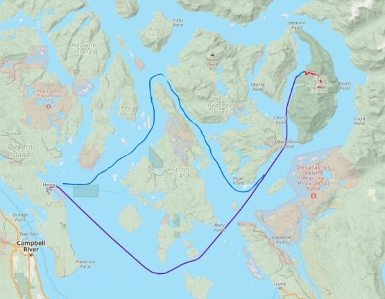
Trevor and Alex took the lead this time organizing the trip so for once I no longer needed to be on the frontline dealing with the logistics. A total of 6 boats/ferries would be needed for this one particular objective. Combining the “beta” from the old Fairley guide and Anthony’s sea kayaking trip report we were able to figure out the route in the bigger picture. There was still no information detailed to the current era’s standards so we decided to bring two 30m taglines so that we could tackle almost anything. The other party members were Adam Walker from Las Vegas, Dave Golias from Seattle and Kelly Wilson from Whistler, and combining our expertise in route-finding and rock climbing I was very confident that we could get it done in just a single day. For the home-to-home itinerary we extended the trip to 2 days to justify the cost and the complications. We would be spending at least 7 hours on the water so we might as well bag a few other objectives. On the first day we took the 6:15 am ferry to Nanaimo, drove north and tagged Mt. Menzies and Newcastle Ridge before heading back to Campbell River for the secondary ferry to Quadra Island. We settled the night on a random FSR pull-out and the next morning we met up with Peter at Heriot Bay at 5 am as planned.
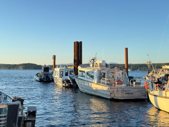
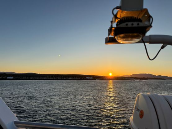
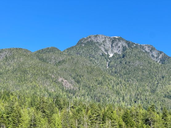
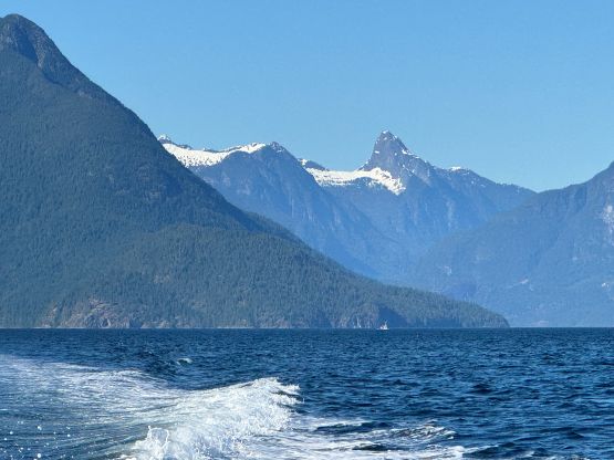
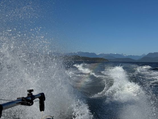
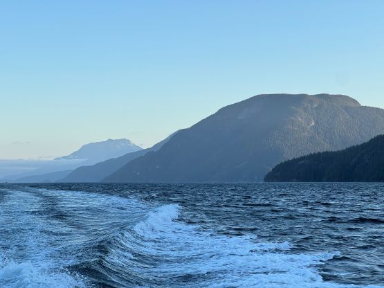
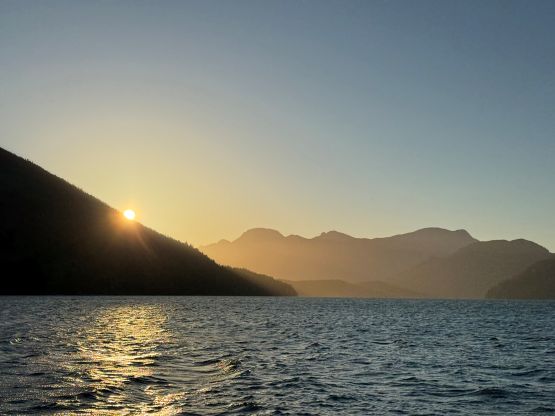
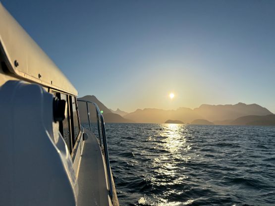
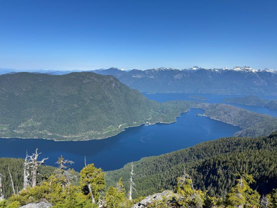
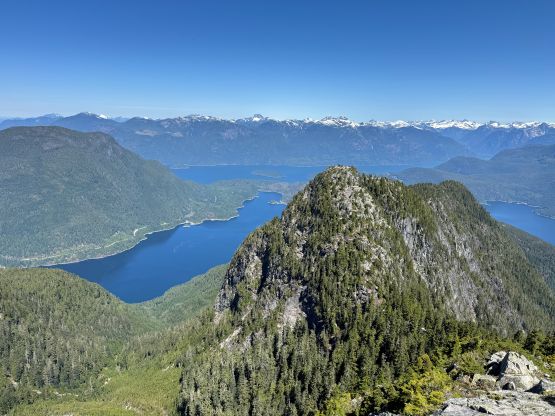
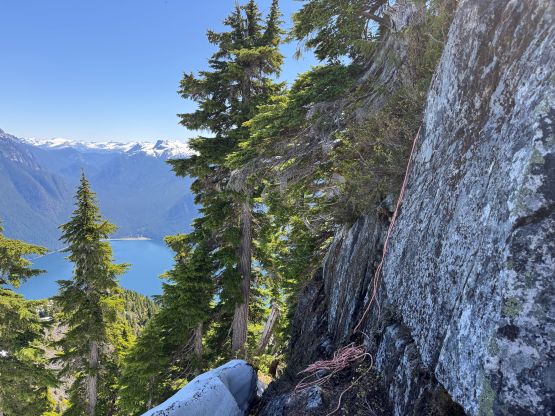
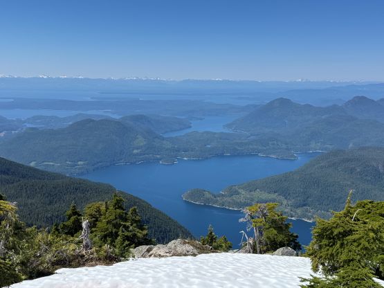
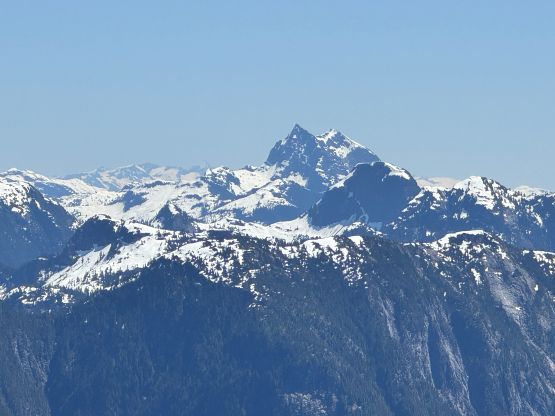
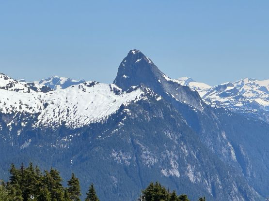
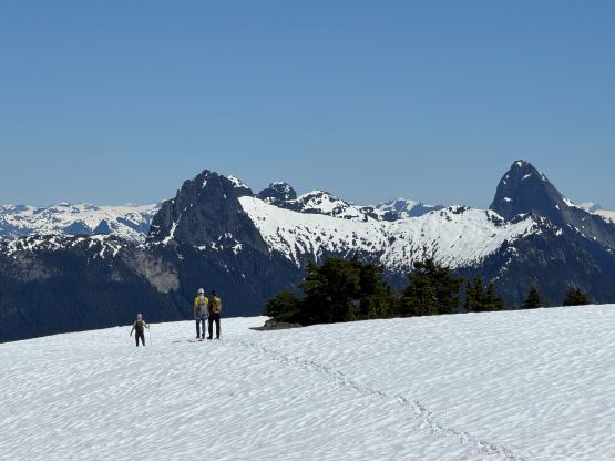
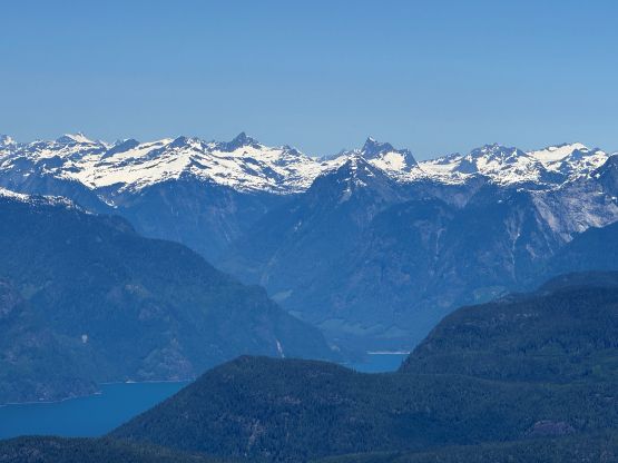
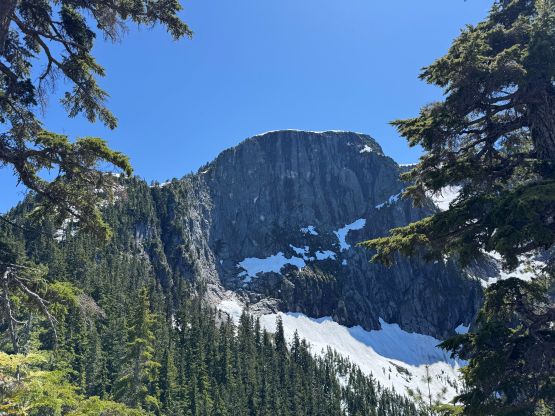
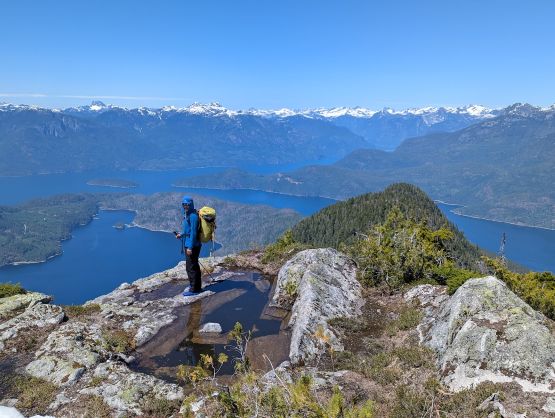
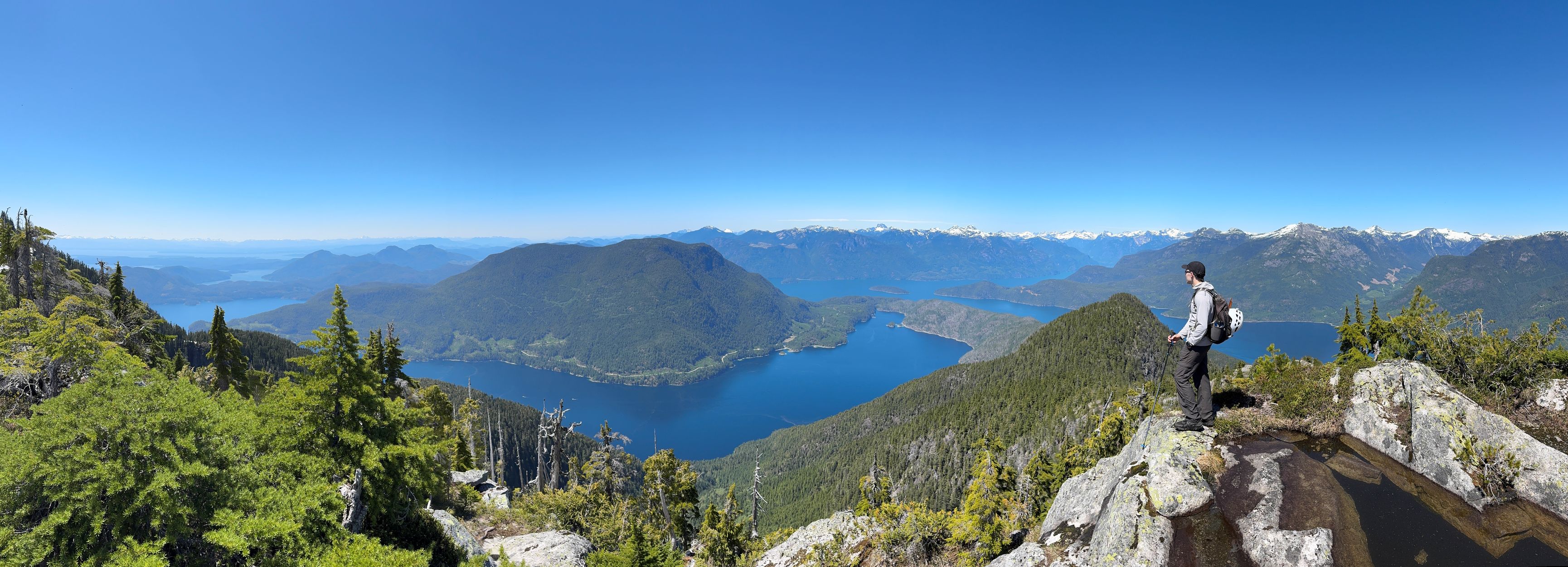
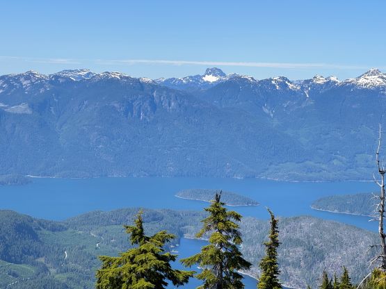
The weather was clear but windy and the water was quite choppy, so we made a detour around Cortes Island on the north side. I wasn’t entirely sure if this route was chosen because of the conditions or maybe Peter just preferred to drive us around for more views. While driving south down the channel between Cortes and West Redonda Islands we got some excellent views of Estero Peak, the one objective that we surely would come back for with Peter. We then wrapped around the south side of West Redonda Island and entered Pendrell Sound of East Redonda Island. The sun had risen behind the Qathet skyline and the water had suddenly become absurdly quiet as we slowly worked our way to the NW flanks of Mt. Addenbroke. We could see the objective looming one vertical mile above. This is certainly one of the steepest islands in the B.C. Coast as Mt. Addenbroke is guarded by vertical forest and bluffs on all sides. If not because of the original and Anthony’s beta we wouldn’t have easily figured out the way. The entire ride took about 1.5 hours and Peter opted to do his fishing in the vicinity. I would communicate with Peter via satellite texting throughout the trip to make sure we could schedule the pick-up efficiently.
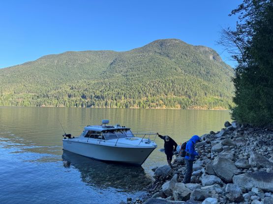

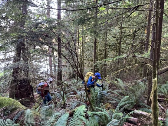
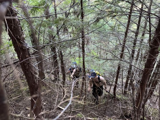
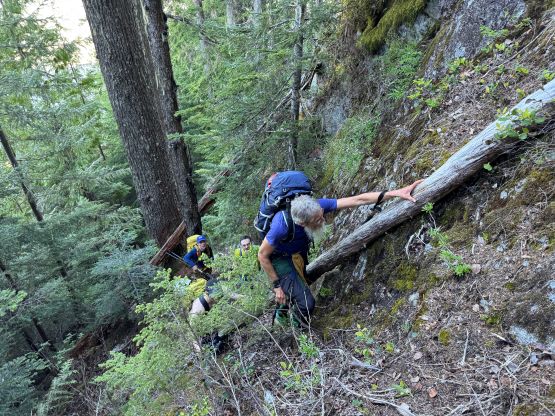
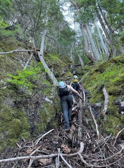
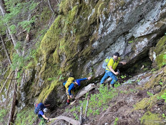
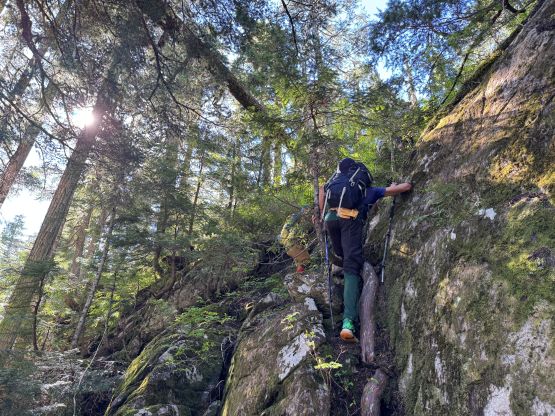
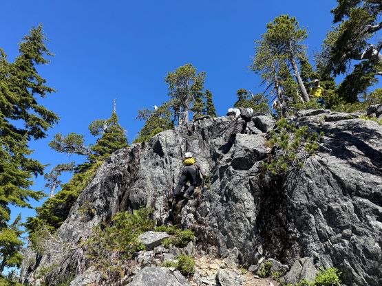
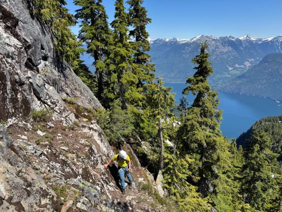
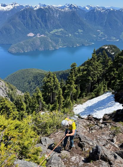
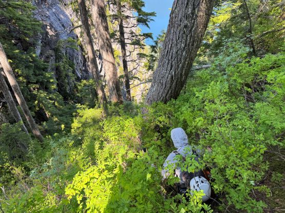
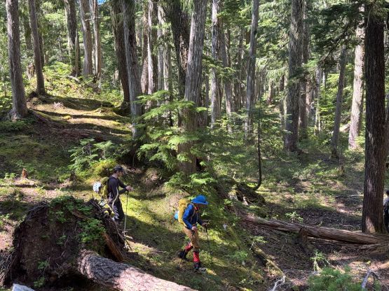
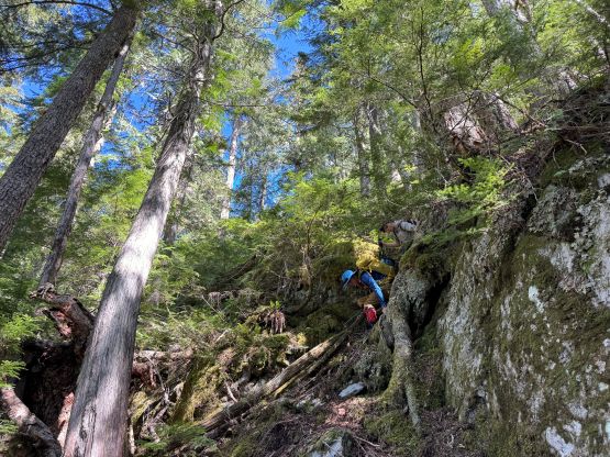
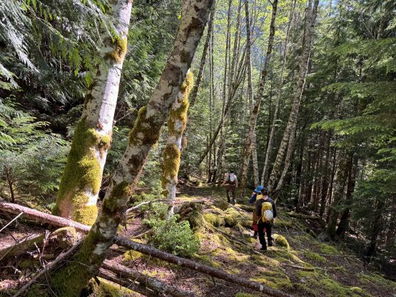
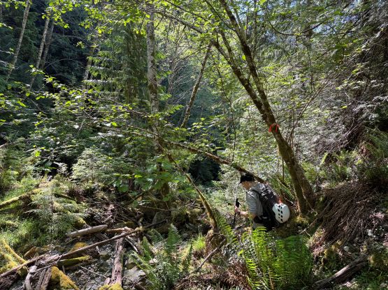
Two of us needed a bathroom break but we were soon on the way. Alex led us onto the long-gone logging road but the walking was much easier than we thought. There was actually very minimal bushwhacking and the road bed was also easy to follow. We made some steady progress until the first obstacle at 350 m elevation, where the road bed disappeared into a creek bed. The creek crossing was trivial but we had to head upstream a short ways to pick up the remnant of the road on the opposite side. We then had no further issue following this road to 550 m elevation. Shortly after crossing another stream we took a long break and then dived into the secondary growth mess above. I then took over the lead route-finding around the hundreds if not thousands of pick-up sticks. The bushwhacking was not inspiring but was still better than expected. This was simply what one would expect from the typical North Shore routes. At around 800 m elevation we came to the base of the troublesome bluffs. Alex and Trevor had done some extensive digging and the ropes were brought mainly for this band of bluffs, so we naturally picked a 4th class route without wondering around by too much. I actually went climber’s left to check things out but the correct (flagged) route exists on much farther climber’s left. Of course none of us was aware of that. The 4th class ramp system made a few of us donning harness. Alex set up the handline and Adam used the jumar that I had brought up. Meanwhile Trevor and Dave had went ahead to scout things out and the general bearing was to trend climber’s left afterwards.
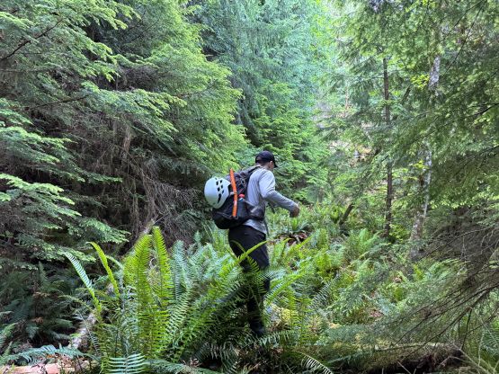
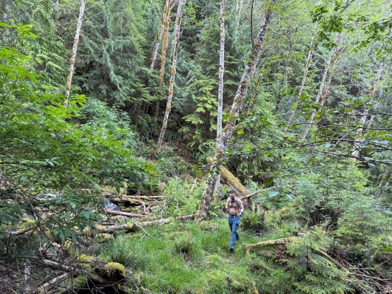
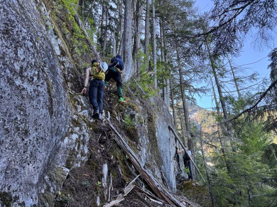
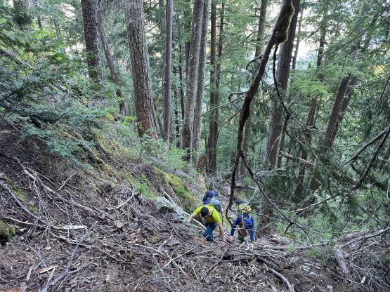
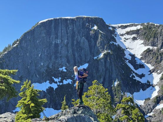
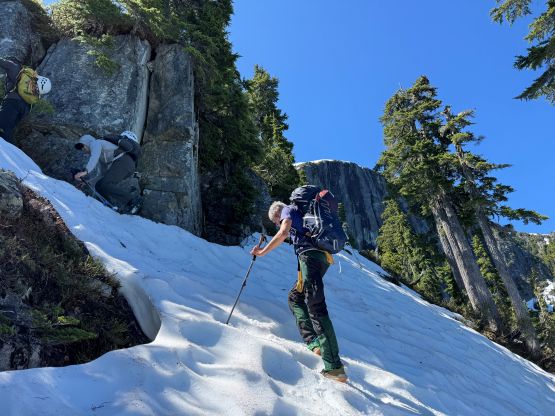
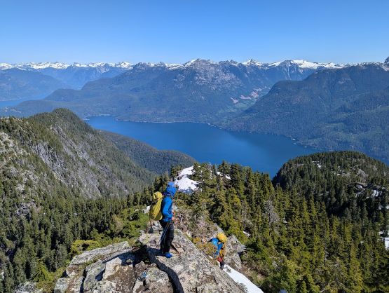
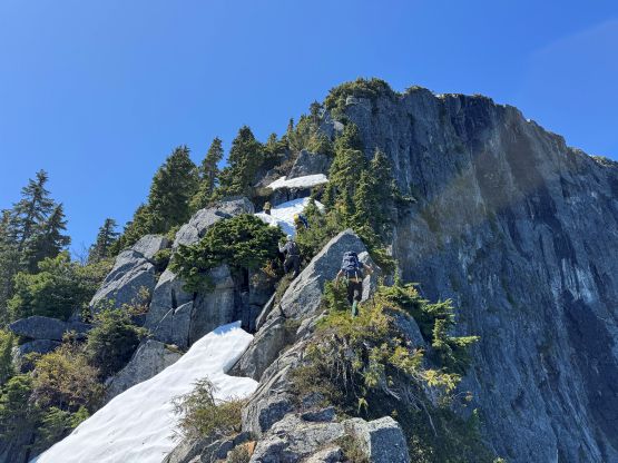
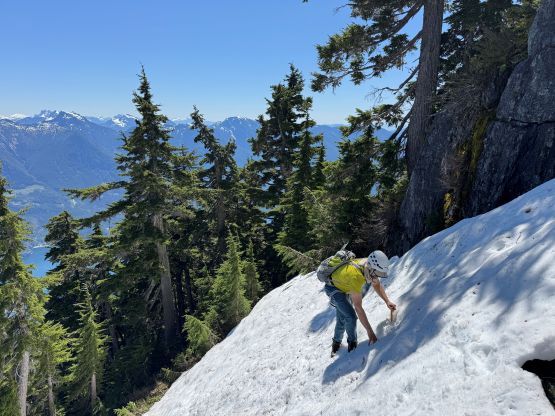
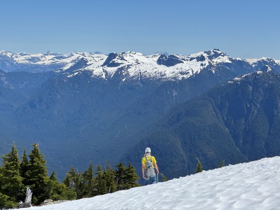
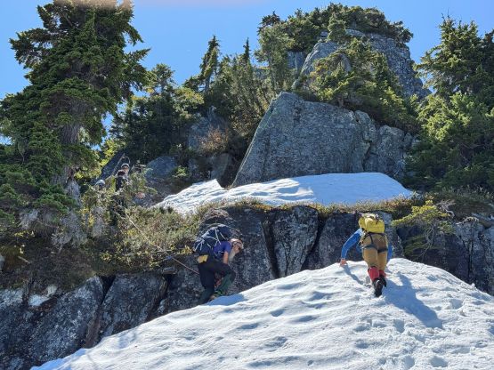
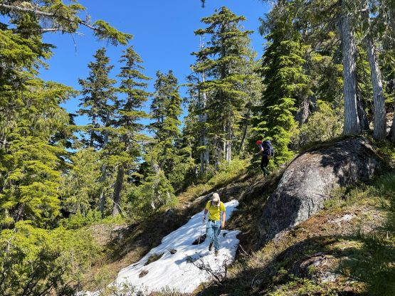
Just when we were about to pitch out the second band of bluffs Alex spotted some flagging tapes down to the left (north). Given the size of our group it made sense to avoid rope work for as much as we could, so we lost some precious elevation in search for the elusive non-technical way to surmount this cliff band. It existed, after all. A while later we entered a steep and wet gully that required some 3rd class scrambling on rotten roots, loose rocks and down-sloping slabs, but that was basically it for this zone. The rest of the plodding to the first false summit was trivial from scrambling perspective. The bushwhacking did become thicker but again, this was typical in the North Shore. From the first bump we realized immediately how rugged this mountain is. Traversing the gap between the first and the second bump was quite tricky and required some exposed 3rd class scrambling, and the plod to the second bump afterwards involved ascending some steeper snow slopes. We had brought boots and ice axes but the snow was soft and they ended up staying the backpack for the entire day. The top of the second bump offered a nice spot to take another long break.
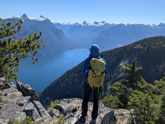
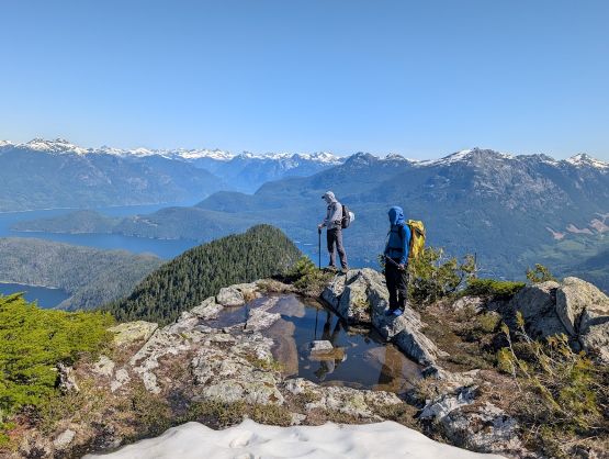
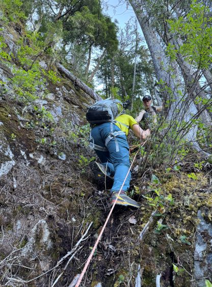
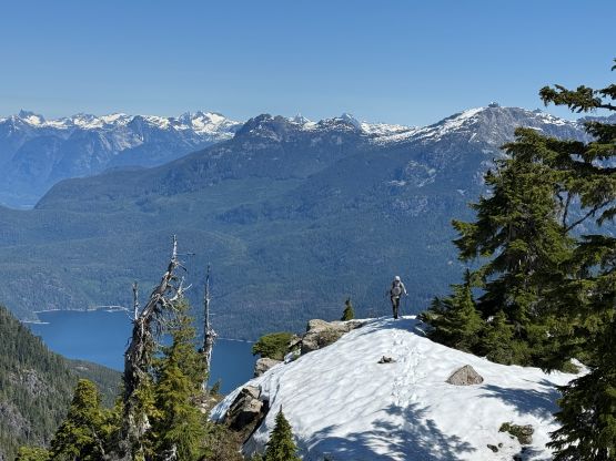
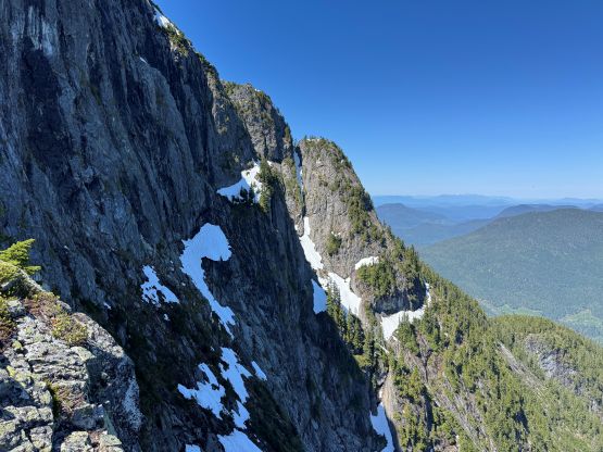
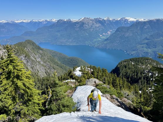
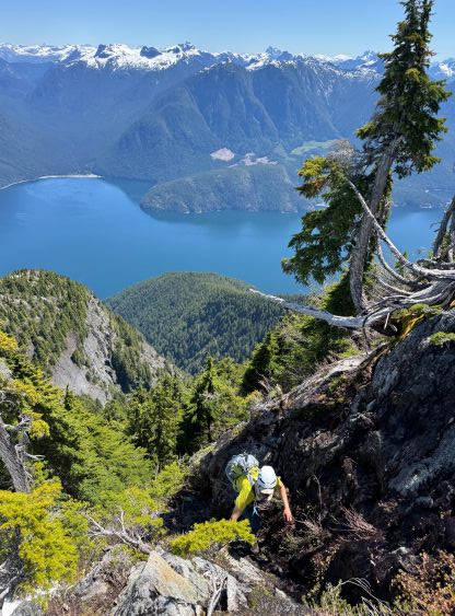
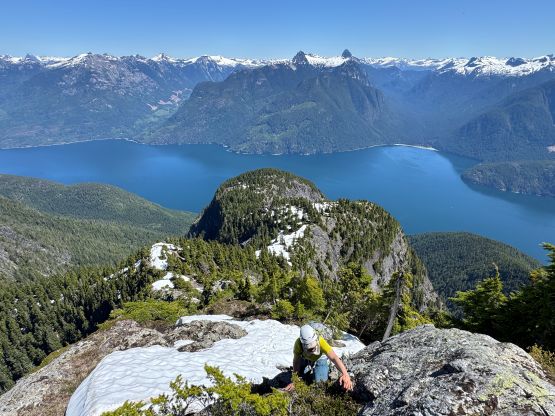
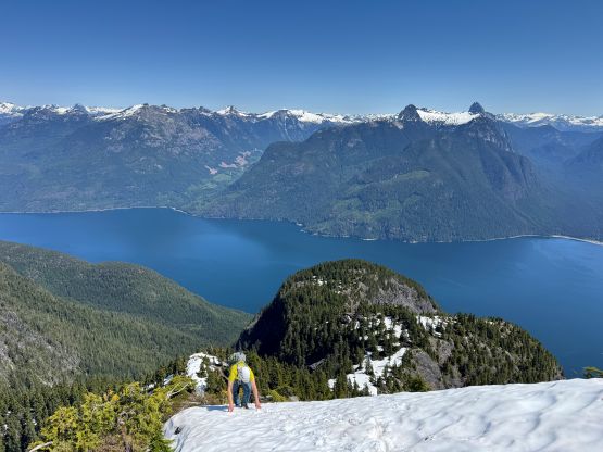
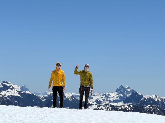
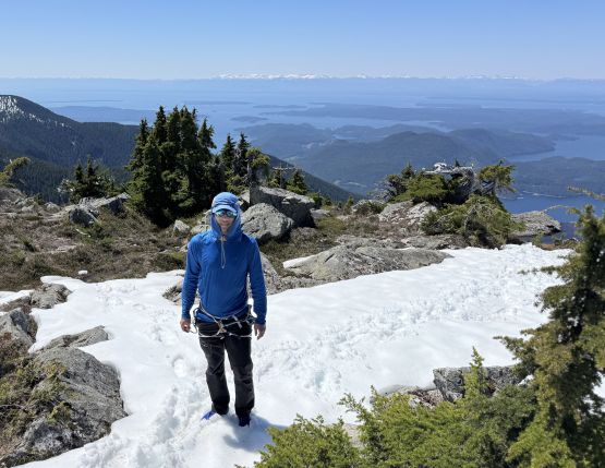
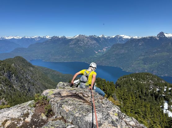
This false summit has almost exactly 100 m prominence but without Eric Gilberton’s level of surveying it’s not possible to determine if this is indeed a P100m objective or not, so I wouldn’t bother to put it up on peakbagger.com myself. In any case we started down towards the saddle between the 2nd bump and the main peak, and the scrambling was again, class 3 with lots of route-finding. The lower ridge of the NE Ridge of the main peak went rather easily with mostly plodding and bushwhacking on the typical North Shore type of terrain, but the scrambling had become spicier towards the top. We broke out the rope again for a short pitch of exposed 4th class slabs, and then there came a steep snow slope followed by another technical step. We all ended up using the rope for down-climbing this step (stiff 4th class) on the descent and this ended up being the technical crux for the entire route. Trevor, Dave and Kelly went ahead afterwards and stuck closer to the ridge crest but they didn’t make quick progress. The three of us behind traversed climber’s left and found an easier alternative. There was still plenty of 3rd class terrain and steep snow, but we generally had no further issue sending to the upper plateau. The true summit was then attained but the views were the best from the edges of the plateau. There’s also a cairn as tall as ourselves but we couldn’t find a summit register. None of us would come here expecting a gigantic cairn nor a flagged route through the lower forest given how scarce the information was. This is apparently not a “rarely ascended peak” among the locals having accesses to kayaks and/or boats, and this is just another example that speaks of the culture in these small communities in B.C. – do as much shits as you can, and post nothing online.

The plan was to take three consecutive boats all the way back to Vancouver on this same day so we absolutely needed to rush on the descent, but things couldn’t be done too much faster given the amount of rope work needed. There were still strategies as most of us could have down-climbed everything except for that crux step, and we had two 30 m taglines to work with. We all descended the route that Alex, Adam and I took and ended up using the ropes on 4 sections to get off the NE Ridge of the main peak. I only rappelled the crux step and down-climbed the rest. The re-climbs of the two bumps along the ridge were annoying and exhausting but not difficult. Adam had unfortunately cut his hands trying to run to keep up with the rest of us, but we must rush to catch the ferries. Alex and Trevor led most of the descent afterwards but I took the lead route-finding down that bluffs zone at 800 m elevation. The decision was made to scout out the flagged route. It was nowhere “trivial” but at least we didn’t need to take the rope out again. The terrain kept sucking us into the drainage down skier’s right afterwards but we resisted that temptation and did several traverses towards skier’s left. We eventually managed to descend this section of secondary growth forest relatively paralleling our ascent route, and joined the road at 550 m elevation. We then power-walked and concluded the round trip in just over 10.5 hours round trip. About 4.5 hours of which were “stopped time” according to my Gaia app.

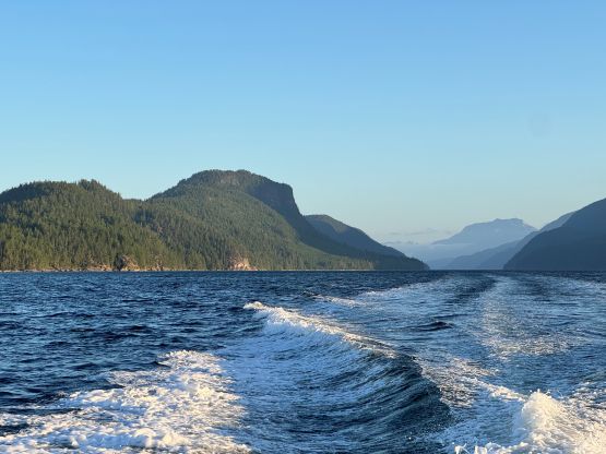
I had texted Peter the moment after descending to the road so Peter was already at the bay waiting for us. A few of us dipped into the sea for refreshment and we were soon on the way back. This time Peter took the most obvious route wrapping around the south side of Cortes Island but the ride still took 1.5 hours. The water in the open ocean was very choppy that I even become airborne one time. This was scary and fun at the same time, and reminded me the ride at the end of Mt. Caubvick expedition in northern Quebec. Kelly, Trevor and Alex rushed afterwards and caught the 7:10 pm ferry from Quadra to Campbell River so they definitely would make the 10:40 pm ride back to the mainland. I got stuck with Adam and Dave as I had to drop them off at the campsite so there’s no way for me to catch that ferry. I opted to take my time having dinner and eventually took the 8:40 pm ride back to Campbell River. Checking the Google Map I thought I still had a chance to catch the last ferry back to Vancouver so I sped at averagely 130 km/h down the Island Highway, and eventually got back home at 1:30 am in the morning.