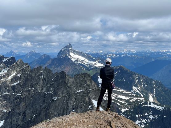
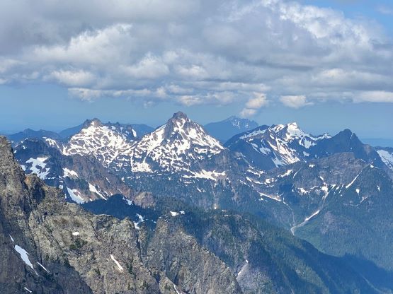
Monte Cristo Peak
June 22, 2023
2175m
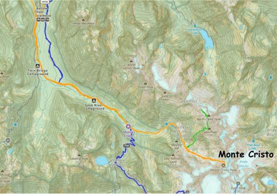
Mountain Loop Highway, WA
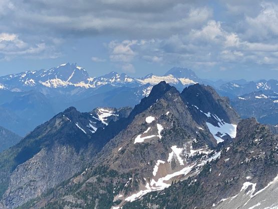
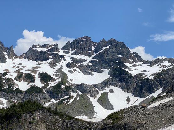
The are quite a few iconic peaks in the area known as “Monte Cristo Group” and the namesake objective, Monte Cristo Peak is generally considered as the hardest in the group. There are definitely more technical rock spires including “East Wilmans Spire”, but those are rather minor and do not boast prominence. The peaks in this area could be done in a mere few hours “after work” in the 1970s using mining roads but the mining had been long discontinued, making Monte Cristo a ghost town. Nowadays the access is much more difficult. While Kyes Peak, the highest in the group, is usually done from Blanca Lake (south) side, all other peaks are usually approached by biking the 4.5-mile road to Monte Cristo ghost town. The round trip distance is about 30 km but with biking it’s not too bad.
Elise and I had been planning an ascent of Monte Cristo Peak since Dave G. and Trace G. did it a few weeks ago. I was actually invited to join their trip, but disliked the weather forecast and eventually opted for Mt. Pershing in the Olympics. The recent weather pattern had been sunny in the morning but stormy in the afternoon/evening and we determined at the last minute to pull the trigger on Thursday with a pre-dawn start. Elise had more plans on Friday and Saturday while I needed to be back home for work, so we drove out separately. We slept in our respective vehicles at Barlow Pass trail-head, now only accessible from Granite Falls side due to the closure of a portion of Mountain Loop Highway, and set the alarms at 4 am. In terms of gears we brought a 60m half rope for the technical pitch and rappel, a small rack, a 20m rope and a snow picket in case the moat being “impassible” and needing an additional rappel into, two ice axes each, crampons, mountaineering boots and rock shoes. At the last minute I opted to leave the rock shoes behind as Elise would definitely lead the pitch in her rock shoes, and I should be able to follow 5.6 in approach shoes, which I could also use in the biking and hiking portion. Instead of the usual combo of “trail runners + mountaineering boots + rock shoes” I opted for the new combo of “approach shoes + mountaineering boots” to save a tiny bit of weight. The two of us together only had my fatbike as Elise’s bike had been unfortunately stored in her parents home in Vernon, B.C.
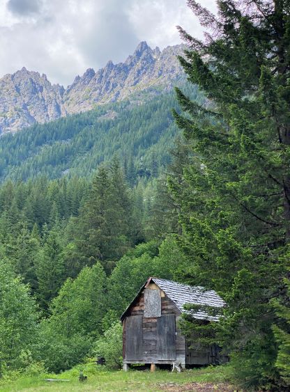
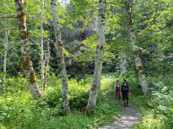
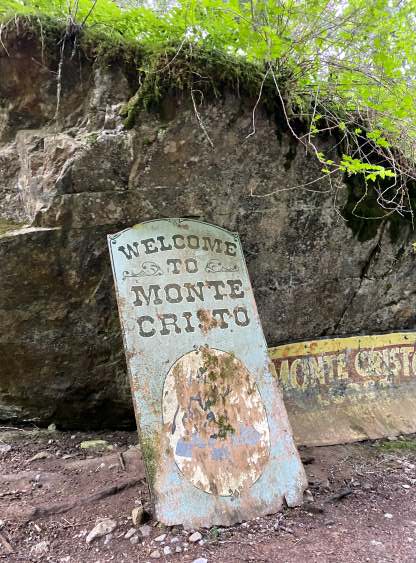
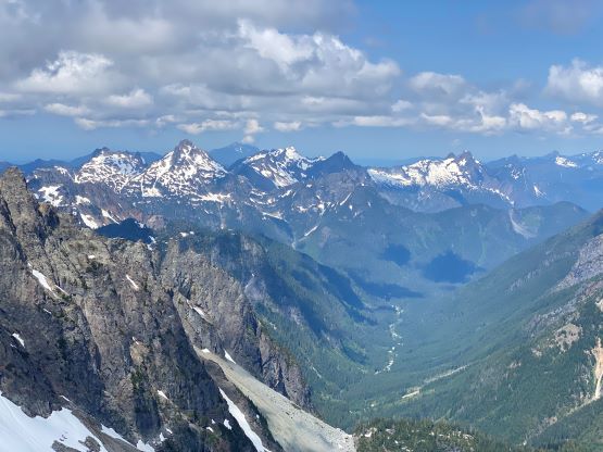
The alarms went off and another truck came in unloading two climbers, Chris and Grayson. I thought they might be going for the same objective based on their packs, but that wasn’t the case. They were not aware of the road’s closure so couldn’t get to Sloan Peak’s trail-head from this side. Their back-up plan was Cadet Peak in Monte Cristo Group, but we invited them to might as well join us for Monte Cristo Peak as they were keen and fit. Due to the glacier crossing on Sloan Peak they fortunately had harnesses and some basic gears. They did not have a second ice tool nor rock shoes but those were rather “contingency gears” that might not be required, and in a group of 4 it’s usually easier to figure out some solutions if needed. Chris and Grayson also did not have their bikes so the three of them walked while I rode. This turned out to be a perfect approach for biking asides the infamous log crossing, several wash-outs and the section immediately before the creek crossing. There’s evidence of some recent trail work and we later encountered a lot of hikers. A lot of people come here just to see the ghost town. I decided to ride slowly with the group as I was concerning about bears in the early morning hours and it’s always more fun in a group. The log crossing was tricky with a bike but in a group I could get a some assistance. I checked the phone as we entered the ghost town of Monte Cristo, and we had covered 7 km in just over an hour. I had no idea how they could walk so fast, especially with the heavy ass packs.
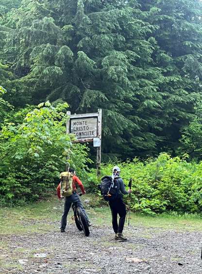


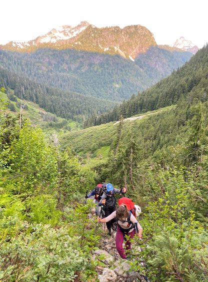
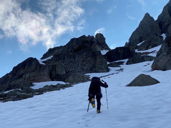
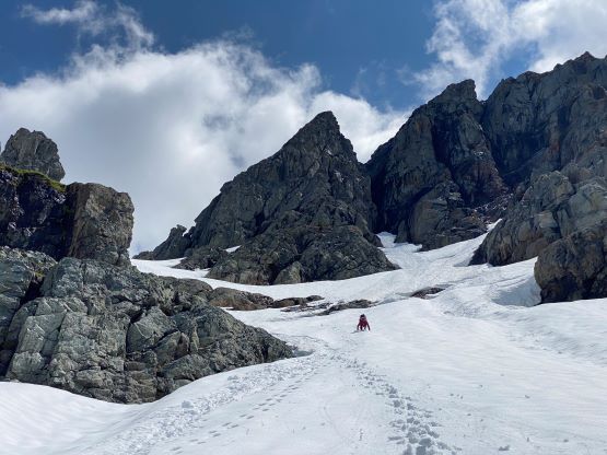
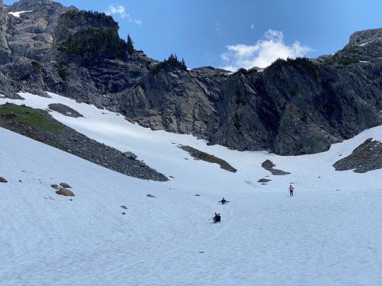
I had forgotten to bring the combo lock and I knew some hikers might appreciate having my bike for the descent, so I pushed the bike for about 100 m up the trail and hided it in the woods. We then dashed up the increasingly steep climber’s trail towards Glacier Basin. Elise was leading and resumed that blistering pace. The trail was easy to follow, but overgrown such that in no time we were soaked from the car-wash. The vegetation was extremely wet from the recent rain and the cooler temperature. I took over the lead and did my best to get rid of the water droplets (using my lightweight poles) but we were still thoroughly soaked. I anticipated this car-wash based on Trace’s trip report so Elise and I came prepared with two pairs of socks. Elise was also using her trail-runners solely for the approach so we couldn’t care much about being wet or not. We took a lengthy break once the trail yielded to a continuously snow field in Glacier Basin, ditching some unnecessary gears. It turned out that we had 3 snow pickets in the group which was clearly not needed, so I ditched mine in addition to the wet socks and Elise’s wet shoes. This turned out to be a mistake as the picket was no longer there upon returning.


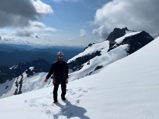
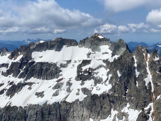
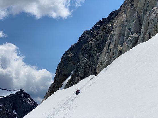
I decided to use the Trango Towers mountaineering boots instead of Trango Techs (which had become my new favourate in recent years), as the Towers are overall a little bit stiffer. I did not want to bring the ice climbing crampons so I needed a stiffer pair of boots to fit the Irvis Hybrid crampons in case the snow climbing to the north col being front-pointing the whole way. I knew there’s some recent alpine snow but didn’t know it went down to as low as 1500 m elevation. There was about 10-15 cm fresh stuff that had gone at least one or two melt-freeze cycle, making the snow climbing portion rather effortless. This layer of new snow made the step-kicking as perfect as possible. The grade of the slope steepens to 45-50 degrees into one constraint before dialing back to 40-45 degrees for the final ascent to the north col. The new snow stuck well to the old surface except for that short constraint section so we did have to do some front-pointing after all. I lent my mountaineering axe to Grayson and climbed in just one ice tool. The fresh snow made me worrying about the rock climbing portion but that’s on the east face with warmer temperatures and more sunlight.


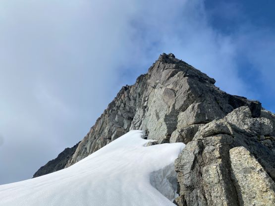
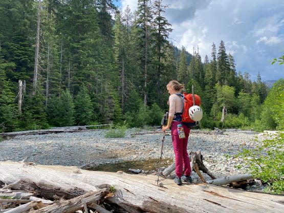
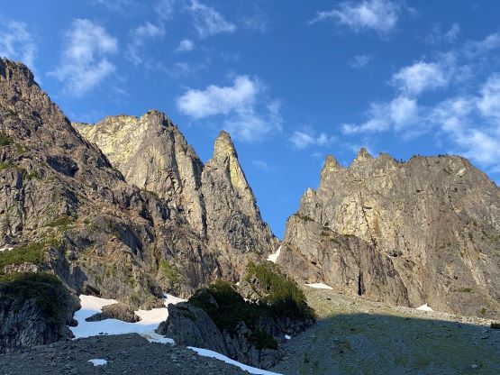
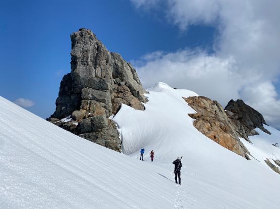
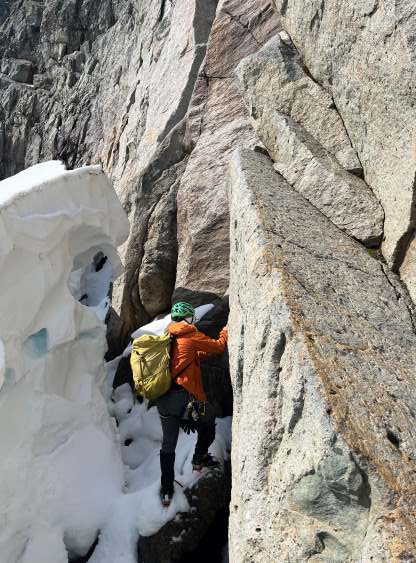
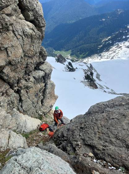
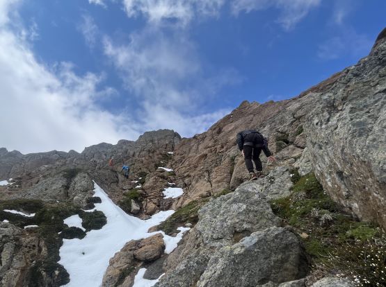
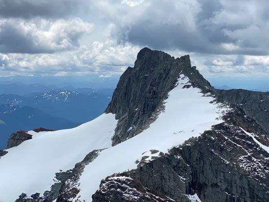
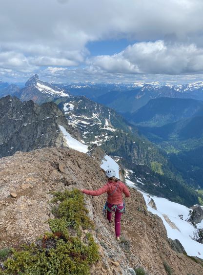
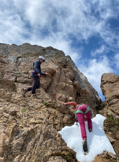
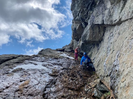
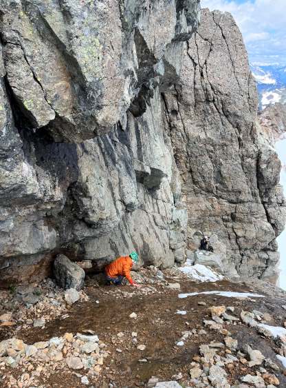
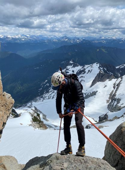
We took another break at the north col to don sun protections as prior to this we had not tasted the sun rays in this day. I then led the short but steep traverse to the base of the east face. It wasn’t very obvious where’s the 5.6 line but I had memorized a few other trip reports so I assured the group that as soon as the line became visible I would be able to recognize, and I did. The moat was definitely an issue as we were now in the tailing end of each year’s Monte Criso window. I firstly went to check out a possible drop-in spot above/beyond the climbing pitch, but determined the snow wasn’t entirely continuous. Meanwhile Chris and Elise spotted a possible way to get into the moat about 5 m downhill from the pitch. I agreed with them, and offered to lead us in. A few 4th class moves were required (crampons on rocks) but otherwise the 20m rope was not needed. There’s a rocky platform at the bottom of the pitch with room for two, that we used to ditch the packs and to switch footwear. The platform was unfortunately covered in the fresh snow so it wasn’t entirely dry. Elise was creative to use gaitors as a ground sheet…
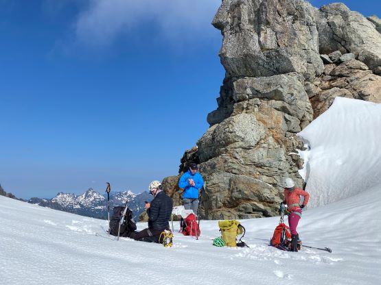
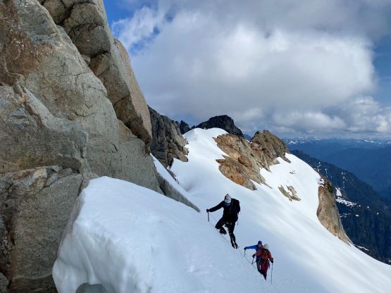


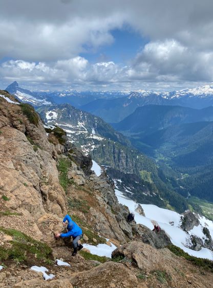
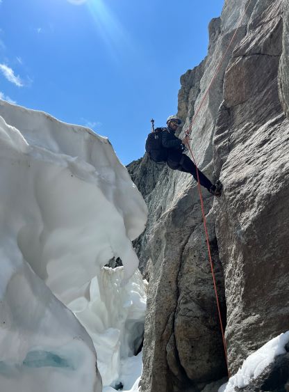
There was no fresh snow on the steep pitch but some parts were still wet. Elise led like a champ as always, placing two nuts, a cam and some slings on the freshly-drilled bolts. Dave had mentioned the bolts to me so we weren’t surprised seeing them. This pitch was harder than expected based on the 5.6 grade. I assumed that’s an old school grade or a grade when snow covered most, if not the entire pitch in the early days when the glacier hadn’t retreated by much. Elise fixed the rope so that Chris and I could climb using a combination of prussiks, a jumar and a micro-traction as self-belay. Chris had brought a micro-traction due to the glacier travel on Sloan Peak, whereas I’m now more used to jumars thank to the Himalayan expedition that I just did. Grayson, the 4th in the team, then had a top-rope belay. A few pieces were back-clipped and left for Grayson to clean as the pitch involved some traversing. At least one bulge on the upper half felt very stiff for 5.6, that 3 of us ended up grabbing a fixed sling (left by other parties) to aid through. I probably could have figured out the sequence but didn’t want to spend too much time there. Above the technical crux we had a wet ramp to ascend and this ramp was also partially covered in fresh snow. While Elise and Chris opting for the exposed 4th class slabs on the outer edge, Grayson and I squeezed through the chossy corner which was not as elegant but felt safer. We then had to deal with steep heather, dirt and then choss on the final portion to the summit. The fresh snow did complicate things but only by a little bit. We all ditched our backpacks, so Elise climbed the entire grass/choss section on rock shoes. I had my approach shoes while Chris and Grayson did in their mountaineering boots.


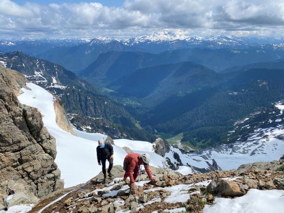


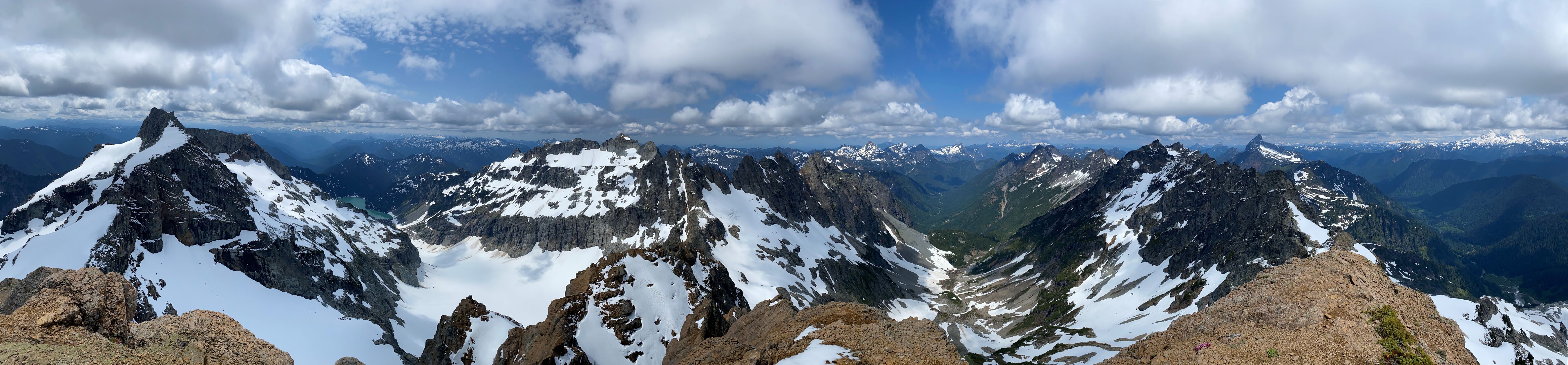


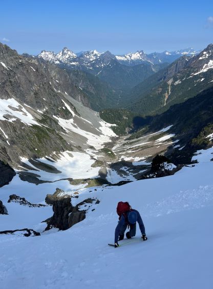
Due to the weather concern we didn’t linger too long on the summit. We could already see the clouds building. The descent of the upper slopes of this mountain took a while due to the party size and route-finding. It was either on choss or grass, so pick your poison. The 60m rope was sufficient for the rappel using a new bolt backed-up by a nut. We didn’t end up leaving anything behind ourselves. The east-facing slopes had now turned slushy thank to the fresh snow, that the traverse was slippery and required a lot of care. The descent from the north col was also slippery enough to warrant down-climbing facing into the slope, for hundreds of meters until the slope finally petered out near the bottom. The bottom 1/3 was rather enjoyable. Elise and I boot-skied while Grayson and Chris glissaded. The next stop was in Glacier Basin to pick-up the ditched gears, but my snow picket was no longer there. My stinky socks were also touched and moved. I initially thought about animals but then we met several groups of hikers going up. I then realized the picket must have been stolen, not by marmots but rather human. After my experience on Everest’s camp 4 I now assumed anything left behind and visible could, and would get stolen.


I sped up in case the bike was also stolen, and sure enough by the time I got there one dude was sitting right beside the bike and that surely looked suspicious. He explained that he was looking for a geocache or something. For the ride-out I opted to go ahead to enjoy the speed, but I offered to wait for the group at the road’s junction as well as the creek crossing as Elise wasn’t tracking her GPS to save battery. Those are the only two splits that one might get off-route. I also carried some of Elise’s gears to lighten her pack as she had another trip to do the next day. While riding the final few kilometers out we got poured on all the way to the parking lot. The rain was rather heavy that I got soaked through again. Our round trip time was 12 hours but my track shows the moving time to be only 6.5 hours. Elise and I then drove out towards Granite Falls for a much-needed Mexican dinner before resuming our own ways.