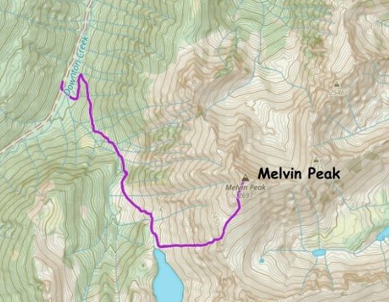
Melvin Peak
November 3, 2024
2697m
Downton Creek / Duffey Lake Road, BC
Downton Creek has a rather large drainage basin that occupies a good chuck of the eastern Cayoosh Range that parallels the Duffey Lake Road not far from Lillooet. This drainage basin boasts 20+ peaks and was once known for the easiness of the access. Things had changed drastically in the recent few years. I wasn’t following the stories closely but apparently a key bridge at the bottom had deteriorated to the point that some barricades were put there (presumedly for liability issues) that essentially blocked all vehicular accesses. The bridge was fixed and the barricades were moved recently thank to some new mining activities somewhere 7 km up the drainage but rumours were that a new gate would soon be installed by that mining company. People were taking advantage of this short access window and I decided to join this “Downton madness” for the simple reason of why-not. I had done two trips in the Downton drainage back in 2015 and 2017 and I thought those trip reports could be already put in the museum by now. Harry Crerar had recently done “Melvin Peak” and I thought it would be a no-brainer to simply follow his footsteps. Most of the peaks in this range are unnamed or unofficially named and “Melvin Peak” isn’t an exception. I’m not a fan of extensively using unofficial names but I have to make an exception for the Duffey zone, as otherwise there simply aren’t many names at all.
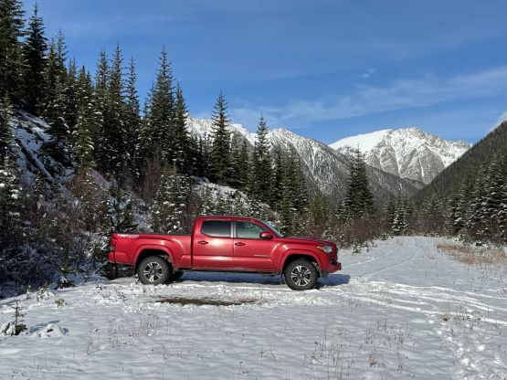
The weather forecast suggested a brief window on Sunday towards the north and Erica and Trevor were on board to explore. I wasn’t too sure about the snow situation as it had been raining and snowing for the past two weeks, but judging by the Duffey Lake’s webcam I thought there’s a good chance I could push the Taco to the supposed trail-head at 1540 m elevation, or at least within a reasonable walking range. I did come up with an alternative objective if the road’s blocked or the snow situation was worse than I thought, but we were definitely more keen on “Melvin Peak”. I finished work at 8:30 pm on Saturday evening in White Rock and subsequently made three stops in various parts of the city to swap vehicles, grab Erica and finally, Trevor and we made to Pemberton in good time. The weather had been raining and drizzling, and the situation on Duffey Lake Road was not looking very promisingly. As expected, the drizzle changed to snow as we drove towards Joffre Lake’s parking lot and the road had not seen any vehicular traffic in at least the past few hours. I had to push through a fresh set of tire tracks and though not difficult, the speed had to be reduced to 40 km/h or lower. This further delayed our progress. Thankfully the road became bare again as we slowly approached the Downton area, but the barricades were quite difficult to negotiate. There were three concrete stones and I barely managed to squeeze through the 2nd and the 3rd ones with only a few centimeters of spare on each side. Up the Downton FSR the driving situation was not difficult until hitting continuous snow at 1000 m elevation, but as expected there was only a few cm of accumulation. Tire tracks extended all the way to about 1 km beyond Statimcets’ turn-off and the last few kilometers were rather flat, that I did manage to push the truck all the way to the trail-head. The pin-stripping was definitely worse than I thought, but I wouldn’t complain given how far we had made in the marginal conditions. The clock had been dialed back by an hour thank to the time change, and we decided to wake up at 6 am.
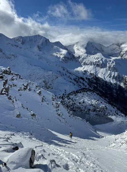
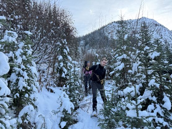
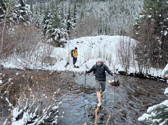
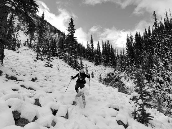
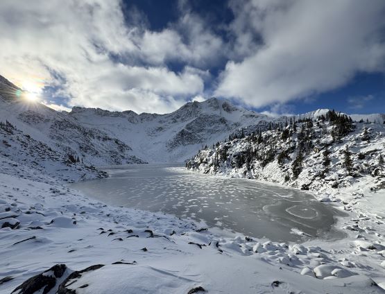
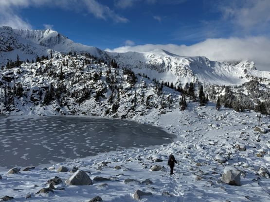
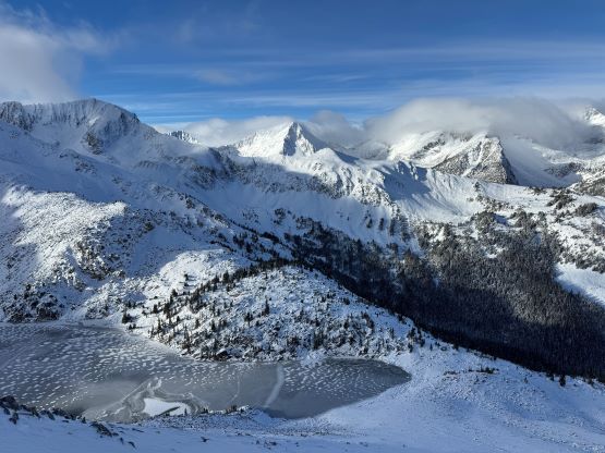
The morning routine took longer than I thought but we still managed to start at 7:15 am after packing all the wet gears. There’s 10 cm of accumulated snow at the parking lot and we decided to start with carrying the snowshoes. Right off the bat we faced that crossing of Downton Creek. The bridge’s pulled but dry crossing didn’t seem very feasible. I did not recall Harry mentioning having to take the boots off but we just had two weeks of continuous precipitation so the situation could be different for his group. I did bring a pair of sandals in the truck but wasn’t keen to backtrack, so we just did the crossing barefoot. It was painful to say the least. There was a log covered in snow and ice on the upstream side, that Erica and I eventually used on the return, with snowshoes on. The spur road beyond the creek crossing was heavily overgrown, that we had to do some extensive bushwhacking in the alders after making passing that southwards-turning switchback. The old road eventually disappeared in some cut-blocks and we roughly followed Harry’s GPX track sending into the hanging valley, trending slightly climber’s right. I made the call for us to don snowshoes in this stage as the snowshoes could serve much more than just the flotation. They helped the traction and also provided enough surface area to essentially “smoothen” the various type of holes, rocks and sticks under our feet. The going quickly became easier and we decided to pick a route that would allow us to keep the snowshoes on for as much as possible. I thought Harry’s route to Viola Lake was contrived and unnecessary so we did our own variation by making a lengthy diagonal ascent of a boulder field. There was at most 20 cm of snow but we must kept the snowshoes on for various aforementioned other reasons. The route went basically as I thought, and we arrived at the lake’s outflow rather quickly. I considered this kind of shoulder season trips “expensive” because our snowshoes had to be heavily beaten. The terrain and the condition was very similar to “Tigger Peak” that I soloed in 2017 on the south side of the Duffey Lake Road, and I wondered why I kept picking these boulder-hopping objectives at this sketchy time of a year.


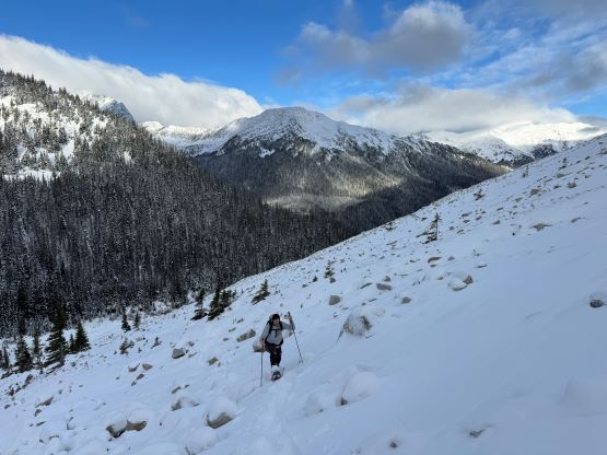


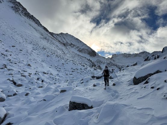
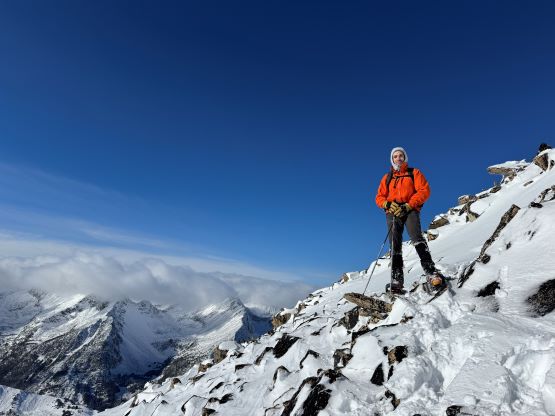
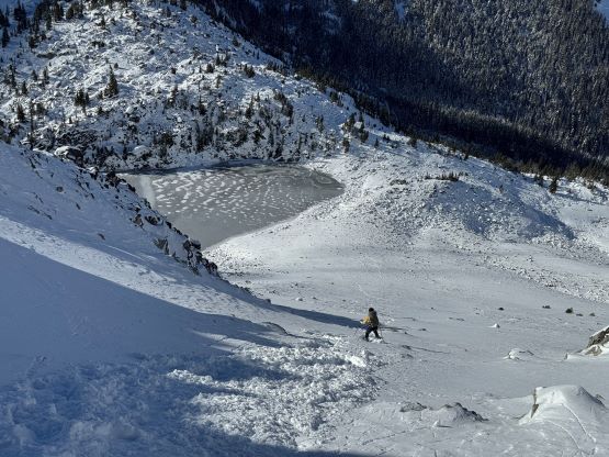
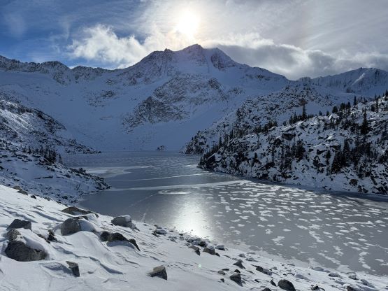
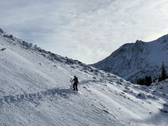
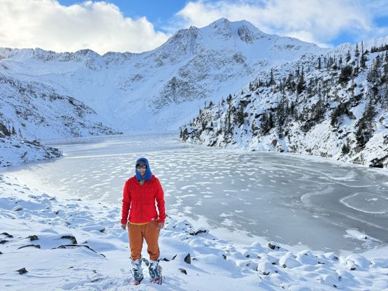
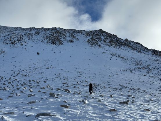
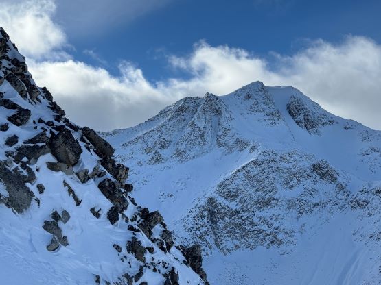
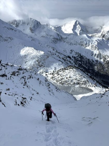
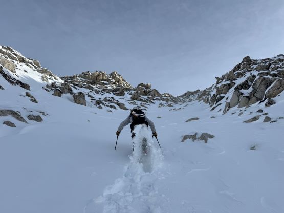
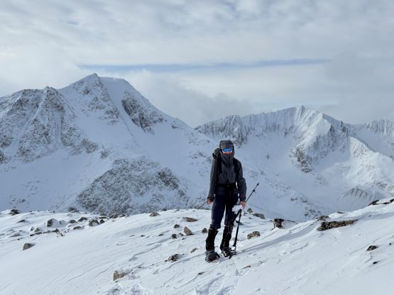
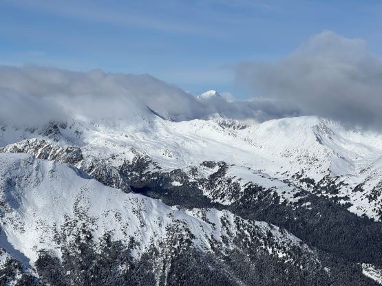
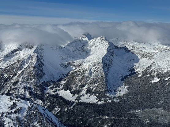
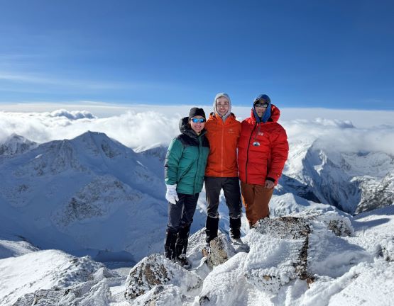
The lake’s already frozen and the views were excellent, so we did our first break donning some sun protection. We then evaluated our route choices. Again, I thought it’d be better to keep the snowshoes on for as much as possible so the decision was to use the cross-loaded gully directly above the lake’s outflow. This was similar to the route that Harry took, but we planned to stay in this gully for the entire course to Melvin Peak’s upper south ridge. The three of us took turn breaking trail and the going was fairly efficient, but the condition was quite sketchy as we heard several whumps along the way. There was thankfully not enough snow to raise significant concerns, but we must pick our route more carefully. The new snow was not bonding well at all. The upper gully that Harry et al. did not ascend had a few steeper constraints and at least one of which required a scrambling move or two, but we did also manage to ascend this entire gully with snowshoes on. Nearing the exit I led us exiting the gully on climber’s left side and we were quickly deposited onto Melvin Peak’s south ridge. We then traversed the east side of the ridge to dodge the bitterly cold wind but also to stay on continuous snow, and then made the in situ decision to ascend the SE Face instead of the S. Ridge. The purpose was again, to stay longer on snow or to use snowshoes for as much as possible. The final few hundred meters of gain to the summit was very foreshortened but at least the views’ were improving. Trevor made the call to ditch the ‘shoes for the final 100 m horizontal traverse to the summit. We might or might not have saved much time, as without the snowshoes we had to pay much more attention on the hidden holes. We nevertheless made the summit and it was such a luxury to be up on such a high peak at this time of a year, without cold winds.


The descent was daunting given the amount of unpleasant terrain we had to negotiate, but I knew based on the past experience that the descent should be much simpler, mostly because all we needed was to retrace our steps. I was basically correct. I thought about to tag that unnamed P100m objective to the immediate south but the terrain was not looking very appealing. It would be doable, but we didn’t have to do it. I also had the option to add an hour of work in the evening so I’d rather get back home earlier and not miss that, so down the gully we went. We didn’t pay much attention on the descent and triggered a size 1 wind slab, which thankfully caused no harm. The rest of the descent was unpleasant but not eventful. I led us keeping the snowshoes on all the way back to the truck, and the snowshoes provided some extra traction and flotation for that final river crossing. We did not take the boots off and didn’t get soaked neither, and our round trip time was just under 6.5 hours. This was once again, a trip that the driving time almost doubled the hiking time. Erica and I took turn driving and I eventually got back home at 8 pm, hastily took a shower and worked an hour subsequently. The next day I slept straight to 10 am and I was still feeling tired.