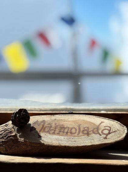
Marmolada
August 12, 2025
3343m
Trentino-Alto Adige Region, Italy
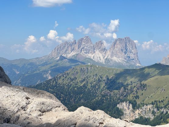
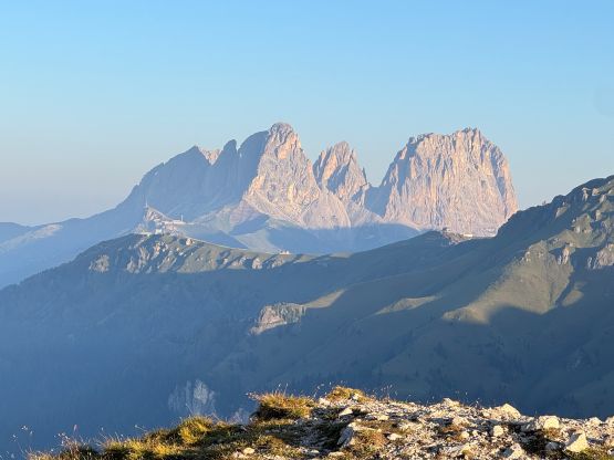
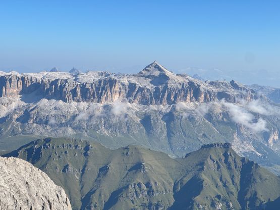
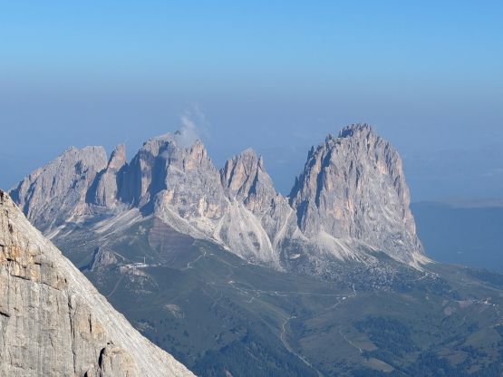
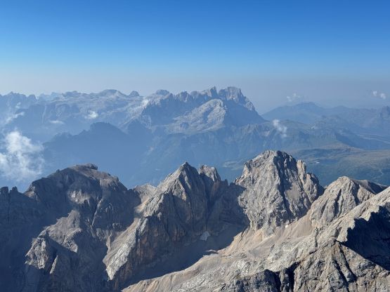
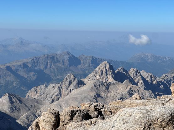
Marmolada is the highest peak, and also the “Queen” of the Dolomites in the Italian Alps. There are multiple summits on the massif with elevation above 3000 m. The highest point is Punta Penia. For the locals it is important to distinguish Punta Penia from the other peaklets but for international peak-baggers it is good enough to simply call it Marmolada as hardly anybody would be interested in the sub-summits anyway. This highest peak on Marmolada massif subsequently boasts over 2000 m prominence making it one of the main objectives in this trip. The normal route via the north glacier has killed 11 people in 2022 due to part of the glacier collapsing so the current “standard route” is the west ridge which is a Grade B ferrata climb. James Barlow etc. had climbed the west ridge by accessing from Refugio Contrin to the SW, but such route requires an overnight stay. Looking at the maps and studying several other GPX tracks obtained from peakbagger.com I figured it’s much simpler to make a traverse over to the west ridge from the normal route’s trail-head to the north. Little did I know that this is already the standard way among the local climbers, as we crossed path with tens of climbers during the day, many of which were guided.
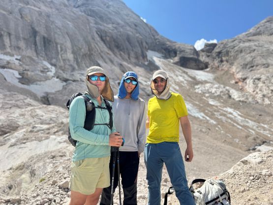
This route provides enough challenge for Erica and Caspar to be interested in, but at the same time, not too difficult/risky for Adam to sit it out. The 4 of us had been travelling and climbing in two separate vehicles for almost a month, but this was the only peak that the 4 of us did together. The plan was to find a car-camping spot somewhere along the access road and start the hike no later than 6 am. There’s no weather issue but the day would be nuclear hot. Adam and I would be travelling down from Germany after completing an ascent of Zugspitze whereas Erica and Caspar had a much shorter drive within the Dolomites after climbing Cima Grande di Lavaredo. Adam and I took a scenic route in the Dolomites, stopped multiple times for photos and eventually got to that village of Penia by around 8 pm. There are a shit ton of car-campers in this country so this is apparently legal, contrary to what we observed in Austria. Adam was quite picky about where to pitch the tents but we eventually found one perfect spot, next to some logging activities. Erica and Caspar did not show up until 11 pm so we were already asleep by then. There was enough cell reception for communication, thankfully. The next morning we needed more time than I thought to finish the morning routine, and then Caspar took a wrong turn while driving, so we didn’t start as early as I was hoping for, but that’s fine.

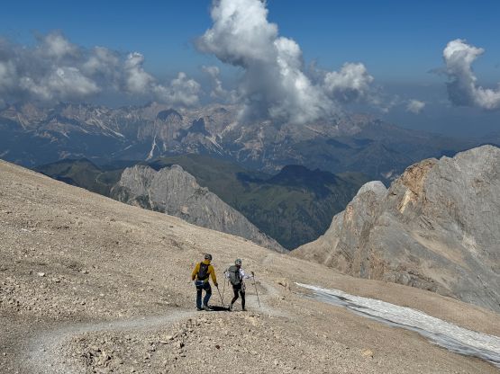
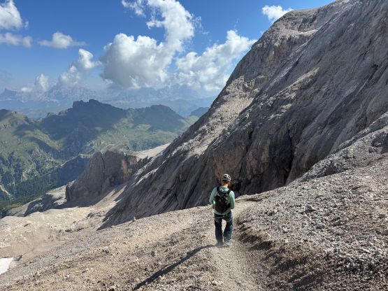
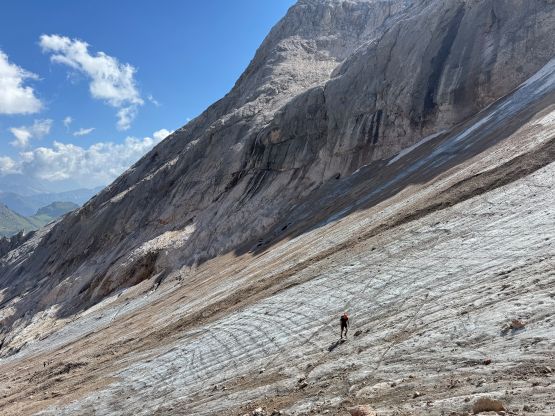
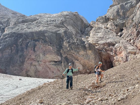
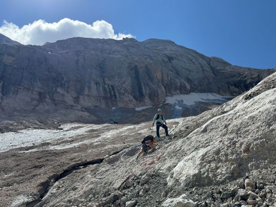
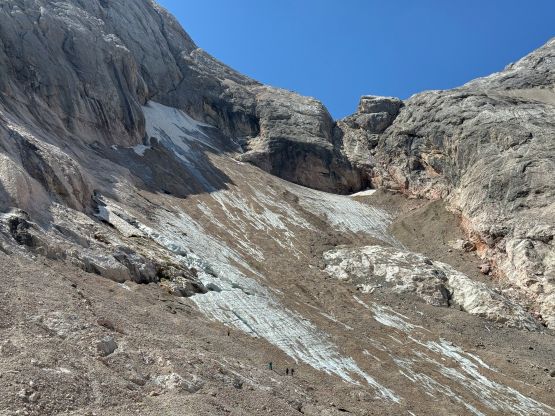
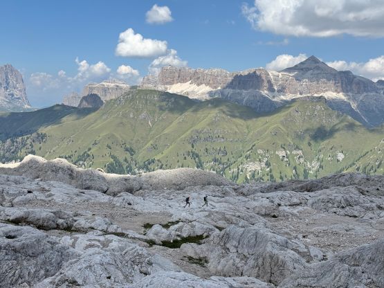
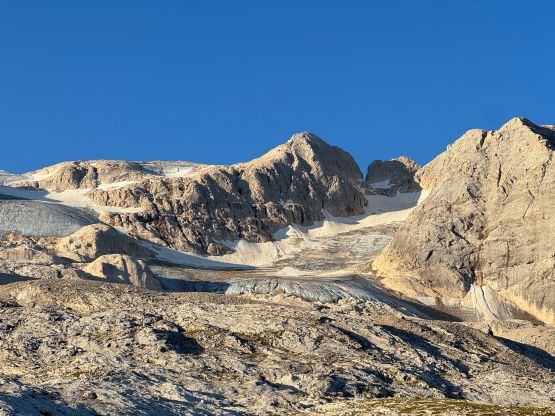
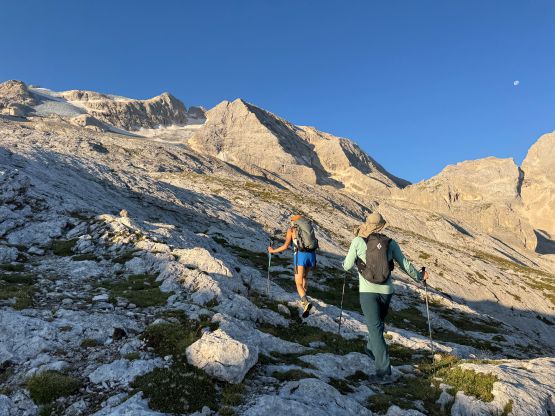
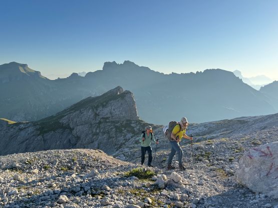
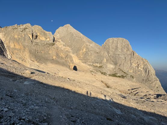
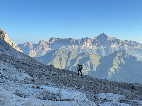
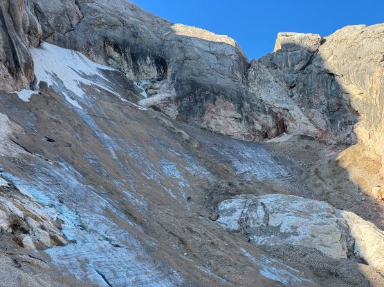
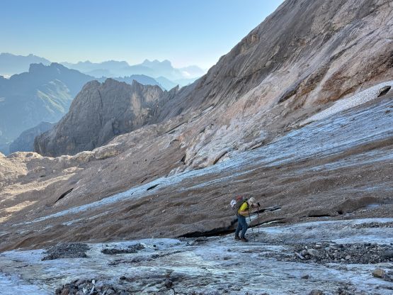
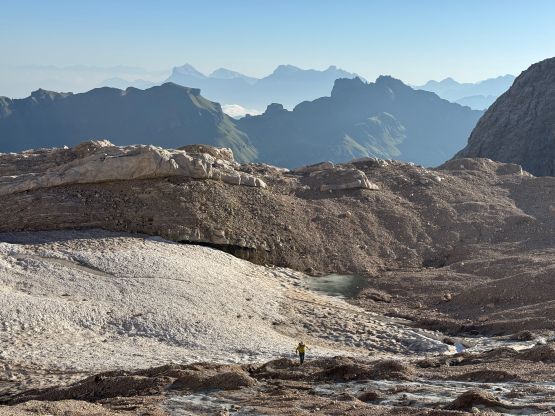
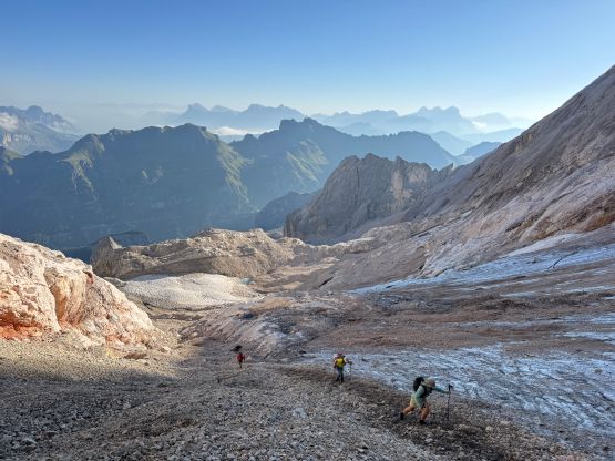
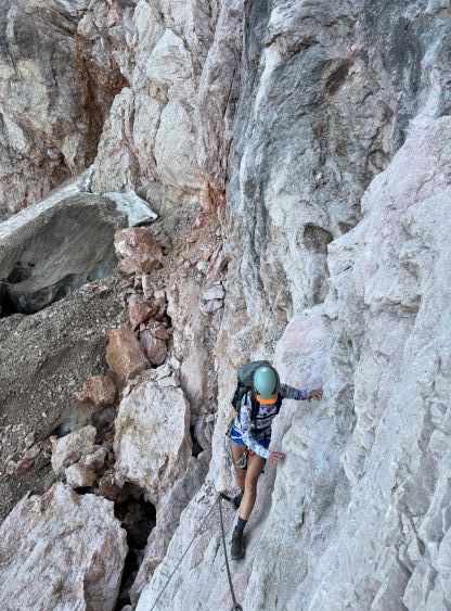
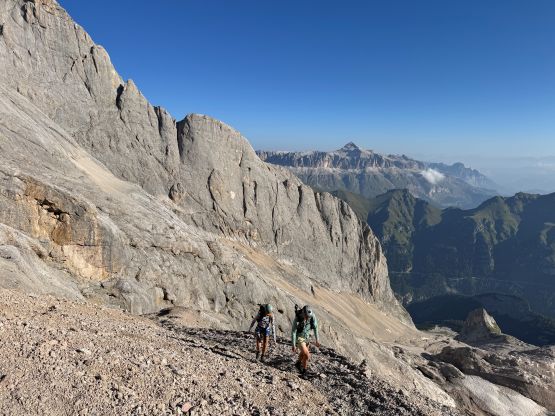
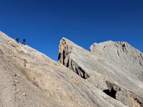
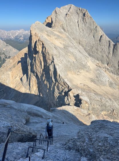
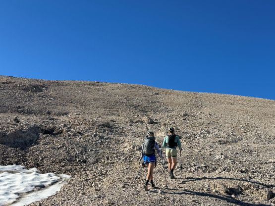
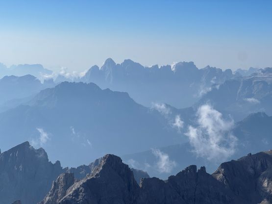
The start of the route is Rifugio Cima Undici. At least one big group started right after us so we wanted to stay ahead of them, and who knew how many parties were already ahead. We followed the trails (sometimes with too many side branches) to the shoulder underneath the north glacier (normal route) and then traversed westwards aiming for the valley separating Punta Penia with Gran Vernel. I wasn’t anticipating much of a “trail” because I thought the west ridge is more often accessed from the SW side, but I was wrong. This is actually a very popular route nowadays, that we would have a trail to follow for most of the way. There were some up-and-downs but nothing major. Into the valley the going was straightforward on slabs and ramps and the route was still very well marked, until underneath that small but steep pocket glacier. Most parties ahead including the one GPX file that I was trying to follow all went climber’s left before crossing the middle part of the said glacier to the start of the via ferrata climbing. The glacier was completely dry by this time of a year that the crossing would be entirely on ice, and the angle wasn’t looking promising for us only having trail runners with aluminum crampons. I simply looked around and proposed that we should do our own route-finding by staying much lower on climber’s right side of the tongue. We still needed to cross some ice but the angle was nearly flat. The right (west) side of the glacier had some slabby terrain covered in pebbles, as well as a shit ton of treadmill scree, but imposed no technical difficulty. The ice axes and crampons were simply not needed.

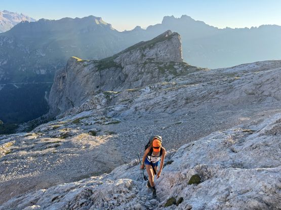
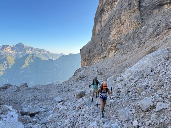
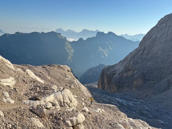
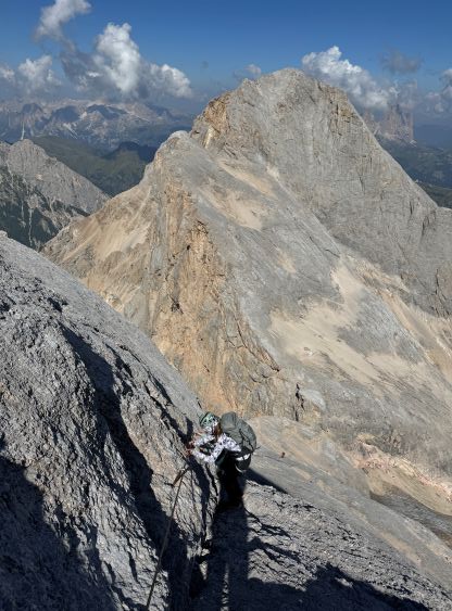
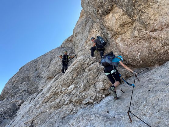
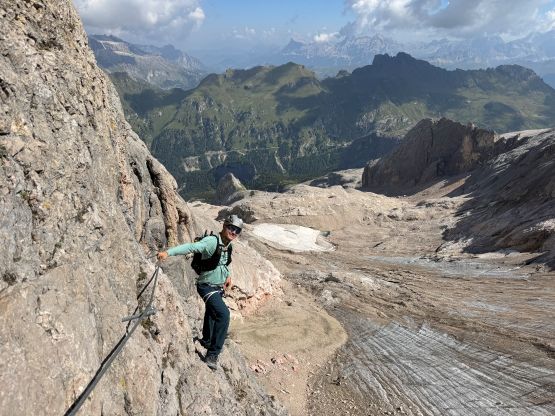
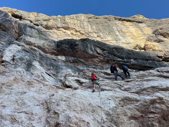
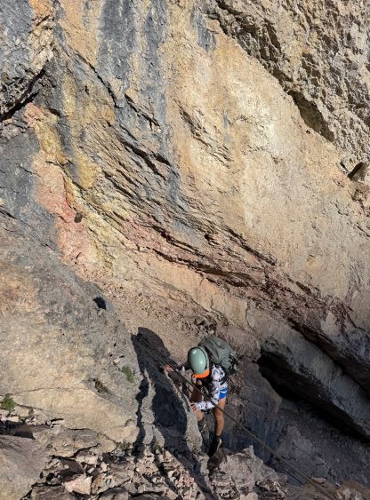
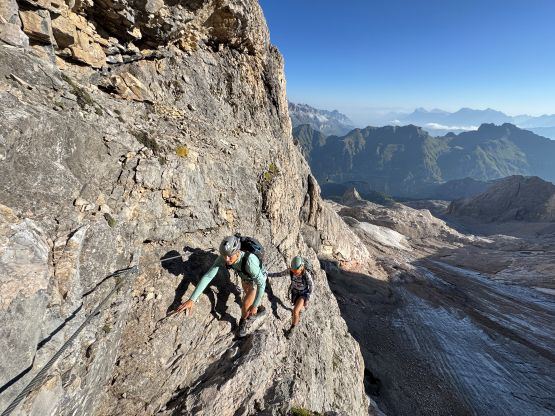
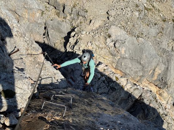
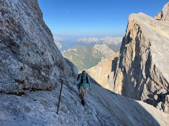
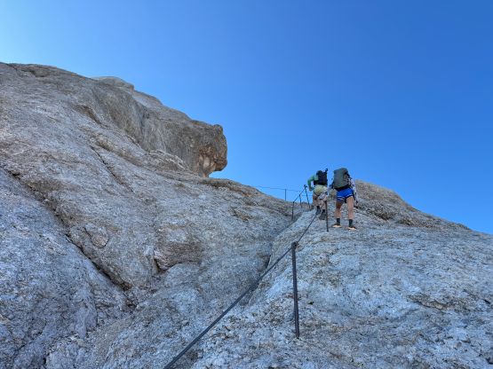
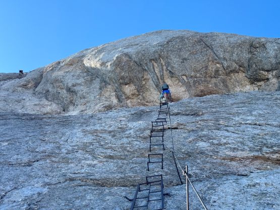
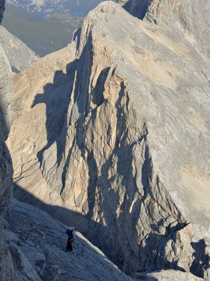
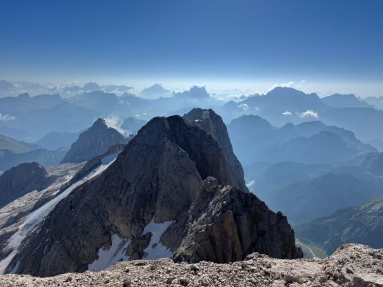
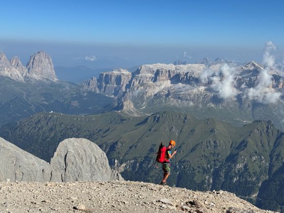
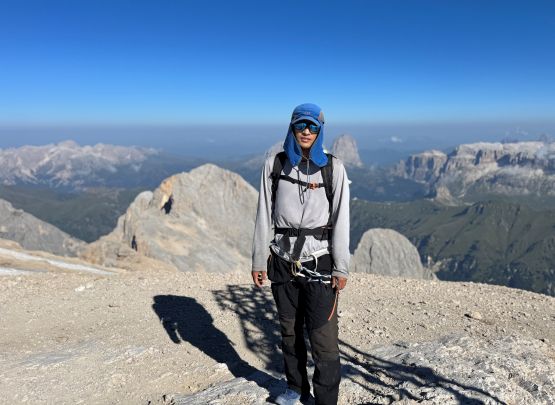
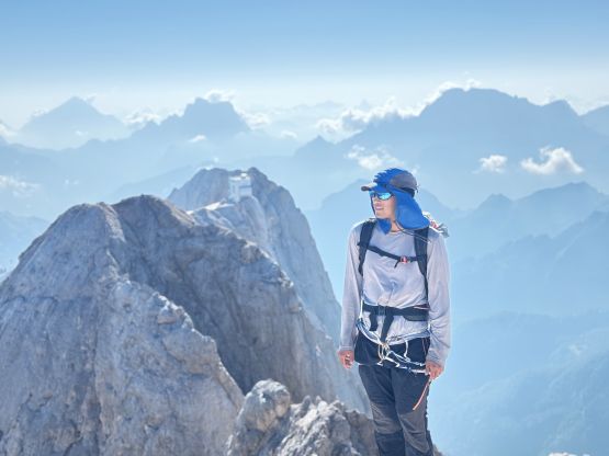
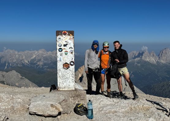
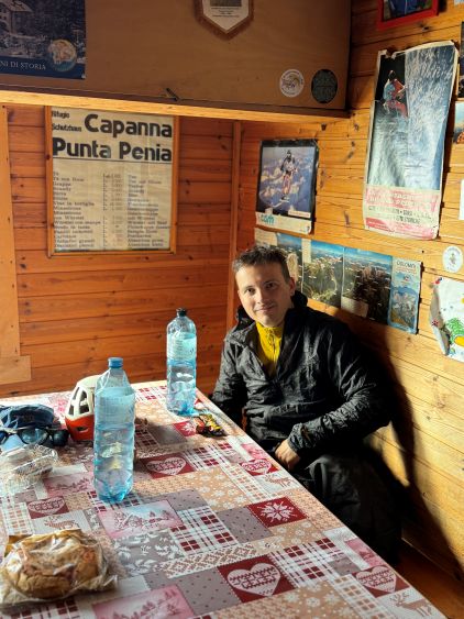
We all donned harnesses at the start of the climbing because we were anticipating some difficult climbing, but it was actually quite chill. The crux was actually at the very start. The initial few meters were completely vertical and lacked reliable footholds, but afterwards the going was mostly just an “exposed scramble” aided by the artificial holds, pitons and chains. There’s one notable exposed ledge traverse shortly after the initial crux, as well as several areas with loose rings/pitons. The “holds” on this mountain were coming loose that we needed to check them just as if we were climbing in the Rockies. Above the col the climbing was mostly done on ladders made of metal rings, and there’s at least one stretch of 60-m pitch on ladder with lethal exposure, but there’s no technical difficulty. The route was just long and mentally and physically taxing. Adam had already decided to do this climb at his own pace because he was going to use the ferrata kits. The three of us otherwise, did not bother to use the ferrata kits nor clip into any of those safety lines. The climbing was just not hard enough. The finish of this route was anticlimactic because the final 100 m gain was on some ugly scree, but at least there’s a cool hut next to the very summit offering some kind of variety. We waited for Adam to show up and then took a long break inside the hut playing chess and talking to the locals.
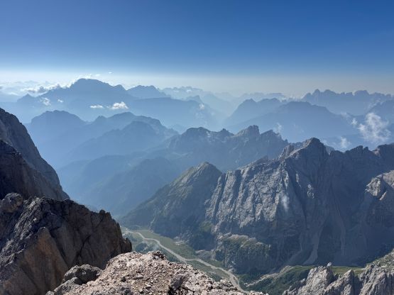
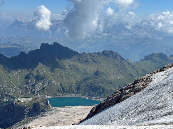
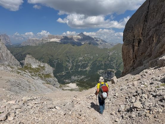
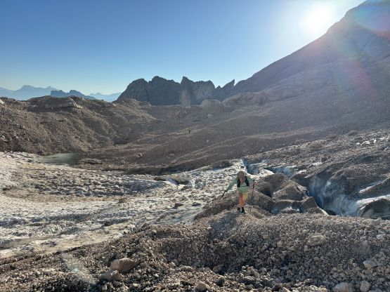
Eventually it was time to start descending as we had more than 3 hours to drive afterwards (towards Cima Brenta). Erica and Caspar ran ahead and disappeared in no time. I had to work 120% hard to even keep up with their pace, and I could only do that on easier stretches. On the harder parts I had to be a bit more careful so it was basically not possible to catch up, but that’s fine. They needed to delayer at some point and I would catch up by taking less time on transitions. There were at least 20 other groups coming up while we descended, and the guides weren’t particularly happy about our descending speeds. One guide was trying to “teach” us something in Italian because we all zipped by his client who was not moving at all. I think some of these guides need to learn how to yield to faster traffics. Due to concern of rockfall we kept descending all the way to a “safe” spot far beneath the glacier, and waited for Adam. Adam eventually showed up 40 minutes or so later, and we descended the rest of the way together. There’s not much worth noting afterwards and our round trip time was under 6 hours including all of the long breaks. Adam and I then drove straight to Cima Brenta but Caspar and Erica opted to do some touristy stuffs. I felt quite tired even just by pushing the 3+ hours of driving immediately after finishing Marmolada so I was not surprised at all that by the time the alarm went off at 4:20 am, I was down to myself soloing the hardest “ultra” without snow/ice in the eastern Alps.