Lennox Mountain
February 9, 2025
1796m
Skykomish / US-2 Corridor, WA
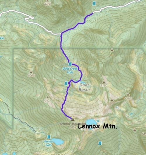
Lennox Mountain boasts over 600 m prominence but is not a popular objective. The reason is obvious as the routes are unpleasant whereas the peak itself offers little mountaineering interest. There are at least 4 different routes traversing different sides of the massif but three of them require substantial amount of bushwhacking and the 4th route (from Bare Mountain trail to the south) is undulating and contrived. The standard route seems to be the SE (Coney Basin) route. I had honestly not put in much thoughts about Lennox Mountain but then Matt, Elise and Mel made a successful ascent on Friday following the north bowl (Goat Basin) route. I was actually invited to join but due to various reasons I opted to wait for their result and in the case they made the summit, my plan was to follow their tracks on Sunday. The north route was pioneered (at least on the Peakbagger app) by Ryan Stoddard and Matt basically followed his GPX track. The advantage of this route was the higher starting elevation given that the Money Creek Road was plowed from time to time but the status of this road was uncertain. Matt as usual, went first to embrace the unknowns and confirmed that it was possible to drive to within 2 km from the starting point, so the trigger was pulled.
There was some precipitation on Saturday dumping upwards 20 cm of snow down to sea level, and I debated for at least several hours whether it would be safe to poach their tracks, but in the end I opted to keep the original plan. The avalanche forecast was still “moderate” and the stress was still on that persistent weak layer buried more than a meter deep. The 15-20 cm light fluffy snow wouldn’t change the bigger picture. I also worried about the road as it’s almost certain that the plowing machine wouldn’t be working on Saturday during the precipitation event, but I had fate on my brand new Subaru. The road’s not steep so pushing through a bit of fresh snow should be within the Subaru’s limit. Erica and I left home in the previous evening as usual, and we got to Skykomish after midnight. I was correct that the road was not plowed but several vehicles had already gone ahead to lay some tracks on the fresh snow. The tracks were everywhere and difficult to use, so I basically made my own tracks. The Subaru was amazing in this kind of condition and I didn’t even need to use the “X Mode”. I even attempted to drive beyond Matt’s starting point as the new snow had covered that “sheet of ice” that Matt encountered, but I quickly gave up on that idea. After encountering some slipping I gingerly backed down, turned around and settled for the night.
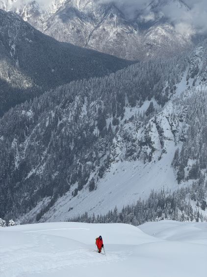
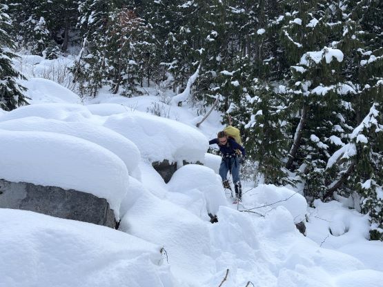
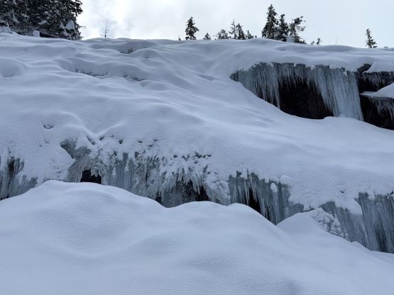
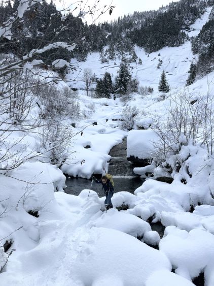
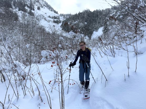
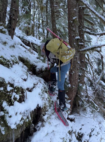
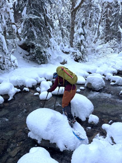
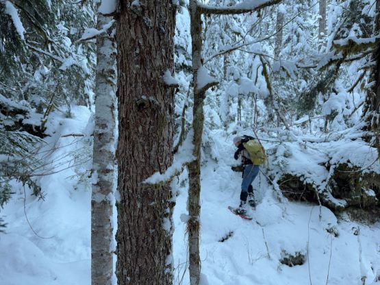
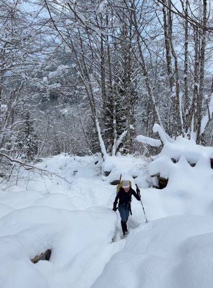
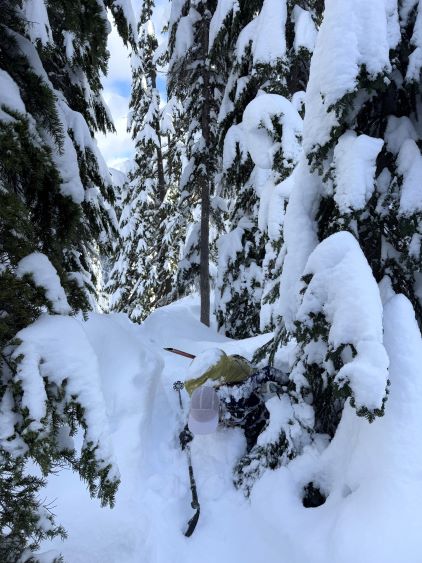
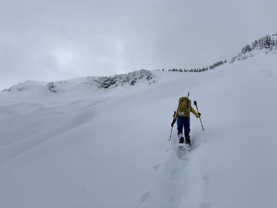
The forecast was showing clearer skies in the morning so I wanted to take advantage of that to get some views. It was however still precipitating by the time we got up at 5 am so I reset the alarm to 6 am. We eventually started the day without the need to use head-lamps. We easily plodded up the road following the existing set of tire tracks and then located the partially covered snowshoe tracks left by Matt’s party. Among the two variations at the start we took the western branch following Elise’s advice. I hoped she helped us to avoid the worst of the bushwhacking as the route we took was already quite unpleasant. The bushwhacking was tolerable but the fresh snow made things annoying. The were several ravines with difficult descents and reclimbs, and a major creek crossing that required one strenuous move. Erica slipped and fell into the creek but managed to somehow stay dry afterwards. I also had to check the GPS multiple times as the snowshoe tracks were barely visible after the previous day’s precipitation. I had opted to wear the 30′ snowshoes and we did have to break trail on top of their tracks, but the tracks helped us eliminating the route-finding which I was very thankful about. A while later we got into the lower basin. The tracks alternated between following the creek bed (on boulders) and the bushes on the sides. Neither was pleasant and we simply did whatever the other party opted to do. We had to hop across the creek a few times near the frozen waterfalls at the head of this lower basin, and each time became more difficult than the previous. This stretch of unpleasant terrain culminated at a partially filled-in boulder field, that even with the existing tracks we both discovered deep holes a few times.

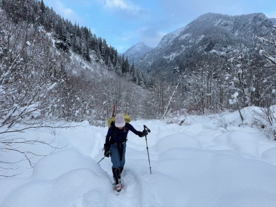

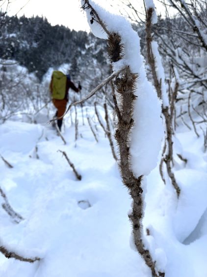

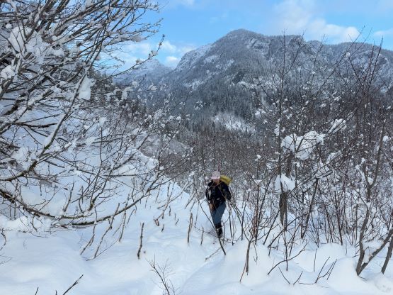

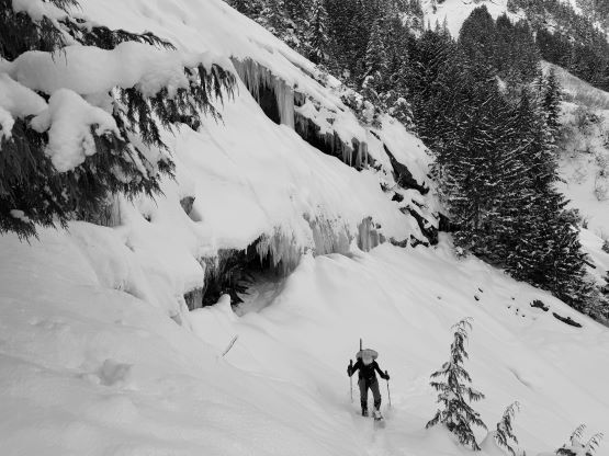


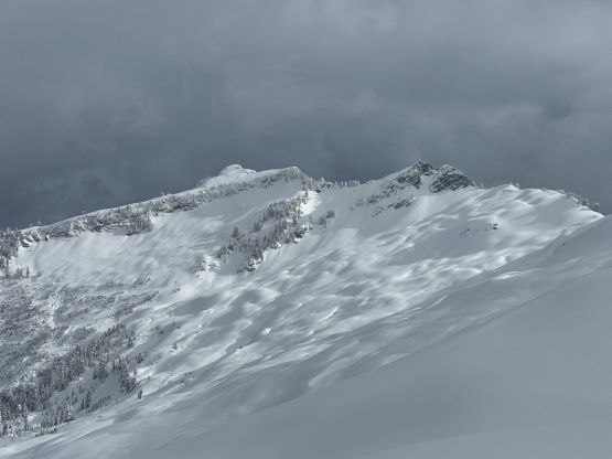
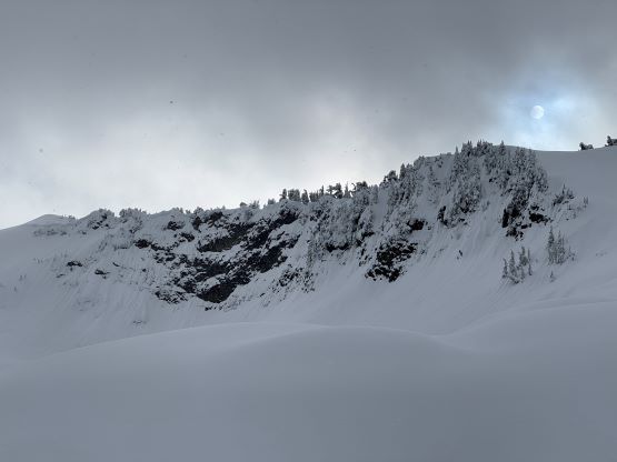
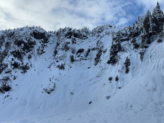
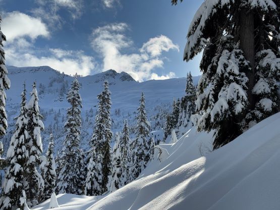
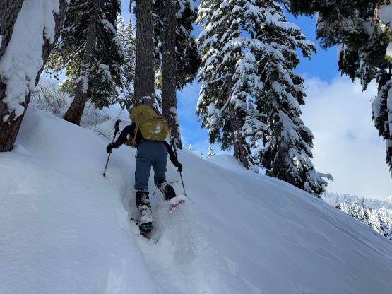
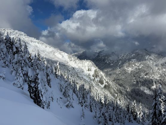
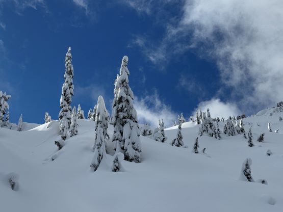
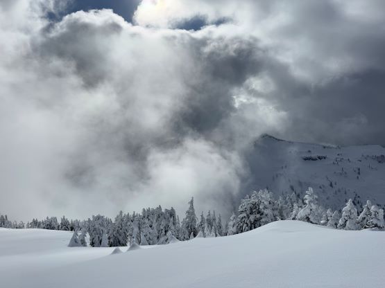
There were also abundant amount of Devil’s Clubs and other thorny plants that I don’t think this route would make any sense in any season but the deep winter. The boulder field stretched on forever but eventually we crested the lip and descended into Goat Basin with the frozen Crystal Lake. This short stretch of descending could be avoided by strictly following Ryan’s GPX track but again, we simply followed Matt’s footprints without second guessing the route choice. To get out of this upper basin required one long stretch of steep forest and the slope angle approached 45 degrees on several micro-terrain features. This was the section that I was concerning about, but the other group made it up and down just fine and so did we. The snow also suddenly became very deep and powdery and the trail-breaking would be waist deep at times if not because of the tracks. Even on top of the tracks we had to plow through the 20 cm of fresh snow and that was quite exhausting. After what seemed like a long time the slope angle eased and we aimed at the distant NW Ridge with one more steep slope to ascend. This part of the route deviated from Ryan’s route but was actually more efficient. The ascent of the NW Ridge was without event and was done mostly in the white-outs. The weather thankfully cleared up for a few minutes after we got to the summit so we had some views, at last.


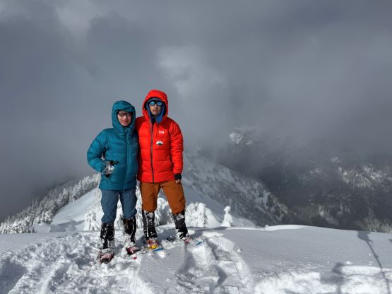
Our ascent time was 4.5 hours so we were doing fine despite the trail-breaking. I made us wait for at least 20 minutes on the summit hoping the weather could get even better. It did, so the waiting for worthy. Meanwhile Erica was able to catch some sporadic cell reception so we made some updates on the socials. It was eventually too cold to linger any longer so we descended. The descent was fast and furious especially with the 30′ snowshoes. I was able to plunge down on the virgin snow for as much as possible. Erica, though only had the 22′ snowshoes, was light enough to stay floating on the existing tracks. In no time we were down to the upper basin and it was then the time to embrace the unpleasant terrain. I thankfully had plenty of experience in dealing with any kind of snowshoeing conditions so we got down fairly quickly. We did discover a few holes but that’s unavoidable. This kind of trips was also not cheap because the wearing and tearing of our snowshoes on the rocks, but this was just part of the game. We eventually finished the descent in just over 2 hours and our round trip time was 7 hours. We took our time packing up the car-camping gears and at the same time, prepared our post-hike meal before driving home. I eventually got back home at 6:30 pm in time for dinner, and then worked at 8 pm. This was another great day out but I was glad to never have to come back for Lennox Mountain.