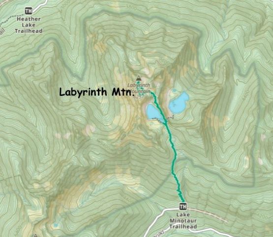
Labyrinth Mountain
October 31, 2023
1943m
Stevens Pass / US-2 Corridor, WA
Labyrinth Mountain is a popular objective in the broader vicinity of Stevens Pass and boasts over 500 m prominence. This is a short hike with a trail to the summit that involves only 700 m elevation gain. The only difficulty comes from the access as one does need to drive some miles on logging roads, from Smithbrook Creek to Lake Minotaur trail-head. The road condition was rather excellent. I think a normal SUV should be sufficient enough but I opted to take the Tacoma for extra contingency. I had seen a recent trip report mentioning some icy sections on the north side of Nason Ridge’s crest so I decided to carry tire chains in the truck to be 100% sure. That trail-head, on the other hand, helped to confirm that a “trail” had been broken and snowshoes were not needed. This was the sole reason why I chose this objective, that was to take advantage of this recent condition update.
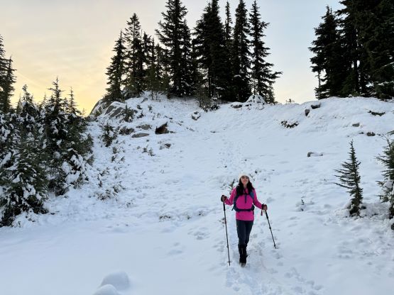
Kate L. and I had been talking to each other for a while on the internet and I invited her to come along. The plan was to leave White Rock at 3 am in order to be back home in time for work in the afternoon (4:30 pm). I wasn’t sure if she’d be keen to drive 4 hours out for a mediocre objective but it turned out that she was not picky at all. We indeed managed to leave White Rock at 3 am and got to Smithbrook Creek about 3.5 hours later. I had finished most of the objectives accessed from this drainage but I had to drive the farthest this time. There was indeed some snow and ice on the road after cresting Nason Ridge but the driving was straightforward and imposed no problem whatsoever. It was still pitch dark when we parked the truck and that was according to the plan.
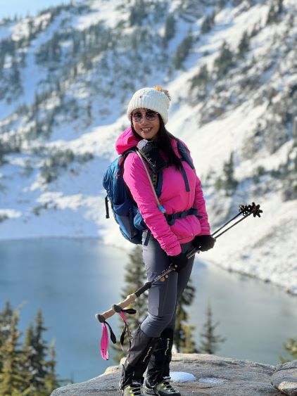
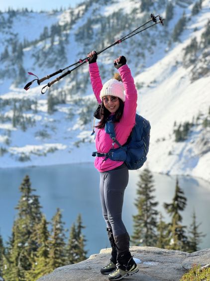
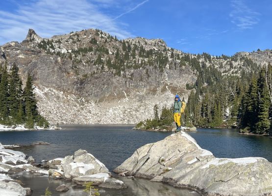
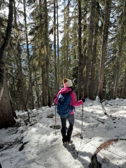
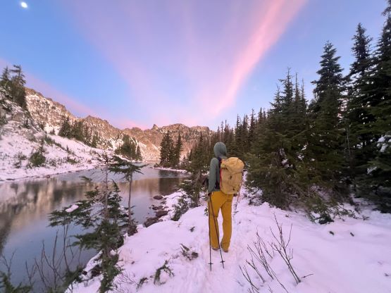
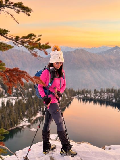
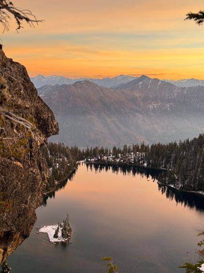
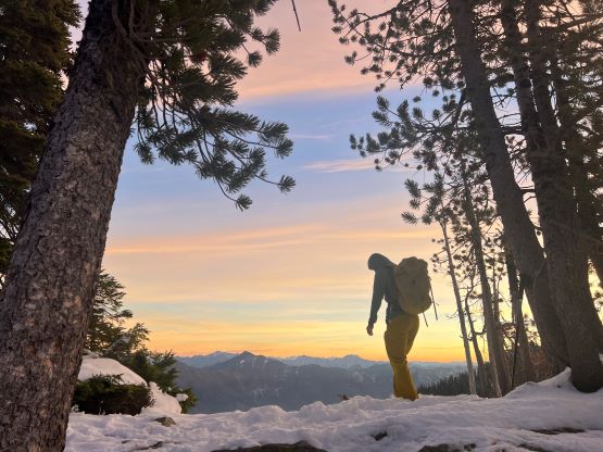
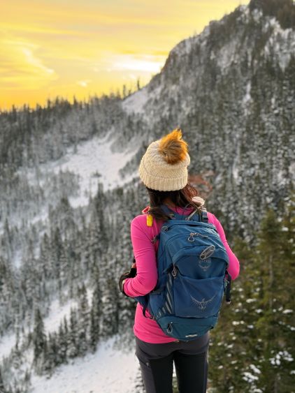
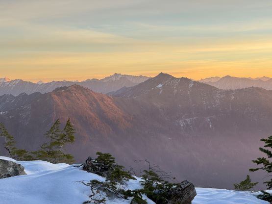
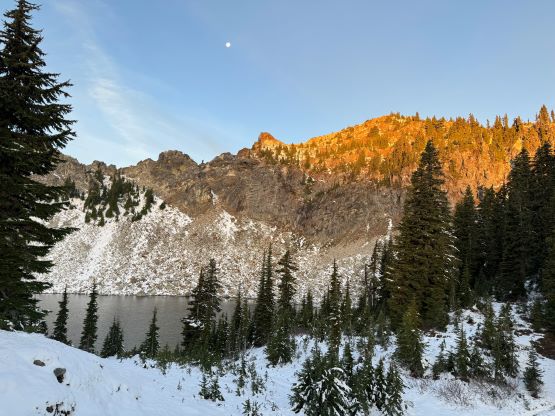
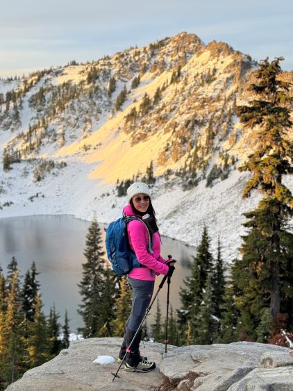
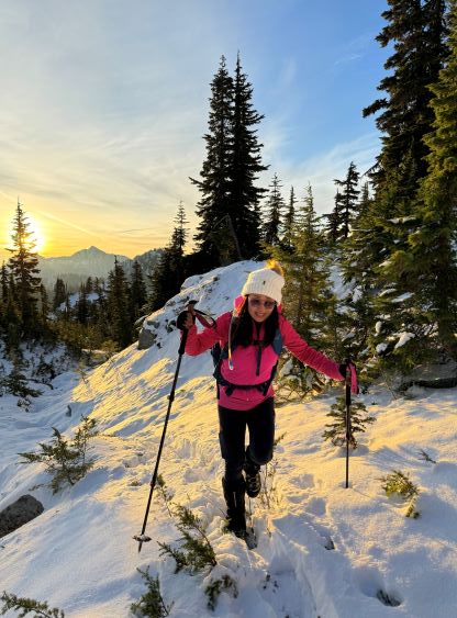
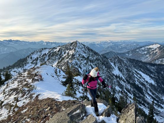
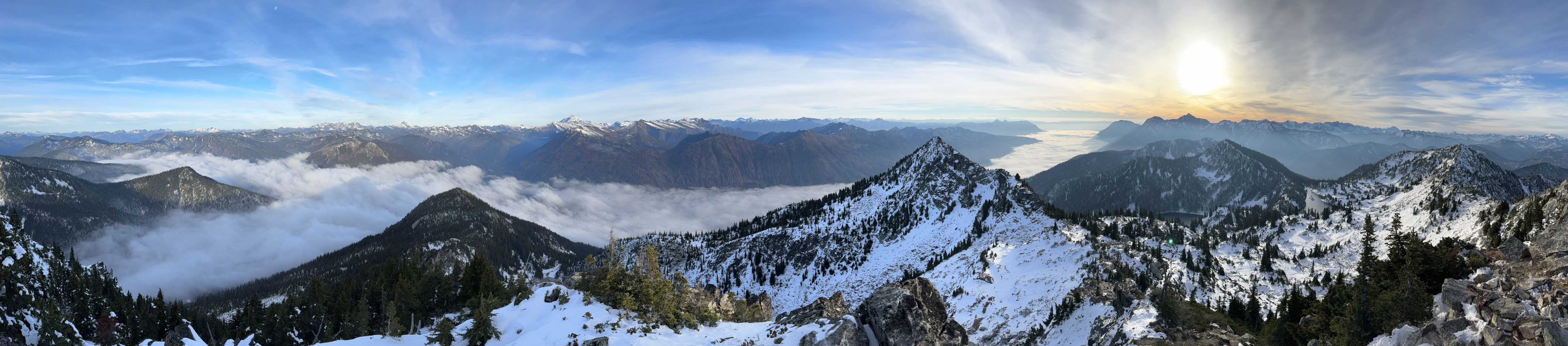
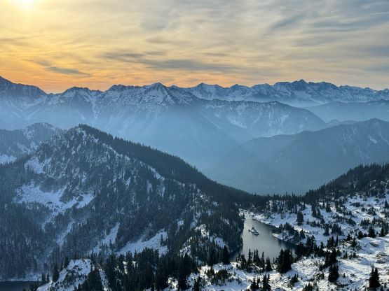
Both Kate and I opted to wear Trango Tech mountaineering boots. I had suggested Kate to purchase a pair of the Trangos to be better prepared for the winter and the general off-trail scrambling on rough terrain, and this would be the perfect trip to break them in even though the condition was simple enough that wearing the hiking boots would be totally fine. I too decided to wear the mountaineering boots for simplicity. The trail had become steep and icy after gaining a few hundred meters elevation but the microspikes stayed in the backpacks. The horizon had become bright enough to stow the head-lamps by the time we reached the snow-covered meadows under Minotaur Lake, and we subsequently watched the perfect dawn/sunrise horizon from the scenic ridge between Minotaur Lake and Theseus Lake. The views were beyond our expectation that we immediately started taking tens, if not hundreds of photos.


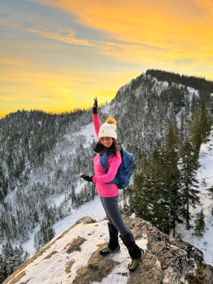

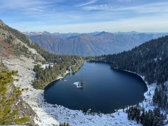
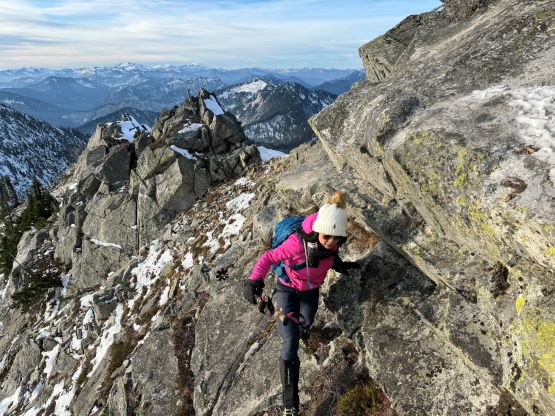
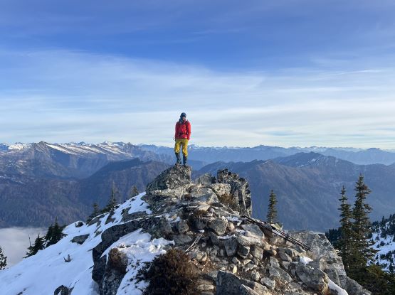
The only downside was the cold winds which kept us moving. We picked up the set of tracks heading upward into the bowl/basin under the south slopes of Labyrinth Mtn., but then took the wrong set of footprints ascending onto the jagged south ridge. The footprints terminated at the south ridge and it’s apparent that whoever made this set of tracks turned around or merely aimed to explore the ridge. Turning around would not be an option for us as attaining the true summit would be mandatory, so we scrambled northwards and dealt with a series of 3rd class steps, sometimes tricky with the fresh snow. I had given my gloves to Kate and decided to just scramble in bare hands, and I became quite cold when I eventually reached the summit. Unfortunately the cold winds meant we couldn’t stay too long up there.


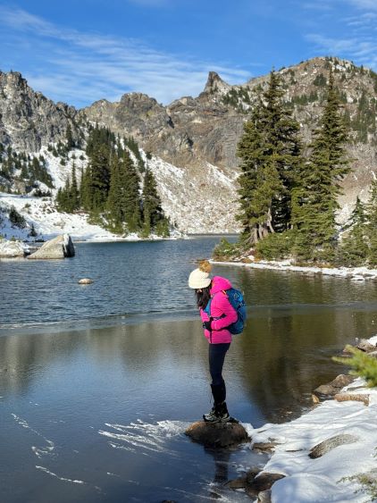
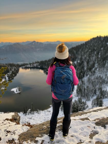
To descend we picked up the correct trail and dropped into the south side bowl without an issue. We also picked up the set of tracks and quickly rejoined our own tracks. We then made a dash down to the ridge separating the two lakes and took a few more breaks for photos. The wind had finally died down that we eventually opted to take a proper break for food, before resuming the descent down to the outflow of Minotaur Lake. I had thought about to ascend the two unofficially-named bumps but decided against that. Instead, we slowed down and did some photography on the shore of this lake. The rest of the descent back to the trail-head was tedious and monotonous, but with chatting it wasn’t too bad. I also somehow managed to stay awake for the entire drive homewards, with one stop in Bellingham for lunch. I eventually got back home in time for work.