Kings Peak (BC)
July 2-3, 2024
2061m
Vancouver Island, BC
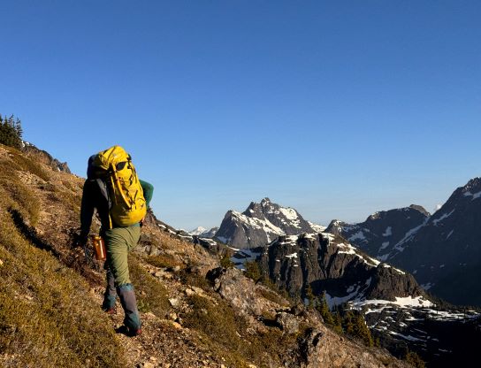
There are quite a few peaks named “Kings” in North America and some are much bigger in size. This one locates on Vancouver Island and is one of the more popular hikes in Strathcona Provincial Park. Kings Peak does not boast significant prominence as it’s connected towards Elkhorn Mountain, but is one of the peaks on the island above 2000 m elevation. The position guarantees some superb views on a clear day. Erica grew up in Victoria, B.C. so we had been discussing a trip to the island for almost a month and the ideal window finally came in the first week of July. Unfortunately Erica had lots of work commitments so the most we could do was 2 days away from home. In fact, she had been pushing back 80% of her work continuously for like a month in order to accompany me on these trips, so I could not have asked for more. My original plan was Nine Peaks but I switched it to Kings Peak in favour of a more relaxed itinerary. Kings Peak can be easily done as a day-hike but I wanted Erica’s first “proper” island summit to be as memorable as possible, so the decision was to camp on the summit, as many had done. Erica drove out to Victoria a day earlier to return her vehicle whereas I would drive out separately and pick her up from Victoria on Tuesday morning.
I consulted with a few people to make sure the short FSR that leads to Kings Peak’s trail-head is doable in the Corolla, then booked the first ferry from Tsawwassen to Victoria. I had to wake up at 4:30 am and barely had enough energy to drive to the terminal. I ended up sleeping through the entire ferry ride. We then had 4+ hours of tiring drive northwards to the Strathcona and we had to take turn driving. Erica had been working till 3 am so neither of us got much sleep, if any. Erica found a cute Pho restaurant in Campbell River and that marked the start of the highs in this trip. Prior to that we both had to push to our limits to make this trip happen. The 1-hour drive from Campbell River to the trail-head was very scenic with some lakeside views. We stopped briefly for some photos but vowed to do a proper lakeside stop a day later on the return. The short FSR to the trail-head was not as smooth as I was expecting, but doable in the Corolla with some careful driving. To my surprise there weren’t that many mosquitoes at the trail-head so we took our time and eventually started the ascent at 2 pm. This wasn’t as early as I hoped, but would do.


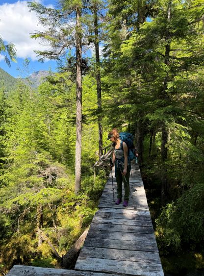
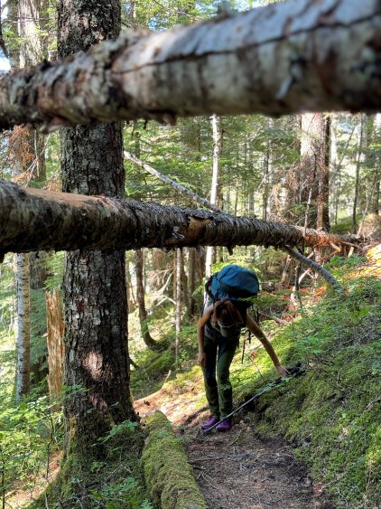
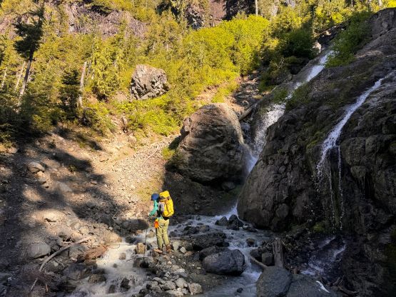
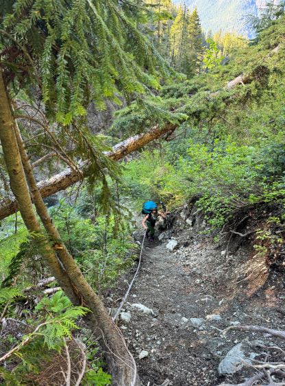
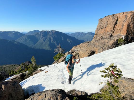
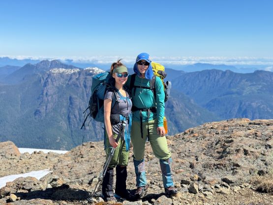
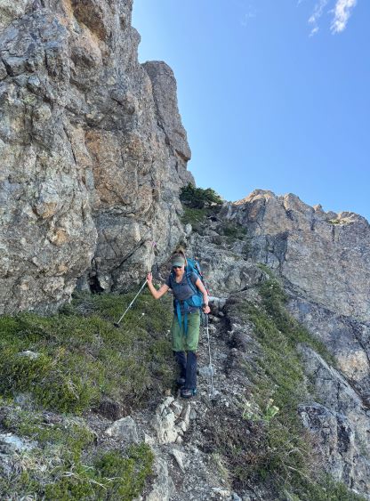
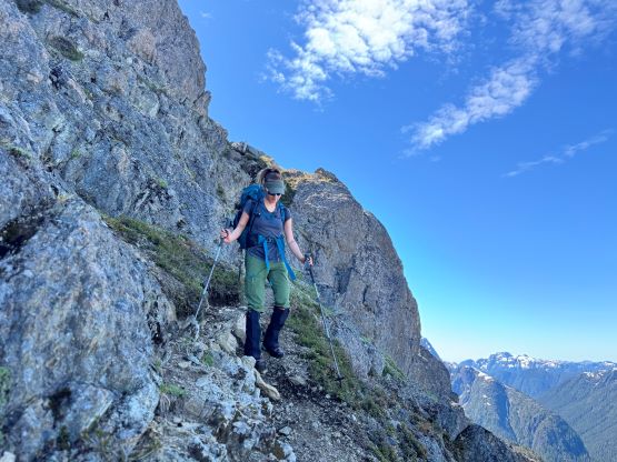
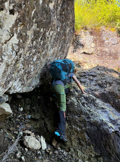
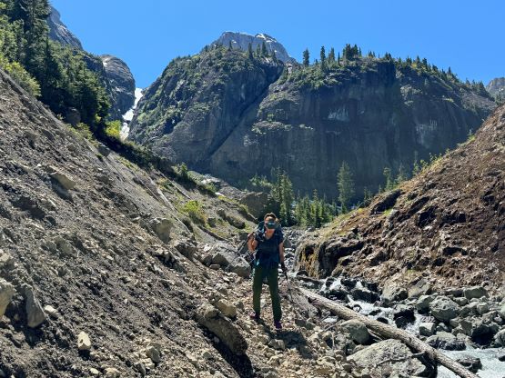
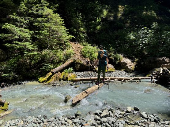
I noticed a higher powerline road that could potentially save ~20 minutes of walking each way, but that would definitely require the Tacoma and I wasn’t too keen to drive the truck that far for another trip, so we just did the standard trail-head. There were some up-and-downs at the start and the first creek crossing had a proper foot bridge. For an unofficial trail on the island the quality surpassed my expectation. The lower flanks had lots of well-engineered switchbacks and there wasn’t any insanely steep “climber’s trail” type of terrain until the two consecutive creek crossings. The most recent AllTrails report indicated an unexpected turn-around at the second of these crossings so I brought a pair of sandals, which surely became dead weight for training purposes. The creek crossings turned out to be trivial by just rock-hopping. Taking the shoes off was not required. There was a stretch of loose and steep side-hilling on the climber’s left side of a canyon, and the few old fixed ropes suggested we were definitely on route. This section was a bit strenuous on the trail-runners and required some caution. This was Erica’s first time testing out the new Arc’teryx shoes and she was happy about the grips. We then took a break at the 1300m bowl to reload the water bottles and swap footwear to mountaineering boots. Most parties opted to camp in this bowl but as mentioned earlier our plan was to camp on the summit.


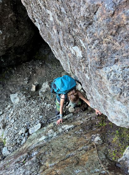
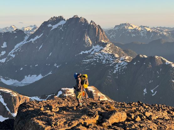
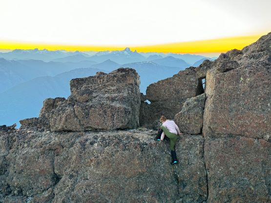
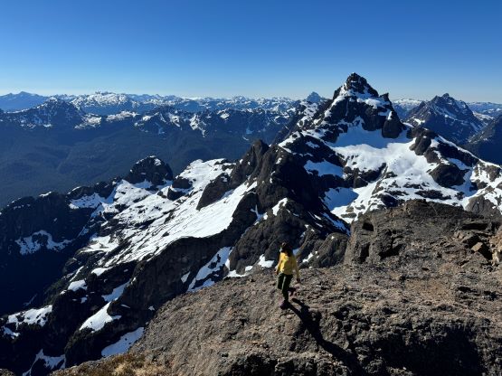
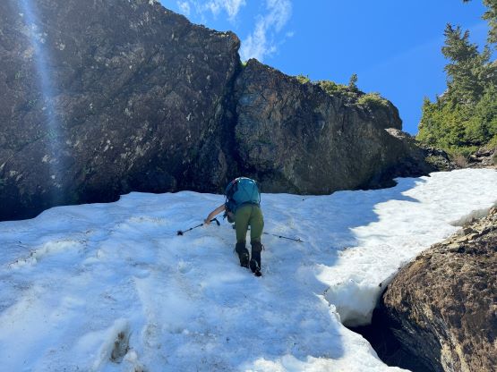
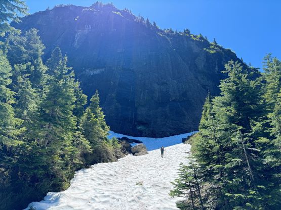
There was still substantial amount of snow in the hiker’s gully leading up onto the NW Ridge system and we were definitely glad to have brought the mountaineering boots for that section. There were also plenty of loose rocks and a few interesting scrambling steps. One particular step required some definitely 3rd class moves on wet rocks but I wasn’t sure if we had picked the easiest path. The gully wasn’t too long so we topped out on the NW Ridge at the so-called “golden hour” and Erica was super pumped about our experience so far. The next section appeared steep and it sure was. We had to do some interesting scrambling mixed with some steep snow to ascend the “nose” on the ridge, but no special gear was required. The route-finding wasn’t trivial but there were also footprints made by the previous parties so we didn’t have that much work to do.


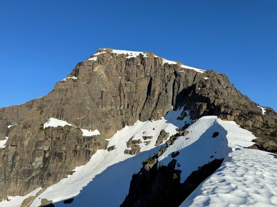
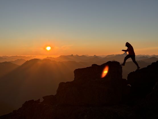
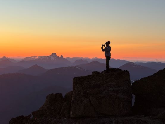
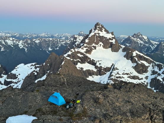
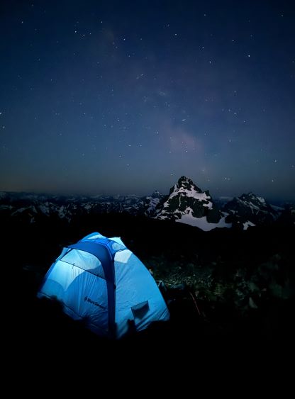
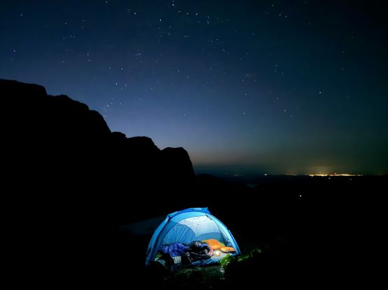
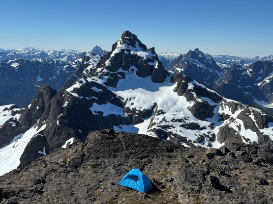
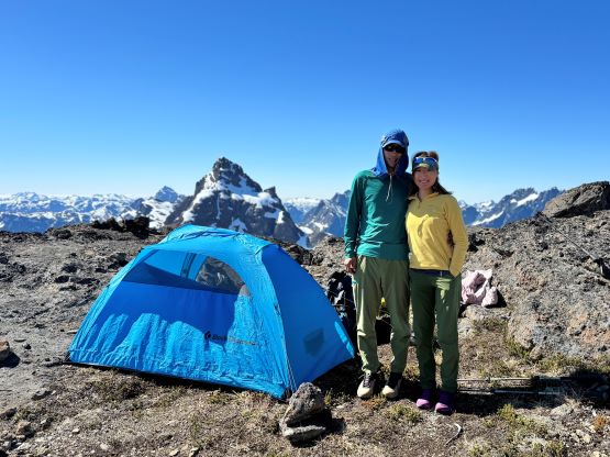
We then picked up an obvious path traversing diagonally across an exposed ledge onto the SW side of the west peak of Kings Peak. The traverse across this SW Face was nice and gentle and was mostly on snow. We deviated from the reference GPX track as I wanted to minimize elevation loss and regain, and were successful in making a traverse directly to the col above Kings Peak’s north glacier without much of elevation loss. This involved another exposed ledge traverse but we also found a better way on the return. We had previously thought about the more-direct north glacier route but the “main gully” was definitely melted out. As we slowly made our way up the standard route towards the summit the winds picked up as forecasted. We summitted about 40 minutes before sunrise but there wasn’t any obvious tent platform on the very summit and it was definitely too windy to spend the night there. We ended up scrambling two platforms down the south ridge and found a very cool tent site that clearly hadn’t been used often. It was still windy down there but the wind was tolerable. After hastily setting up the tent we spent the next few hours taking photos and socializing. We even caught some strong cell receptions and made a few phone calls to share the wonderful experience. This was Erica’s first summit bivy and I could tell that she was extremely stoked.


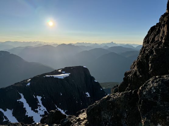
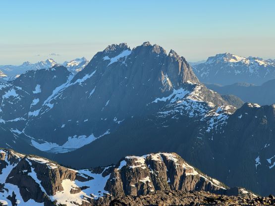
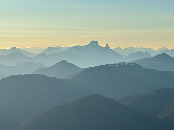


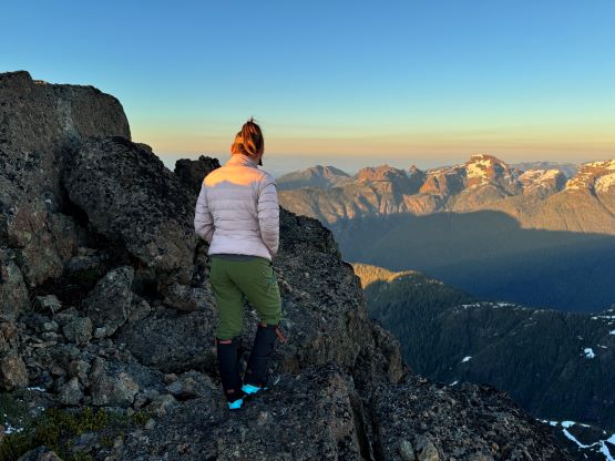

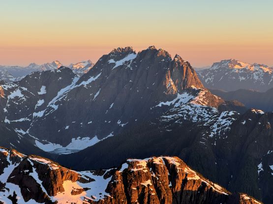
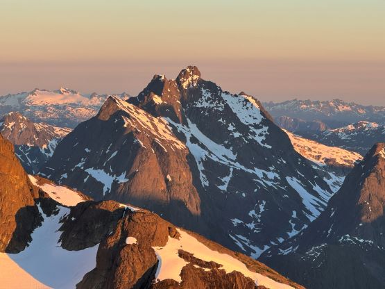


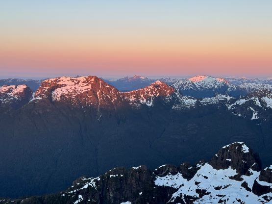
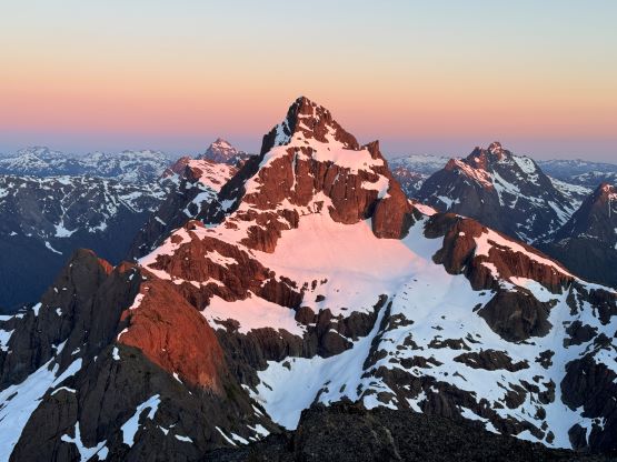


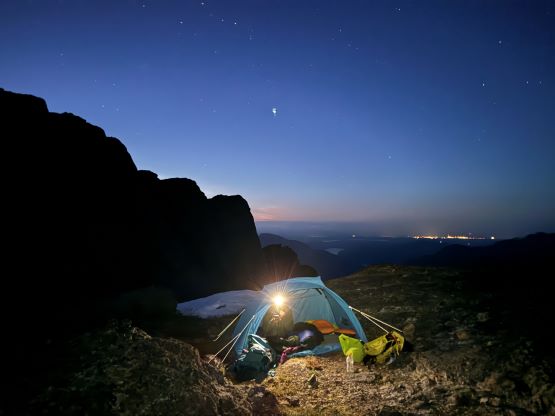

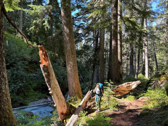
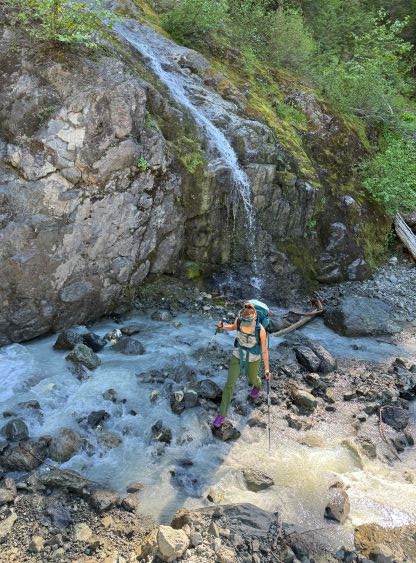
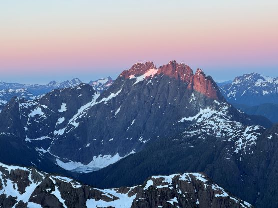
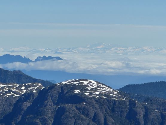
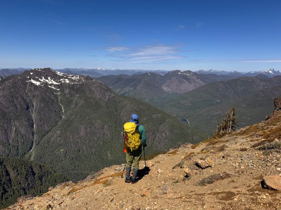
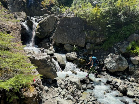
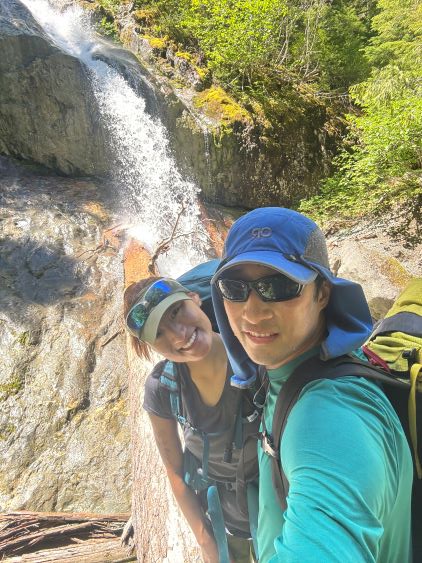
Through Googling we learnt the sunrise was supposed to be at 5:20 am but I thought the timing was a bit off. In any case we went to bed at almost midnight and I set the alarm at 5 am. By the time I woke up the sun’s already up but I still forced myself out to shiver in the cold. The views were definitely spectacular with the alpenglow on Mt. Colonel Foster stealing the show, but we also had seen similar views the night before so I didn’t bother to wake Erica up. I only wondered around for a few minutes and then went back to sleep, and slept till almost 9 am. It was becoming too hot to be inside the tent, so we both got up. The morning routine was very lazy and slow going as the views were very distractive, but by 11 am we did eventually start the descent. We did a bit of variation at the SW Face section to avoid that exposed ledge and definitely found a better way, with cairns indicating we were on route. The rest of the descent was rather uneventful but we did take our time taking a few longer breaks. There was one interesting waterfall in the lower forest and we stopped there to explore things around. We eventually got back to the vehicle at almost 3 pm and the round trip time was just over 10 hours sans the camping time.


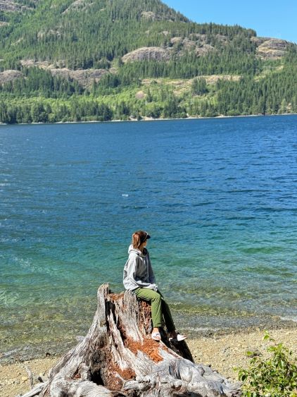
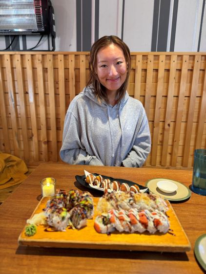
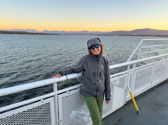
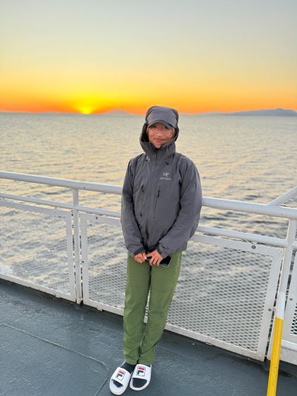
As promised to ourselves we found a much better spot to take a break on the shore of Upper Campbell Lake while driving back. I also made Erica to drive us back to Campbell River as she was excited about the curvy island’s roads. I then took over the drive and got us back to Nanaimo and meanwhile we managed to secure our 8:40 pm ferry spot from Departure Bay to Horseshoe Bay. I found a cool little ice cream place in Nanaimo and Erica found a neat little sushi restaurant within a few minutes of walking distance, so we aimed directly to those places. We had about 1.5 hours to kill so the restaurant and the ice cream were the perfect stops. The ferry turned out to be delayed by 20 minutes but that also put us in a better position to watch sunset from the ride. That was another extremely memorable moment in this trip. We eventually got back home before midnight. Talking about living our lives, this trip sums it up well.
Erica’s turning 23 in a couple days, and we had done 23 peaks together. Our first trip was Courtney Peak et al. back in the last few days of May. What a first month!