Ağrı Dağı (Mount Ararat)
July 14-16, 2024
5137m
Doğubeyazit, Turkey
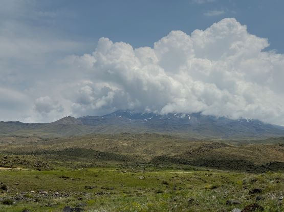
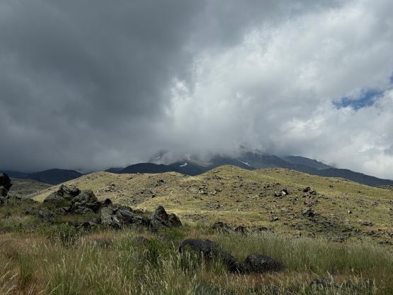
The 5000-m glaciated volcano Mt. Ararat is the highest peak in Turkey and the local name of this mountain is Ağrı Dağı. Needless to say this is the primary objective of this eastern Turkey trip among Deividas, Dave, Adam and myself and this would also be Dave’s 50th out of the world’s Top 100 by prominence, making him ranking the 3rd on that list. A guide is legally required to climb Mt. Ararat and there are many touring agencies to choose from. Deividas picked “Ararat Climb” and all I did was to pay the fee (500 EUR per person), book the airlines and show up with the required gears. When it comes to guiding companies I’m usually on the picky side but this one turned out to be excellent. Our lead guide Recep has done this objective over 300 times, has all of the local connections and is stronger than any of us here, and we also had Ramida the excellent ground support who ended up hiking to Camp 1 and waited for us there. The normal itinerary to climb Mt. Ararat requires 5 days but Deividas booked only 3 days because we would be already acclimatized on the other mountains. The itinerary only gave us one summit window (which I didn’t like), but there’s also the option to push for the summit on the 2nd day, energy and weather permitting.
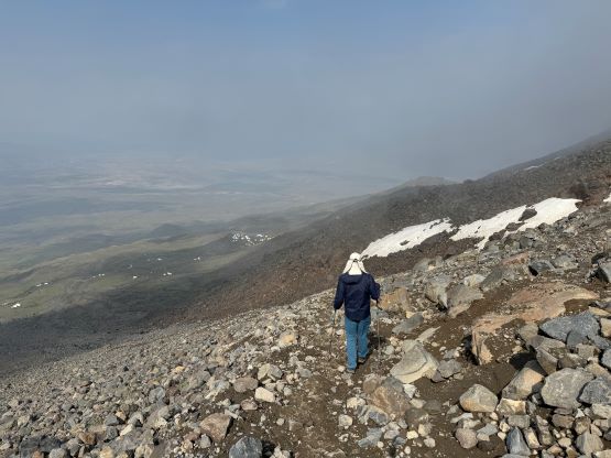
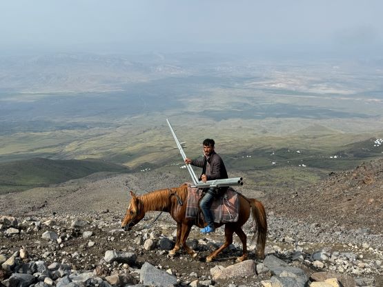
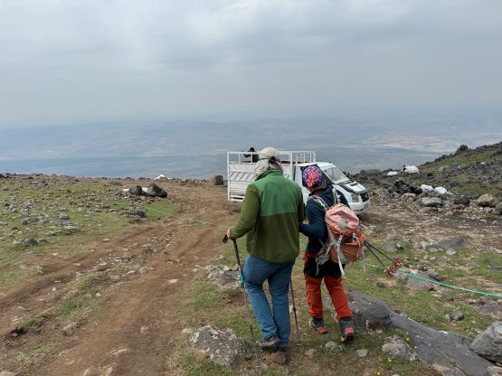
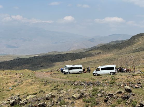
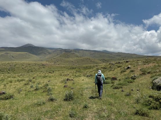
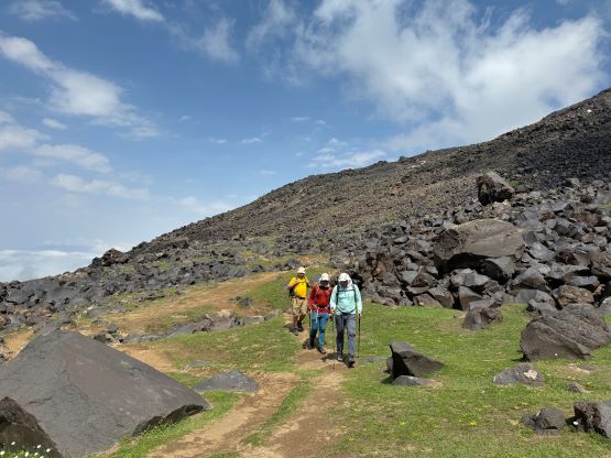
Doğubeyazit is the closest town from the standard SW route and is often used by climbers as the “base”. One would expect to see Mt. Ararat climbers in any of the hotels in this town. In the previous day we checked into Atlihan Hotel after completing an ascent of Süphan Dağı, the 4000-m volcano on the shore of Lake Van. There was no air conditioning in this hotel which was not to my surprise. And as usual I did my trip report and laundry routine and then we all went out for a late dinner at 7:30 pm. We did not come back until almost 10 pm but thankfully the pick-up was scheduled at 10 am so we had lots of time to do packing. Adam and I would pack our gears into one duffel bag that was to be transported to C1 and then C2 by horses, and the rest of the stuffs would be left in another duffel bag in the hotel. I was still seriously jet lagged so there were a few hours in the morning that I simply laid on the bed doing nothing. The pick-up showed up on time and we did one more grocery shopping before driving to the trail-head. We had learnt that the dirt roads go all the way to C1 at 3200 m altitude but those were only for emergency use. Us ordinary hikers would have to start trekking 1000 m lower at the “car point” on my Gaia map. The objective of this first day was simply get to C1 and rest and I anticipated 2-3 hours of hiking at most.


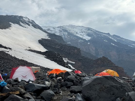
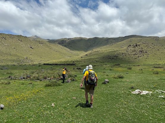
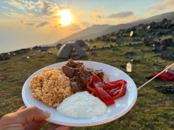
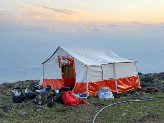
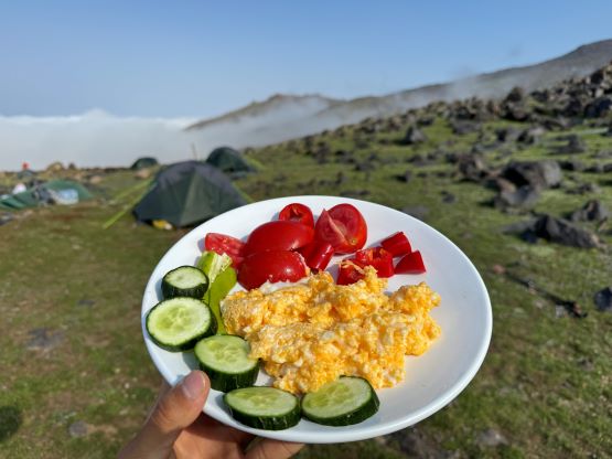
As usual Adam went ahead right off the bat but the location of C1 is confusing as different companies had occupied different areas. Adam ended up missing our campsite and went at least 50 m too high, but there was abundant cell reception on various parts of the mountain, so the communication wasn’t too difficult. The rest of us followed Recep hiking at a slow pace, taking lots of long breaks. I couldn’t recall much from this first day as the terrain was mundane and the hiking was quite boring. They gave us fresh fruit and juice bottles and I made sure to empty them first before eating my own snacks. It also turned out that they had provided enough food for us throughout the trip so bringing my own snacks was only for the contingency purposes. Not far below the campsite we left the trail and did some cross-country travel to reach Ararat Climb’s C1, which was lower and to the right (east) of most of the other camps. As planned the rest of the day was spent resting, eating and hydrating. There were still some cell receptions, though sporadic at times, and the sunset as well as the food services were beyond my expectation. There were also two private toilets and the four of us each got an individual 3-person tent.


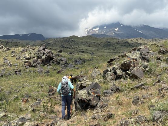


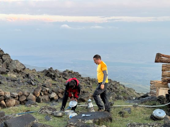
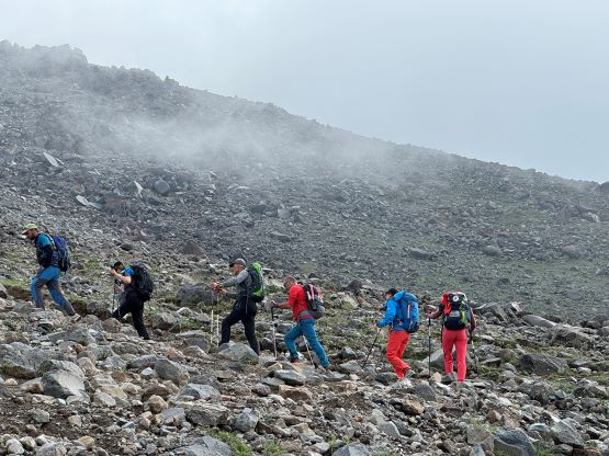
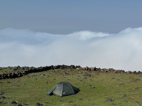
It rained on us for a few hours at night and that forced me to get out of the tent to move my duffel bag inside the vestibule. This also marked the change in the weather pattern. We had exclusively hot and sunny days up to this point but it rained on us every single day afterwards and I bet the latter is the “norm” of the area. The objective of the second day was to simply ascend to C2 at 4150 m elevation so we only had another 2-3 hours of work to do. The horses did not show up as planned but Recep explained that they were not able to move up in the white-out in the morning. The horses eventually showed up at 10 am about an hour later than planned, and we started hiking moments before they came to C1. There’s no point in starting earlier because we would otherwise have no tent and food at C2, and it’s more pleasant to be sitting at the lower altitude. There’s little worth documenting about the hike to C2 because we again, were mostly following a trail. The terrain was steeper and rockier than lower down, and we encountered and passed quite a few large groups of trekkers. Adam and I decided to go ahead but I made sure to get the exact location of our company’s C2 before committing to the faster pace. Adam and I eventually showed up at our camp, higher and to the left of most other companies’ in 2.5 hours. The horses were not there yet but while sitting and waiting I made the spontaneous decision to go for the summit on this same day, in the afternoon.


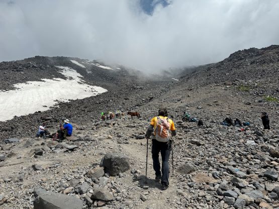

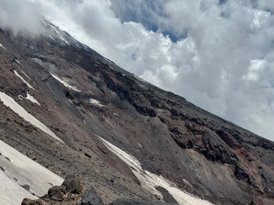
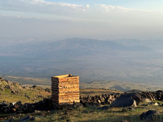
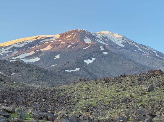
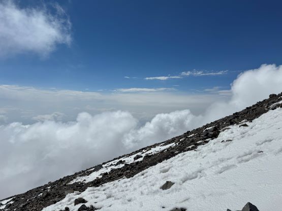
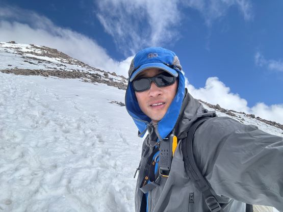
This would result in 2000 m elevation gain at higher altitude without being properly acclimatized and not to my surprise, no one else ended up joining me so I had the entire climb to myself. Part of me wanted to avoid the conga line (100+ people) on the following morning and part of me had no fate on the weather forecast, but I think I just wanted to rush things to get the job done. I got to the camp with more than 7 hours of daylight time and I couldn’t justify sitting around while doing nothing. Once the horses and luggage showed up I made a hasty re-pack, changed the footwear from trail-runners to La Sportiva Trango Tech mountaineering boots and bolted up solo. Recep gave me a walkie talkie to carry but I would also have cell reception on most part of the route. In terms of the gears I carried crampons (but not used), and opted for the standard spring/fall layering system as if climbing in my home region. The section between 4500 m and 4800 m was the worst as the route/trail ascends a series of cascading creeks/waterfalls and the terrain was extremely muddy and loose. I ended up dislodging quite a few boulders and I was glad that nobody was around. I encountered patches of snow from 4700 m and the snow became continuous another hundred meters higher. There was a brief moment that I got some views but after getting onto the icecap I was traversing inside the “ping-pong ball” all the way to the very summit. The metal post and the GPS confirmed that I made the summit in about 2 hours 15 minutes but the strong wind and the rapid ascent at the higher altitude meant I did not enjoy a single moment of the upper section. I was able to send out a few text messages to inform Recep the progress.


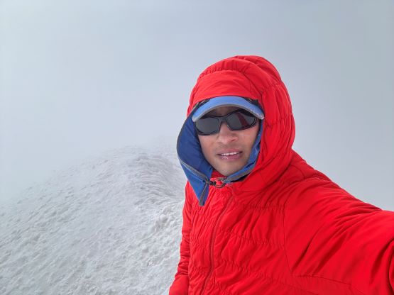

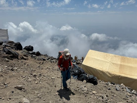
I lingered on the summit for about 10 minutes taking a few selfies but mostly to layer myself up and re-apply some sunscreen. I was able to take a few selfies and I thought about to wait to see if the weather would improve but the cold winds forced me to give up on that quickly. It was very painful to take the gloves out again to don the sunscreen but that was not optional even though the sun was actually behind the clouds. The descent on the snow/glacier was fast and furious as the soft condition meant I was able to glide and plunge down most of it. That flat section at 5000 m had some post-holing but it wasn’t bad enough to really slow me down. I then did a continuous dash down to that loose and muddy stretch, taking advantage of every single meter of soft ground, whether it’s snow or scree. I eventually exited the ping pong ball at about 200 m above C2 but a few rain drops forced me to pick up the speed again. I eventually finished the round trip in 3 hours 15 minutes which was faster than most people’s one-way time. I chilled at the kitchen tent for about an hour until dinner (6 pm), had lots of chicken with pasta and then went to bed early. Unfortunately I was not able to fall asleep so killed at least 5 hours by listening to music. Meanwhile it was pouring cats and dogs for at least 2 hours and continued drizzling throughout the night, making me glad to have done the summit already.


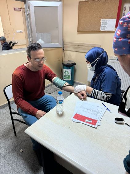
The plan was for Dave and Deividas starting at 4 am with Recep, and Adam at 5 am to catch up to them near the summit, but Adam showed up at around 6:30 am so it was not good. Adam had some serious stomach problems and turned around at 4350 m altitude, which was frankly quite common for him so we didn’t take it too seriously. I couldn’t fall back to sleep so I might as well get up to help Adam packing, and we decided to descend together to C1 to see if the situation would improve. Unfortunately the illness only became worse and Adam started to show some serious breathing difficulties. I offered to carry both of our packs down, and we still had to walk at a snail’s pace and this was when I started to question if it was just the food poisoning, or if there’s some actual altitude illness involved. Unfortunately I’m not experienced enough to distinguish HAPE from the ordinary sickness but either way our only option was to self-rescue to C1 where the truck could come to pick us up. Thankfully there was reception so we were able to keep both Recep (who’s on the summit) and Ramida (who stayed at C1) informed. The decision was made to call for a truck pick-up at C1 but still, we must hike ourselves down to C1 at the first place. Adam was really struggling on the final 200 m descent but at least we made it, and the truck came within 20 minutes. Recep had also run down 2000 m to catch up to us. Another hour later we were transported to the hospital and Adam felt considerably better after descending below 3000 m. They put him on oxygen for about an hour afterwards. I was quite sure that this wasn’t the ordinary food poisoning but rather a mild HAPE, and the situation was very dangerous. We had some quick and effective communication with both the guide and the ground support, and we were lucky there’s a road that goes to C1, as otherwise the outcome could be very different. This was already my second time having my partner gone seriously ill (first time was Dave having HACE on Ojos del Salado), and I think this was enough for me to rethink about pushing too fast at high altitude. Sure there are people like Kristin Harila and Nimsdai but do we really have to take that much risk, after all.