Veten and Brurahornet
July 22, 2024
613m
Måløy, Norway
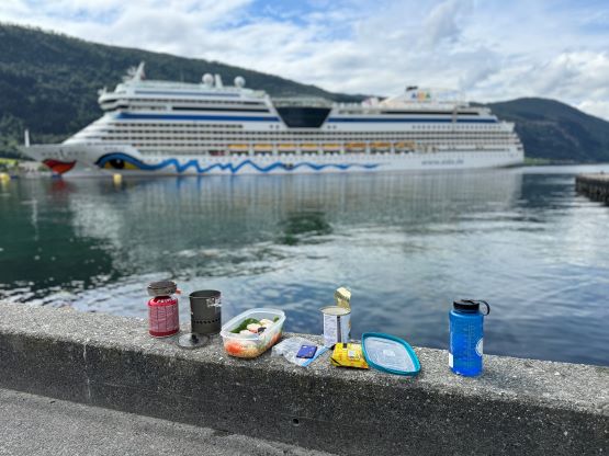
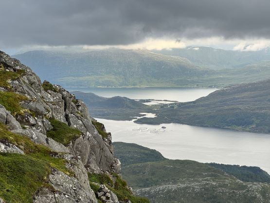
Veten and Brurahornet are the two highest peaks on the island of Vågsøy and the nearest town is Måløy. This is one of the most beautiful coastal areas in the southern Norway and also one of the most important fishing spots in the country. The higher of the two (Veten) boasts over 600 m prominence. Erica had been wanting to visit the coast and the weather was also pushing us towards that direction on the 3rd day of our Norway trip. A major system came in and it was pissing everywhere in southern Norway, with the exception of the far western areas and only towards the later half of the day. I had noticed this weather system a few days earlier so I planned the trip to take in consideration of that. The island’s high point of Vågsøy seemed like the perfect objective to salvage this otherwise, rainy day. We were tired from travelling and the ascent of Snøhetta in the previous day so slept in till 11 am in our hotel in Nordfjordeid, did our grocery shopping and cooked lunch while sitting next to the beach. We then leisurely drove west for another hour to the island. It was still early in the day so I made the spontaneous decision to check out Færestrand, a random short hike on the far west coastline. It wasn’t as spectacular as expected but it was still good to at least do something while visiting the island.


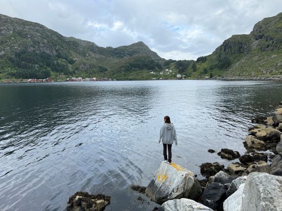

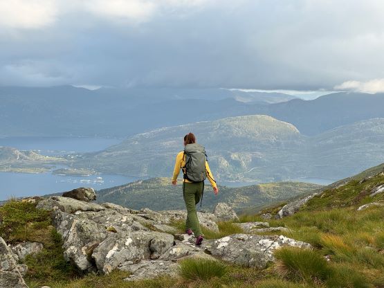
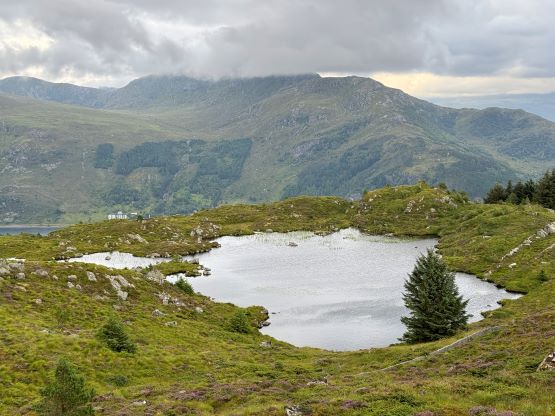
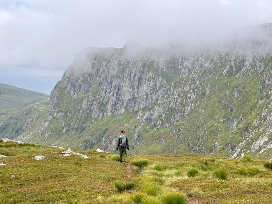
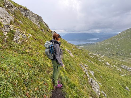
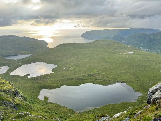
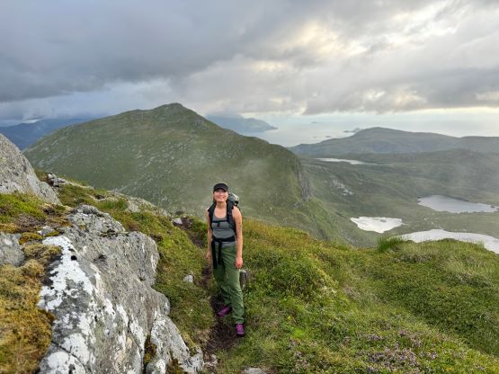
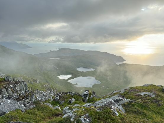
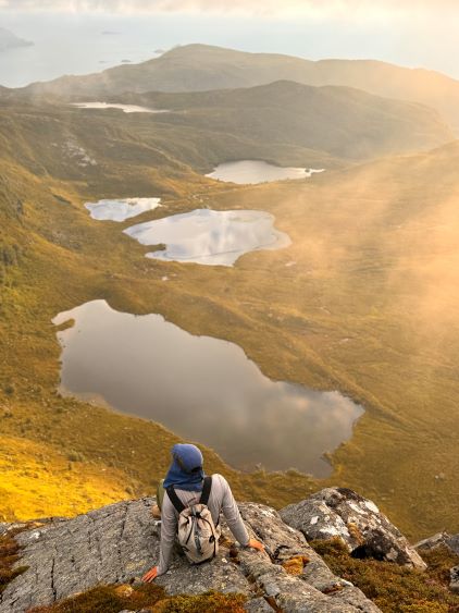
We did not start hiking until the evening, but the dusk hours are extremely long at this latitude and at this time of a year, that we’d have light until midnight. I had done no research about these objectives beside the tracks on the Gaia map so we parked on the south side of a substantial dammed lake south of Veten. The trail was well marked and easy to follow, and the lower section through the forest reminded both of us Vancouver Island for some reasons. It wasn’t very hot but the air was extremely humid. Thankfully after a while of slogging we got above the treeline and from there we would be accompanied by some incredible views. The ascent of the SE Ridge was longer than I thought as the views were very foreshortened, but with the ever changing views it never felt too boring. In short time we arrived at the summit. The fog came in and out creating some dramatic views so we lingered on this summit for quite a while.


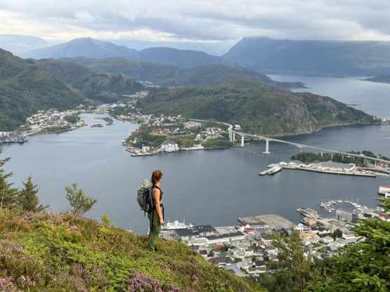
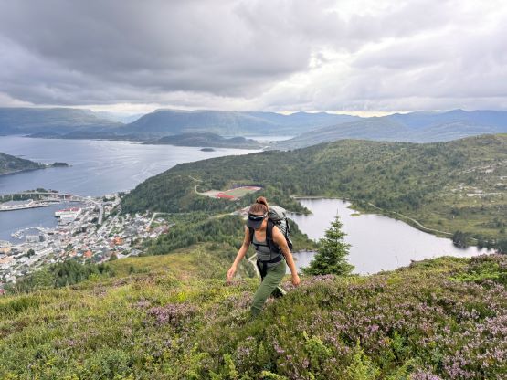
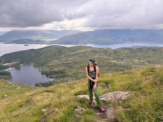

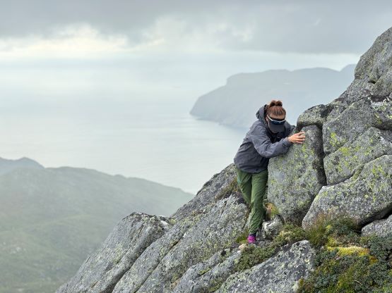
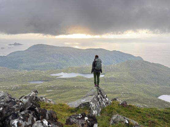


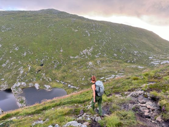
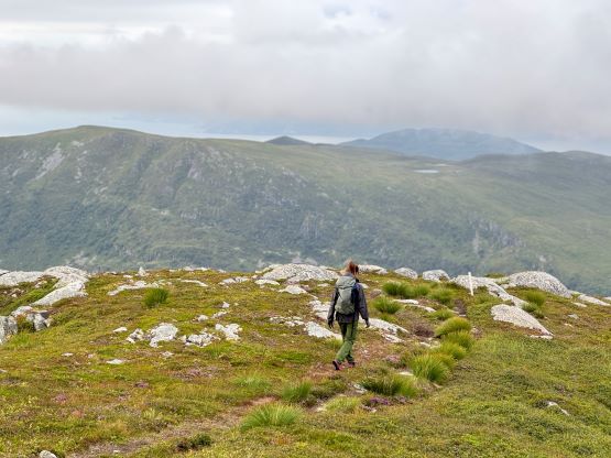
I was debating about adding the second highest peak on this island into the itinerary but we were already there so we must make a dash across the ridgeline. There’s a trail that links up the two peaks but this trail is considerably less defined and is more like a “path”. In any case we made quick work down towards Veten/Brurahornet saddle and then picked up the path ascending the SW slopes of Brurahornet. There were lots of boggy sections as well as undulating terrain near the summit. We kept traversing to the far northern summit to make sure we definitely tagged the highest point on this mountain. The views were again, on and off due to the fog but I thought this one offered better views overall.


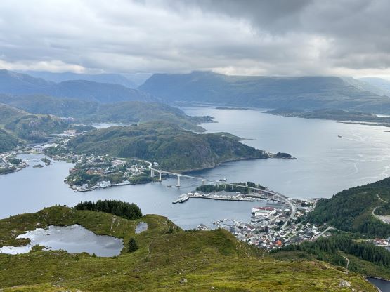
The trails on the Gaia map are incomplete for the area but I had seen a trail map near the start of the hike, that a trail descends from Veten/Brurahornet saddle directly down towards the city of Måløy. It turned out that the trail branches off very much near the summit of Brurahornet and is well signed and easy to follow. We skipped the sub-P100m, but named bump on the SE Ridge of Brurahornet and went straight down this trail back into the city, and eventually had to slog ~2 km back to the parking lot along some paved roads. It was already almost 10 pm so we cooked dinner at the parking lot, and unfortunately the area was quite buggy. The original plan was to drive another 3 hours towards Kolåstinden but I determined that we no longer had the energy to drive that far away. The alternative plan was Trollvasstinden which was only an hour and half away, and we eventually got to the trail-head past midnight.