Store Smørskredtind
July 24, 2024
1631m
Norangsdalen, Norway
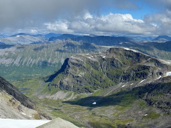
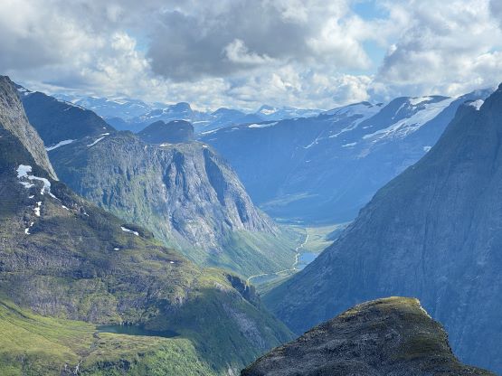
Norangsdalen is one of the narrowest valleys in Norway with 1000m-high vertical walls on both sides and Store Smørskredtind is the highest peak on the north side of the valley, boasting over 1300 m prominence. Unlike most of the P1000m objectives in southern Norway this one does not have an “easy” route to the top, and that’s what made it interesting. Petter had sent an email earlier in the year, suggesting Adam to leave this one behind and that somehow got forwarded to my inbox. I was intrigued and did a little bit of my own digging including reading Petter himself’s trip report, as well as the few reports on Peakbook. Petter’s trip report made it sound complicated but doable, and I assigned Erica “homework” to figure out the beta if she really wanted this peak. Erica is keen on anything that’s not a “walk-up”, so she did do her homework and it was her motivation that convinced me to give it a try, weather permitting. I then went back to Peakbook and found a direct access to the “easier” southeast side of the peak, and I made Petter to download the GPX track for me. This is different than the route Petter took though they share the same scrambling finish, but I believed this was the easiest possible way up the mountain.
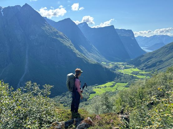
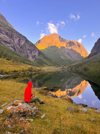
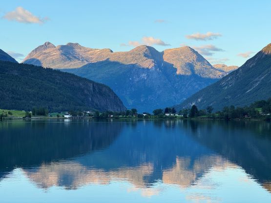
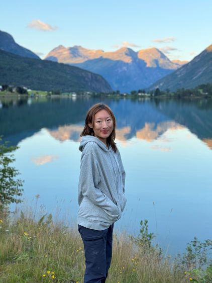
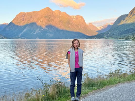
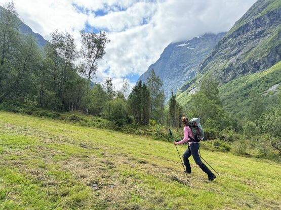
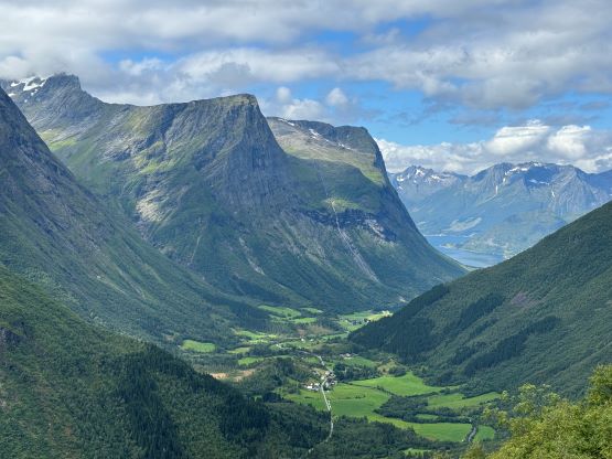
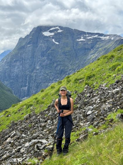
That weather window happened on the 5th day of our trip and we had planned the itinerary to take in consideration of this ascent. The forecast had been changing all the time, but the latest models converged that the later half of the day would be better, so we camped at the coast and slept in. We woke up naturally at around 8 am and didn’t start driving almost an hour later, and meanwhile got a text message from Adam that it was currently inside a ping pong ball on Kvitegga, not far from our objective. The drive back into the mountains took about two hours and we routed it to avoid taking the ferry. We enjoyed our scenic ride into Norangsdalen from the south and stopped numerous times for photos. I had never researched about the valleys so I knew nothing that this was apparently quite a special place in the country. The reference GPX track started on a random small pull-out but I was able to drive a short ways into the dirt roads, and parked in front of someone’s farm. The farmer came right behind us and we had some nice, though seemingly long chats about mountaineering and risks in general, and he gave us permission to park at his property for our climb. We then took our time cooking brunch and did not start hiking until 11:30 am. I bet Adam had already finished his miserable hike by the time we started. There were already signs of clearing above us, so we stayed hopeful.

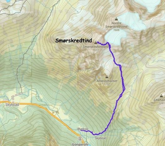
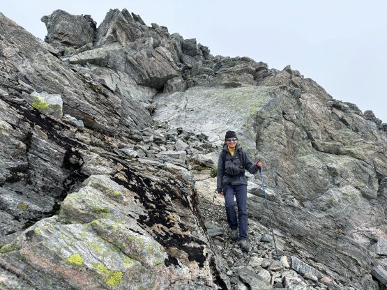
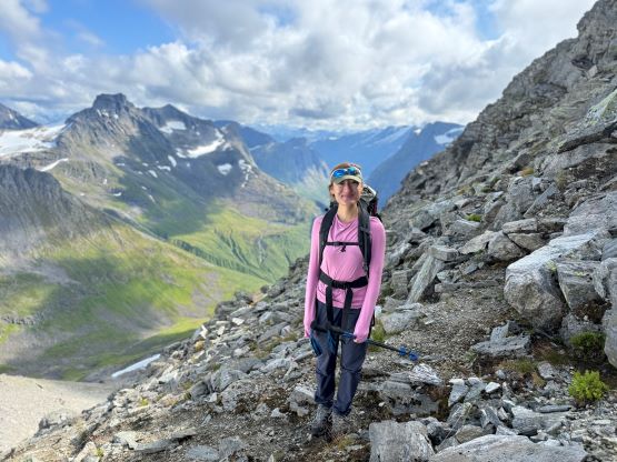
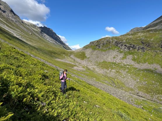
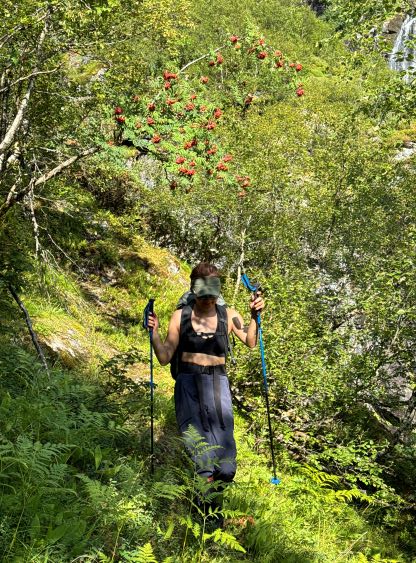
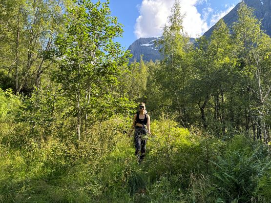
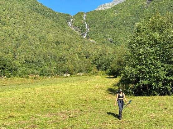
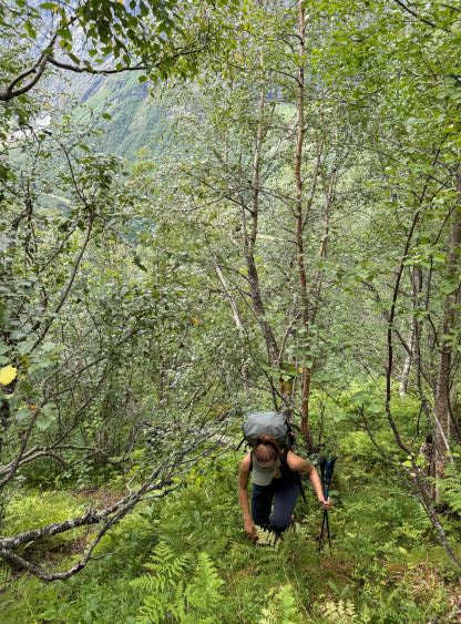
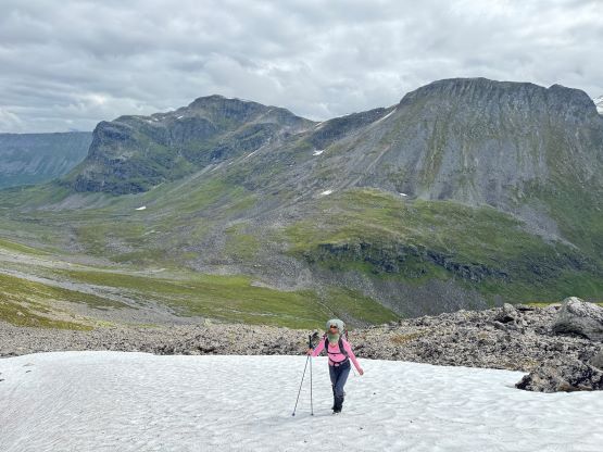
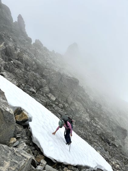
It wasn’t very clear if this route would be a bushwhack so we aimed directly towards the steep section of the climb by doing cross-country travel across the farmland. We picked up some old and overgrown roads on the far side and that road quickly became a path, and sure enough we found a cairn and an obvious path heading towards the direction we wanted. It was such a relief that we no longer needed to do 400 m of bushwhacking as the heat and the humidity was already taking a toll on us. It reminded me the conditions on Vancouver Island actually. The trail was easy to follow, but the grade was relentlessly steep for the entire way up. I had also opted to wear mountaineering boots for the entire trip as I was anticipating bushwhacking, but in retrospect the trail-runners would be more than sufficient enough. We had also brought ice axe and crampons but those all turned out to be training weight. Somewhere around the zone where the trees thinned we came across a nice viewing platform, and took our first break there. We then continued marching up the trail until it disappeared into some boulder fields and grassy slopes at 750 m elevation. The route started to traverse into the valley but the going was painfully slow thank to the tall grass and the slippery boulders.
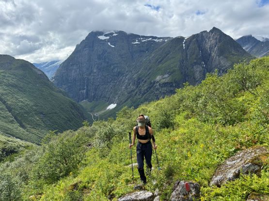
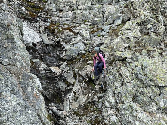
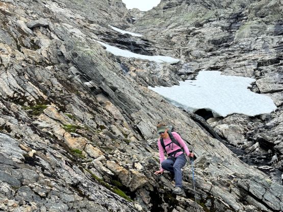
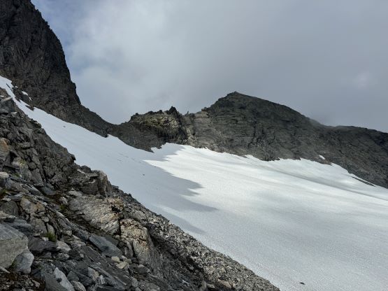
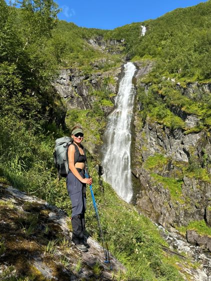
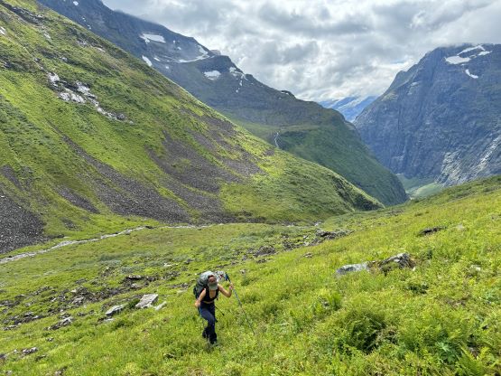
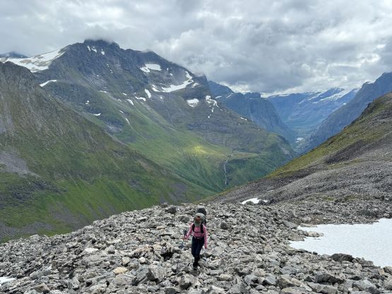
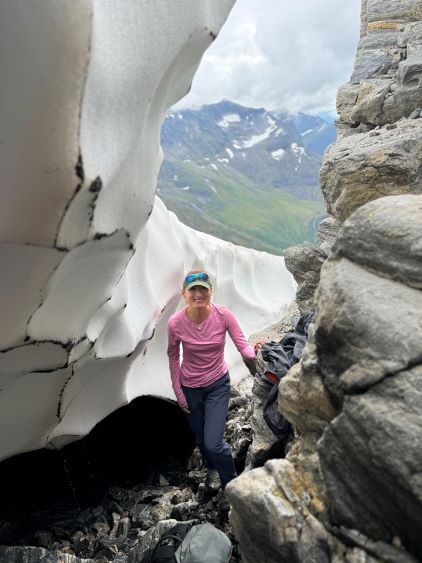
It started to make more sense to abandon the GPX track and go directly upslope to avoid traversing more of those slippery terrain, but I kept our bearing diagonally to the right and the plan was to aim at the basin south of the summit. Needless to say the going was not very pleasant, but the plan worked out nicely and we were in that basin about half an hour later. Looking at the GPX track we had made a straight track at exactly 45 degrees angle from being perpendicular to the contour lines. There were several patches of snow in that basin that helped speeding the progress but otherwise it was a painful slog on unstable rubbles and I was starting to worry about the situation of the water sources. I had promised Erica that we would for sure see some running water so I only hauled 1 L of water up. I was already out of water and Erica was not doing much better. Thankfully we found a moat with running water and I was able to scramble in and out of it. Erica then followed and we scrambled up the backside out of the moat for fun.
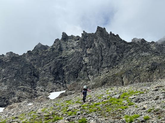
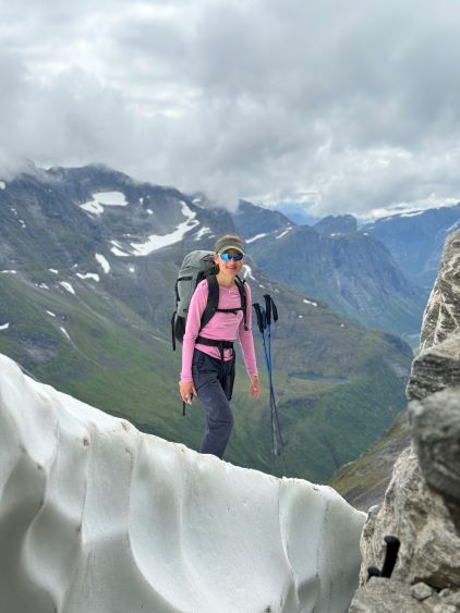
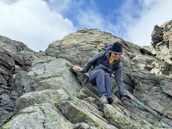
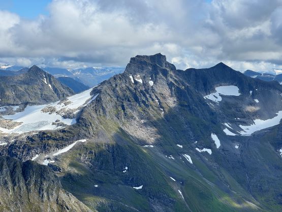
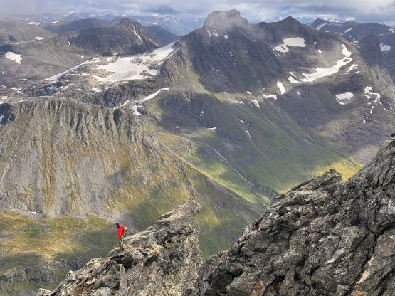
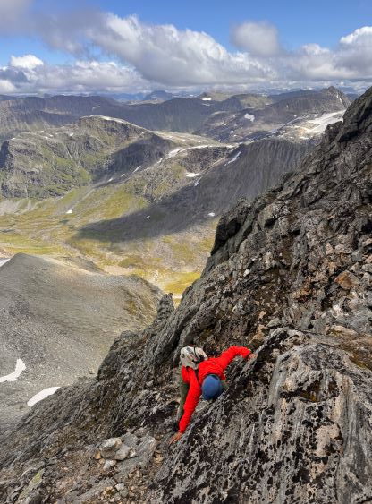
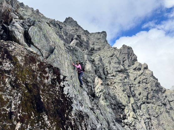
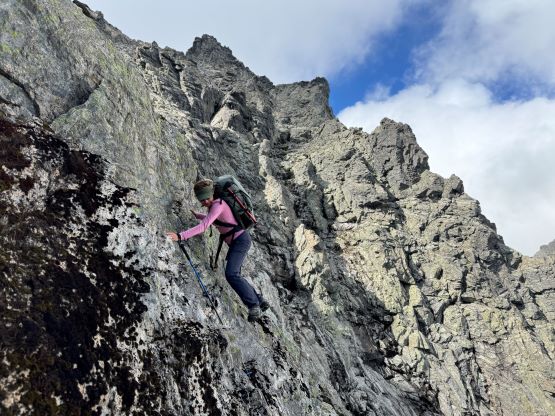
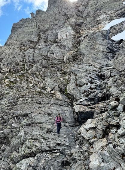
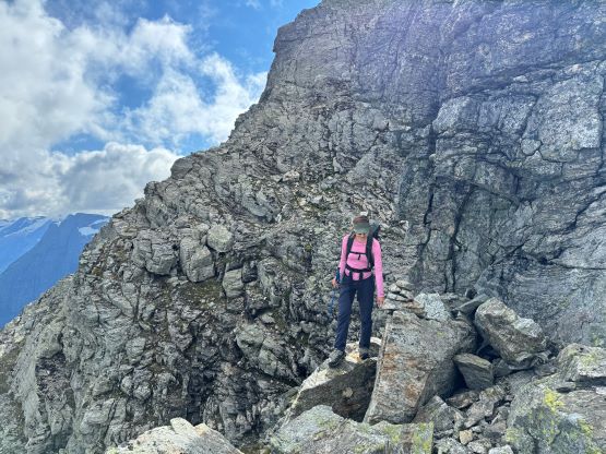
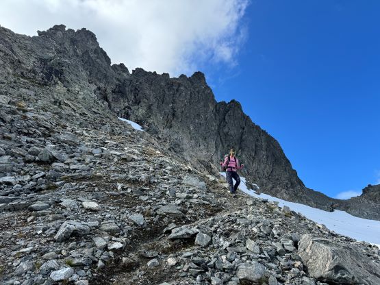
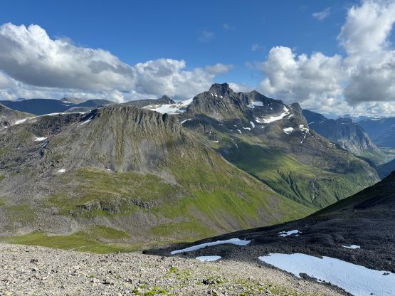
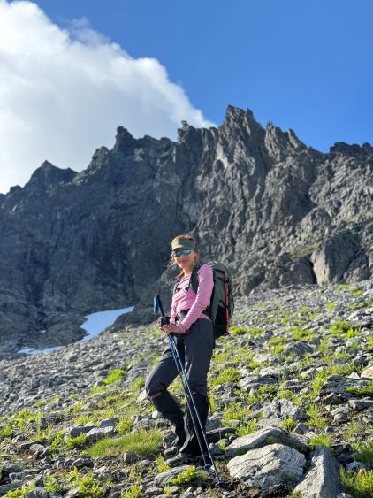
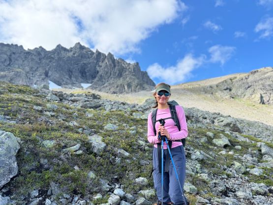
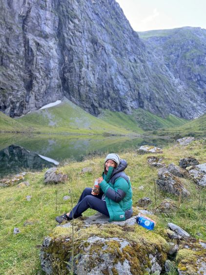
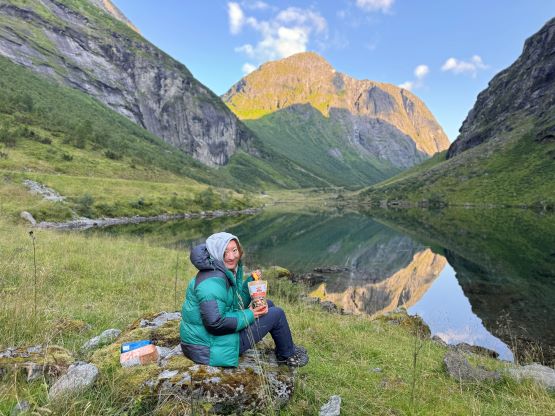
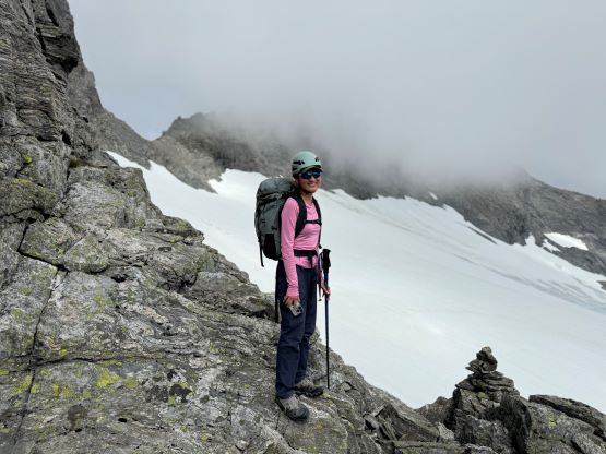
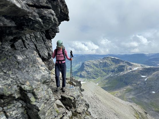
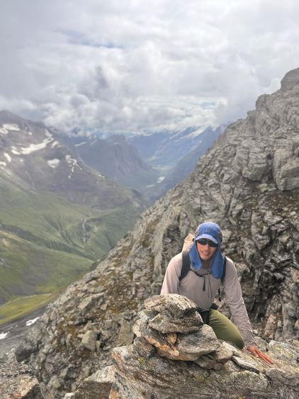
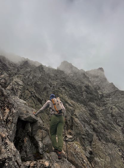
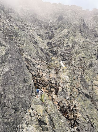
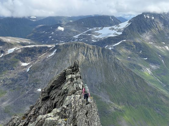
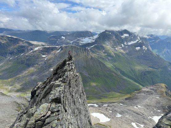
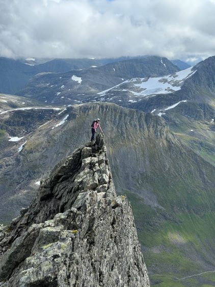
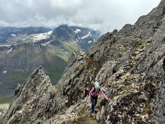
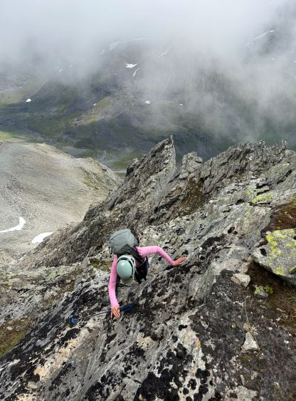
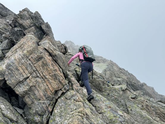
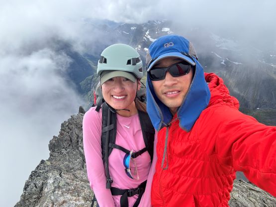
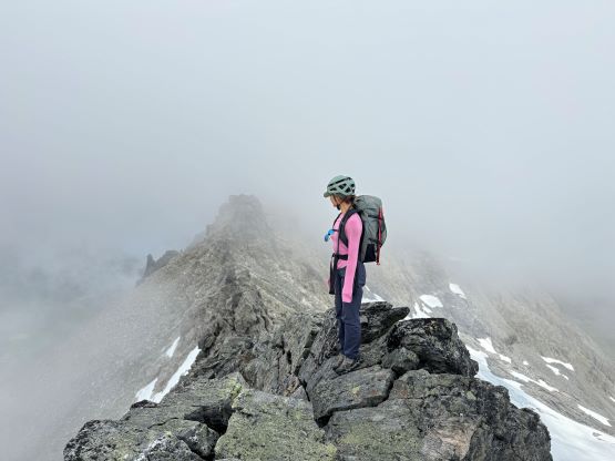
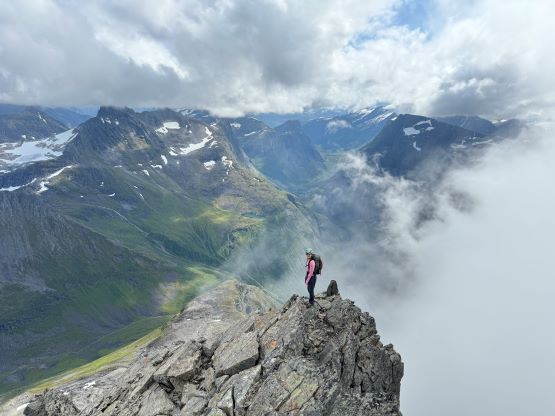
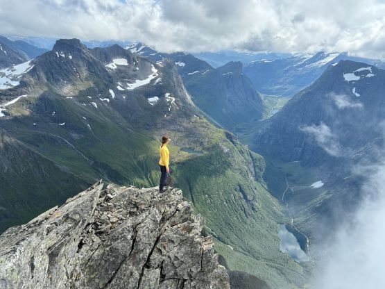
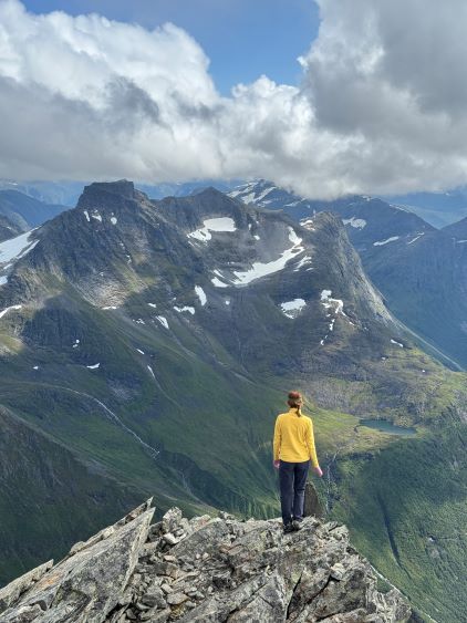
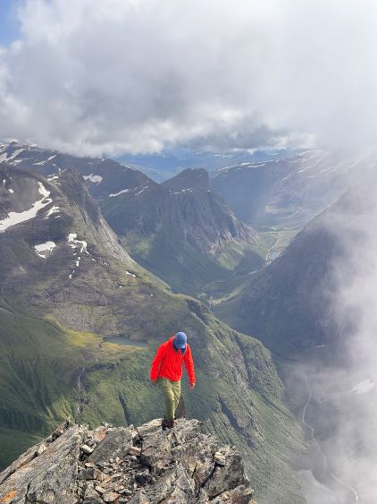
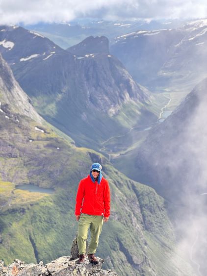
We then merged onto what seemed like an obvious path with cairns that ascended the east ridge and this path brought us into the SE Gully standard route. There’s one exposed ledge to traverse into the gully and then we crossed the main gully and scrambled some sustained 3rd class terrain on the climber’s left side. We for sure did some 4th class moves but those could or could not be bypassed with more careful route-finding. I couldn’t care much because one purpose of this trip was to get Erica more scrambling experience so the harder the better the outcome would be. At one point the terrain brought us up onto the ridgeline on the far climber’s left side, and we decided spontaneously to walk across that exposed knife-edge (not on route) for added fun. We got some cool photos there. I thought the terrain above this section had become easier as we made some zig-zags on 3rd class terrain, with lots of cairns leading the path. It didn’t take us too long to reach the summit but the weather was foggy, so we waited and lingered up there for at least an hour. The weather eventually improved from time to time that we were able to get some views. It never fully cleared up but we were satisfied about the views so it was the time to start going down.
And of course as soon as we started the descent the weather fully cleared up. It was overall still that “sunny and hot” afternoon as predicted in the forecast. The descent off the scrambling section felt straightforward and again, the hardest was the route-finding but we were experienced on that. We then more or less followed our own GPX track descending slowly but steadily back into the valley. The terrain was very steep and slippery and none of us had much fun dealing with those unstable boulders covered in foot-tall wet grass. Finding the trail again was a great relief, but my feet didn’t like the rigid mountaineering boots descending that steep trail. We took a few more breaks and eventually finished the round trip in under 7 hours, though 2.5 hours of which was stopped/resting time (over 500 photos were taken). We had the big plan to ascend the country’s high point, Galdhøpiggen on the following day and there was 3.5 hours of driving between the two trail-heads. We still had to prepare dinner and set up camp and it was already getting into the evening hours so the time was ticking. We ended up having dinner in that deep valley, and pushed all the way to midnight and eventually camped on the lower part of the road heading up to Galdhøpiggen’s trail-head.