Sollia
July 23, 2024
661m
Gurskøya, Norway
Sollia is the highest peak on the island of Gurskøya and subsequently boasts over 600 m prominence. This was not on the original itinerary when Erica and I decided to do some peak-bagging in southern Norway, but sometimes it was the weather that helped us make some decisions. On this particular day the weather was sunnier towards the coast but soggy on the higher peaks deeper in the fjords. Adam had been on Skårasalen and was now camping at the Kvitegga’s trail-head, and his reports were nothing but drizzling and white-outs. Erica and I, on the other hand, stuck closer to the coast and got some decent weather on Trollvasstinden and then Helgehornet. We still had a few more hours until sunset and I suggested to drive farther west onto those islands to make full use of the unforeseen weather window. The P600m island’s high point sounded like the perfect plan, as I estimated the elevation gain to be no more than 350 m based off Gaia’s topographic map. This would result in car-camping somewhere on the coast and not getting to Store Smørskredtind, our objective for the following day until at least 10 am in the morning but that was fine. The weather was supposed to be better towards the later half of the following day anyway.
The drive onto the island of Gurskøya was interesting as we had to drive through some long, undersea tunnels with some substantial amount of descending that made my ears pop a few times. I wondered how far had we gone down before ascending back up towards the surface. This tunnel got us onto the island of Hareidlandet and we had to drive across another bridge onto the destination island. The last few kilometers of the access road was unpaved, and of course we encountered a locked gate about 2 km from the supposed trail-head. Judging by the number of cars parked I knew this was the actual trail-head and we just had to walk from here. I was a bit reluctant to walk 4 extra kilometers given that we were already tired from the aggressive itinerary but there’s no way I could have driven all the way to this spot but not getting the summit, so we quickly did some repacking and started the plod. The original plan was for me to carry all of our gears but with the extra distance we decided to shoulder two backpacks instead.
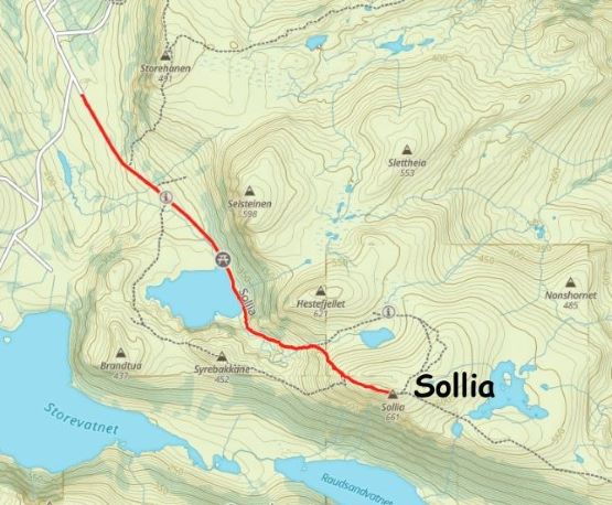
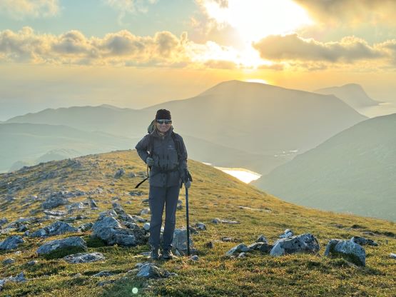
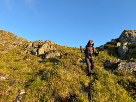
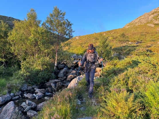
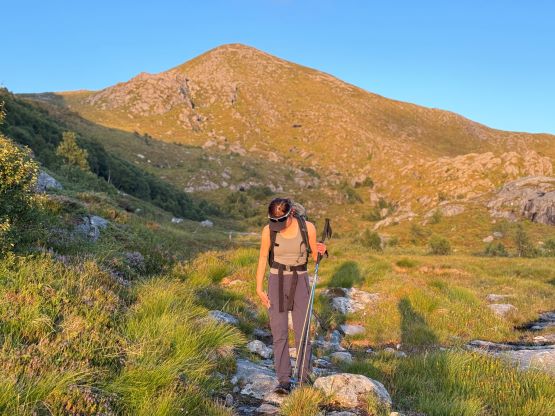
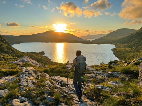
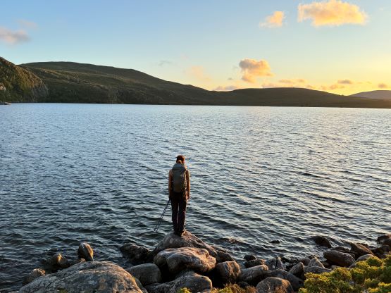
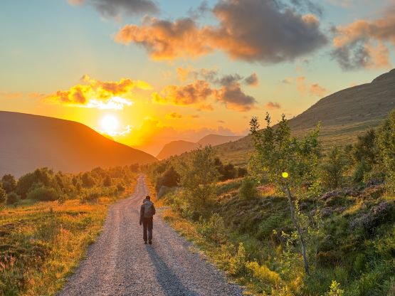
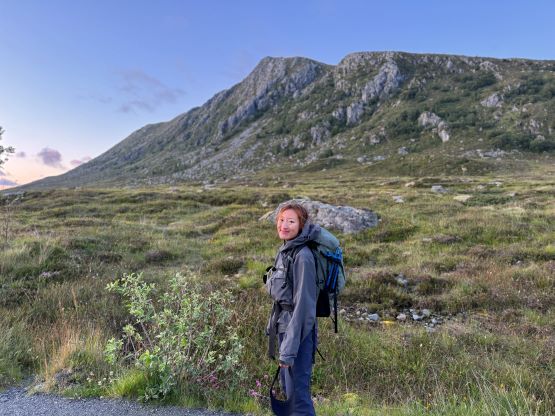
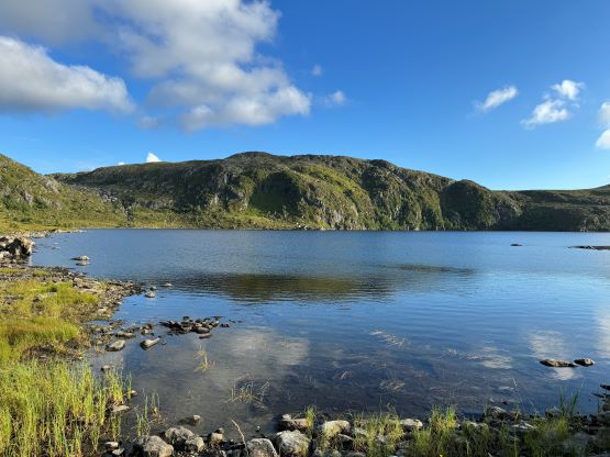
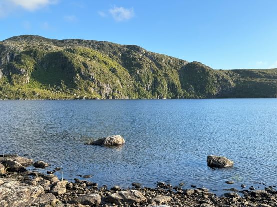
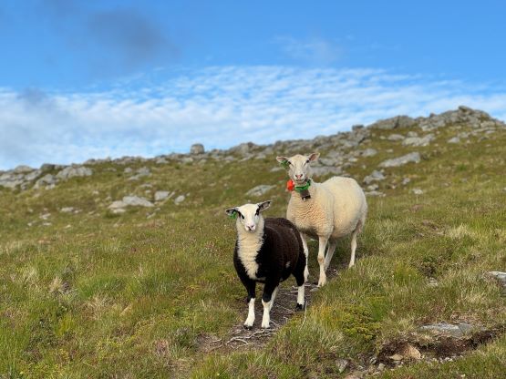
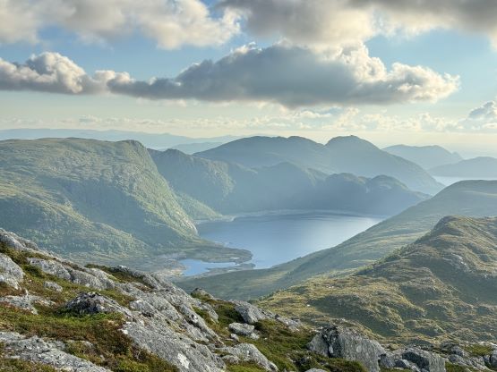
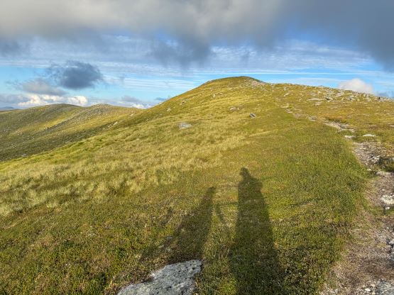
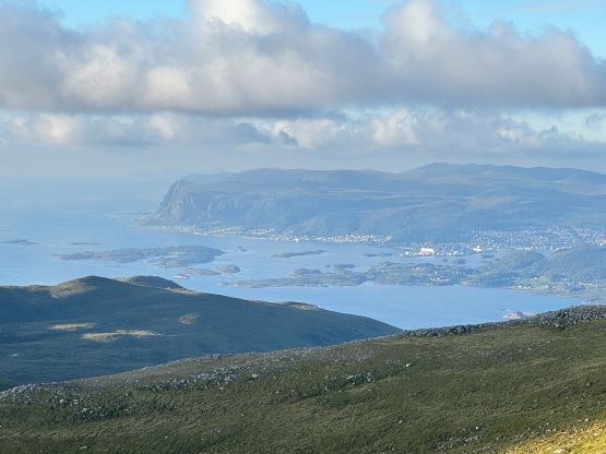
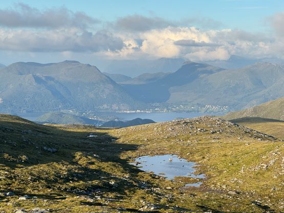
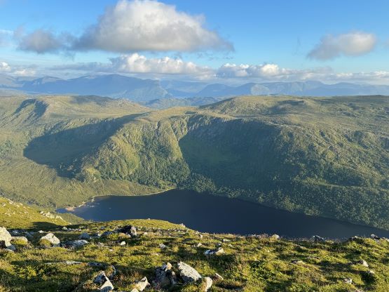
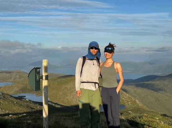
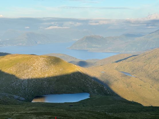
The plod to the supposed trail-head was without event and we got to appreciate the surrounding landscape more closely. I was however, not impressed by the actual trail that traversed across the east shore of Mørkevatnet. At least 50% of the trail was in marshlands and it was nearly impossible to keep our shoes dry unless we opted to go at a snail’s pace. We couldn’t afford to be that careful about the footings given the lateness of the day. Thankfully the condition improved as soon as we started to gain some elevation. The trail was thankfully obvious enough to follow until the upper ridge, and we got to see more sheep along with landscape that resembles Scotland and Ireland. The experience was similar to Veten in the previous day but I thought the terrain here was more open and the lighting was also better. We plodded across the first summit to settle on the farther (eastern) summit, and found out that the eastern summit was actually 1 m higher according to the official signs.

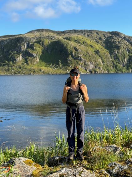
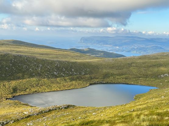
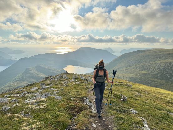
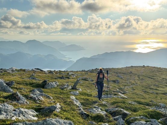

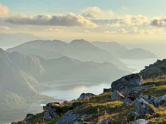
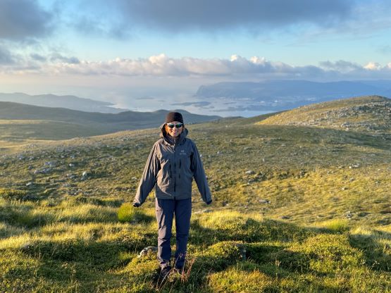
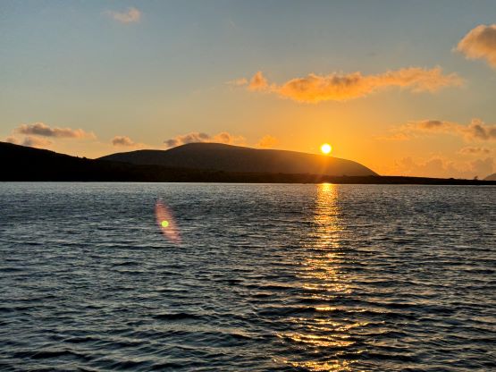
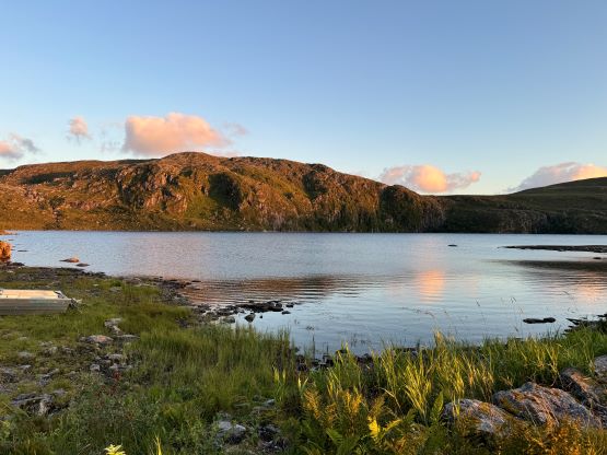
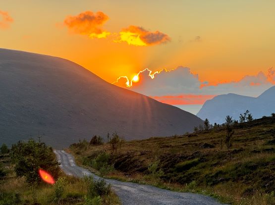
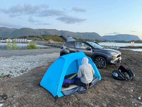
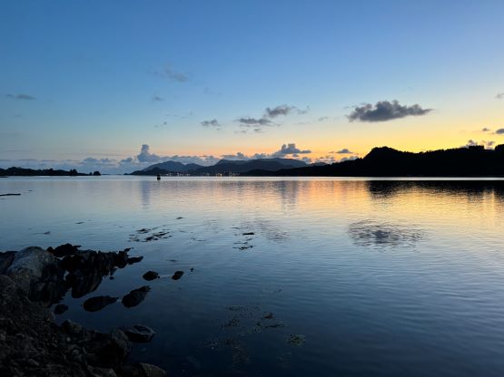
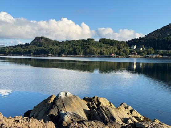
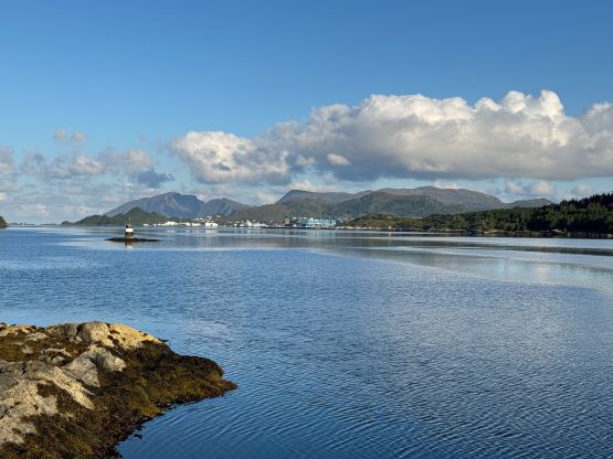
We lingered on the summit for almost an hour as the lightings kept getting better and better. The golden hour at this latitude could last for a few hours and so would be the sunset, so we eventually decided to slowly descend. The return hike was uneventful and I paid more attention on that soggy stretch to keep the shoes dry for the following days. The sun eventually got down below the horizon as we plodded the gated part of the access road back towards the parking lot, and our round trip time was just over 3 hours including everything. I had previously spotted what seemed like a perfect car-camping spot on one of those lesser islands between Gurskøya and Leinøya and that turned out to be a boat-launching spot. We nevertheless opted to set up the tent there because it was already 10 pm and that’s too late for the boat owners to fuss around with us. The camping experience was of course excellent and we slept in till 8 am on the following morning. We could see lots of clouds to the west so there’s no point to rush.