Kolåstinden
July 27, 2024
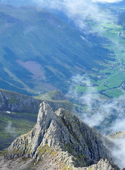
1432m
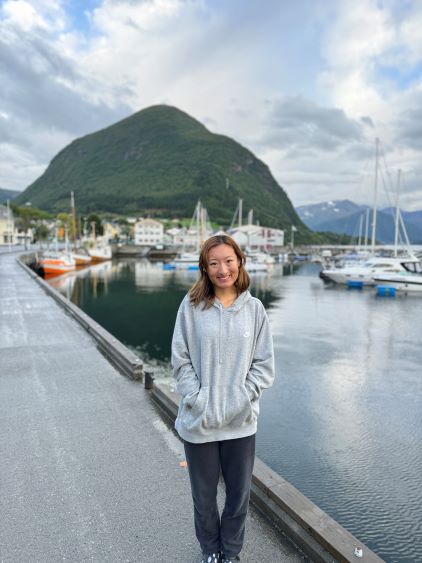
Ørsta, Norway
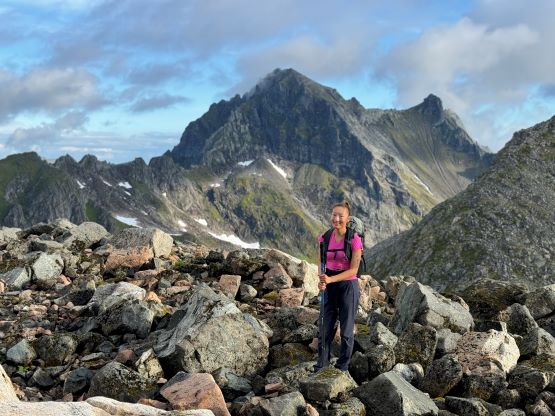
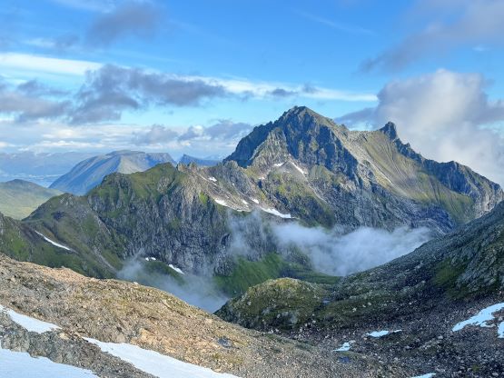
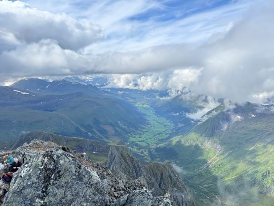
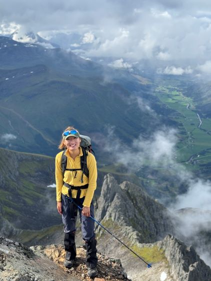
Kolåstinden is the highest peak in the large area to the NE of Orsta and subsequently boasts over 1000 m prominence. This is also an iconic looking summit that doesn’t quite offer an “easy” route to the top. It seems like most parties had climbed this peak on skis in the spring but it is also very doable in summer, with some simple glacier travel and exposed scrambling near the summit. There’s a well-used trail that ascends into the valley between Kolåstinden and Saetretinden and that can be used as the access trail in summer. I had downloaded a GPX track from Peakbook but that involves a full traverse of Kolåstinden and the north and south summits of Sætretinden, which wasn’t super helpful but I had figured out the most efficient way based on the topographic maps. This was one of the primary objectives between Erica and I because it involved everything.
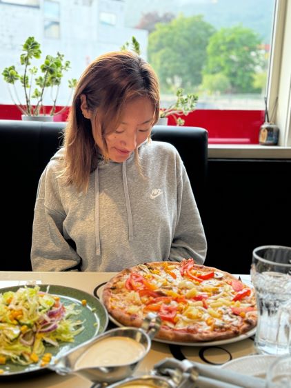
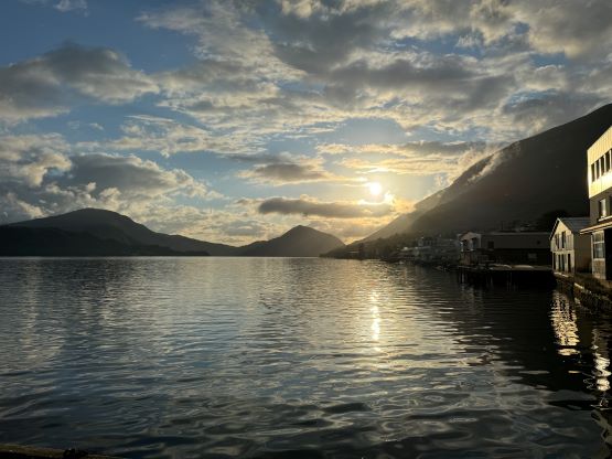
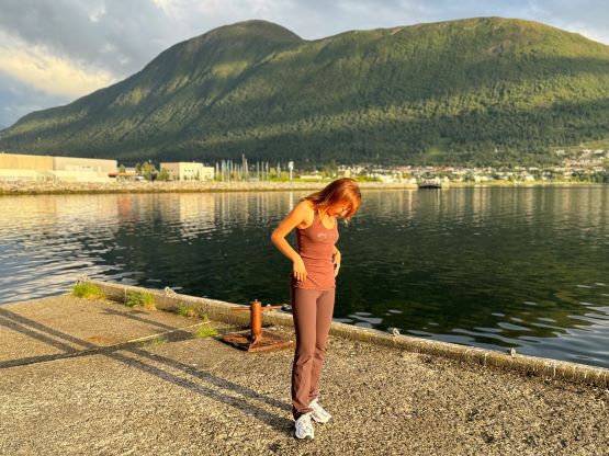
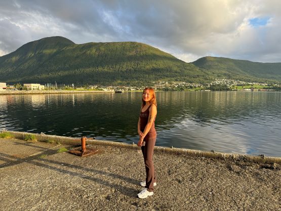
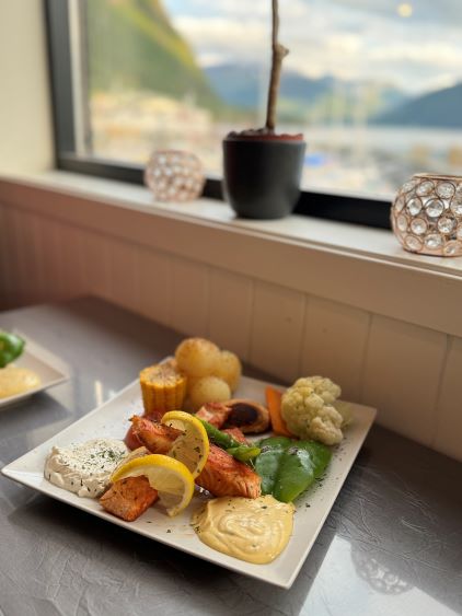
The weather on the 27th seemed to be okay but wasn’t 100% ideal, but I determined that it was good enough to finally give it a try. We would be based in Volda for two nights as the objective of the next day would be Skårasalen. This meant the day we climbed Kolåstinden was the only day in this trip that we could relax a bit, without the pressure of having to drive several hours away after the hike. Unfortunately we couldn’t stay in one place for two consecutive nights as this was in the summer and most places were fully booked. Erica did her job by finding some affordable homestays. The first night costed about 110 CAD and the second night costed only 55 CAD, and for both nights we had our private room. By comparison there wasn’t a single hotel room under 200 CAD in this touristy area. I also made Erica to pick restaurants and she did a good job. The meals were excellent and none of them was outrageously expensive. The weather forecast suggested the better windows to be in the early mornings so unfortunately we couldn’t take full advantage of the homestays. The alarm was set at 3:30 am on Kolastinden’s summit day and it was very difficult to wake up, but we had to. Thankfully the drive to the trail-head was not long and I waited to prepare breakfast until arriving at the trail-head. The early wake-up made the morning very miserable but it was worthy, as we got rained on the descent.


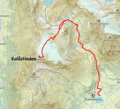
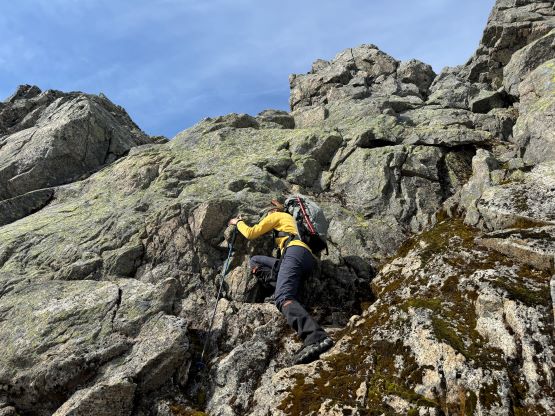
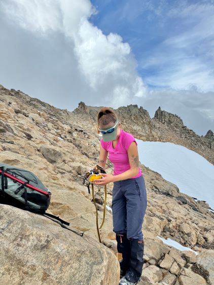
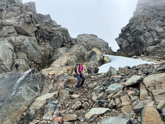
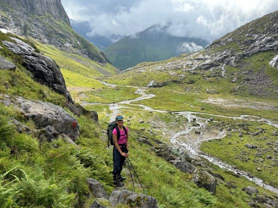
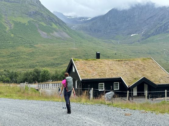
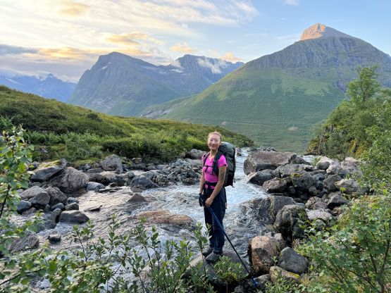
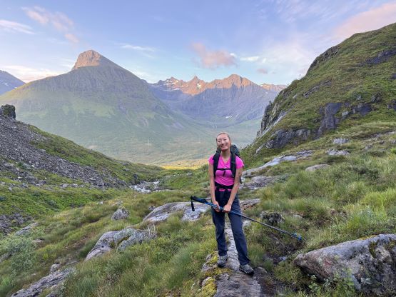
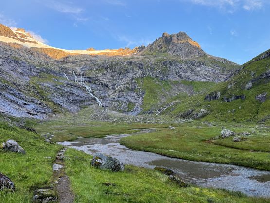
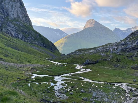
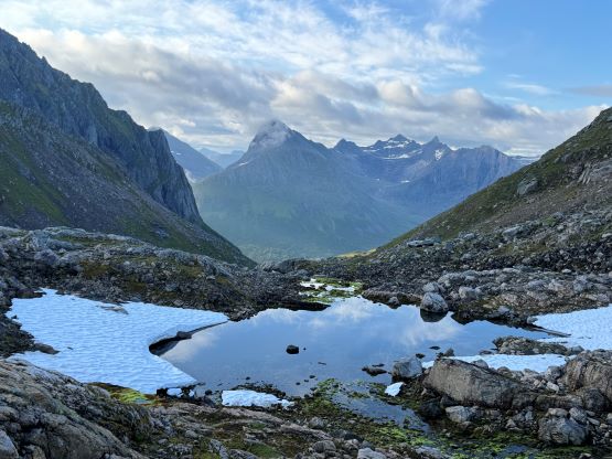
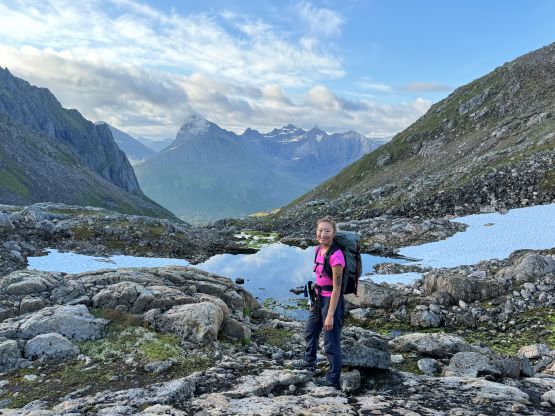
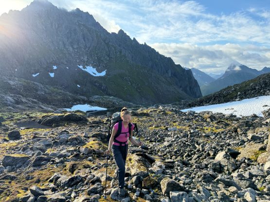
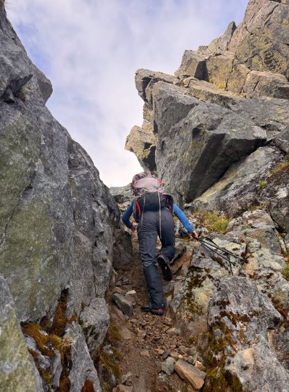
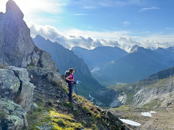
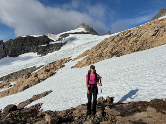
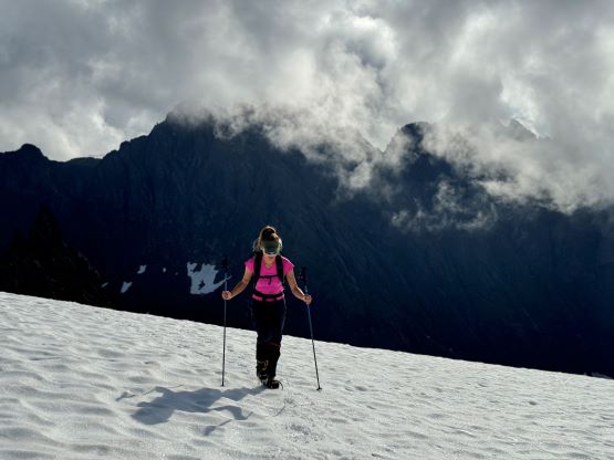
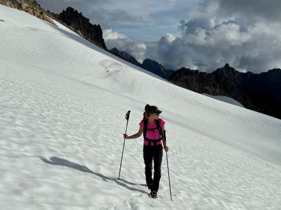
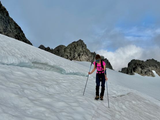
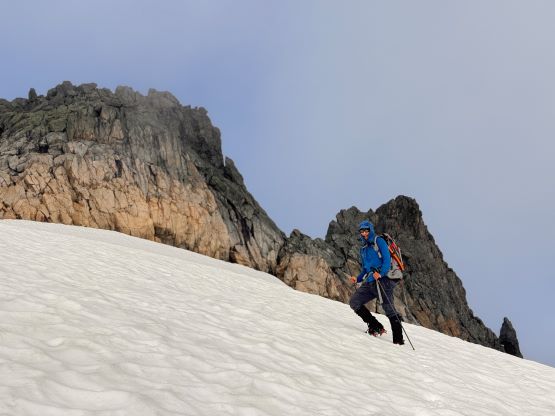
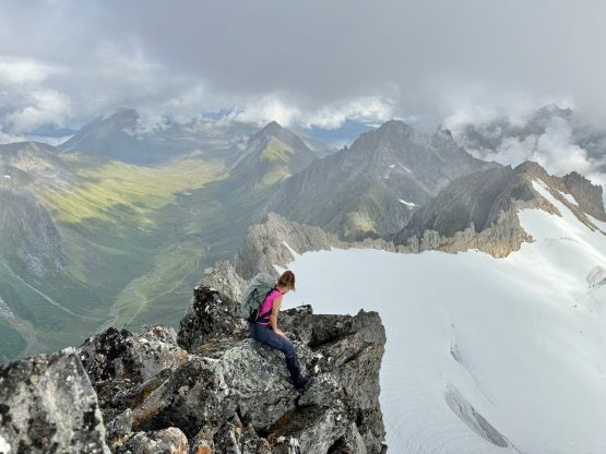
It seemed like based on the maps we could have driven higher than the supposed parking area which was right on the highway, but that was not the case. The roads in that village were clearly blocked with signs of “no driving” and I reluctantly decided to abide the rules this time. So we parked at the highway and plodded through the village and picked up the trail shortly after. In terms of the gears we decided to carry ice axe and crampons but no rope, as we needed to conserve energy for the next two days and I was confident on my route-finding skills on a glacier. The hike up through the valley was very scenic that we stopped frequently for photos. The weather was cooperating but the trail crossed at least one major swampy area that made it difficult, if not impossible to stay dry. The trail continued much higher up in this valley than I had hoped for, which was good. We eventually left the path and hopped across some easy boulder fields to the base of an obvious chute that would grant access to Kolåstinden’s upper slopes. This chute still held fair amount of snow, so I ditched the trail-runners for mountaineering boots, and also made us don crampons. The snow climbing was actually quite steep, but not steep enough to warrant the use of an ice axe. The upper few meters of this chute was choss so we removed the crampons and scrambled it up.


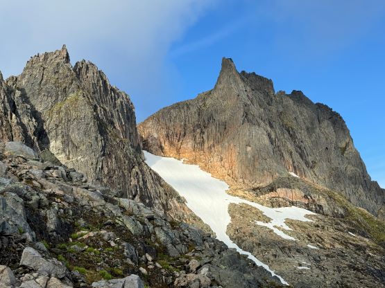
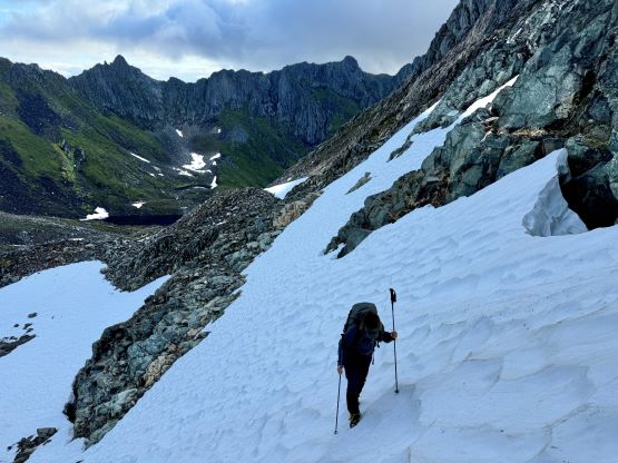
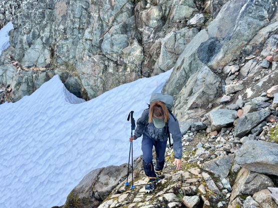


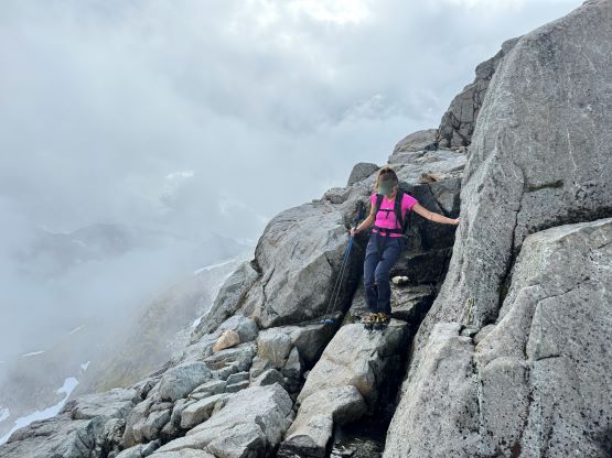
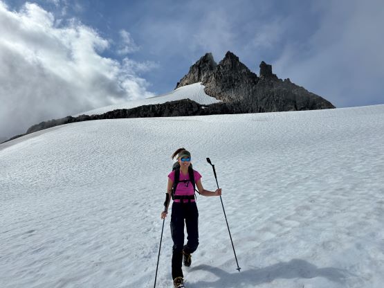
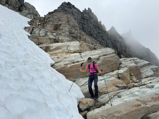
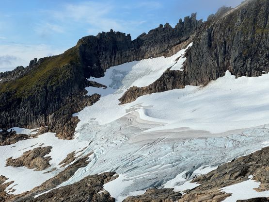
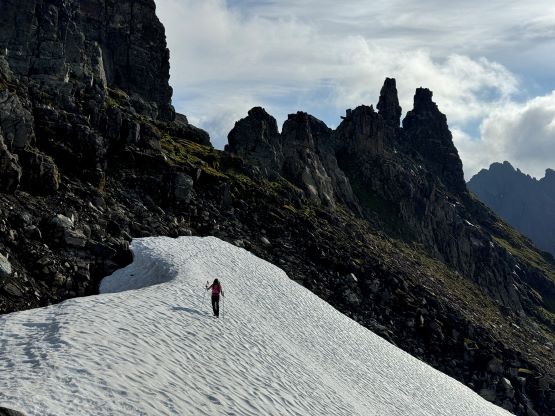
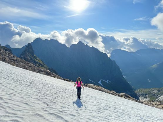
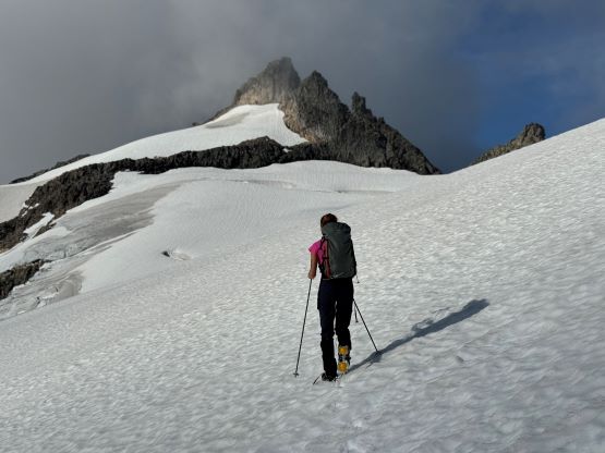
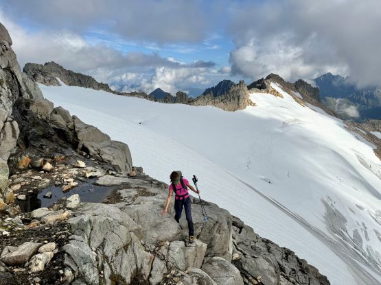
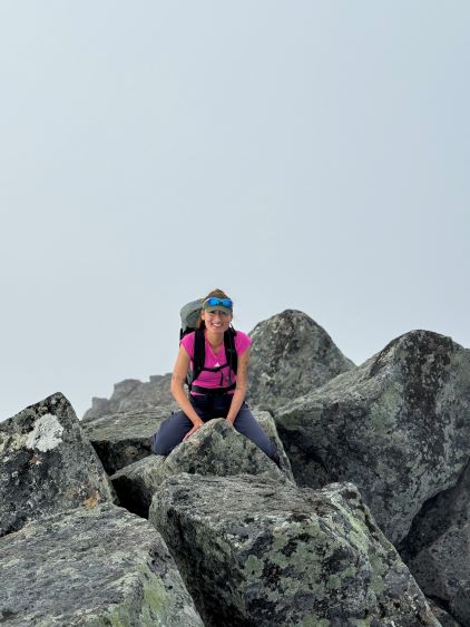
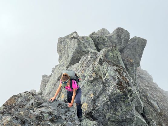
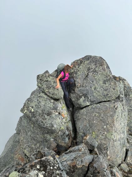
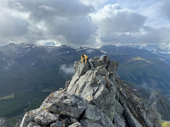
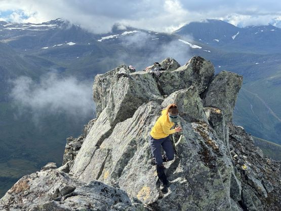
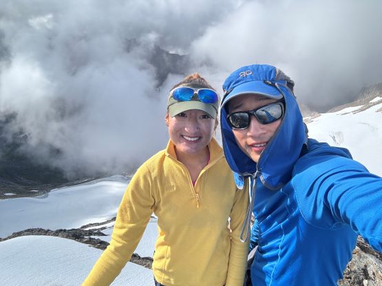
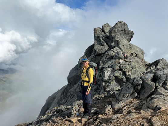
Once on the other (south) side of the notch we descended a little bit and then kept a rising traverse over slabs, snow and some difficult micro-terrain to access the glacier. In retrospect it would be easier to lose a little bit more elevation to stay mostly, if not entirely on low angled snow slopes but it worked out both ways. I also decided to not follow the existing GPX track to cross the glacier, but rather take a more direct route. There were two notable crevasses to cross on snow bridges and it would be nicer to show Erica some actual glacier navigation up there. The second crevasse which was way up high near the upper rock face required some careful probing. We then had some easy 3rd class scrambling to deal with (with crampons on), and then there came the highest snow face below the summit block. This slope eventually steepened to around 40 degrees but the snow was reasonably soft and there was no need to use an ice axe. The summit block was easier than appeared with quite a few hidden ledges to guide the way, but there’s a sting in the tail. Most parties claimed this peak by reaching the summit ridge but the highest point lies on the far north side. The traverse across required some sustained difficult scrambling with decent amount of exposure. At least one spot was 4th class and the rocks were covered in moss and very slippery. We actually did the full traverse two times as the weather improved as we got back to the false summit. I decided instantly to go back to the true summit for more photos and Erica followed. Meanwhile there was a team of three coming up but they only went to as far as the summit ridge, and we exchanged our respective surprises of seeing another human being up on this objective.


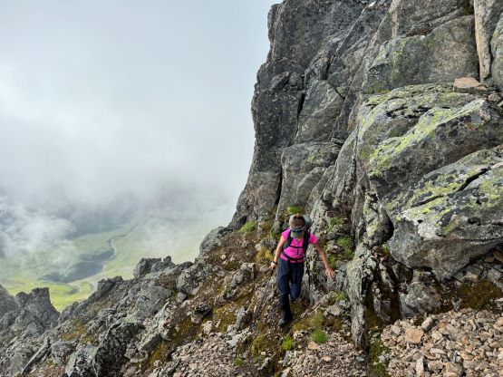


After having too much fun up there we decided to start descending. Those guys had come up from a different route from the south, and planned to descend the same way that Erica and I took. They took a higher traversing line back across the glacier but we opted to follow our existing set of footprints. I liked to draw a more direct line on the GPX map and it’s more fun to navigate around those crevasses. We did follow them descending a more roundabout but significantly easier route to avoid those rock slabs, and eventually caught up to them at the bottom of that choss/snow chute. All of us opted to not use crampons and that required taking a slightly different line staying more on choss than snow. For the entire day I thought about to do those peaks of Sætretinden but eventually decided to conserve energy, as the weather was not bomber. This was definitely the correct decision as we got hit by a fairly heavy rain storm while crossing that swampy section on the descent. The rain did not last long so we didn’t get soaked, but it would not be very pleasant to be still up high. We eventually finished the round trip in 7 hours 15 minutes taking in account of everything. The rain had fully stopped so we took our time cooking lunch at the trail-head. We eventually drove back into Volda and checked into our next homestay. We earned ourselves a few hours of resting time but I took advantage of that to catch up with the trip reports. Erica found us a nice restaurant in Ørsta which was about 10 minutes of driving away, so we drove back out in the evening and came back another hour or two later and settled for the night.