Otgon Tenger Uul
August 2, 2024
4010m
Uliastai, Mongolia
Mongolia is known for being the most sparsely populated country in the world but not so much for its mountaineering, except for maybe Khüiten Peak, the country’s high point on the far western corner bordering China. The country however, offers much more than just the highest peak and in fact, there are 18 “Ultras” or peaks with 1500 m prominence in Mongolia. Petter Bjørstad had climbed two of them (including Khüiten Peak) back in 2019 and then Rob Woodall and Deividas Valaitis had climbed another 7 of them in 2023 but that’s basically all the “beta” we had. Petter organized this long trip with Adam and I and the plan was to do 13 of them over 34 days. I would add Khüiten Peak at the end of the trip for 6 additional days, making a total of 40 days for me in this country at a cost of over 7000 USD excluding the international flights. Otgon Tenger was originally excluded by the guiding company as it’s sacred and any form of climbing is not permitted, but they somehow decided to offer us the package at the very last minute, to fill in the “travel/buffer day” at the start of the trip, so all the sudden we had an extra peak to climb so why not. But because this ascent was essentially illegal, even by just driving the Landcruisers to the base camp I would not want to mention the name of this company nor the name of our guide. Rob and Deividas sneaked in from the SE last year and almost ran into trouble but we would do it from the west. It’s longer from this side but there’s less chance of getting caught.
There aren’t a shit ton of flights into and out of Ulaanbaatar so our travel from Norway to Mongolia was not without risks. The connection in Instanbul was only 70 minutes so our chance of success depended heavily on the airlines. It turned out that we did make all of the connections and we flew 4 flights from Bergen to Oslo, Istanbul, Ulaanbaatar and finally Uliastai in one day. The 4th flight was the domestic flight and the Mongolian security took quite a few pieces of items out of my luggage including one of the battery packs. I spent at least 20 minutes arguing with them but to no avail. But on the other hand I made a few Chinese friends during the 4-hour layover in the capital, while trying to purchase their domestic SIM card. The eSIM was too expensive but I got a 30D/50G package in just over 20 dollars at the airport. I thought that was quite excellent.
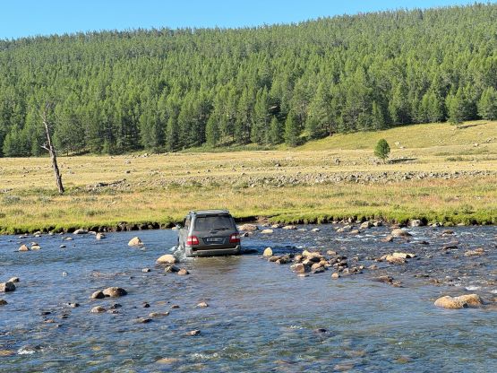
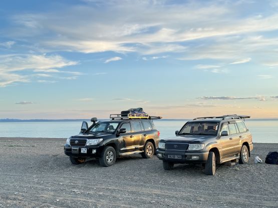
We landed in Uliastai on time and the guides were there to pick us up. We had one English-speaking lead guide who would also be our cook, one climbing guide who’s also a driver, another driver and two Landcruisers. We firstly drove into the town for lunch and some groceries and then drove west into the mountains. This was a good introductory trip for me in this country because the driving was very difficult. Petter said there’d have a lot of driving like that in the upcoming month. One of the Landcruisers turned out to have some problems with the 4Low so we only had the high gear for this outing, and for the rest of this entire trip I would assume. It didn’t cause any problem on Otgon Tenger but I hoped we wouldn’t run into issues later. Other than that, the service was quite good. It was a little bit difficult to make them do things in our way but that had to be understood as they had no clue of who we are. But eventually they agreed to walk up early and do this objective in a single day instead of making a higher camp. This would involve over 20 km trekking with a glacier crossing so not that easy for our first day at higher altitude coming straight from some exhausting traveling. The dinner was not served until 9:30 pm so sleep didn’t come until 11 pm at the earliest. The plan was to have breakfast at 3:30 am. Adam decided to skip it so it would be just Petter, myself and our climbing guide. There was some confusion about the time zones here which caused the guide to get up essentially an hour earlier (or us being an hour late).


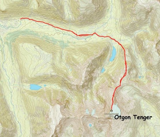
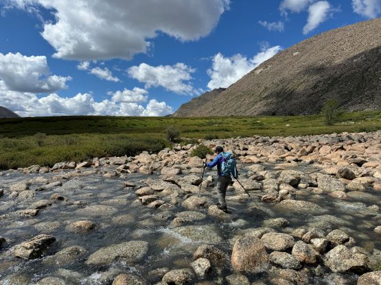
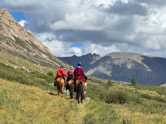
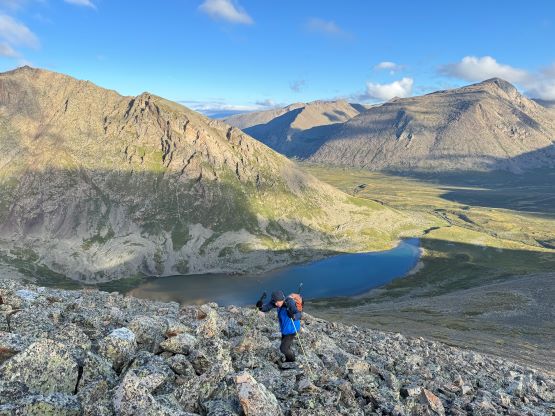
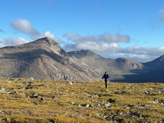
Finally we started the approach with head-lamps on. I opted to just follow from behind as I was tired of thinking, nor did I know anything about the west/north approach of this peak. This guide turned out to be legit and did all of the route-finding with essentially no backtracking, and that was without the use of GPS nor even a map. The first 3 km was the continuation of this road system and could technically be driven by these two vehicles but they had insisted to stop at the “established” base camp area, probably more because of the legality issues than the capability of the vehicles. We tried to push them but they did not bite, so 6 additional kilometers of walking that’s it. The head-lamps were no longer required just when we finished the remaining of the road plodding. There was still a path here and there afterwards and the guide was able to pick the best way so there wasn’t any bushwhacking for us. There were however, two tricky creek crossings but we were able to hop on rocks without wetting our feet. My shoes were soaked from the dew on the wet grass but I had carried a pair of mountaineering boots so my feet would be dry for most of the day.

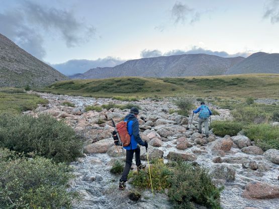

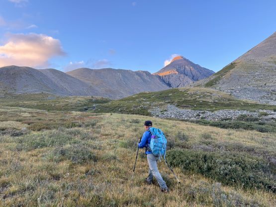
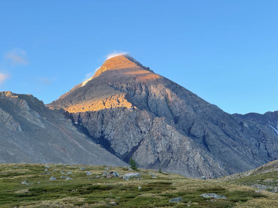
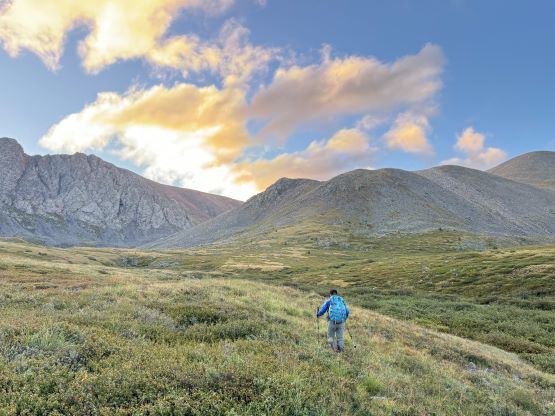


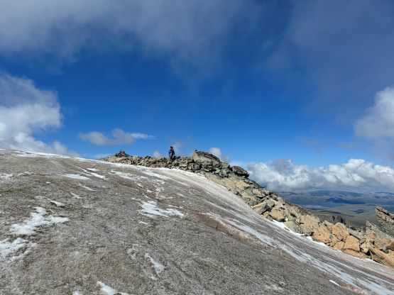
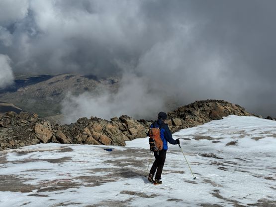
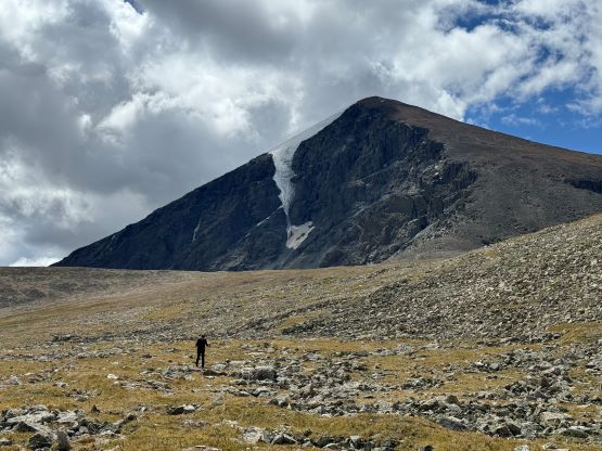
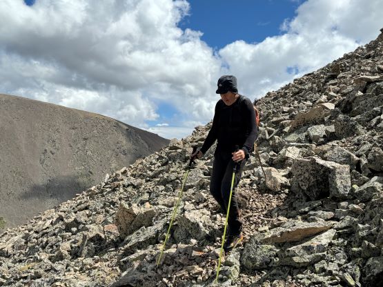
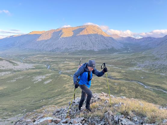
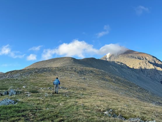
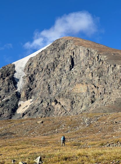
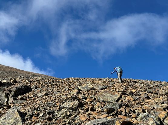
We finally gained some notable elevation by ascending a steep and grassy slope to gain the north ridge system and from here we would have 1300 m elevation gain to the summit. Needless to say this was a tiring slog especially considering the altitude. The guide was quite fast as he needed not have to acclimatize so Petter and I just did it in our own pace, making the guide wait numerous times. Putting the ego aside I think it’s crucial to not push too much on the first day. There were a few steeper rises but the lower ridge was generally pleasant to travel on. I did my first batch of ditching on one of the lower bumps, leaving a jacket, a bottle of water and the spare battery pack behind. We did our proper resting at the shoulder where Rob/Deividas’ route joined. I ditched my trail-runners and donned mountaineering boots, and the shoes and the socks were all dried out by the time we returned. The last 700 m gain was a pure slog on brisk sized rubbles and the unpleasantness reminded me the good ‘ol days in the Rockies. The glacier cap was a cake walk on some low angled ice, that I didn’t even bother to don crampons, let alone rope and harness. I could have done the whole thing in just trail-runners but it wasn’t a terrible idea to bring some contingency to assure 100% chance of success.
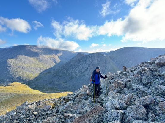
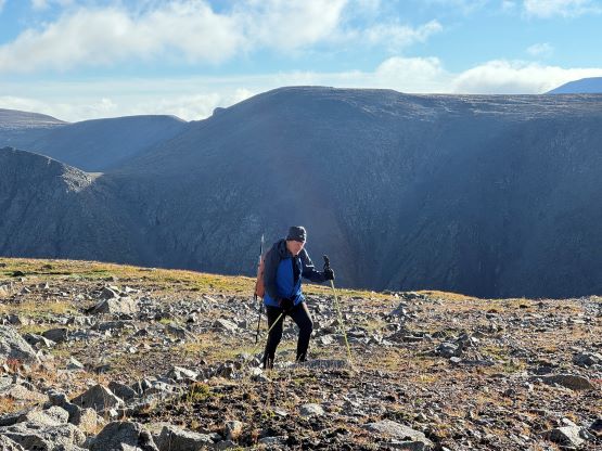


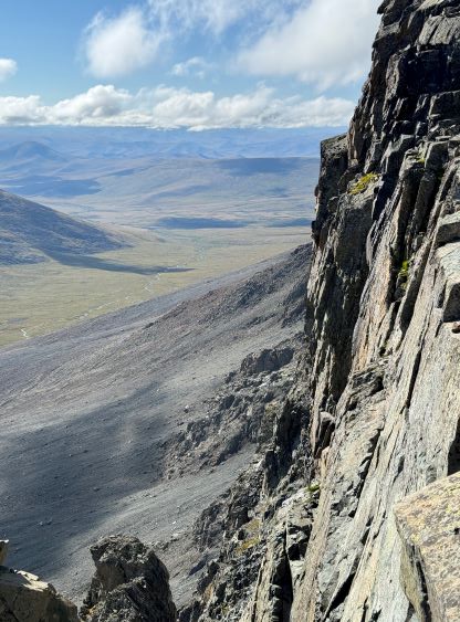


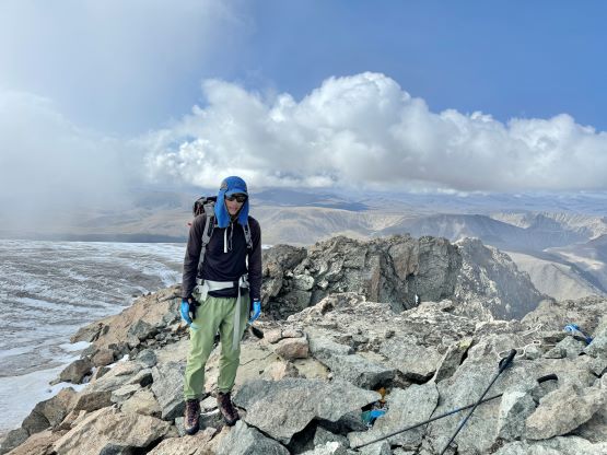

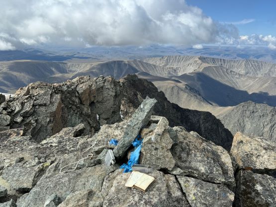


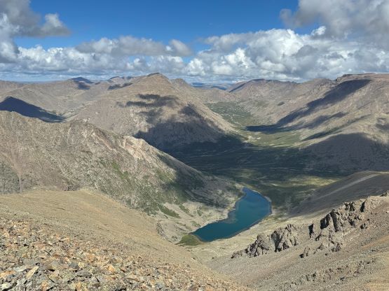
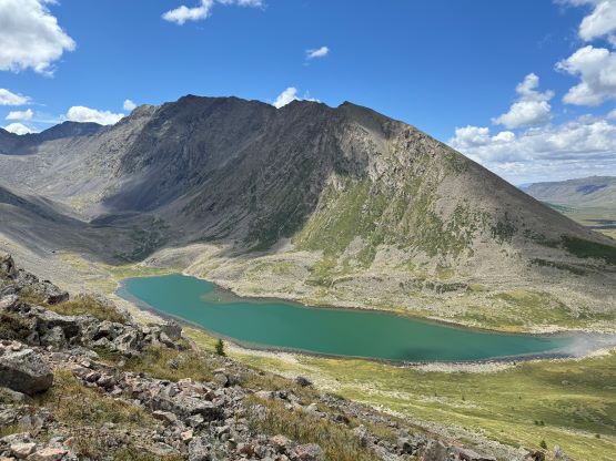
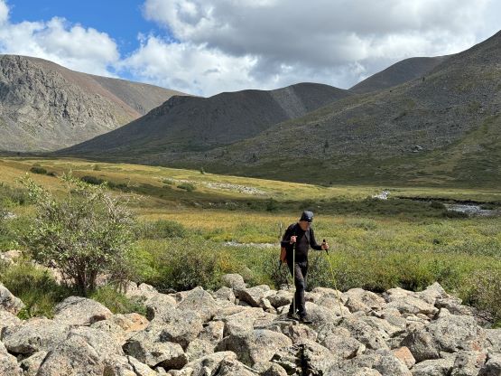
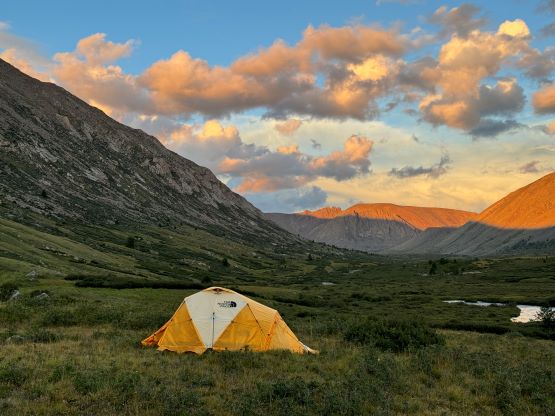
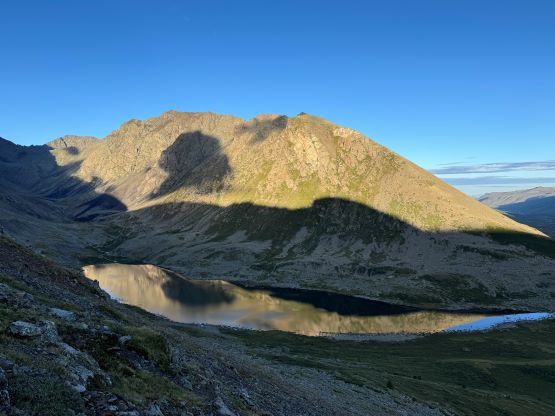
After taking in enough of the views we descended. The upper 700 m took a long while as Petter needed to be uber careful about those loose rocks. I ended up taking a short nap at that gear dump and we did the rest of the return together. The terrain was definitely tedious but not too bad, and the views were on our side. That final 6 km of plodding across the flat valley was extremely boring and I was very tired from the lack of sleep, the altitude and being jet lagged. We got back at 3 pm after being away for exactly 11 hours but Adam was not there. Petter and I thought about to break camp and drive towards our next objective but we couldn’t do that without Adam’s return. We knew he would likely hike some nearby smaller peaks but he ended up being away until 8:30 pm, also spending 11 hours on the mountains. Adam did get three peaks including one with over 400 m prominence. We were happy to see him returning and spent another night at the base camp. The next morning we woke up naturally, broke camp and drove back to Uliastai, and continued driving westwards towards Khyargas Lake.