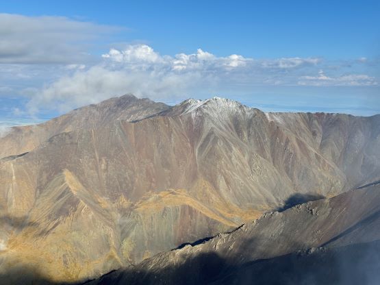
Jargalant Khairkhan
August 14, 2024
3796m
Khovd, Mongolia
“Khairkhan” is just another Mongolian word for “mountain” and Jargalant Khairkhan is a stand-alone massif that rises abruptly above the desert floor in the immediate vicinity of Khovd. This peak is detached from the taller glaciated ranges in the Altai Mountains and therefore boasts over 2000 m prominence. This is more like a mountain range itself and the highest peak is roughly in the middle of it. Rob and Devidas had figured out a solution from the west in 2023 but their route involves over 1800 m elevation gain. Petter suggested that we should look more carefully as he suspected there might exist a “better” way, as Rob and Deividas had already screwed up Altan Hohiy by driving in from the wrong side of the mountain. I went back to the maps, and sure enough roads were clearly seen on the opposite side of Jargalant that went to as high as 2450 m (500 m higher than Rob and Deividas’). The roads seem to originate from the small village of Chandmani which should be accessible from the main Ulaanbaatar-Khovd Highway. I spent at least half an hour mapping things out on the satellite images and even drew a proposed GPX track using the Gaia app.
There were a few travel days from our previous objective to this one including one and we even had a “fancy” night of stay in a hotel in the city of Khovd. The hotel was not impressive as hardly anything was functioning. The shower wasn’t quite working, and neither was the toilet. There was no air conditioning nor even an elevator and we were assigned a room on the 5th floor, but nevertheless our company promised this was “the best” hotel in Khovd so I wouldn’t complain. That’s part of the price for travelling in some of the more remote corners in the world. The next day we met up with Gangaamaa (Gangaa), the head guide of this company and also the “most fabled mountaineer in Mongolia”. Gangaa had ascended K2 and Everest so definitely deserves respect, but an accomplished person like her is also expected to have some personalities. Petter had actually dealt with Gangaa back in 2019 for two weeks and told me some of the stories behind the scene, so I did have a bit of mental preparation about what’s going to come up next, but we should let the story unfold one day at a time.

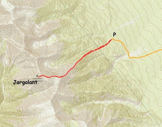
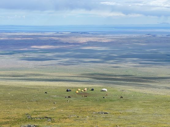
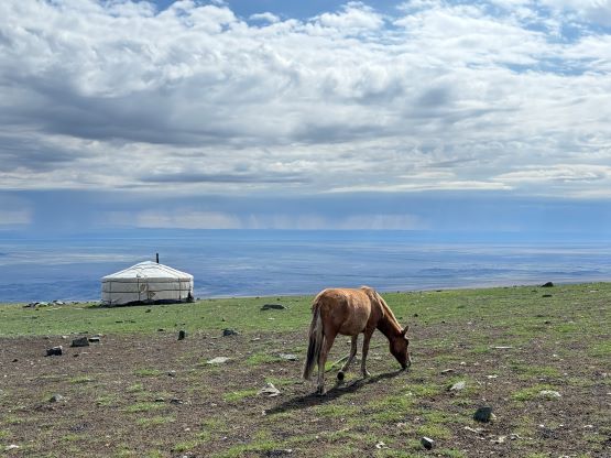
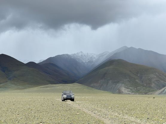
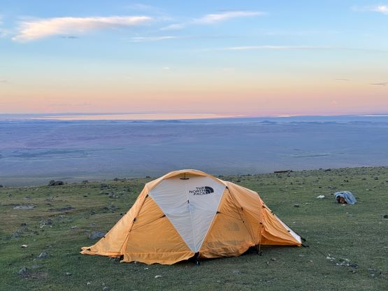
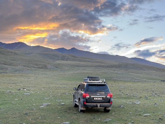
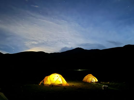
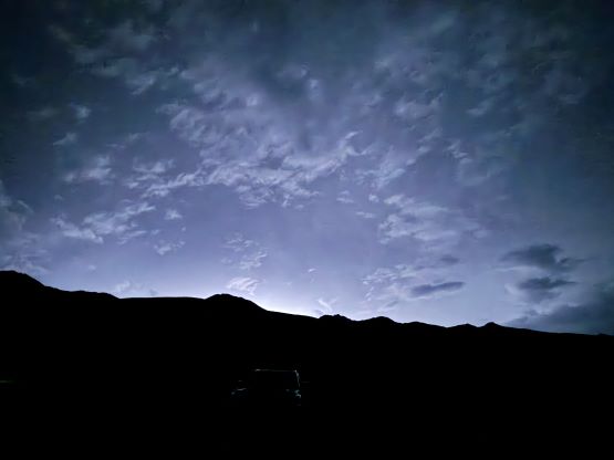
Regarding this particular objective the communication was never clear. Gangaa’s proposal (back from many months ago) was a 2-day ascent with a high camp but she never mentioned anything about the starting point nor the route we were going to take, and not to mention that we certainly wouldn’t need 2 days even if we took Rob and Deividas’ route. Gangaa later admitted that that itinerary was more like a preliminary plan and should not be followed exactly, especially for this and the upcoming two peaks that she knew nothing about. Petter and I planned to take my experimental route from the backside and we hoped to shortern this hike to a mere half-day objective. These people had insisted multiple times that in Mongolia nobody uses GPS to navigate, so instead of making useless “plans” at the hotel using my phone’s app I told Gangaa as well as the drivers to go to Chandmani first, a place that they at least knew something about. They seemed to be very certain about their way so sure, let them do their job but several mistakes were made after passing Chandmani. We eventually went back to the GPX track that I drew from the satellite images and I had to direct the driver at the very end. The last few kilometers were kind of rough but the Landcruisers got us even beyond what I thought was the road’s end. There were several yurts pitched at 2500 m up on the slopes and we made our basecamp there. This was shaping up to be an easy objective. The weather wasn’t very stable and it rained heavily on us overnight, with lightning strikes every few seconds for at least an hour of duration.


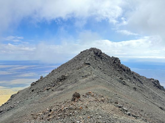
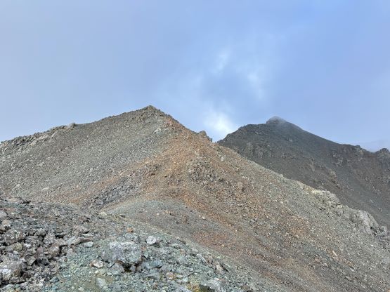
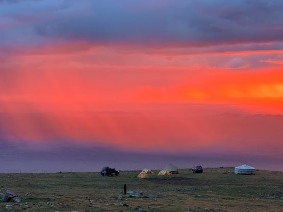
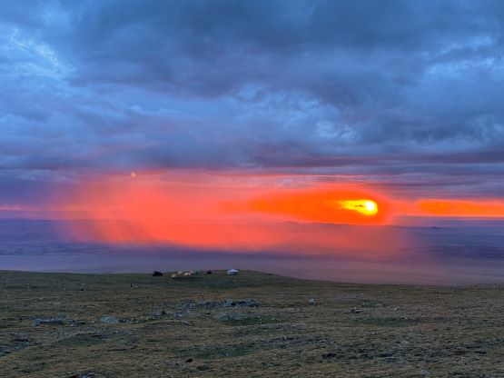
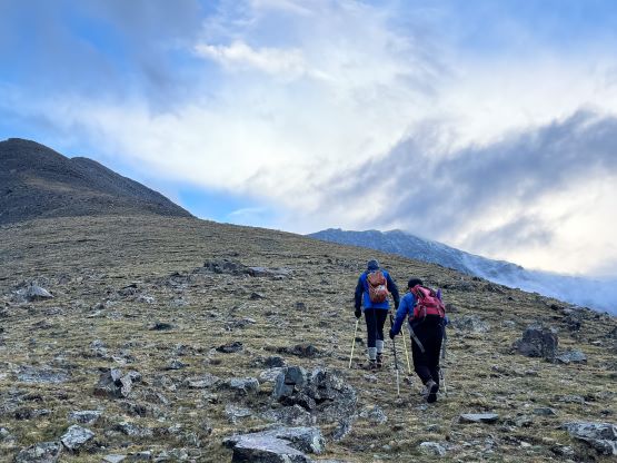
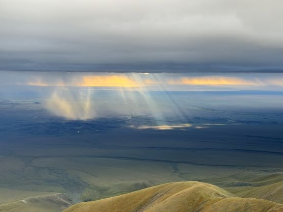
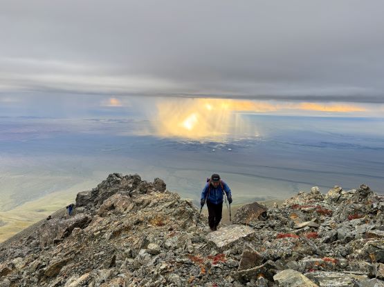
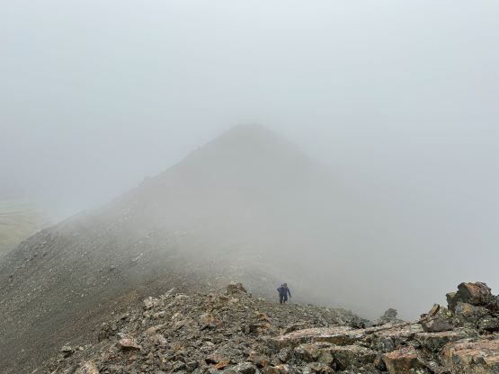
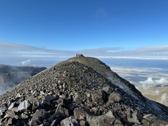
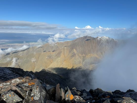
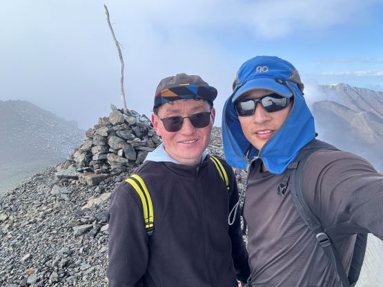
Gangaa decided that we would have breakfast at 5 am to start hiking no later than 5:30 am, but it seemed like nobody was waking up except for Gangaa herself. It turned out that our iPhones all got switched back to Ulaanbaatar time which is 1 hour off, while we were sleeping. This might due to the fact there was actually some spotty cell reception at the basecamp, probably due to the direct sighting towards Chandmani. Because we all missed the alarm our starting time was slightly after 5:30 am but that was fine. There were still lingering showers to the east of us, and the weather was mostly overcast but without any immediate threat of thunder. The clouds actually made the sunrise more dramatic. The ascent itself was no-brainer and didn’t have much worth nothing. We hiked up open grassy slopes directly aiming at the false (east) summit, until the grassy slopes gave way to a rocky ridge. There were some minor up-and-downs and scrambling but nothing exceeded “class 2”. The hardest was trying to bypass the false summit on the north side, which involved some loose terrain. We entered the fog but surprisingly broke through the fog layer not far below the true summit, and got rewarded with some excellent views. Naraa, Manlai and I got there in time with the views, but Petter showed up just when the fog came back in.


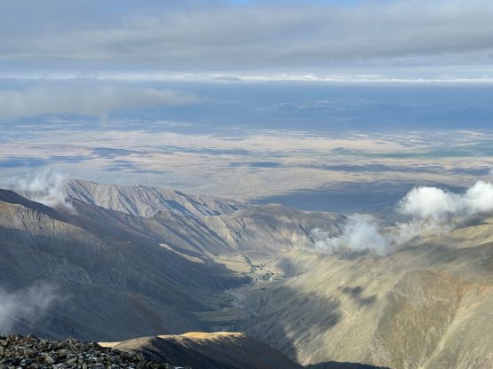

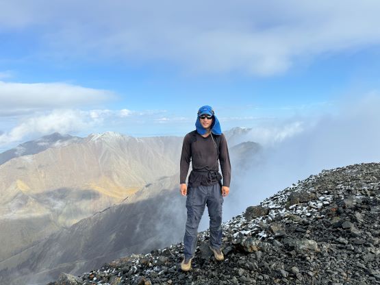
I didn’t quite like the weather so I opted to get a head start on the descent. I told everyone else that I would see them back at the base camp, and then went ahead. I finally descended below the cloud layer after side-hilling around the false summit, but took several spills afterwards on wet rocks. I decided to play a bit more carefully until the rocks gave way back to the grass, and got back to the base camp in 4.5 hours round trip. The others showed up about half an hour later and then the thunders came. We hurried up, broke camp before the rain started, and drove the hell out of this place. The weather was really unstable it seemed like, and were definitely lucky to get this peak in between the thunderstorm events, and even luckier to get some views. For the drive-out we followed the exact route that I drew on the GPS app and I did record an actual driving track for the future parties to follow.