Ikh Ovoo
August 23, 2024
3802m
Tseel, Mongolia
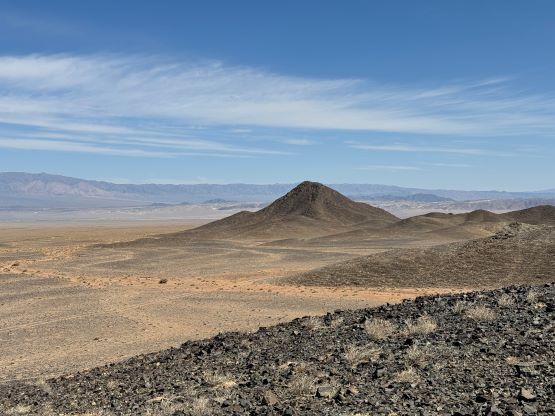
Ikh Ovoo is the highest peak on Aj Bogd and one of the few P2000m “ultra” in Mongolia but the location is very remote, only 60 km away from the Chinese border and over 300 km away from the nearest paved “highway”. Petter had organized this trip with Gangaamaa Expedition but Gangaa rejected Ikh Ovoo right off the bat and that was at least half a year ago before all the things came together. Gangaa by no doubt is one of, if not the most experienced mountaineer in Mongolia but this company is not the best at communication. We never understood the reason why this one was rejected but Dünkheger and Turgen were included. I was able to see multiple roads within close proximity from the summit on the north side and these roads look reasonably well on the satellite images. Dünkheger and Turgen, on the other hand, seemed way more complicated to me though for very different reasons.
The final itinerary did not include Ikh Ovoo but we would see. We were able to earn 4 extra days by doing Jargalant, Bumbat and Bataar in a timely manner and we eventually brought up Ikh Ovoo again to Gangaa at Sutai’s basecamp. That’s where we would have to make a tough decision whether to go directly towards Ikh Ovoo afterwards or eastwards across the paved highway towards Khasagt, skipping Ikh Ovoo. Gangaa understood our needs and the reasons behind this request, but our drivers refused to drive 600 extra kilometers off pavement and that’s when we learned the actual remoteness of this objective. On the Gaia map there’s a “yellow road” that goes to the NW side of the mountain. I had assumed that road to be entirely paved as it links the city of Altai to another Chinese border crossing but that was actually not the case. This road in fact sucks balls with some very rough going canyons. We understood the drivers’ frustration because Ikh Ovoo was not on the original agreement. It was completely unfair for them to do that much extra driving especially that we were also using Manlai’s personal vehicle so there came our negotiation skills. I was hoping that Petter could take care of this part because I’m definitely more of a mountaineer than a business man, but Petter was already in the tent and it was up for me to bargain. I honestly had very little clue but then I went to Richard/Denise’s tent (by pure coincidence the two Mongolian teams overlapped at Sutai Uul), and learnt that their drivers’ wage was only 75 USD per day, excluding petro costs. I thought Ikh Ovoo would add 2 full days of driving so I bargained with 150 USD per driver with us also paying the extra gas. Everyone agreed including Petter and Gangaa, so done deal.
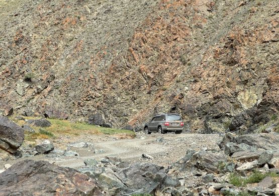
Gangaa and Manlai had spent at least an hour together with the map in the previous day and the decision was to aim for Ikh Ovoo first and then come back towards Altai for Hasgat Khairkhan. This meant we would likely take a direct way south-eastwards, skipping the paved highway to Altai. I told Rob that we might not go the same way and I sure was correct. We finished Sutai’s ascent in mid morning and immediately drove down to the small village of Tonkhil for some grocery and gasoline. We then drove more or less directly SE towards Tugrug and then turned onto the curvy road towards Bugat, crossing a long but shallow mountain range. We turned SE again before reaching Bugat and entered another desert plain and settled not far afterwards in a north-south trending shallow canyon. I thought we were deviating from the planned N-NE approach but they seemed rather confident that we would be okay. This had been a very long day and we had to set up the camp in the dusty winds. Our stoke level was not quite high but we got the tents erected (not without some frustration) and the winds died down overnight.
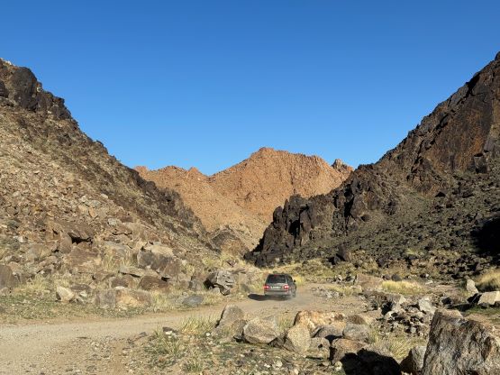


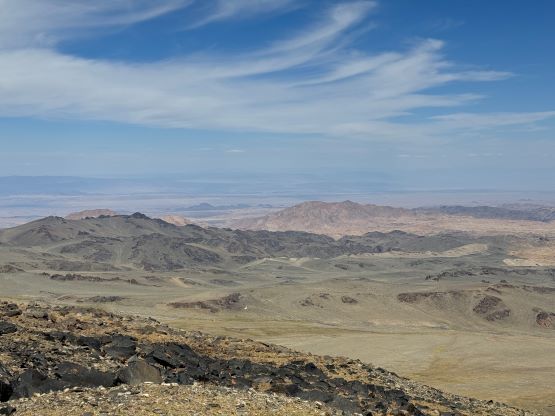
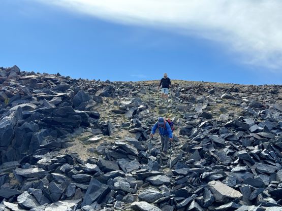
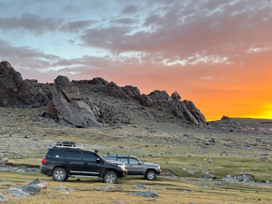
The navigation on our summit day was quite a disaster but again I think this was all because of the communication problems. I eventually got what our lead driver (Manlai) wanted to do, that was to go around the south side of the mountain to the village of Altai (yes, another named place called Altai) and drive up from the south. I had certainly considered this route which was shorter but I also told Petter that this would not be my first choice because the NE side had multiple roads, all looking decent on the satellite images so the NE attack would be much more robust. Clearly our Mongolian guides had issues understanding the concept of robustness but that’s understandable given how terrible their civil engineering is. Anyway I eventually took over the lead and directed the second driver to the side that I wanted, admittedly without much communication. The second vehicle, also without communicating decided to split up and do their own way and it costed us over an hour to regroup (on my planned route). Nobody was happy. We had 6 people in this team and all 6 of us have superb capabilities with more than enough reputation in their own fields and country. This is often not the best case based on my own experience. Petter probably disagrees as he’s Norwegian but I’m definitely more exposed to China’s sole dictatorship and North America’s individualism. The final steep spur road on the planned NE access eventually became rocky and rough enough to push the capability of these Landcruisers and I called it at roughly 350 vertical meters below the supposed basecamp. The drivers were panicking about the vehicles and petro capabilities and I thought we could make their lives easier by walking. We were more than 400 km onto these dirt roads since Sutai and we could walk a few extra kilometers. So that’s actually the majority of this trip report because the hike itself was literally nothing. Ikh Ovoo turned out to be another perfect example in this prominence-chasing game that sometimes (or maybe in a lot of cases) it’s not all about one’s mountaineering skills.


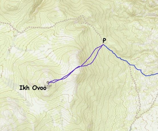
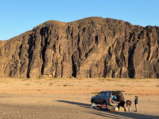
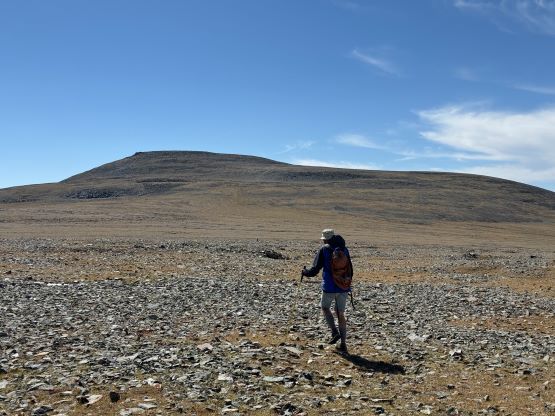
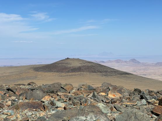
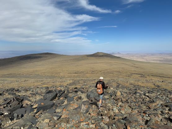
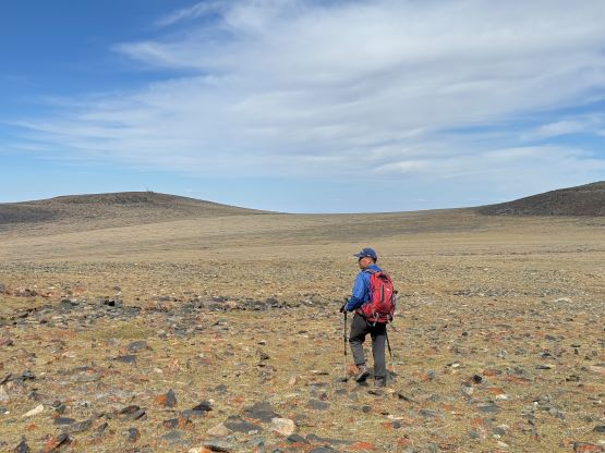
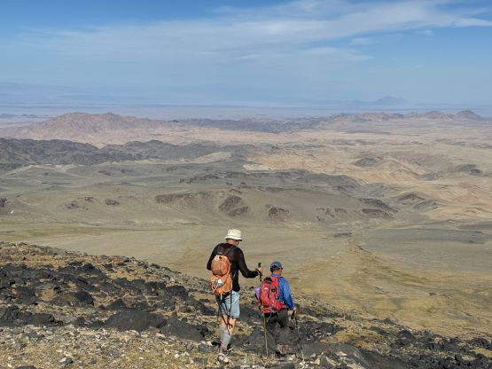
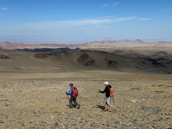
Petter and I told Gangaa that the guides didn’t have to come along if they wanted to rest, but Manlai wanted to come as he’s never been here before. That’s good because I wanted them to actually enjoy this adventure rather than being here solely for working purposes. Naraa stayed behind to help Gangaa and the second driver setting up our camp. From our current location it made the most sense to aim directly at the col between the two eastern sub-summits instead of trying to follow this bad road up to the 3500 m supposed basecamp. Petter went about 5 minutes ahead and Manlai started a few minutes behind me and all three of us took different ways. All three ways worked but we did not merge together until that said col. Petter and I got ahead of Manlai for about 10 minutes and did the rest of the plodding together. The route to the true summit was obvious. I considered the south peak but that appeared to be over 3.2 km away and I thought 7 extra kilometers was a bit too much for an add-on P100m dumpster, so opted for being lazy for once.


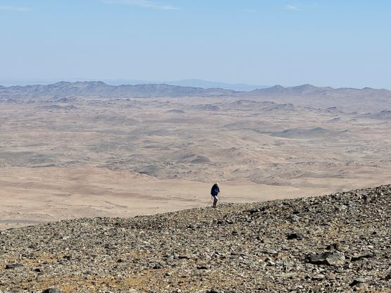


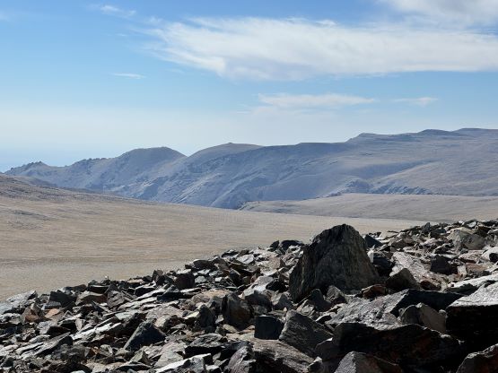
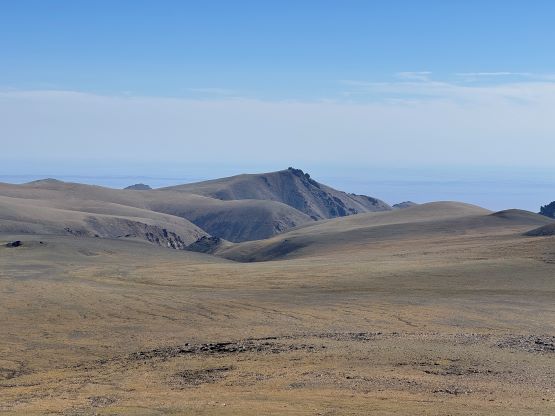

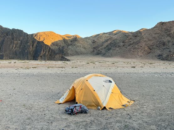
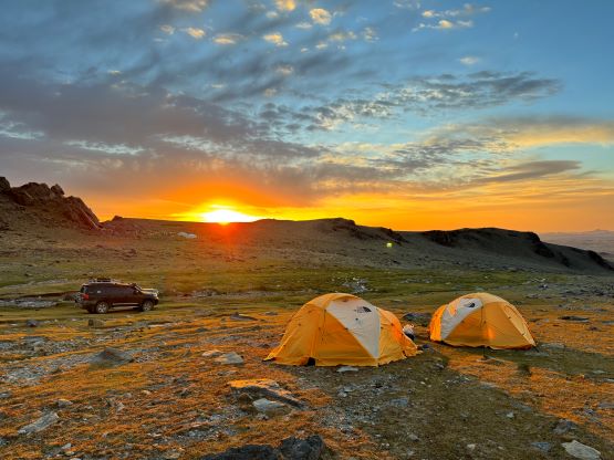
I decided to follow behind and not put my brain in more use on the descent, and Manlai did a great job leading us down taking a different but equally efficient way. We were back in the camp in just over 2.5 hours round trip, covering about 9.5 km distance and less than 600 m elevation gain. This was one of the fastest ascents I’ve done at 3800 m altitude. The terrain’s easy and Petter was certainly very fast on this kind of country, that it took everything out of me to close in that 5 minutes of gap, and I was sure Manlai (who had soloed Shishapangma without oxygen) also worked the hell out of him to catch up to us on the summit. Gangaa was already preparing the meal for us upon our arrival and the evening routine was relatively uneventful. The local people did require us to move our tents further away from that tiny stream which provided their drinking water, and we did not see Rob, Deividas, Richard and Denise showing up. I told Petter that they probably wouldn’t want to drive that last kilometer of rough roads and I was actually correct. The next morning we packed up and drove out, and immediately saw one of their vehicles and one of their tents. The other vehicle was apparently left behind in Altai due to mechanical issues.


The objective of this day was to drive 300 km northwards to Altai and we had booked a hotel stay in that city. We decided to let Manlai do his job and he was definitely very knowledgeable. For a few times we clearly deviated from the “main roads” on the Gaia map but Manlai’s route always worked out and probably went at shorter distance overall. I stopped tracking after getting to Tseel and I thought the second half from Tseel to Altai would be easy, but I was wrong. The second half was considerably rougher with lots of bad roads in canyons that likely had seen some flooding events in the recent days. It was a slow crawling most of the way and it took us over 10 hours to conclude the day. The hotel stay in Altai, on the other hand was another story. This time everything worked out and it felt unreal by Mongolian standards. Petter even got his first shower in 24 days and he was happy about that.