Dünkheger
August 20, 2024
3315m
Bulgan, Mongolia
The large plateau that rises 2000 m above the desert floor about 300 km NE of Ürümqi, Xinjiang lies on the border between China and Mongolia but the highest point is entirely in Mongolia, but in less than 1 km from the border. The name of this mountain is Dünkheger (冬赫格尔) in China but Altun Oboo in Mongolia. There had been virtually zero information (not even a single picture online) but it does seem to me that the Chinese name is slightly more used. Frankly speaking the only information I could find about either of the names was either on some maps, or in the China-Mongolia border agreement in 1963, which had been written in Chinese but I do also read Chinese. The first time I heard about this peak was actually from Deividas, that “there’re 18 ultras in Mongolia but one is on Russian border and one is on Chinese border and they are far from any other” and that was before I signed up and paid for this 40-day trip in Mongolia. Petter organized the trip with one of the more reputable companies in the country, and I was surprised to hear that Dünkheger was actually included in the itinerary.
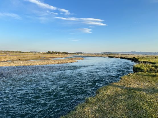
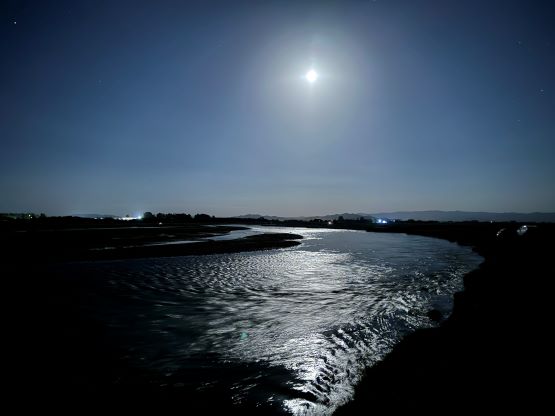
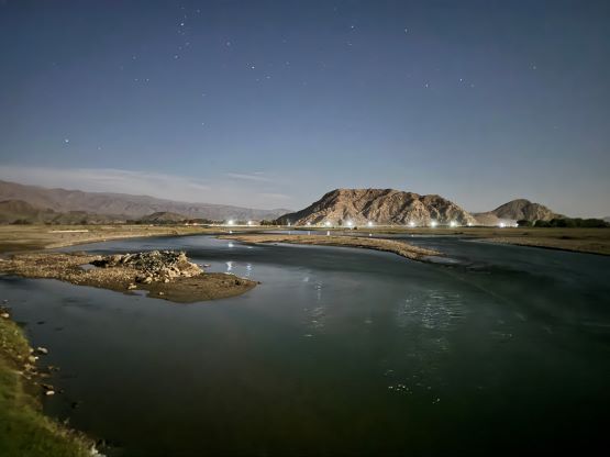
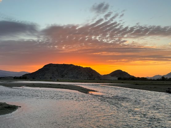
I was skeptical about the feasibility despite the promises because sometimes the guiding companies had no clue about the location of “true summits” of their targeting objectives. This was not the case for us, but there were plenty of other, foreseeable issues. There were together one head guide, two climbing guides (one also being a driver), one additional driver, two Landcruisers in addition to Petter and myself, as well as soldiers that were patrolling the area and everyone, human or machine, had been stretching to their respective limits to make this a success ascent. Petter and I decided to skip some details including the name of this company and our guides because we don’t want anyone in this team get in trouble. After driving out of Munkh Khairkhan we located ourselves in the small border town called Bulgan for the night. But prior to arrival we stopped at another town to obtain our permit to enter this border zone. We got denied to climb to the summit of Dünkheger but we did get ourselves permitted to at least visit the area. We hoped that the soldiers could be somewhat flexible upon our arrival, which might or might not be the case. Honestly our chance of success was not high, but we were already there and we had no better peak to do so why not give it a try. The plan at Bulgan was to find us a guesthouse but due to the change of dates the houses were sold out. We spent at least 2 hours trying to make some decisions but eventually settled on the camping option, which was the cheapest but the least pleasant. Thankfully the view beside the river was great and there was enough reception for me to fully catch up with the trip reports. The night was too hot on the desert floor so I needed to sleep with the tent doors open, but unfortunately a dust storm blew in and I woke up with everything in the tent covered in a layer of sand.

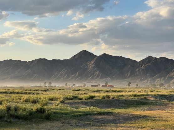


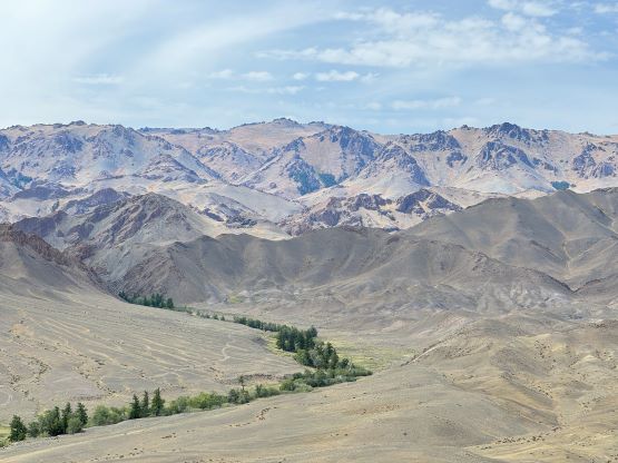
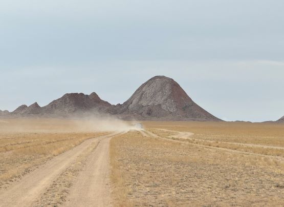
The following day was a travel day. We were not terribly far from Dünkheger but we had run out of paved roads. My GPS eventually recorded a single way of over 130 km distance from the end of the pavement to our basecamp. We left westward from Bulgan and quickly encountered the queue of trucks next to the Chinese border. Our head guide later told us that it might take several days for these trucks to cross the border. We then did the next 50 km driving parallel to the border, sometimes within a handshaking distance. I could totally see the slogans on the other side but I’m not allowed to post any picture of the Chinese border here. But since I read Chinese I could make out the words, that translate into “only one thing in one life, to protect our mother country’s border security”. They had a paved road, fences, border posts (and presumedly cameras) for basically the entire stretch and I wondered what would be the practical reasons to spend that much on that, given that Mongolia would never attack China.

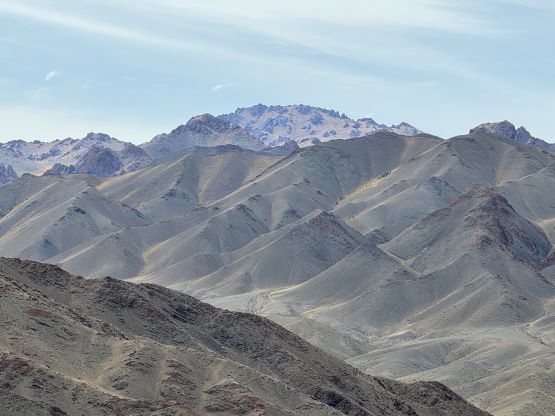
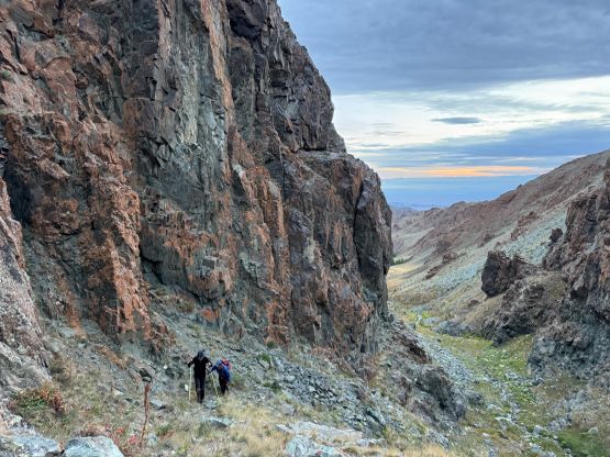
After about halfway down we left the border and did some cross country travel using roads that were nowhere seen on Gaia map, and in total we encountered 4 security check points. The second one was empty but all others required us to stop to show the paper work. The last check point was more like an army base and required a slight detour, and up to this point we were in line with the “best case scenario”. But about 10 km after merging onto the “white road” on Gaia map we encountered two soldiers on motorbikes, with one being the boss in this area. This guy checked our passports thoroughly and had some seemingly lengthy talk to our guide, but eventually reluctantly decided to escort us to the camping area, which required another 10 km of very rough driving into a drainage system. The roads definitely put our Landcruisers in test and the one I was sitting in got a massive hit minutes before settling on the camping area. Our guide had at least 4 major talks to the soldier boss and he basically denied our presence in the area, saying it’s too close to the border and the Chineses were carefully watching us using binoculars. The information was that we could not go within a certain distance from the border. After pleading with no avail the guide called me out to explain where exactly we planned to visit and I told the soldiers that we were only to climb to a small peaklet that was sort out within that said distance range and he eventually allowed us to carry on. This was a nice guy and he was certainly there to help us, being flexible with the not-so-flexible border rules. We spent the rest of the day doing nothing and I even contemplated a midnight ascent using full moon to ensure 100% success. But I quickly gave up on that idea as I thought the 5 am starting time would be sufficient enough. The key was to plan the route very meticulously (using Gaia and Fatmap) to minimize the traveling time in direct sight from either side of the army.


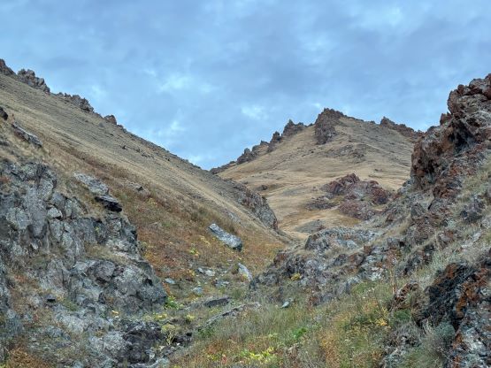
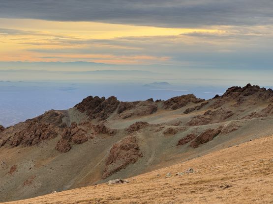
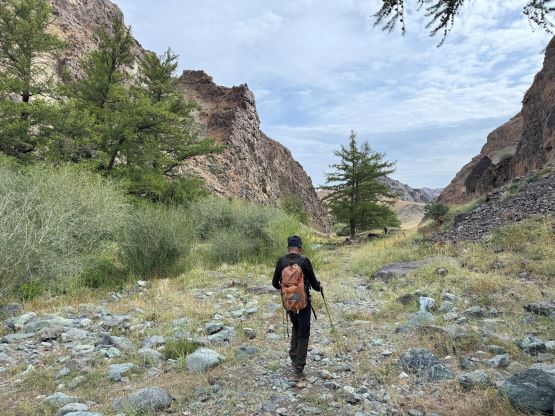
Our guides woke up early to prepare our breakfast. Petter and I got up at 4:10 am and were already hiking by 4:45 am. That was almost 20 minutes earlier than planned but I liked it. We would be only accompanied by one climbing guide and all three of us needed to use the head-lamps for about 45 minutes. I thought we would have a road to follow based on the satellite images but the reality was a mix of animal trails, open grassy slopes and easy creek crossings. We were able to mostly stick to the bottom of this valley, including the section that seemed like a canyon on the satellite map. The canyon turned out to be trivial. We had been aiming for that said bump on the north slopes of Dünkheger and we were doing better than expected. The terrain had been giving us very little trouble. The story after this would be kept vague but our peakbagger dots were green and you all know how much “black-and-white” that Petter and I are in this game. The route itself is honestly no brainer and needed no additional explanation. It’s a class 1 off-trail hike with the only annoying section being a swamp in the middle of a shallow valley. I had very little time to fuss things around so simply plodded through the swamps both ways and got my shoes thoroughly water-logged.

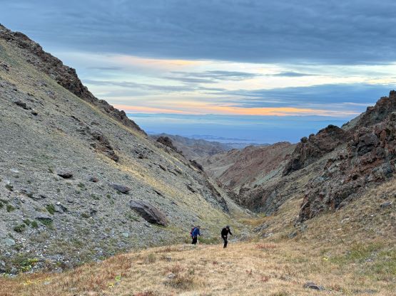
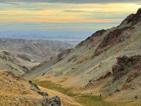


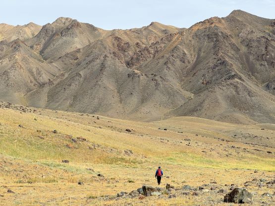
Petter had been pushing to his physical limit to minimize the time spent up high so we eventually needed to take a break after descending back into the drainage. Throughout the descent we had been discussing where and when would we see those soldiers on motorbikes (the boss said there were a lot of them patrolling on different parts of this area) but ended up seeing nobody. Our round trip time was under 5 hours. After getting back to the camp our head guide told us that the soldiers might want to check our phones afterwards but that’s okay. We did as promised, and took no photo of the Mongolian soldiers nor the Chinese borders throughout this entire outing. The soldiers weren’t at our camp (which was to my slight surprise) so we decided to pack up and drove out.


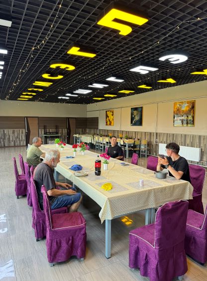
Before making a check-out at that army base we made an in situ decision to visit a memorial not far from the entrance of our access valley. I didn’t understand a single Mongolian words but apparently hundreds of people were killed somewhere here. Petter and I also decided to visit the nearest high point which unfortunately only boasts ~40 m prominence. I nevertheless got up and down in flip flops. We then went back to that army base but that soldier was still not there so we continued driving out. We took a different route that might be slightly faster than the one we took on the way in. We were back in Bulgan at mid afternoon and this time we were successfully checked into the guesthouse. With shower and toilet all functioning we finally got some “luxury” for the first time in this entire trip. Luxury only by Mongolian standard as elsewhere in the world those should be rather “standard” for most, if not all hotel/hostel/guesthouse stays.