Dund Saikhany Nuruu
August 31, 2024
2830m
Bayandalai, Mongolia
Dund Saikhany (Sayhni) means “Middle Beauty” and Nuruu means “Range”, and this is the lowest of the 18 Ultra prominent peaks in Mongolia. This was the last common objective in this trip between Petter and myself. We were based in some privately owned guesthouses in the previous night and spent a good part of the following day driving to the small town of Bayandalai on the SW side of the objective. Our guiding company paid for the unplanned stay in that guesthouse, probably due to the horrendous amount of mosquitoes in the area that made camping otherwise extremely unpleasant. Getting into Bayandalai was a welcoming change from the hundreds and hundreds of kilometers of driving on bad roads. All of the sudden we were on pavement. The plan was to set up camp at the base of the peak and Gangaa for once decided to let us do the navigation.
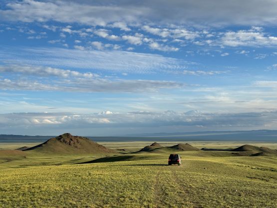
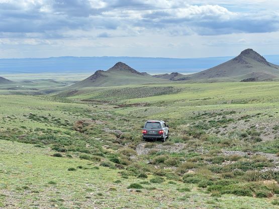
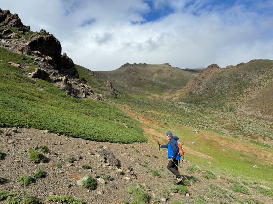
Again I didn’t take Devidas and Rob’s “beta” for granted and went back to the maps. I had proposed an attack from the SW that offers the least amount of hiking, but such would involve driving a longer distance on unpaved roads. I was actually planning to direct our driver towards that way but the reality didn’t quite match what I’d seen on the satellite images, probably due to the images being old. The satellite images didn’t even fully show the paved highway so we missed a critical turn. That’s okay as we would then take Rob and Deividas’ route from the SE. Gangaa and Manlai would be happy about this decision because we were maximizing the driving distance on this paved highway. Rob’s GPX track was mostly correct but we opted to take a variation near the end, by driving up a paralleling gulch further to the east. This would give us a higher starting point and we surely had no issues driving all the way to 2350 m elevation. The problem was then we were positioned a few kilometers to the east of the route. Thankfully our skillful and determined drivers were able to drove us at least 2 km westwards by crossing several troublesome gullies, so now we had parked ourselves much closer than Rob and Deividas’ starting point, from both elevation and distance perspectives.

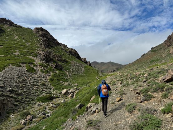
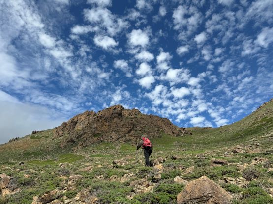
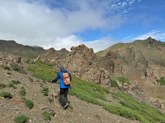
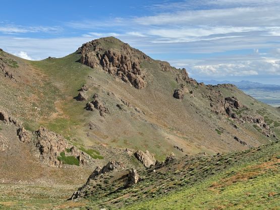
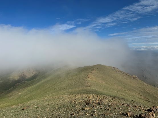
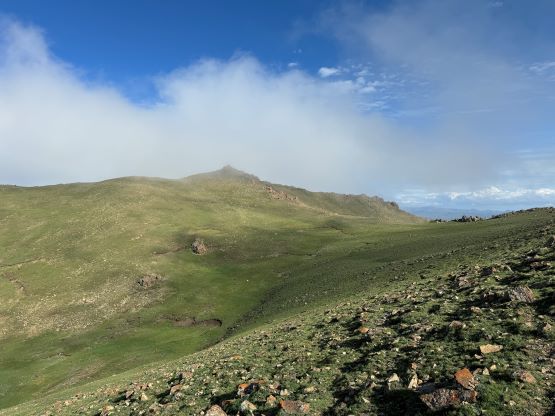
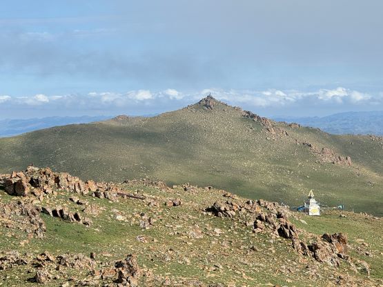
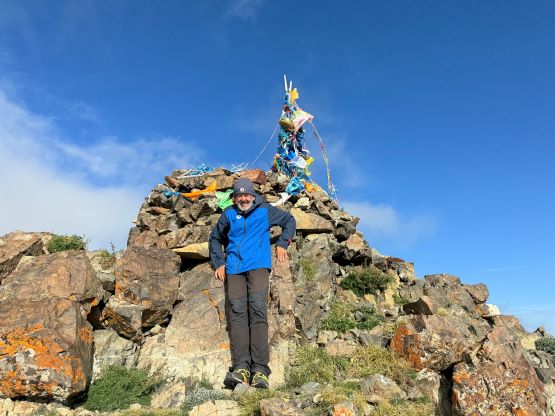
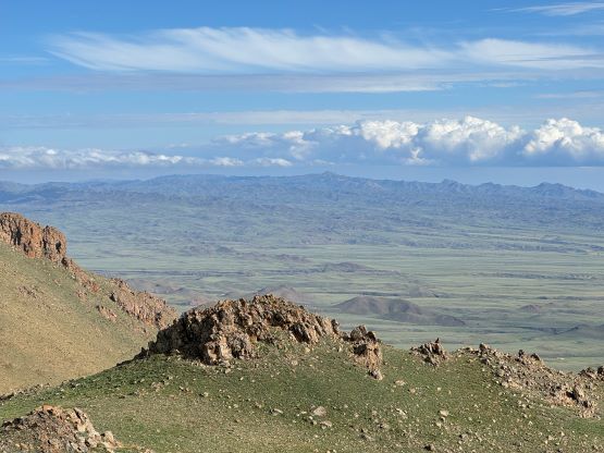
The weather was improving and supposed to be even better towards the evening so I decided that we should make the summit bid right now, even though it was getting late in the day. Petter needed some convincement but reluctantly agreed and Manlai would also go up with us. This turned out to be a critical decision but not due to the various factors that I had thought about. Waiting for the next morning would not be possible in this case and we might have lost this peak if we didn’t opt to go right away, but more on that later. We still had to traverse westwards into the next gully system but only for 500 m horizontal distance, and then easily plodded up this valley. Petter was setting a blistering pace and Manlai was trying really hard to keep up. I didn’t understand because the summit was still engulfed in the clouds and the forecast was calling for more promising weather later in the evening, so I on purposely slowed down and did the rest of the ascent alone, but behind the team. The route positioned us onto the SE Ridge of the eastern peak so it naturally made sense to tag this P40m eastern sub-summit. There wasn’t much to see up there due to the clouds so I quickly made my way over to the true summit where Petter and Manlai had been waiting for at least 15 minutes. I then decided to tag the western sub-peak as well mostly because Rob and Deividas had gone there. It was a few meters lower based on their observation, which could be confirmed by my GPS readings, but the weather finally improved at this stage of the day so I was definitely happy about this seemingly meaningless side trip.


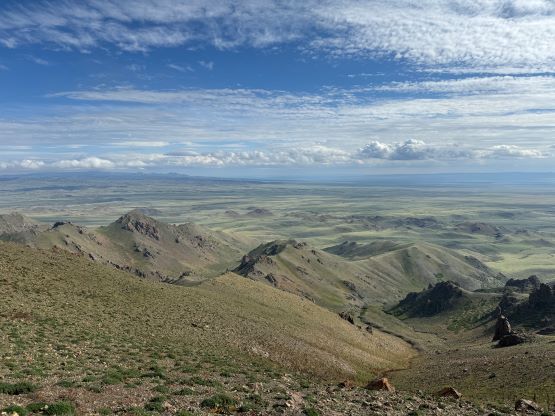
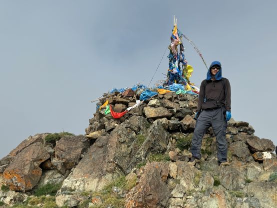

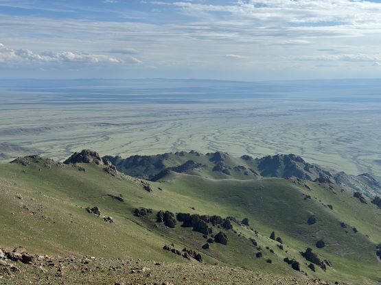
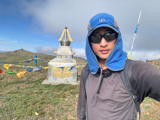
I made my way back to the main peak where Petter and Manlai had been patiently waiting. They were happy about this longer stay because of the improvement in weather. We then descended together at a rather furious pace and finished the round trip in 2.5 hours. This was when we learnt the sacred status of this mountain, that it was apparently not permitted to climb. A few locals had driven up on their motorbikes and threatened to come and fight with us in the evening, so we quickly packed up and drove away after dinner. I had no clue why these people loved “ultra prominent peaks” so much, as among the 15 peaks we climbed in this trip 3 of them were sacred and essentially illegal. Manlai picked a better way driving out by staying entirely on tire tracks so my driving GPX is the one that we used on the way out. We then found a designated camping area about half an hour eastwards not too far from Dalanzadgad, and spent most of the following day driving across the Mongolian Plateau towards Ulaanbaatar. We could have driven all the way into city on the 1st of Sept. but opted to camp about 100 km away to the south. My only complaint was not having cell services at that camping location. On the 2nd of Sept. we finished the drive into the city of Ulaanbaatar and checked into a nice hotel, but the traffic situation was horrendous to say the least.