Baatar Khairkhan
August 15, 2024
3984m
Khovd, Mongolia
Baatar Khairkhan is the 7th “Ultra” that Petter and I bagged in this trip, but was the first one that we actually followed Rob and Deividas’ beta from the previous year. They had driven all the way to above 3000 m elevation and made the ascent in mere 2.5 hours so there’s little point in trying to find an even-better way. Furthermore we had slowly gained trust on our Mongolian guides navigating in their Mongolian way, so we decided to simply let them direct us to the base camp. We did not tell them on which side of the mountain should we approach from, but we trusted that they would figure it out in their own way.
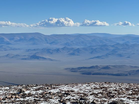
Gangaa stated that we would drive north around the range so that’s a good sign, as at least they knew we would have to approach from the west side of the mountain, even though none of them had been up on Baatar themselves. They also figured out the correct spot to leave the paved highway without using a GPS nor a map, and I thought that was also quite impressive. About halfway in following Rob’s driving track they stopped to ask us the detailed direction afterwards. I told them that based on the GPX track, the previous group had driven up the ridge feature ahead but based on the overall direction they decided to follow the valley. This deviated from Rob’s driving track but the two routes eventually merged much higher up in the valley. The final few kilometers were quite rough with lots of rocks on not-so-defined paths, and we eventually stopped 50 vertical meters lower than the previous party’s starting point. Petter was pushing them to drive a little bit further but we had stopped at a decent camping area, and it wouldn’t make any difference in the bigger picture anyway. Meanwhile I convinced Petter to go for the summit in the evening instead of waiting for the following day, and we would again be only accompanied by Naraa.


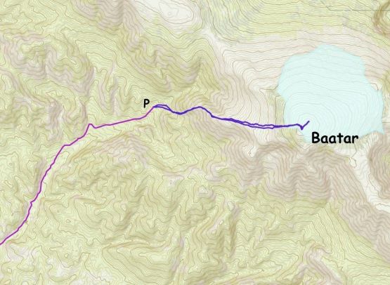
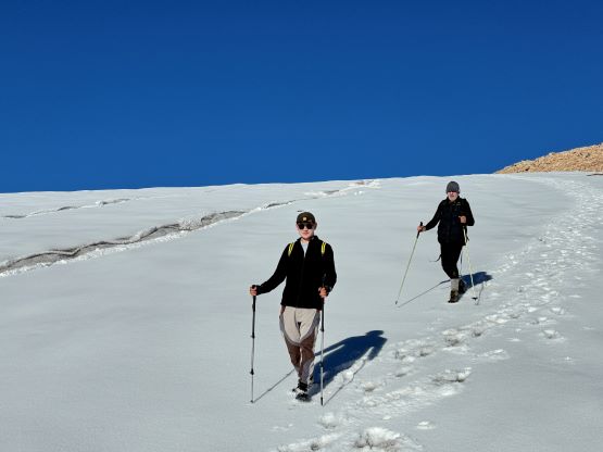
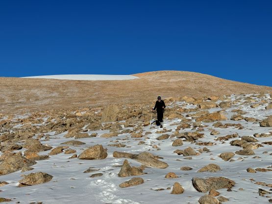
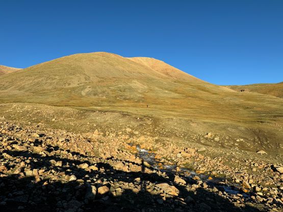
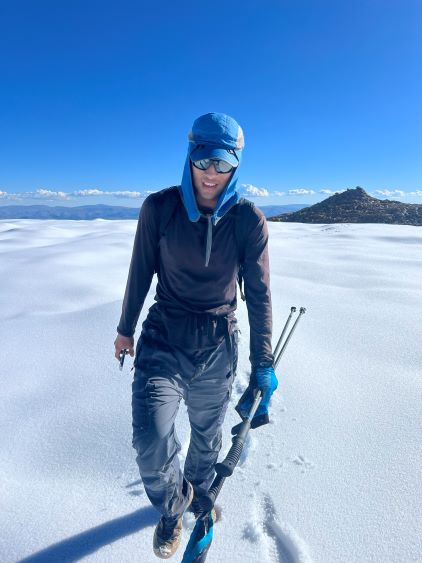
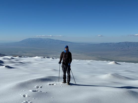
I estimated our round trip to be no more than 5 hours and I was definitely correct. We decided to take Rob and Deividas’ descent route as that seemed more direct. There’s a creek crossing at the start and we were able to hop across on rocks. The lower half of the route was quite steep, but the terrain wasn’t too bad. The steep part was mostly on grass and scree, which made the ascent slightly annoying but the scree would be perfect for the way down. We regrouped after getting onto the long and gradual ridge that would eventually lead us onto the icecap near the summit.


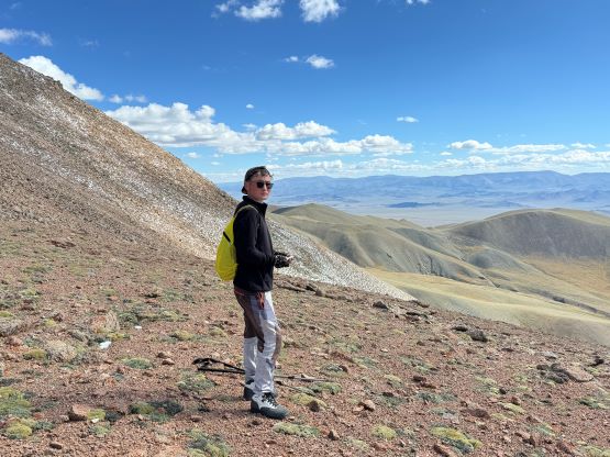
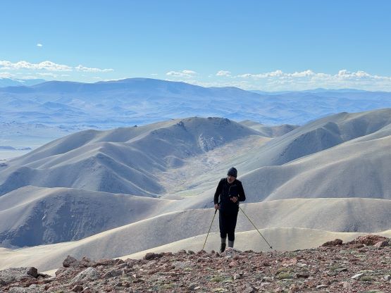
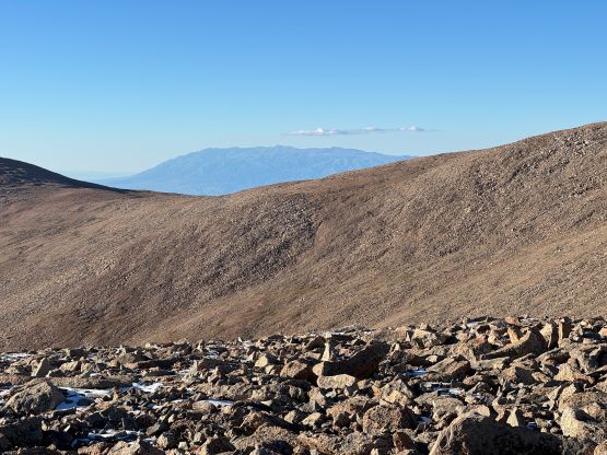
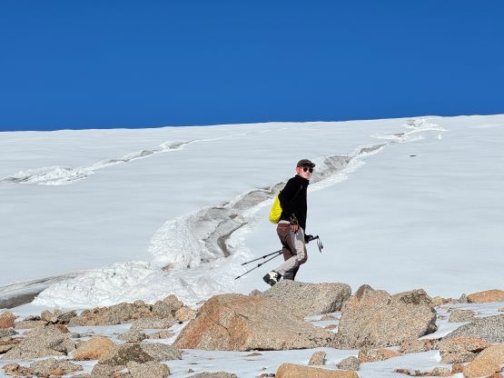
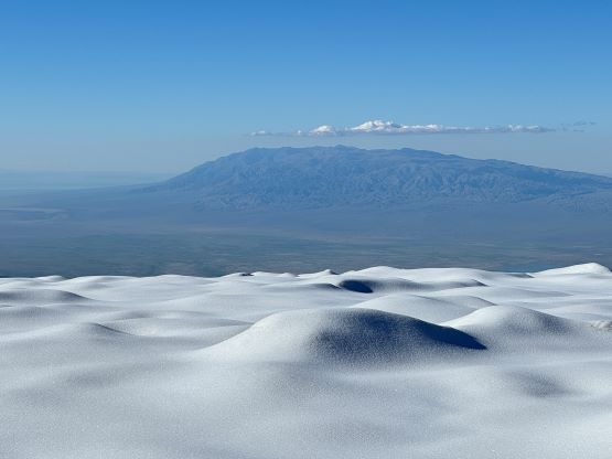
There was fair amount of fresh snow from thunderstorms in the previous day which made for some 10-cm trail-breaking. The ridge was quite boring so Naraa and I eventually went ahead and I pushed the pace slightly harder near the top, and managed the ascent in just under 2 hours. The true summit was determined to be the pointy rocky one but we would check out that glacial icecap anyway for completion purposes. I also got some very weak signals and was hoping to make some updates from the icecap, but to no avail. The reception stayed “E” on this mountain which was good enough to send some messages but not for the socials. Petter showed up on the true summit shortly after and also decided to check out the icecap. Petter determined the icecap to be 5 meters lower based on his GPS readings. This was our second “ultra” in the same day and that is not a commonly done feat, and very likely the first time ever in this country.


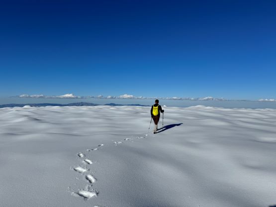


I decided to wait until the basecamp to have a proper dinner, as the descent wouldn’t take much energy anyway. Our tracks on the snow made the navigation slightly easier but we still took some different lines on the way down. Petter and I mostly followed Naraa and he stayed consistently skier’s right of our ascent track for some reasons. That steep section near the bottom was perfect for Petter wearing his mountaineering boots, but was a bit painful for me wearing trail-runners. We eventually finished the round trip in 4 hours, concluding this efficient and successful day. The objective for the next day was simply driving to the base camp for Munkh Khairkhan so there’s little point in rushing. There was still some very weak reception in my tent but it took something like 20 minutes to send a message. I did get a message sent out to Erica but that’s it. I decided to sleep instead and deal with the “real world” later when there’s proper reception, which turned out to be on the summit of our next objective…