Kinabalu
September 4-5, 2023
4095m
Sabah, Malaysia
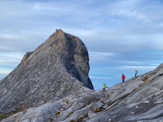
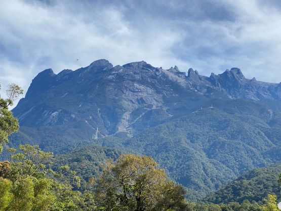
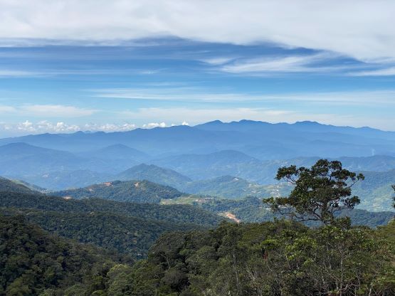
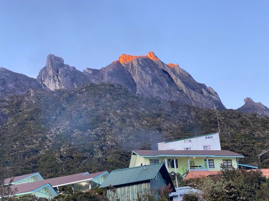
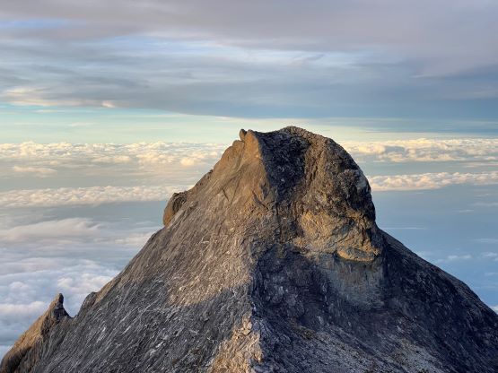
The massif of Kinabalu is a dome of granite with multiple spires, poking 1000 vertical meters above the densest tropical jungle of Borneo. It is the highest in Malaysia, the highest in Southeast Asia and the 20th most prominent peak in the entire world that also boasts over 2000 km of isolation. Needless to say, from statistical perspective this is one of the more significant objectives in the global scale. The ascent is however, nothing fancier than a “walk-up” on staircases and slabs, but does require over 2000 m elevation gain at moderate altitude. The fact that this peak is in Malaysia makes it “not that straightforward” as this country is known for the rigorous regulations and red tapes. Dealing with Kinabalu’s red tape is almost certainly more difficult than the climb itself, and it’s definitely not the smart place to practice that trespassing thing. There are multiple check-points including one at over 3700 m elevation, and climbers must wear the given name tag and carry a hard copy of their passport at all time.
The first, and probably the most important thing to address is that to climb Kinabalu one must be willing to play that gambling game at a high cost. The authorities had cancelled the 1-day permit even prior to the pandemic so all climbers must spend at least one night at Laban Rata Guesthouse which has a limitation to fit at most ~160 climbers. This essentially becomes a quota for this climb, that the slots are entirely booked months ahead. Nowadays it’s essential to book the climbing date more than half a year in advance and there’s absolutely no flexibility whatsoever if one wants to change the days. Considering that this peak locates in Borneo, one of the larger tropical rainforests in the world this is essentially a gambling game against the weather god. Furthermore, all climbers, regardless of experience must have a guide at all time. I consider this requirement to be rather minor compared to the “fixed date” thing, but it does jack up the cost. Adam and I hired our guide through Amazing Borneo Tours, one of the larger companies out there, but our cost was about 600-700 USD per person not including the expensive flights to get here. Depending on who you are, this might be “too much” for a summit that’s not even guaranteed.
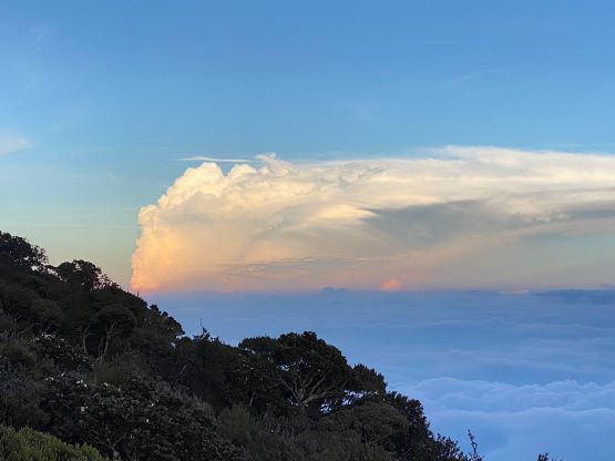
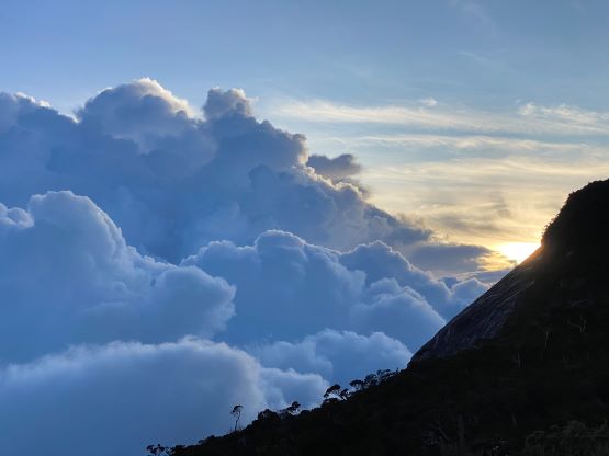
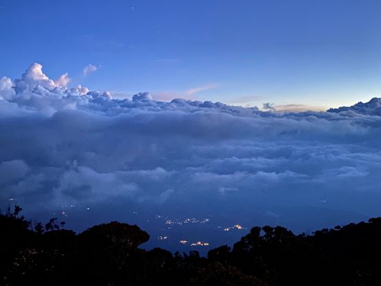
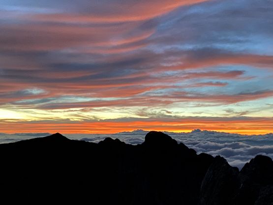
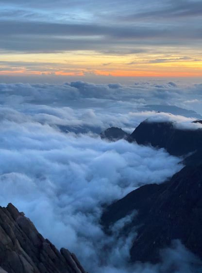
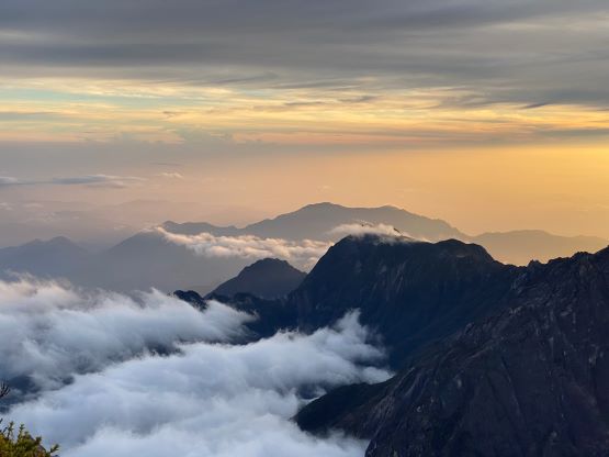
I later learnt that it’s still possible to obtain a day-trip permit with a special application (not illustrated online so have to negotiate in person at the park’s office) and this 1-day option can bypass that stupidly expensive stay at Laban Rata Guesthouse, but one still legally needs to hire a guide and it’s not possible to start climbing until 7:30 am when they open the Timpohon Gate. The weather in all tropical regions is generally more stable in the early morning and the afternoons are usually hammered by thunderstorms. It’s a debate between lower costs with uncertainties (1-day) and a higher cost with a higher chance of success (2-day, 1-night) and my choice was definitely the latter. It was not useless to research and learn about this day-trip possibility though because Adam and I had planned a contingency day at the beginning. The purpose was to take in account the odds of flight cancellations but then it also gave us a slim chance to obtain a day-trip permit at the very last minute, so we essentially had two windows – the original 2D1N package with summit day on Sept. 5th, or a day-trip on Sept. 3rd (if we can get the permit sorted out in the PM of Sept. 2nd upon arrival). It turned out that one of the flights were indeed cancelled but we somehow arrived on time with the checked bag, and the weather was on our side. We used the contingency day to bag two bonus high points and even got some excellent views on Kinabalu with both sunset and sunrise, and not a single drop of rain over the two days. That was not something to be expected as most attempts to summit the highest point in Southeast Asia ended up in misery with no view. It’s important to plan for the worst but sometimes it just turn out to be the best case scenario.
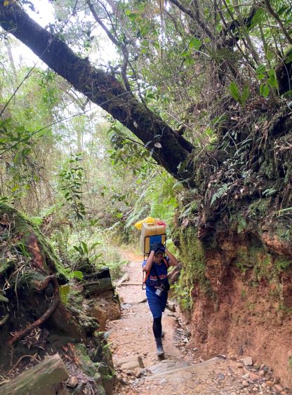
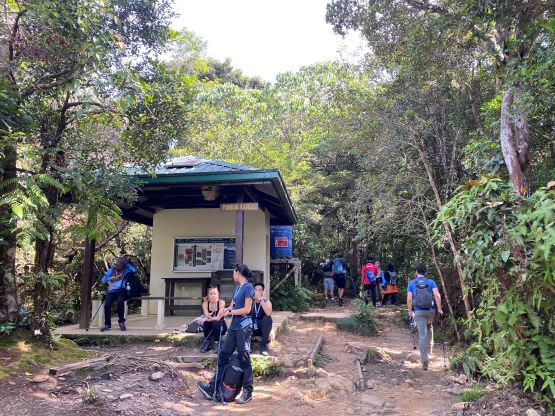
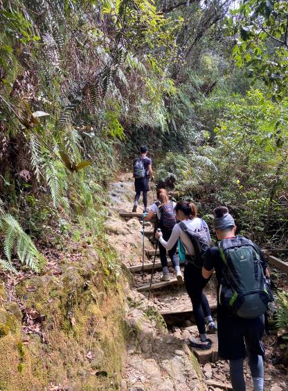
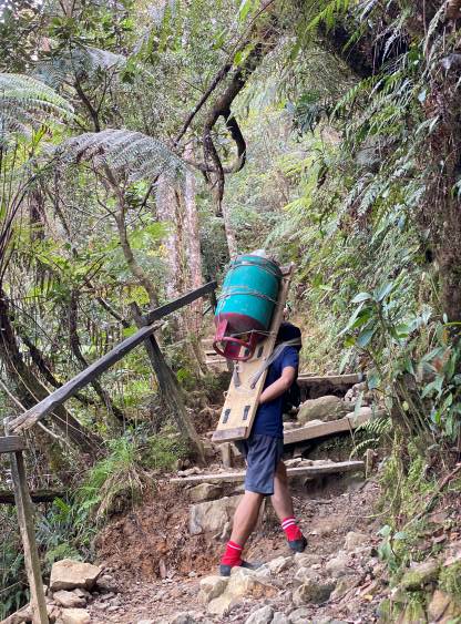
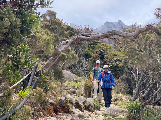
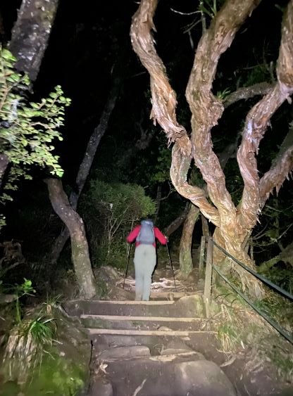
The paper work behind the scene costed me at least 1-2 hours because I needed to submit various forms to the company but it paid off nicely in the end. Malaysia is definitely a very organized country compared to Indonesia where we just spent a month and half in. The company had arranged a huge tour bus with the company’s logo to pick climbers up from various parts of Kota Kinabalu, and our pick-up was exactly on time. The traffic was a bit horrible that the 2-hour ride turned out to be 3 hours but we couldn’t blame the company for that. The registration process at the park’s gate was surprisingly easy probably because they had done the registration ahead of time. We got our guide, and the three of us hopped onto a small van and drove up the narrow roads to Timpohon Gate which is the actual trail-head. It seemed like a lot of groups had already started but we would eventually pass every single one of them.

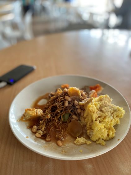
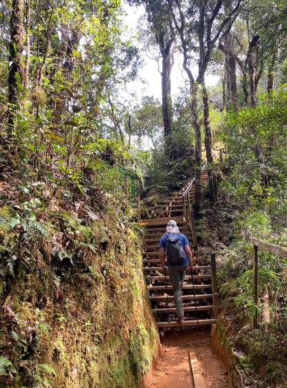
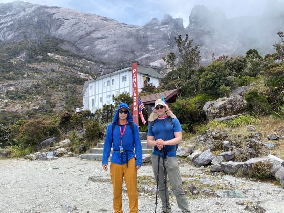
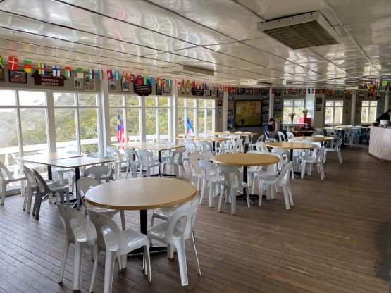
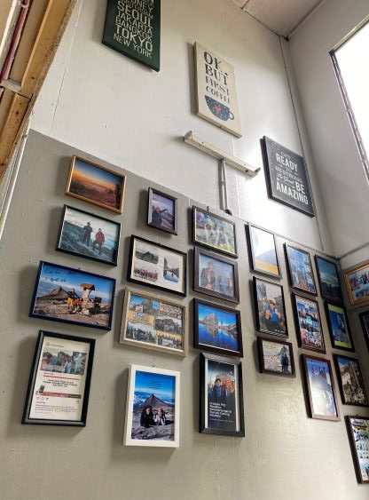
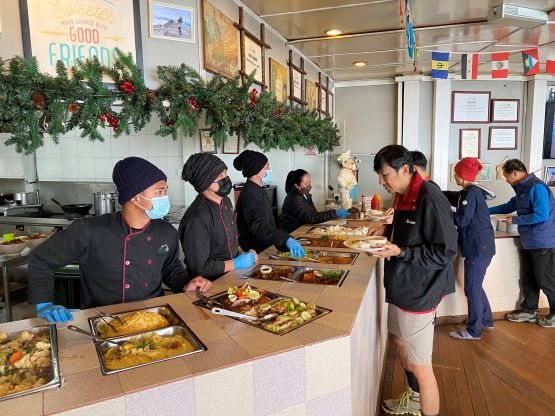
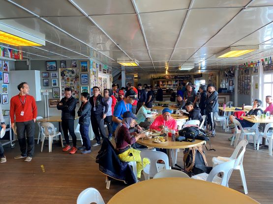
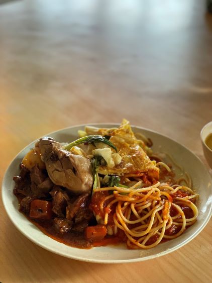
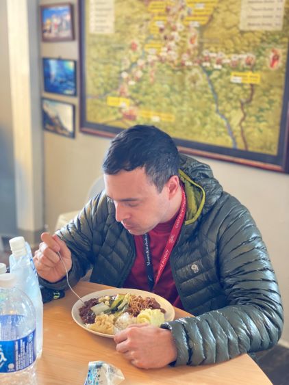
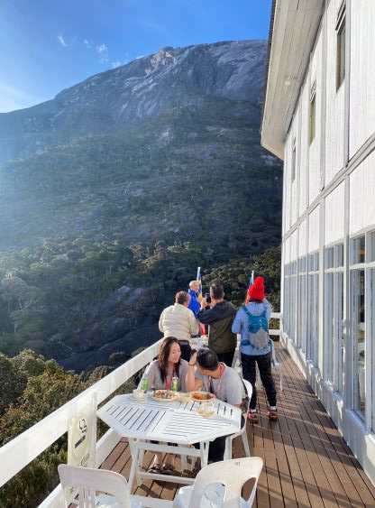
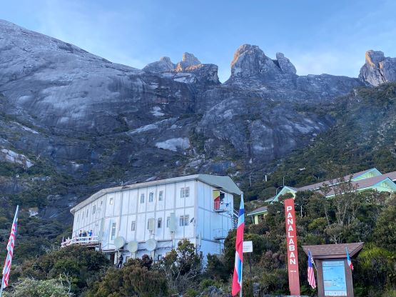
Right off the bat Adam was leading at a blistering pace because he needed to pass all of the crowds ahead. I never felt that much of an urge to pass the gang but I nonetheless tried hard to keep up. Once the steepness kicked in I felt much easier because I’m much stronger on the steeps than on the flats. The guide was surprisingly strong and had no problem to keep up with us. In fact, I think he could have left us in the dust for both the ascent and the descent. The approach to Laban Rata Guesthouse at 3250 m involved 1400 m elevation gain, mostly on staircases. I disliked the staircases but after a while I was able to get into a rhythm. We ended up only needing one short break to finish the box lunch that they gave us. I ate the food mostly because I didn’t want to carry them. After 2 hours 45 minutes of grunting the three of us made to the guesthouse and it wasn’t even noon yet. The receptionist said that the check-in would not open until 1 pm and the buffet dinner wouldn’t start until 4:30 pm, so there’s plenty of time for us to rest. I ended up taking a nap before dinner. By the time 4:30 pm rolled in most of the other climbers (over 100 of them) had arrived. I had read somewhere that the food was not satisfactory but that was not the case for us. The food was excellent both in quantity and in quality, that even Adam had no complaint. Both of us did two batches of grabs. I reminded us that it’s not very smart to overdo dinner at higher altitude but we still ended up eating and eating until we couldn’t stuff anything in anymore. I then spent the next couple hours watching sunset from various locations and making new friends from Kuala Lumpur, whereas Adam went straight into the room to sleep. We were lucky to be assigned to the 4-person dorm as some dorms were filled in by 8 people. I eventually went back to the room at 9 pm but could not sleep until midnight. I could feel the heart rate was higher and that’s to be expected when moving directly to 3250 m from sea level.

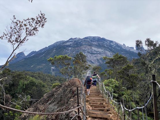

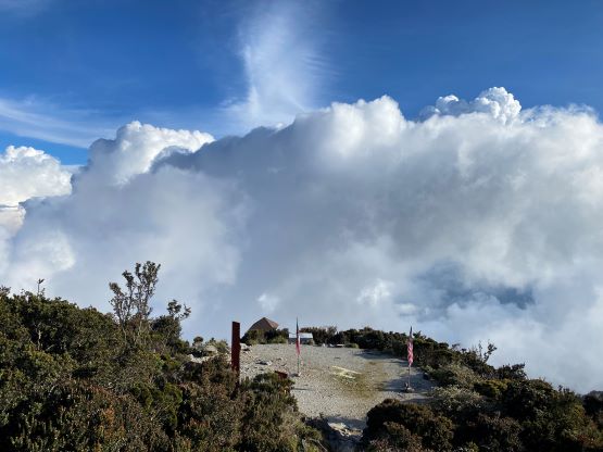


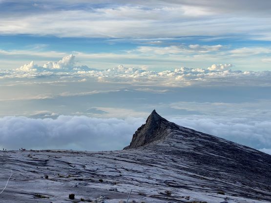
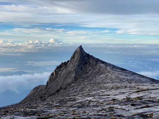
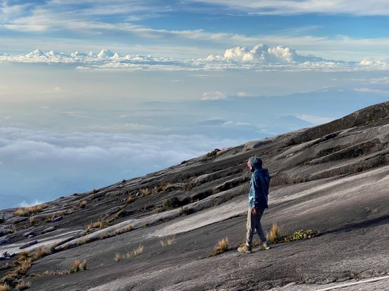
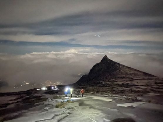
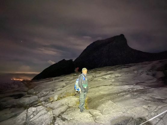
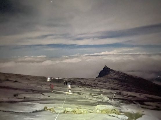
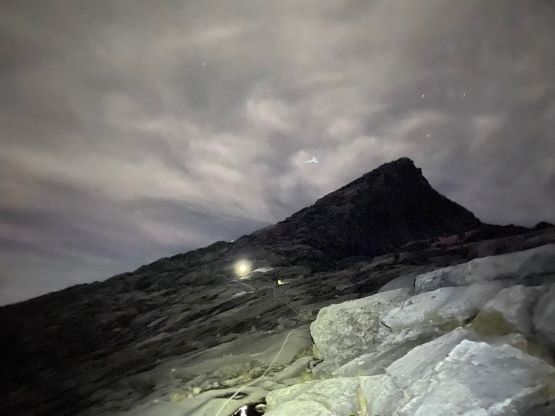
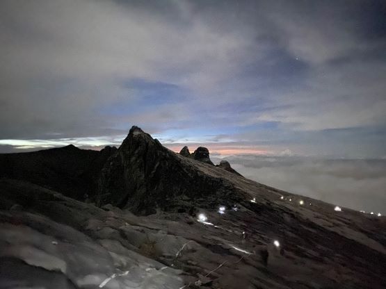
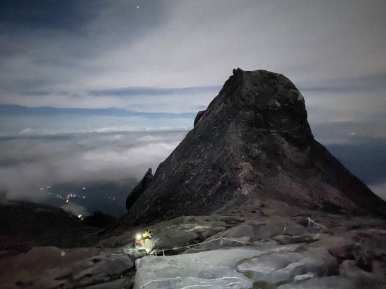
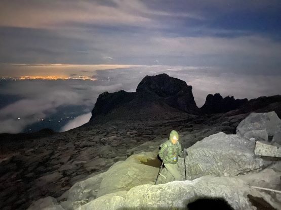
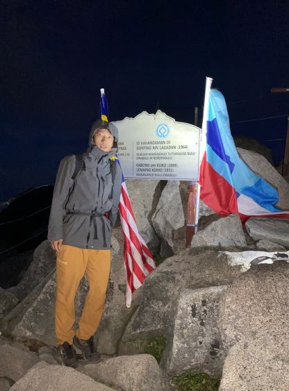
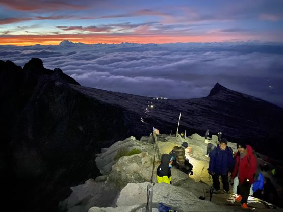
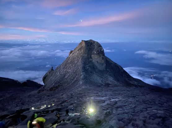
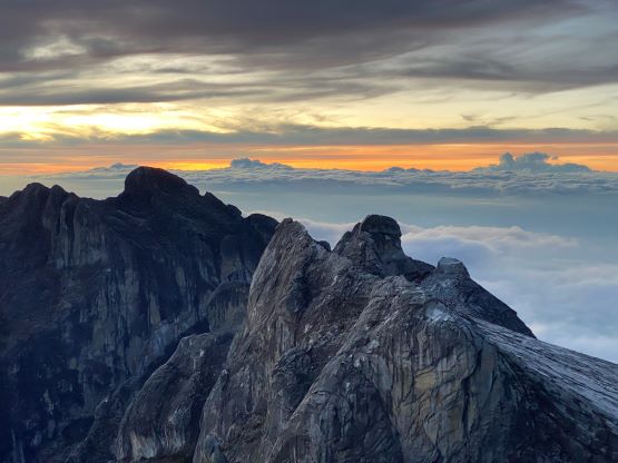
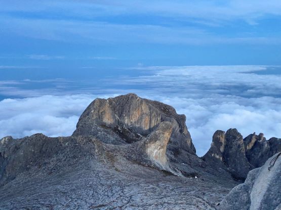
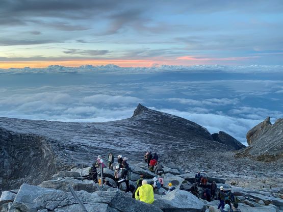
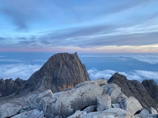
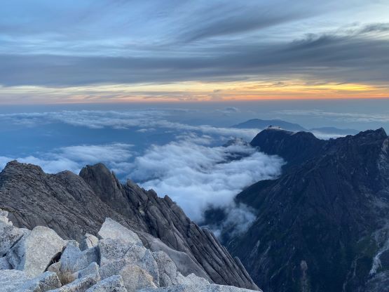
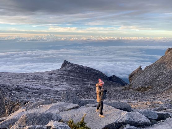
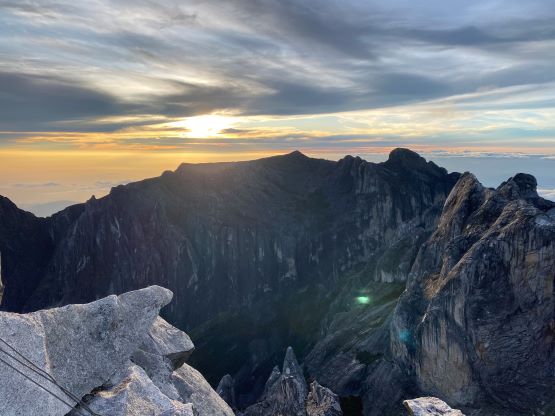
The other two woke up at 1:30 am to be ready to leave at 2:30 am, and that’s the time when everyone else would leave. We had communicated with the guide in the previous day that we wanted to leave later, and the agreement was 3:30 am. I would have called 4 am or even later, but the officials at the uppermost checkpoint would turn around anyone that hadn’t shown up at 5:30 am and we didn’t want to take any risk on that. It turned out that we were way earlier for that deadline and by that checkpoint we had already passed half of the gang ahead. Above the checkpoint the route traverses onto the endless granite slabs and a juicy rope had been fixed all the way to the summit. The terrain was mostly class 1 but the rope served nicely as a guideline in the dark. Adam and I on-purposely slowed down to the maximum possible extent as we sensed that we’d be summitting another important mountain in the dark, but we still ended up summitting in the dark about 1 hour before sunrise. There were several groups ahead of us and they opted to wait for the sunrise, so we would do the same. The only difference was that we didn’t bring enough warm layers. After about 20 minutes Adam gave up on the sunrise and went back down, but I managed to shiver through another half an hour until the show’s over. The correct starting time for us should be 4:30 am, 2 hours after the gang’s left. It’s also worth noting that the true summit boulder lies outside the fenced area behind the summit congratulation sign. I hopped over the fence to stand on the highest ground, but within a minute the guides (even from the different groups) forced me to go back in.


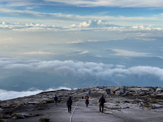
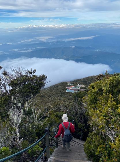
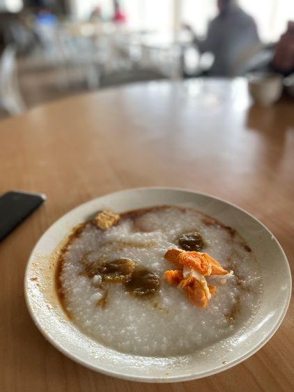
I eventually decided to descend and I mostly jogged down the slabs. The trekking poles would not be very helpful on the smooth slabs so I stored one of them inside my pack and carried the other one. The guide had already gone down but was waiting for me at the checkpoint, and I caught up to Adam about 100 m from the guesthouse. We went straight back into the guesthouse and the highlight was again, their food. The buffet breakfast was plenty enough for us. Adam was keen to descend but we were told that the earliest bus to drive us back to Kota Kinabalu would not leave until 1 pm, so what’s the point in rushing. I decided to sleep a couple hours in the guesthouse as I’d rather be lying down than sitting, but by 9:30 am I could no longer sleep anymore due to the noises created by the other climbers. I quickly got up and dashed the 1400-m descent with the guide, in a single shot without any break. I got down in 1 hour 25 minutes and my round trip time was just over 8 hours excluding time spent in the hut, but including the hour-long summit stay. I think this peak is totally doable as a day-trip but the park’s regulation makes it difficult if not impossible, and certainly not very worthy as summitting at midday would almost guarantee to be in the clouds with no view. The company had been extremely helpful that they ended up finding a vehicle at 12:20 pm. I was not anticipating that due to the rigidity in this country so that was a pleasant surprise. In the end despite the over-price I would still recommend this company due to the ability of their guides and the willingness to customize based on our own needs. By comparison most climbers ended up not showing up at the park’s gate until 4-5 pm which would be 6 hours later than our time.