Mount Mtelo
January 1, 2024
3336m
Kenya
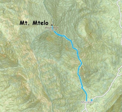
Mt. Mtelo is one of the “ultras” in the central/western Kenya. This is a fairly popular objective in the area with at least two trails to the top. Both of these trails originate from the village of Mungat to the south-east, and hikers can combine them to make a loop. Over the past few years at least two parties from the international peak-bagging circle did this hike. Adam and Petter came here first just prior to the pandemic (unguided), followed by Deividas et al. guided by African Ascents. Rob W. and I decided to hire the same guide that the second group used (Julian Wright, the owner of African Ascents). Julian wasn’t cheap but we wanted to have the highest quality of service considering our ambitious schedule and the unpredictable factors in this part of the world. Alastair Govan from Scotland was also invited and would join our team from this objective onward. Rob and I had already done 5 peaks in this trip but Alastair missed out those due to commitments in the Christmas time.
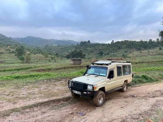
There’s one full travel day from Lake Baringo to village of Mungat and we would then stay two nights in Mtelo View Eco Lodge on the edge of this village. The driving was on a mix of paved roads and rough backroads, but we made quick progress this time. We collected Alastair at around noon and tackled the final ~20 km rough roads together. The drive to the village of Mungat out of the floor of Rift Valley was very steep and rough. The first section wasn’t actually too bad as there were two strips of pavement on the road. Julian was able to align the wheels to these paved strips so the steepness wasn’t really a problem. The flatter stretch after going over a pass was on the other hand, very rugged. The Landcruiser and Julian’s excellent driving skills were both needed here, and even so we were crawling at a pace not much faster than walking. Nevertheless we made to the village and found our lodge. This was a very nice place to stay with private rooms, hot shower and electric outlets. The only downside was the lack of WiFi (not surprised), and the lack of cell reception. I was only able to catch sporadic 3G reception and the speed of the internet was not quite enough to get things done. Nevertheless it was better than no reception at all, so I wouldn’t complain. The dinner wouldn’t be ready until 7:30 pm so I went back to the room and took a nap. Meanwhile Alastair and Rob went out to watch a football game. I wasn’t quite interested in that and was rather tired. There wasn’t a ton of surplus in the dinner’s menu but the chicken was great. There was also a family of cats sharing the chicken with us.


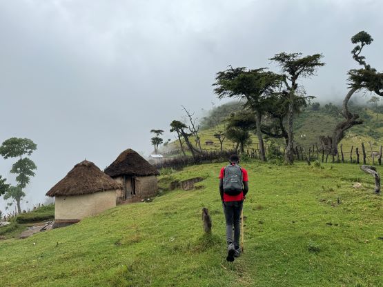
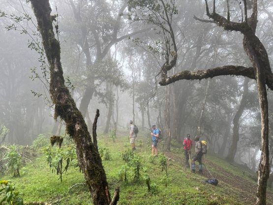
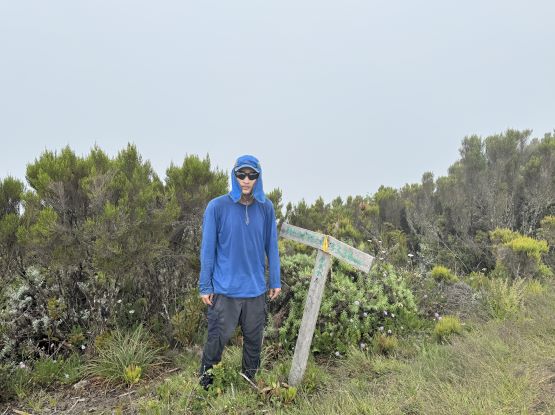
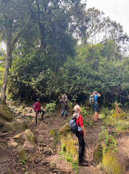
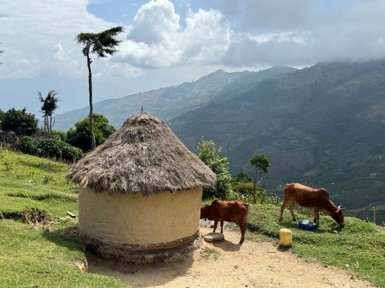
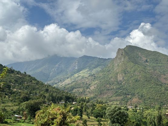
The plan was to have breakfast at 5 am and start hiking not much later than 6 am, but it was raining quite hard by the time I woke up. I nevertheless showed up at the kitchen and the breakfast would actually be served on schedule. Rob and Alastair was nowhere to be seen, but Julian showed up a few minutes after 5 am. Neither Julian nor myself was stoked about this weather so the decision was to sleep for 2 extra hours and show up at the kitchen at 7 am to reevaluate things. I knocked Alastair and Rob’s rooms and passed on this new decision. We were mostly on the same page here as nobody liked to hike in the rain. The rain thankfully stopped in about an hour but I kept sleeping until the said 7 am time. We all dressed up properly, had breakfast and departed in about an hour. It was overcast and the peak itself was engulfed in the clouds, but it was not raining and that’s all we needed. Julian had found a local guide (Hopson) and Elijah would also accompany us to the summit, so among Rob, Alastair and myself we had three guides for this all-on-trail class 1 hike. That was quite a treat for the New Year’s Day.


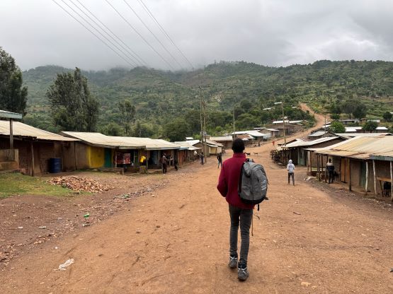
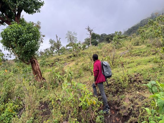
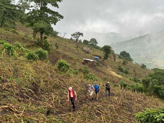
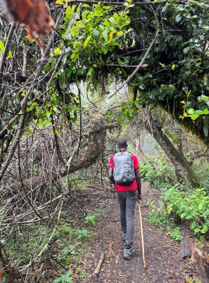
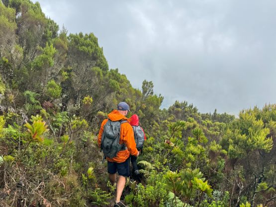
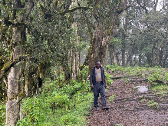
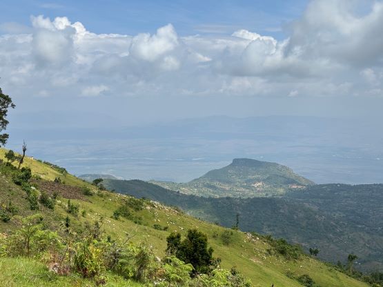
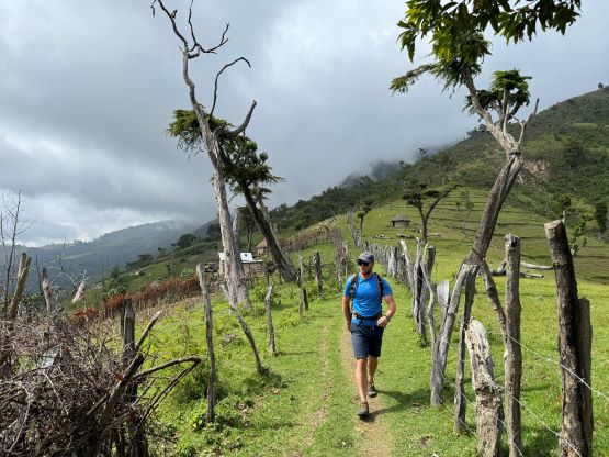
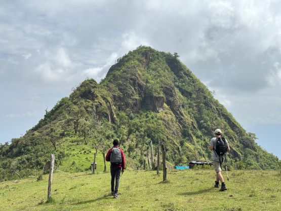
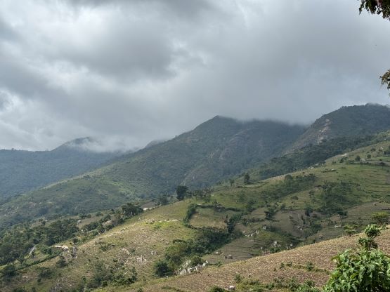
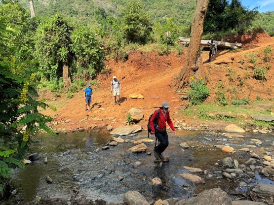
We followed Hopson’s lead plodding through the village of Mungat and then onto the farm roads/trails. Between the two routes we would take the SE Ridge both ways as our departure was already at least 2 hours later than planned. The SE Ridge is the shorter of the two routes. After a while of plodding on flat terrain we hopped across a stream using rocks, then the grade finally picked up. The air was humid and saturated, that I opted to wear shorts and still decided to take the shirt off. I was drenched and we weren’t even moving that fast. We then had a long and gradual ascent to the 2400 m saddle on the SE Ridge. This saddle separates the main summit from the iconic-looking subsidiary bump further to the south. This unnamed sub-peak has right around 100 m prominence. The view was mostly non-existing as we did the entire ascent in the clouds but the best thing of arriving at this saddle was the sudden increase in the strength of reception. A few of us suddenly had 4G services so we were all on the phones for at least the next 20 minutes. Mine was still not strong enough to fully browse the social media but it was good enough to at least catch up on the news etc. Not having any sort of reception in New Year’s Eve meant there’s definitely messages to catch up afterwards.


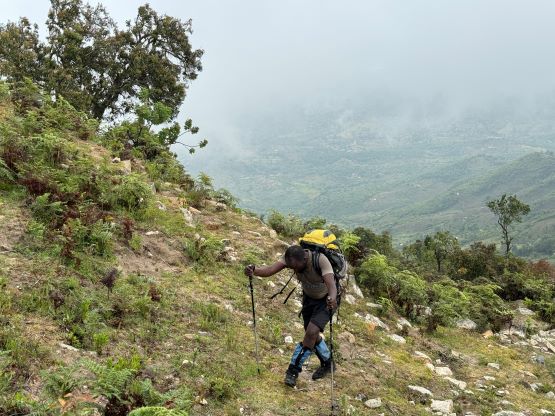
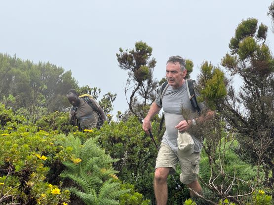
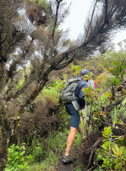
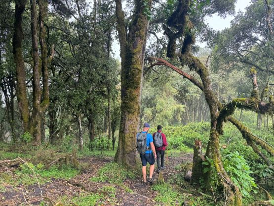
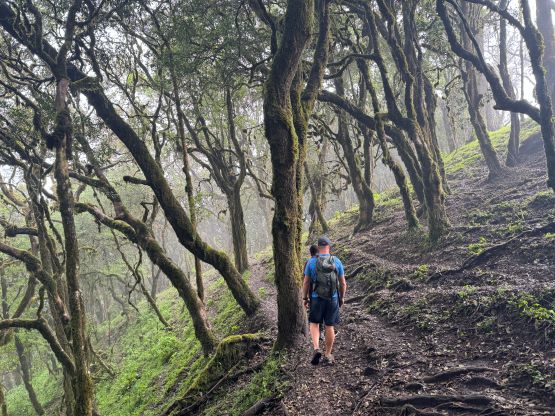
A while later we got into a cool-looking forest, but we had little time to appreciate the surroundings. We must keep plodding as the time’s getting on. Hopson was able to maintain a fast pace throughout, and this started to become challenging at around 3000 m elevation, especially for Alastair who had just showed up at this altitude without any kind of acclimatization. The final 300 m gain was mostly in some scrubs and the trail was slightly overgrown. At places we had to brush against the vegetation and some of them were thorny. I paid more attention this time and mostly avoided getting stabbed. There was no view whatsoever from the summit but we did ascend through some clouds layers. The UV intensity was quite high up there and we could even see patches of blue skies above.


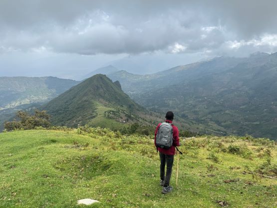
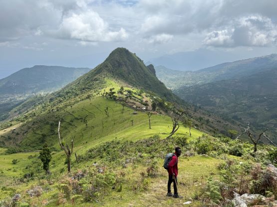
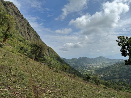
After about 20 minutes on the summit it suddenly started raining, which was surprising. I thought the rain’s done for the day and the weather would gradually clear up but I was wrong. The rain came quite heavily for a while that Rob opted to take his umbrella out again. I did not bring any rain gear except for a jacket, so I just needed to tough it out. Thankfully the rain stopped soon and the vegetation hadn’t got saturated yet. My pants were soaked but my shoes and the socks stayed dry. Lower down the sun gradually came out so we took numerous long breaks. Julian was showing us some plants and birds but I’m not a biologist and not interested in those anyway. We were able to catch glimpses of views down into the Rift Valley before committing to the steep descent back to the village of Mungat. Our round trip time was under 7.5 hours and the pace was quite leisure on average. There were certainly some sections where we pushed the speed, but for the most parts we were walking quite casually. The rest of the day was then spent in the Eco Lodge. There was unfortunately no more hot shower but the cold water would do. The lodge even offered us laundry services (first time ever in Kenya), but I had already done most of that myself. I gave them the pants and the socks as those were dirty enough that I couldn’t be bothered to wash them myself.


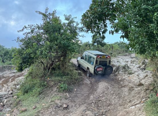
On the following day we woke up “leisurely” at 5:40 am to be ready for breakfast at 6 am. The weather was clear but there must have some rain overnight as the vegetation was wet. The morning routine was a bit slow but we were not supposed to be in a hurry anyway. Driving out of the Mtelo area was quite challenging given the muddy conditions. There’s one steep hill that we tried twice but failed twice. The rest of us had to get out while Julian gave it a final go, using as much momentum as possible. The result was positive but had it rained anymore overnight we could have been stuck here for at least a few more hours. I was honestly not expecting this kind of adventure. We then gingerly drove down the steep and winding roads back into the Great Rift Valley. The objective for the day was Kamelogon and there were more unknowns regarding the road condition and feasibility.