Monte Cimone
August 2, 2025
1577m
Emilia-Romagna, Italy
Monte Cimone is a standalone objective in the SW corner of Emilia-Romagna region of Italy and boasts over 1500 m prominence and 160 km isolation. This is not part of the Alps anymore but rather extends into Apennine Peninsula. Needless to say, the weather could be very different than the Alps. There’s some intense thunderstorms sweeping across the Alps on the 3rd day of this trip so we could either wait in the hotel and McDonalds to ride out the storms, or drive somewhere terribly far away to escape the system. Adam and I picked the latter. I spent at least an hour researching and checked various forecast models at least 50 times and eventually picked this “simple” Ultra, more than 6 hours of driving away. The gas and toll would be ridiculously expensive in Italy but least I wasn’t going to pull the mileage into my own vehicle, so who cares. The weather was also not that great down there but all models agreed with some chances of sunshine in the evening hours.
We checked out at around 10 am and started the long drive westwards and then southwards into Italy. The border crossing was also without event and there was no passport checking nor questions asking whatsoever. About an hour after entering Italy we were slammed by one thunderstorm after another. I had to turn on the wiper to the fastest possible mode and it wasn’t still not enough. This reminded me the old day in Alberta Rockies where thunderstorms are quite a “thing” in summer. Another few hours later I was too tired to continue so Adam took over, driving up the winding and never-ending roads into the hills. I fell asleep right away but when I woke up I noticed some more intense thunderstorms not far from us to the north. This was contrary to the forecasts and sure enough, the forecasts had changed. The objective was now on the very edge of another storm and we could hope that the storm would give us a miss. This was fortunately the last storm of the day so we could have waited for two more hours and aim to summit at sunset, but that would mess up our itinerary afterwards. Adam noticed that the ski lift was still operating but would be closed in 20 minutes, so we quickly found a spot to park (away from the crowds so we didn’t pay) and geared up for some possible rain. It was sunny to the south and stormy to the north, and we were supposed to go west.
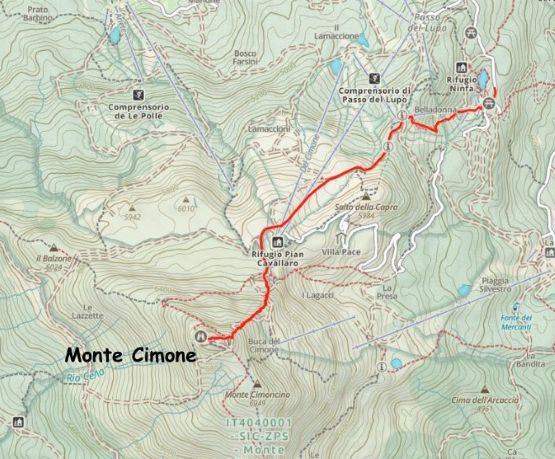
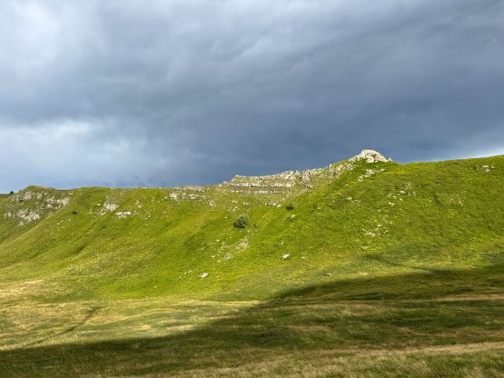
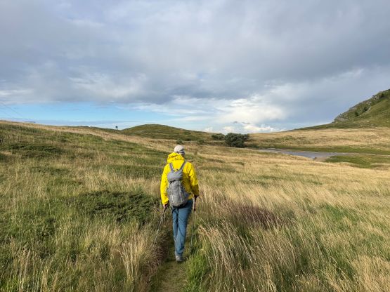
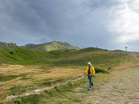
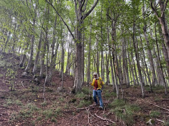
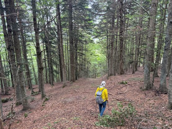
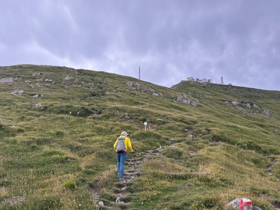
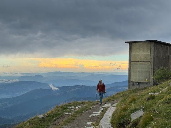
There are several lifts on the lower flanks of this mountain but only the lowest one was in operation. This would still give us 200 m of benefit and the cost was only 5 EUR per person so why not. After exiting the lift we encountered some gusty head winds and we could definitely see some lightnings to the north, but it did seem like the storm was not moving towards us. We marched up following the ski resort’s roads and then took a short-cut trail towards Rifugio Pian Cavallaro. The rifugio was positioned on top of a P10m bump so we didn’t actually check it out, but it could be used as an emergency shelter if the storm did come our way.
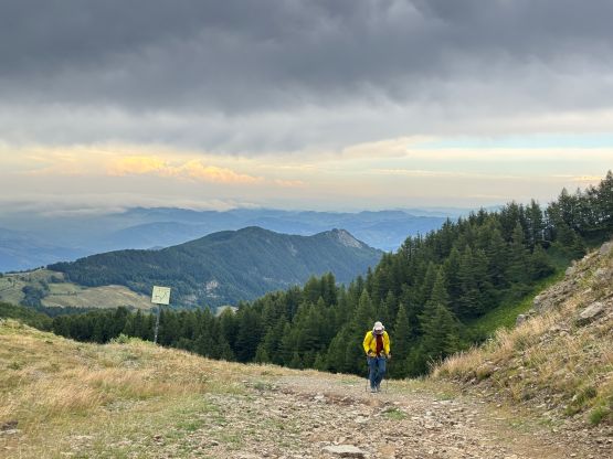
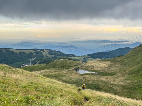
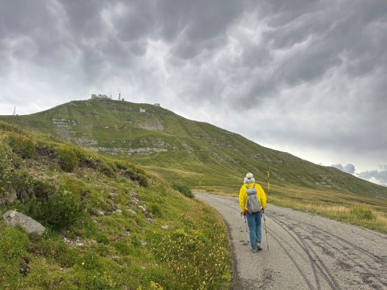
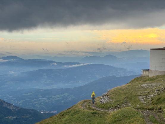
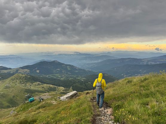
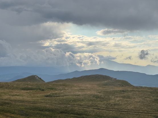
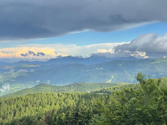
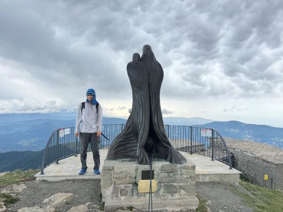
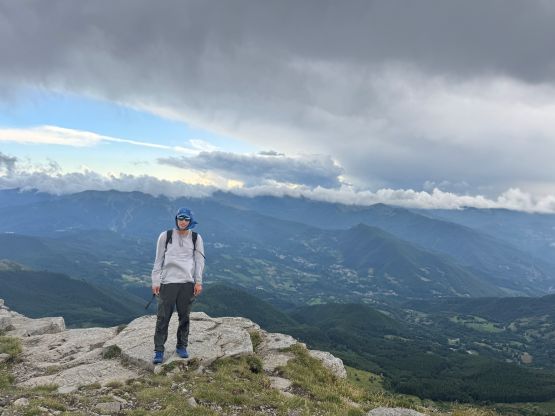
We still had over 300 m elevation gain left and Adam proposed that we should ignore the “standard route” and go for the shortest possible way, that was to ascend straight up the spine of the NE Ridge. I agreed as I could see trails on the ridge and also on my Gaia map. We had no idea why no one else took this route, at least according to the selected trip reports we had read on peakbagger.com. The trail was quite good albeit steep. I think our ascent time from the top of the chairlift to the summit was just under an hour and we stayed for at least 10 minutes up there soaking in the views. There were intense storms to the west and north but we were not in immediate threat.
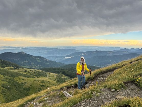
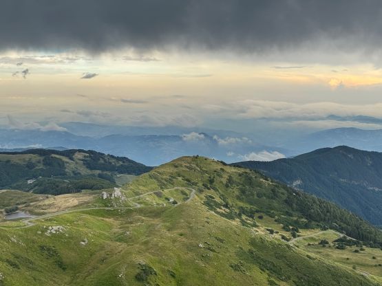

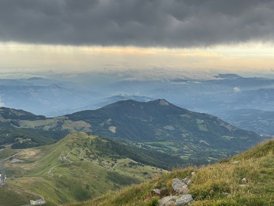
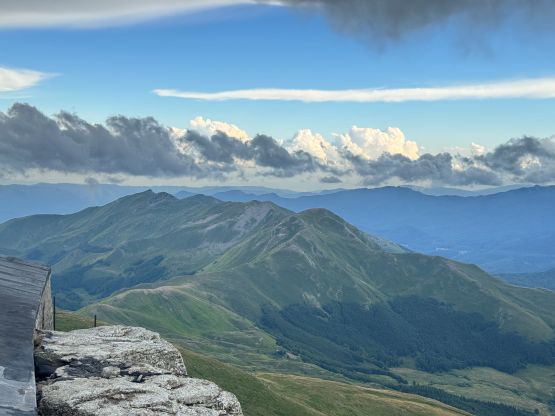
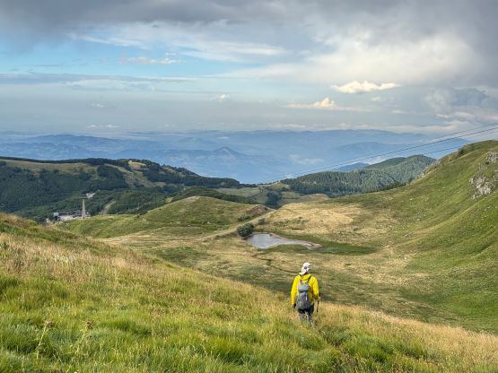
We actually got some excellent views due to the time of the day and the storms around so the plan was working out nicely. I followed Adam running down the NE Ridge and then we took our time leisurely walking back to the ski lift. The lift was not in operation anymore (not surprised) and the toy cars were also locked. We had no choice but to walk down that final 200 m to the trail-head village where we parked our vehicle. The trail was unfortunately in a terrible shape so we basically just bushwhacked our way down. The bushwhacking was more like “walking in open forest” so it wasn’t too bad. Our ascent was 500 m and descent was close to 700 m and our round trip time was under 2 hours. The weather was promising in the Dolomites on the following day so we had another 4 hours of driving to do. Adam and I had to take turn doing that but we did eventually position ourselves in the vicinity of Trento by 1 am. There were several easy “Ultras” to choose from and we picked Monte Bondone, the easiest of all.