Monte Bondone and Cima Palon
August 3, 2025
2180m
Trentino-Alto Adige, Italy
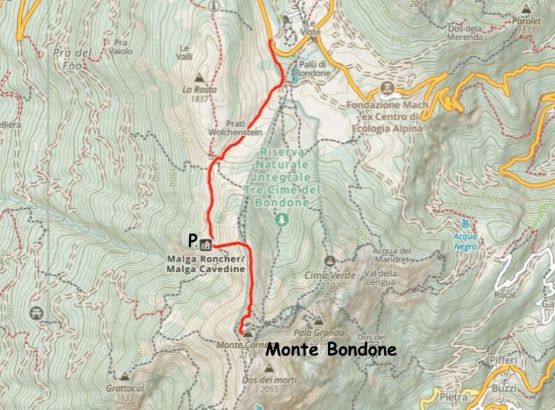
Monte Bondone to the SW of Trento might not be a “big mountain” in the Italian Dolomites but does boast over 1600 m prominence making it one of the “Ultras” in the region. This is arguably the easiest one in the vicinity as the standard route is nothing fancier than a “walk-up” and can be shortened significantly by driving to one of the higher starting points. This peak has another name “Cornetto” but I’m not sure which is more commonly used among the locals. Adam and I originally planned to follow James Barlow’s north ridge route but upon getting there, we discovered the unpaved but ungated roads that ascend much higher on the NW side of the mountain. In the previous evening we pitched our tents in a picnic area not far from the trail-head. The winds were howling and there were severe thunderstorms with lightnings every 20 seconds to the east. It was definitely freaky but we weren’t in immediate danger.
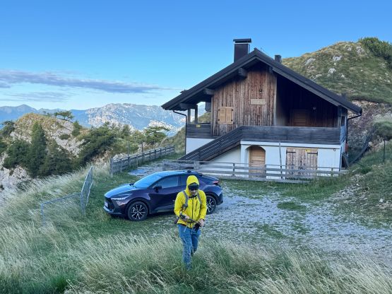
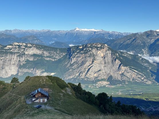
I triple checked the weather forecast and determined that we weren’t threatened until the afternoon, so there’s no point in doing an alpine start. We didn’t pull into the camping area until 1 am and we just did more than 10 hours of driving in the previous day, so desperately needed to sleep. We got up at around 6 am and started driving within an hour. We quickly discovered that the road beyond the supposed “trail-head” was not gated and the condition wasn’t terribly bad, so I immediately decided to drive us farther. Any advantage could be beneficial in this type of month-long, day-after-day mission so without any question I would push the car to the highest possible place. There was some cobblestone pavement to assist the steep ascent to the pass between Monte Bondone and La Rosta but then the road just kept delivering. I noticed a rifugio on the west side of our objective that could shave off another kilometer of walking each way, so kept pushing further. We did encounter some rough section and hit the undercarriage a few times, but managed to drive all the way to that rifugio without damaging the car. I would call this road “easy 4WD” and definitely wouldn’t recommend for a rental 2WD without years of off-roading experience. I also don’t know if it’s even legal to drive the vehicle this far up because we saw nobody doing that. Everyone else we encountered a few hours later on the road was walking. By this point we had shortened the hike by more than 50% so we started to formulate plans for the rest of this day. There’s no way to sit out a sunny day in the Dolomites without adding in some bonus peaks.
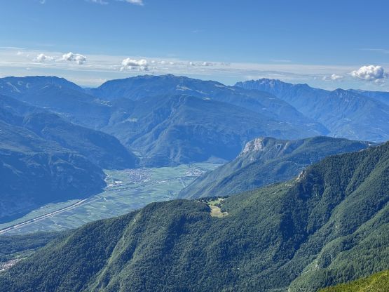
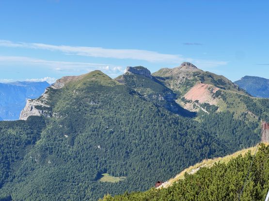
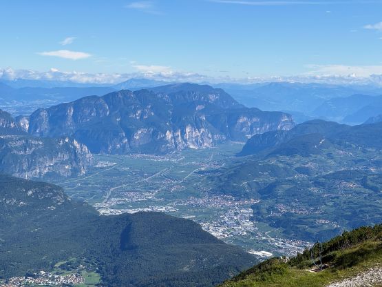
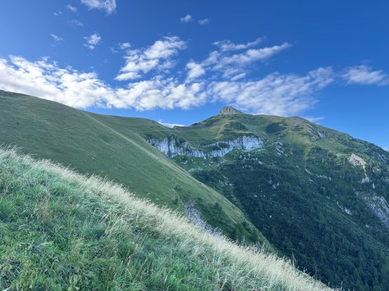
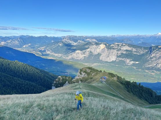
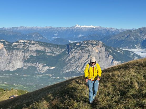
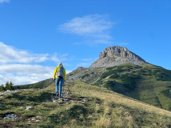
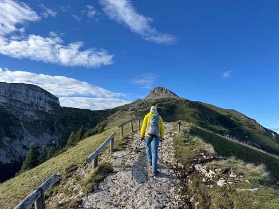
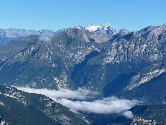
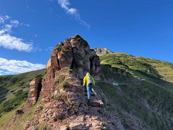
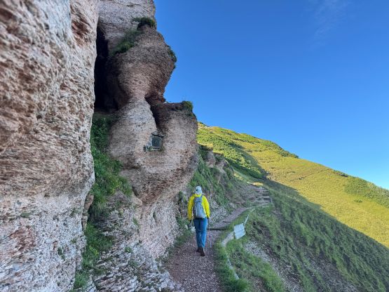
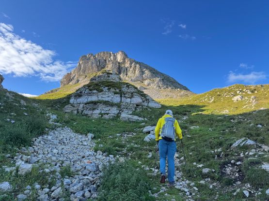
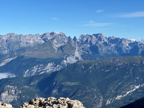
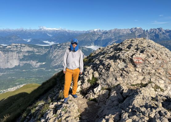
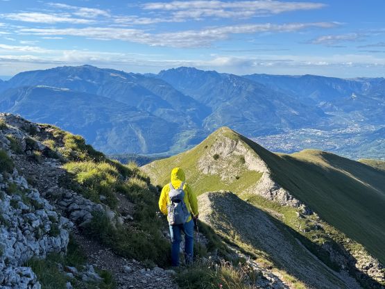
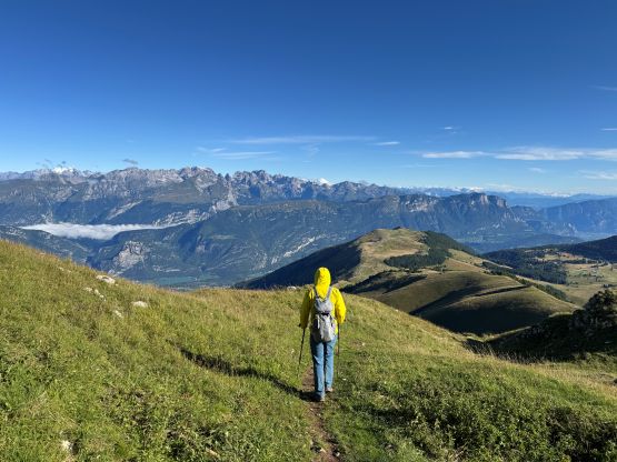
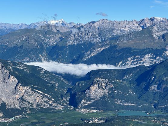
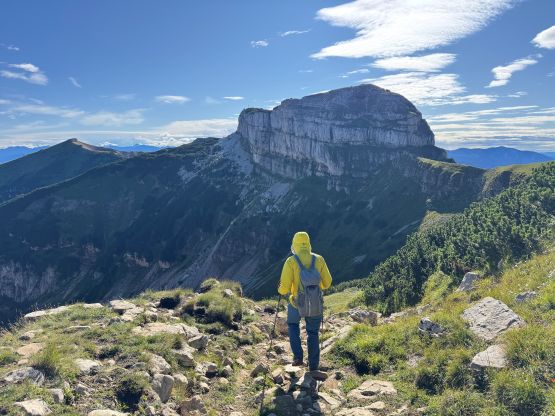
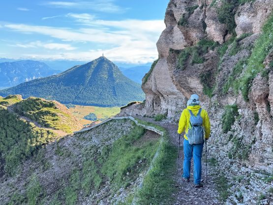
In any case we quickly started the ascent and donned most of the layers that we had brought in this trip. This was a chilly morning and the winds were brutal. There’s a trail shown on my map ascending from the rifugio to the north ridge and it sure exists. The trail wasn’t in the best condition but we were able to follow without issues. The grass was wet but I didn’t get my shoes fully soaked. The trail on the north ridge was in some much better shapes so clearly most, if not all folks come up the standard routes while doing the (supposedly) longer hike. The views were opening up drastically with Cima Brenta stealing the show to the NW, as I followed Adam’s lead towards the summit block. The route to the summit was more like a corkscrew as the scramble was done on the south side. There was only one move that I would classify as “scrambling” and the rest was just plodding.
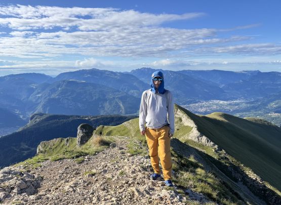
The winds were still howling so we couldn’t stay too long up there. We also had made plans for doing at least two or three extra peaks later in the day, and we had another 3-4 hours of driving eastwards to do afterwards, so we must hurry. In no time we were back at the vehicle. The crux was actually the drive-out but it wasn’t as tough as I thought. Thankfully we encountered no incoming vehicle, nor anyone in the rifugio ticketing us. We did encounter hordes of hikers on the road but they were all walking. I included the driving part of the route into the GPX track as I do believe one’s supposed to walk this road, but Adam and I are simply not rejecting any oppourtunity to shorten the outing.
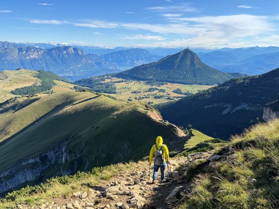
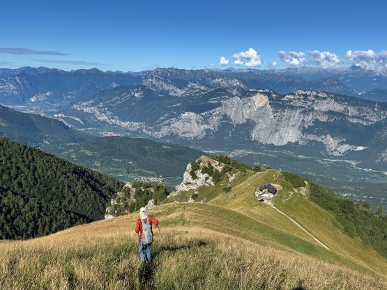
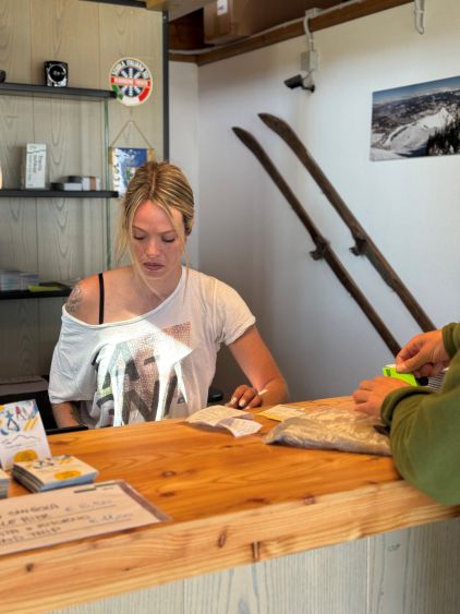
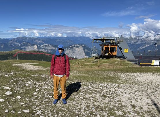
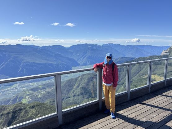
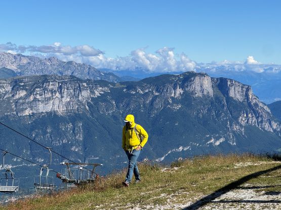
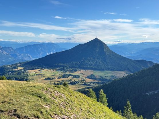
Adam noticed a P500m objective in the vicinity and I saw some ski lifts on the map. Combining our findings we pulled the immediate trigger to tag that peak. The drive to the village of Vason only took a few minutes and the ski lifts were technically not opened yet. We were about 20 minutes too early but they sold us the tickets anyway. The cost was 8 EUR per person for the round trip. Cima Palon is actually quite a popular hike so it felt a bit weird taking the chairlifts up and down without doing any work, but there’s just no way to squeeze this objective into the already-pushy itinerary otherwise. I also noticed a P1000m objective to the north with ski lifts and Petter Bjørstad’s trip report (in 2025!) confirmed our finding. So that’s where we were heading next.