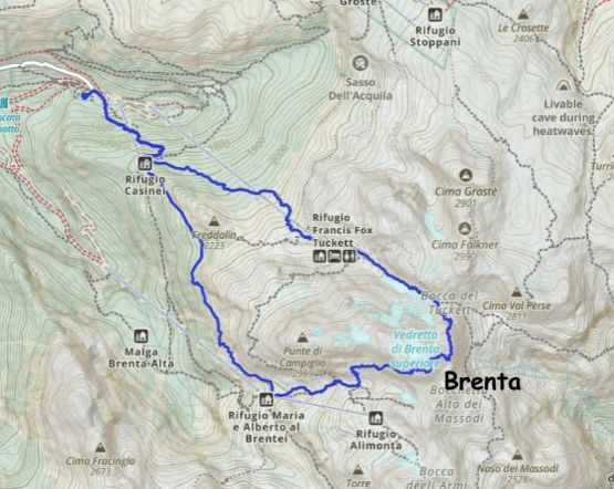
Cima Brenta
August 13, 2025
3152m
Trentino-Alto Adige Region, Italy
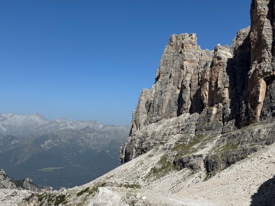
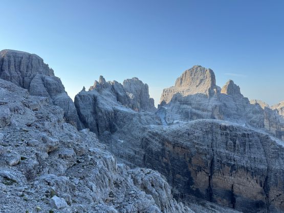
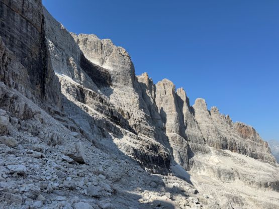
Cima Brenta is the highest peak in the “Brenta Group” of the southern Dolomites, and subsequently boasts just over 1500 m prominence making it one of the 44 ultra-prominent peaks in the Alps. This is also one of, if not the hardest “ultra” of the Alps in which the difficulty does not come from the aspect of glacier travel. Unlike most of the other peaks I did in this trip Cima Brenta made me spending at least an hour or two researching. The online “beta”, at least in English, was not that great but I was able to put together the pieces by using Rob Woodall/James Barlow’s trip as well as the SummitPost page. My preliminary plan was to take Woodall/Barlow’s NE Ridge descent route as the way to go both up and down, together with Erica and Caspar and maybe Adam, but the plan changed at the very last minute. The NE Ridge has a technical notch near the very top but the majority of the route is Grade B ferrata, whereas the other standard route (South Face) has no ferrata but plenty of exposed 4th class terrain with tricky route-finding.
The weather had been excellent for at least a week so I needed to take full advantage of the window, doing at least one important objective each day. In the previous day the 4 of us together climbed the west ridge of Marmolada and then we had to drive 3+ hours to the trail-head of Cima Brenta above the village of Madonna di Campiglio. The last few kilometers was a very narrow and busy singletrack and we had some issues with the incoming traffics. There’s even one ambulance picking up one injured climber or hiker. Adam and I drove straight to the destination and still didn’t get there until 8 pm so I wasn’t surprised at all that Erica and Caspar couldn’t make it in the end. Erica also suffered from some food poisoning, and Adam was also not feeling it by the time the alarm went off at 4:20 am. Down to myself I spent at least 20 minutes at the very last minute to put together the original south face route because that’s the way to theoretically avoid any real 5th class climbing. Without a belayer I didn’t feel comfortable having to solo that NE Ridge’s notch though in retrospect, I would be totally fine. I was definitely more comfortable dealing with 4th class choss with route-finding given my strong background in the Canadian Rockies. I carried Adam’s 30 m rope but did not use it.
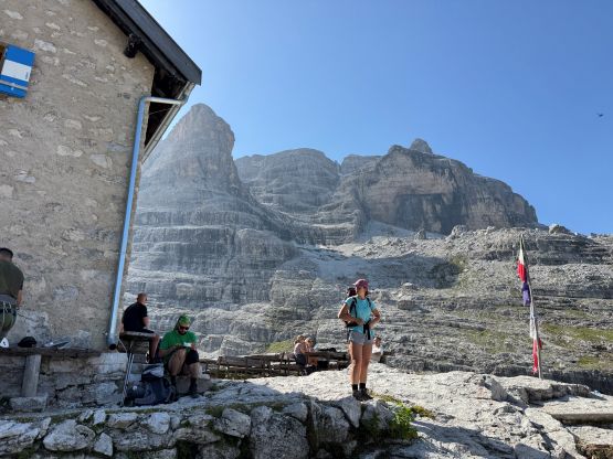
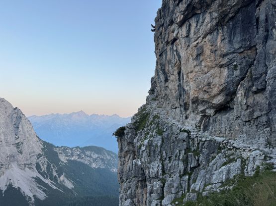
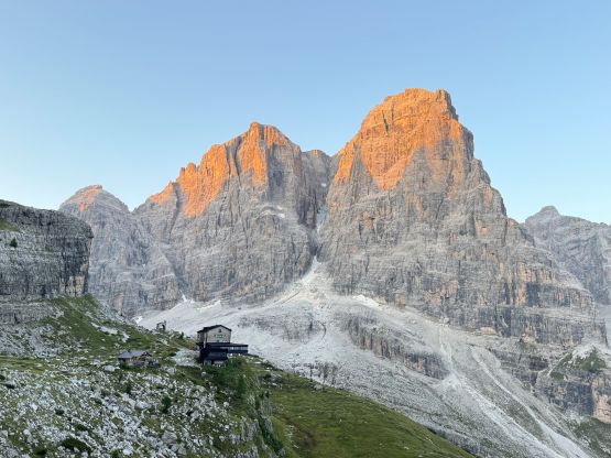
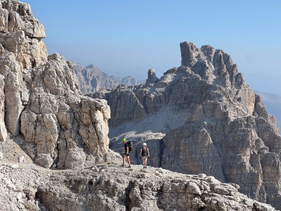
This peak also requires some significant physical effort, with the net elevation gain around 1700 m and there are plenty of up-and-downs and micro-terrain. With a heavier pack I opted to plod at a slower but more steady pace. I reached the first hut (Rifugio Casirei) when it was just bright enough to not use the head-lamp anymore. I made a mistake right away thinking the lower trail to the right was the way. In fact that trail only leads to the outhouse so I wasted a minute or two. The fork came very quickly after and I took the right fork heading for the upper hut (Rifugio Brentei). This section traverses across some narrow ledges including one interesting tunnel in the wall. The views were excellent with the morning alpenglow but there were fair amount of up-and-downs. I would not be very happy if I had to go back via this trail because of that. One nice thing about soloing was that I no longer needed to take many breaks along the way. My first break was a few hundred meters above the upper hut to load up the water bottle in a not-so-great water source (but that’s the only source), and that’s basically it. I didn’t really have to stop for food for the entire ascent, and I managed the entire ascent in dark and/or shade so there’s also no need for sun protection until the very summit.
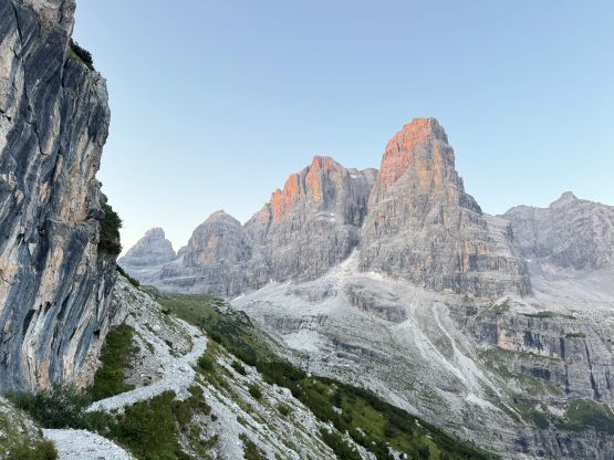
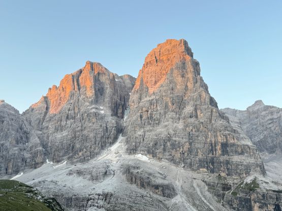
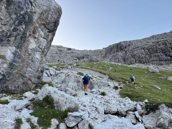
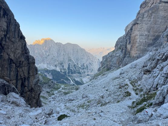
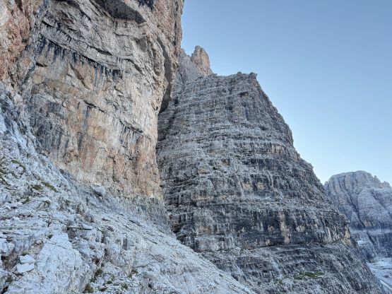
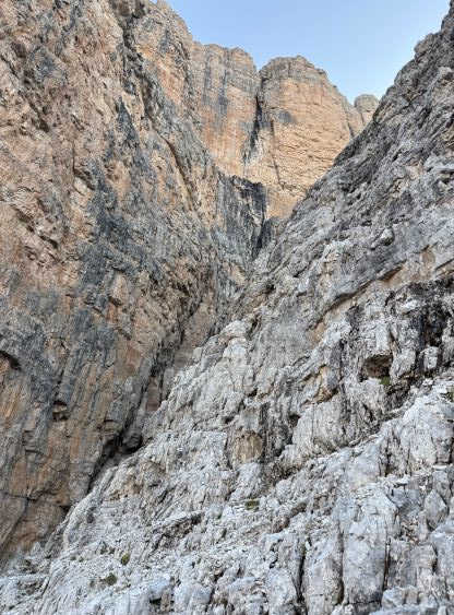
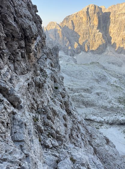
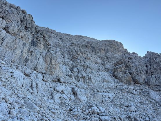
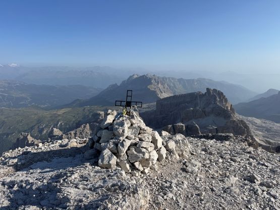
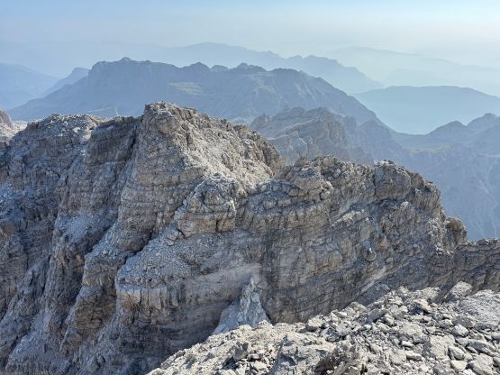
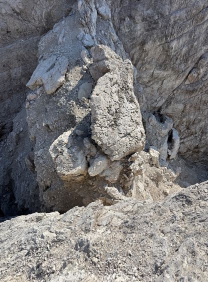
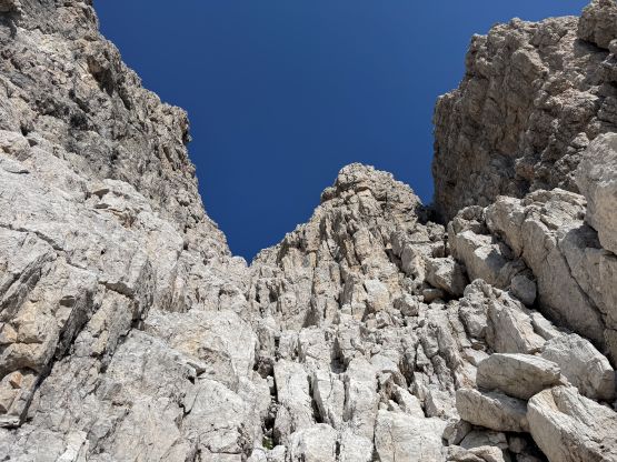
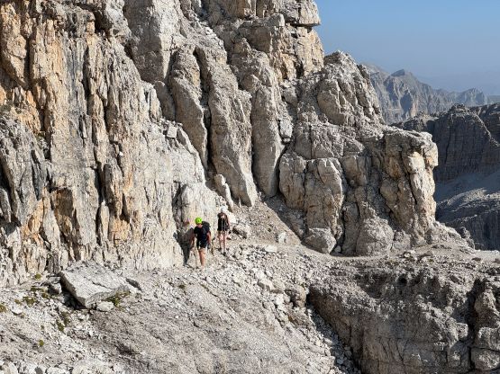
Shortly after passing the only water source I left the well-marked trail and picked up the faint climber’s trail heading for the lower headwall. I passed a few backpackers and it seemed like nobody was following me, so they were either doing hut-to-hut traverses or heading for Cima Tosa. The lower headwall was trickier than I thought with several stiff 4th class moves and harder-than-expected route-finding. I had to backtrack a few times in the micro-terrain and also consulted with the GPS multiple times. I took one trekking pole out after finishing this headwall as the next stage was a long traverse on simple ledges due climber’s right. There’s one tricky crossing of a deep chasm that required a very awkward crawling move or a leap after an exposed step-down. I chose the latter but that leap move definitely required some courage. I checked Rob’s trip report later and it seemed to me that they picked the former. I didn’t quite like that move because the feet were poor and the hand “holds” were slopers. There’s another similar but easier chasm crossing at the very bottom of the infamous 4th class ramp/ledges. This next stage was mentally taxing with sustained route-finding in micro-terrain, but didn’t give me much trouble as again, I’m from the Rockies and had been climbing in this kind of shits for over a decade. I stuck more on climber’s right side following the occasional cairns and bolts. There’s no ferrata nor artificial holds but I also liked this peak because of that. This kept the hordes at bay so that I had the entire ascent to myself. Higher up the terrain became mostly 3rd class so I had no clue how Rob and James missed the finish. There was definitely still fair amount of scrambling but the route was rather obvious for me. My ascent time was 3 hours 40 minutes and there was cell signal on the summit so I took my time there updating the socials and texting the friends. I spent over 20 minutes on the summit which sort of killed the round trip time, but that’s okay.

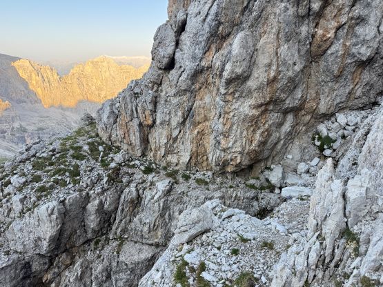
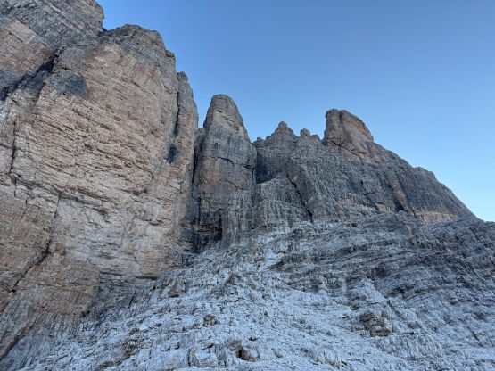
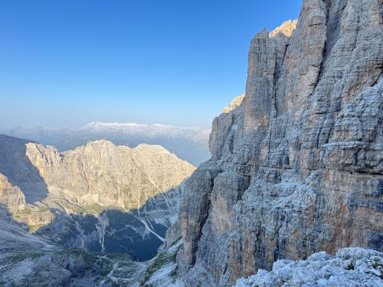

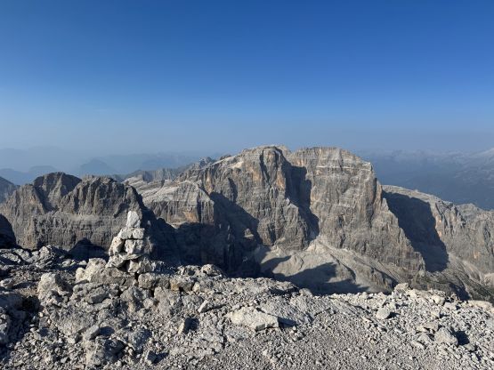

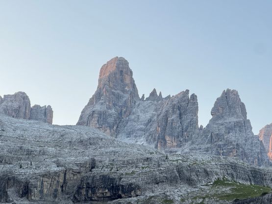
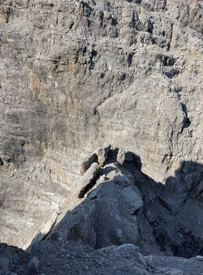
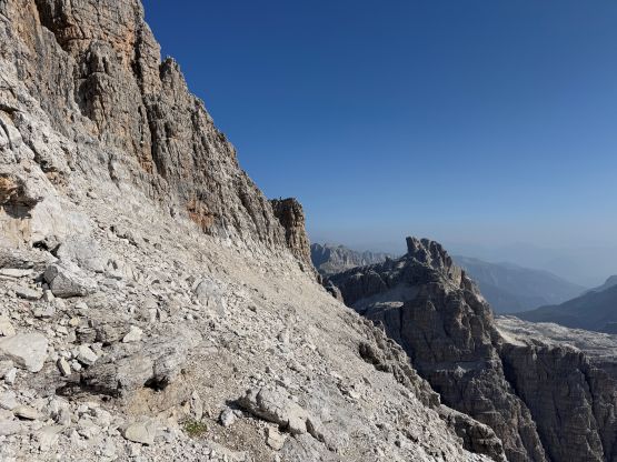
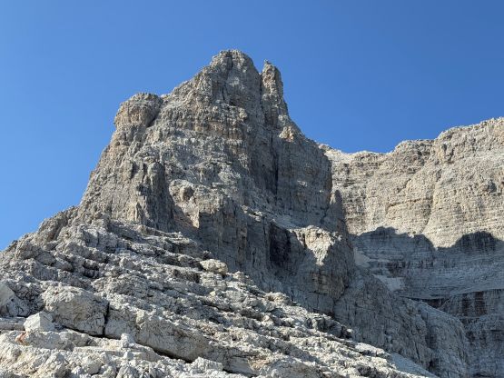
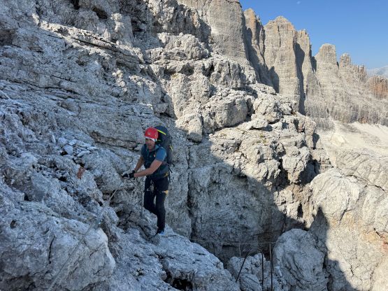
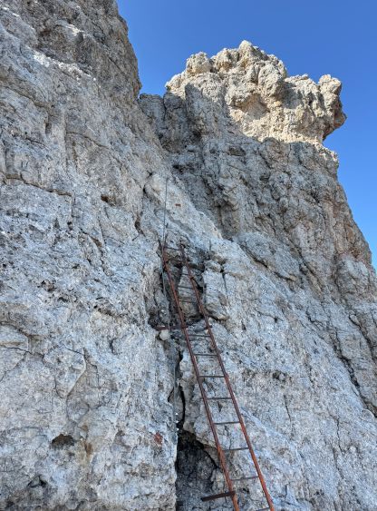
The in situ decision was then made to descend the NE Ridge because on one hand I didn’t quite want to down-climb all of the 4th class ledges unless I had no other choice, and on the other hand I did bring a rope to make a rappel or two, if needed. My thought was to rappel the 5th class notch on the NE Ridge but once there, I decided to down-climb it. There’s a batman rope assisting the down-climb but even if using the rope, the pitch felt like 5.5 ish. The last few moves had me using both hands grabbing the rope while pushing my feet onto the blank wall with no positive hold whatsoever. Without the rope this would be a proper climbing pitch. The rope was also very old and didn’t touch the bottom, so I don’t know if it would “always” be there. To get out of the notch I also had to solo a few tricky moves on slabs but there was a shinny bolt above the step. I could have easily reached out to that bolt and aid these moves using a sling, but I chose not to for the challenge. By this point the technical challenge of Cima Brenta was over, but I still had a shit ton of 3rd class terrain to deal with, with plenty of exposure. I was surprised by the length of the down-climb to just get onto the ferrata route. I also had no clue why they didn’t extend the ferrata to the very summit via this route. In any case I had James Barlow’s GPX so the route-finding wasn’t a problem. I did not meet other people until dropping down onto the ferrata line. There were about 10 groups going up but I doubt those guys would try the true summit. The ferrata down-climbing wasn’t too bad but there were fair amount of vertical terrain that needed care.

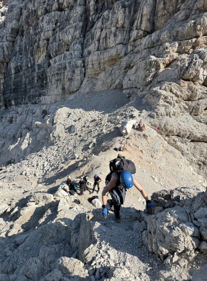
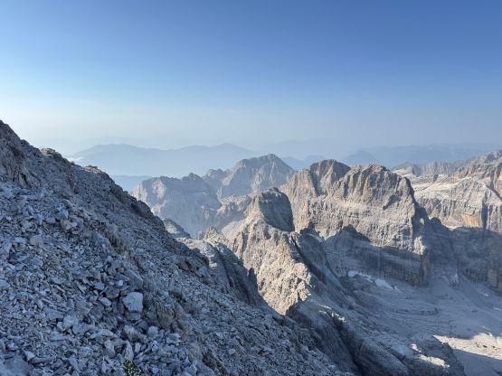
The scramble finished at the deep saddle of Bocca del Tuckett and it was there that I started to encounter trekkers that had no harness nor ability to scramble. I was anticipating some sort of snow travel down the valley from there as per James/Rob’s trip but this must be a very dry year. The middle of the valley had some patches of snow covered in black choss but that’s it. The snow was not continuous so I decided to follow the footpath on the side. This path was not pleasant at all with lots of hardpacked choss but again, I’m from the Rockies so I had no issue with that. I did make a dumb route-finding error by staying too high. I could have backtracked and wasted 10 minutes but opted to continue traversing until finding a reasonable way to scramble down. This added more 4th class down-sloping terrain into the trip, but it worked. It was then a scenic albeit long plod down to Rifugio Francis Fox Tuckett but I didn’t linger there. I thought I might as well make a good round trip time so jogged most of the way down after that. I did stop briefly at the very first rifugio to drink some water. My round trip time was 6.5 hours. The authorities had unfortunately closed the downhill traffic for this access road but thankfully the waiting time wasn’t too long. This was just a super busy area with lots of hikers coming, including several buses that dropped off hundreds of tourists.