Antelao
August 26, 2025
3264m
Veneto Region, Italy
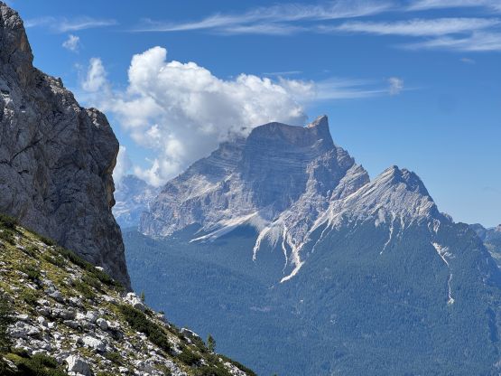
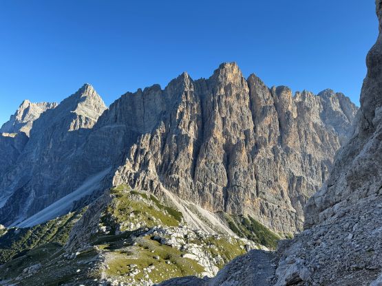
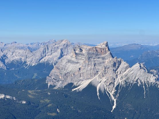
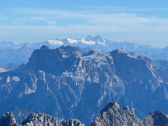
Antelao is the “King of the Dolomites” as well as the 2nd highest peak in the area, towered only by Marmolada the “Queen of the Dolomites”. This peak is considerably less popular and more challenging than Marmolada. The normal route, though not a roped technical climb, is also not a via ferrata climb and involves considerable amount of exposed 3rd/4th class scrambling on loose rocks. The nature of this route resembles more of the typical mountaineering in my home country (Canada) than in Europe. The physical aspect is not to be underestimated as well, as a car-to-summit ascent would involve 1900 m or 2100 m elevation gain, depends on whether one chooses to approach from the east side or the west side. Most parties would opt to spend a night or two in one of the huts but as always, I preferred to make a car-to-car ascent as I very much disliked the booking system of these huts. I also valued efficiency more than anything else. For the final 12 days of this trip I planned to bag 12 “ultras” so there’s no time for me to spend a night in a hut halfway up this mountain. For “beta” I used Petter and Rob’s trip reports as well as the SummitPost page.
Adam had decided to sit this one out due to the dangerous terrain and this is also too far of a drive and not difficult enough of a climb for Erica and Caspar to join, so I was down to myself having to solo a difficult peak again, which was completely okay. This time I did take my time reading Petter’s trip report (including photos linked), as well as Rob’s trip reports on peakbagger.com, and determined at the very last minute that I should be completely fine to travel light without a rope. I also checked the webcams and weather forecasts at least 50 times to make sure there’s little or no fresh snow on the upper route, as any presence of snow and ice would turn this into a difficult mountaineering ascent. I studied the two approach options and decided to try the east side approach from Rifugio Alpini. The benefit was to have 200 m elevation advantage but the downside was the uncertainties in the road access. Various reports indicated the need of a 4×4 vehicle but I decided to try nevertheless. The road was indeed difficult, but not terrible enough to be a show stopper for the rental 2WD. The final 6 km was sustainedly rough but I just had to be uber careful not getting a flat tire. Adam and I eventually parked about 200 m away from Rifugio Alpini and pitched our tents in fading daylight.

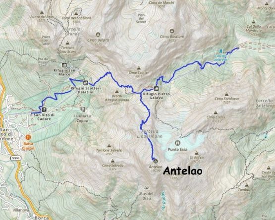
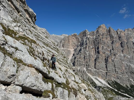
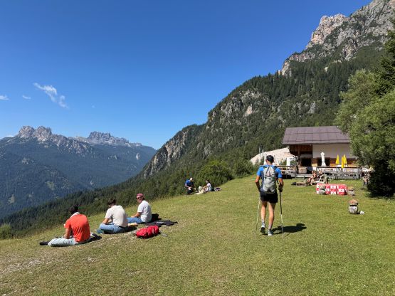
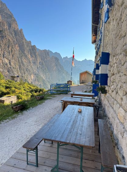
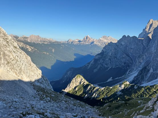
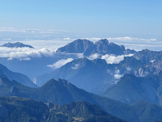
The next morning I got up at 4:30 am to start hiking by 5 am. Adam was also awake and his plan was to put more mileage into the vehicle to tag two of the easy P1200+ m “Ribus” in the vicinity. This rental car was already 2000 km overdue for maintenance but the servicing was not part of our responsibility. I very much doubt the company had ever come across drivers putting 10,000 km into the odometer in less than a month. I did email them about the concerns and we were currently waiting for their response. Adam preferred to minimize the chance of getting a flat tire so I would make a traverse across the massif and exit westwards to San Vito di Cadore where he would pick me up on paved roads. I liked this plan because then I would get to see two sides of this mountain, even though this meant an additional 200 m descent on my way out. There aren’t much worth noting about the approach to Rifugio Galassi that climbers usually use as a “base camp” for Antelao. I wasn’t pushing for speed but I kept a steady pace and did not stop for a break until arriving at the hut besides donning some sun protection.
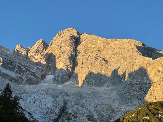
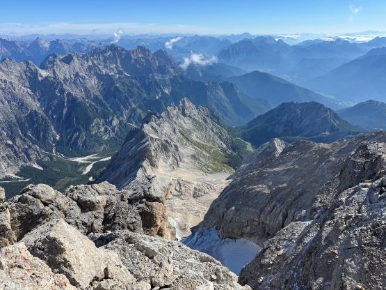
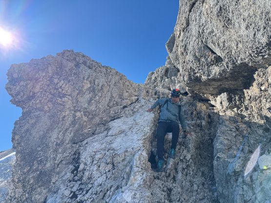
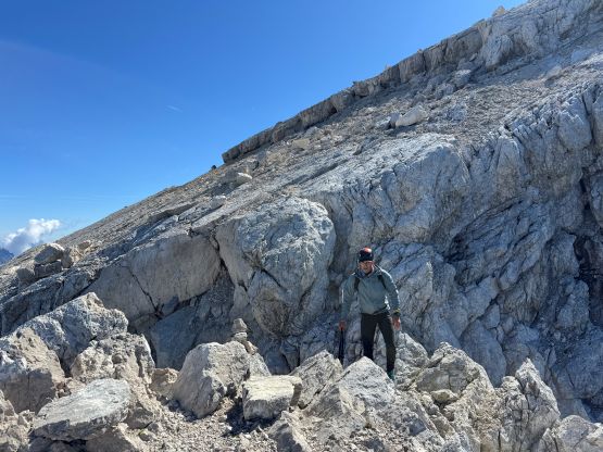
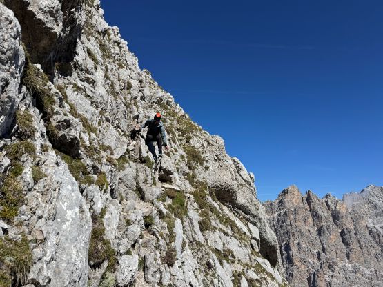
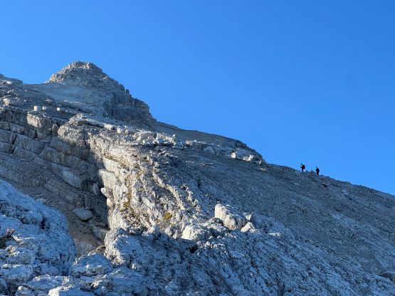
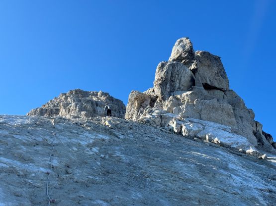
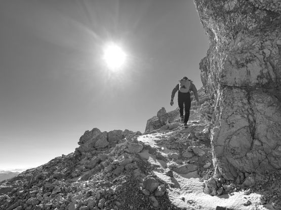
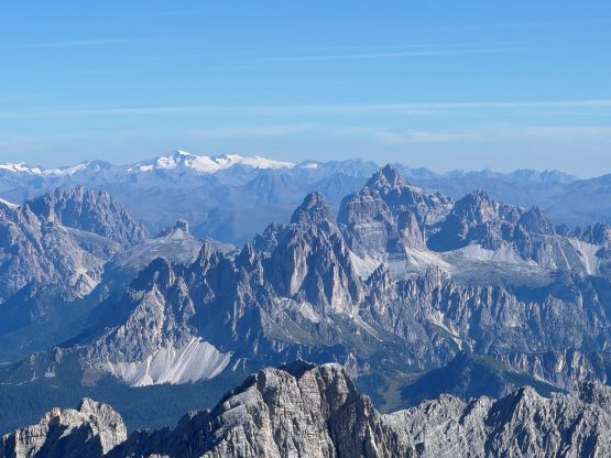
The only reason why I stopped at the hut was to clean my sunglasses. I’ve not someone who minds dirtiness but my sunglasses were getting to the point to obscure my vision and the hut was the most convenient place that had a soap with running water. I was never able to fully clean them up but could make do for at least a few more days afterwards. From the saddle at the base of the route I still had 1100 m elevation to gain and again, I was never aiming for speed but I disliked stopping for no purpose. I simply kept plodding at a steady pace and it was obvious that I was doing quite well on time. I could see a party or two ahead moving at a reasonably fast pace but I was definitely closing in the gap. The presence of these parties made me speeding up while traversing towards the ramps and ledges at the start of the scrambling sections. The route-finding on Antelao was very difficult that even with my Rockies experience I still got off route 3 or 4 times. I picked a difficult start right off the bat, which was fine, but the mistakes I made higher up required me to backtrack. As a result I did not catch up to the party ahead until way up high on the north ridge. These series of ramps and ledges to get out of the lower amphitheatre was definitely harder than I thought.
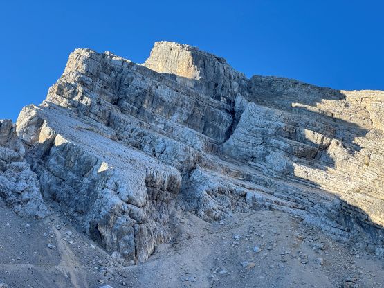
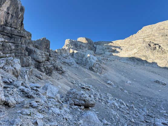
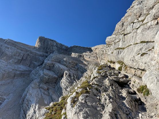
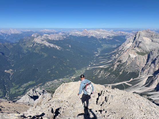
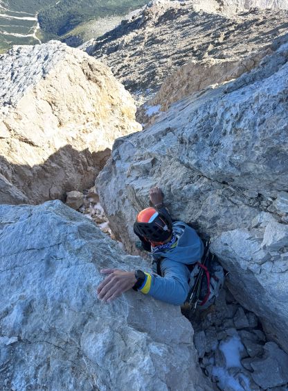
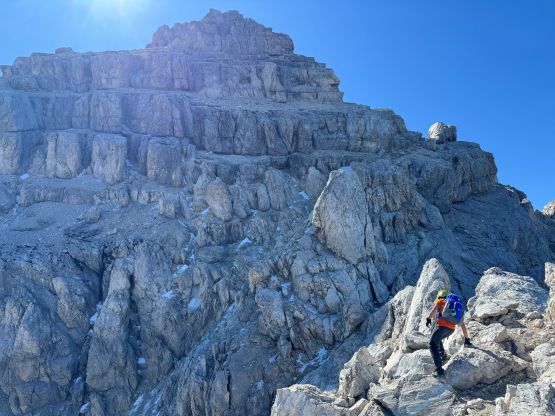
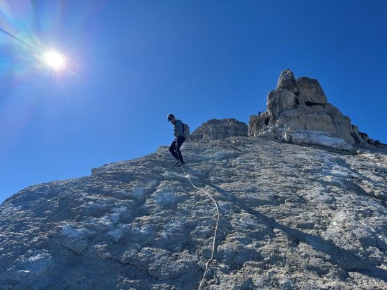
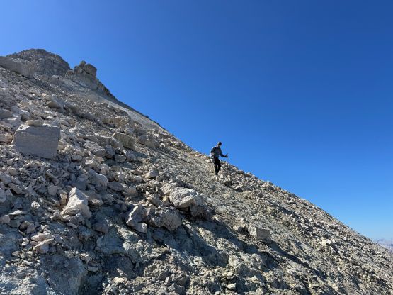
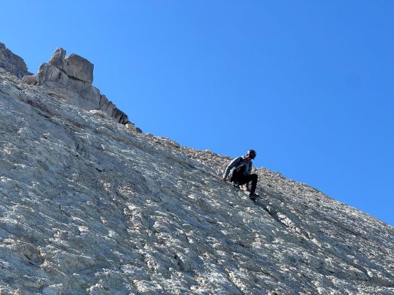
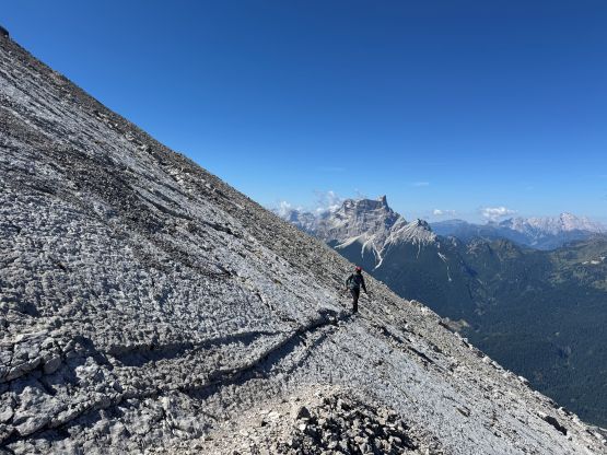
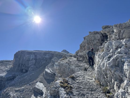
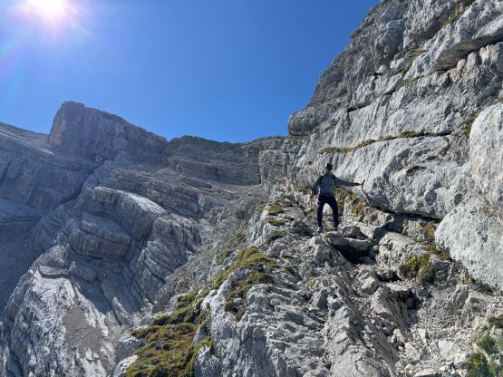
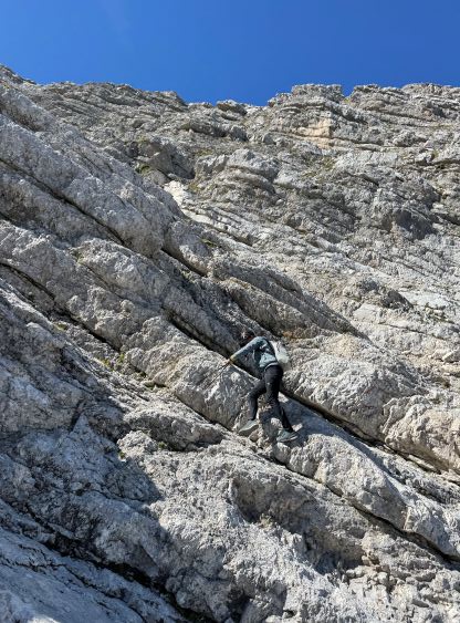
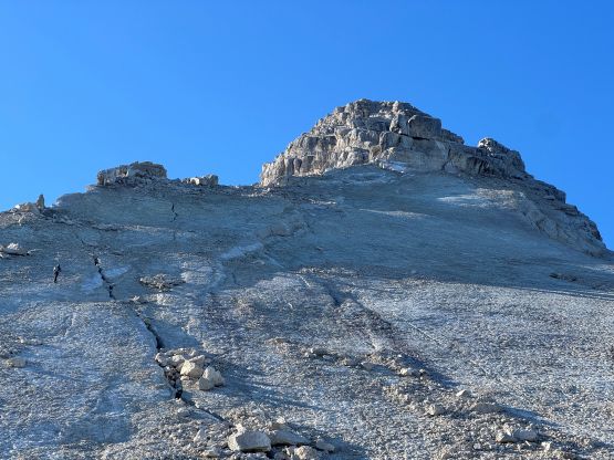
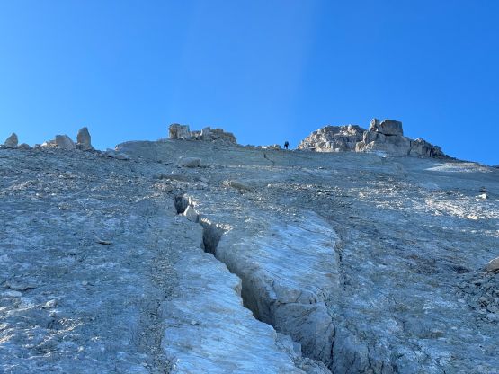
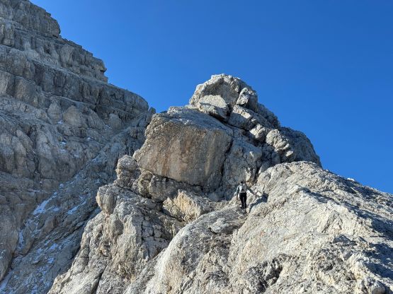
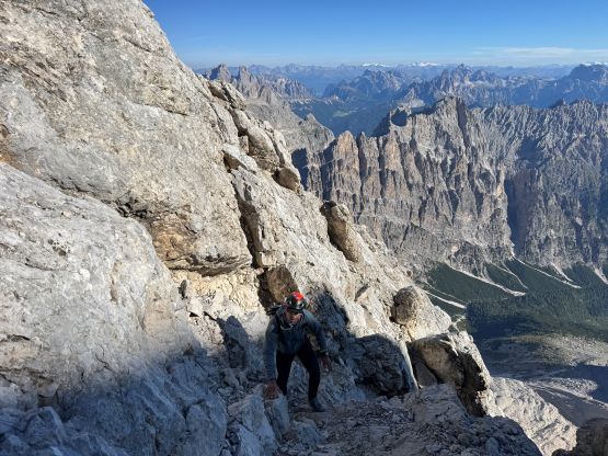
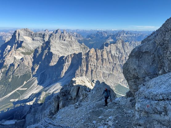
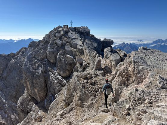
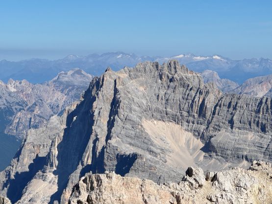
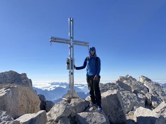
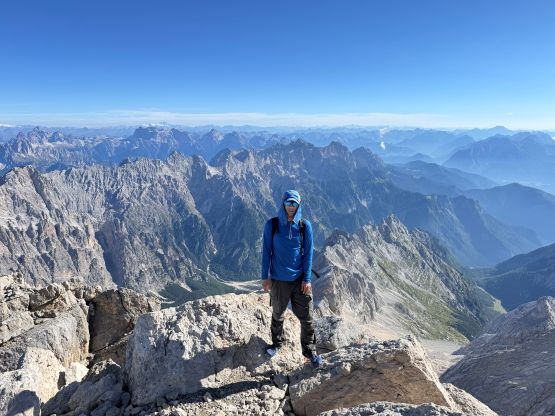
I then stayed on or slightly to the right of the crest of the ridge and the terrain was mostly class 2 slabs covered in some pebbles for a long period of time. There were a few narrow sections and at least one tricky rock band requiring a 4th class move or two. Overall I found this middle section of the route “not too bad” and I did successfully pass the party-of-two ahead. Not far after passing them I was at the bottom of the infamous slabs and this was the site of the 2014 landslide. The entire upper layer of the rocks were peeled off so the next 100 m elevation gain was mostly on smooth slabs covered in pebbles and dirt. I could totally see why Antelao isn’t attempted often because this section was quite risky in many ways. The scrambling was not difficult (mostly 3rd class at the maximum) but a mistake could easily be fatal. I came across the spot where Rob’s party got belayed by their guide. There’s already a fixed rope but I did not use it as I never thought it was really needed. I then caught up to the soloist ahead (Giovanni) who had been leading the gang on Antelao on this day. I more or less did the rest of the ascent and descent together with this guy. Giovanni had been working on the 83 3000ers in the Dolomites and our paces were mostly on par with each other. Above the slabs we started to encounter some fresh snow but there wasn’t much accumulation to be a problem. Giovanni and I altered leads for the complicated summit block and we did lots of exposed traverses, some 4th class climbing and a few backtracks before eventually standing on the summit. The true summit was a few meters beyond the religious cross so I went there to be 100% sure. My time to summit was 3 hours 20 minutes from the car. Again I was not pushing for speed but I basically did not stop. I never ate anything for the entire 1900-m grunt.


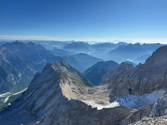
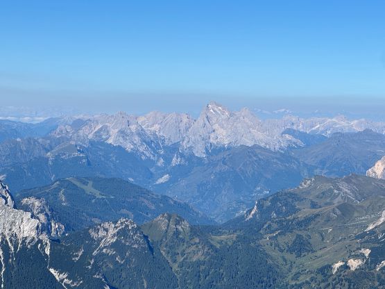

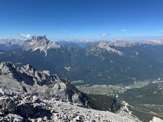
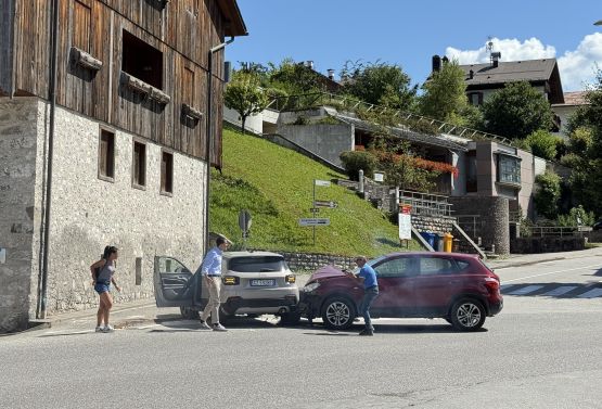
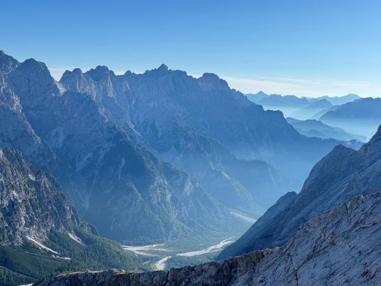
I caught some cell reception and informed Adam about my progress. Adam ended up switching the order of his objectives and went for Col Vicentin first before Tofana which was a tram-assisted “ascent”. If I pushed the descending pace then I would be waiting for Adam for many hours which I was not looking forward to, so I took a lengthy break on the summit soaking in the views. I also opted to descend together with Giovanni for simple reason of why-not. We again got confused a few times trying to descend the summit block but made a few backtracks and did a few of our own variations here and there. The slabs definitely required caution but wasn’t too bad. The ramps and ledges were also not too bad as the route-finding was much easier on the descent. It didn’t take us long to get off the difficult terrain. We then took a few long breaks including spending at least an hour in Rifugio Scotter in which Giovanni bought me some drinks. I then followed his lead down the trail and road system. My car-to-car time was 7 hours 14 minutes including all of the breaks so Antelao was really not that big of a deal. Giovanni gave me a ride down to the town of San Vito di Cadore where I walked around for some Italian experience. The most memorable observation was a car accident right in front of me. That accident caused a major traffic delay and not to my surprise, Adam got stuck in it. I walked north so save him from queueing in the traffic, and we resumed the northwards drive into Austria. I had already made the decision to do Hochkönig on the next day. I was definitely tired and I knew Hochkönig was one of the longer ones left on the itinerary, but we must take advantage of the good weather to get as many harder ones done right now as possible.