Gunung Merbabu
August 5, 2023
3145m
Java, Indonesia
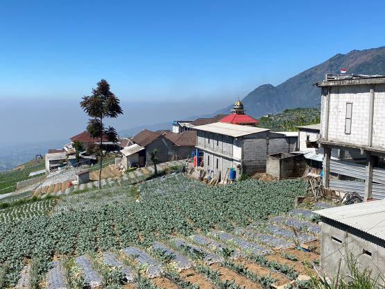
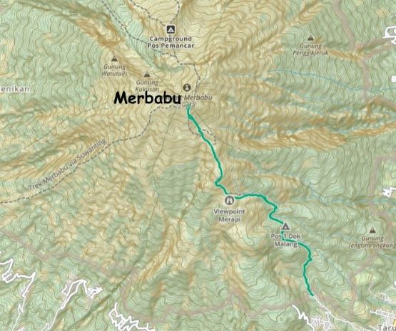
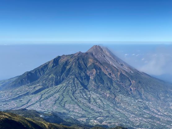
Gn. Merbabu is one of the more significant volcanoes in Central Java and because of that, this is also one of the most popular objectives in the area. This is also due to the close proximity to the urban areas. There are three major approaches from different sides and the detailed “beta” of each can be found on the Gunung Bagging website. Rob Woodall had taken the northern approach but it’s not the shortest way. The southeastern approach from Selo has the highest trail-head elevation. I usually take Rob’s route for granted because he usually does a shit ton load of research, but in this particular case I couldn’t understand why he went for the longer route. Adam and I had hired a private driver for a week so extra driving distances weren’t something we’d worry about. After making the decision to ascend from the Selo (SE) side we booked an expensive hotel about 1 hour’s drive from the trail-head. There were other hotel options closer to the trail-head, but we preferred luxury over the 1 extra hour of sleep.
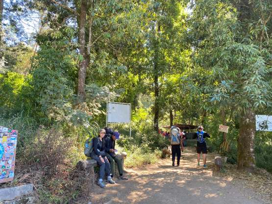
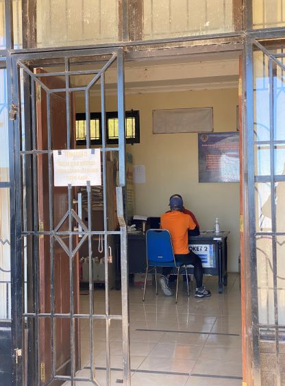
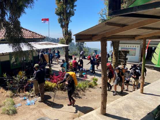
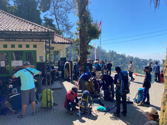
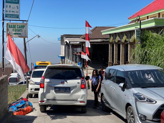
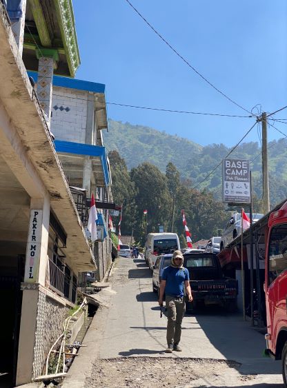
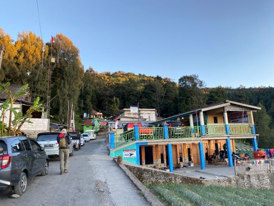
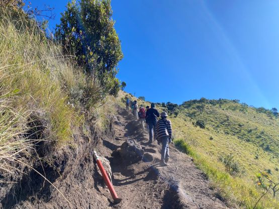
Our driver came to pick us up at 5 am and within an hour we made to the steep, narrow and winding roads past Selo. I thought we might have to get off the vehicle to hire some ojeks but our driver was skillful. This was definitely a sketchy road with so many blind corners and stretches that could be difficult, if not impossible to pass oncoming traffics. This was also a Saturday so hundreds, if not thousands of hikers would be going up, albeit a few hours behind our schedule, so the parking situation would only become worse later in the day. We had to park a few hundred (horizontal) meters below the drivable end, but that’s fine. There was of course a gate, with two guys making some firm statements that we needed to fill in an online form. I was very confused but we soon realized the issues. There’s a quota system regarding camping on this mountain but we were not going to camp at all, so they only charged our parking fee and let us in. The process was a bit stressful but the result was very positive. There were at least two more check points not far from the trail-head, but nobody’s working at 6 am, so we did not pay any additional fee nor did that stupid blood pressure test.
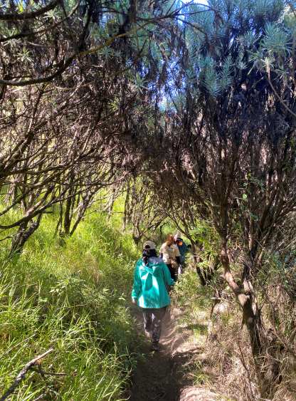
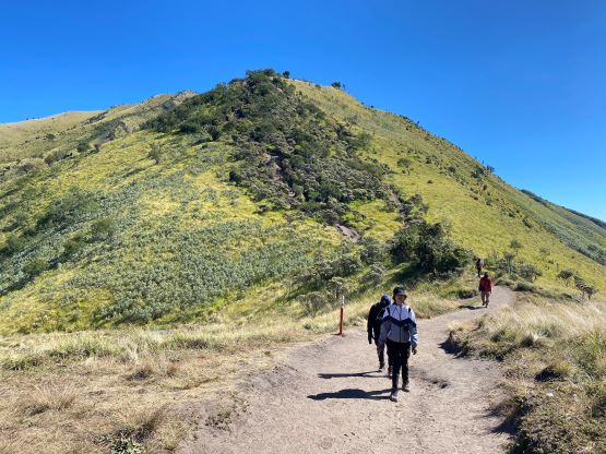
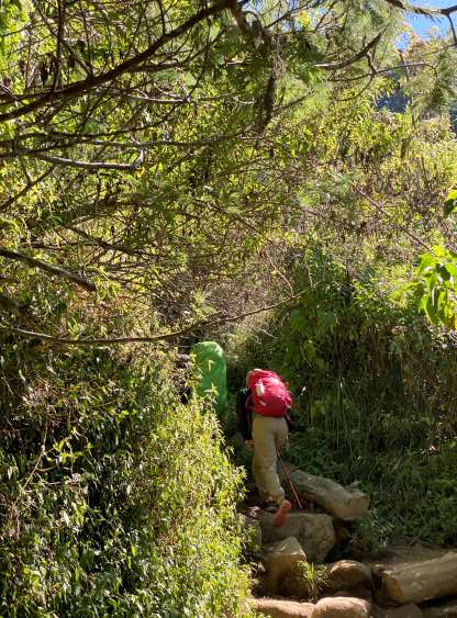
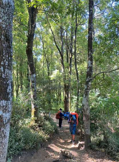
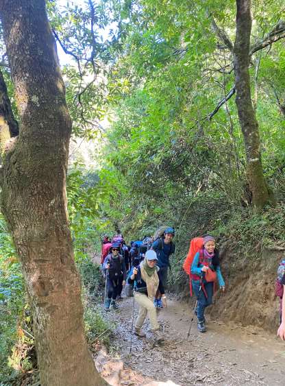
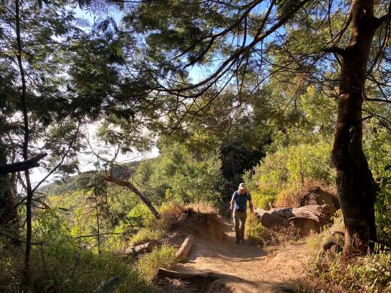
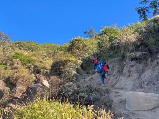
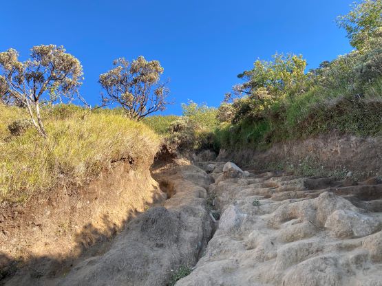
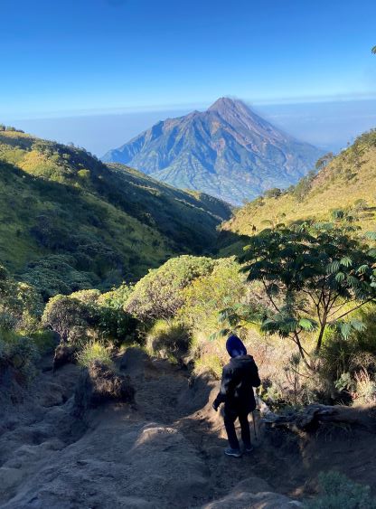
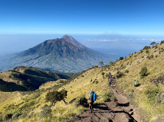
This hike was shorter than I thought with only 1300 m elevation gain required, but the terrain and the trail was not as nice as some of the ones we just did recently. This peak was the dustiest I’ve done so far in Indonesia and the weather was very windy. The decision to leave the jackets behind (so no extra layer besides the t-shirt I was wearing) suddenly became questionable, but I ended up being able to generate enough heat by hiking fast. I also somehow forgot to bring sunscreen and sunglasses. Adam was actually relying on using my sunscreen so we together only had a tiny bit in his backpack, which was actually not the worst case. The sunglasses, though not critical in Indonesia, could serve as a shield from the dusts. Not having that shield meant I got a lot of ashes and sand crystals in my eyes and at times it was very difficult to see even the immediate ground ahead. The trail was mostly in the forest until Camp 2 and we entered the dusty zones after that. The wind only magnified the dust problems. The trail was also extremely steep and slippery for the few hundred vertical meters between the two highest camps, that I actually don’t think the averaged Indonesian hikers could handle the terrain. In fact, many sat on their asses to descend, as I observed a couple hours later.
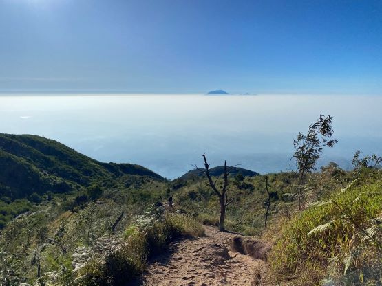
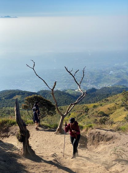
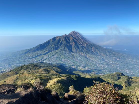
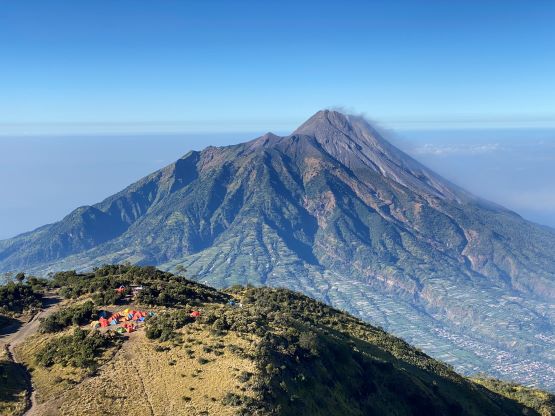

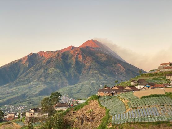
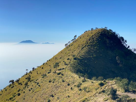
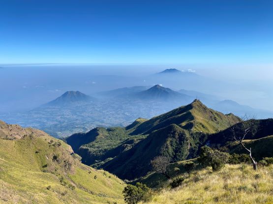
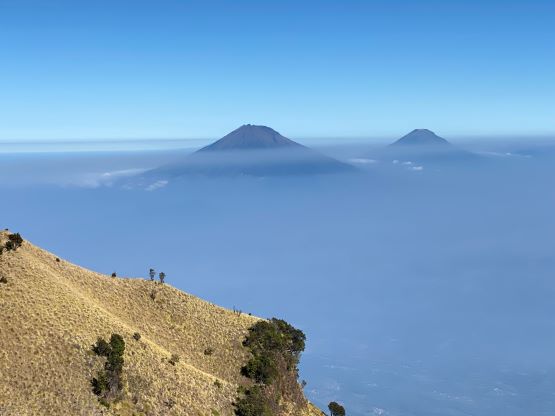
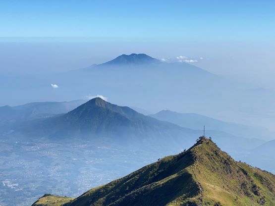
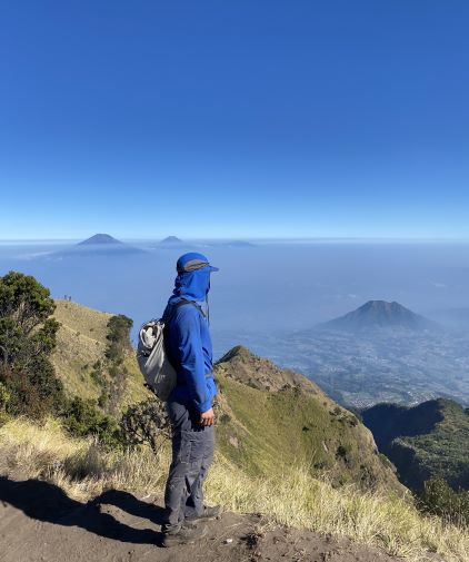
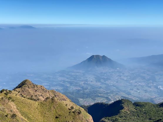
Passing the highest camp I briefly entered back into the forest for about 5 minutes. I finally got a brief break from the winds and the dusts, but then the final 300 m grunt onto the summit was bad. The dusts were actually mostly made by other hikers but given the popularity of this objective there’s no other way around. My strategy was to dash up as fast as I could do, and hopefully able to outrun the dusts. I did have to take several rest stops but otherwise I made the entire ascent in 2.5 hours without taking any break. The summit was cold thank to the wind, but I was able to stay for about 20 minutes to soak in the views. I was able to see the two peaks that we just did the day before, as well as the little bonus objective that we would do later in the day.


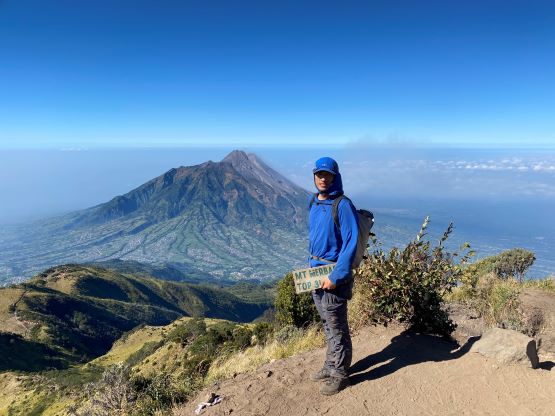
I was the only person on the summit not wearing a jacket so needless to say, I had to go down to keep myself warm. Adam was about 20 minutes behind and was still grunting up that final steep slope, and I said we would regroup at the trail-head. I then made a single dash all the way down without stopping, and I jogged all of the dusty stretches as that’s the only way to outrun the dusts. I passed hordes and hordes of hikers and campers from camp 1 down to the trail-head, and hundreds more were still at the bottom doing this or that. I then realized that this was a Saturday. I wouldn’t be surprised if 300 people would be gathering on the summit on the following morning for sunrise, but I guess that’s typical for a popular objective in Java. All of those check-points were active now, and some were there doing that blood pressure test. I was glad we didn’t have to do that to prove we were “healthy enough” to do this objective. My round trip time was 4 hours 15 minutes. Our driver and vehicle was not at the same place, but I found him about 100 m down the street. Adam showed up about half an hour later and we immediately drove towards the next objective, Gunung Andong. I wasn’t extremely keen about that add-on, but we were doing great on time so why not.