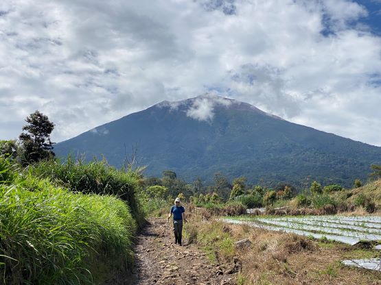
Gunung Kerinci
August 21, 2023
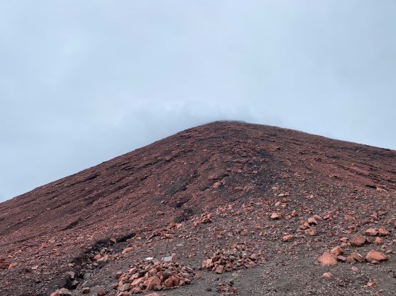
3805m
Sumatra, Indonesia
Gunung Kerinci is the highest peak in Sumatra and also the highest volcano in Indonesia. It’s also one of the world’s 50 most prominent peaks so from statistic perspective this is an extremely significant mountain. The ascent is nothing fancier than a “walk-up” but the area is in a tropical jungle and the weather can be bad at any time of a year. The island of Sumatra is different than Java, that it does not have a distinct dry season. Generally speaking it’s drier from May to September but the difference between the “dry season” and the rest of the year isn’t significant. There’ll still be a lot of precipitation even in this time of a year. Adam and I had been spoiled by Java’s incredible weather. I arrived in Indonesia on July 16 and it had not rained for over a month. I thought the trend would continue for the Sumatra section but I was being too optimistic. It turned out that Gn. Kerinci was actually my introductory trip to the jungle mountaineering. We did most of the ascent in pissing rain, dealt with miles of jungle mud and summitted in marginal visibility.
This peak legally requires a guide and it’s a decently popular objective, so the decision was made to abide the rules. We used the company recommended by Deividas/Dave. I had already read their 2022’s trip report. Those guys sneaked in the last few legal days and climbed it while the volcano was erupting. The trip sounds rather terrifying, and the peak was subsequently closed for over 7 months afterwards. Thankfully the volcanic activity had slowed down (but still very active), that the government opened the climbing season before our arrival. The standard way to do this peak was to spend 3-4 days on the mountain, but we booked the shortest possible package, the 2-day-1-night option. We ended up just doing it in one day as the guiding company was flexible. Even for this sole reason I would recommend this company because most Asian guides would not customize your own trips like that.
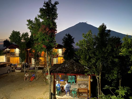
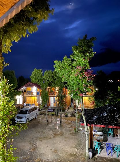
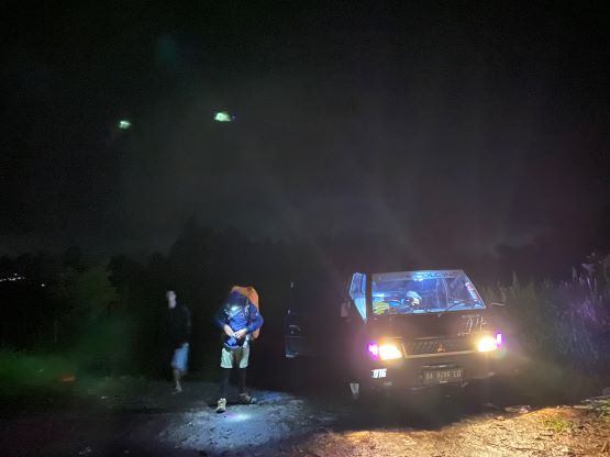
The previous day was spent travelling. Adam and I boarded the Jakarta-Padang flight in the early morning and arrived at Padang, the capital of West Sumatra at 9:30 am. The driver was already there to pick us up, and we spent the next 6 hours driving southwards to Kerinci View, our homestay at the base of the mountain. The driving distance wasn’t outrageous but the roads were winding and narrow. It’s the typical Indonesian road that could hardly be driven faster than 40-50 km/h. We also did a few stops for food and grocery. Rapani, the owner and the head guide welcomed our arrival. We explained some of our needs and concerns during the briefing and Rapani was able to work things around. I was thinking to make the summit on the first day, so we wouldn’t want to start hiking at 9 am as per the “normal way”. I requested a departure time at 4 am and he agreed without even arguing. We also explained that the “red tape” was the sole reason for us to hire a guide so after passing the gate we would take off, make the summit on our own and regroup with the guide and porter at the camp, and Rapani agreed as well. The breakfast was served at 3:30 am. We carried their box lunch and 3 L of water each as with this new plan we had to bring all the food and gears to make the summit on our own. I was not anticipating a full day of rain so I was underdressed, but it’s fine in the end. The drive to the trail-head required a 4×4 vehicle so we all piled into a pick-up truck, and arrived in half an hour.


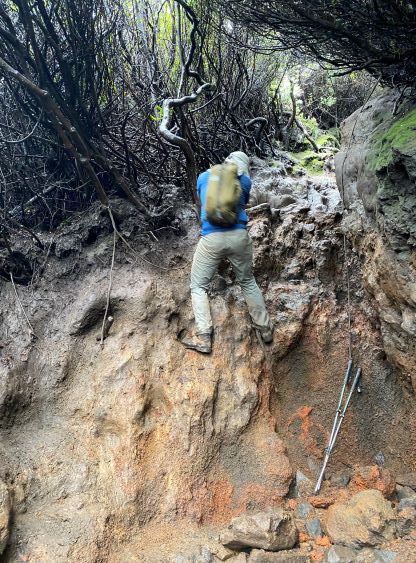
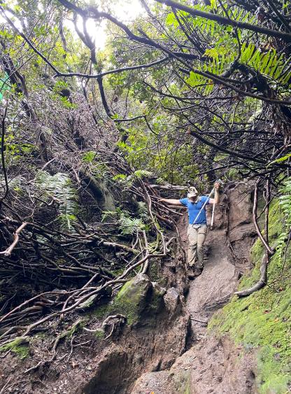
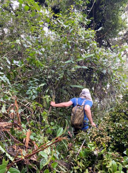
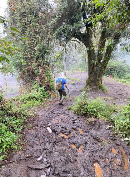
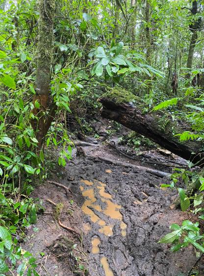
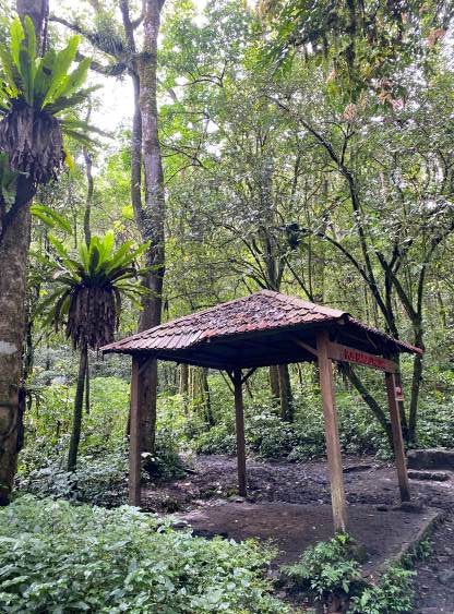
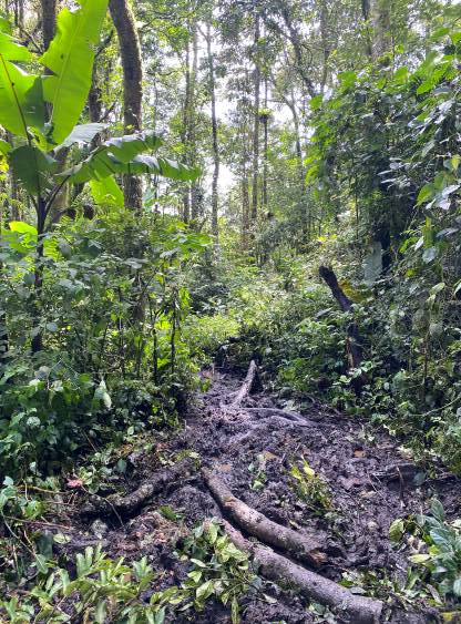
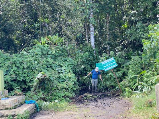
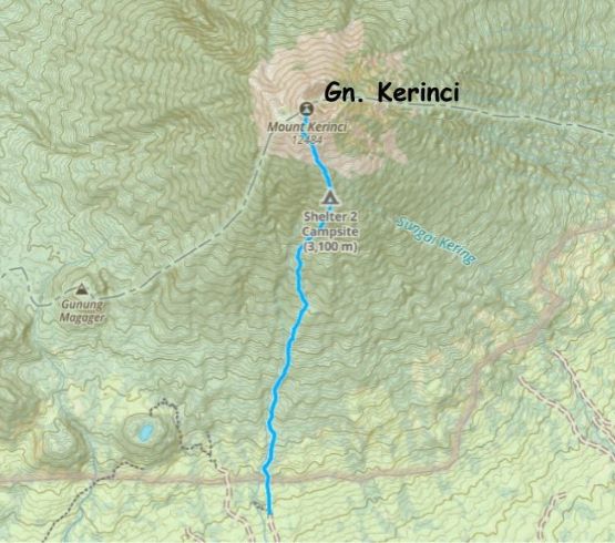
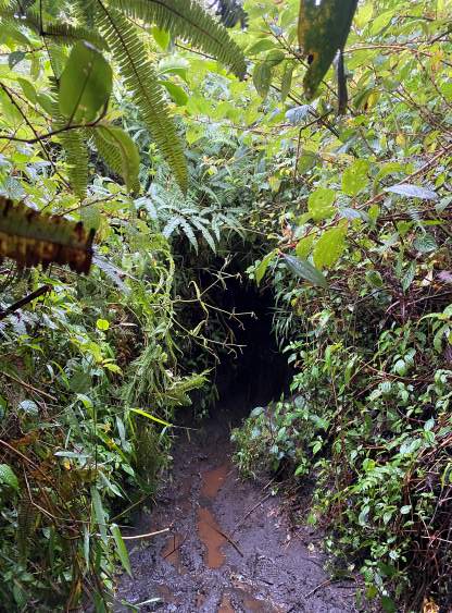
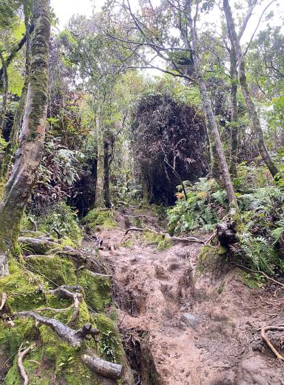
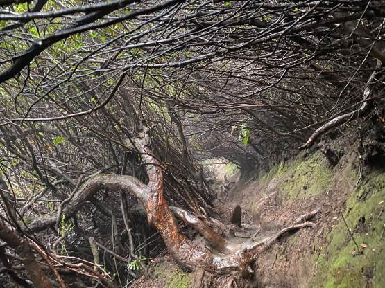
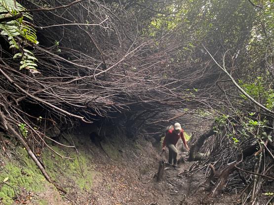
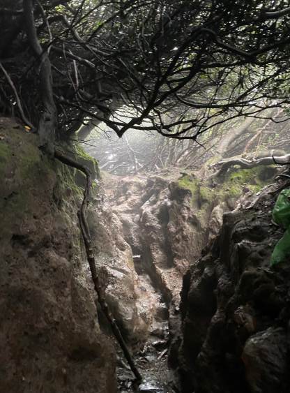
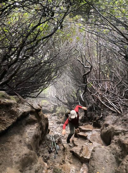
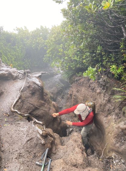
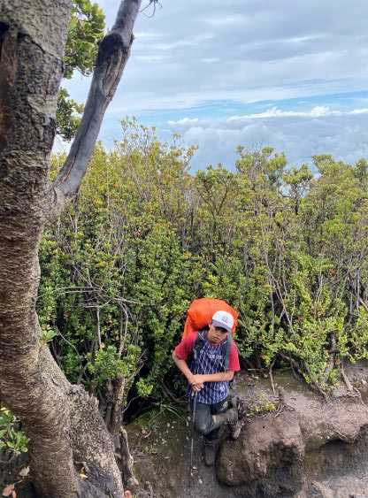
There was actually about 10 minutes of walking on the deactivated portion of this road to reach the actual trail-head. The registration was obviously not open at this time of the day, but Rapani had already done the registration for us anyway. The guide and the porter needed a break to take their jackets off whereas Adam and I started hiking in the cold and did not need that stop, so we took off from this point. There was about 2 hours of head-lamp time ahead, and the jungle was much worse than expected. The mud was continuous and non-stop right from the beginning. I thought the flat stretches were the worst as we had to post-hole at times. Once the grade picked up the going was actually easier as it then became a scrambling game. The mud made the terrain extremely slippery but I preferred that over post-holing. About 1 hour later it started to drizzle and the drizzle quickly became a steady rain. It never turned into downpouring but the rain was heavy enough to be annoying. The first camping area was the only one with a shelter, so we took our first break there, after gaining 700 m elevation. The head-lamps were no longer required, and I talked to some guides about the weather. The communication was difficult because of the language barrier but I did get one comment that “you are not in Java here”. It seemed like everyone at that camp was about to resume the plan, so the weather must be pretty tame for this area’s standard. Adam showed up a few minutes later in his poncho. I only brought one t-shirt and one hardshell. Wearing the hardshell would be too hot, but I couldn’t completely soak my only shirt, so my decision was to hike shirtless to at least Shelter 2, maybe even Shelter 3.
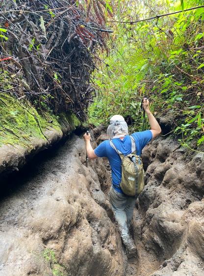
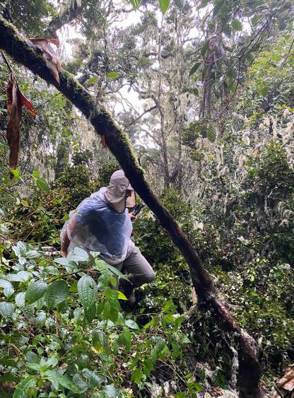
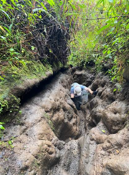
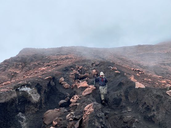
There were 500 m elevation gain between Shelters 1 and 2, so this section was quite long. The terrain had gradually become steeper and more technical, and 3rd class moves had started to become frequent. I thought this was actually quite fun, because I preferred hands-on scrambling over the numbing plodding. Shelter 2 was disappointing as there’s no “shelter” there, but thankfully the intensity of the rain had decreased. After a brief stop for food we carried on towards Shelter 3 at 3300 m elevation where we were supposed to spend the night at, and this section of the trail was the most technical. There were quite a few difficult spots and I took one fall by blowing a foothold. There’s no exposure so I didn’t check thoroughly, but this was the jungle mud steps that my mountaineering experience would come in no use anyway. It required consistent problem-solving. The rain made the jungle mud look, feel and taste like dirrahea.

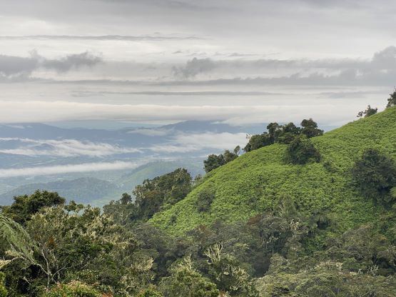

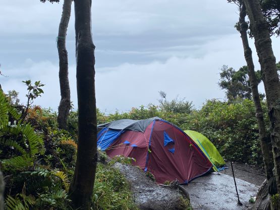


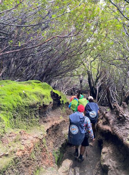
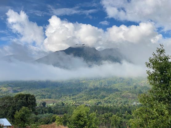
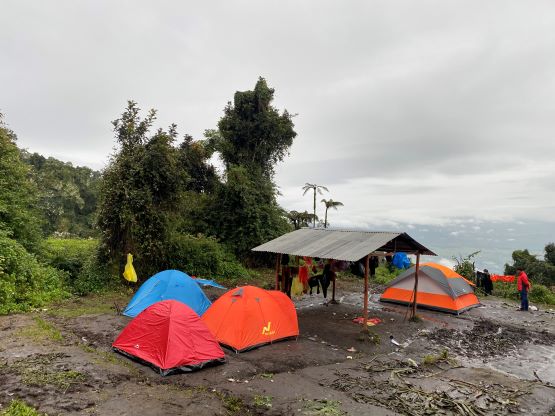
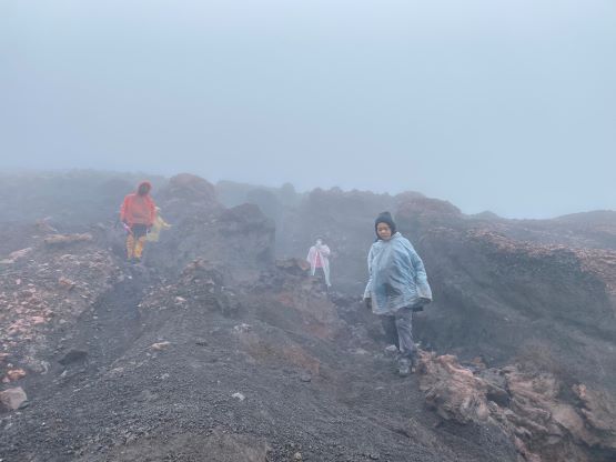
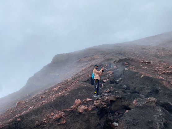
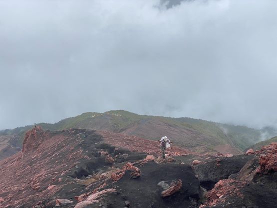
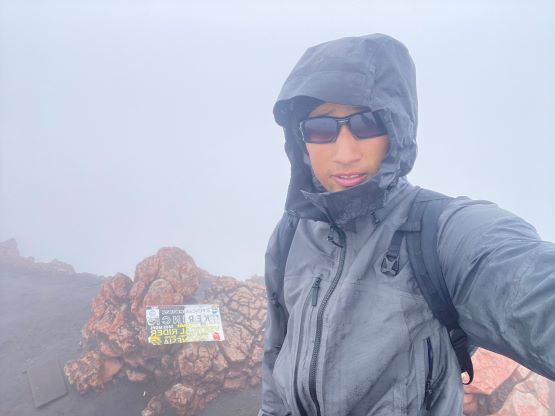
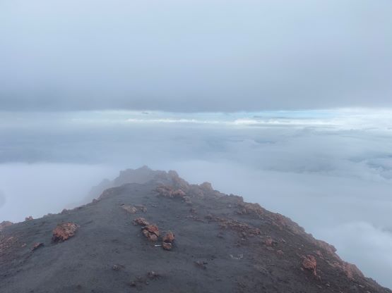
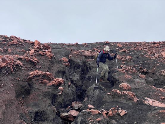
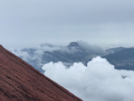
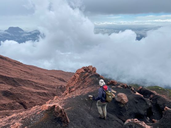
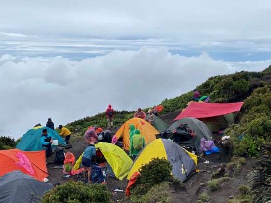
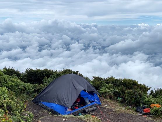
Shelter 3 marked the transition from jungle to the alpine zone, and was much bigger than the previous ones with at least 15-20 tents already pitched. The weather was misty, windy and drizzling so we went straight past the camp for the summit push. Most of the hikers were on their way down from the summit. The final 500 m elevation gain to the top was quite steep and loose, but not difficult. The weather briefly improved to reveal some views but the sky stayed grey. The sulphurous gases were extremely acidic on this mountain, that my eyes started to hurt after a few minutes. I quickly donned the sunglasses even though the light wasn’t intense enough to warrant the use of them. There were three locals following us to the summit and we celebrated the success together. The weather could become worse in this intermittent white-out with drizzling and my layers were definitely undertooled so we must descend immediately.

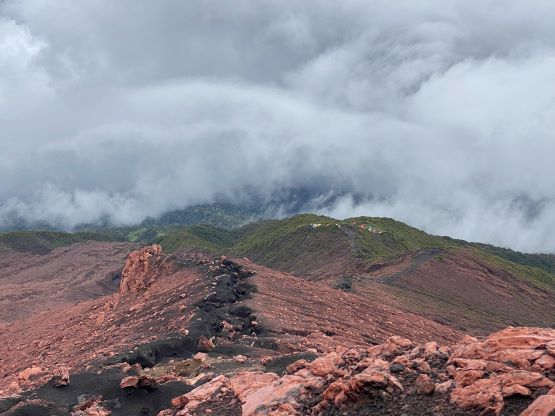
The descent was mostly about techniques and experience on the loose terrain so we made quick work down to Shelter 3. The weather was actually improving with more and more views showing up, but it was still drizzling. I needed a break for food as I hadn’t eaten much at all, and there’s no way I would carry that heavy ass box lunch up and down the mountain. The cold rice and chicken was not very tasty but I had to force myself to consume. I ended up eating all of the meat but dumped half of the rice. After at least half an hour at this camp the guide and the porter still didn’t show up, and I was getting quite cold. We made the spontaneous decision to descend, find the guide and the porter and camp at Shelter 1. It turned out that they were actually not that far behind, but there’s no way for us to go back up to Shelter 3 to camp. I then threw out the idea to descend all the way to the trail-head. It was only 11:30 am so why making a camp at that first site, from which the descent could be easily made in 1 hour. The guide was actually keen but the porter was too tired for that. There’s actually cell reception so called Rapani and made the final decision. The guide would follow us to the trail-head, whereas the porter would climb up to Shelter 3 to spend the night.


The descent through the tree roots and the jungle mud was actually quite fun and surprisingly easy on the knees, as the diarrhea mud made the ground extremely soft. I did not enjoy the final few kilometers where things became flat. The post-holing was still unavoidable at places but I did manage to keep my feet dry, somehow. Our round trip time was 9 hours 19 minutes including all of the stops, and the guide finished half an hour later. We were now officially the dirty jungle guys as we both were as filthy as we had ever been, and our cloths necessitated some thorough washing afterwards. The driver and the truck was not at the trail-head yet so I called Rapani to make sure he’s coming to grab us. It turned out the truck arrived a mere minute after the guide – talking about the perfect timing. After a much-needed lunch stop at a warung we drove back to the guesthouse at 2:30 pm, and spent the rest of the day relaxing and socializing with a British couple who came here for road biking. The next day was a rest day. We leisurely woke up at 7 am, had banana pancake breakfast and then drove 5 hours northwards to Kayu Jao Resort.