Gunung Arjuno
July 30, 2023
3339m
Java, Indonesia
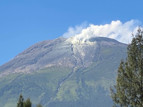
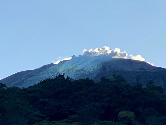
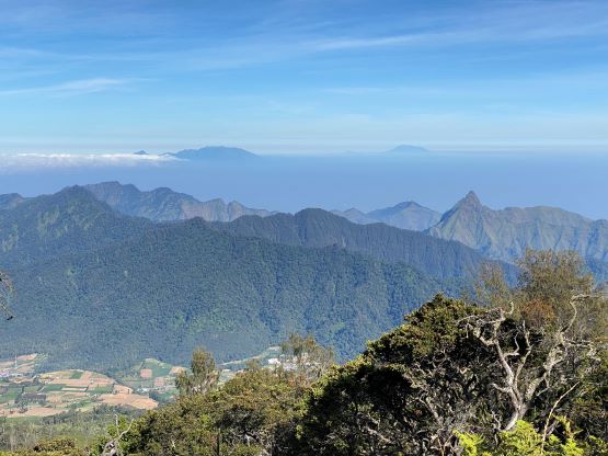
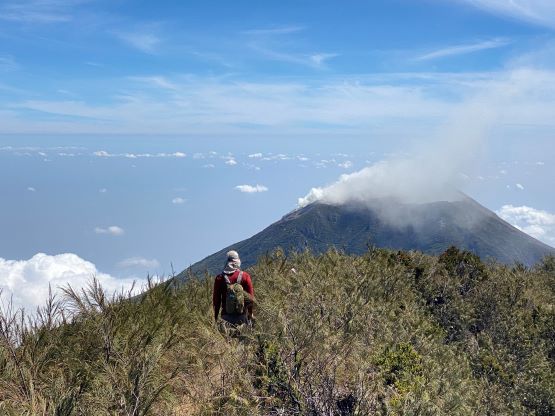
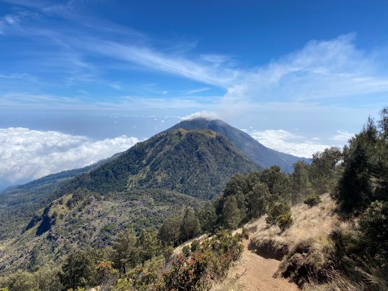
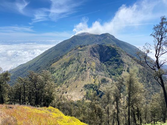
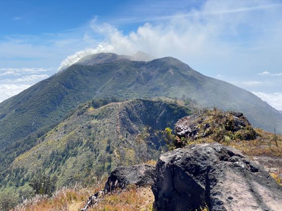
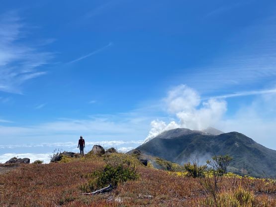
Gunung Arjuno, also spelled and pronounced as “Arjuna” is one of the tallest volcanoes in Java and itself boasts 4 distinct summits. The southern one (Arjuno) is the highest but the other three are also popular destinations. It seems like the northernmost summit (Welirang) is currently puking enormous amount of sulphurous gases but the other peaks seem to be safe, for now. Gn. Arjuno also boasts over 2800 m prominence making it one of the most significant peaks on this island, either by elevation or by prominence. Due to the closure of Gn. Semeru this turned out to be the next objective after Argopuro and the driving between the two would likely take a day.
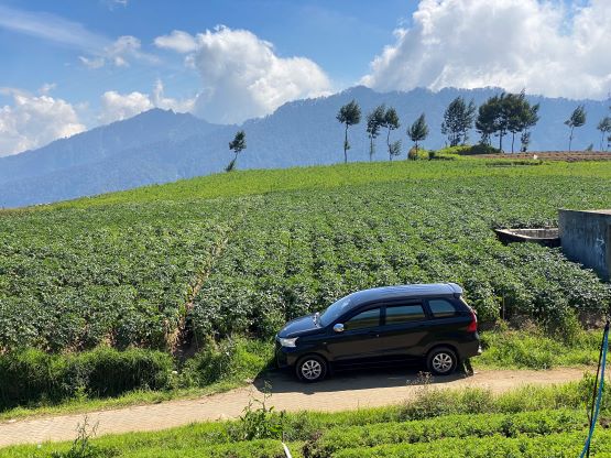
I contacted the same driver (Jose) recommended in Rob Woodall’s trip report and through negotiating Adam and I decided to hire him for at least 7 days for our second phase of the Java slam. Jose picked us up from our hotel on the west side of Argopuro at 6 am and the objective of this travel day was the city of Batu, situated right in between Gn. Arjuno and Gn. Butak. Adam had booked a hotel in the middle of this city for 3 nights, serving as our “basecamp” for the next two peaks. The traffic was surprisingly non-existing in the morning, that we arrived in Batu in less than 5 hours. Maybe it’s because we took the expensive freeway but still, this was even faster than the time suggested by Google. I guess the traffic problems in Java would rather be hit-and-miss. I’ve heard that the traffics on this island has the potential to be some of the worst in the world, so maybe we were just lucky. On the following day Jose picked us up from this Batu’s hotel at 5:30 am and we drove up to the farm roads on the west side of Gn. Arjuno. Rob W. had parked at the end of the pavement but we managed to push a little bit further, and parked at the next intersection at 1950 m elevation. The final few hundred meters would require an ojek or a proper 4×4 vehicle with high clearance.


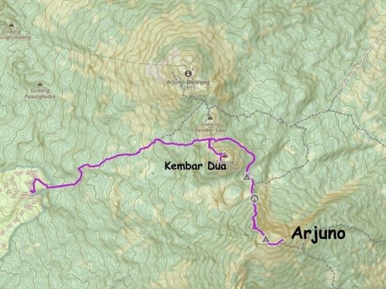
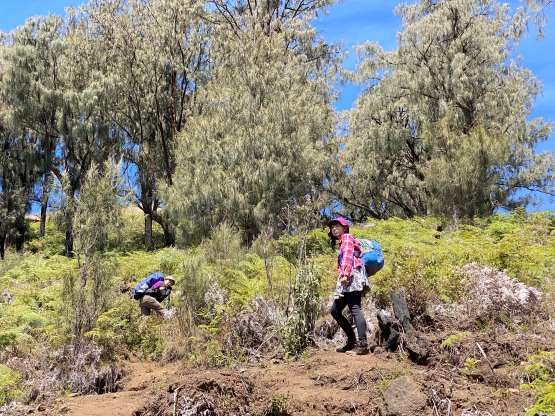
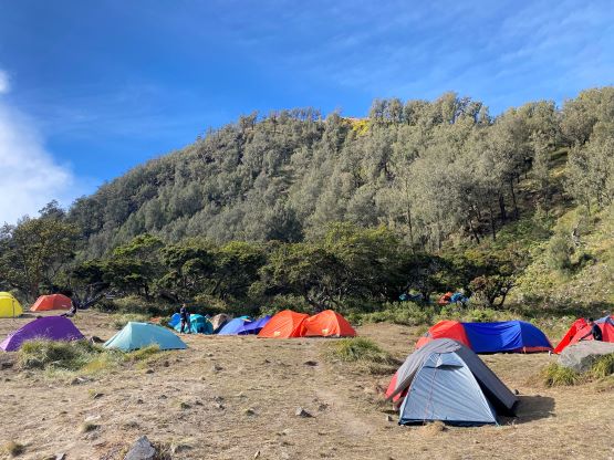
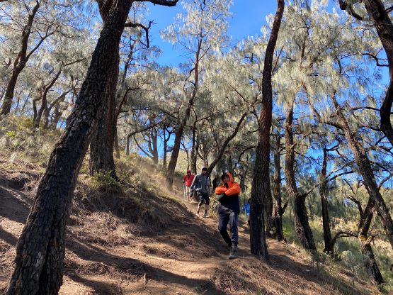
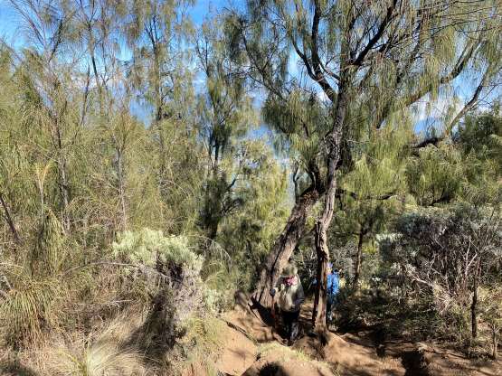
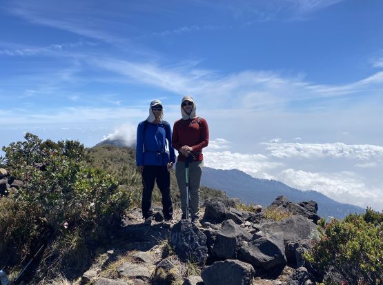
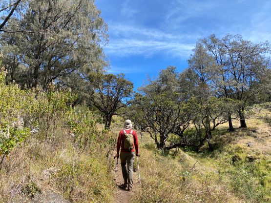
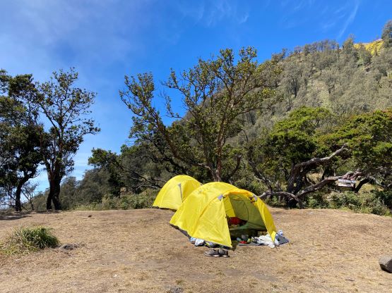
Jose would wait for us at this exact location as there wasn’t enough of cell reception to communicate. Adam and I then took off, dashing up the farm roads to the start of the trail. The views were excellent and we anticipated another gorgeous day up high. The ascent to the camp at Kembar Satu/Dua saddle involved almost 1000 m elevation gain. The trail was excellent and well signed, so there’s little worth documenting. We took a mandatory break at the camp donning sun protection. Up until this point we hadn’t seen anybody but the camp was a busy place. At least 20-30 tents were perched and some groups were just about to start their day. I wondered if anyone would come to ask where’s our guide, but nobody bothered.


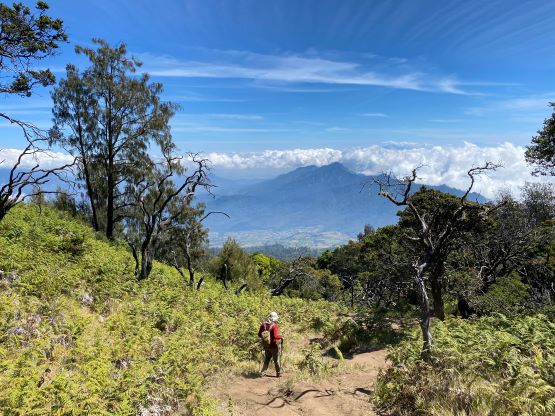
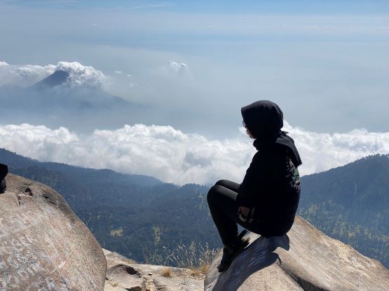
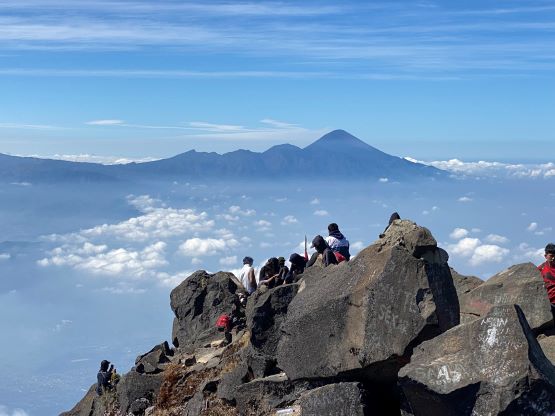
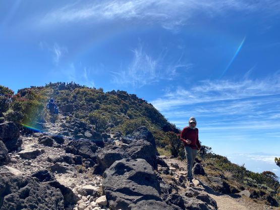
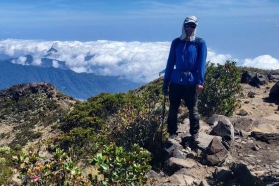
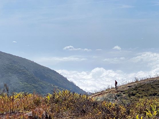
The next stage traversing around the east side of Gn. Kembar Dua involved over 100 m elevation loss, that must be regained a few hours later on the return. This was frustrating, but we had done our homework so we knew it. Adam led the way, dashing down at a mad man’s pace that in no time we were ascending again. From the lowest point of this trail we had to gain over 500 m elevation to the central (true) summit of Gn. Arjuno. I was not looking forward to the slog, but let’s face it. We crossed path with at least 50, if not 100 hikers on their way down. I assumed they all woke up earlier to watch sunrise from the summit. There were still lingering people on their way up, and we passed all of them. Prior to this trip I had been told to take measurements on both central and east summits as there’s a debate about the true summit. I did not own any fancy surveying equipment, but my GPS showed the central summit to be about 10 m higher than the east. Most hikers traversed over the central summit to tag the east one (which offers better views), so we also did that. The east summit was extremely crowded so we didn’t bother to linger.


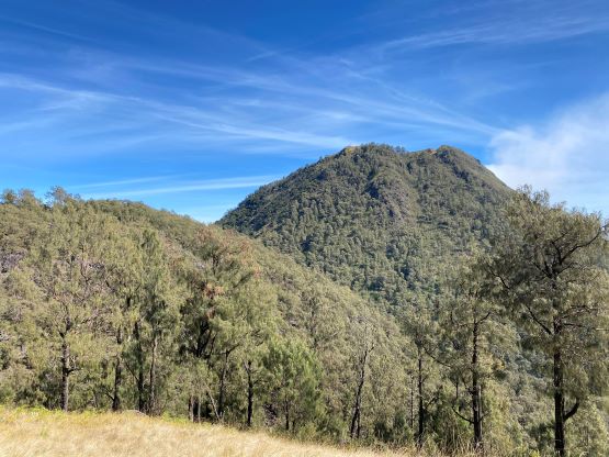


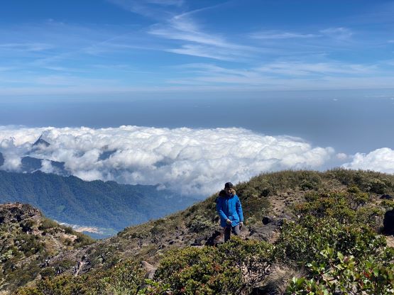
I made a single dash down the 500 m face back to the bottom of the trail’s low point, and once Adam showed up we made another single dash back to Kembar 1/2 col. We had been discussing the potential to include Kembar 2 (Dua) in this trip and we made the final spontaneous decision to execute that plan. I had to be honest that I wasn’t particularly keen, but I wasn’t that tired so why not. The ascent involved more than 200 m elevation gain, and the true summit required a circumnavigation of the crater, and was farther than I thought. At this point we were already committed so we must tag the true summit. I was glad that I did this side trip because we got very close to some active volcanic vents. I’m not sure if that’s very safe, but I did think that was very cool.
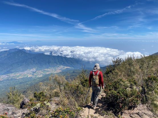


By this point we had gained over 1800 m elevation in this day so we were both somewhat tired. A lengthy break was needed on the summit of Gn. Kembar Dua but after 15 minutes we decided to go down. I again, made a fast descent down to the camp and waited for Adam to show up. I then followed Adam’s lead jogging most of the way down the main trail, and finished the round trip in just over 7 hours. The driver was patiently waiting for our arrival because his driver’s license had been taken by the park’s officials. Apparently we needed to register and obtain a permit to climb this route at their “basecamp” and now they wanted to talk to us. It turned out that they didn’t bother to lecture us and we didn’t even need to pay besides a stamp thing that costed only 30 cents. They did take a photo and record our names and IDs as they still officially needed to get us a “permit” even though we’d already finished our trip. I later learnt that Jose was wondering around the trail-head with his drone and gun and that’s why he got caught. Hunting was strictly prohibited in this conservation area. Adam then found a fancy restaurant for us, but grocery shopping afterwards in this city wasn’t that straightforward. We eventually got back to the hotel at 5 pm.