Volcán Zunil
March 17, 2024
3542m
Xela, Guatemala
Volcán Zunil is one of the volcanoes in the vicinity of Xela (Quetzaltenango) that boasts over 600 m prominence but this one does not have that characteristic cone shape, as it’s gone dormant for some very long time. The adjacent Volcán Santo Tomás looks more like a proper volcano, but Volcán Zunil is the taller of the two so I had to prioritize this particular one, even though I do admit that I was contemplating the double-header. The information online wasn’t extremely clear but I was able to dig out some “beta” on Wikiloc, that there are essentially three routes that can be done as a “half-day stroll” for someone like myself. The most popular one starts from Fuentes Georginas (hot springs) and that’s the one I was originally hoping for, but then I happened to come across an article saying the access through the hot springs is subjected to some operational hours, that hikers aren’t allowed to start until 9 am in the morning. I thought that could still work, but wouldn’t be ideal as I would want to start hiking no later than 7 or 8 am at the latest due to the heat and the long drive to Lake Atitlán afterwards. I then debated about the “Alaska Route” versus the lesser-known one from Finca la Chingada, and opted to explore the latter. The decision-making process took me an hour because there’s pros and cons for each. Kate and I had hired Oswaldo who had a reliable 4×4 vehicle, that Finca la Chingada route has the potential to be the shortest if we could drive all the way to the end of that road.
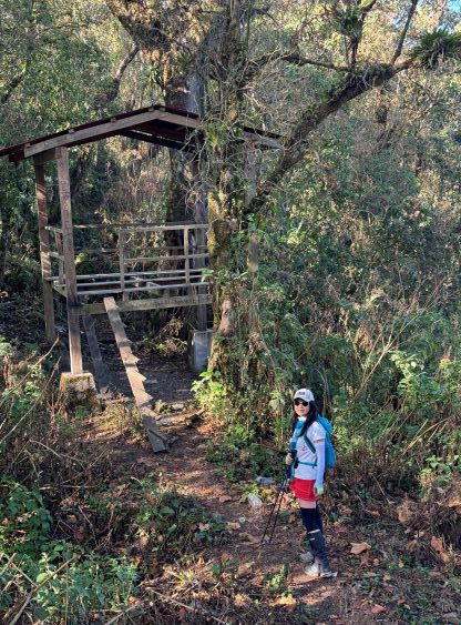
Oswaldo came to pick us up from the hotel in Xela at 6 am in the morning as usual, and the drive to the small village of Tzumucabal took about 40 minutes. Up to this point our route shares the same driving direction as the standard Fuentes Georginas route, but then we would turn left at the village onto some narrow and rough dirt roads. These roads were not a surprise to me, as that reference article mentioned the need of a serious 4-wheel-drive vehicle. After about a kilometer of crawling we did also have to switch to 4-Low but thankfully the condition stayed more or less the same for the whole way up. We encountered one farmer on his way down, and that gave us the assurance that the road would go. To my surprise we were able to drive past the road’s end onto what was shown as a “trail” on the Gaia map, and this got us successfully bypassed a farming house with a troublesome dog. That dog was chasing our vehicle as we drove past it, that I would definitely not be stoked to encounter it while on foot. Eventually at 2700 m elevation we came across a large area with good turning-around. We could have driven for at least 1 km further, but I made Oswaldo to stop. At this point we had already surpassed the “best case scenario” so I was more than happy enough to start walking.

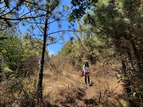
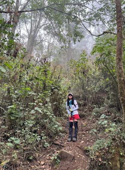
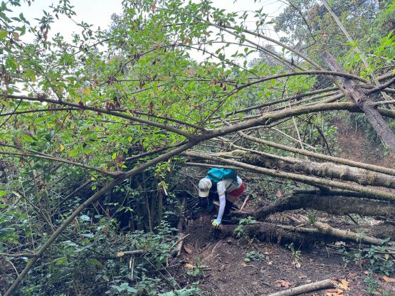
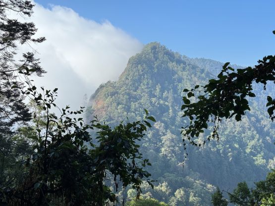
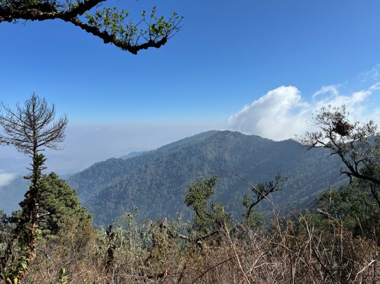
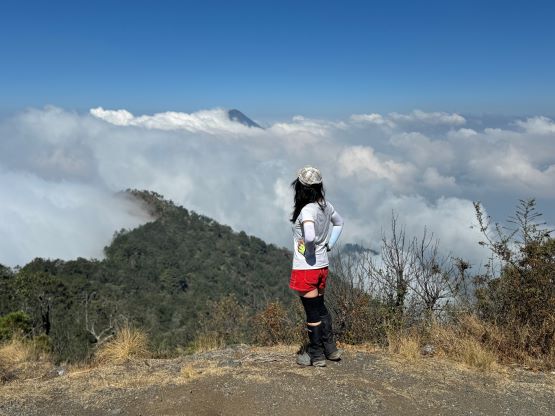
It turned out that the 2 or 3 km to the 2930-m saddle joining the standard route was entirely on the remnant of this road, but only the first kilometer or so could have been driven. The rest of the road had disintegrated that one would need an ATV or a dirt bike to negotiate. There were unfortunately a shit ton of garbage and that had attracted a lot of flies that quickly became annoying. I also worried about the safety issues as this “road” was more like a trash dump, but I doubted if we would end up seeing anyone here. The road had narrowed down to a singletrack trail not far after joining the standard route and the trail to the Zunil/Santo Tomás saddle was quite undulating. Not doing much lingering at the saddle we turned left. The trail to Volcán Zunil was mostly well-engineered except for one steep and sandy section that required caution. The grade gradually eased off and we were eventually traversing 1-2 km of flat ground across the north slopes of our objective. I took a break while waiting for Kate to catch up, and meanwhile encountered a large group descending after spending the night on the summit. That turned out to be the only human being we saw on this outing. The trail brought us to the east side of the summit block and the final attack was a bit steep but uneventful. There had been some thick cloud coverages but the summit was tall enough to poke above the clouds, granting some views.

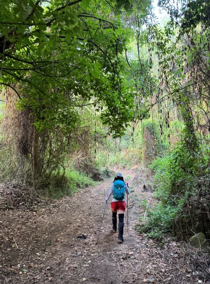


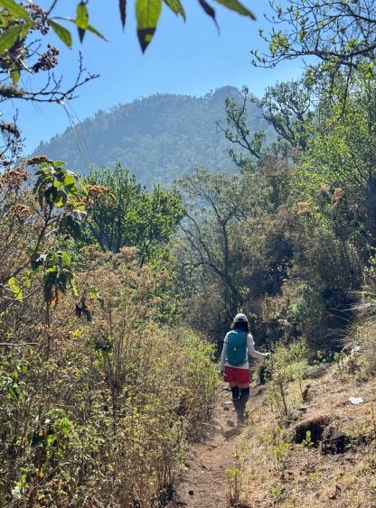


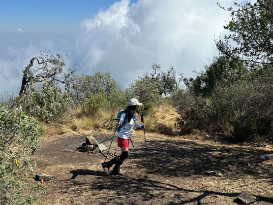
The ascent had been quite a boring one as we were in the forest for most of the way with very limited views, and both Kate and I were tired from the day-after-day peak-bagging in the past week, so we took a long break on the summit. It was eventually the time to start descending, and we basically made a single dash down to the truck without stopping for food nor water. Our round trip time was 4 hours 20 minutes and we even caught up to that descending group on the drive-out. Those people had parked much lower at the village of Tzumucabal and one of them hopped into our vehicle for a short but lucky ride. That guy was basically limping so we were happy to help out. I then directed Oswaldo to drive us to San Pedro La Laguna but Kate’s hotel booking turned out to be a massive fail. I think we got scammed as nobody in the neighbourhood could recognize that name (Apartamento Jacob) and the owner had stopped replying after Kate made the payment. I thought we had to cut the loss so we drove 40 minutes to Santiago Atitlán and found a neat hotel there, in situ. I actually liked this little town better as we were actually closer to the next objective.