Volcán Santa María
March 16, 2024
3772m
Xela, Guatemala
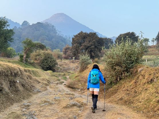
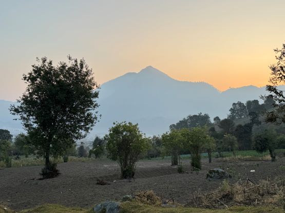
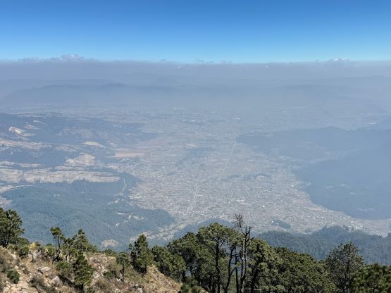
Volcán Santa María is the iconic cone-shaped volcano dominating the southern skyline of Quetzaltenango (aka. Xela). This peak is very recognizable from many of the summits in Guatemala such that even though it is only a “P1000m objective” this has to be one of the primary objectives in this trip. I would not be satisfied if we ended up missing out Volcán Santa María. There’s a well-trodden trail to the summit, but the ascent requires over 1200 m elevation gain which can be considered “substantial” by Guatemalan standard. Kate and I based ourselves in the Lar Antiqua Hotel in Xela for two nights, and Oswaldo would still be our driver. For this particular objective a 4×4 vehicle would not be needed, but it was still very convenient to have Oswaldo available for the entire day. I was also secretly planning a bonus objective if time/energy allowed, and that one would most likely require the 4×4 capability.
Our plan was to not hire a guide even though most parties that logged their ascents on peakbagger.com did end up using a guide. At least one trip report even indicated the use of a police escort in addition to the guide, and that made me worry about the safety in this area, or in Guatemala in general. Robberies had been reported on this particular objective but then our trip would be on a Saturday with hundreds of other hikers and Mayan prayers, so the risks should be rather low. My stand for this topic is to embrace the risks but to try limiting the consequences, as if you don’t trust people then you could not travel at all. I would be leaving all the IDs and the USD cash in the hotel and carrying only a few hundred GTQ (no more than 50 dollars worth). I even made Kate to leave her primary phone in the hotel, to limit the consequences in case a robbery did happen to us. I unfortunately did have to bring my trusty iPhone 15 Pro as the local SIM card as well as What’s App could not work on my spare iPhone.


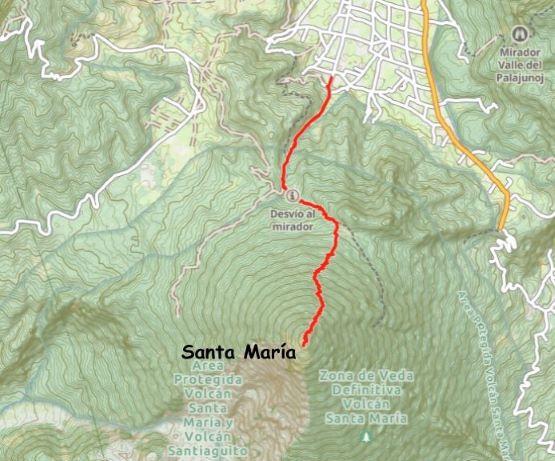
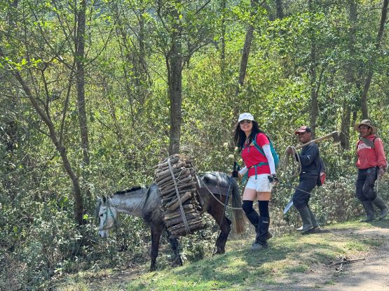
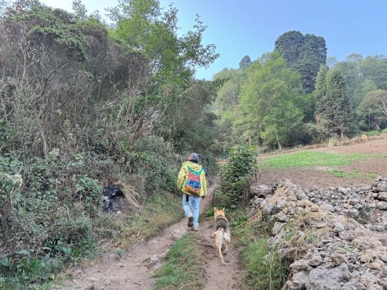
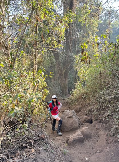
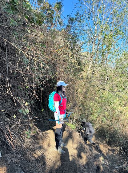
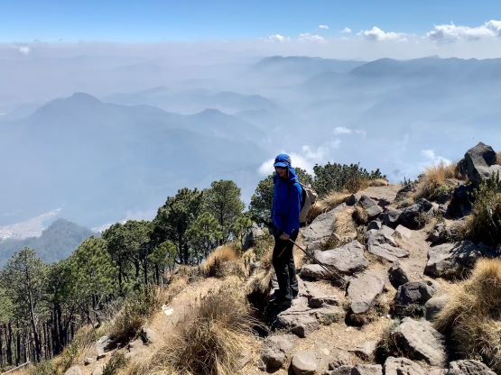
Oswaldo opted for a cheaper hotel this time but showed up at 6 am on time for the pick-up. The drive to the trail-head took no more than 20 minutes, and the secondary “road” labelled on my Gaia map turned out to be just a trail, so having a 4×4 vehicle did not give us any advantage this time. Oswaldo decided to drive back to his hotel for a proper breakfast and a much-needed nap, as I told him the expected round trip time was 5 or 6 hours. Not far from the trail-head we caught up with two guys with machetes and I started to wonder about the safety issues, but it was obvious that those were just the local farmers going for a walk. I started to talk to them in Spanish and sure enough, they were very kind and friendly. The conversation lasted for more than half an hour and did slow us down, but I considered that as a free Spanish lesson as the guys could not speak any English whatsoever. Kate, on the other hand, was more interested in the culture that the guy Geronimo showed us. By the time we said farewell to Geronimo we were not far from the saddle on the north side of the peak, and the rest would be a straight-up grunt for over 800 m elevation gain.

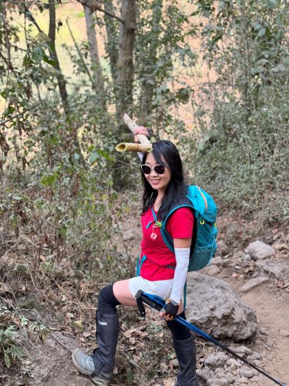
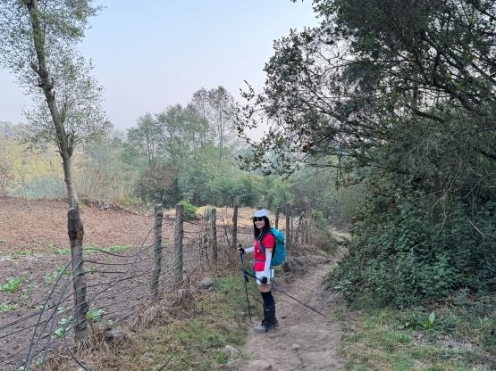

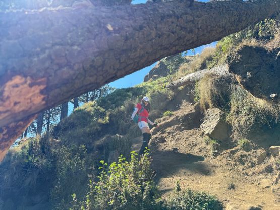
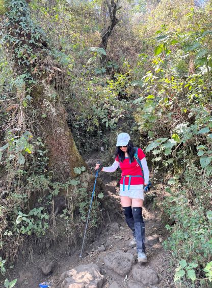
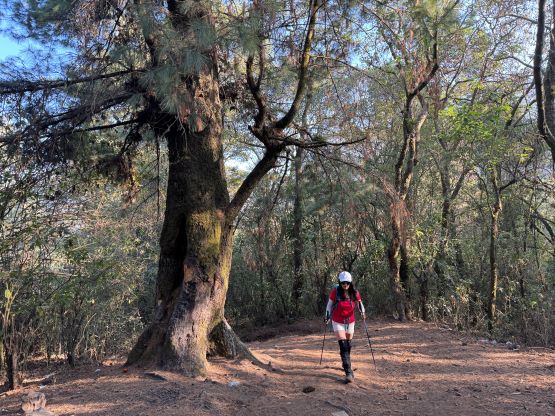
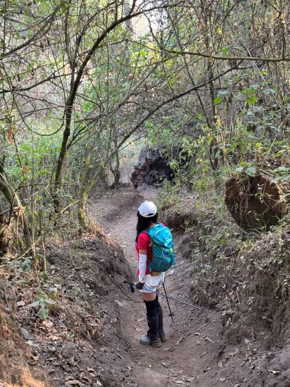
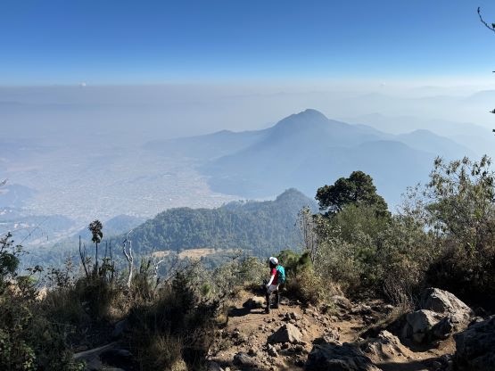
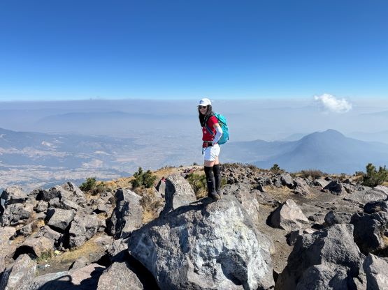
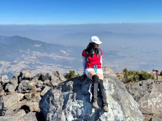
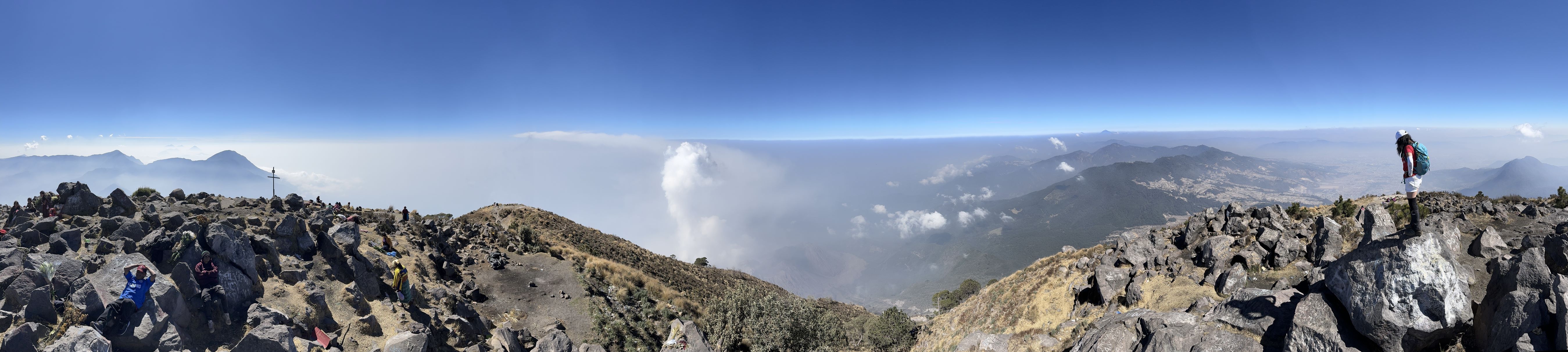
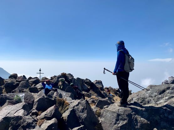
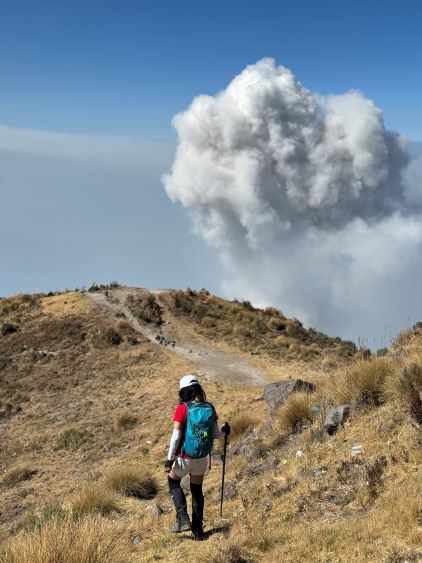
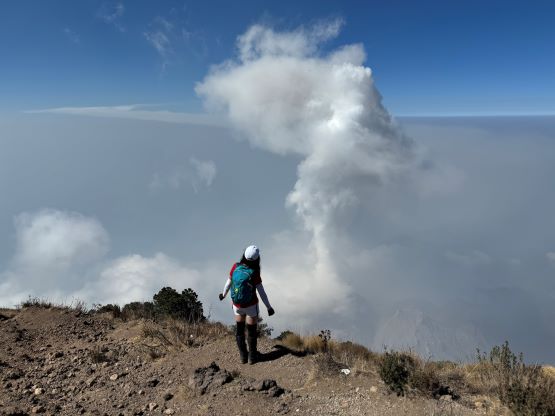
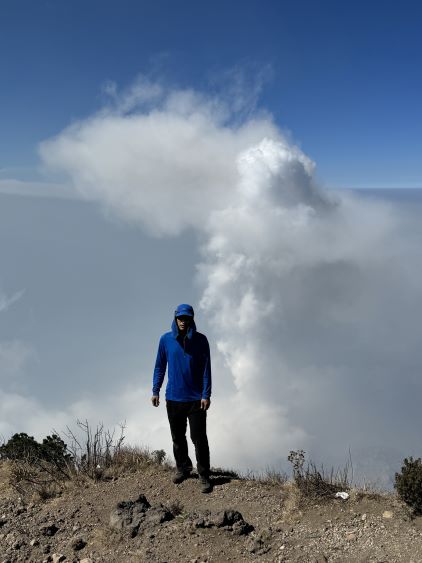
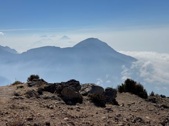
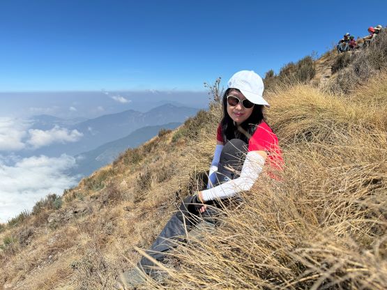
I had read multiple trip reports complaining about the quality of this trail but I could not see where that came from. The trail did eventually become rocky but the grade was not that steep at all, and the rocks could not bother anyone with some scrambling experience. We did encounter a bunch of locals struggling and maybe it was them who made the complain. My suggestion is to stop giving shits and go improving your fitness and skills. Kate and I made only one stop for the entire ascent, at slightly above the saddle to don sun protection. I made Kate to not take a single break afterwards and we passed literally everyone else in front. The ascent did start to feel like a drag, but I liked the no-break challenge, and we eventually showed up on the summit with at least 20 others. Most of them were the Mayans who brought flowers up there to pray. The true summit was either one of the two obvious boulders and to get there required a bit of scrambling. I knew there’s a better viewpoint towards the erupting volcano Santiaguito slightly beyond the summit, so we carried on and did our break at the viewpoint. Luckily for us, we did observe one eruption but the views were somewhat obscured by the smogs so it wasn’t as spectacular as I was hoping for.
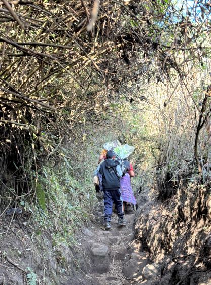


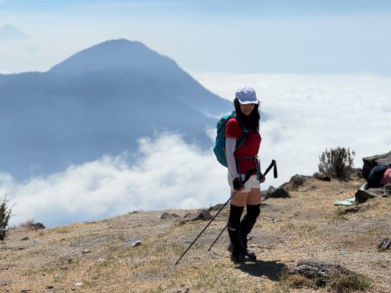
It was eventually the time to move on, and we again made a single dash down to the north side saddle, losing 800 m elevation in one go. We did do a few more stops afterwards. Kate called for a break to apply some blister pads whereas my stop was to chat with a English-speaking girl living in Xela. Most of the hikers were on their way up, and many of them were carrying a heavy pack. I guess the culture here is somewhat similar to Indonesia, that the “best” way to enjoy a mountain is to camp on the summit. There’s no source of water whatsoever on this route so they would have to carry all of the water for 2 days, and that seemed rather painful to me. Our round trip time was under 5.5 hours and Oswaldo was there waiting, as expected. I then made the spontaneous decision to solo Almolonga aka. Cerro Candelaria or the true summit of Cerro Quemado. Kate was tired and opted to go back to the hotel to do some laundries and also to prepare for our dinner. I think Kate was smarter because this secondary objective turned out to be harder than I thought, and my day would also become a grueling sufferfest with 2000 m elevation gain.