Volcán San Pedro (Guatemala)
March 19, 2024
3020m
Lake Atitlán, Guatemala
Not to be confused with the 6000m+ “ultra” Volcán San Pedro in the Atacama region of Chile (which I have seen in 2020 but did not climb), this is a much smaller peak that looms above the touristy Lake Atitlán in Guatemala. The elevation can be considered “low” as a volcano in Guatemala but this peak still boasts over 900 m prominence. This is also a very popular hike among the locals and the international tourists as the trail starts right above the village of San Pedro la Laguna, but the safety issue has always been a concern. Robberies on the upper slopes had occurred frequently in the past, that even with policemen guarding the trail-head as well as halfway up the mountain one can still be expected to be robbed. One trip report that I red (in English) sounded rather serious, that a robbery occurred on the summit by 5 young men with machetes and guns, but that’s just one particular case and cannot be considered as a “representative” for this hike. According to a German guy that Kate and I met on the “lookout” which is at the end of the maintained trail there had been no robbery since June 2023, so it might not be as bad as I thought. Nevertheless I made us to both bring the redundant iPhone and no cash/ID whatsoever, which meant there’d be no way to communicate with our driver after leaving the trail-head. I made sure that Oswaldo would show up 4 or 5 hours later to pick us up.

Oswaldo showed up at 5 am in front of our hotel in Santiago Atitlán and we spent roughly 40 minutes driving around the volcano to the trail-head near San Pedro la Laguna. The trail-head registration office had not opened yet, which meant we wouldn’t need to pay that ridiculous 100Q per person entrance fee, for now. We had to start hiking with head-lamps on, and the crux was within the first few hundred meters. Including the trail-head we met quite a few aggressive dogs barking as if they’d come to tear us into pieces in no time, that I was forced to lead us into the bushes on the upslope side. We bushwhacked 10-20 m higher than the trail/road away from what seemed like a private home, that despite the non-stop barking the dogs did not come to bite us. The bushwhacking lasted for about 15 minutes and by the time we finally got back on the trail much higher than the house we could still hear the barking from behind. I wondered what to expect on the return, but I made myself to not worry about that until a few hours later. From now onward the biggest risk would be getting robbed, and I told Kate that if we hear any sound made by human beings we should tuck the iPhones under our waist belt. Those old iPhones were still overall the most expensive items that we carried.
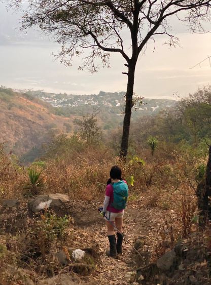
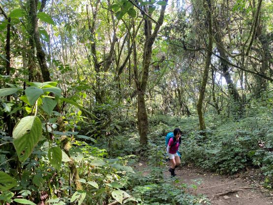
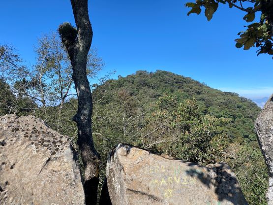
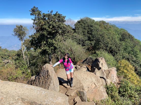
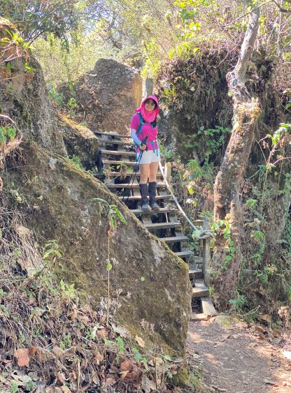
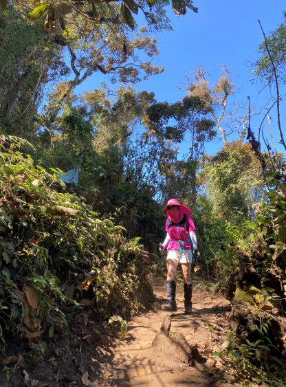
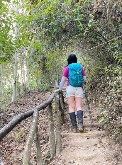
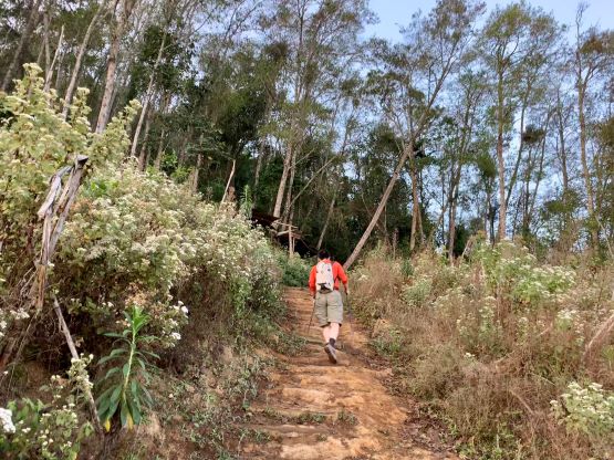
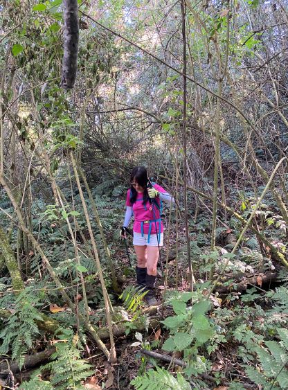
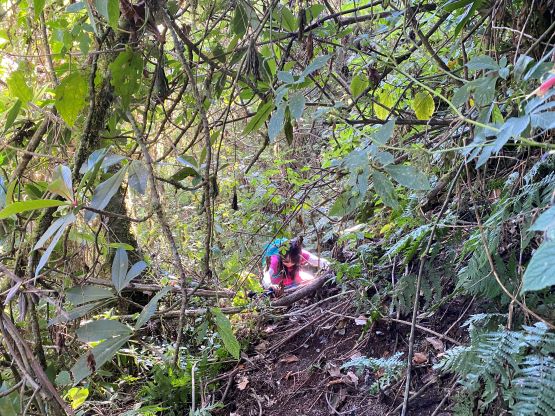
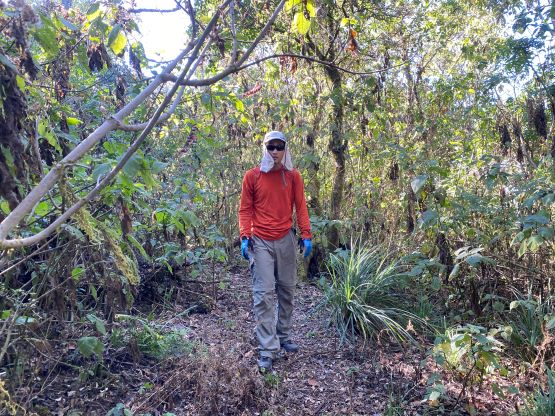
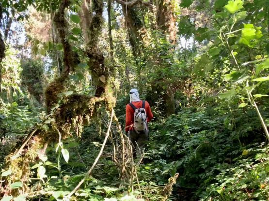
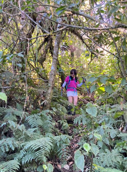
The next thousand meters of elevation gain was very boring but this trail had been well engineered. I could sense why they wanted to change an entrance fee as this was definitely the most developed trail that we had seen in this country so far. We passed a few stations with “lookout” structures but we refused to waste time there. I knew the best views would be on the final lookout/viewpoint or the east rim of the summit area. Kate and I again, did the entire push from the trail-head (1800 m) to the camping area at 2860 m without stopping, but upon reaching the camp site we had to take a break. Kate was extremely hungry and tired whereas I needed to don the long pants and gloves for the bushwhacking ahead. Of those who logged Volcán San Pedro on peakbagger.com I bet no more than 20% actually went to the true summit. I had downloaded Sam Grant’s GPX track and read a bunch of the reports, and I came here expecting an “on trail bushwhack” similar to what I had done in Indonesia last year. The truth was much more relaxed, that even though we did have to some bushwhacking the commitment was rather tame. This was more of an “unofficial trail” to me. We did not encounter anything thorny despite the warnings by the others. Kate managed this entire section in shorts (she did not bring long pants) and did not complain, and that says something. The true summit was viewless as expected, so we took some victory photos and went down.


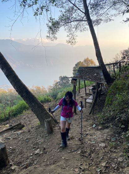


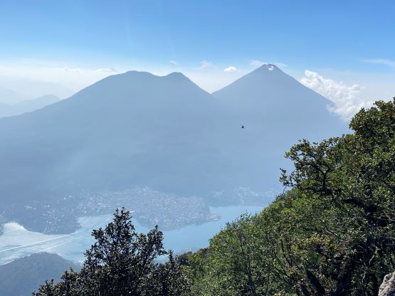
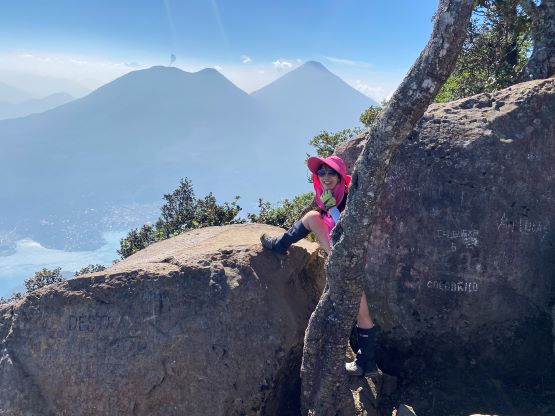
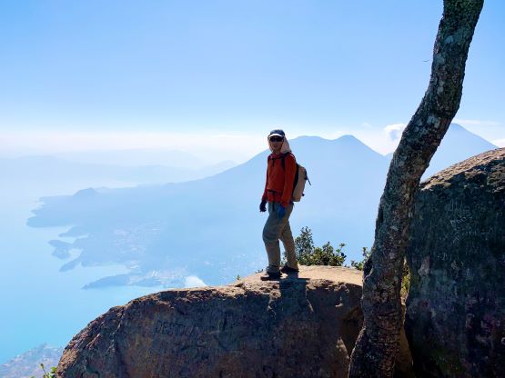
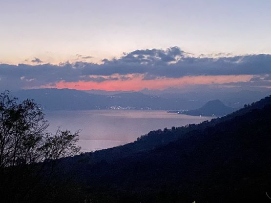
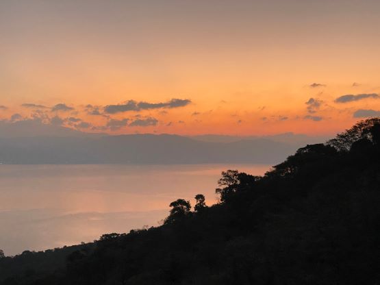
I had considered to skip that trail-end viewpoint because to get there required another 150 m elevation gain. We were already tired and we had two big volcanoes to climb on the following two days, but I still made us to go for the viewpoint for completion purposes. To be fair I didn’t care that much about the views, but I have to admit that the views made this detour worthwhile. We had missed out seeing Lake Atitlán from the top of Volcán Atitlán but we managed to get those views from this peak. While taking pictures a lone German dude showed up and we had a brief chat about the safety issues. This guy had paid the entrance fee and got the “beta” from the policemen that the last recorded robbery event was in June 2023, almost a year ago. I thought there’d be at least one robbery incident per month given the reviews that I had seen, but maybe the situation had improved in the recent time. We met a few more hikers (all foreigners) on the descent and they all asked me “is it safe up there” so everyone knew the problems. While descending we did encounter a group of locals with machetes so I tucked the iPhones and slowly walked into them, but it was apparent that those were working on the trail. We also did not encounter those aggressive dogs probably because it was now in daylight time. I think we showed up too early for the dogs (in the dark with head-lamps on). Upon returning to the trail-head the registration office wanted us to pay, but we refused as there had been no services in guiding us through the dogs zone. That German guy said that the policemen had walked him through the initial few hundred meters. I was trying hard to make the argument in broken Spanish and they eventually gave in. We saved 200Q, and then spent the next few hours driving to Antigua to locate ourselves for the last two objectives.