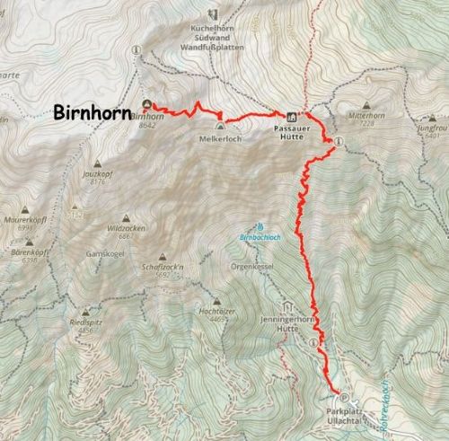
Birnhorn
August 31, 2025
2634m
Austria
Birnhorn is one of the “ultra prominent peaks” in the Northern Limestone Alps of Austria, boasting over 1600 m prominence. This peak is not terribly far from the city of Salzburg. Towards the end of this extended Alps trip I had 4 more “Ultras” to bag in the last 4 days, but the weather was not cooperating in these days. It took a lot of meticulous planning to layout a plan that would more or less guarantee the chance of success on all of these peaks. The first day had some decent forecasts and it made sense to tag the biggest of the 4 objectives, namely Birnhorn. The scrambling might be less involved than Ellmauer Halt but Birnhorn requires a shear amount of elevation gain (over 1700 m cumulative). Most parties would opt to spend a night or two in Passauer Hut about 2/3 of the way up, but Erica, Adam and I would do it in a single push, as always. In fact, I thought “half a day” would be more than enough for us given that we all had reached our peak fitness over the course of a month of peak-bagging.
In the previous day we ascended Hochtor and then drove a few hours westwards to Salzburg to swap the rental vehicle in the airport. The vehicle that we had been using for the past month was already 3000 km overdue for a service so the company insisted on an exchange in one of the three major cities in Austria (at no additional cost). The closest one was Salzburg but this still added some notable driving distance, but it didn’t seem like we had other choices. We did use this oppourtunity to tag Gaisberg in the vicinity of Salzburg as otherwise we wouldn’t have bagged it in this trip. I then drove us 1.5 hours due SW towards Birnhorn. Finding a sneaky car-camping spot in the pitch dark proved to be difficult once again, but I saved us at the very last minute by spotting a pull-out within a few minutes of driving to the actual trail-head. The alternative was to camp at the trail-head but it would be noisy at night. Not to mention that car-camping in Austria is considered illegal so we didn’t want 100 people to see our tents erected in the middle of the lot.
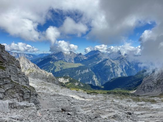
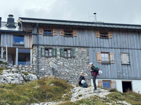
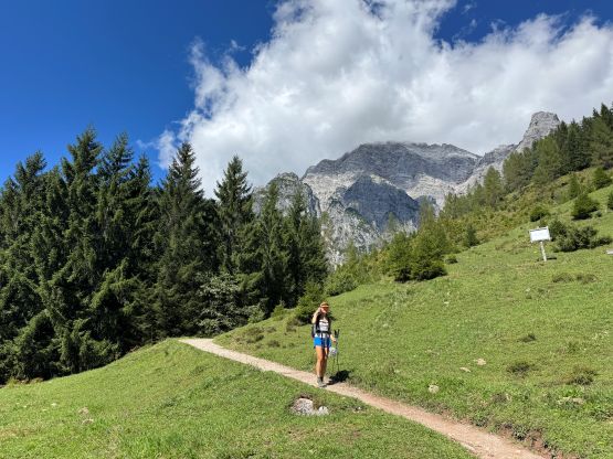
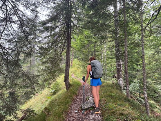
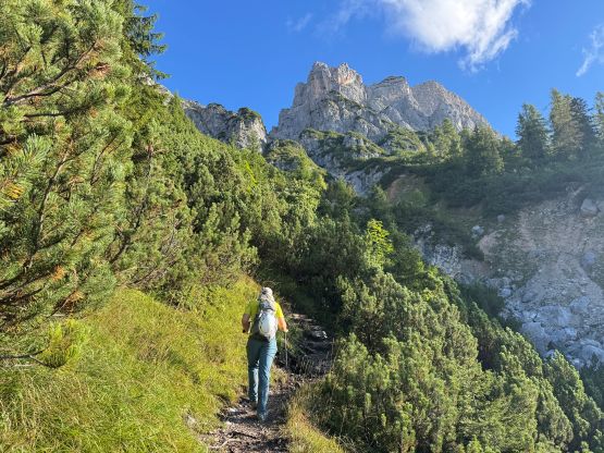
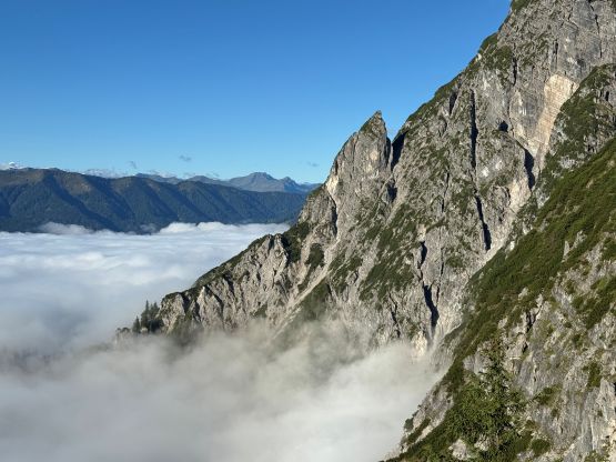
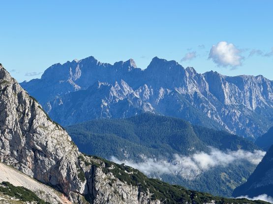
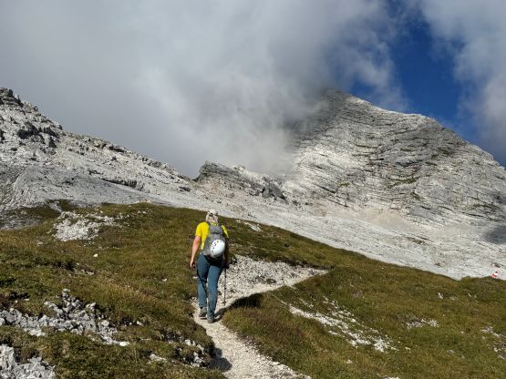
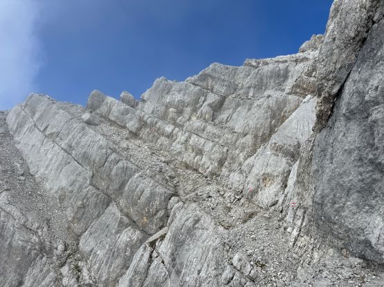
We opted to start at a more civilized hour as the forecast was looking promisingly for the entire day, and again Adam volunteered to go ahead to set the pace. Adam was motoring up the hill fairly fiercely and we did not stop for a break until 2/3 of the way up to Passauer Hütte. I called for that break because the thinning forest was starting to give me some sunburns. The weather was 100% overcast but we had broken through the inversion layer. It was indeed a bluebird day as forecasted, but convection clouds were starting to build on top of the peaks. The last quarter of the plod to Passauer Hütte was quite scenic with cliffy terrain all around.
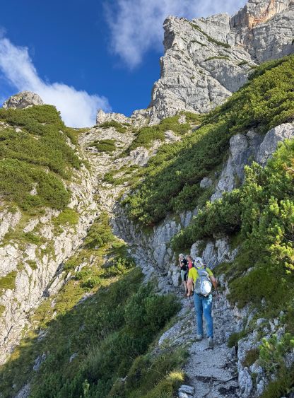
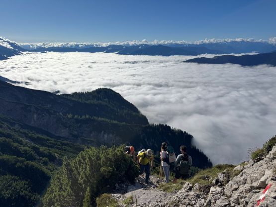
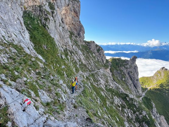
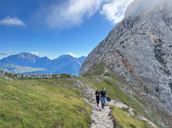
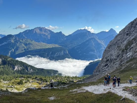
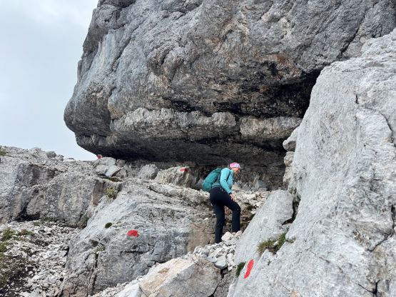
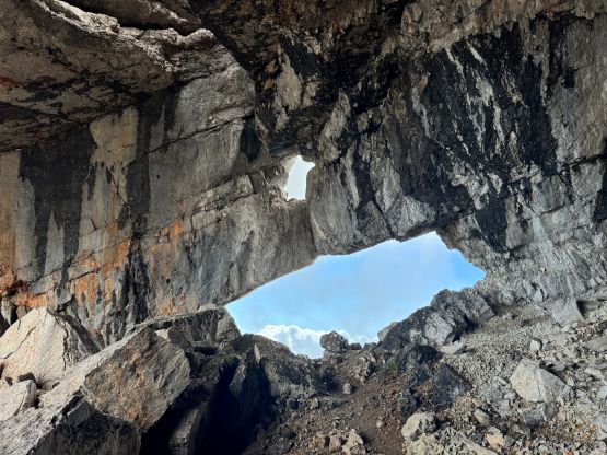
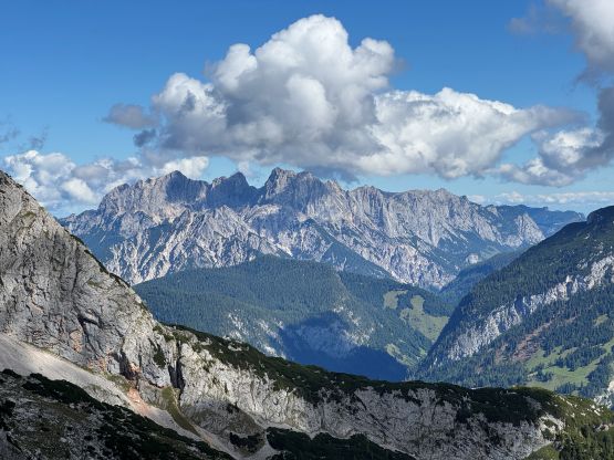
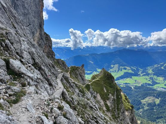
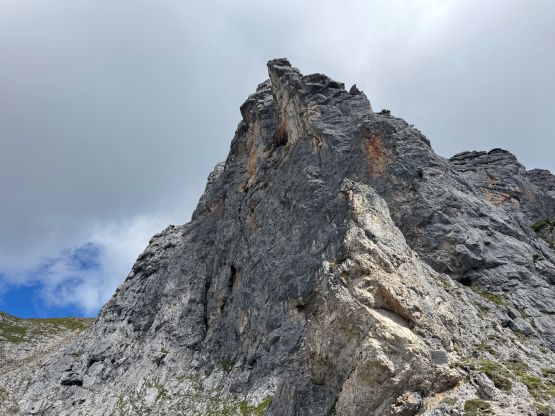
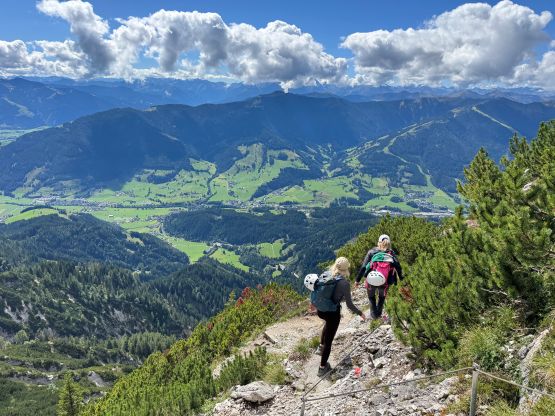
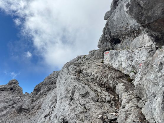
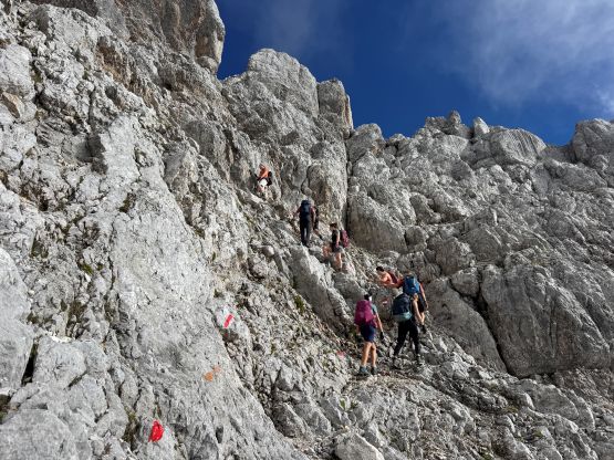
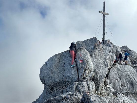
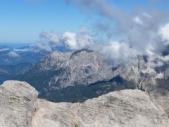
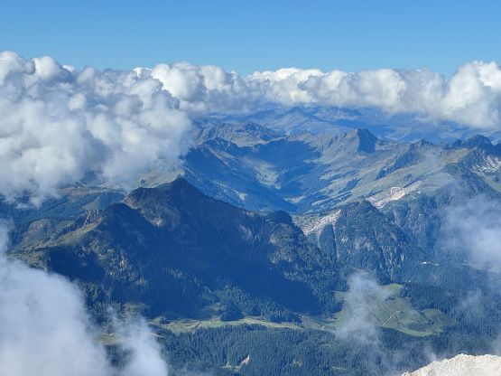
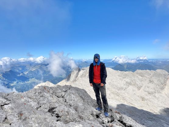
Adam continued past Passauer Hütte without stopping whereas Erica needed to stop for some water and food. I wasn’t too keen on stopping because the hut was crowded and the area was in the shade, so I set my personal goal to reach the summit without eating any food (just like on Antelao), as well as beating James Barlow’s time. I remembered James talking about his Birnhorn’s time and I thought I would have a good chance beating it if I continued onward solo. I passed Adam and then dived into the mist following the so-called “standard route”. The scrambling was trickier than expected with lots of pebbles on down-sloping terrain, but the route-finding wasn’t difficult thank to the abundant painted flags and markers. There were also several large groups ahead “guiding” me the way, despite the lack of visibility. I thought the difficulty was mostly in the range of class 3 but I did do a few trickier moves, but I also never bothered to really search around for easier alternatives. I also passed one of the said large groups by taking a harder but more direct variation. A while later I was on the final leftwards traverse across some narrow grassy ledges before getting on the summit ridge. Traversing to the true summit still required a few difficult moves, and the views were disappointing due to the convective clouds. I did beat James Barlow’s time by about 15 minutes. Erica showed up about 5 minutes later but I was getting too cold to wait for Adam, so decided to start down alone.

There is a designated descent route but the car key was still in Adam’s pocket, so I was “forced” to take the same route down, which I thought wasn’t too bad. Erica and Adam later descended the other route and thought the other one was better but only for mitigating rockfall hazards. I couldn’t really pick up the speed because of various groups on their way up underneath me. There’s a fountain a few minutes above the hut so I stopped there for water, as the hut’s drinking water required payment. I did make an additional stop in the hut to use their bathroom (without paying, of course). Over the course Erica somehow got ahead of me but I didn’t realize that until catching up to her near the finish line. The only reason that I could catch up to Erica was because she’d on the phone calling, for most of the descent. Otherwise she would have been much faster than me. My round trip time was 5 hours 15 minutes and Adam showed up about an hour later. I took the oppourtunity to dry out our gears in the sun. The day was still young but we had a mission tomorrow, so spent a few hours in the McDonald’s for WiFi and charging, and then leisurely moved towards Ellmauer Halt.