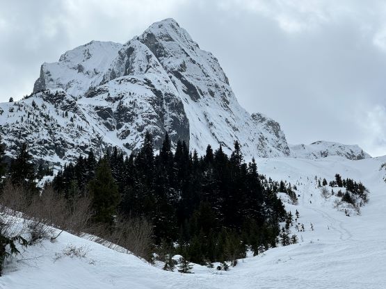
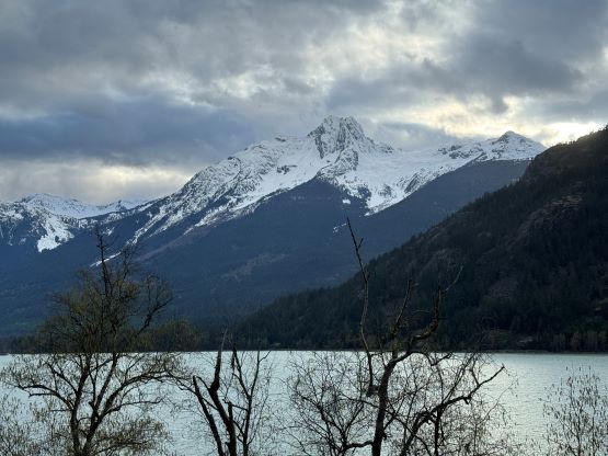
In-SHUCK-ch Mountain (Gunsight Peak)
April 6, 2024
2386m
Pemberton, BC
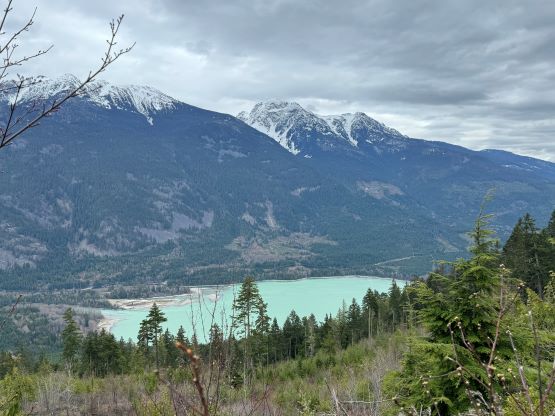
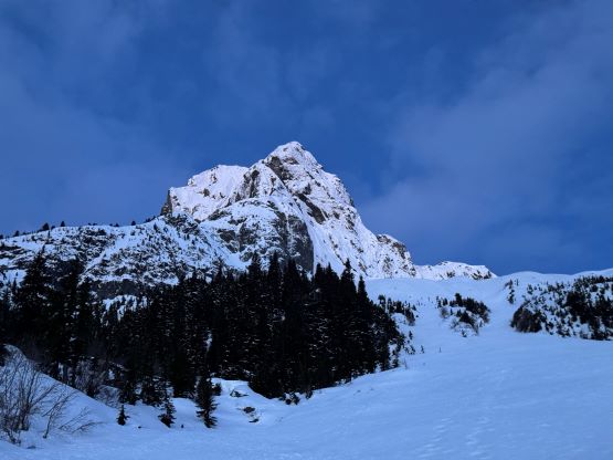
In-SHUCK-ch Mtn., also known as “Gunsight Peak” is an obscured peak looming 2000 vertical meters above the south end of Lillooet Lake, not far from Pemberton in the east or “backside” of Garibaldi Provincial Park. This peak attracts one’s attention especially while driving northwards up the namesake In-SHUCK-ch FSR. Not a lot of people had explored that far down the FSR but those who had could not have missed that iconic “Gunsight Gap” on their way back home. The climbing information was scarce to say the least, mostly because of the technical difficulties in reaching the actual summit. This is one peak that had seen more “attempts” than summits and not a lot of useable “beta” could be dug out from the few failed attempts that had been published online. The climbing routes did get briefly mentioned in Bruce Fairley’s guidebook as well as in Alastair’s old fashioned, all-text-no-picture trip report but those “information” was of no use by the current era’s standard. I found out for many cases that the old trip reports could be more misleading than being useful, and Alastair had deliberately made his trip report vague so future parties wouldn’t have an “easier” time. I completely understand the reason behind it, but I stand on the very opposite side of this “beta vs. no beta” political debate. Fast forward to 2023 Elise and Chris G. were the first in this modern era to embrace the unknown. The outcome was not to my surprise, unsuccessful, but unlike the previous generation Elise and Chris had passed on some important “beta” to the rest of us, such that Seb G. and Thomas M. went in almost exactly a year later and made a successful bid. I was unfortunately in Guatemala at the same time, so I missed it out no matter what.
About two weeks later while still peak-bagging in Cuba I reached out to Elise as I started to see a window immediately after my flights home, and this window was indeed shaping up to be “that one”. The weather was mediocre but I liked the colder conditions and I was certain that the choss in the first constraint that stopped Elise on her first attempt would still be glued by ice. I don’t think the ice in that constraint had been constantly formed because it was certainly not there in March 2023. This year had been warmer than usual with more freeze thaw cycles and more precipitation events in the form of the sticky “spring snow” even in the middle of the winter season. I knew I’d be pushing the limit by doing an all-nighter push immediately after an exhausting overnight layover, but I must take advantage of the rare conditions. The physical challenge of this objective is not to be underestimated, as one must gain over 2000 m just to get to the base of the technical pitches, with a hefty pack and without a trail. Most parties would need 2 or 3 days but we were going to make it in a single push, home to home. I was scheduled to arrive in Vancouver at noon on Friday and the plan was to leave home at around 10 pm on that same day. I was relying on the flights to be not delayed (which was thankfully true), and I also tried really hard to sleep for a few hours by pitching out my mattress and sleeping bag at the departure gate during the 10-hour layover in Dallas-Fort Worth Airport. I also booked 3 hours of work on Friday afternoon so I literally would have zero rest but that’s just how I plan things sometimes. No pain, no gain.
I managed to get everything packed about 2 hours before the 10:30 pm departure time so I also caught up with some sleep at home. In terms of the technical gears we would bring one 60-m half rope, two pickets, three screws, technical ice tools and technical crampons. I would have brought more for a peak that involves more than 100 m of continuous technical climbing but with Seb and Thomas’ recent beta we were able to find the right balance between “too heavy” and “not enough contingency”. In fact, I was very confident that we would nail it in one shot because the “recipe” was already there and I was very experienced in timing the right window with the right team for the right objective. I did reach out to a few more partners, specially those specialized in ice and mixed climbing but it was only Elise, Francois and myself heading out in the end. The pressure was on Elise and myself to lead those pitches and I was slightly worried about our abilities but the objective turned out to be in our league. Still, this is one of the hardest peak in the corridor by the easiest possible way and I found the overall commitment to be very similar to Pyroclastic Peak that Elise and I did a few months earlier, together with another friend, Mel. By 10:45 pm Elise and Francois showed up in Francois’ Subaru with a Washington plate and they drove us there by taking turns. I took my rare oppourtunity this time to sleep on the backseats and we arrived at the “trail-head” about 3.5 hours later. The spur road had an massive washout not far up from the beginning so it was pointless to attempt driving any further than the lake’s level.

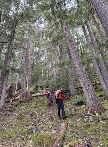
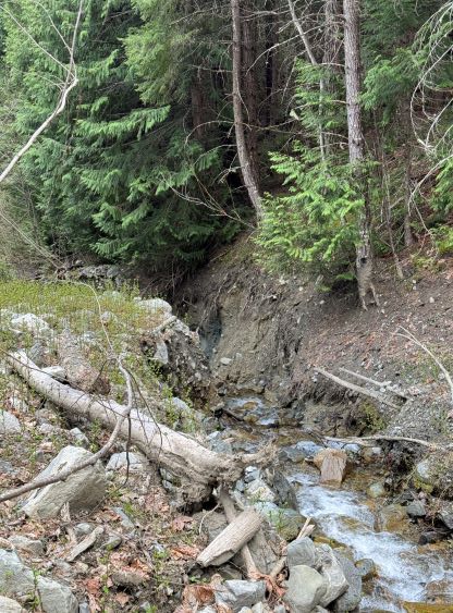
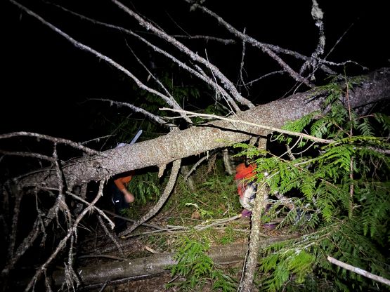
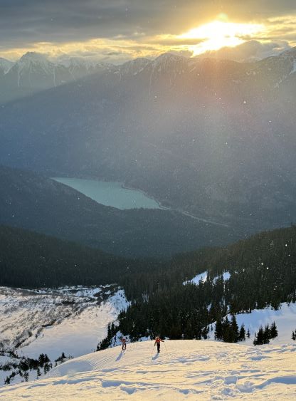
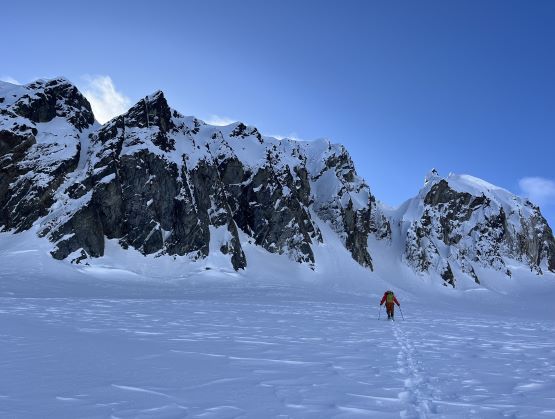
The washout that was mentioned in Seb and Thomas’ trip report was indeed massive, and in fact was difficult to cross on foot. I took a slip crossing this washout on the return about 15 hours later and injured my finger, but more on that later. The initial sighting of this spot made me search for another way, but Elise dropped in and showed us the sequence of the moves. Francois and I then followed without much of a problem. Our pace walking up this spur road was not as fast as I was hoping for, partially due to the frequent alder thrashing but mostly because of the heavy packs. Coming straight from a Caribbean trip with donkeys and guides to something like this would not help, but we made steady progress nevertheless. I paid specific attention to the spot where Seb and Thomas made an navigation error as the correct road was blocked by some downed trees and appeared significantly overgrown. We did have to hop across about 20 dead-falls in total but the road improved higher up, but then the final kilometer did involve some continuous bushwhacking in alders that were thick enough to be annoying. I took a look at the GPS and it had taken us 1.5 hours to reach the end of the road and we took a needed break there. The next 400 m elevation gain was to ascend straight the hell up the forest and this section was actually quite easy by comparison. The footings were mossy and slippery but there was virtually no bushwhacking except for the cut-block at the beginning. We actually picked up the faint remnant tracks from the previous group after hitting snow at around 1100 m elevation, and then traversed some steep and icy slopes northwards into a broad and treeless basin, and it was then finally bright enough to see something.
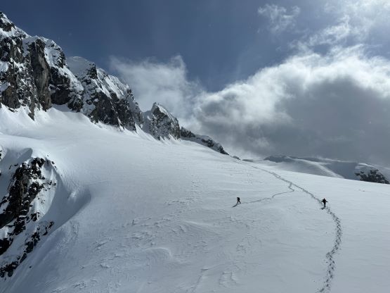
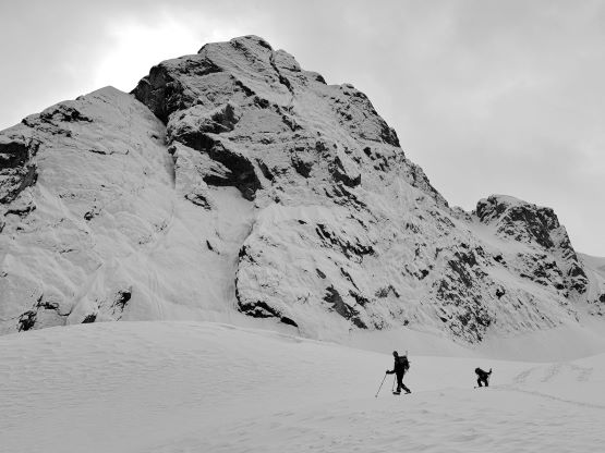
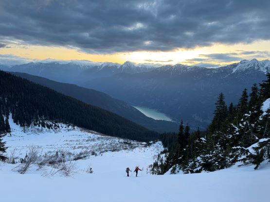
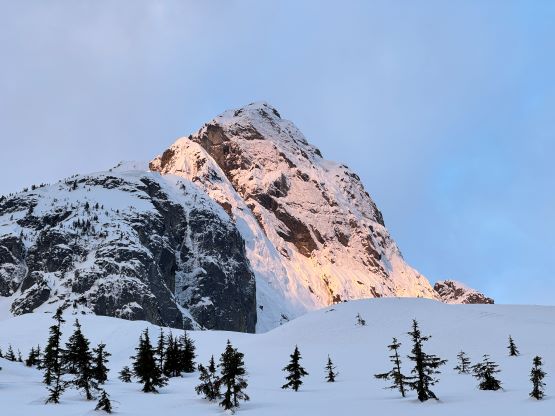
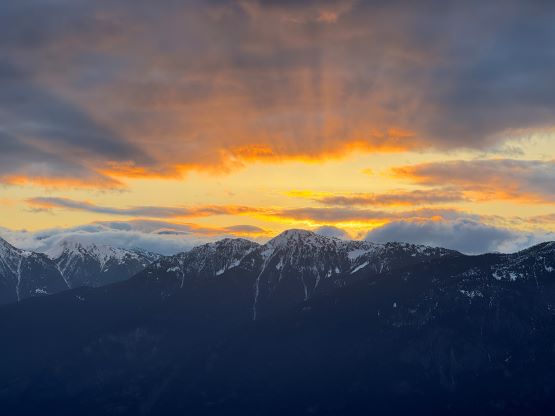
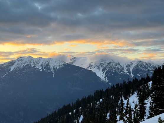
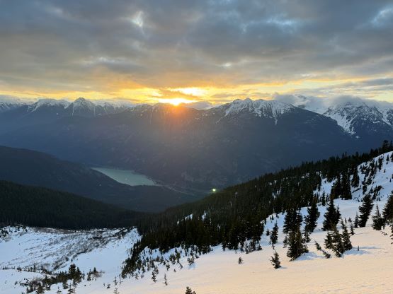
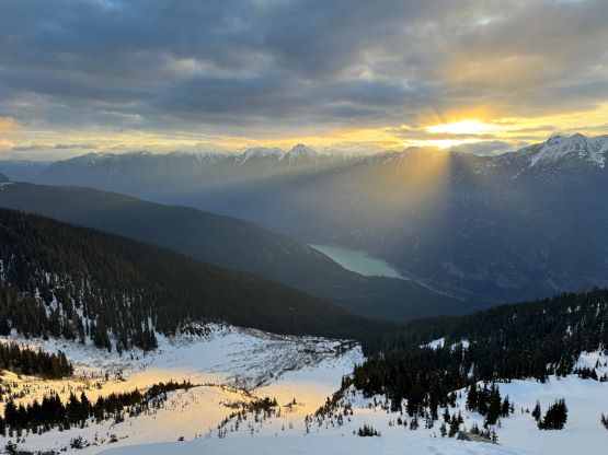
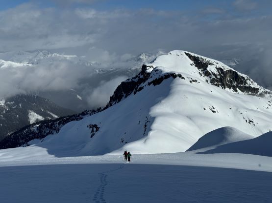
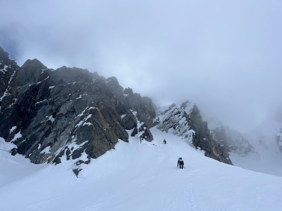
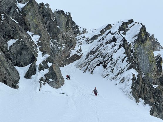
We would then plod 700 vertical meters straight up the middle of this open valley to the broad col about a kilometer north of the peak and the middle section of this valley was in some avalanche chutes. After gaining about 50 meters elevation I made the call for us to don snowshoes mostly for the added tractions. The snowshoes were definitely needed after ascending through the avalanche chutes. I think the previous group went climber’s right but we stuck on left chute variation and dealt with some steeper terrain afterwards. There was about 20 cm of recent snow heavily redistributed by the winds and we found isolated pockets of wind slabs almost everywhere, but none of them was reactive. The weather was not as great as I was hoping for. We could see a system strengthening to the north, and we had light flurries throughout the entire day, but the visibility was good up until this point and we even got some sunrise pictures. The trail-breaking was variable but not heavy enough to really slow us down, that I made us to plod all the way beyond the col to finally take a break. We then leisurely gained the final 200 m elevation up this small glacier to the base of the route, which appeared rather similar to what I saw in Seb and Thomas’ trip report.


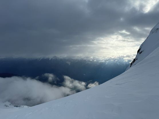


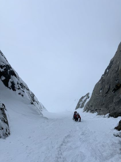
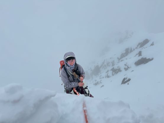
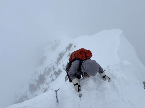
The weather unfortunately closed in as we wallowed up the “fan” towards the bottom of the first constraint. We entered a white-out for the next couple hours but the precipitation stayed light throughout and there’s hardly any accumulation going on. The first constraint did not appear that scary anymore from the bottom and I even tempted to solo it, but the ice appeared rather good for protection so we played it safe and pitched it out. I played two ice screws with one being mediocre as the ice was thin, but they definitely boosted my confidence on leading. There was one unexpected crux ice step about 10 m higher up than this initial ice-covered slab that took me a while to figure out a sequence. I could not find any place to put in a protection so I essentially did it with a huge run out. The angle of the terrain thankfully mellowed afterwards and I was even able to find the previous group’s single-nut rappel station. I then ran out the rest of the pitch to the bottom of the second, mixed constraint. I evaluated my options and decided to build my own anchor to belay Elise and Francois up to this point.
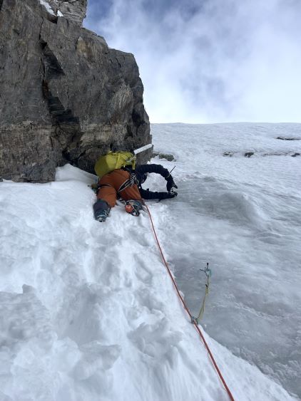

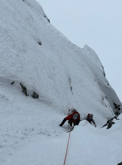
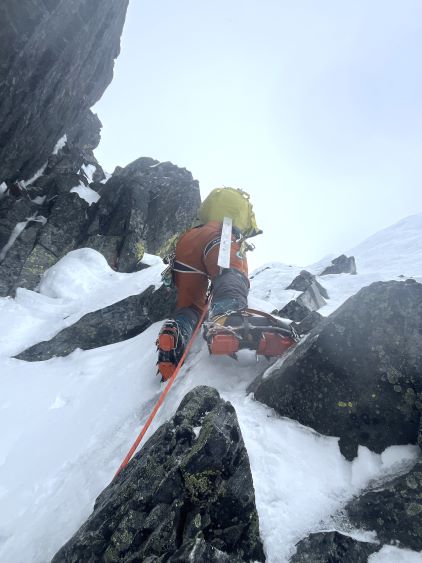
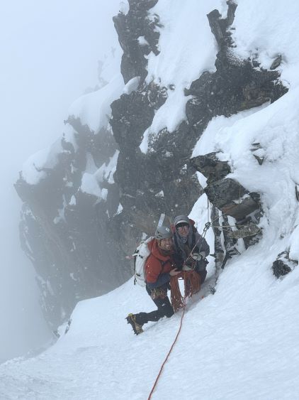
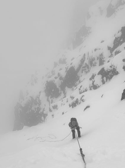
The second pitch was the only one that the previous group needed a rope for, so we would definitely pitch this one out. Elise wasn’t extremely keen on leading due to the questionable rock quality so I was on the sharp end again. There were a few dry tool placements and some tip-toeing on rock holds, but it wasn’t that difficult after all. I knew Seb did a meandering lead, but I could see their next rappel station about 5 m up on the left side wall so I aimed for a more direct attack. This meant we did a bit more steeper climbing but our protections were more secure. I managed to put in another nut higher than their aforementioned rappel station, and then ran out to the following rappel station (exactly 30 m pitch) to belay the others up. The rest of the climb would be entirely on snow, but the rope was already out so we might as well use it. There were some steep front-pointing on the initial stretch but the rest was just some easy, 45-50 degrees soft snow including that uber-steep traverse under the summit. I ran out the entire 60 m and belayed Elise and Francois up from the very summit using a T-trench. With a belay Elise and Francois climbed a more direct line to top out, avoiding that traverse section all together. The precipitation and the white-out had never gone worse but we unfortunately had no view from the top. The good news was that I managed to catch some cell receptions so I was able to send out an Instagram story before putting them on belay.


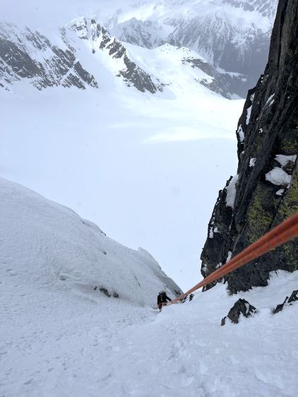
I could not find the uppermost rappel station built by Seb and Thomas for some reasons so we evaluated our options for the descent. The easiest way would be for Elise and Francois to rappel off the single 60-m strand whereas I would dissemble the anchor, toss the rope and then down-climb. After deciding that I could definitely down-climb this 60-m snow pitch we did the exact same as planned. There were some ginger moves but nothing too sketchy, and by the time I got down to the rappel station they had already finished the next rappel to speed things up. We also decided to relocate one of the previous group’s rappel station so that we could avoid using that single-nut station. While leading the last rappel down the icy corner I even managed to take out that nut using my ice tools. Our 60-m rope was just long enough (with a bit of weighing) to get us bypass that icy corner so our plan worked out rather perfectly. While pulling the rope I made the spontaneous decision to simply drop it to recollect at the bottom of the “fan”, where I was also able to recollect Elise’s dropped walkie-talkie and Francois’ dropped glove so we ended up leaving nothing on this route and even retrieved one piece of gear. The weather had magically improved which pissed me off a little bit.


Now with some blue skies we took our time to recollect ourselves and leisurely descended that north side glacier. I even did a short detour to a small hill to check out more views but the others did not bother to do this unnecessary 20-m elevation gain. We fortunately had very minimal elevation regain afterwards even though we had 2000 m tiring elevation to descend. The snowshoeing section was the easiest for me. Francois hadn’t got used to snowshoeing yet so he post-holed his entire way down on foot. Elise did a few switches between snowshoes and boot-packing but eventually opted for snowshoeing. I finally took the ‘shoes off at the bottom of this open valley but we had some unexpected post-holing afterwards while traversing back into the forest. The snow was still strong enough to support our weight but some thin spots had become quite weak in the afternoon’s heat. There wasn’t much to take note of for the rest of the descent besides perseverance and unpleasantness. I had opted to wear the Nepal Evos for the whole day and my feet were definitely not happy about this decision on the bottom 1000 m of the descent. The alders on the spur road were still annoying, that we could not plod at “full speed” as we otherwise thought about. And as mentioned earlier I took a slip while crossing that washout. I knew it was happening I was able to react but my body was not listening to my command as I had already reached my physical limit at this point. My hand was still hurting two days later but fortunately I don’t think anything’s broken. Our round trip time was just over 15 hours and we did our next stop in Mile One for food. Francois managed to drive us all the way back to conclude the 24-hour home to home push.