“Hynes Peak”
October 30, 2025
1897m
Squamish, BC
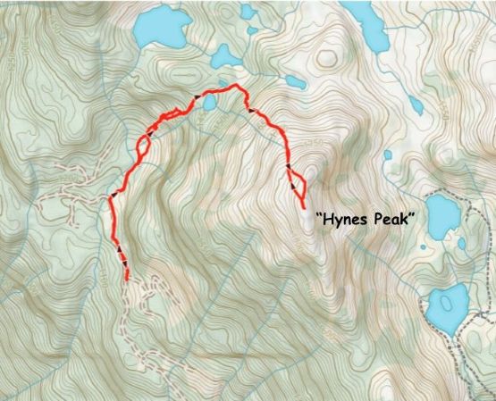
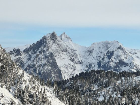
“Hynes Peak” is one of those bumps in the vicinity of Tricouni Peak that had sort of gained popularity in the recent years. There used to have only two named peaks (Tricouni and Cypress) in the area but thank to some random person sitting in front of his computer there nowadays has more than half a dozen “objectives”. This is a good and bad news for peak-baggers. Anyone that knows me knows how much I hated those “bivouac names” but they had already started to “stick” at least on the internet, so I had no choice but to “accept” them. This particular objective boasts over 300 m prominence so regardless the status of the name, this is a legit objective. I’ve seen at least one Facebook report that involved skiing or snowshoeing but the searchable trips were all done in summer months. A quick glance at the maps saw lots of possibilities to explore so the routes are not limited to the existing/published ones.
Matt made the suggestion to tag one of the P300m objectives in the Sea to Sky Corridor on Thursday. I was instantly rejecting the idea because I was swamped at work that my motivation in hiking had literally hit the lowest point these days, but then I checked the weather and changed my mind. This past Thursday saw the only chance of sunshine in the period of 10+ days so I either took advantage of the weather or sat in the office for another 10 days doing nothing. I chose the former but we still needed to aim to get back for my routine afternoon/evening work. “Hynes Peak” seemed like the right choice. Matt and I discussed the route possibilities and eventually opted to take Tareef’s route as it’s by no doubt the shortest option providing that we could drive to the road’s end. Matt had one of the most capable 4×4 vehicles out there in the market so it made sense to take advantage of that. We decided to leave North Vancouver no later than 5 am and to make that happen I decided to crash in Matt’s house for the night. I didn’t get there until 1 am so only managed to sleep for a couple hours.
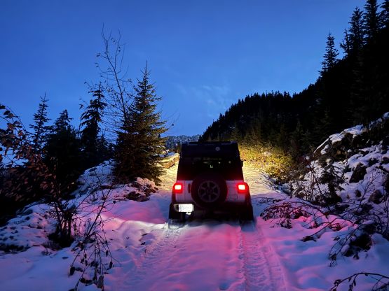
Matt woke me up at 4:30 am so we were hitting the road sooner than expected. We stopped for breakfast in the Cloudburst Cafe in Squamish before venturing off-road into Squamish Valley. The unpaved portion of the Squamish Valley FSR was in a terrible shape with a million pot-holes, but Matt drove aggressively nevertheless. The spur roads towards Tricouni Peak’s trail-head was definitely 4×4 territory. Back in the days I did Tricouni Peak as well as Cloudburst Mtn. all from Chance Creek on the east side so this was actually my first time riding on the standard west side access. The roads were worse than I thought and would be pushing the Subaru’s limit if it was me driving. These roads imposed no issue whatsoever to Matt’s Jeep Wrangler so in no time we were at “Tareef’s turn-off” deviating from Tricouni Peak’s access and onto Branch 223 heading north. We encountered continuous snow at 1000 m elevation so the last kilometer was quite slippery, but thankfully the existing tire tracks made the job easier for us. We were able to drive all the way to the 1150-m junction and parked the Jeep for the day. Tareef had driven 500 m further to the absolute drivable end but we saw no point in pushing for that. We also timed ourselves perfectly to not need to use head-lamps.
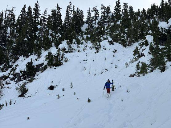
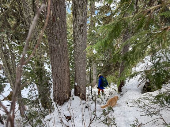
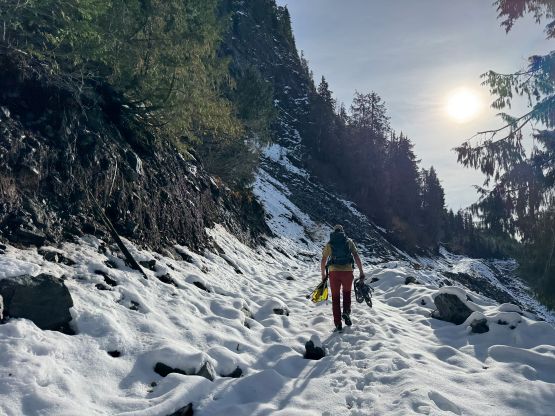
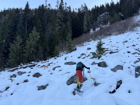
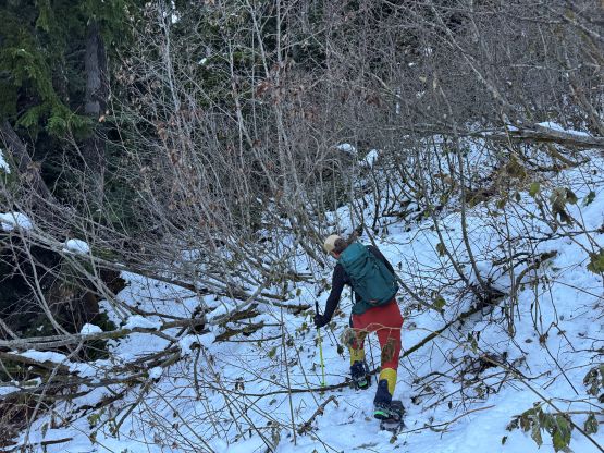
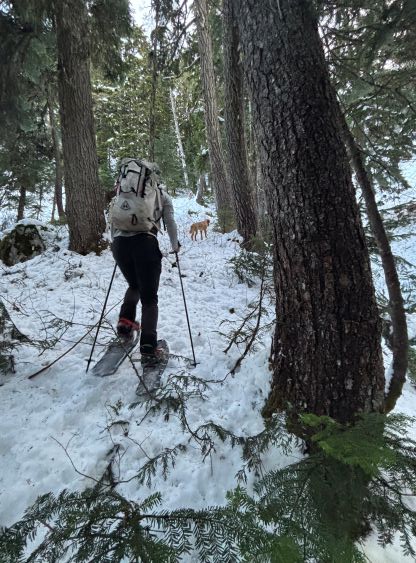
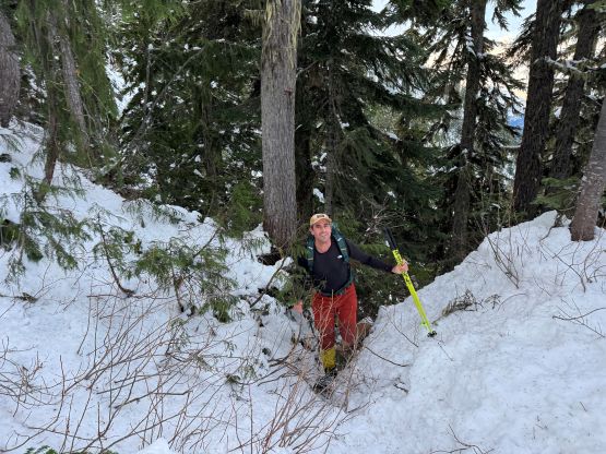
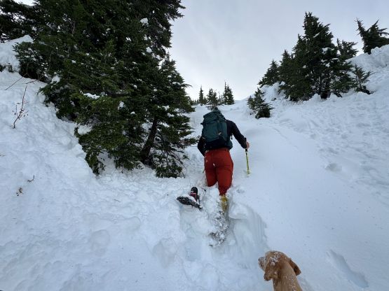
There was enough snow to don boots and gaitors right from the vehicle so we both did that. I then followed Matt’s lead plodding to the road’s absolute end with some minor descending, and then dived into the bushes. I was anticipating some nasty bushwhacking based on Tareef’s pictures in his trip report and the insufficient snow coverage but the situation was nowhere as bad. A few minutes later we got tired of the post-holing and donned snowshoes, and the snowshoes stayed on for the rest of the outing. There was some mandatory bushwhacking over dead-falls and alders mostly in the patch of open area before entering the steep forest, but nothing substantial. Once entering the mature forest the bushwhacking was basically over. The terrain was quite steep but we stayed more to the climber’s left and managed to avoid the troublesome cliff bands that Tareef was struggling with.
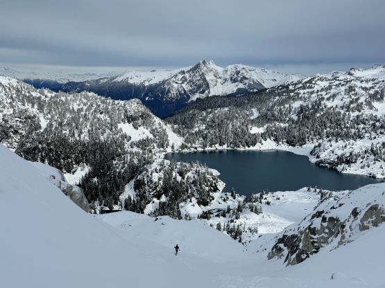
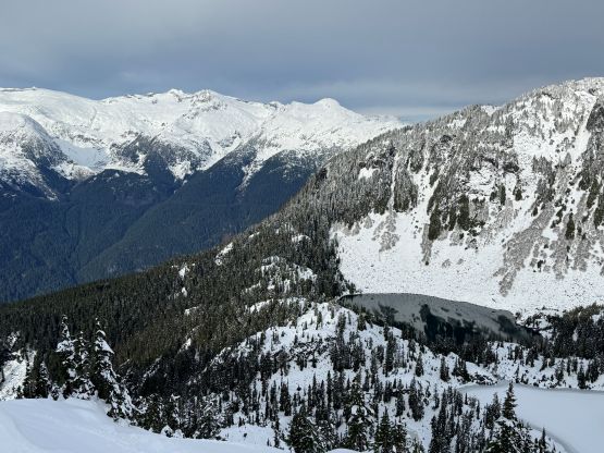
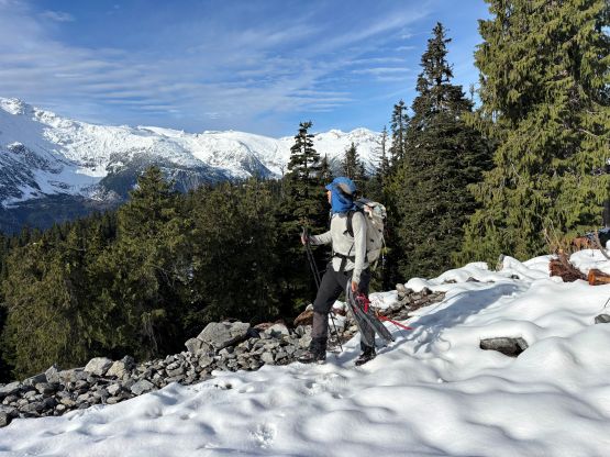
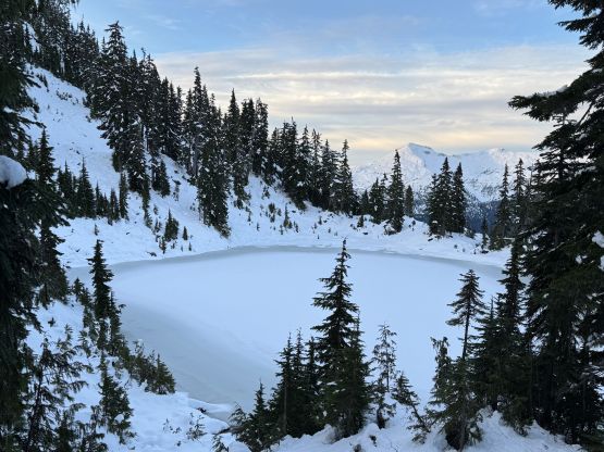
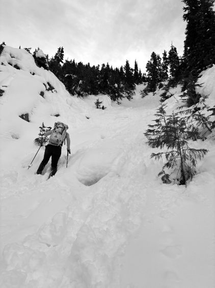
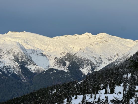
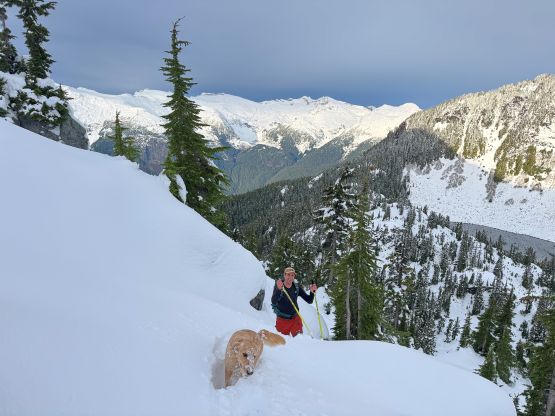
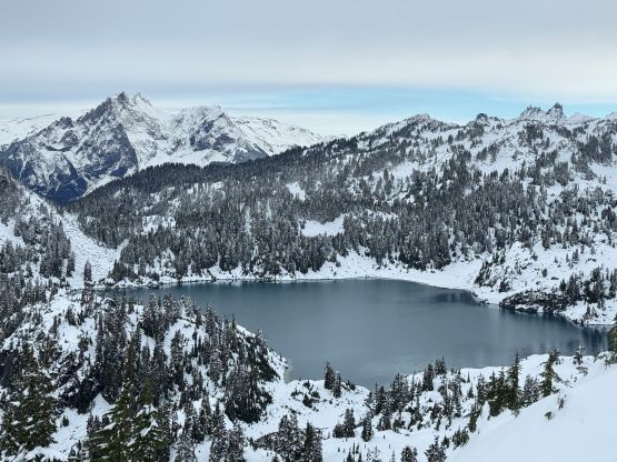
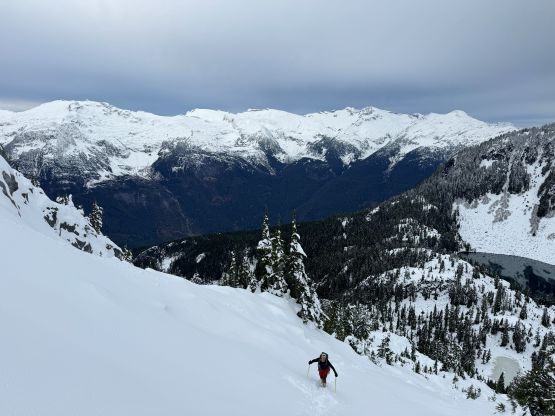
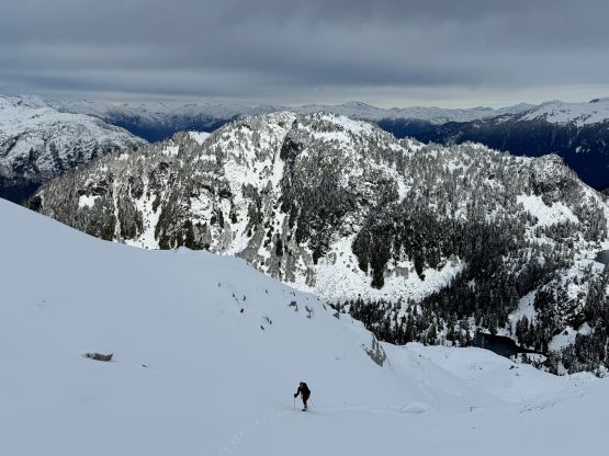
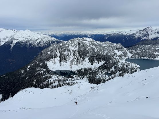
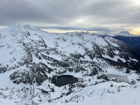
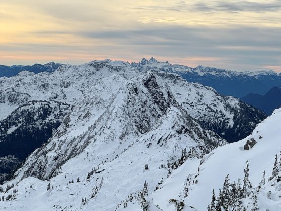
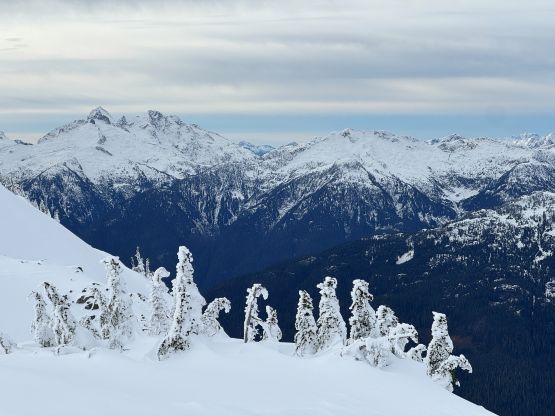
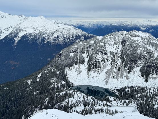
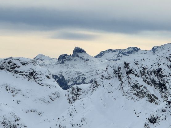
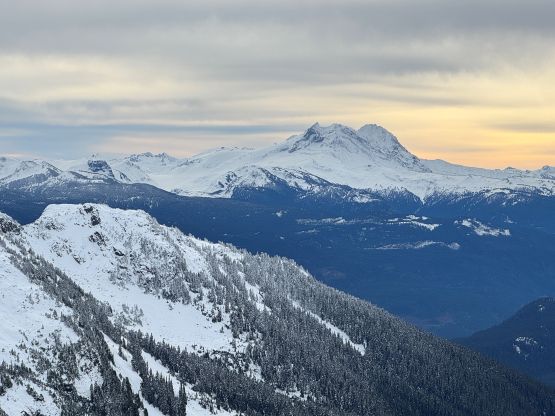
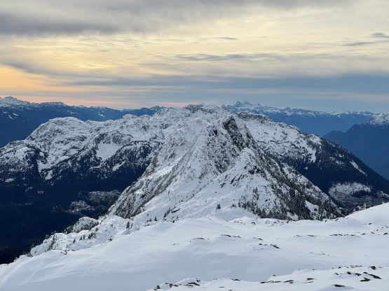
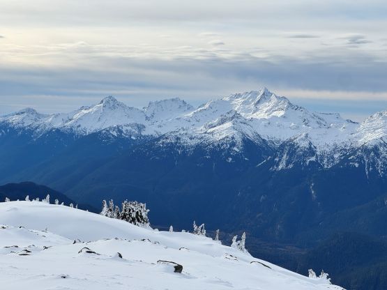
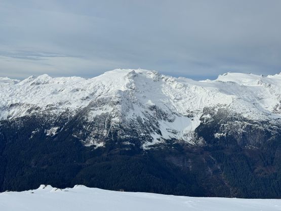
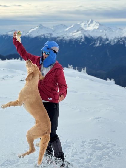
By the time we got to Pykett Lake there was a sudden change from the forest with lots of underbrush and insufficient snow to the flat meadows with too much new snow. We were suddenly post-holing knee+ deep even with the snowshoes on, and the condition was heavy and wet which made for even worse progress. Matt broke trail skirting around the undulating terrain on the north side of Pykett Lake and then I took over. My original plan was to ascend the steep chute towards Iceberg Lake because the terrain beyond that seemed more friendly, but the chute was steeper than I thought and didn’t have enough snow. The “plan B” was then to follow Tareef’s GPX track ascending the steep and complex terrain to our immediately right. The terrain was indeed complicated. I initially traversed across some insufficiently covered boulder field into a steep chute, but the going quickly became crotch deep wallowing up the 40-degree gully. The wallowing forced me making a tough exit to the right but the terrain was still horribly steep. Matt then took over for a while but the going was not getting any easier until above 1700 m elevation. The grade was no longer that steep and the snow condition had transitioned to “dry powder”. The view was unfortunately very foreshortened. I got impatient higher up and went for a steep but direct route up the NW Face, but this positioned us onto the northern sub-summit. The traverse to the true summit involved more steep terrain but at least the views were excellent.
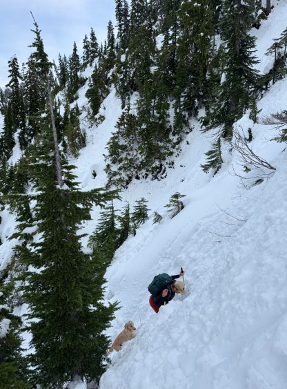

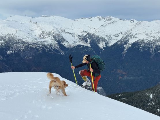
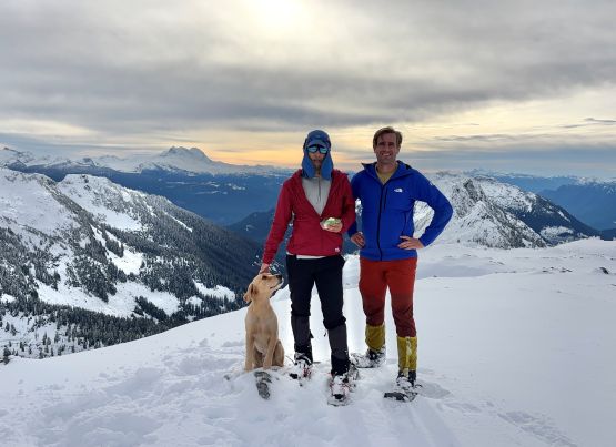
It had taken us 2 hours 45 minutes to ascend this peak which was a tad slower than expected, so we needed to hurry up on the descent so that I wouldn’t be missing the working hours. Matt found a better way descending from the summit avoiding having to reascend the false summit, and then we more or less followed our own route back down to Pykett Lake. The snow condition was a bit on the heavy and wet side so I took my time descending. We both did several glissades down the steepest parts of those chutes and that was really fun. Descending the steep forest below Pykett Lake was not as enjoyable but at least we had our own tracks to follow, so the route-finding was non-existing. Lower down Matt picked a different way through that open field presumedly to avoid that band of slide alders, but the bushwhacking was not much easier overall. I think it would be hard to completely avoid bushwhacking but at least the heinous stuffs were short-lived. The sun came out completely during the final kilometer of uphill plodding back to the vehicle. Our round trip time was under 4 hours so we weren’t doing that terribly on time. We even earned ourselves enough time to have a proper lunch in Squamish before rushing back home for work. Overall I would highly recommend “Hynes Peak” as a shoulder-season objective due to the excellent views and the easy access, providing one owns a beefy 4×4 vehicle such as Jeep Wrangler or Toyota Tacoma. On the other hand, I doubt this will ever become popular in the dead winter once the access road gets snowed in, and the route we took is also very prone to avalanches.