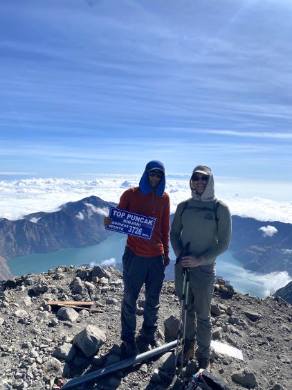
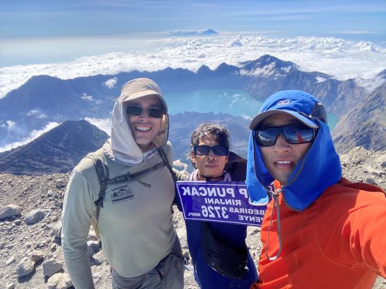
Gunung Rinjani
July 18-19, 2023
3726m
Lombok, Indonesia
Gunung means “Mount” in English and Rinjani is the highest peak on Lombok Island in central Indonesia. This was the first objective that Adam and I decided to climb and the plan was to bag as many “Ultras” as possible in Indonesia. This country has countless islands and volcanoes – a perfect recipe for producing prominent peaks. Being the island high point Gunung Rinjani is the 38th most prominent peak in the world despite the complete lack of technical challenges. It’s however, not as “easy” of an objective as one might expect due to the physical challenge (over 2700 m elevation gain), as well as the somewhat complicated logistics. A guide is required, the law is enforced and folks who attempted this peak without a guide were turned around. The government had also issued a quota system on the maximum number of people allowed in a day (~180) so making an early booking seems essential. After reading multiple trip reports we opted to follow the rules. I found this John’s Adventures and after consulting about the prices I decided to take the offer. This might not be the cheapest company but I trusted their service since they’d been guiding this peak since 1982. There are multiple packages to choose from and I always prefer the shortest/simplest, and in this case was the 2D1N (2 days, 1 night) option. The climbing days had to be fixed thank to that quota system, so we needed some luck with the weather. That’s the main reason why I decided to come here in July. The oppourtunity cost for not being in Northern Hemisphere at this time of a year is very high, but July is Indonesia’s dry season and we needed good weather.
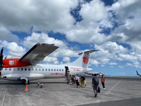
I booked the tickets through EVA Airways routing the layover in Taiwan. There’s no significantly better option and I must suck in the 1900$ one-way ticket from Vancouver to Denpasar. I arrived in Bali in the afternoon of the 16th and subsequently obtained my 30-day visa on arrival. They unfortunately do not issue tourism visa for over 30 days so I somehow had to deal with that later in this trip, either by a complicated extending process or by flying to another country and coming back. Adam showed me some local food and we even walked to the beach after sunset. The purpose of this trip was peak-bagging, but coming to Bali without going to the beach seemed rather unacceptable. The next day (July 17th) we took the Wings Air to Lombok (LOP) and the flight was delayed by about an hour. The driver was at the airport waiting for our arrival and it took us a while to find him due to some miscommunication. The drive to Senaru on the far northern part of Lombok Island took at least 4 hours thank to the heavy traffics and some road constructions. The manager, as well as John himself were there waiting and gave us some briefing and a late dinner. The hotel was overall better than expected but they only gave one bed for the two of us. I guess most people come here with girlfriends, wives and husbands and they probably had never seen two dirty peak-baggers coming for their missions.


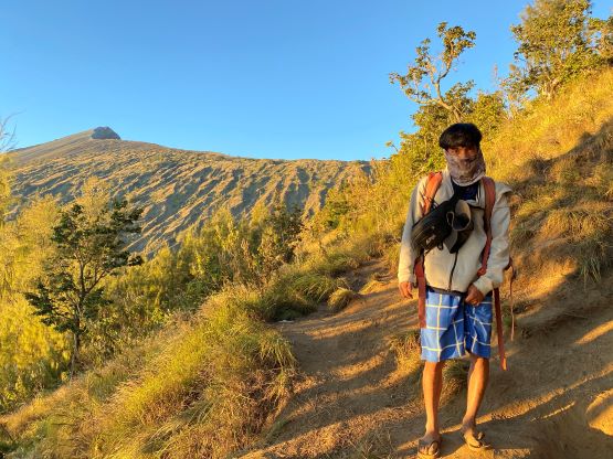
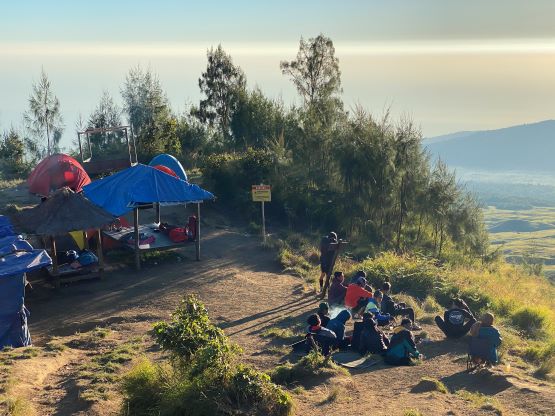
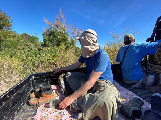
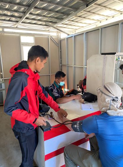
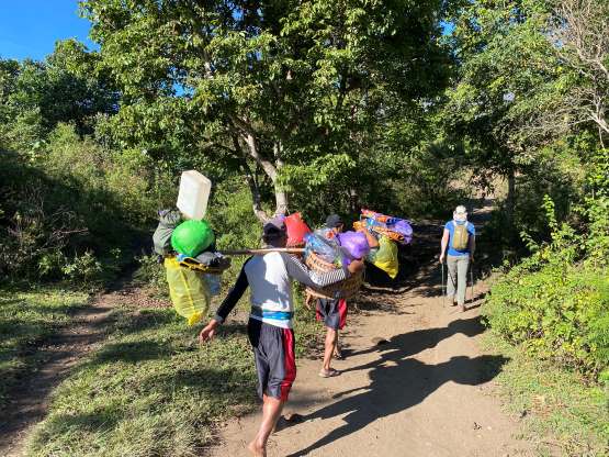
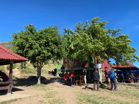
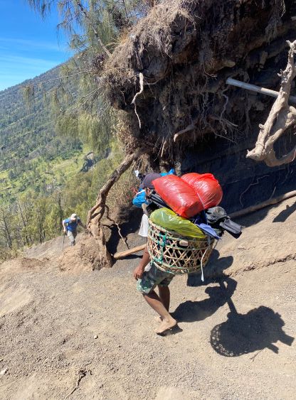
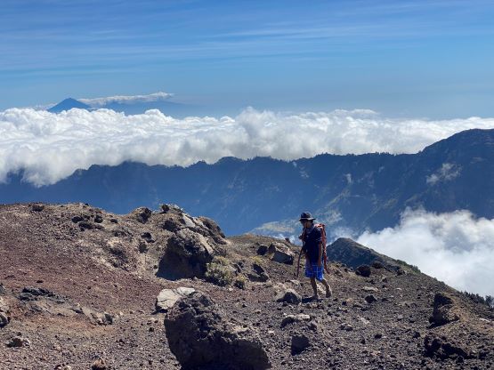
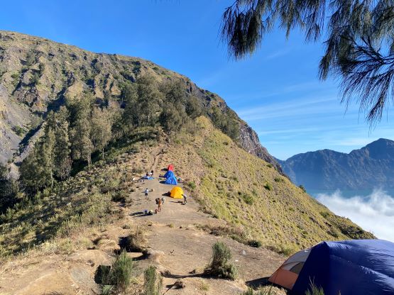
Adam and I decided to wake up at 6 am for the last-minute packing and breakfast and the guide, porters and the truck came at 7 am to pick us up. All of us had to sit on the truck’s bed to be transported. Our first stop was a doctor’s place in Sembalun for a mandatory blood pressure check and our next stop was the park’s gate to obtain our permit. The whole process took about an hour. By the time we finally parked at the trail-head to start the trekking it was already very hot. The weather seemed to be very stable without a single piece of cloud, but that’s not the greatest for this particular approach as we’d be hiking mostly in open terrain without forest coverage. The approach to the camp involves about 1600 m elevation gain and the guide anticipated at least 7 hours, but we knew we’d be faster than that. Adam dashed up the trail right off the bat on a blistering pace and I was struggling to keep up until past “Pos 2” where things finally started to become steeper. Adam had to slow down due to the heat and the steep grades but the heat never seemed to bother me by that much. I was glad to finally have a more civilized pace. I think we did two additional stops to cool off but otherwise we pushed all the way to the camp in just over 3 hours. Our guide, Adi was with us the whole time. Based on the pace Adi proposed to summit on Day 1 and we decided to take that offer as the weather seemed to be really good. The porters were hours behind so we wouldn’t be able to get our lunch nor to rest in the tent anyway.


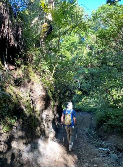

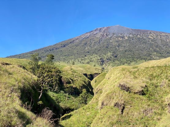


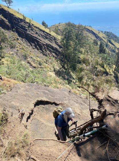
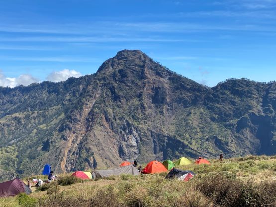

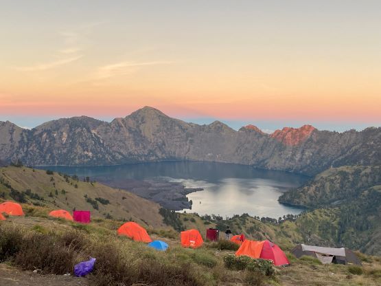
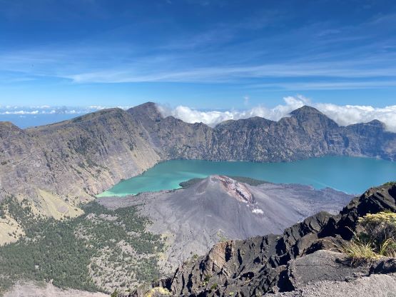
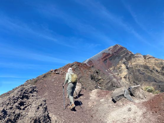
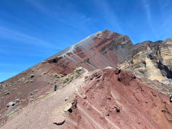
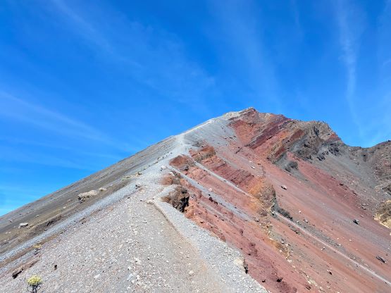
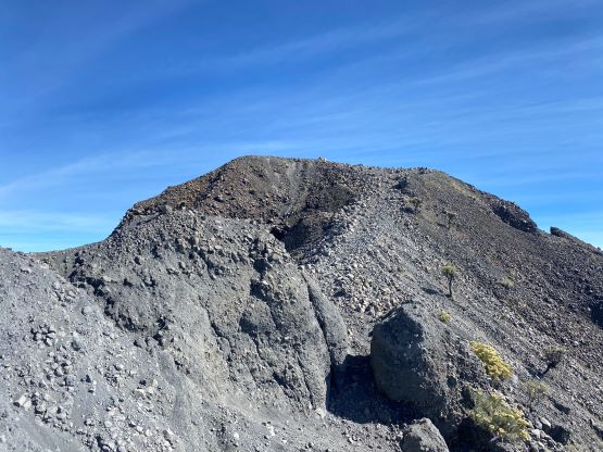
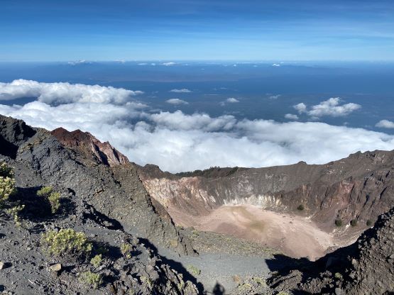
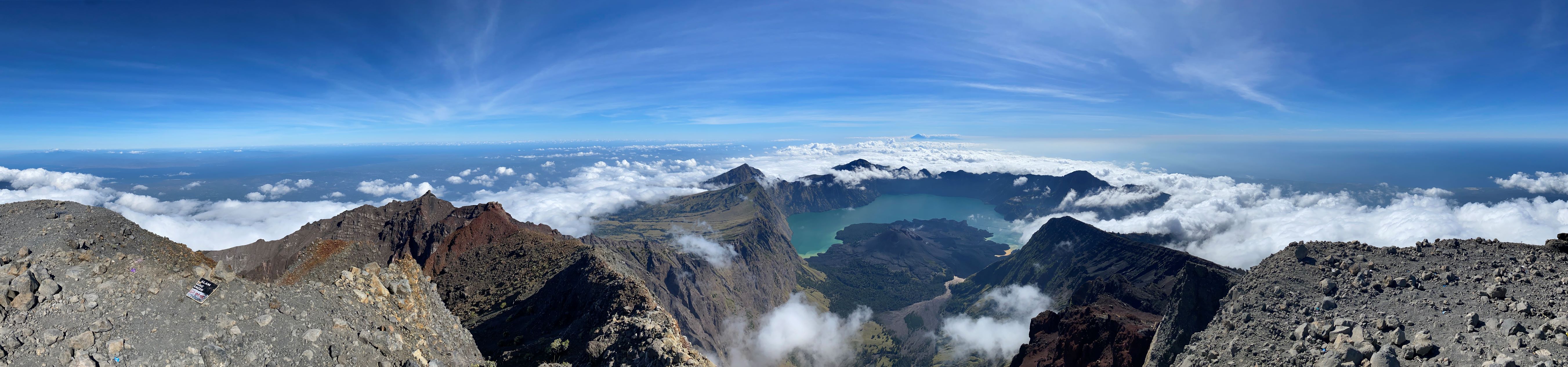
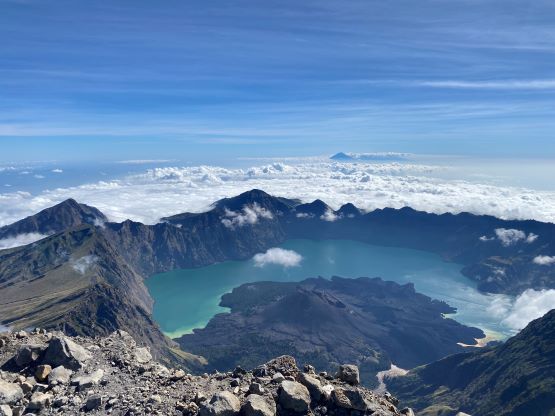
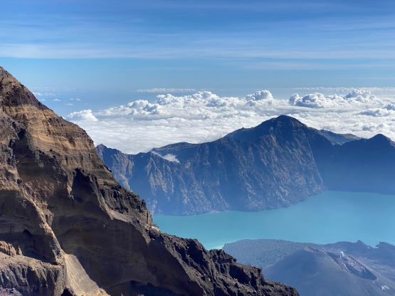
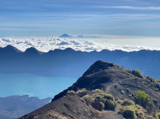
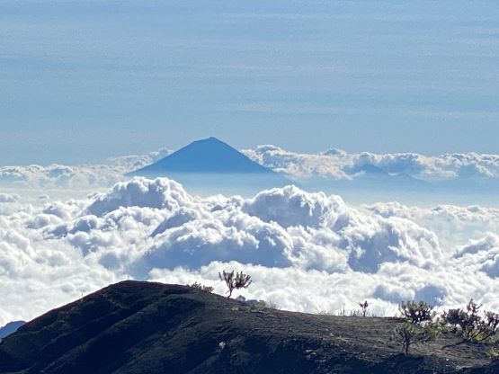
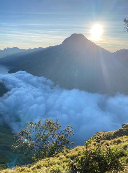
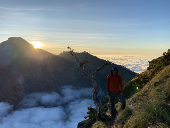
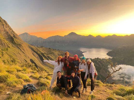
The three of us together did bring (just enough) food and water to make this happen. We all knew that we’d be pushing it but we liked to have some challenges. Again, the heat was the major problem as the upper route was also entirely in open terrain without any shade. The “basecamp” area stretches for at least 1 km long and we opted to drop gears and camp at the lowest possible spot. The worst section of the route above the camp was the 300-m grunt onto the NW Ridge. I knew this part was going to suck based on the other trip reports but I honestly was anticipating “not bad at all” since people like to exaggerate and make things more dramatic than they actually are, especially in this modern era. But when I actually got there I had to say that it’s quite unpleasant. The trail/path was easy to follow, but the terrain was entirely on treadmill volcanic sand. The effort to make this 300 m elevation was probably similar to gaining 500 m on a nicer trail. Thankfully the topping on NW Ridge offered more dramatic views down into the crater lake (Child of the Sea) so I got a second wind of energy to carry on. The bulk part of the NW Ridge was pleasant, but the uppermost 300 m elevation gain was again on treadmill sand. I was not particularly happy about the terrain, so angrily went ahead and waited on the summit. Adam was running low on water but I had a bit of extra. I drank for just enough to keep going for another hour and gave the rest to Adam after him and Adi made the summit.


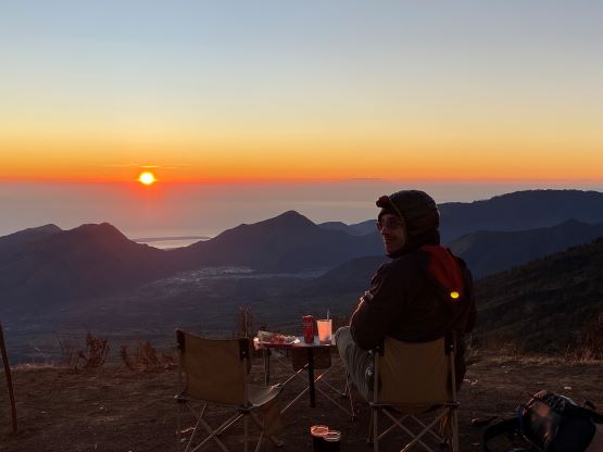
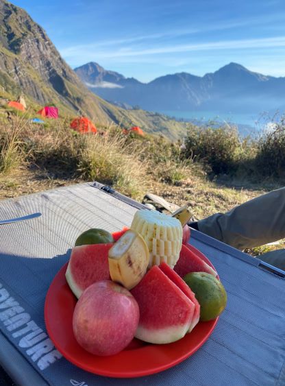
Because I had no water with me anymore I opted to run down to camp mostly to get the much-needed water. I ran all of the loose parts but I had to stop and dump sands off the shoes for at least 10 times. I tried to just carry on and suck it up, but then I started to feel hot spots in the heels. I finally slowed down after realizing that I could definitely get back to camp without drinking anything. The porters were patiently waiting and greeted me with water, tea and Coke. I also told them to start making food and little did I know that what they were preparing was our “lunch” even though it was already 4:30 pm. The “lunch” was excellent and beyond imagination. This was downright one of the best food and service I had ever had with guiding companies so there’s no complaint on that. We spent the next 2 hours waiting and watching sunset while socializing with other parties, and the porters made another meal (chicken curry) for us. This time it was the supposed “dinner”. I was surprised that I was still able to stuff most of the meal in, and I guess we must had burnt a lot of calories after the exhausting 2700-m gain in the heat.


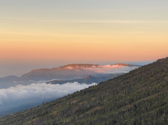


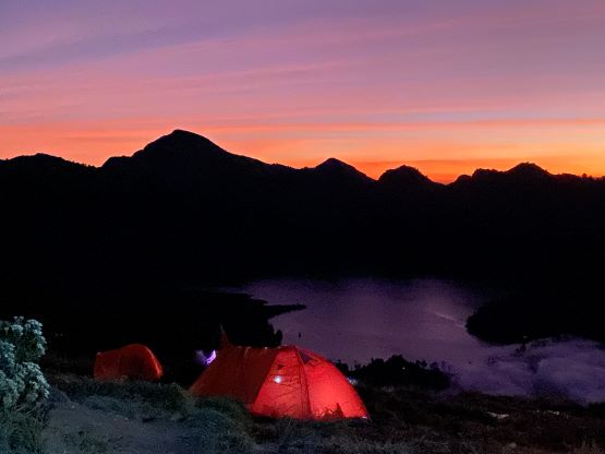


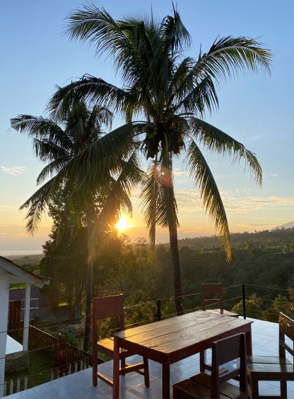
Adam was keen to descend as quickly as possible on Day 2 to beat the heat and the dust, so we set the alarms at 5:30 am. Thank to the jetlag I woke up naturally before that. This turned out to be the perfect time to wake up to fully soak in the sunrise views. The actual sunrise only lasted for about a minute long, but the colour changes before and after were rather magical. The breakfast was again, excellent and this time we could no longer finish. Both Adam and I eat much more than the averaged persons so I’m impressed by how much food they serve their clients. The descent was rather uneventful. Adam, Adi and I made sure to be the first group going down so we didn’t have to suck in the dusts as much as we did on the way up. We waited at “Pos 2” for about an hour for the porters to show up, and then descended more or less together down to the trail-head. Adam and I briefly contemplated about using their motorcycle services but the costs were too high for our likes. It’s not that we “needed” to ride their bikes down anyway. The manager gave us congratulations in the hotel in Senaru again and apparently no guide had done the summit on the first day so we were the first, but honestly I thought it was quite doable by fit parties. By “fit”, I meant in BC/Canadian standard. My GPS shows the round trip time to be a mere just over 9.5 hours excluding camping time.