Gunung Liman
August 2, 2023
2563m
Java, Indonesia
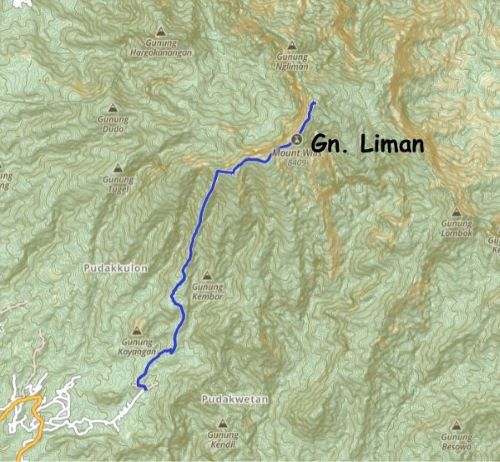
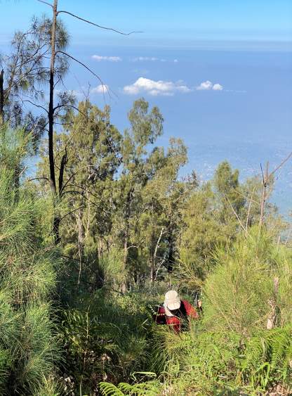
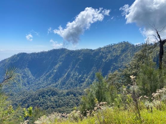
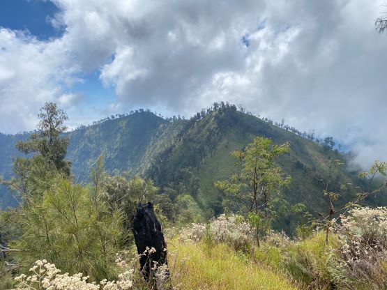
The massif of Gunung Liman locates in a remote area in East Java and boasts three separate objectives with Liman being the highest. The other two are Limas and Wilis and those two are completely different climbs that cannot be linked together. Gn. Liman itself is the most obscured among the 17 ultra-prominent peaks in Java. There are only two published routes – the NW Ridge that used to be the “standard route” and also the one Petter Bjorstad took in 2019, and the southern approach as illustrated in Rob Woodall’s 2022 trip report. Both routes have established “trails” but those trails are so overgrown that several hours of bushwhacking is now required to reach this elusive summit. The underuse might be due to the area being in a conservation zone that technically requires a special permit, though many climbers (myself included) do not follow that rule. On top of that, there are three summits of equal height and to safely claim the prominence status one must traverse and ascend all three of them. The NW Ridge leads up to the northern top, whereas the other route leads onto the southern top. Ideally one can do a traverse, up one side and down the other, but then a complicated pick-up arrangement must be previously made. The in-and-out traverse of the three peaks from either side would add at least 2 extra hours of bushwhacking (for maybe only 1 m of elevation difference), making Gn. Liman a dauntingly serious task, physically but especially mentally.
I read both of the trip reports several times in addition to the excellent “beta” provided in the Gunung Bagging website, and eventually decided to take Rob Woodall’s route mostly because his trip was made a mere few months ago so the “beta” would be rather fresh. I was quite certain that Rob’s southern approach is longer and bushier than the NW Ridge, but I preferred to minimize the unknowns. The bonus point was that Adam and I already had the exact same driver that Rob used, so we knew he could get us to the starting point. There wasn’t a hotel anywhere close to the “trail-head” and we eventually booked one in Ponorogo about an hour’s drive away. The hotel was great, but then we had to wake up early. The driver came to pick us up at 5 am and we drove to the exact starting point in Rob’s trip. The final stretch on cobblestone pavement was steep, but not problematic. The drive would wait for our return at this location and he ended up spending most of the day there doing nothing (10 hours).

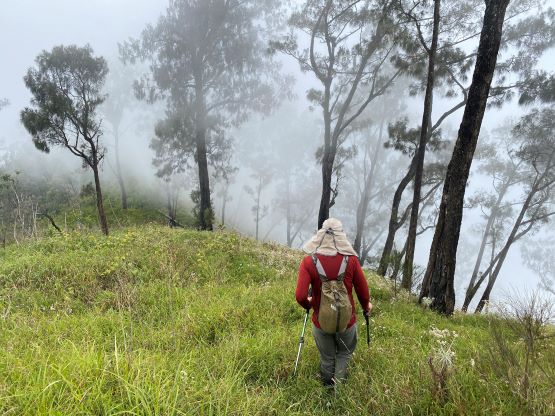
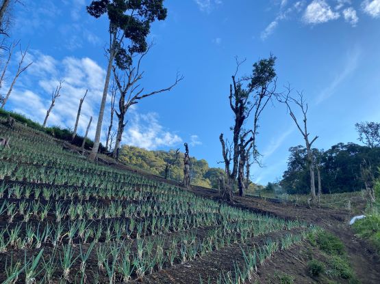
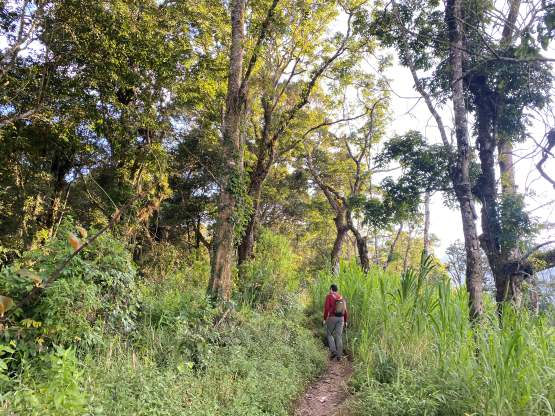
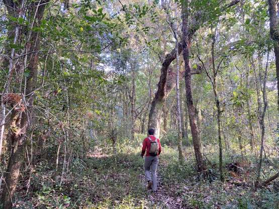
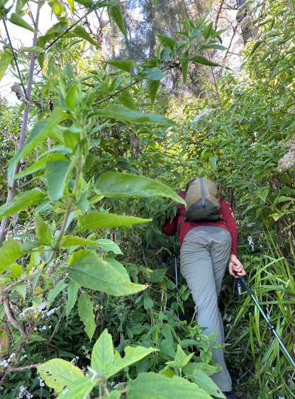
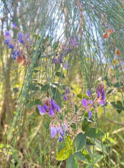
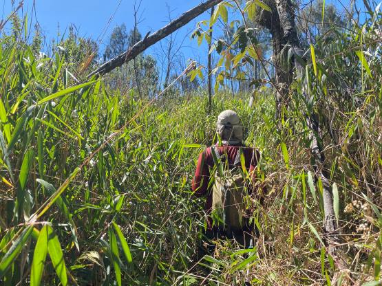
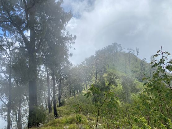
Rob mentioned that an ojek could potentially save half an hour’s walking each way and he was correct. However, it wouldn’t be easy to arrange our ojek rides as our hotel was very far away and we had no local connection. It did seem like the trails were regularly used by motorcycles, including one that passed us on the way up, but those are farmers doing their jobs. In any case Adam and I decided to forget about the ojek rides and just dealt with the distance on foot. It was honestly not too bad and the farmers were friendly, even though we probably technically shouldn’t be there. After passing the second “Pos” the trail suddenly became narrow and overgrown and in another 20 minute we officially started the bushwhacking. It took us about an hour to get to this point, so a total of over 8 hours in this day was spent thrashing around. The path was visible the entire way (hence no route-finding required), but we had to constantly pushing against the brushes. The steep ridge ahead ascends over 500m onto the “summit ridge” also the crater rim. There was some exposure at places, and zillions of spider webs. After getting a few fat spiders right on my face I decided to take it slowly, using my trekking poles to break the hundreds of webs before committing to the moves.


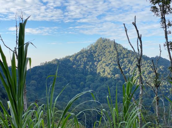


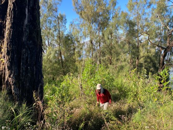
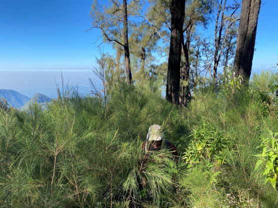


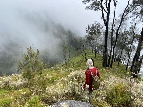
I was hoping for the “trail” to be better on the crater rim traversing towards the southern peak, but I was wrong. The worst of the bushwhacking was around the southern sub-summit before the south peak, where we had to deal with 3-m tall grass fields and invisible foot path. Adam estimated that from this spot we would need 4 hours to get to the northern peak and back and that’s assuming the trail wouldn’t become worse. I agreed, but we were also too far into the game now to consider turning around. Thankfully by the time we were pushing towards the southern peak the thrashing had become progressively easier. I made sure to take some GPS readings on each of those summits and the result was inconclusive. I would say the south peak has the lowest probability to be the true summit, but it’s within the error range. Unless a professional surveyor comes with accurate measuring tools, one has to climb all three peaks to claim the success on Gn. Liman. The traverse to the central and then the north peak wasn’t much better, but also didn’t get worse, that with perseverance we eventually made it. We saw the path coming up from the opposite side and it surely looked to be less brushy, but again the reason we didn’t choose that way was because of the lack of certainty.


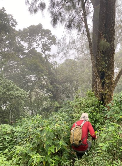
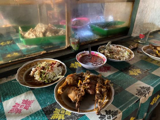
The heat was really taking its toll on us. Despite the 2000+ meters of prominence Gn. Liman was actually the lowest objective that we did in this trip in terms of elevation, and the lack of winds and the tall grass only magnified the heat problem. I had brought 3 L of water and I nearly drank them all by the end of the day. We were not looking forward to all of the elevation regain while traversing back to the south peak, but we had to face it. Thankfully it wasn’t actually as bad as we thought. The section around that lower southern sub-summit was just as terrible as a few hours earlier, and so was that steep and brushy ridge descent. The entire descent down to “Pos 1” was bushwhacking, and once entering the mist layer the ground had also become slippery and muddy. I felt several drops of rain but those were probably just moisture in the clouds. We did not officially get rained on, thankfully. It felt like a relief after descending back onto the good trails. Our driver seemed to know this local area and managed to find us a warung place for dinner, and that was excellent. I thought we had to wait for at least an hour but we didn’t have to. Adam and I ate pretty much all of the food in that local restaurant. The plan for the next day was Gn. Lawu and we had already booked a hotel on the east side of it, so we had over 2 hours of driving ahead despite the tiredness.