Gunung Dempo
August 30, 2023
3173m
Sumatra, Indonesia
Gunung Dempo is the highest peak in South Sumatra and boasts over 2400 m prominence, and it’s a fairly straightforward ascent without much of the nasty terrain. Despite that, the English “beta” was very limited on the internet. Two of the world’s leading prominence-based peak-baggers, Petter Bjorstad and Rob Woodall had not done this peak so there’s virtually no useful information on peakbagger.com. The “Gunung Bagging” website does have a detailed report, but the article was written more than 10 years ago and is seriously outdated. This trip could actually be easier and less confusing if there wasn’t that outdated article documenting two routes that are apparently closed and overgrown. The driving direction was also extremely confusing that both Gaia GPS and Google Map had labelled “too many” roads. There is indeed one road that stays completely paved and easy to navigate, but most of the other roads are not drivable by a passenger car, and the GPS apps could not distinguish the correct one from the others. Because of that I also tracked the driving direction and the GPX is attached in this trip report.
Adam noticed a GPX track for this peak on Wikiloc about a few weeks into this Indonesia trip, and I agreed to give it a try but it had to be towards the end of the trip. The GPX track (9 years old) matched what I read on the “Gunung Bagging” website so I took it for granted, which turned out to be a problem. The main challenge was the travel logistics. Prior to Gn. Dempo we were based in Padang in West Sumatra and we had to take two connecting flights to Palembang with a layover in Batam. These two flights would consume one day. After this trip we would fly to Jakarta. The drive from Palembang to Pagar Alam at the base of Gn. Dempo would take 7 hours so we needed a total of 5 days for this one objective – two days of flying, two days of driving and one day of hiking. It’s likely that we could do it in 3-4 (longer) days but I needed enough contingency such that we could still make the summit even in the worst possible scenario. Our previous driver in West Java helped us to find a private driver for the 3 days return from Palembang at a cost of 1.25 million IDR per day, which was on the expensive side but acceptable. That’s the end of the planning stage.
About one day before departure I received an email saying the first leg of the Lion Air flight to Batam was cancelled and this subsequently screwed up the connection. I tried to change the flights on the internet for 2 hours but to no avail. Thankfully at the moment we were already driving towards the airport so we just showed up and got the issues fixed. The flight to Batam did go without event, but the next flight to Palembang got delayed by 2 hours. We were supposed to arrive in Palembang at 11:30 am but did not get there until 9 pm, turning this into an exhausting day. Our driver arrived on time at 5 am, and the plan was to drive all the way past Pagar Alam to check out the registration post to get the paper work done. Gunung Dempo had a massive eruption about a week earlier, but I found several locals immediately via social media and confirmed the status of this route was still “open”. One of them responded that we needed to bring oxygen masks and that’s another reason why I insisted to show up at the registration the day before. If the masks were indeed mandatory then we must find a way to obtain them at the last minute. This turned out to be unnecessary but again, it’s important to plan with contingencies. Our driver was skillful and got us to Pagar Alam in just over 5 hours, passing almost every other vehicle on the roads. It was not clear where exactly is the registration post, so we directed him to the start of the Wikiloc’s GPX track near a Tiger Museum or something. To our surprise there was no registration nor a “basecamp”, and the trail appeared seriously overgrown and underused. We soon learnt from the locals that this is rather an old trail that had been closed long time ago so it could be very bushy.


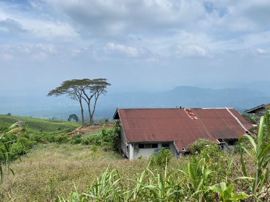
If the Wikiloc’s GPX track was our sole “beta” then we would have decided to just suck it up, but after talking to these people on social media over the past few days I knew this is a rather popular objective, that it would be worthwhile to find the better (newer) route. The Gunung Bagging website did mention the other route so we drove southwards, but the actual trail was somewhere between the two routes described there. As mentioned earlier the driving was confusing. About an hour later we found the registration, paid the fees, did the paper work (oxygen mask not required). Adam and I insisted that we should drive further to locate the trail-head and this was a correct decision as we simply couldn’t find the start of the trail. Within a kilometer the road became unpaved and rough, so we turned around and went back to the registration post. The communication was difficult due to the language barrier so the two guys there had to go with us to show the trail-head. That was quite nice. It was about 500 m beyond the end of the pavement, so I made a waypoint and went back. Having no GPX to follow was intimidating so I wanted to be 100% sure. I took a picture of that trail and sent to the social media contact, and got the positive response. The plan was then made to leave our homestay in Pagar Alam at 4:30 am and do the first hour with head-lamps on. The homestay was the worst by far in this entire trip. There was no air conditioning, no shower, no wifi, but hot and humid with mosquitoes. Adam explained how this was the nicest possible stay in this entire town. I believed him, as it’s just a poor place with hardly any modern facility.

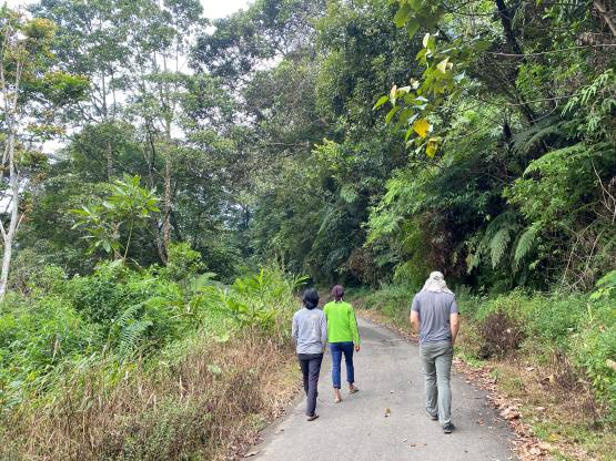


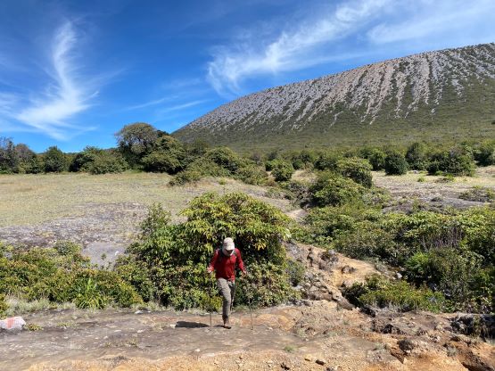
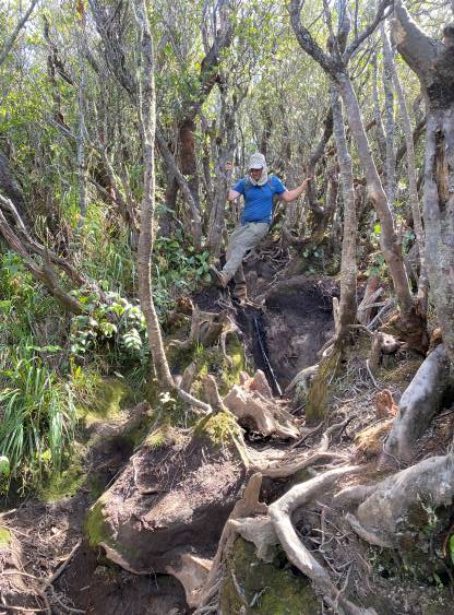
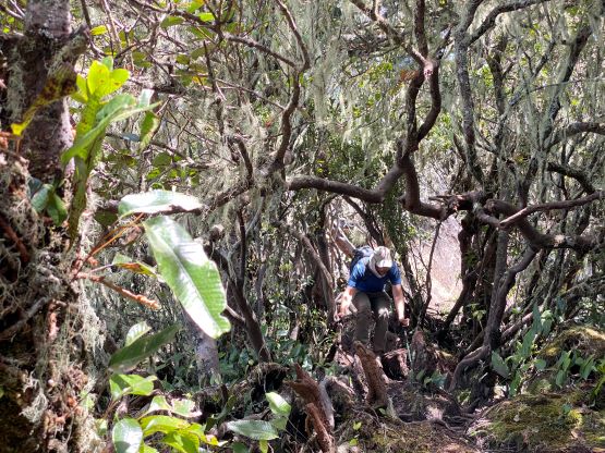
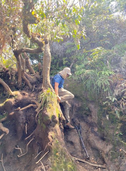
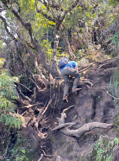
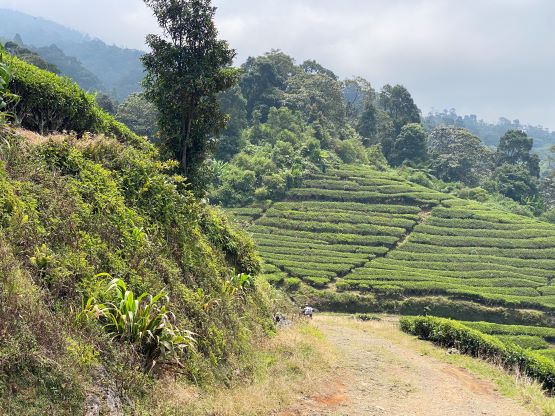
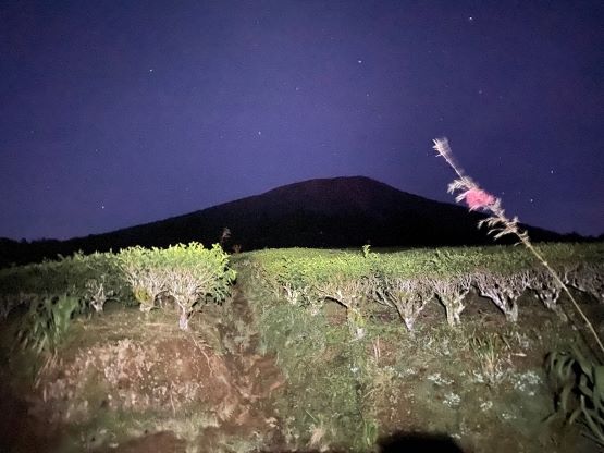
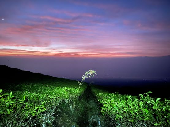
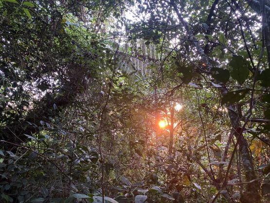
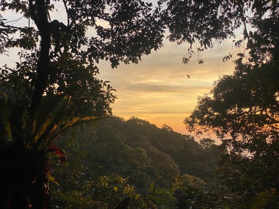
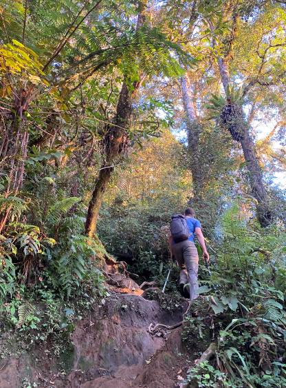
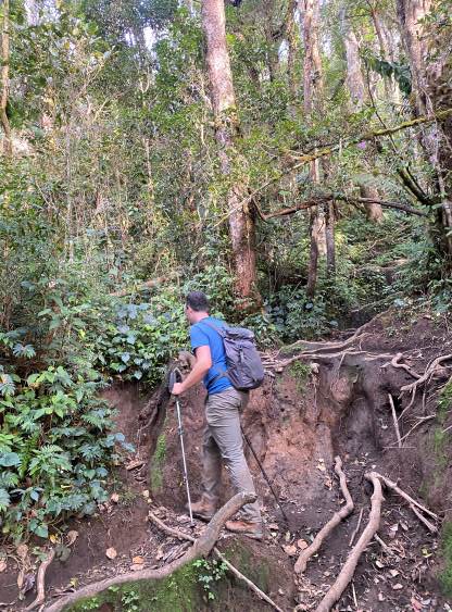
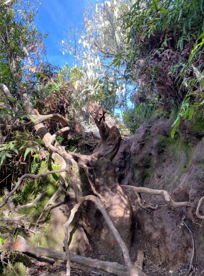
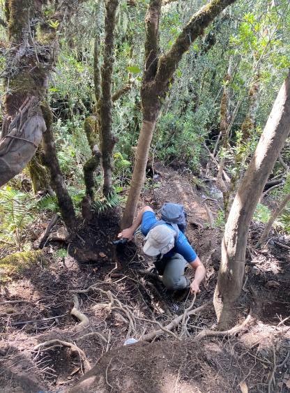
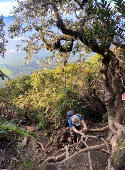
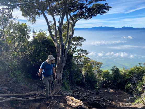
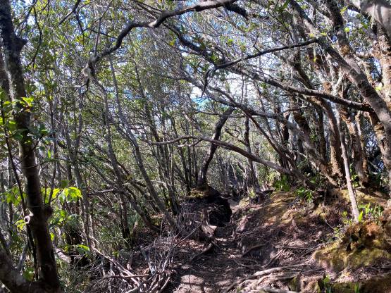
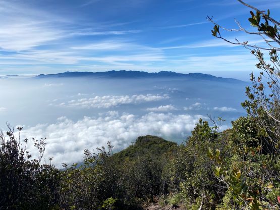
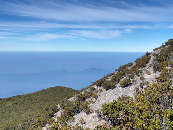
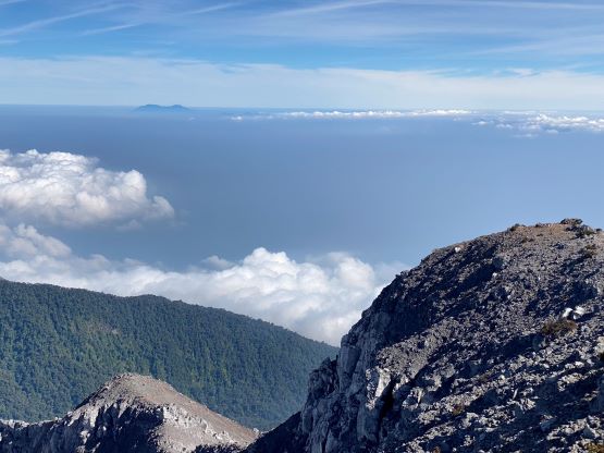
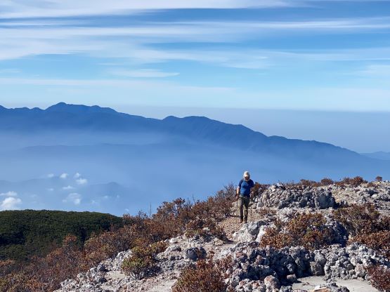
The actual ascent was a piece of cake compared to what we needed to do prior to the ascent. The driver dropped us off at the end of the pavement at 5 am and in short time we hiked up through the tea plants into the jungle. This was nowhere like in West Sumatra, that the trail was mostly wide and dry, and there was no leech to be seen. The hike was quite physically demanding though with about 1600 m cumulative elevation gain on mostly jungle roots. After about halfway up to the false summit the trail became insanely steep that we were constantly scrambling on the roots and mud steps, that sometimes it felt like class 3. The views opened up briefly under the false summit and we could see Gn. Patah, the “broad ultra” behind us on the skyline.


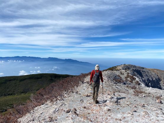
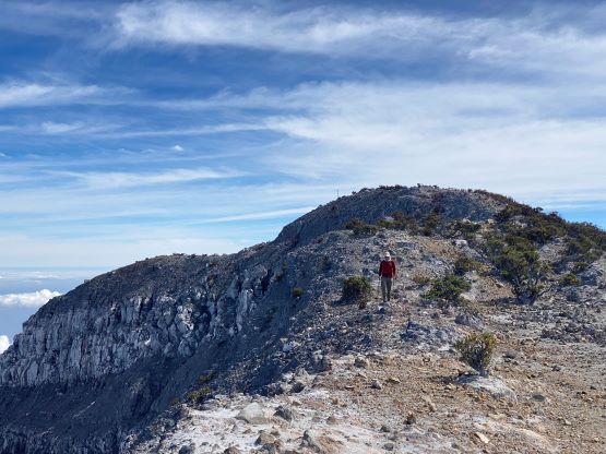
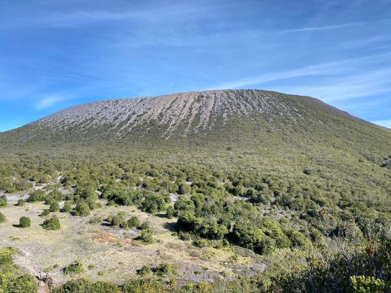
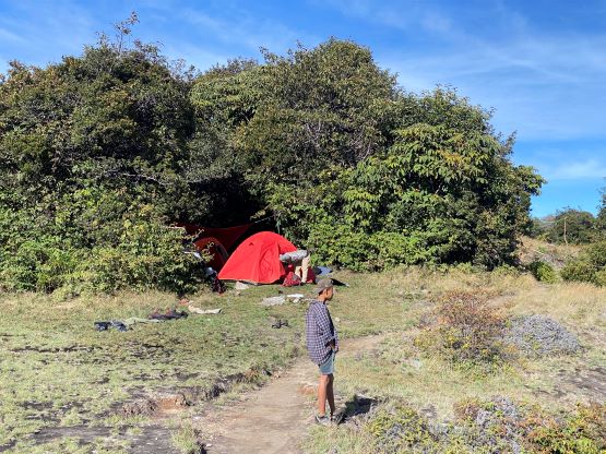
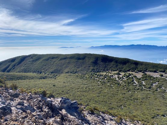
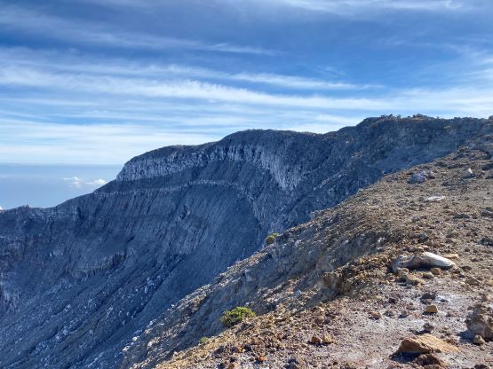
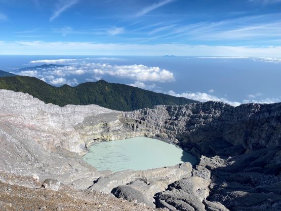
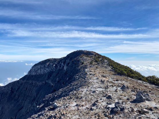
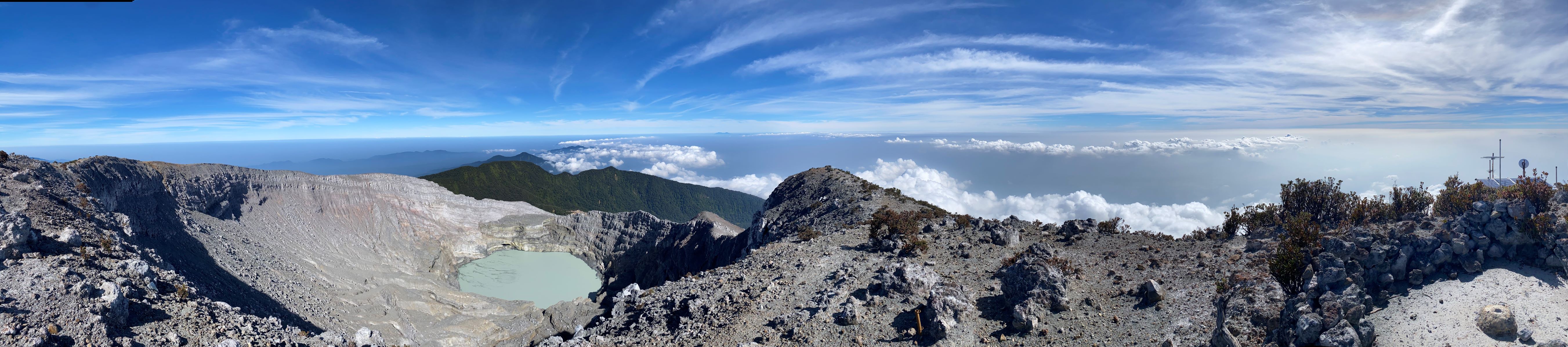
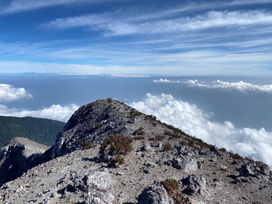
The false summit was completely forested so there’s no point in lingering there. The path brought us down to the broad camping area between the false and the true summits. Unfortunately there was a mandatory 50-m drop that must be regained on the descent. Plodding across this camping area was confusing as the paths weren’t obvious, but the paths converged in the end. The ascent onto the summit ridge was done in a dry gully with some loose rocks, but nothing worth noting. The true summit was about 500 m to the north and the traverse across the crater rim was incredibly scenic. I kept thinking about that massive explosion a few days ago, and I wondered if we could see one like that. The volcano was however, sleeping deadly and did not show any sign of activity while we were there.


After about 20 minutes on the summit we decided it’s time to descend. I made a single dash down to the camping area, one dash back up to the false summit, and another dash all the way down to the bottom. The descent was extremely boring and tedious, that we had to consistently pay attention to the ground. There wasn’t a single section where I could simply shut down the brain into a “zombie mode”, so it was quite mentally tiring. We told the driver to come back to the end of the pavement at 11 am and wait for us there. I got down at 12:30 pm and he sure was not there, so I had to walk an additional kilometer down to the registration post. As soon as the driver saw me he realized the mistake. At least he drove up to save Adam from walking this extra distance. We then drove a few hours eastwards to Muara Enim about halfway between Pagar Alam and Palembang, and the new plan was to squeeze the return driving and the flying to Jakarta into one day. Of course I then received another email about flight cancellation. This time they didn’t even bother to rebook our flight so I started to worry. Thankfully a few hours later I got a text message saying our Lion Air flight had been merged with the Super Air Jet and would depart half an hour later. Hopefully this flight wouldn’t turn out to be a problem. If all work out as planned we would earn ourselves a bonus P1000m objective in West Java. Let’s see.