Gunung Ciremai
August 14, 2023
3078m
Java, Indonesia
Gunung Ciremai is the highest and the most prominent peak in West Java but not the most popular hike as it’s quite far from a major city such as Jakarta. It’s in a National Park with some rigorous registration process. The park’s ticket is quite expensive nowadays for foreigners (270,000 rupiah). Adam and I had a full driving day after finishing Slamet. Our driver for this final phase of Java’s ultras trip was Alfian, the manager of FlyingCamp and also a guide. We did not hire him to guide us on these hikes but we needed his local connections and translation in addition to his vehicle and the driving. Alfian reminded us that we were in the beginning of Indonesian’s Independence Day madness, that the traffics could be terrifying. We did encounter some traffic, but it was in the tolerable range. Alfian also knows a local guesthouse near the start of Ciremai’s route so we drove straight to that place, and arrived in the afternoon.
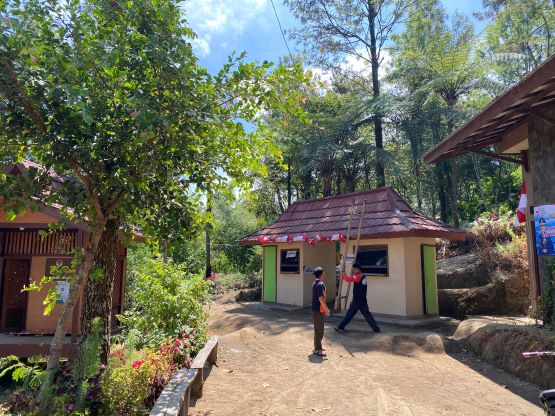
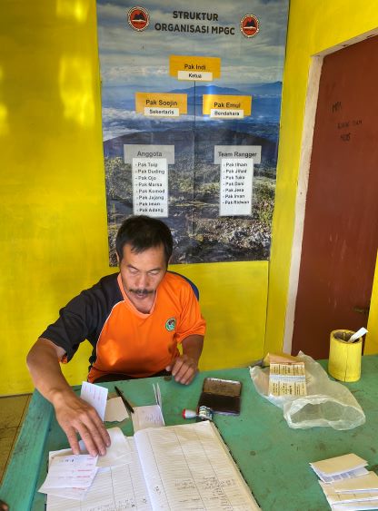
The plan was then made to take ojeks to the basecamp to sort out the paper work. Based on our previous experience we knew there’d likely be nobody at the registration at 6 am. We could potentially just skip it but I was damn glad we didn’t do that, as they did check our permits/tickets upon returning. The ride to the basecamp was quite long and we had to dodge some truck traffics. The trucks were mentioned in Rob Woodall’s trip report so we knew what to expect. The other option would be riding on the back of one of those trucks, but ojeks were perfectly fine as well. The registration seemed rather formal and involved multiple papers with stamps. They also needed the pictures of our passports. To our surprise they gave each of us a 50,000 rupiah’s worth of free meal after we finished the trip on the next day, but the meal turned out to be “not enough” for our needs. It was more like a “snack” and we still needed a proper meal afterwards. After all of these complications Adam and I returned to the guesthouse in about one hour and we didn’t have much to do for the rest of this day. The room was tiny and lacking some basic facilities, but this was rather just a guesthouse halfway up the mountain, that we couldn’t expect it to be as luxurious as some of the hotels in the cities.
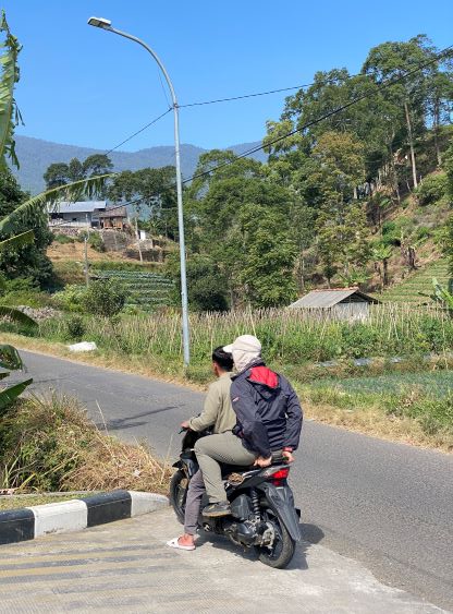

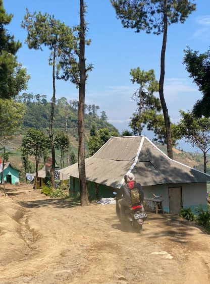
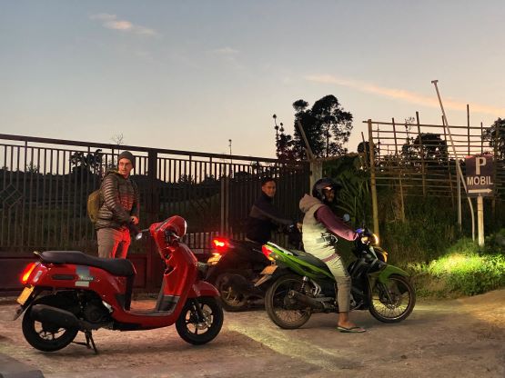
Adam and I stressed multiple times that the ojeks must show up at 5:30 am in the morning and then we ordered the breakfast to be ready at 5 am. The ojek drivers ended up showing up at 5:15 am but the breakfast was also not ready until 5:15 am. I thought they forgot our breakfast but I think 15-minute late is considered rather “normal” in this part of the world. This was then our 2nd time riding to the basecamp with the same ojek drivers so there’s not much worth documenting. It was quite chilly in the morning but the jacket was only needed for this ride. The rest of the day was hot. As expected there was nobody at the registration and I wondered again if we should have skipped the whole paper work process to save both time and money. We did that on Lawu and Merbabu and got away with no hassle/fine whatsoever, but you should not do that on this objective.
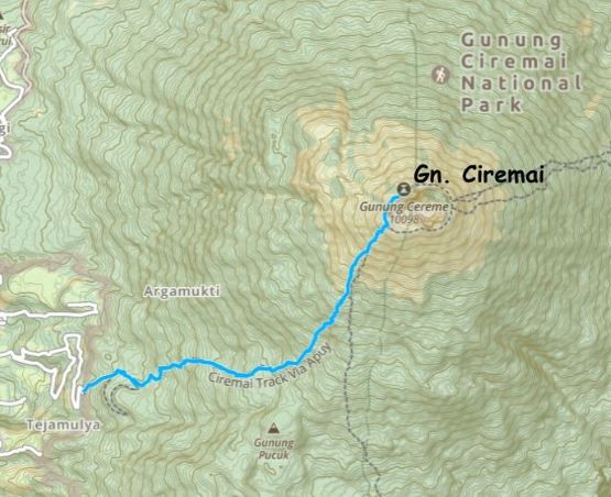
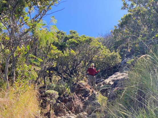
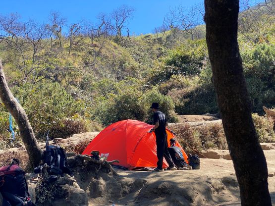
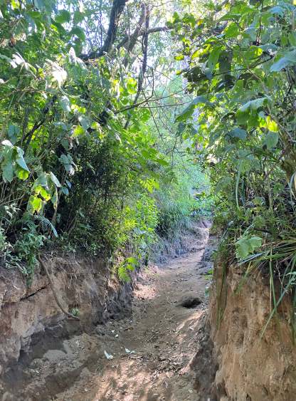
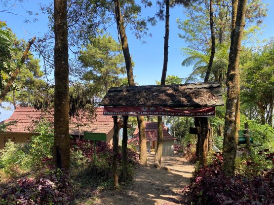
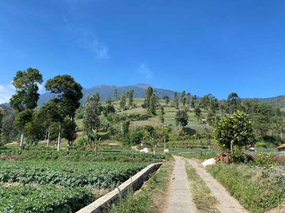
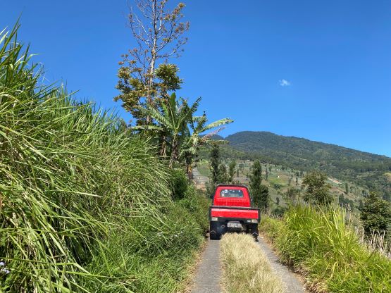
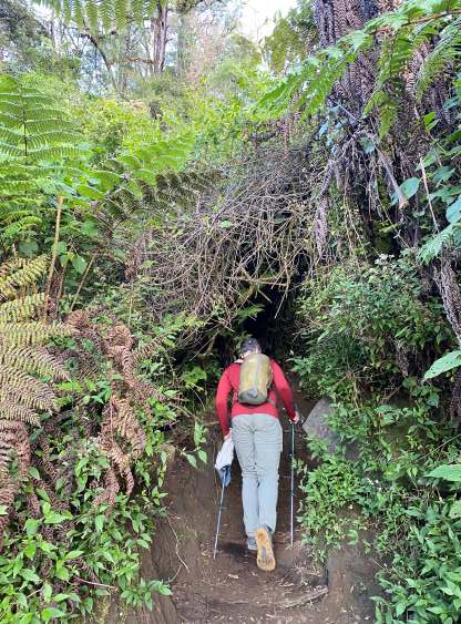
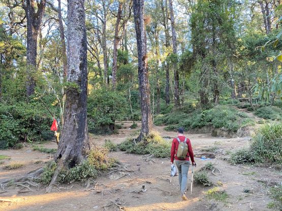
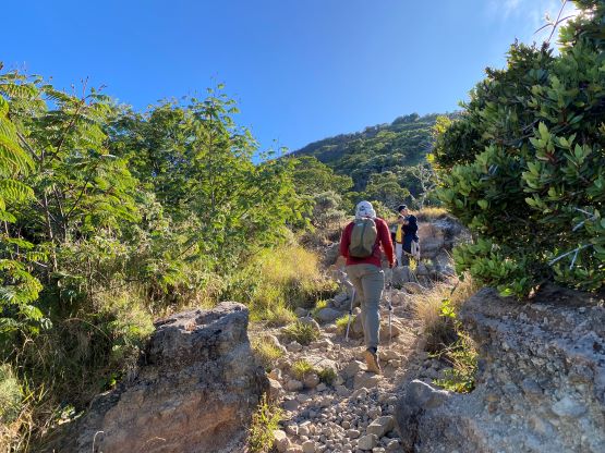
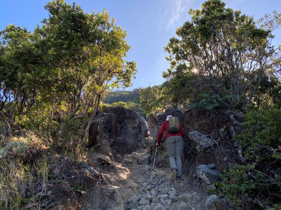
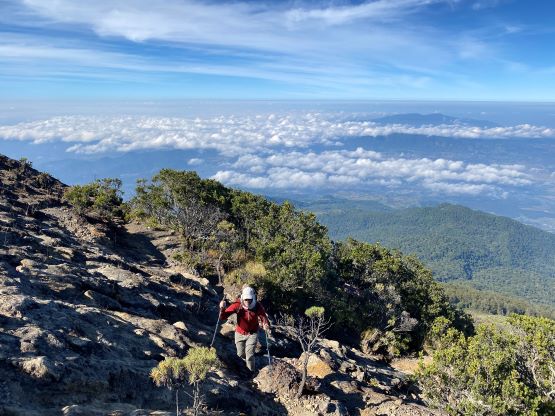
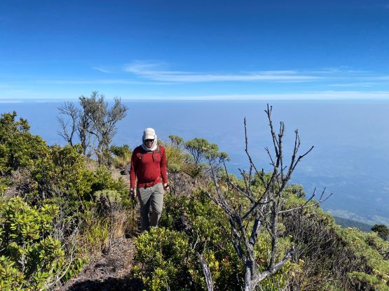
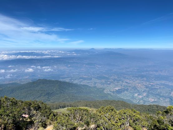
The first couple kilometers of the route is actually an ojek trail but riding a motorbike is strictly forbidden beyond the park’s gate. The ojek trail yields to a proper hiker’s trail past Pos 1, and the trail progressively became steeper the higher we went. The lower half of the route was on west-facing slopes so we wouldn’t get any direct sun rays until much higher up. This was perfect as the day was exceptionally hot. I later learnt that the temperatures in West Java are averagely higher than the rest of this island due to the denser habituation. This further meant the following few hikes would likely be unpleasant if we do not start early enough. There’s one massive camping area about 2/3 of the way up and that’s where we took the only break on the ascent, mostly to don sunscreen.

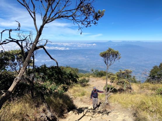
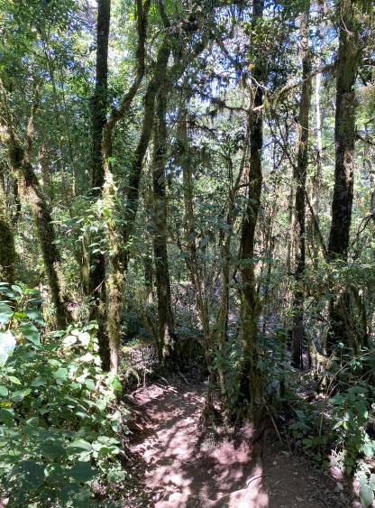
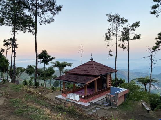
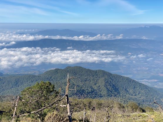
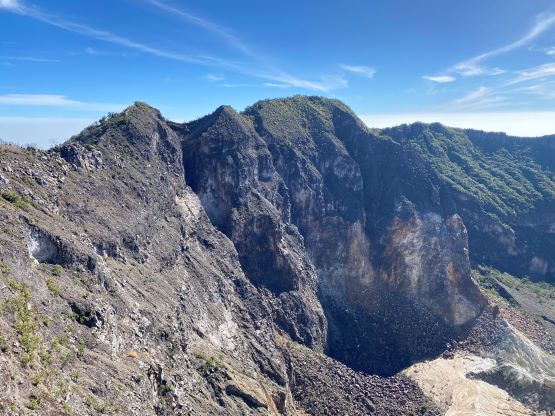
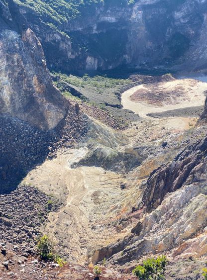
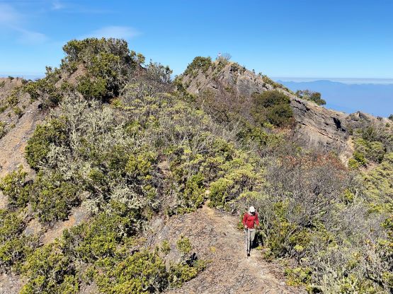
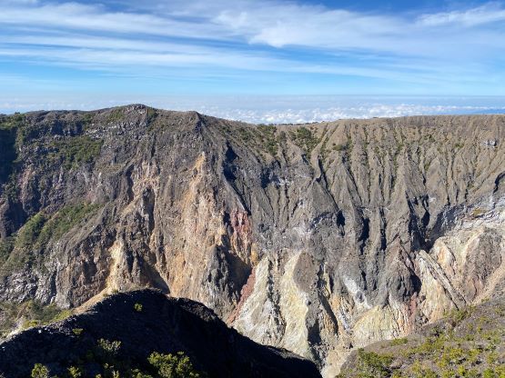
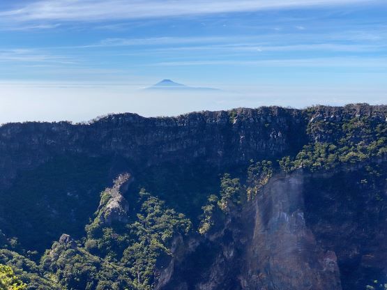
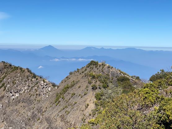
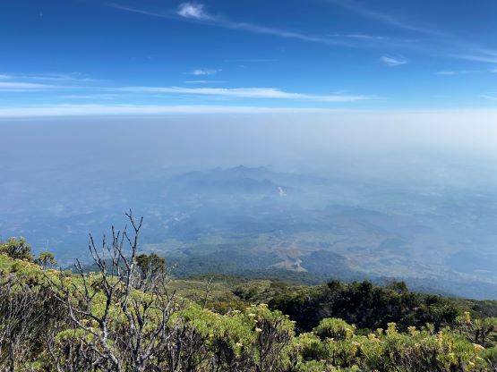
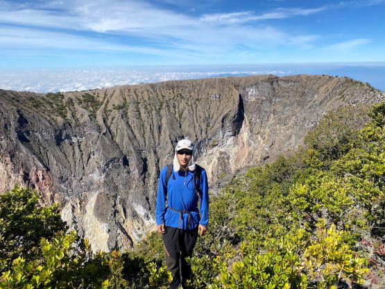
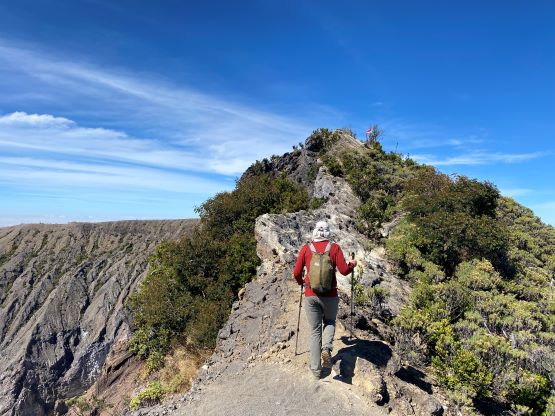
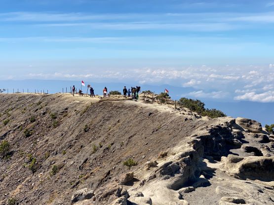
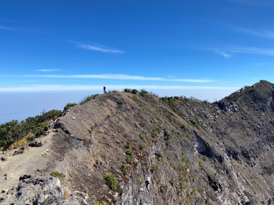
Above this camp the forest became semi-open and the trail suddenly became dustier. The entire upper mountain was covered in some layers of volcanic ashes and this upper trail was one of the dustiest that we did in this entire trip. We didn’t feel too bad because the traffic on this mountain was rather light. We only encountered 2 or 3 small groups on their way down and that’s it. I think the reason is rather obvious. Gn. Ciremai is a harder objective by Java’s standard and the summit (view) is not the nicest. Most folks would prefer Gn. Slamet and Gn. Merbabu as both offer much higher reward-to-effort ratio. In any case we grunted onto the crater rim after scrambling on some dry mud steps. It then became obvious that the northern rim is the highest but 99% of the local hikers would call it at the rim. Adam and I must continue to the true summit. The traverse was more involved than I thought, with some scrambling, some exposure and some bushwhacking. The true summit itself was partially forested and we never got that 360-degree view on any part of this mountain, and that might explain why it’s not quite popular yet.


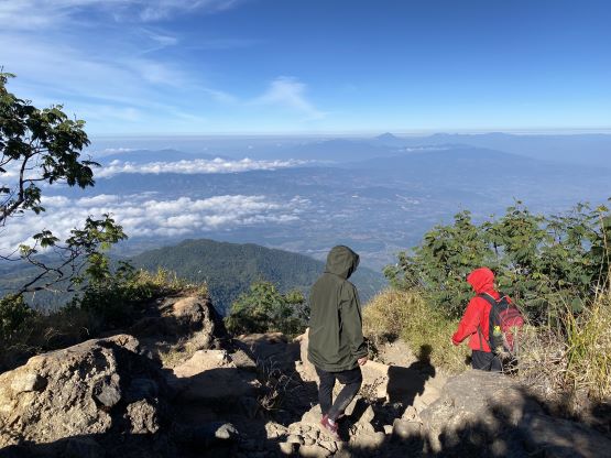


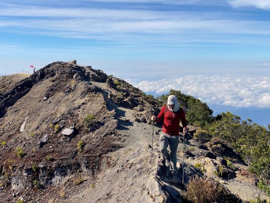
There wasn’t much benefit in lingering on the true summit so we quickly made our way back, reversing what exactly we did. There were several confusing branches and we subsequently took a wrong turn. Thankfully I called out the mistake before it’s too late. We only had to backtrack for a few minutes to get back on track. Some sections of the rim traverse required caution but nothing’s really worth noting. I thought about to check out the touristy south rim like Rob Woodall did in his trip, but opted for being lazy. Adam had no desire whatsoever to check out a point that’s not the true summit, so I reluctantly decided to just go down. I usually try to be very thorough and do not skip that kind of touristy spots because I need the views for photos and especially Instagram, but we were in the middle of a long peak-bagging trip and I must conserve energy whenever applicable.

I then made a single dash down to the trail-head losing more than 1500 m elevation in one go. The trail condition was great for jogging and my round trip time was slightly more than 5 hours. Adam was 10 minutes behind. The security guard at the trail-head actually wanted me to show our permits so I was damn glad we got the paper work sorted out in the previous day. The promised free lunch was decent but not the greatest (not enough volume), so we still needed a meal afterwards. I actually caught some weak cell services at the trail-head so I could have just arranged the ojek pick-up with our driver Alfian who’s been patiently waiting at the guesthouse, but we would lose time that way. The simplest solution was to get two ojeks from the park’s office, but they wanted to charge us 50% more money. There was thankfully another hiker (on his way up) nearby who spoke some English to help with bargaining, and we got the price down an acceptable level. About 20 minutes later we were back to the guesthouse, and another hour later we started the 4-hour long drive to Garut at the base of Gunung Cikuray.