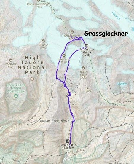
Grossglockner, via Stüdlgrat (SW Ridge)
August 8, 2025
3797m
Austria
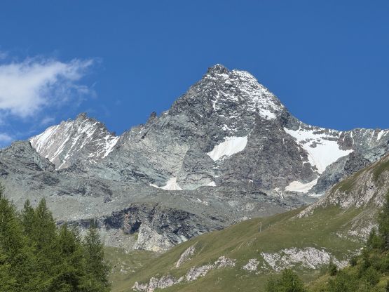
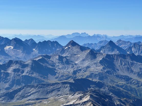
Grossglockner is the highest peak in Austria and the 3rd most prominent in the Alps, making it one of the most significant objectives in the entire range even though it’s not one of the 4000ers. The standard route goes up the SE Ridge from the high hut at 3400 m elevation and most parties would spend 2-3 days for the climb to the Austria’s highest peak. I however, decided to do that in a single day push and Erica and Caspar agreed. The most obvious reason was to save time as we only planned 35 days in the Alps and that was nowhere “enough” to bag all the peaks that I wanted, but I also disliked the system of booking these huts. Finding spaces for three at the very last minute is often considered “not possible” but booking far ahead is essentially a gamble against the weather god. There had been some significant precipitation events dumping up to 50 cm snow in the past week and the weather had been extremely unstable, so we didn’t pull the trigger until a week after our arrival even though this was listed as the first major objective in this trip. Erica dug out some recent guided reports and Friday showed guaranteed sunshine for the entire day, so the trigger was pulled. While executing the plan we spontaneously upgraded the ambition to climb the harder SW Ridge (Stüdlgrat), without knowing what we had signed ourselves up for.
Car-camping is considered illegal in Austria but that was the only viable way as we are too cheap to stay in hotels in Europe. Adam helped finding that perfect spot to sneak away from the crowds not far from the trail-head using satellite images even though he wouldn’t be joining us for the climb, but Erica and Caspar, in a separate vehicle was about an hour ahead and opted to scout things out. There was surprisingly cell receptions in the hills and Erica reported back that they had found a reasonable spot, beyond the toll gate. The toll for the road access to Grossglocker was 15 EUR per vehicle. Adam and I drove in and approved the decision. This was on one of the dirt roads going sideways near the vicinity and there was just enough room for two vehicles and three tents, so we settled the night. The alarms were set at 3:30 am and the plan was to drive to the actual trail-head at 4:30 am.
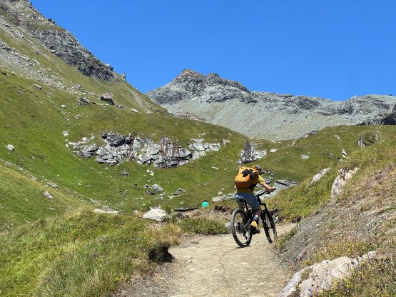
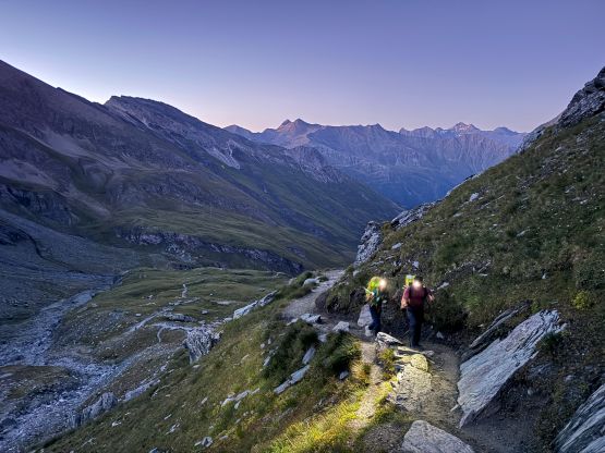
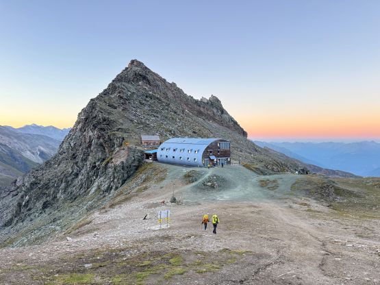
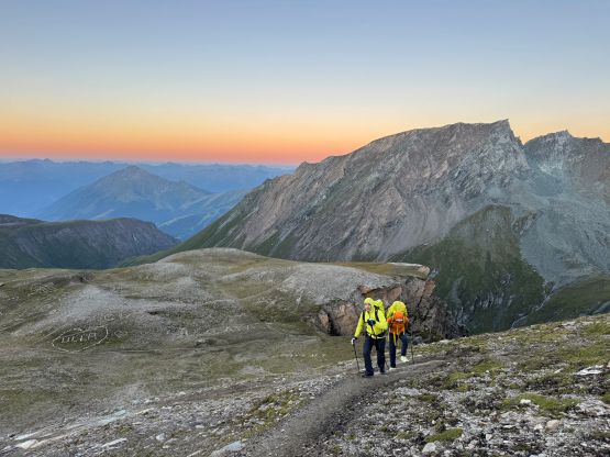
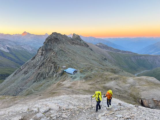
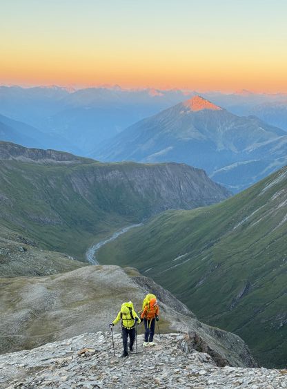
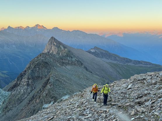
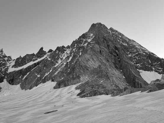
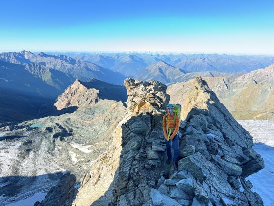
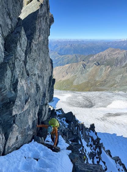
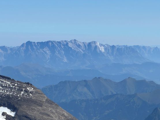
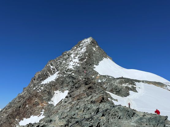
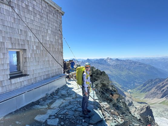
There are two ways to start this hike and we picked the trail option traversing on the east side of the main creek. This is shorter than taking the road on the left side. The trail joins the road at under the set of switchbacks and it was here that the grade picked up. It was then a sustained grunt past the lower (2200m) hut all the way to the middle (2800m) hut. There were options to take short-cuts but in the dark we mostly followed the main path. We got to the 2800m hut (Stüdlhütte) at dawn and spent about half an hour taking in the views. Meanwhile I noticed a massive sign showing the more direct route (Stüdlgrat) and a grade of UIAA IV. None of us had done any research about this route so I turned off the airplane mode and did a bit of digging. I only had enough reception to look up for “UIAA IV” and it roughly translates to YDS 5.4 as far as my limited research went. The parties ahead all went towards Stüdlgrat so we thought it would be more fun and faster to climb this route instead. It of course turned out to be harder than expected, but was still in the realm of our ability, but did turn an easy-ish outing into an unexpectedly spicy climb.
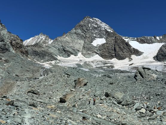
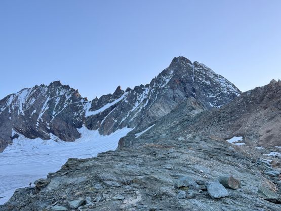
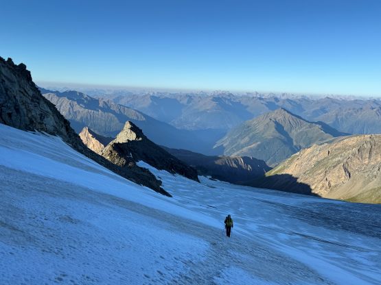
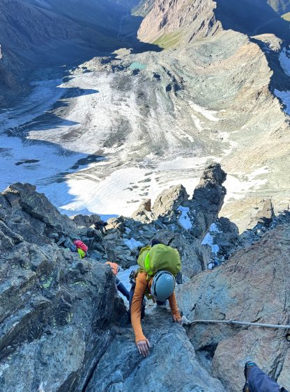
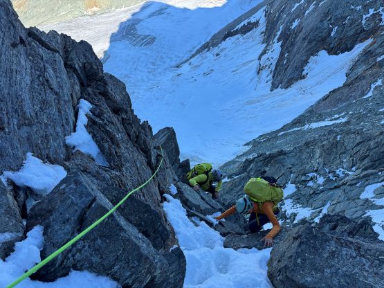
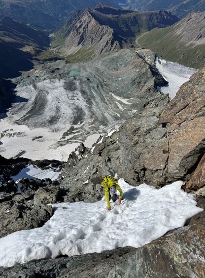
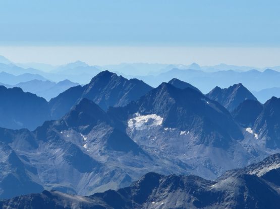
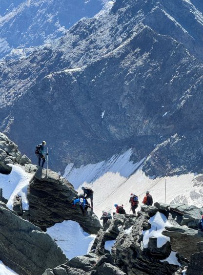
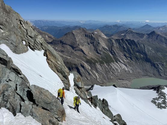
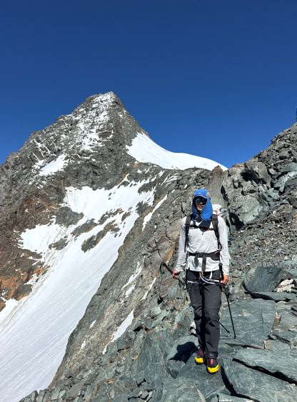
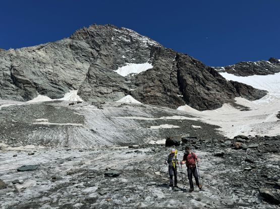
We were the second-to-last group starting up this route so it was quite simple to follow the parties ahead plodding up the switchbacks towards the edge of the glacier. This glacier is different from the standard route’s, but was in similar conditions. We donned harness and crampons at the edge but didn’t bother to use the ice axes nor the rope. The snow condition was more “Rockies like” though, that despite the highway of tracks we still had to be very careful about the crevasses. There was no overnight freeze despite the clear skies. For one section we had to traverse on some blue ice but elsewhere was an easy plod following the tracks. The glacier was foreshortened and did become steeper near the start of the rock route, but it was never steep enough to warrant the use of ice axes (for us).
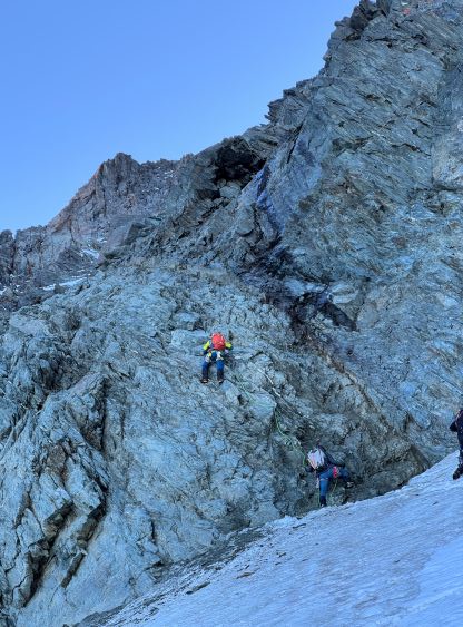
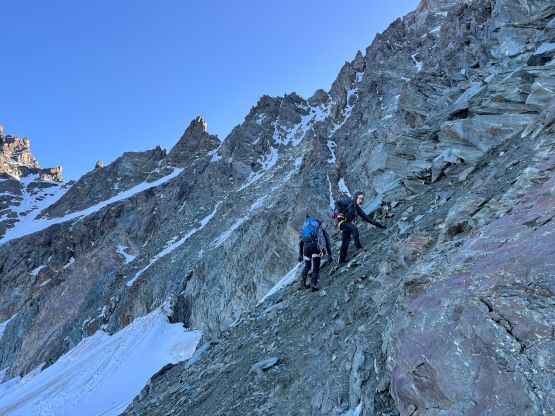
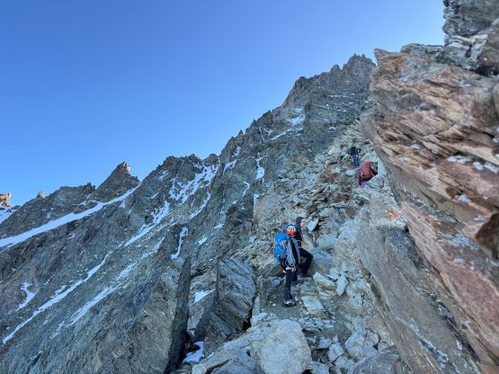
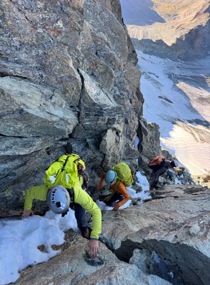
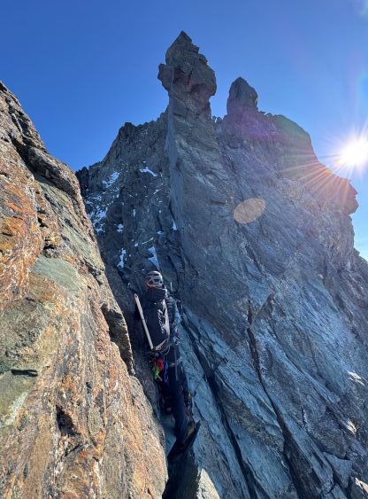
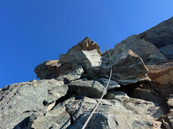
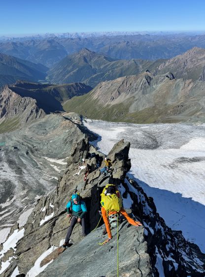
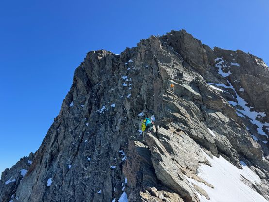
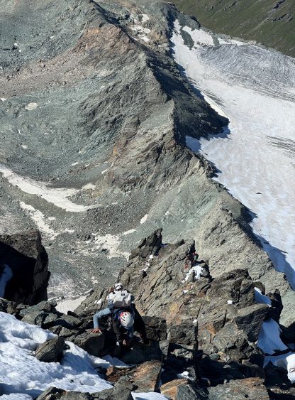
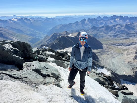
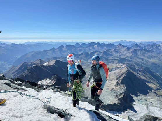
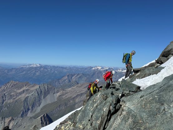
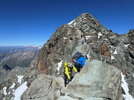
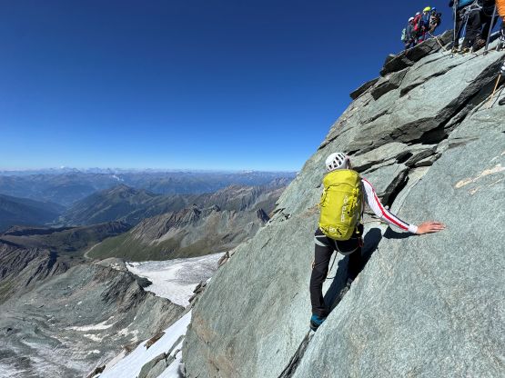
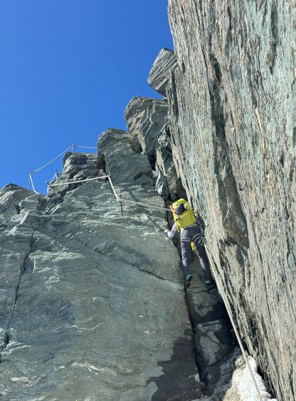
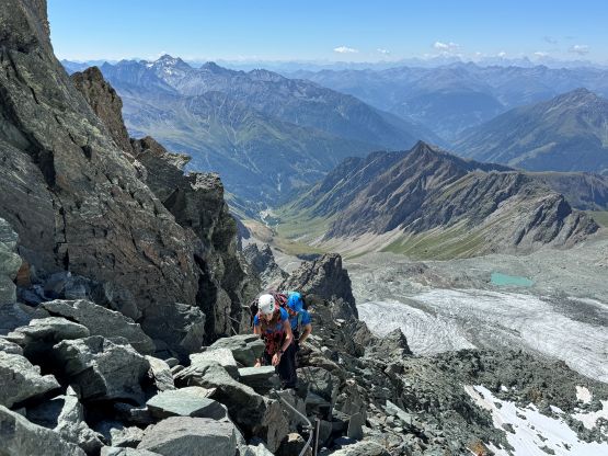
Most of these guided parties were competent and efficient but they were still not as efficient as us when it comes to the gear transitions. We passed several parties at the transition point and subsequently soloed the first pitch. The terrain was loose and down-sloping. What appeared to be 4th class turned out to be 5.4 ish even with the aid of the artificial handholds (pitons). This was shaping up to be a tough climb. We then had some ledges to traverse back and forth across and the climbing never exceeded 4th class for a long period of time. The route mostly stayed on the climber’s left (north) side of the SW Ridge but did occasionally pop onto the ridge crest. The next notable spot was a chimney feature aided by more artificial holds and this pitch felt like low-5th class as well. The plan was to solo most, if not the entire route so we kept pushing past more guides leashing their clients in short ropes. One guide didn’t quite want me to pass, but I insisted on passing as we were definitely faster. By this point we had passed at least 20 people in the gang, and there were still about 15 ahead. The route started to become sustained 5th class climbing from about halfway up so the uppermost 250 m was an intense show with some insane exposure. The north side of the route was still covered in snow so we did fair amount of snow climbing sans ice axes, crampons or any form of protection. The next memorable pitch was a near-vertical slab with absolutely nothing to hold onto. There were thankfully a chain with some basic ferrata stuffs, so we leashed ourselves in and soloed it up. Even by pulling on the chains this pitch felt like at least 5.6 to me that it was very difficult to manage in boots, but we kept pushing.
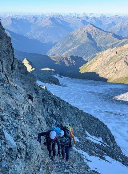
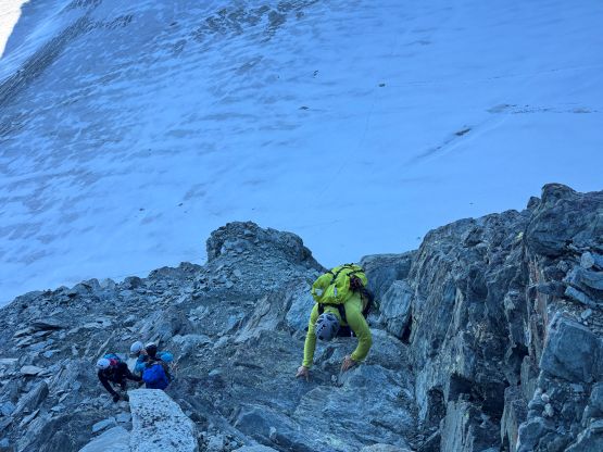
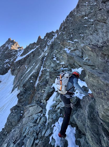
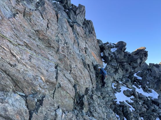
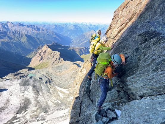
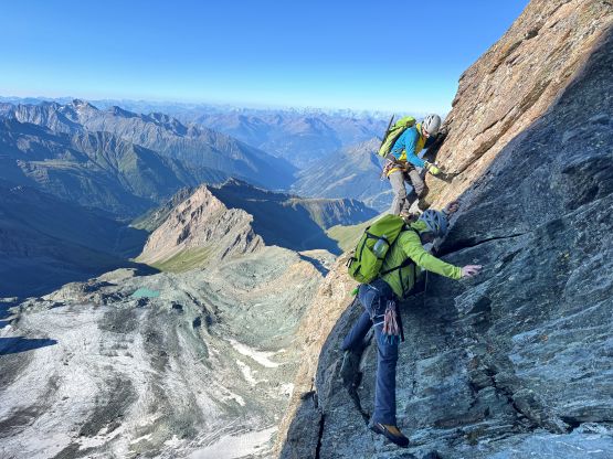
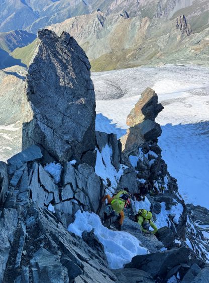
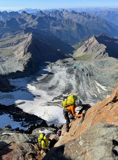
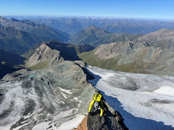
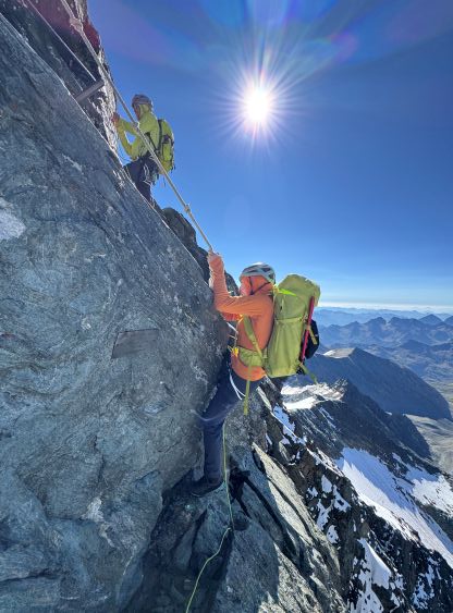
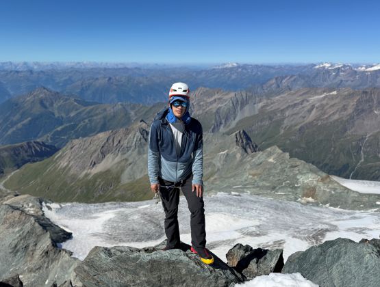
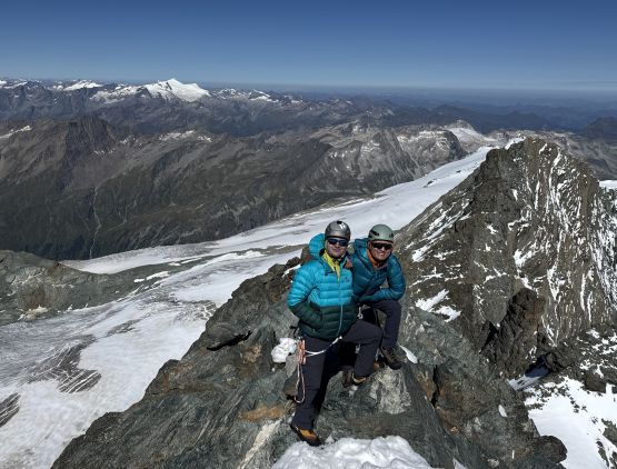
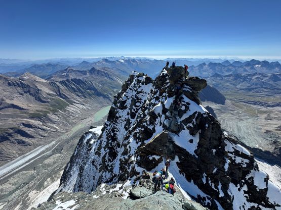
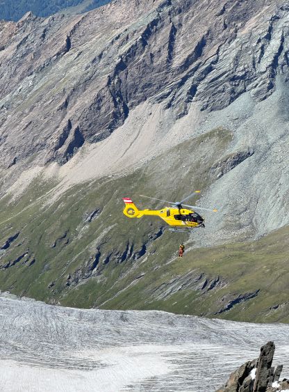
Eventually there came a leftwards traverse on incredibly loose rocks. A simple mistake would mean straight to death falling several hundred meters off the mountain. I started to pause for a bit looking for another ledge that required a very awkward down-climb. Caspar called to start belaying, which I agreed. The guided party behind then told us that the correct route traverses on the sunny side of the ridge. I did inspect that side but saw nothing to climb on, but I failed to spot the two shinny bolts. That was indeed the route, so there’s no way I would solo that. After some slow rope management I was in the position to lead this pitch and there were several intense mid-5th class moves required. This pitch was no more than 10 m long so having the 48-m rope was an overkill and created more drags than needed. We then coiled the rope and soloed more and more 5th class terrain until an overhanging move with a fixed rope stopped our upwards progress. Erica was leading at the moment and she didn’t want to solo that move. Caspar, having the strongest upper body in the team, volunteered to lead it. Watching a 5.12 climber struggling didn’t inspire so I definitely needed a belay there. It took me a while to figure out the moves even with a top rope belay. The grade did eventually ease above this step so we soloed the most 3rd and 4th class terrain to the summit, finishing as one of the earliest parties on that route. Our ascent time from car was about 5 hours 40 minutes. There were at least two separate helicopter rescues on the route while we descended, so some of the people we passed had gotten themselves in trouble.


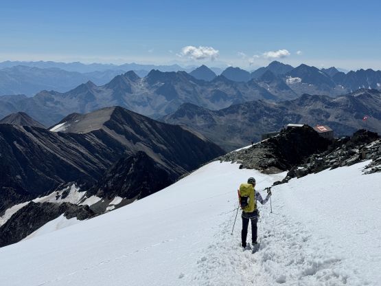
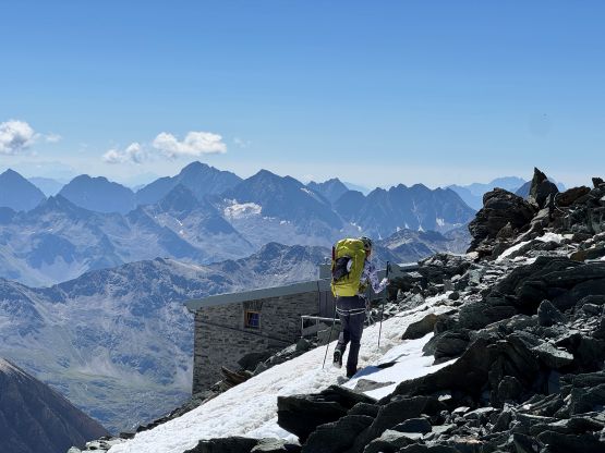
There were at least 150 people on this mountain and most of them were coming up the standard route, which we would descend soon. I don’t know why they could be so slow after sleeping at 3400 m. There were some inevitable traffic jams but that’s just part of the game on Grossglockner. This route was thankfully a piece of cake compared to what we had just done, so the rope stayed in Caspar’s pack without being needed anymore. There was a lot of hypes about that “gap” but we found it be mostly 4th class and with chain protections. Some of the more exposed terrain was actually to get off the eastern sub-summit where we must down-climb some exposed ledges covered in snow. Lower down we had to lower ourselves using some batman ropes of 2cm diameter. I pulled my biceps a bit as I wasn’t very used to this type of climbing, having my entire body weight holding to the arms and the fixed rope. Further down the route was entirely covered in the fresh snow but there was already a track. The terrain was about 40 degrees and there’s some exposure, but the ice axes stayed in the packs. Caspar even went for a few glissades to speed things up. Once down to the 3400-m high hut we all went in to search for drinkable water, but to no avail. The staffs were going to charge us for water, so no thanks. I simply cannot support the idea of having to purchase water. We together had barely enough water to get down to the glacier, so pushed onwards and refilled the water bottles down there.

We then swapped the mountaineering boots for the comfy trail-runners. The paths weren’t very obvious yet but we soon picked up the main trail descending towards the 2800-m hut. Looking at the maps we made the decision to take one of the short-cuts straight down into the valley, bypassing that middle hut. I then took off ahead and jogged the rest of the way back to the trail-head, finishing the C2C round trip in 9.5 hours. Erica and Caspar went for some beers in that lower hut so showed up about 1.5 hours later, and then we drove down to the town of Lienz. There’s a McDonald’s and Adam had been there already for about 2 hours after completing his solo climb of Sandspitze. Erica and Caspar were limited by their driving distances due to the rental company so Adam and I took off again, driving another 3+ hours to the NE for Hoher Dachstein. The weather was great everywhere but I wanted to take advantage of this high pressure system to knock off some harder peaks. A day or two later the authorities had closed Stüdlgrat due to “rockfall”.