Fuji-san / 富士山
September 9, 2023
3776m
Shizuoka / Yamanashi, Japan
Fuji-san or 富士山 is the highest peak in Japan that does not need much introduction. Almost everyone knows the existence of such peak and it’s one of, if not the most popular objective in the entire world that one cannot drive up or take a chairlift to the summit. There are three popular routes and all involve at least 1400 m elevation gain. Adding in the moderate altitude and the fickle weather Fuji-san might not be as “simple” as one might expect. At least I underestimated this objective. Just because hundreds, if not thousands of hikers go up this mountain in any given day does not make it a “giver”. The original plan was to spend 3-4 days in Japan and do a bunch of peaks, but then the country was hammered by a series of typhoons that it started to make no sense to head over there. I never do fixed-date trips unless there’s no other choice, so we did not want to book flights until the very last minute. This gave us enough flexibility to postpone Fuji-san, and we decided to stay longer in Malaysia and got Trusmadi after Kinabalu. The ascent of Trusmadi added 2 days into the itinerary and it was far from being “cheap” or “easy”.
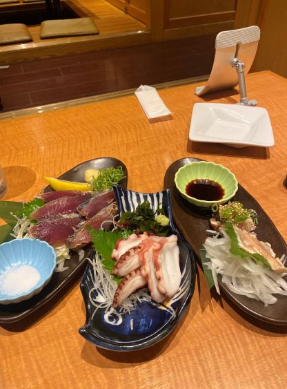
We still had to somehow make our way over to Japan and we now only had 3 days (Sept. 8-10th) between Trusmadi and Yushan’s ascents. To make it work we must push things a little bit harder. The plan of the first day was to take overnight flights (no sleep) with a layover in Shanghai, followed by 4+ hours of complicated train travel to Fujiyoshida at the base of Fuji-san. I had decided to take the slightly longer, but much more popular north side (Yoshida) trail as it gives the highest degree of robustness. There’s unfortunately another typhoon landing in Japan on Sept. 8th creating over 100 mm of rain in the vicinity of Tokyo, so our second flight from Shanghai (PVG) to Tokyo (NRT) got delayed by 3 hours. While waiting in Shanghai it was not looking very positively. I assured Adam that even this flight got delayed by one full day we would still do Fuji-san, no matter what, albeit summitting at night with two or three restless days in a roll. It turned out that they did not extend the delay so we got to Tokyo Narita in the late afternoon. The customs were not straightforward and neither was the trains. We had to deal with the Friday’s rush hour traffics and it was extremely confusing to navigate all of the train connections, but we must somehow get it figured out. About 4 hours later after 4 connecting trains we made our way to Fujiyoshida at 10:30 pm, had a late sushi dinner and went to bed past midnight.


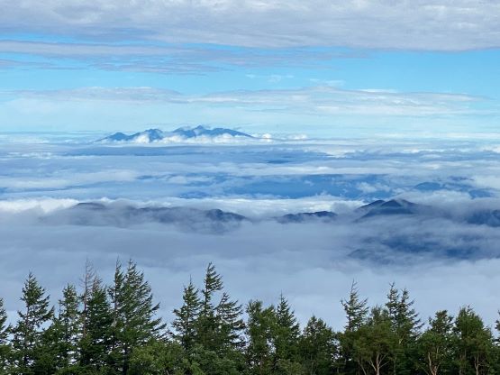
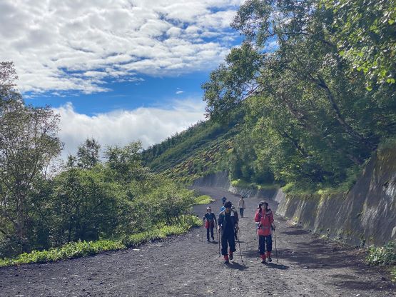
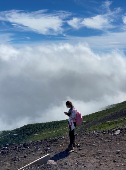
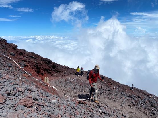
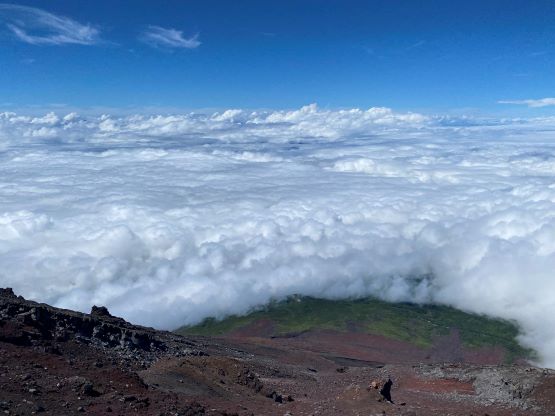
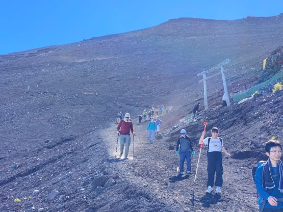
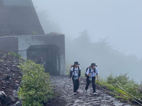
A few hours later we got up at 6 am. To catch some sleep we decided to take the second bus to the 5th station (trail-head) and this bus would depart at 7:20 am. The people in Japan take time extremely seriously so if they promise to depart at 7:20 am, they will. There were a shit ton load of people taking this bus so most of them didn’t get a seat. The ride took about 1 hour, and the weather was initially overcast and drizzling, as “promised” by the forecasts. The weather forecast in this country was completely useless because we broke through the clouds and it was completely sunny on the upper mountain. I brought too much clothes anticipating a miserable day in the clouds and the winds, but it turned out to be a sunny and warm day. There was already some views from the trail-head. To my surprise we did not have to purchase an entrance ticket but we did donate 1000 yen to a volunteered search and rescue team. They asked us to donate, and the price was reasonable, so we might as well.


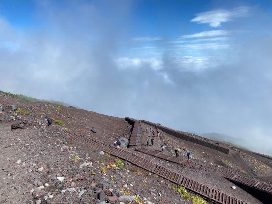
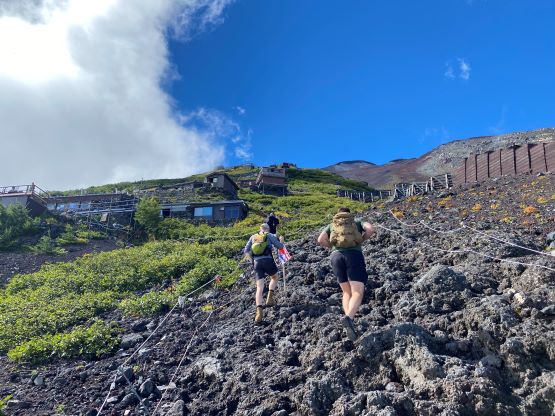
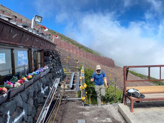
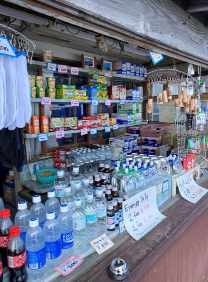
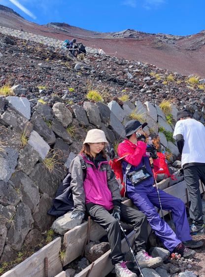
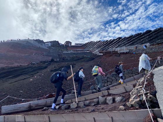
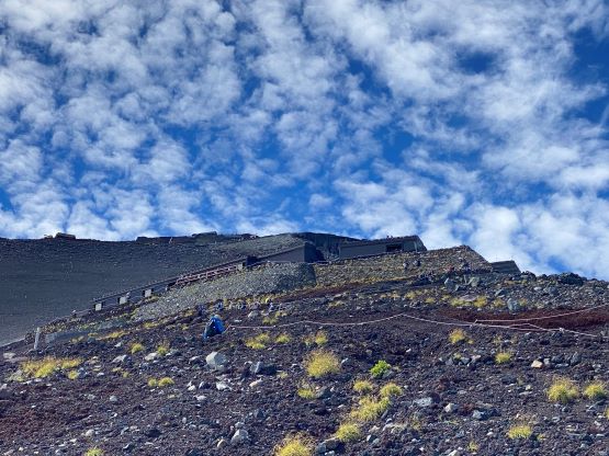
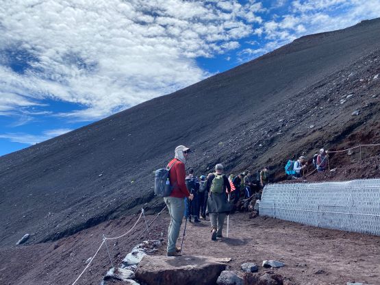
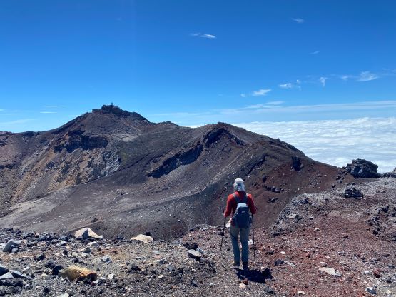
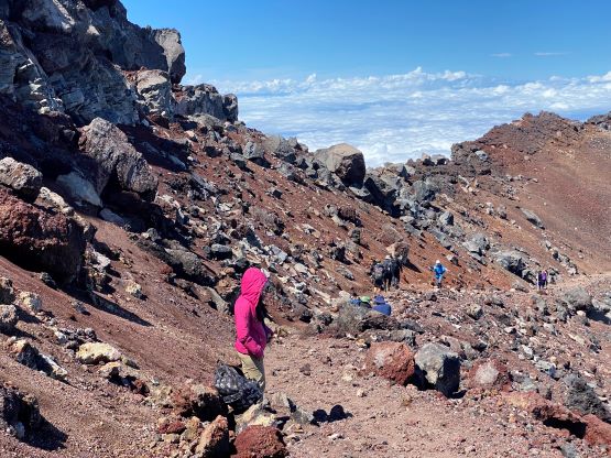
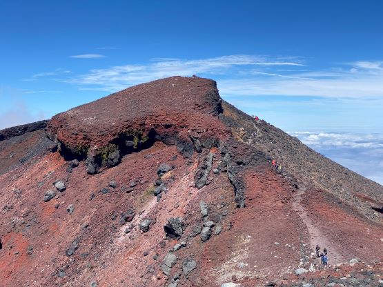
The first kilometer of this route was plodding across a flat dirt road with some descending before reaching the actual trail-head. I had no idea why they wouldn’t extend the drivable road to the trail-head. At this point I was forced to switch my rain pants for the normal pants that I brought simply for a “back-up”. It was sunny, hot and humid and I definitely overdressed. The trail made a gradual ascent for about 1 km to the 6th station before starting the relentless switchbacks for 1300 m elevation gain all the way past the 9th station onto the crater rim. There wasn’t much worth noting as I had seen lots of pictures and videos of this route on social media. It was exactly like what I had seen, albeit with LESS crowds than anticipated. Some mentioned standing in the queue for hours but that’s if one goes for the sunrise view. The people that we encountered were mostly day-hikers which meant they were all decently fit. The last section after the series of houses and huts in the “8th station” was quite steep, and involved some high-steps on rocks and some scrambling but aided by handrails. We were both tired from the non-stop travelling so we needed several breaks and didn’t plod that much faster than the rest of the crowds. It took us 3 hours from the trail-head to the crater rim.


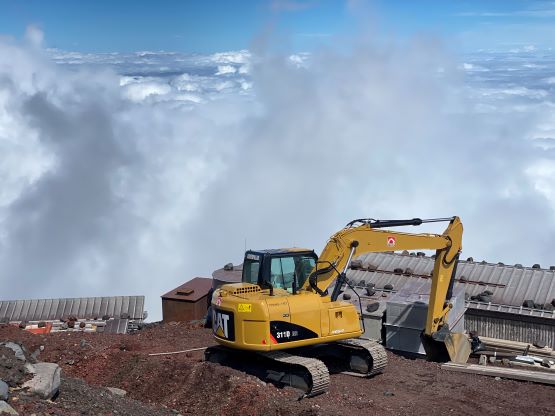


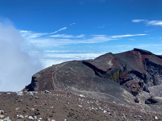
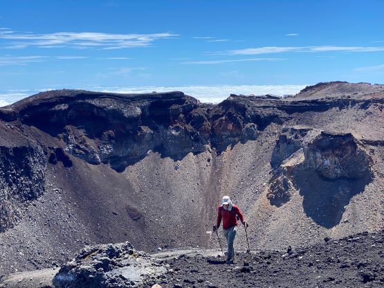
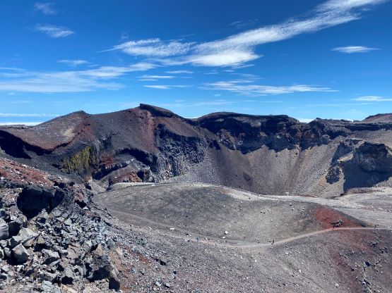
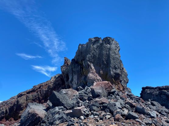
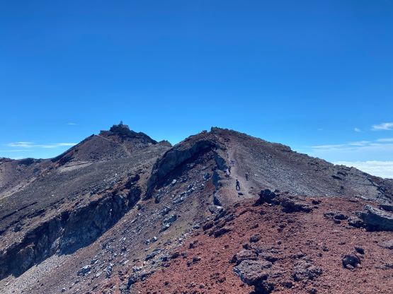
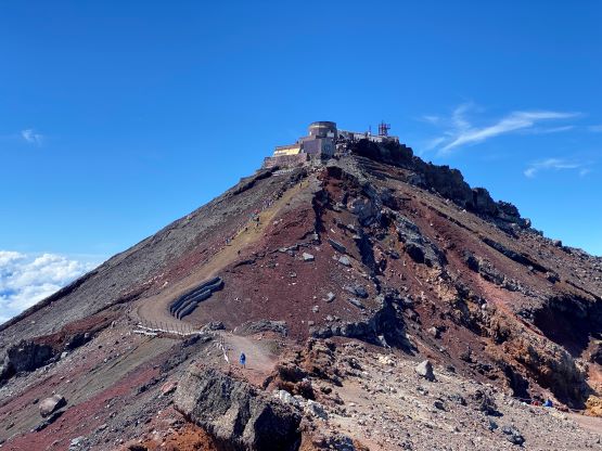
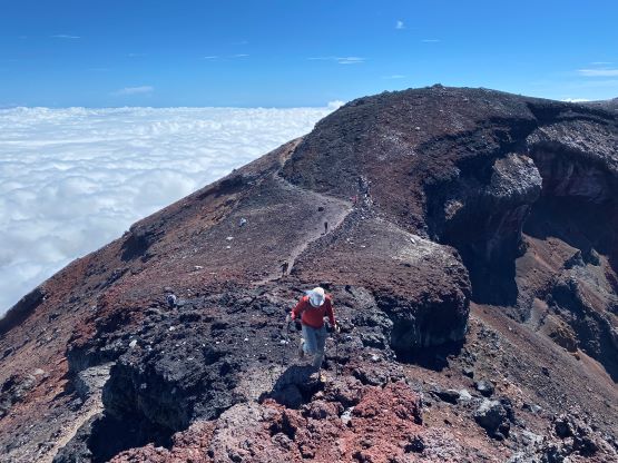
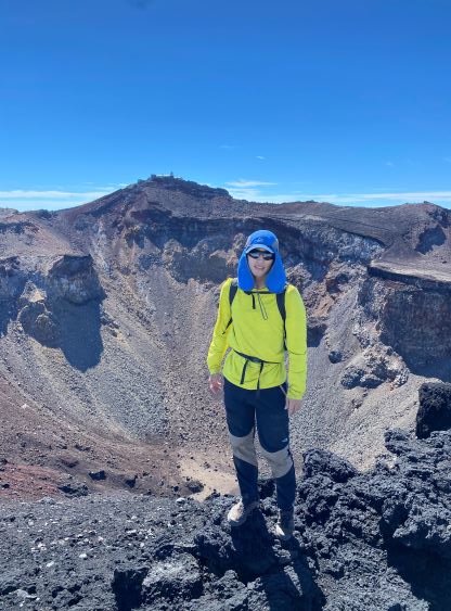
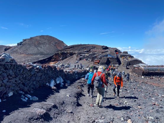
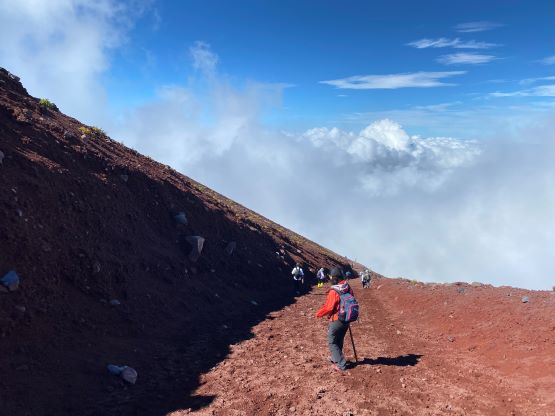
The downside of doing Yoshida (north) route is the required traverse across the crater rim to the true summit. This added distance and elevation, but made the trip more scenic as the best views were from the crater rim. We decided to do a full circumnavigation of the rim in a counterclockwise direction, tagging all of the high points along the way. There are 9 named high points including the highest peak, but only 1 has more than 100 m prominence. Two of those sub-peaks are somewhat worth noting whereas the others are all “dumpster diving” that I shouldn’t even had bothered with. The first bump that we did was Hakusandake on the north side of the rim, and this was the most interesting of those sub-peaks. We took an unofficial trail up the east slopes to the summit, and descended the south ridge to the saddle with the highest peak. The south ridge descent was a scramble that required some route-finding. I did one 4th class move followed by a traverse across a bench. Adam didn’t like that down-climb and had to take a much longer route around. As a result I reached the true summit about 15 minutes earlier. People were lining up to take a picture with the summit so we didn’t any longer than absolutely necessary. The true summit was somewhat ugly and anticlimactic due to the queue and the building structures. I wondered why they must build those things on the country’s highest peak.


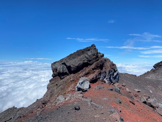


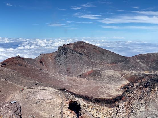

We made our way quickly down the east side of the true summit and tagged 4 minor bumps that I’m not even bothering to mention. Those are all pointless bumps and one of them required hopping over a fence. The second-to-last bump (Izuga-take) was a tiny bit more interesting as it involved a somewhat exposed ridge. The north side of this bump was a vertical drop but I spotted a line that worked out for a down-climb. I would rate this down-climb 4th class and the rocks were kind of loose. Adam didn’t like it and went all the way back down the south ridge and around. We both took a direct, scrambly route up the final bump (Joujuga-take) where we were joined again by hordes of tourists.


The descent of the Yoshida trail is different than the ascent. It’s more gradual with longer switchbacks, and they made the ground loose so it’s easier for the knees. I mostly jogged my way down but took a lot of breaks along the way. I did make a fairly serious mistake by taking the wrong branch down down Subashiri trail on the east side of this mountain. Adam followed me behind but fortunately we realized this mistake while it wasn’t too late. Instead of backtracking we just did an off-trail traverse across some horribly loose scree to rejoin the correct trail. The rest of the descent was uneventful but felt like a drag. The buses were waiting and departed at 3:40 pm on time. The low clouds were still lingering so by the time we got all the way down to our hotel in Fujiyoshida we were still not able to see the mountain. That was a bit of a bummer of an otherwise, perfect day. A lot of the restaurants weren’t opening at 5 pm so we were “forced” to have another meal in that same sushi restaurant. I made sure to order an entirely different menu because our stay in Japan wasn’t long enough to make me fully appreciate the food in this country. One of the reasons to visit Japan is the food, so I needed some variety and I did not care about the cost, at all.


The day was not over yet as we must take the 4-hour train connections to the east side of Tokyo. Adam had booked our second hotel in Chiba to position ourselves better for the flight to Taiwan. This ended up requiring 5 connections that we did not make to Chiba until 10 pm again. We were downright exhausted, but that’s the deal if one wants to pull off Fuji-san in this fashion. Ideally one should plan to spend one day travelling to Japan and one full day taking trains to Fujiyoshida. To combine the 2 flights and the 4 trains in one day, and then the climb and the trains in another day was definitely not for the averaged. The trains in Japan were much slower than we would have expected. We would need another 1.5 hours to take two trains from this hotel back to the airport so we unfortunately did not get a full night of sleep neither. In fact, I’m just not planning on getting much sleep for the rest of this trip at all.

