Frisco Mountain and Rainy Benchmark
September 27, 2024
2368m
North Cascades Highway, WA
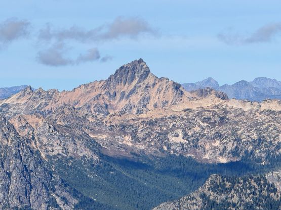
Frisco Mountain is a somewhat obscured objective in the immediate vicinity of Rainy Pass and “Rainy Benchmark” is essentially an unnamed peak about a kilometer to the SE of Frisco Mountain. These two peaks are roughly equal in elevation and the higher of the two boasts over 300 m prominence. The Washington’s P300m or P1K (1000 feet) list is an obscured list that only the die-hard peak-baggers know about, so not many people dare to attempt these peaks. They aren’t terrible mountains, but there are simply too many “better” objectives in the vicinity. The approach is rather short using the Maple Pass Loop trail and the scrambling should not exceed 3rd class if one puts in the effort to search for the easiest way, but there are fair amount of loose, unpleasant and slow going terrain.
I was searching for something not overly demanding as the weather was only good for the second half of the day, but I still wanted Erica to enjoy the trip so the objective couldn’t be too boring. The peaks around Washington Pass offer the perfect combo of short approaches and rugged scenery but I had already done most of those objectives. I went back to the maps and noticed the officially named Frisco Mountain so I did some research. There weren’t a lot of “beta” but the selected trip reports on peakbagger.com and NWHikers.net were sufficient enough, and almost everyone combined it with “Rainy Benchmark”. The USGS had surveyed the elevation of that peak and the surveyor’s trig point was named “Rainy” but the peak itself is essentially unnamed. I generally have little interest in unnamed peaks but “Rainy Benchmark” could be as high as, if not higher than Frisco Mountain, and both peaks boast over 100 m prominence so it would be essential to do both. I extended the invite to a few others but only Holly signed up, and the three of us decided to meet in White Rock at 5:30 am in the morning. I did not anticipate these peaks to take us 10 hours as otherwise I might have insisted on being well rested while camping at the trail-head. I ended up not getting back home until almost 1 am.

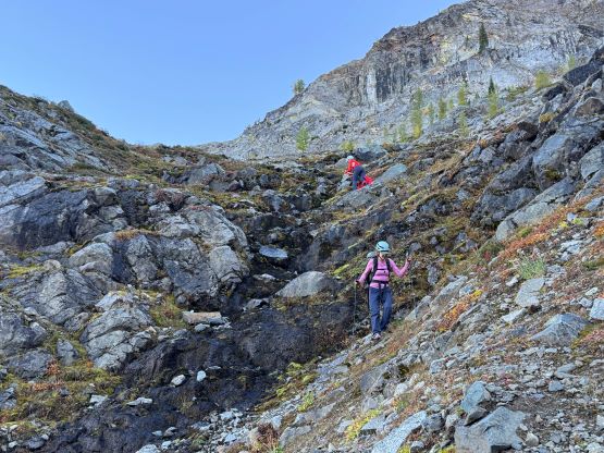
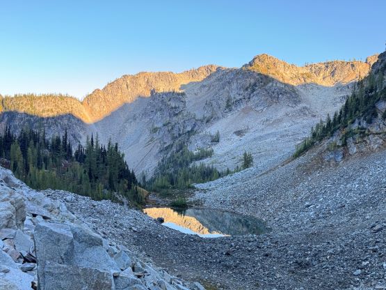
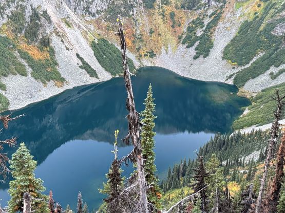
We eventually got to the trail-head at 9 am. The weather was as forecasted, mostly overcast but the rain had fortunately stopped. We decided to take the shortest possible way to approach these mountains so we took the southern of the two branches ascending steeply the ridge overlooking Rainy Lake. At around 1970 m elevation we left the trail and started the descending traverse towards that unnamed tarn mentioned in various other trip reports. My plan was to avoid elevation loss for as much as possible but the micro-terrain wasn’t as straightforward as I was hoping for. Nevertheless I led us traversing across some tricky terrain and eventually dropped into the basin 30 vertical meters above the tarn. Our total elevation loss was only 70 m as opposed to 200 m but we did fair amount of side-hilling on wet grass and one optional wet and down-sloping 3rd class ramp. Holly did not like that ramp and detoured around.

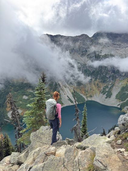


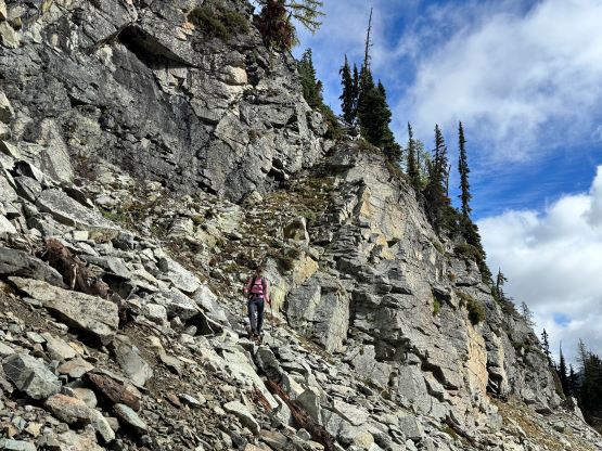
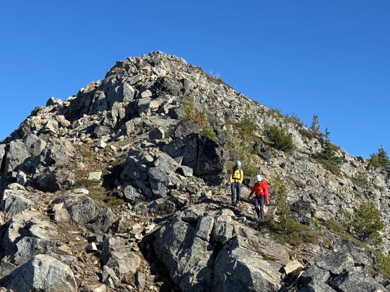
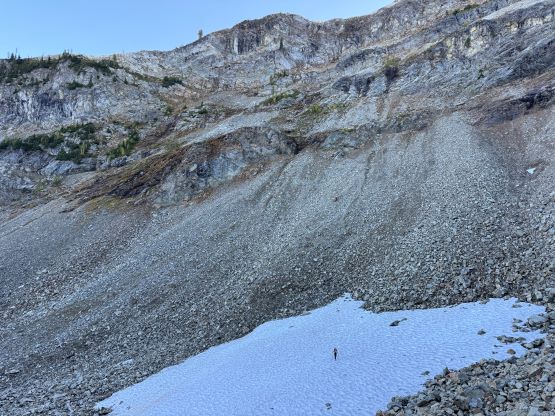
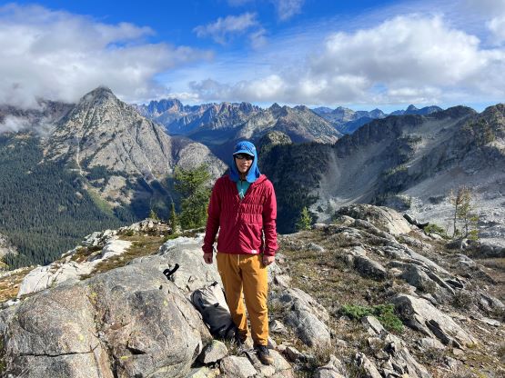
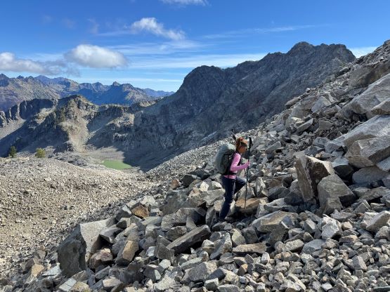
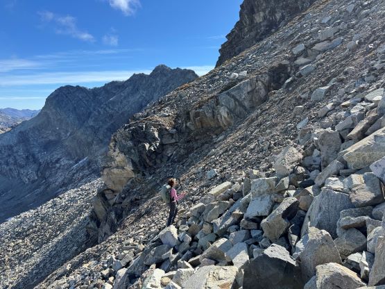
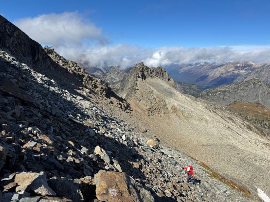
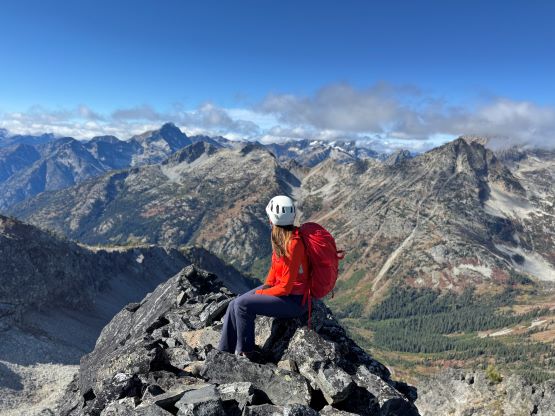
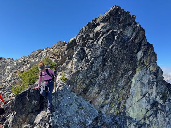
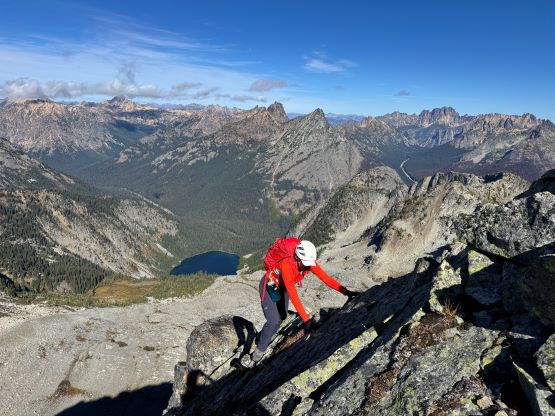
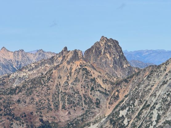
The original route traversed around the steep rocky face on the far climber’s left side but again I wanted to minimize elevation loss/regain by scrambling diagonally up the face from bottom right to the top left. I wasn’t sure if we managed to save time by taking this harder variation but I liked to do things a bit differently and Erica needed to gain more experience on choss. Needless to say, this route sucked and the terrain was horribly loose even by Rockies standard, but it was perfect for practicing purposes. I had recently switched to the “trail runners only” type so I too needed to gain experience on choss while wearing the runners as opposed to my trusty mountaineering boots. Thankfully the clouds finally gave way to the blue skies so we would have a gorgeous day ahead. After taking a needed break we traversed across the next bowl aiming at the east shoulder of Frisco Mountain. This stretch involved a great deal of boulder hopping, and the final 200 m ascent onto the shoulder was again, horribly loose. We were actually on a rock-covered dying glacier so the ground was extremely unstable. For a few occasions I even trigged rock slides a few meters above. At least the route we selected was easy from technical perspective and the final scramble up the east ridge of Frisco Mountain was mostly just “class 2” and was quite enjoyable.


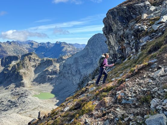


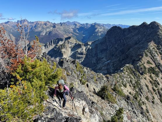


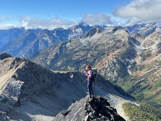
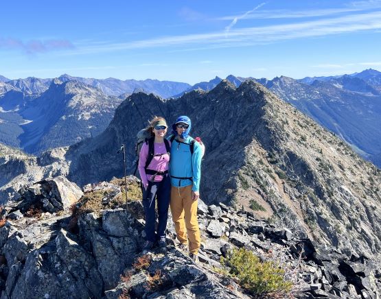

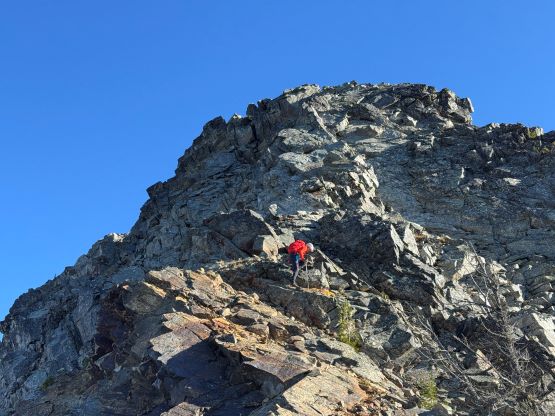
I proposed that we should immediately start the traverse towards Rainy Benchmark and take the break on the other summit and Erica and Holly agreed. Making our way down towards Frisco/Rainy col was straightforward but Erica and I stayed as close to the ridge crest as possible to on purposely make things a bit more interesting. The ascent of Rainy Benchmark was mostly as described, easy except for one 4th class step. There were really just a couple tricky moves so I would hesitate to call that section “class 4”, but in any case it could be bypassed on the climber’s right side as per Matt Burton’s trip report on NWHikers.net. We were more interested in the fun scrambling so I did not even throw out that bypass as an option. There was still fair amount of walking to the summit afterwards, but the terrain was straightforward. I even traversed all the way to the far eastern summit as that appeared just as high. My GPS even recorded the eastern summit being 1-2 meters higher, but that’s well within the error range of my device. Without a professional level survey it would not be possible to determine which of these peaks boasts the actual prominence. It took me quite a while to go there and come back so we essentially did a massively long summit stay on Rainy Benchmark.


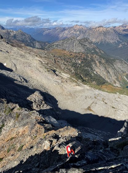


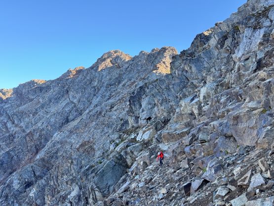
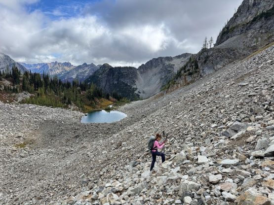
It was eventually the time to descend. I was originally hoping to make the Maple Pass Loop and tag “Crooked Bum” but it was obvious that we wouldn’t have enough time for that. I thought maybe we did not have to go all the way to within 100 vertical meters from Frisco’s summit so took a different way down, which turned out to be loose, down-sloping and wet. The scrambling was at most 3rd class but the terrain was committing and exposed. Not sure how much I want to suggest this route but again, Erica needed to gain more experience so the shittier the terrain the better. The tricky down-climb was then followed by another section of crappy side-hilling on loose talus, which again took a while. We took a few more breaks and then retraced the exact route that we took on the way in, which involved more loose shits as well as fair amount of side-hilling. By the time we finally got back to the trail it was almost sunset. Holly eventually dug her head-lamp out whereas I opted to just use the iPhone’s light. Erica was plodding in the middle of the team so she didn’t even need to use any illumination. I then drove us back to Sedro-Woolley for a deserved Mexican dinner and Holly took turn driving us back to White Rock. I did make a detour to drop Erica off at her place so didn’t get back to my home until almost 1 am. I thought these were smaller peaks but the day was far from being “short”.