Downton Peak and Mount Nraiteskel
June 22, 2025
2640m
Downton Creek / Duffey Lake Road, BC
“Downton Peak” and Mt. Nraiteskel are the two obvious but very different objectives accessed from the end of the south fork of Downton Creek FSR. There aren’t a lot of “beta” especially in the recent era given the deactivation of the access roads. The few existing trip reports are on the old ClubTread forum dating at least one decade back. It might seem obvious to traverse the two peaks to make them in a single outing but Simon and Vlad had tried that and failed. The only “beta” I knew of were parties doing them on separate trips, but I took my time studying the various pictures in Simon’s trip report and determined that it was actually possible to link them up, but not without some steep snow climbing. Francis had been eyeing Mt. Nraiteskel for a while and the plan was quickly formed taking advantage of a mediocre weather window on Sunday. Elise and Francois joined and we all had time to drive out the night before to car-camp at wherever we ended up parking. I insisted that we needed Francis’ truck as I had been to the area recently (Melvin Peak back in November last year) so I knew how much pin-stripping we’d be dealing with. Beyond Melvin Peak/Viola Lake’s turn-off even I had absolutely no idea. The last few kilometers of the logging road appeared very “green” on the satellite images but we were determined to drive as far as possible.
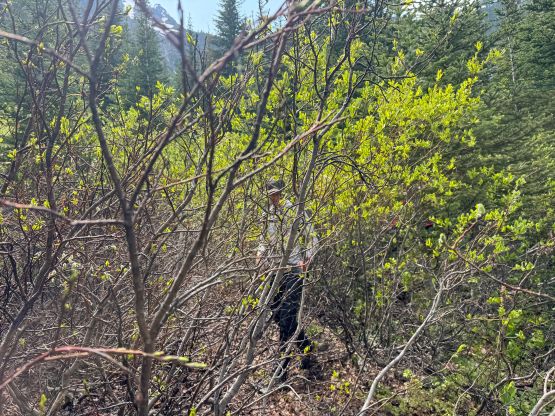
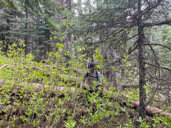
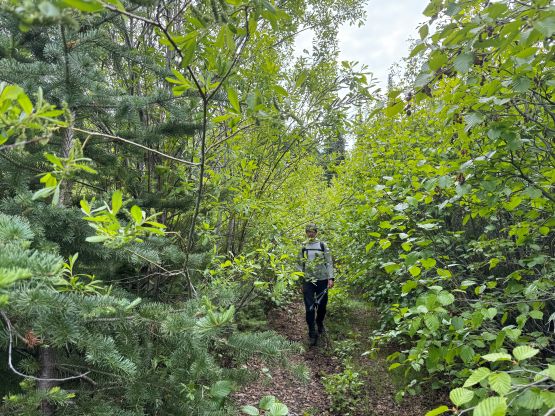
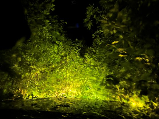
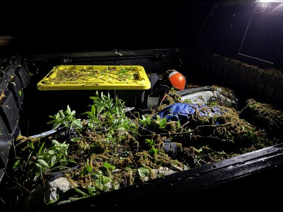
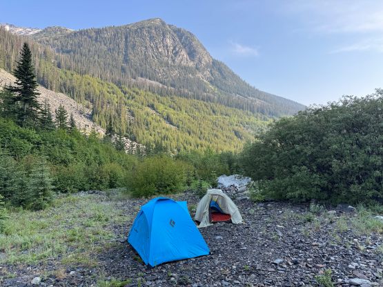
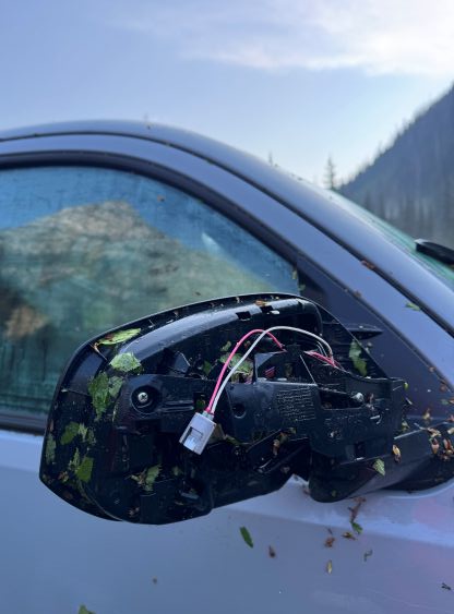
The four of us eventually left the Church at 9 pm and a few hours later we were driving up the Downton Creek FSR. The barriers were indeed pulled apart as reported by the recent parties doing Mt. Seton. The alders started to grow in as soon as we drove past Mt. Seton’s turn-off and the situation had progressively become worse as we drove towards Viola Lake’s turn-off. The amount of pin-stripping was still “tolerable” by SWBC’s standard, though. Past Viola Lake’s turn-off we entered the unknowns, and the alders quickly closed in to the point that we were barely able to see the “road” ahead. I would have parked and turned around but Francis was determined. This was easily the bushiest road I had been on, way worse than the last 7 km to Skihist Mountain’s starting point. For many occasions I was questioning our sanity but we somehow kept going and never encountered an impasse. The rear mirror on the right side was destroyed eventually, but we succeeded in making to within 2 km of the road’s absolute end. There’s a large open area to turn-around and set up the camp but in retrospect we could have pushed on all the way to the very end. The bushes were also extremely wet and that was a good indication of what we were signing up for.
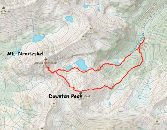
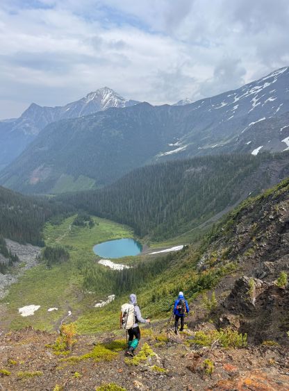
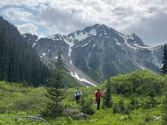
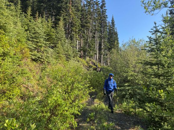
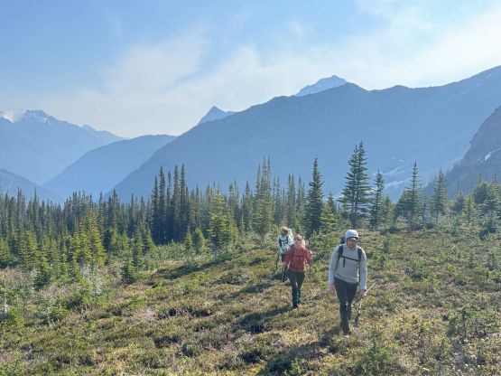
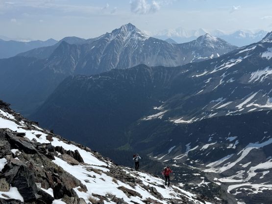
The next morning we all slept in to 7 am but we couldn’t afford starting too late. There’s some thunderstorms in the forecast for the afternoon so we still had to be efficient. The morning routine took a while but by 8 am we all managed to get ready for the exploratory mission. The final plan was made to traverse up and over “Downton Peak” to access Mt. Nraiteskel as we could see fair amount of fresh snow on the higher slopes. This way we could at least get one peak done. Thrashing to the end of the road was actually not as bad as I thought, but we did get quite wet from the alders. I had opted to wear the trail-runners and carry the mountaineering boots to make sure the boots weren’t soaked in the wet bushes, and the plan worked out nicely. The shoes did become wet but I couldn’t care too much about them. From the road’s end we entered a messed-up cut-block and did some annoying but not overly long bushwhacking to access the mature forest. The forest was mostly open so we quickly made our way to the east ridge of “Downton Peak”.
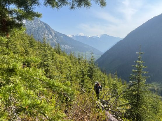

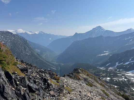

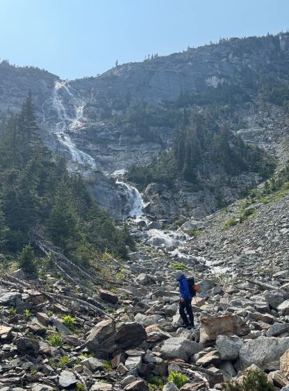
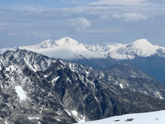
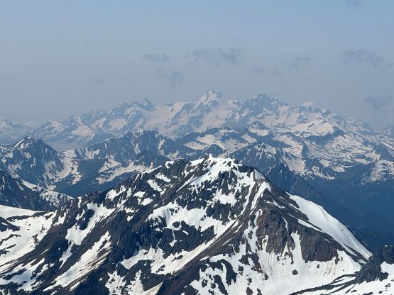
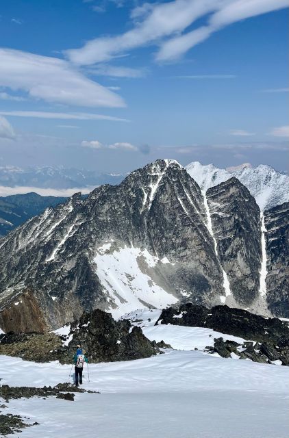
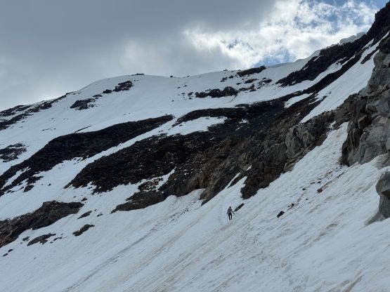
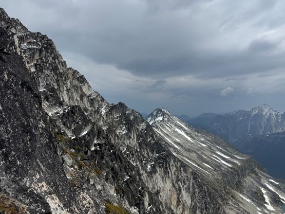
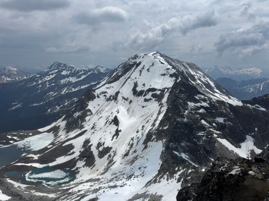
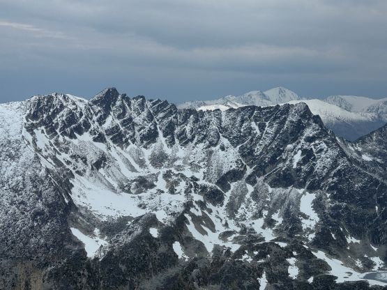
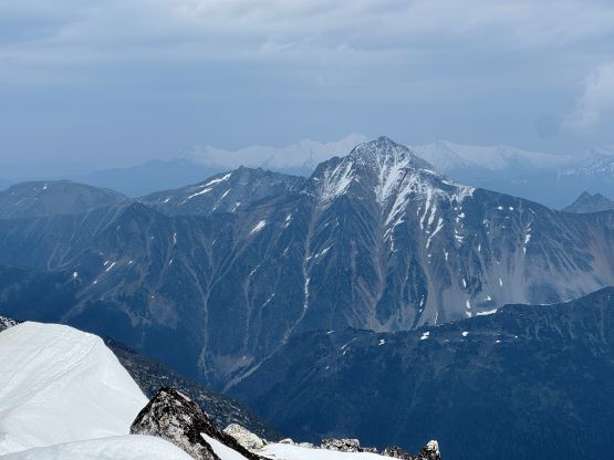
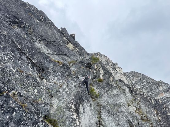
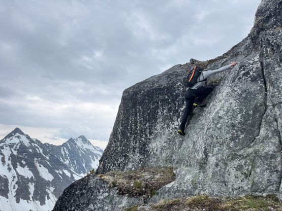
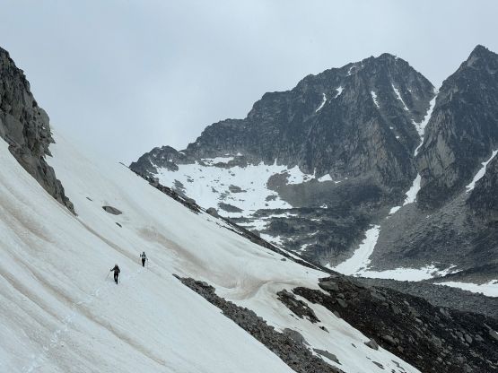
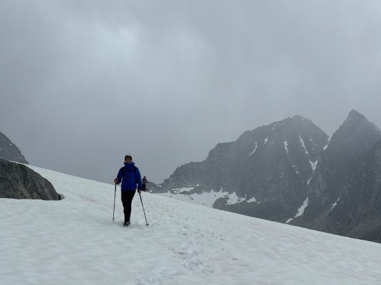
There are many ways to get up “Downton Peak” as this one is entirely non-technical. We decided to stuck close to the crest of the east ridge for simplicity. There were patches of annoying krummholz but the route-finding was generally simple. The grunt was long and monotonous and towards the end we encountered some scrambling. The scrambling could be bypassed on climber’s left, and eventually we stayed on climber’s left after encountering some fresh snow. The amount of fresh snow increased dramatically above 2500 m elevation and we even had to cross a patch of old snow near the very summit. The views were quite good from the top but it was smoky thank to the nearby forest fires.
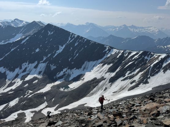
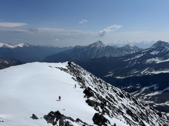

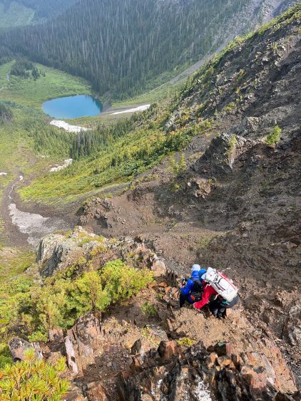
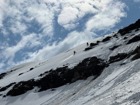
We could see the clouds rolling in from the east so the stay on the summit was short. I took my time swapping the wet trail-runners to the dry mountaineering boots and then led us down the broad NW Ridge of “Downton Peak”. The terrain was a mix of snow slopes and boulders. In about 100 m elevation loss I spotted a line to get onto the north glacier so made the call to don crampons. The direct ridge traverse wouldn’t go, so the north glacier offered the only non-technical passage. The snow route was not very obvious from above but that’s why we came here with 10+ years of mountaineering experience. I managed to pick a line linking up the patches of steep snow from the shoulder of “Downton Peak” to the bowl below Downton/Nraiteskel saddle almost entirely on snow, and without any unnecessary elevation loss. The steepest snow was around 45 degrees and was near the start, and that part needed to be down-climbed facing into the slope as it was also decently exposed. We all brought two ice axes each but I didn’t bother to take the second axe out. The exposed choss was quite shitty even by Rockies standard so this route is best done in June when there’s abundant amount of snow coverage. Lower down I resisted losing too much elevation and did one long side-hilling traverse and then Francis took over the lead post-holing up to the south ridge of Mt. Nraiteskel.
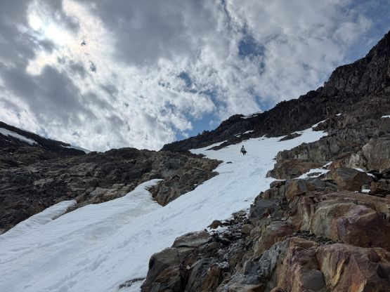
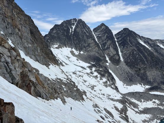
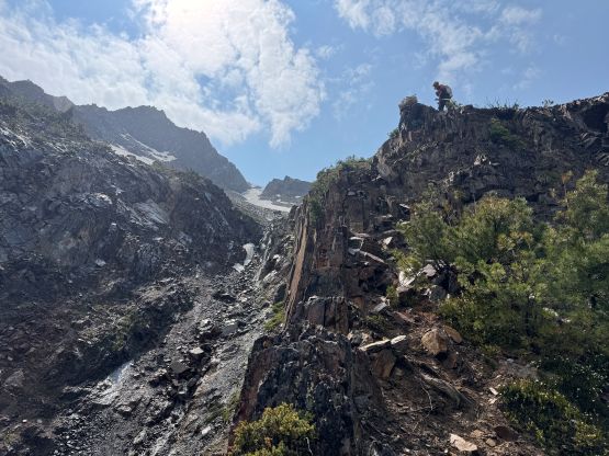
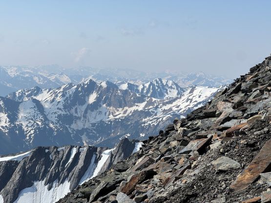
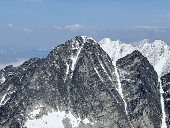
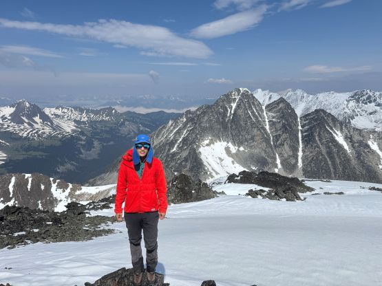
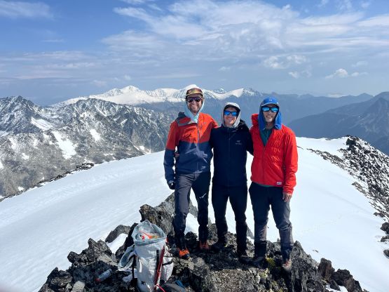
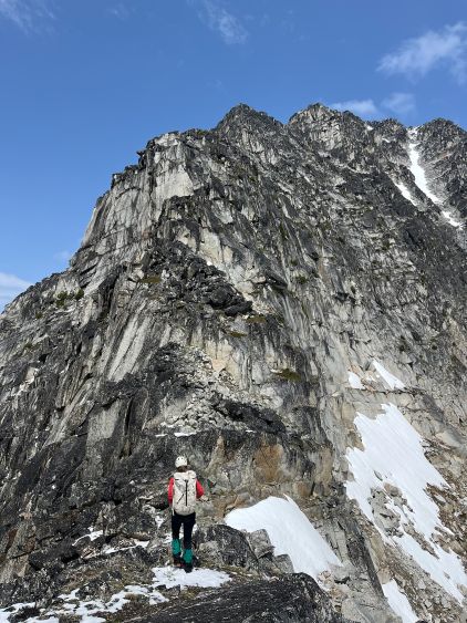
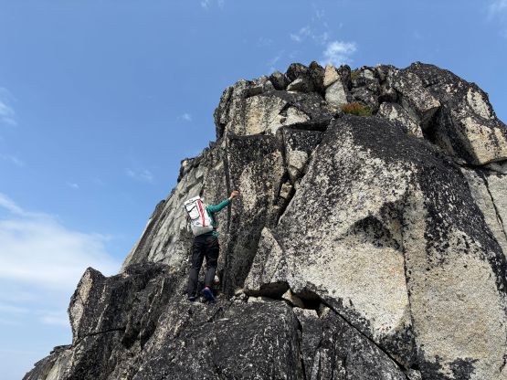
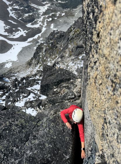
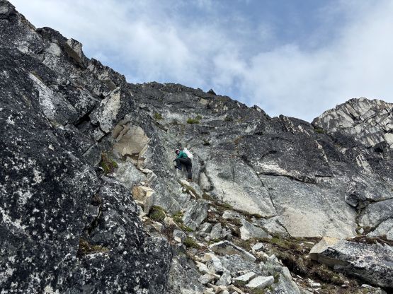
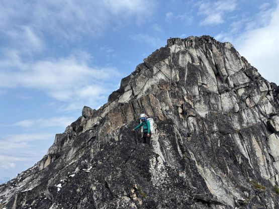
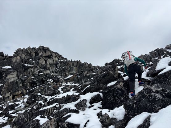
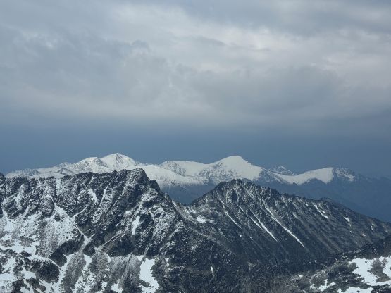
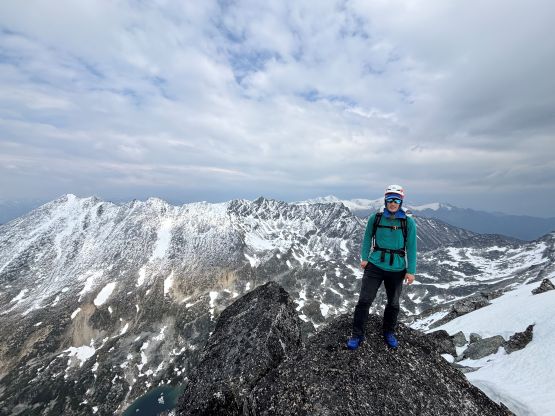
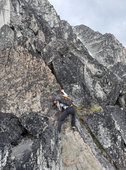
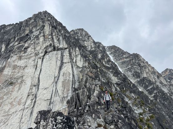
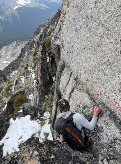
The weather was not looking too promisingly so we decided to ditch all snow equipment at the transition point. I also swapped the footwear back to the approach shoes. Francis and I went ahead but we quickly encountered a pitch of mandatory climbing. After searching around on all sides we committed to an off-width chimney on the climber’s left. It was awkward enough that I had to give my backpack to Francis before making the moves. Elise and Francois followed and we all climbed without the packs. On the descent we found a way to bypass this step with some elevation loss and regain. More 3rd class scrambling with minimal exposure later we arrived at the next “big step” and the route goes up on ledges and ramps on climber’s right. There were 4th class climbing here and there, but nothing sustained nor with significant exposure. The next “big step” were attacked from the climber’s left and it was here that we started to encounter lots of fresh snow. The rocks were quite loose on the west side of the ridge and were covered in lichen, making the progress slow and tedious. Thankfully we found a few cairns marking a few important spots and they helped us confirming the route choice. Not long after we made the summit and the weather was still holding.
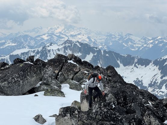
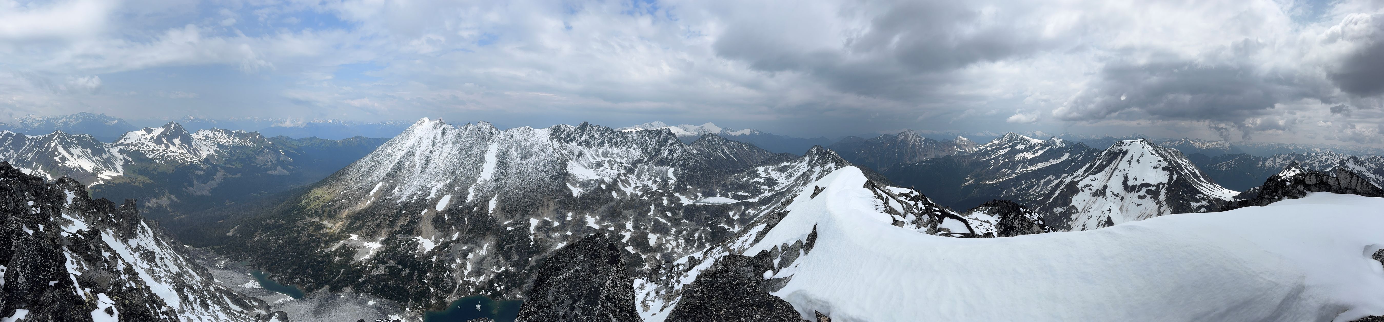
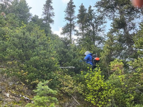
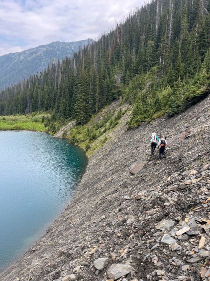
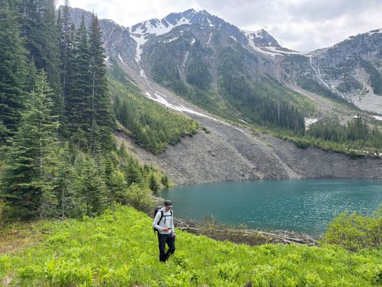
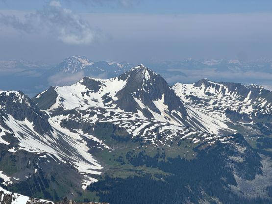
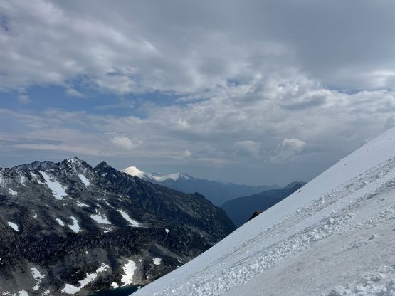
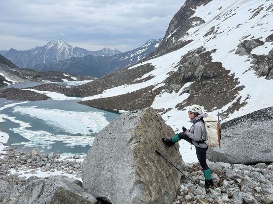
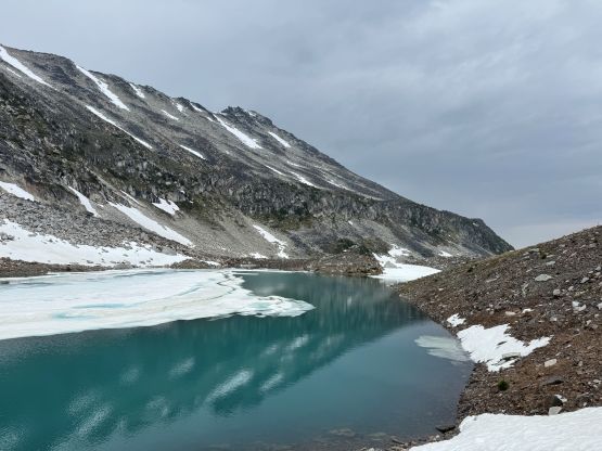
Not doing much lingering we quickly started the descent. The new objective was to get off the scrambling section before the rain came. Francis led us down the snowy part of the route and all I did was to follow his steps to keep up with the speed. I went ahead after the snow gave way to the dry rocks as my approach shoes were definitely better on the dry rocks. The shoes were not the greatest choice for the upper route but I made do nevertheless. Elise and Francois had turned around as we could see them descending far ahead of us. We managed to close in the gap but didn’t catch up to them until the gear transition spot. There were some scattered shower but it never became “rain” so the rocks stayed reasonably dry. I swapped the approach shoes for the boots and then went for a long and fun plunge down towards the lakes in the “upper basin” as described in Simon’s trip report. The two lakes were both skirted around on the south side and the second one required fair amount of side-hilling. There’s one brief period of heavy-ish rain but it didn’t last long, thankfully. At this point we were committed in descending Mt. Nraiteskel’s “standard approach” without having done much research. Even traversing around these lakes required some guesswork as we didn’t know which side to stay on.
The crux was to get down the headwall. There was no existing GPX track and Simon didn’t make it crystal clear as where exactly they went, so it was quite a lot of guess work for us. I’m generally not the greatest in figuring out what others had done without being given a lot of information so we just went down and tried to find our own way. In retrospect we completely guessed the wrong side of the valley to descend, but still made it work in the end. We went to the skier’s right side next to a gigantic choss gully. The gully appeared somehow manageable but was definitely not where Simon and Vlad went, so Francis went down the rib and did some exposed 3rd class scrambling on choss followed by some steep grass. Things were getting hairy but the terrain was still manageable so we kept descending. I made the call to cross the grassy gully to the north side. A mix of 3rd class scrambling and vertical vege-belaying later we finally got down this headwall into the lower bowl. Another long break later we embraced the bushwhacking to the lower lake, skirted around the south side again and then bushwhacked next to the headwaters of Downton Creek to the FSR that we had been walking on in the morning. Our round trip time was under 8 hours so this wasn’t a long outing after all, but the amount of terrain we had covered made it feel like a very fulfilled day. The crux was actually the drive-out and at least we didn’t break the other mirror. About 5 hours later we got back home, and the next day I would be driving all the way to SE Washington to begin the next peak-bagging trip.