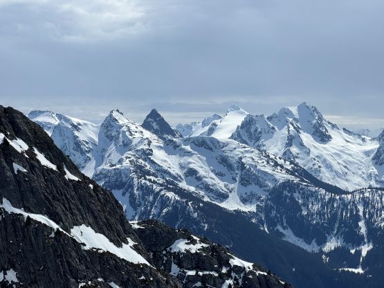
Davis Peak [North Cascades, WA]
April 10, 2026
2150m
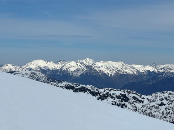
North Cascades Highway, WA
There are a few peaks with the same name in Washington and this is the hardest of them, the one not far from Newhalem in the North Cascades. This peak has reputation of being tough. About a year ago Ryan S. and Nick R. went off the beaten path and did an exploratory ascent/descent by traversing onto the SW Face (on skis), and subsequently downgraded Davis Peak to a non-technical objective. The steepest snow they had encountered was only 40+ degrees, as opposed to the 65-degree notch on the old standard (south ridge) route. The SW Face has since become the standard route of this objective for obvious reasons. However, despite the peak being “non-technical” the approach is still a daunting one and in fact, without a healthy snowpack the Ryan/Nick’s route involves more bushwhacking in alders in addition to the insane amount of dead-falls and bluffs in the lower zone. I don’t know if the Washingtonians are plainly tough or simply didn’t want to stress too much in their trip reports, but I thought the bushwhacking on this approach is one of the worst I’ve done at least in Washington, and I have done fair amount of stuffs.
Mel and I had this common objective for a number of years ever since we did Sourdough Mtn. back in 2019, but I was never too overly keen on it. A week-long high pressure system formed in the beginning of April with the first half being “too warm” but the second half having some much-needed freeze-thaw cycles. I hadn’t been watching the conditions in Washington recently but I knew this would offer a prime window for Davis Peak, and Mel agreed. I did however ignore the fact that the snowpack was in a sad state this year so we would be dealing with more bushwhacking than expected. I had read most, if not all of the trip reports but nobody overly stressed on the bushwhacking part. I knew this approach would suck no matter what, but I wasn’t mentally prepared to deal with one of the shittest approaches ever. In any case Mel and I left White Rock at 9 pm in the previous day and car-camped at the Gorge Falls tourist parking lot. The road was still closed not far beyond that spot due to landslides so I was surprised by the amount of vehicular traffic at night and in the morning. The next day we woke up at 6:40 am and did the morning routine rather leisurely. There was no concern in avalanching given the “green brick” forecasts for days so I’d rather get some sleep. For the gears we opted to carry snowshoes, two axes and a 30-m rope. The rope was mostly for the forested bluffs as most people did stress out the difficulties there. I however, felt the rope being completely unnecessary. It was class 3 with maybe a few class 4 moves, and the exposure wasn’t deadly. The snowshoes might seem unnecessary given the higher snowline but were actually quite needed. The snowpack we having having right now is still “early spring” pack, after all.
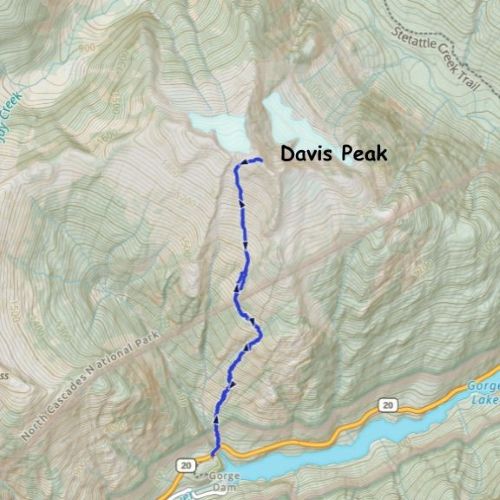
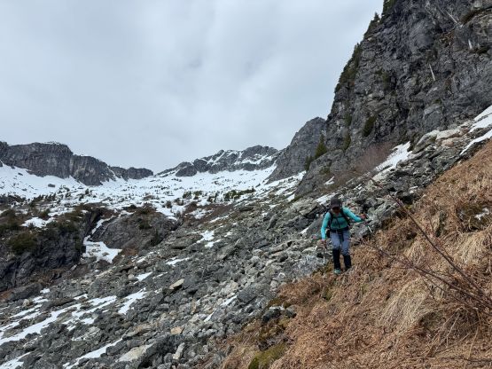
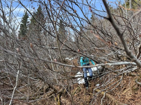
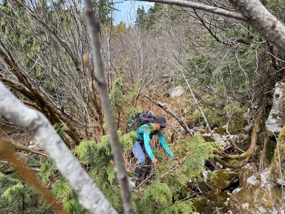
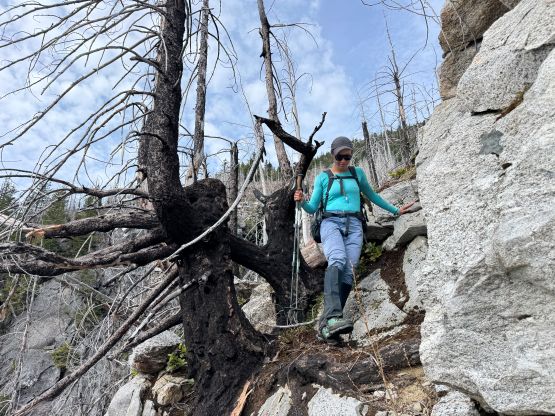
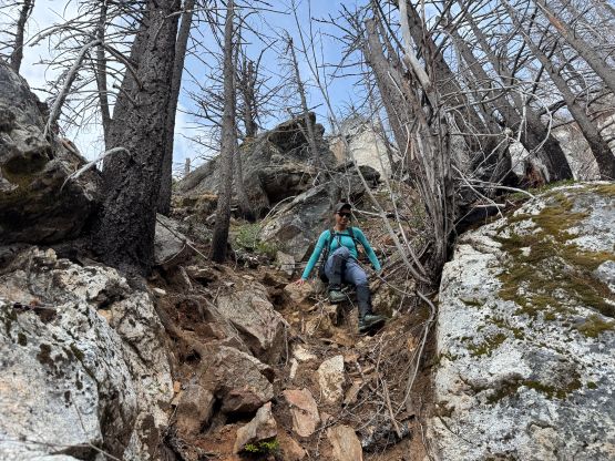
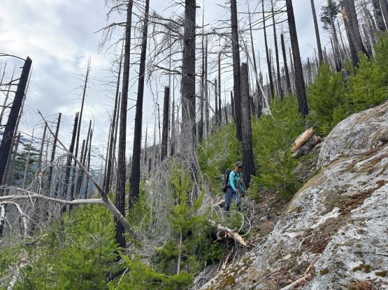
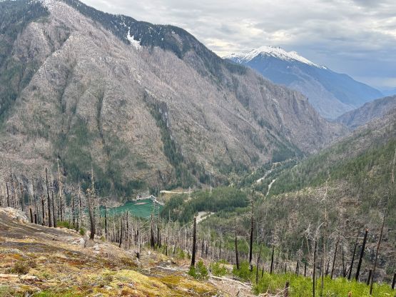
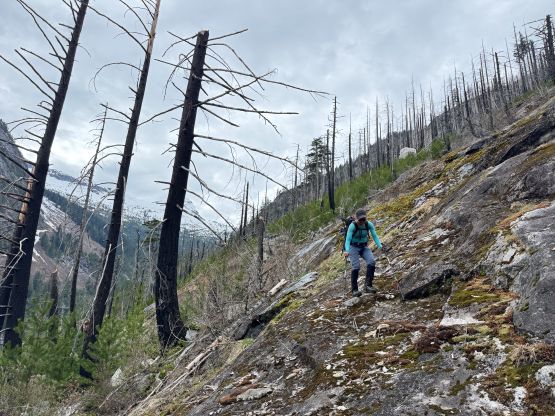
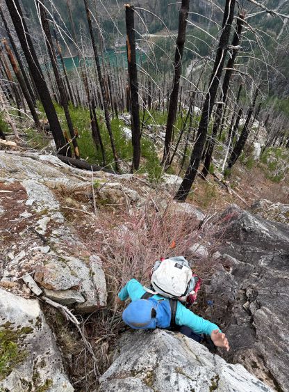
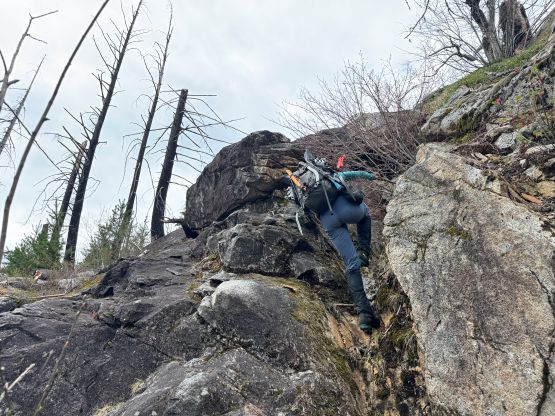
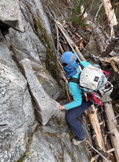
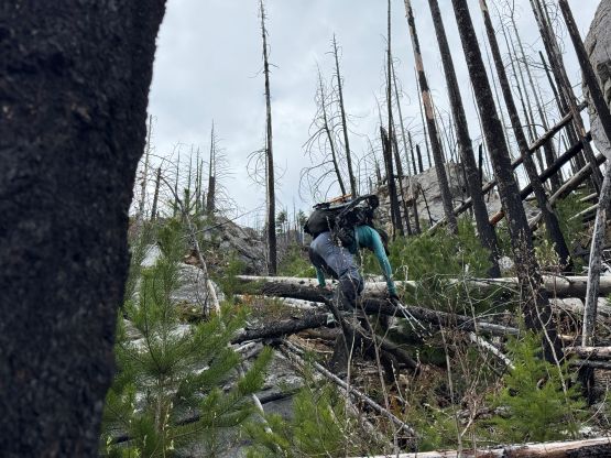
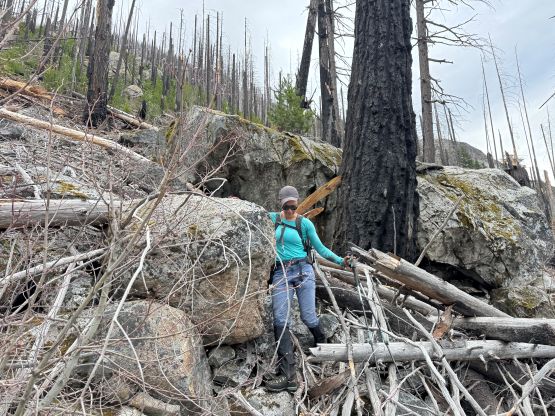
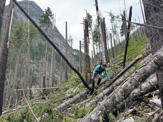
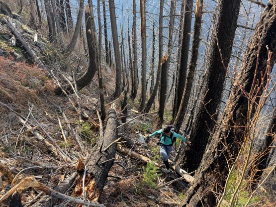
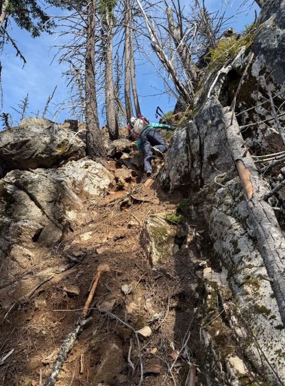
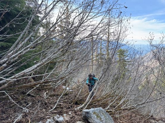
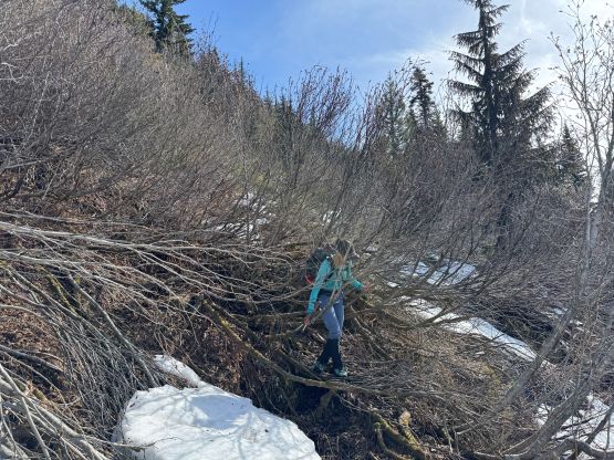
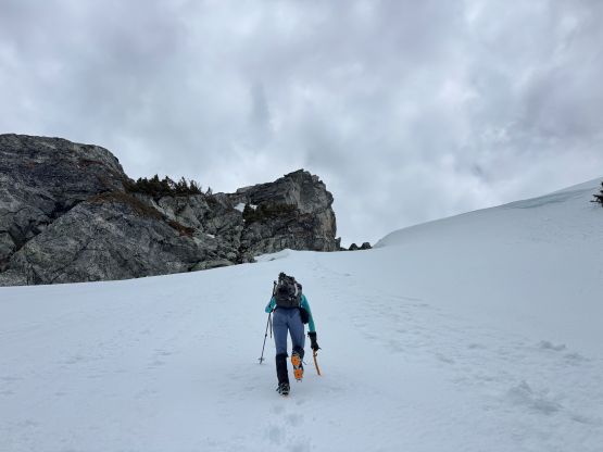
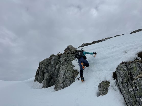
The route ascends from just where the highway crosses Gorge Creek and the general bearing was to simply go “straight the hell up”. I of course had downloaded Ryan’s GPX track and the plan was to follow closely to the known. I’ve seen at least one trip report commenting something like “any deviation by 10 m would result in terrible bushwhacking”, so it made no sense to do our own adventure. The start of the route wasn’t too bad but it soon became a mess in pick-up-sticks mixed with young trees and burnt charcoal, and in less than 10 minutes from the start I dislocated the right shoulder while trying to mantle over a bigger dead-fall. My brain reacted to the mistake but it was either the pack being too heavy or me being still tired from Mt. James Turner, that my body couldn’t react fast enough resulting in a nasty sideways pull on the arm. I nevertheless popped the shoulder back in and continued. It was my 3rd time dislocating the shoulder on a climbing trip and I completed all three trips without needing to call for help nor bailing on the objective. I did however have to be extra careful for the rest of the day as the range of the arm was a bit limited after the injury. The initial 300 m elevation gain took us almost an hour and this was probably the slowest 300 m I’ve done in a long while. The pick-up-sticks situation was much worse than I thought, that I started to let some “4-letter words” fly. Another half an hour later we came to that infamous 3rd class chimney followed by the wet slabs. I followed others’ advices and did a hard leftwards traverse and resisted the temptation to scramble up the slabs.
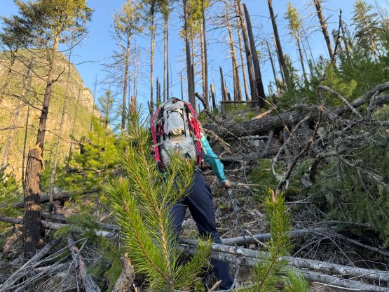
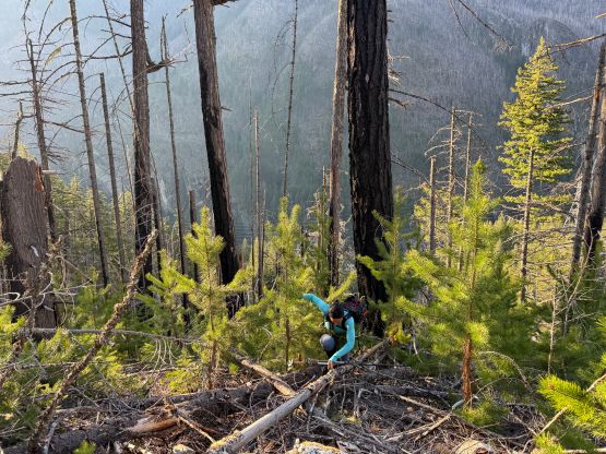
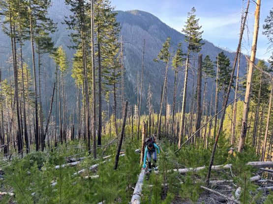
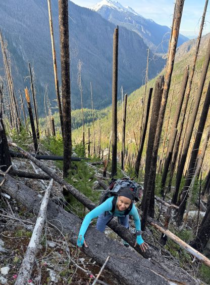
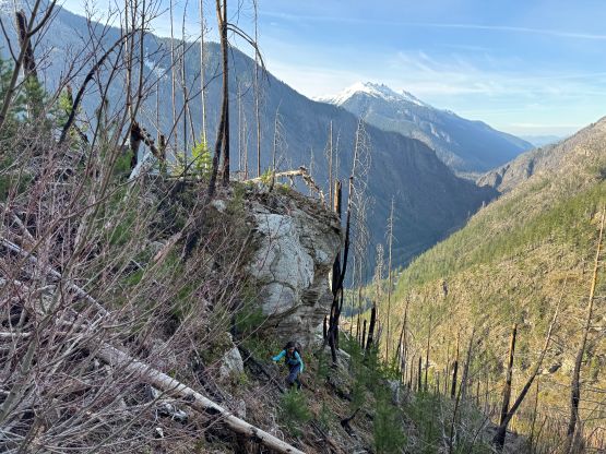
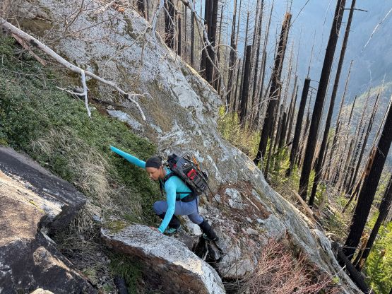
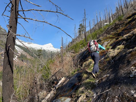
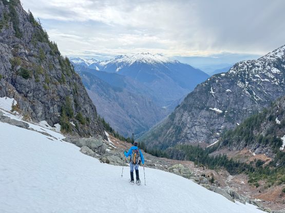
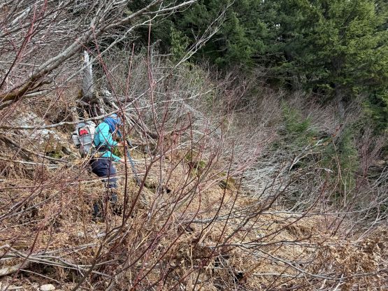
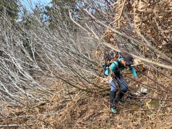
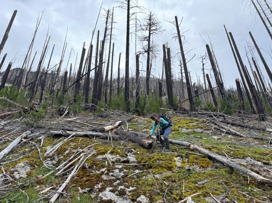
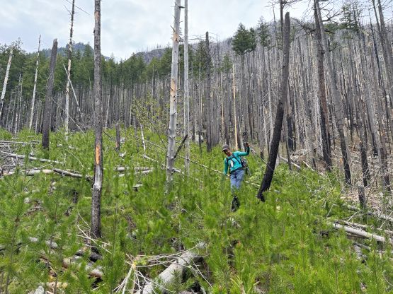
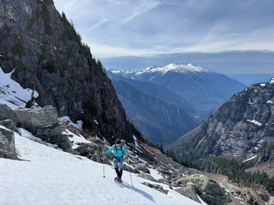
The bushwhacking had temporarily become easier for the next while but at around 1050 m elevation the terrain became bad again. I somehow got misled by the terrain by venturing too far climber’s left next to the obvious gully and came to a 5th class cliff band. I checked the GPX track and sure enough, we were off route. I spent the next 10 minutes evaluating and trying to free solo the pitch while dragging the rope up but eventually gave up and went around. I knew we wouldn’t be gaining much advantage even if I did manage to solo this pitch, but mentally I just needed a break from the bushwhacking. The attempt to rock-climb sure did the job well. Another while of thrashing later with more “4-letter words” flying around we came to some slick grassy slopes and then there came the “bushy traverse” mentioned in Ryan’s trip report. The good news was some running creeks so we could refresh ourselves with drinking water, but there was no snow whatsoever. The other group was already skinning at this point, but we had to deal with bands after bands of nasty alders. The bearing was side-hilling and that only made things worse. We did encounter patches of snow so after post-holing and getting my shoes (and socks) wet I decided to spend a few minutes swapping footwear to the mountaineering boots. There was of course, no “flat spot” on this entire mountain so I had to basically sit on the alders while collecting ticks. We collectively found at least 4 ticks in this trip but thankfully they didn’t bite. Ryan’s GPX track involved some up-and-downs and despite that, I have to say that they did the route-finding excellently here.
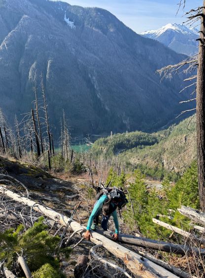
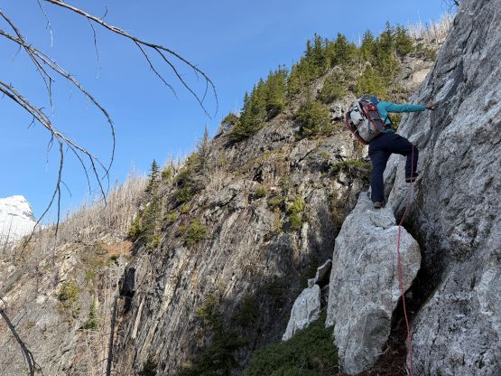
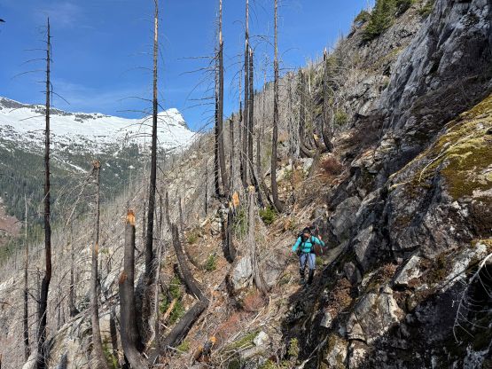
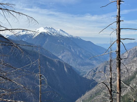
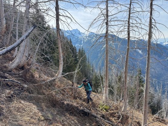
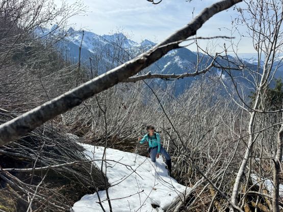
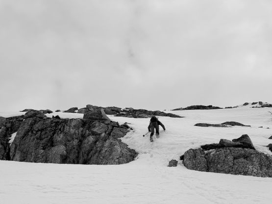
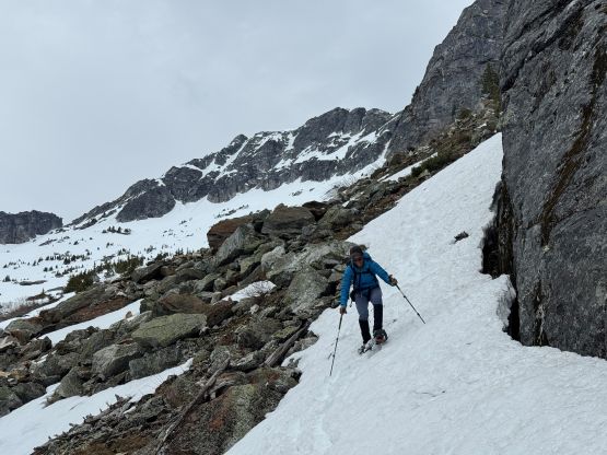
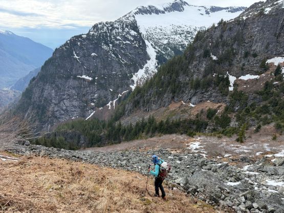
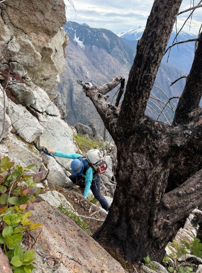
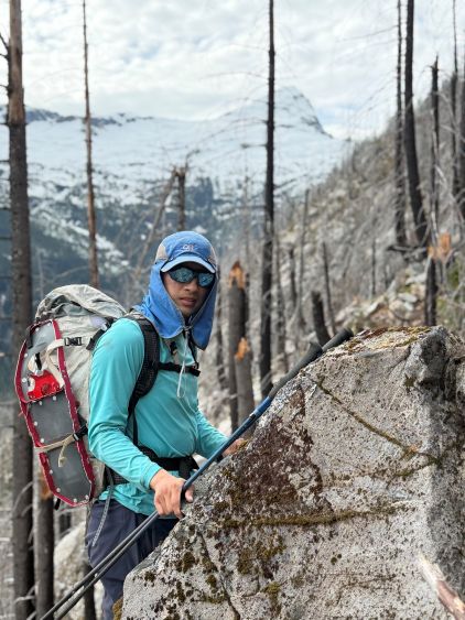
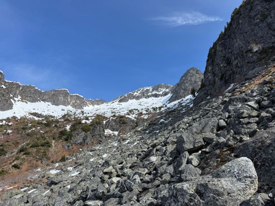
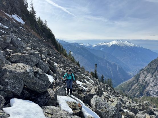
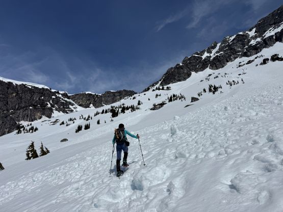
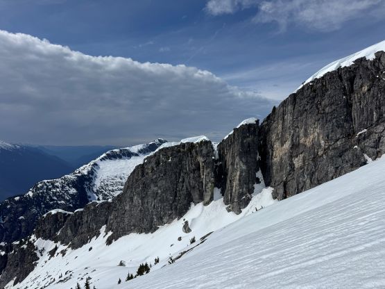
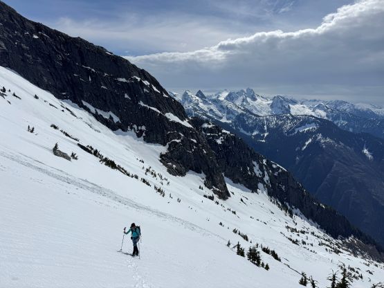
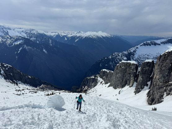
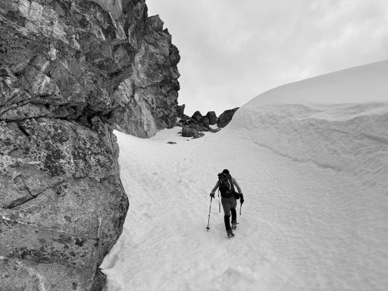
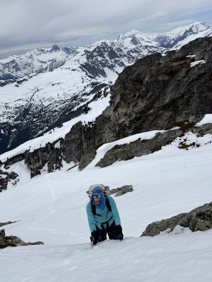
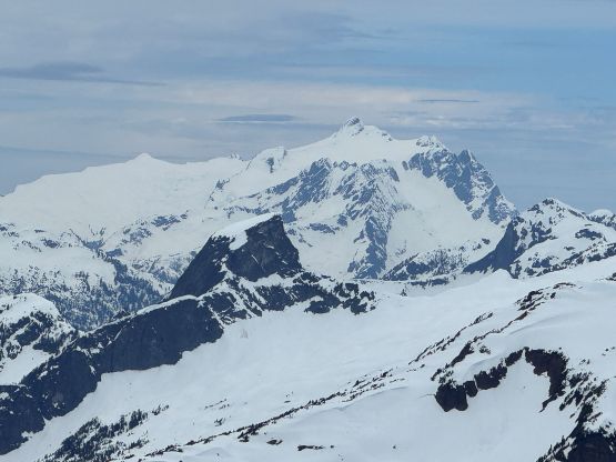
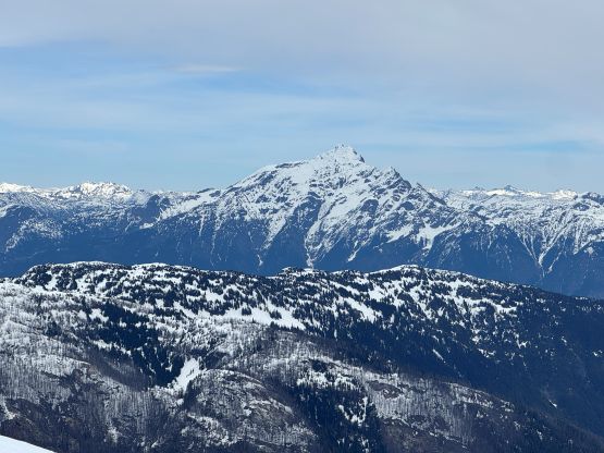
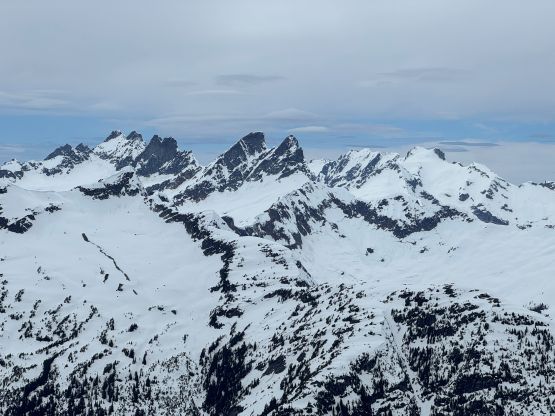
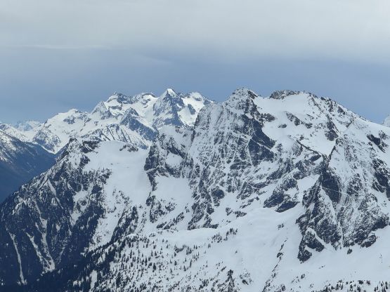
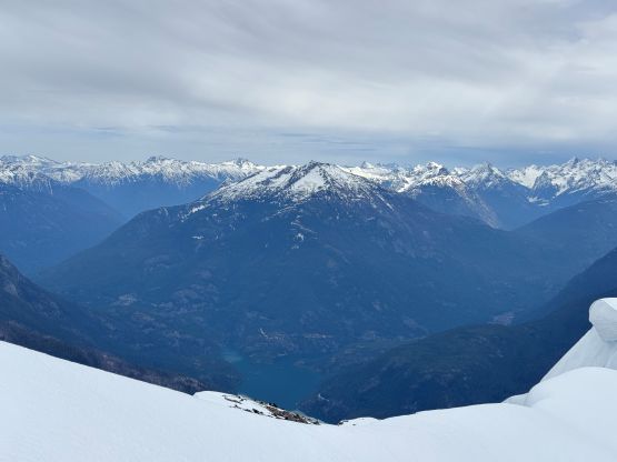
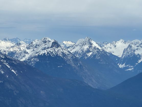
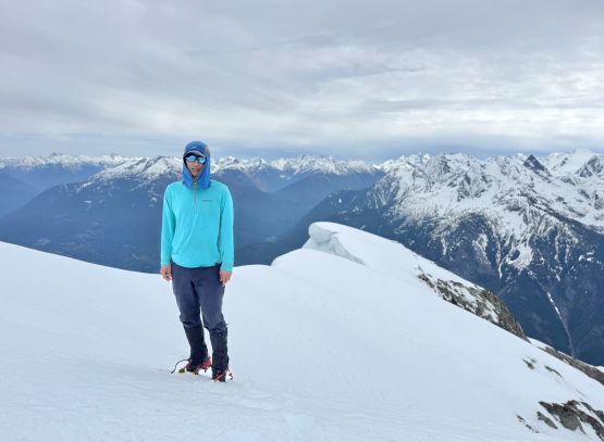
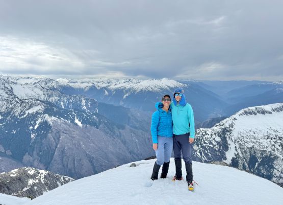
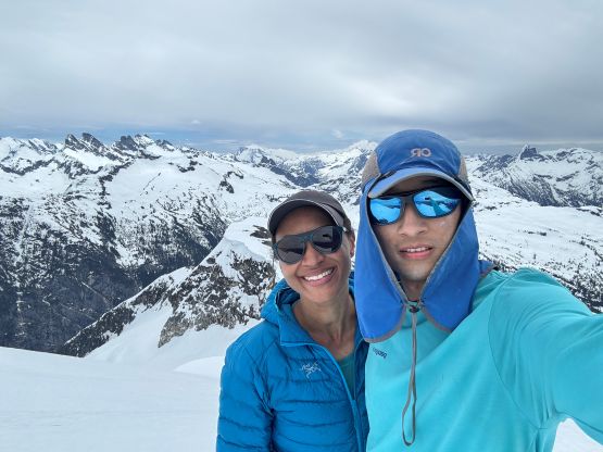
The second half of this “bushy traverse” wasn’t too terrible but the boulder field leading upwards onto the snowfield was quite a different story. The boulders themselves weren’t bad, but the snow patches were inconsistent and isothermal. We found at least a dozen holes and some deep ones could easily result in more injuries. Eventually I made the call for us to don snowshoes even though there were still patches of dry ground to traverse across. We did pick a line staying more or less entirely on snow, and ditched a bunch of unnecessary gears at the last “rocky island” including the stoves, fuel canister, rope, harness and some extra food. The rope was brought for the forested bluffs and I was sure that we could climb the SW Face without a rope. I was correct. After another hour of tiring slog on snowshoes we were at the base of the steep sections. Mel went ahead and did most of the leading, and the going was never worse than 40 degrees. The condition was also quite soft, such that the 2nd ice tool was never taken out. The uppermost W. Ridge leading to the summit was also quite straightforward although we had to stay far from the edge due to cornices. The NE Face of Davis Peak is one of the steepest/grandest in the entire state of Washington and falling off that would surely result in the fastest/longest descent in the state, which none of us was looking forward to. It actually didn’t take us that long to get here so we were doing entirely fine, but I could hardly enjoy any part of this trip.
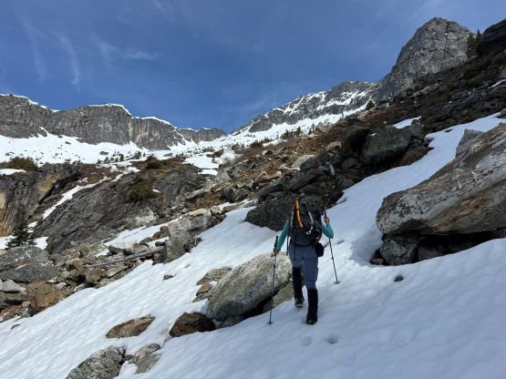
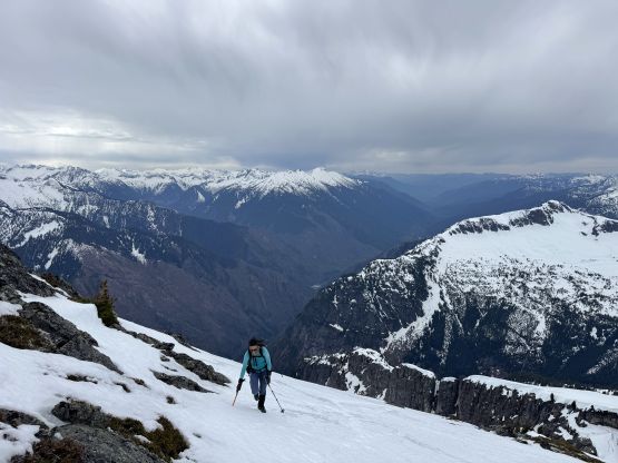
Descending the steep snow back to the ditched snowshoes was fast and furious and then I opted to remove the crampons and carry the snowshoes down while trying to “boot-ski”. I did make probably two dozen turns but the skiing quickly gave way to post-holing. Eventually we had to strap the snowshoes back on. Cooking wasn’t entirely necessary as the trip wasn’t as long as I thought, but I had brought two packs of lunch in addition to the stove so we might as well use them. A long while later we resumed the descent. For the boulder field we opted to stay higher and on snow for as much as possible but still discovered a few deep holes. From the moment we dived back into the bushes all the way to crossing the finish line we decided to stick completely with the knowns even though part of the route might not be as bad had we gone a little bit more left or right. The entire descent could be summed up in just one word: misery. There’s hardly anything worth noting except for perseverance. Being on trail runners my feet were naturally more slick than Mel’s so I took at least a few nasty spills, and I grabbed at least a few brambly branches resulting in picking up thorns from my palms even a day or two later, but I did manage to get down without dislocating the shoulder again. I also collected a ton of charcoal from the burnt logs. Our round trip time was 10.5 hours including all of the stops so this wasn’t that big of the day, but the work load surely felt worse. The best thing for completing Davis Peak was to never have to go up this approach again. This is one peak-baggers’ objective solely for the Cascades hardcores.