Cloudburst Mountain
April 18, 2021
1871m
Squamish, BC
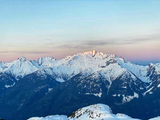
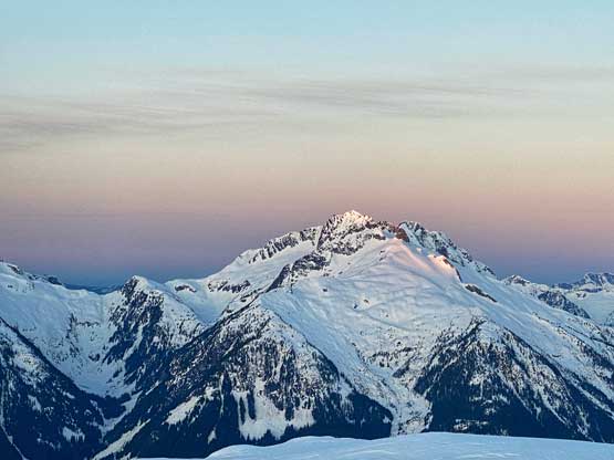
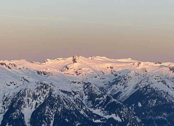
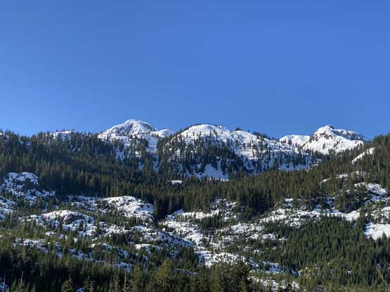
Cloudburst Mountain is not a tall summit by Sea to Sky standard, but it’s a stand-alone massif that boasts over 1000 m of prominence on the southern end of Squamish-Cheakamus Divide. The summer route is well written in Matt Gunn’s Scrambles in SW British Columbia although in my opinion this peak is better done on skis or snowshoes from Chance Creek as it’s sort of a classic in the touring community. The forestry roads in Chance Creek doesn’t melt out until at least May so the earlier you go, the longer you have to walk but 20 km isn’t that big of a deal anyway.
This peak had been on the back-burner of my list for a few years. It’s a no-brainer kind of objective as it’s popular enough that I could just pick a set of skin tracks and easily follow them all the way to the summit with no exploring nor route-planning required whatsoever. The beta is very mature on the internet with multiple GPX tracks accessible for downloading. The access does require some brief driving on logging roads, but doesn’t seem like it’s in the risk of being “gone” in the foreseeable future. Combined all the factors above I was not in a rush to bag this peak at all. I eventually pulled the last minute trigger at the height of this recent heat wave. The weather had been fantastic but there had been no overnight freeze reported even in the alpine. I almost decided to dumpster-dive to avoid snow but an objective with a set of skin/snowshoe tracks to follow also seemed like a decent idea. To make sure I could beat the heat I planned to summit this peak at sunrise and be off the mountain by mid-morning.
I’m rarely able to fall asleep in the first half of night so had I left home at midnight I would have zero sleep. Instead, I left home at around 10:30 pm. I was able to drive 3 km up Chance Creek FSR before hitting snow patches and parked my truck at 1 am. I was able to catch over an hour’s sleep on the passenger seat of my truck. The alarm went off at 2:30 am and I started the plod half an hour later after forcing in some cold sushi.

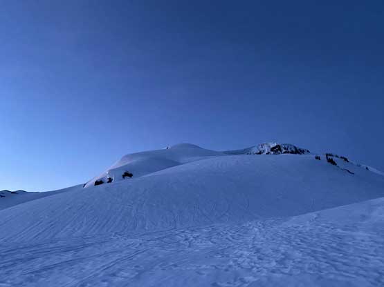
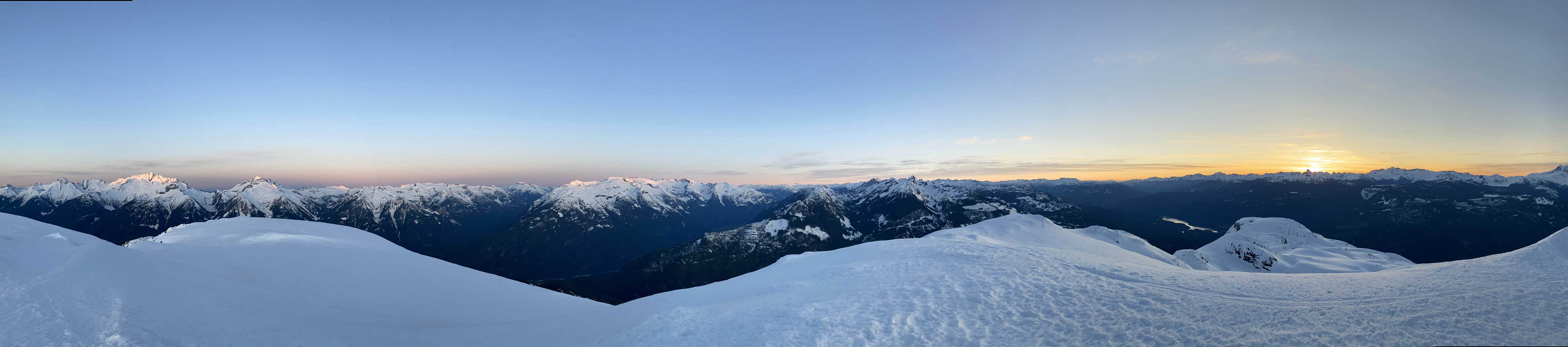
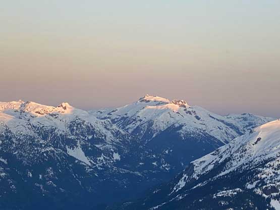
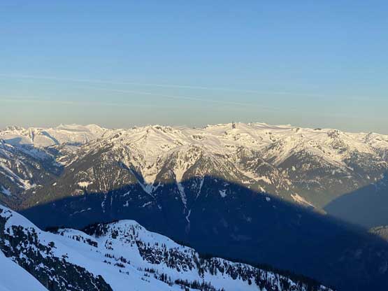
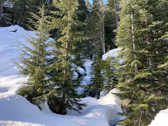
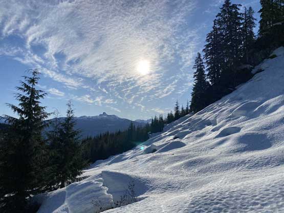
The first few kilometers was a mind-numbing plod up the remaining Chance Creek FSR to the highest driveable end. The snow was firm enough that I could have walked this entire road on foot, but I strapped the snowshoes on anyway for added traction. The lower portions of this road was very icy. There was an annoying dry stretch in the middle of the road that required me to take snowshoes off twice. At the road’s end I followed a set of skin tracks veering into the clear-cut and the direction was double-confirmed with the pre-downloaded GPX tracks. This zone would be a bit disorienting in the dark otherwise without the navigation tool. The skin tracks weren’t very well-defined at places such that I did have to do my own route-finding judgements here and there. The going in the forest was overall not too bad, but there had been some post-holing down into the slurpee even on the skin tracks. The forested zone was also steeper than I thought with fair amount of micro-terrain to navigate. After what seemed like a long while of post-holing I came into an obvious bowl at treeline zone and the sky had finally brightened enough that I could finally see some terrain around me. I followed the skin tracks taking a sharp rightward turn onto a “bench” feature and by 1400 m the post-holing had finally come to an abrupt end. Despite the warm temperatures there had been some radiation freeze at this elevation and the crust could finally support my weight with or without the skin tracks.

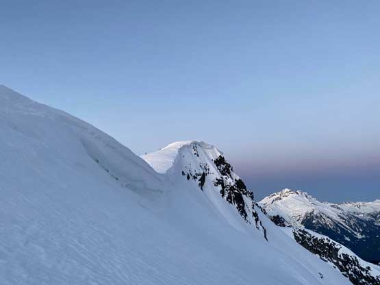
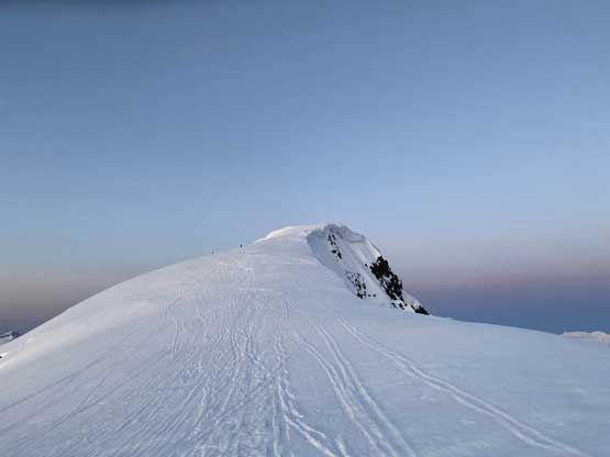
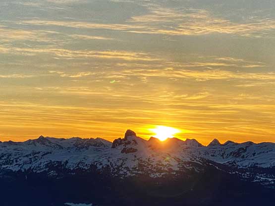
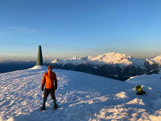
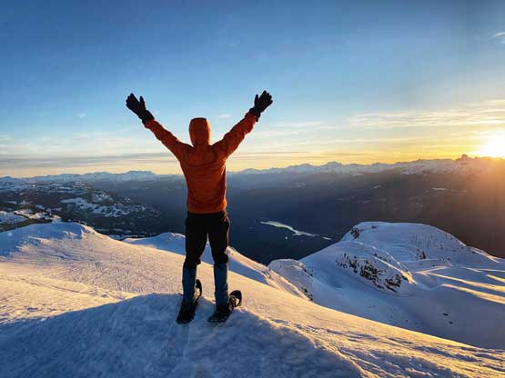
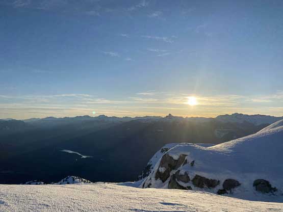
Thank to the firmer conditions I no longer needed to stay on that zig-zagging skin tracks and instead, I picked up the speed and directly attacked a few steep rolls (35+ degrees) onto the broad “NW Rib”. At this point I was finally positive that I might be able to beat the sunrise to reach the summit, so the race began. I had to make one transition to take the gloves out as the wind was quite chilly in the dawn, but other than that I pushed all the way to the very summit in a single shot. There had been no eating nor drinking since I left the truck. I got to the summit with about 5 minutes of spare to sunrise, as perfect of a timing as it could get.


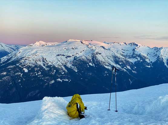


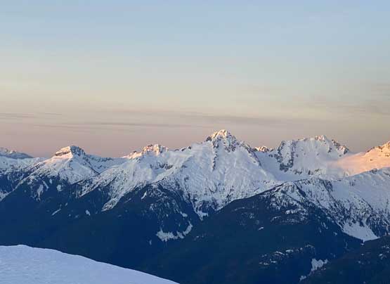

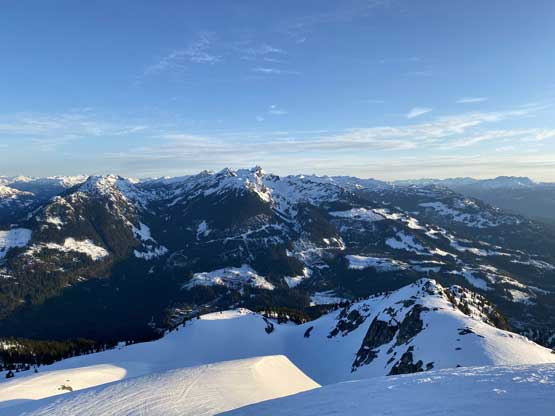
The wind was really cold in this morning that I couldn’t linger too longer than necessary. On the descent the snow was still bullet proof on the upper slopes that walking down those steep rolls was actually hard on my knees. Below 1400 m zone I was instantly back into the slush and a few steep rolls lower down were particularly bad. The descent back down through the forest wasn’t difficult but required caution. I constantly stepped into weak spots and post-holed down past my knees. I had to resist the temptation to speed things up as I didn’t want to take too many face-plants. The road-walking at the end was boring as fuck. After the dry stretch I just packed the snowshoes and walked on foot, which was actually a good call as the snow was still very firm on the road. There were two skiers skinning up on the road but otherwise I had the entire mountain to myself in this AM.


I finished the trip at 9:30 am and started driving almost immediately after finishing the trail-head transition. I was hoping to push back to White Rock but had to call for a nap break near Lions Bay. About half an hour later I woke up with fresh energy, and still made back home in time for lunch.
